Overview
Massively simplified visualizations with analogies that might hopefully help someone ranging from slightly confused to completely lost plot a course and safely navigate Evochrons 3D Map.It took me a while to actually get this so I thought about how I might describe it if I were trying to explain it to someone else. This is what I come up with.I hope it helps.
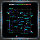
The Box, a Fish Tank, a 3D Map.
Imagine yourself standing on a flat surface facing North with a box directly in front of you. The box is placed with its sides directionally, as a compass, North, South, East and West.
The side you are observing now is facing South. It is facing you and you are facing North.
The side you see directly in front of you is the “rearview” of the box because you are observing it from its rear.
Now imagine the box as a fish tank. You are looking North and forward through the glass wall of fish tank.
From your North facing vantage point looking into the tanks glass walled South face you notice two distinct markings.
One of them is a Y placed middle ways of the left side with arrows above and below it.
This Y obviously indicates the depth of the tank as it represents everything measurable from its top and bottom.
The other marking is an < X > placed middle ways of the top so then, If I am facing North then everything to the left of this X must be directionally West and everything to the right is then obviously East.
The most important thing apparent from our rearview vantage point is the fact that we can pin point the depth of any object floating in the tank and that depth is represented by Y.
We need to walk closer to the box and observe it from above.
We are now looking down at the top of the box.
From our new vantage point above the box, we are looking down, “topview” onto a 2 dimensional map.
We notice the familiar < X > at the top middle of the box placed directionally the same as it was before representing West to the left of the < X and East to the right of the X >.
We also notice a new marking represented as Z and it is placed middle ways of the left side with arrows above and below. It represents North directionally towards the top of the map and South directionally towards the bottom.
From this topview above the box, we can pin point any object in space from a 2D perspective, longitude and latitude just as if it were a conventional paper map.
Imagine placing a mark on an object drawn on the map and then stepping back into rearview so that we may once again look into the face of the tank, perceiving the depth of our mark and the object we placed it onto.
From rearview we are able to adjust our mark for depth so that we pin point the object we marked from above in topview.
Conclusion
Plotting a jump point in Evochron is a two step process.
The topview of the map allows you to place a pin at any point or on an object in space just as you would on a conventional 2D map.
And the rearview of the box allows you to adjust the depth of that pin onto the object.
Once you do so, you have plotted a course inside the box, the tank, the 3D map, that is the 3D space of Evochron.
Simple enough.
Good luck and safe travels.