Overview
In this guide I will explain some concepts to help you avoid building cities with grids, and use a more natural approachI will explain the following concepts; scanning the map at the start, use the natural environment to do some planning and use this planning to create a the start of a city. The city will be set-up as a collection of districts, each possible with the own characteristics, well fit in a structure of railroads, highways and roads in order to form a natural city.
Introduction
In this guide I will explain some concepts to help you avoid building cities with only grids, by using a more natural approach.
I will explain the following concepts; understanding the map at the start, how to use the natural environment to plan your layout and how to use this planning to create a city.
The city will be built as a collection of districts, each with the own characteristics, and how they will fit in a structure of railroads, highways and roads to form a natural looking city.
——————————————————————————————————————-
Note: I am not a native English speaker. All suggestions for improvement are welcome.
Note: This guide is written from the perspective of not having infinite money. However these tips can be used in any mode.
Note: There are more ways to build cities, and this guide cannot be comprehensive enough to cover them all. It will for now remain focused on its main topic.
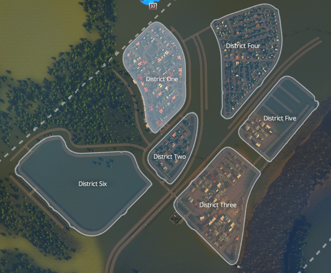
Note: A district in this guide is an area surrounded by a primary road, not by the in-game painting of one which can be left up to the user to create.
Note: This guide uses the mod Precision Engineering. You will need that mod for certain tips.
Scanning
To avoid grids you have to build roads which use the natural curves of the map. Before we can use this natural environment, we need to scan the map to understand the possibilities the map gives us.
During the scanning we need to look for forests, hills, rivers and start to think about how roads, highways, railroads will fit within the natural boundaries of the environment. Edges of rivers and forests can be used for (main) roads, and hills will need a certain approach for roads. All this information will be transferred in a first planning
Tip: you can do this at the beginning while the game is paused.
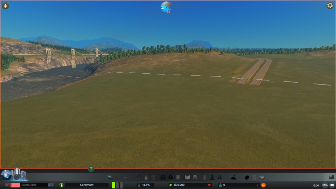
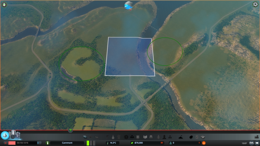
Example
Below is an example of a map Mercia. The pictures show some parts of the total map. You may already have some ideas of your own how this will work.
Some nice forests

The riverside always has some nice curves

We need to consider the hills in this map

Planning
After scanning we will make our first plan. Remember a plan is just a guide, we only need it to be able to start building. The plan will have some sort of guidelines and ideas about areas, districts, highways and (rail)roads. The plan can and will be be adjusted later on as we build organically and as need demands.
In the plan we plan a couple of elements:
Highways
We need to have an idea of where (new) highways will be.
Example
An example on the same map Mercia, the layout of the elements.
The first picture shows some ideas of new highways, creating two circles. We can build one or both circles, creating a ring road, maybe around the downtown area.

Railroads
Also in the guide we plan some new railroads and perhaps some areas for stations.
Example
The second picture gives us some ideas for railroads, based on the already existing railroads in the map and ideas of where stations could be built.

Downtown
Next to that we need some idea of where we want the main center or downtown area of the city to be. We need to find an area for the main center of the city which comes naturally with the map. Since you need high residential, we will not plan the downtown area in the starting square.
Example
Based on the structure of highways and railroads we have at least two possible areas where we can build a town center. We will build the center later on in the game. We will start with some suburban areas in the starting square and decide later to use one or even both areas as the downtown area.
Industry areas
We need to have an idea of multiple industrial areas. The reason to have multiple areas, is that later on, if your city grows, your traffic will become a problem if Cims need to travel a long way between industry and their residential areas.
Example
Next to the downtown areas we can look for areas for industry and some extra suburban residential areas.

Residential areas
After that we can also look for some more suburban residential areas besides the downtown area. We can also think about the characteristics of those areas like low wealth high rises, or high wealth big houses. We also need to have some sort ideas about transport (trams, buses, metro) and some ideas about the commercials areas.
Example
And room for residential areas. We will start with the areas in the starting square and do some low level planning.

Low level planning
Once we have some ideas of the planning (which can also be only in your head), we start to make a more low level planning around the first square. Next to the highways we will also look for other main roads. Use edge of forests, rivers, and hills to look for natural curved main roads.
Example
The purple lines shows where we already planned the highway. Next to that we plan some main roads. We are using the edge of the forest and the river as guidelines to plan some natural curved main roads (pink).

And some planning ahead

We will also need to think about on and off ramps.
Example
The purple lines show some ideas for ramps.

Start Building
Planning done. We can now start to build our first roads. We will work towards a situation where we have a collections of districts, which are connected by main roads. Since we are in the beginning of the game, and therefore we do not have a lot of money, we can only build parts of the first main road and the first part of the first districts. We start to build at least two districts, one for residential and one for industry.
Later on we can concentrate on creating and finishing a district, or a (very big part of a) main (rail) road all in one go.
Example
First of all, we first build a straight road to the starting point of our first more natural curved main road. This straight road will be removed later on.


Then we will build our first curved road (pink) and we will create our part of the first district using the curved road as guideline.

Tips about laying roads and discticts will be explained in the next chapter.
Later on, if we get more money, we will be able to complete the first district.

Laying roads – tips & tricks
Guideline roads
Before laying the actual roads, use guideline roads. You can build guideline roads to already use (parts) of the natural environment. For example create already a guideline road parallel to a river or next to the edge of a forest. Also use guideline roads to build roads which will be replaces by highways later on.
Example
In the examples some of guideline roads are drawn, showing where the highway will come. In the second picture is some of the guideline roads replaced by complete basic roads. Later on these will be upgraded to real highways.

Symmetrical
Roads look more appealing when the curves are symmetrical. To build symmetrical curved roads, use the mod Precision engineering. Make sure both legs of the curve have the same length. You can use the CNTR-key to build roads with a precise angle. Using precise angles is a good way to get well fitting streets.
Example
The first main curved road is created by creating in two parts. Both parts are 34 unit long, divided in 17 and 17 units, and both parts have an precise angle of 135 degrees. The 135 degrees is the best fitting angle to the edge of the forest.

Note: the picture shows an angle of 137,1 degree. This is because it is impossible to create screenshots while holding the CNTR-key. the raod was build exactly with a 135 degrees curve.
Repetitions
Roads and districts also look more appealing when you do some repetitions of roads.
Example
In this picture, repetition of 4×4 blocks of houses.

Symmetrical while connecting
You can use the ALT-key when you are connecting roads. Also use the symmetrical principle here for more appealing looking roads.
Note: Unfortunately I can not make screenshots while holding the ALT-key.
Straight roads
Although we do not want grids, creating roads which have larger parts of the roads being straight will help to create more natural and appealing looking districts and cities.
Example
In the example below some parts of the created districts have still straight roads.

Upgrade
The first roads will be created using the basic two lane road type. Later on, we can upgrade the main road to other types.
Natural connection point
Use natural connection point, like where a curve starts, to connect roads. Avoiding crossroads (4 of more roads together) will help later on to control traffic. Also consider roundabouts while building roads.
Example
Roads have connection points who look and feel more natural


Different types of roads
Later on, when more roadtypes become available, you can use road types the create certain characteristics in district.
Creating districts
After creating the first main roads, we can now create (the first part of) first district. For the district we use the first curved main roads as guideline. In between some of the raods we will create the outside of a district. And we will fill these outlines with secondary roads to create a full filled district. We will use also the principles explained in Laying Roads while filling the district.
Note: You can choose to use the main road as being part of the district, but for traffic reasons I normally choose not to do this and use new parallel roads and connect the parallel roads to the main road.
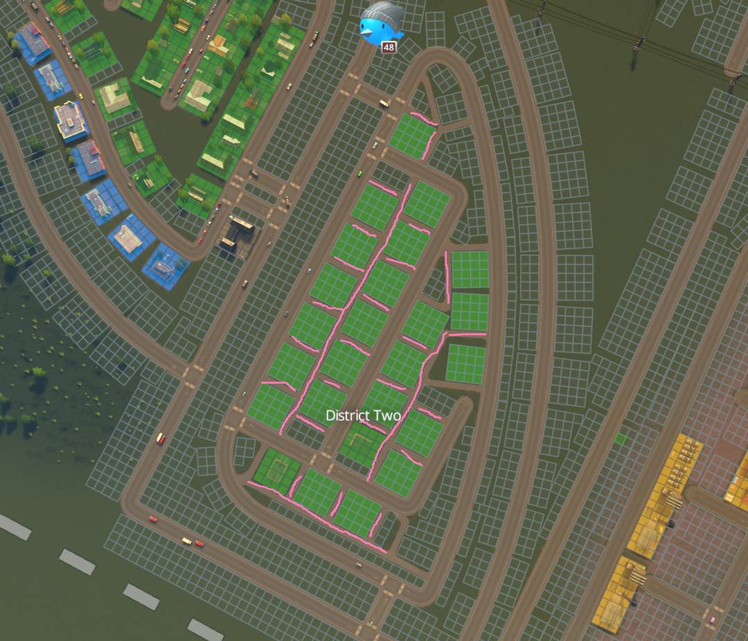
Paths
After you have hit the”Tiny Town”-level, foot paths, gravel paths and bicycle paths become available. You can use all of them to create pattern in districts. Using these paths you can create house areas, with certain characteristics, like all 4×4 big house, or all houses on 2 units width.
Example
After we have filled a district with normal roads (green) we use footpaths (pink)

to create natural patterns in a district.
Facilties
After that, of course you need to make sure that districts have enough education, healthcare, fire and police. You can integrate those buildings in a district. You can also fill a district as a special district like a University district or a Hospital district.
Unique buildings
Normally, especially in downtown districts, you can plan Unique buildings upfront in a district. In that case you can fill an area more for tourists with museums, or a church. Or fill another district with a lot of governmental type buildings.
Transport
A strategy could be to use buses for transportation mostly within a district. To use metro (or tram?) to connect districts. And use trains to connect parts of the city over larger distances.
Decorations
You can finish your disctrict wit docorations, like trees, rocks, parkingsplaces, (small) parks.
Summary
- To avoid grids and build a more natural feeling city you need to use forests, rivers, hllls.
- Scan the map, and make a high level planning of highways, railroads and plan some areas.
- Make a more low level planning for main roads for the first square, and build your first main raods using the environment.
- Use the main roads, railroads and highways as guidelines to build distrits so you city becomes a collection of districts well fit in a structure of roads.
- Use all sort of tips and tricks to fill your districts and give them their own characteristics.
A collections of districts