
Overview
A rough and highly inaccurate rendition of the Forlorn Muskeg region, to serve as a placeholder in anticipation of Whiteberry’s “official” version.
Map
INCLUDES SOME SPOILERS
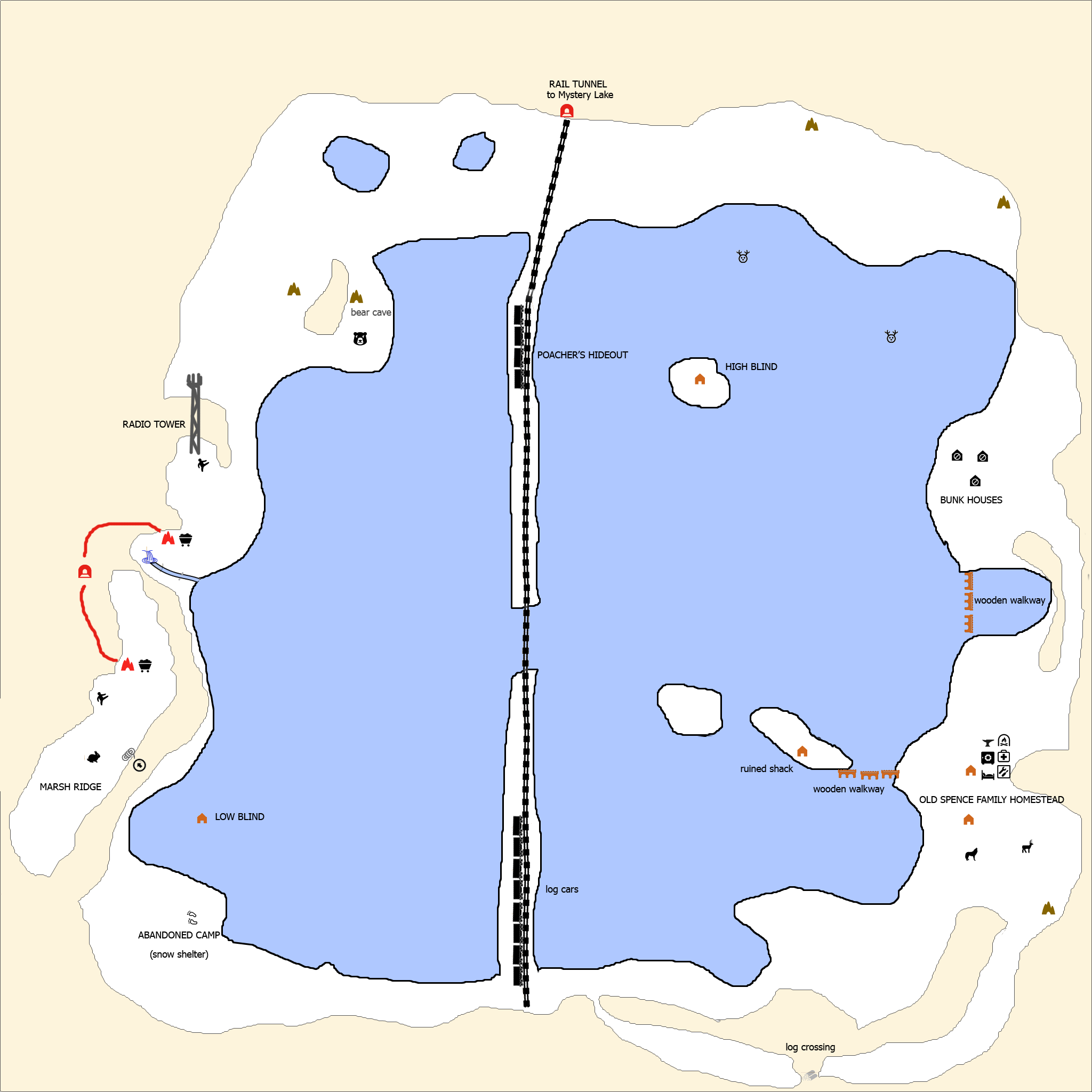
Drawn from memory, so surely very inaccurate with a bunch of things named wrong, and missing all sorts of details. For the sake of familiarity/continuity I copy/pasted elements from Whiteberry’s maps to create this one, if you want an accurate map you’ll have to wait for Whiteberry’s “official” one.
Things not on this map: there’s about 5-6 deer carcasses total, but I only remembered the general location of two of them.
There’s wolves in other places as well. There’s cattails, mushrooms, rose hips, and lichen all over the place, though beyond that, “human” supplies are very sparse.
Most of the area marked simply as frozen water on this map is actually covered with small patches of land…in exploring the area, I got the impression that the weak ice areas are determined by nothing more than being a certain distance from the nearest bit of land, which is the same all throughout the region. So, anywhere the land patches are close together (15 yards or so or less), it’s safe to cross. Because of this, its generally possible to get from point A to point B without going too far out of the way, even when crossing straight through the middle of the marsh. There is a bit of a blockage on the right side of the map, to make it more challenging to reach the homestead, but there is a direct route from the high blind to the homestead. Also, in v.388 its possible to scramble up a rock on the left side of the river, opposite the cave entrance, to bypass the cave system in order to get to the marsh ridge. This will likely be fixed in a later update. Note that there are supplies, including a climbing rope, as well as coal, in the cave, so its worth going through it at least once anyway.