Hidden and unmarked roads - USA - SOUTH - updated 2026/02/20
This guide contains only Arkansas, Oklahoma, Texas. For other locations, please refer for the other guides: https://steamcommunity.com/sharedfiles/filedetails/?id=3629081644 https://steamcommunity.com/sharedfiles/filedetails/?id=3082451616 https://steamcommunity.com/sharedfiles/filedetails/?id=618897575
This is a list of all drivable roads not marked on the map and accessible without any mod or console commands, and the walkthrough on how to reach them.
It assumes you have ALL map DLCs released until now. So those hidden roads near the border that are physically located on one state, but it depends on the other state to be accessible, are listed under the state it's located.
It isn't supposed to be a guide to EASTER EGGS, although in some cases the unmarked roads lead to them.
It isn't supposed to be a guide to complete 100% of ACHIEVEMENTS either, but some of the unmarked roads are related to some of them. In these cases, the walkthrough will be marked as spoiler and you must hover the pointer over the black mask to show picture and description, LIKE THIS.
NOTE: if the achievement is directly related to hidden roads (for example, "Can You Keep a Secret?" in Kansas), then it's not marked as spoiler. That's why you are here after all.
This guide is organized by STATES and then by CITIES alphabetically. When the unmarked road isn't located in a city, the closest one will be used as reference.
Each screenshot has a map, with the unmarked road written on GREEN or RED, and the same colors are used on arrows and notes on the screenshots.
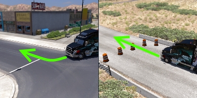 GREEN: the road doesn't have any UI roadblocks (glowing arrows or Xs where only AI drivers are allowed), invisible walls or hard objects blocking it, it's just not marked on map. Some times only easy-to-move objects (cones or signs, for example) are blocking it. You can go through it without problems - even when they have "no trucks allowed" signs. In some cases, these roads can be marked on map after discovered.
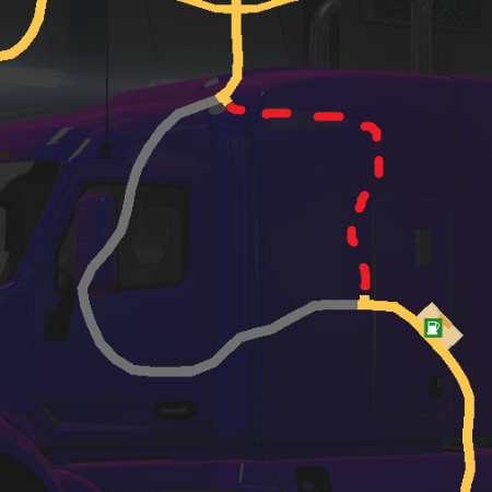
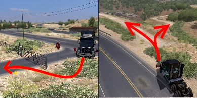 RED: the road's blocked by UI roadblocks or hard objects, or simply aren't connected to the playable area. That is, the ones the players weren't supposed to be - they're supposed to be scenery only. You must use breaches and devs' oversights to explore these areas. In most cases, these breaches are fixed after some time.
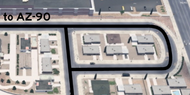 BLACK: the lines indicate the route player can drive after accessing the road. The text indicates points of reference, like landmarks, roads and cities - the same references listed on the walkthrough.
Each unmarked road can be on one or more of the following categories:
SCENERY: it's supposed to be eye-candy only, without any real use besides taking a cool screenshot in a different place. Of course, any of the other categories are implicitily scenery too.
SHORTCUT: it's an alternative route connecting two or more marked roads. Just note that, besides the name, it isn't always the shortest or the easiest route.
EASTER-EGG: it's a message or joke left by the devs, or even a pop culture reference. Notice that only easter eggs related to unmarked roads are listed here, you must check other guides to find other easter eggs.
ACHIEVEMENT: an achievement will be unlocked after hitting a certain spot of the unmarked road. The achievement name is written besides this category. Again, only the ones related to unmarked roads are listed here.
MARKABLE: it's an unmarked road that appears as a dotted path on map after discovered, so it can be easily found later. It's a feature added on version 1.44.
This is a list of all drivable roads not marked on the map and accessible without any mod or console commands, and the walkthrough on how to reach them.
It assumes you have ALL map DLCs released until now. So those hidden roads near the border that are physically located on one state, but it depends on the other state to be accessible, are listed under the state it's located.
It isn't supposed to be a guide to EASTER EGGS, although in some cases the unmarked roads lead to them.
It isn't supposed to be a guide to complete 100% of ACHIEVEMENTS either, but some of the unmarked roads are related to some of them. In these cases, the walkthrough will be marked as spoiler and you must hover the pointer over the black mask to show picture and description, LIKE THIS.
NOTE: if the achievement is directly related to hidden roads (for example, "Can You Keep a Secret?" in Kansas), then it's not marked as spoiler. That's why you are here after all.
This guide is organized by STATES and then by CITIES alphabetically. When the unmarked road isn't located in a city, the closest one will be used as reference.
Each screenshot has a map, with the unmarked road written on GREEN or RED, and the same colors are used on arrows and notes on the screenshots.
GREEN: the road doesn't have any UI roadblocks (glowing arrows or Xs where only AI drivers are allowed), invisible walls or hard objects blocking it, it's just not marked on map. Some times only easy-to-move objects (cones or signs, for example) are blocking it. You can go through it without problems - even when they have "no trucks allowed" signs. In some cases, these roads can be marked on map after discovered. RED: the road's blocked by UI roadblocks or hard objects, or simply aren't connected to the playable area. That is, the ones the players weren't supposed to be - they're supposed to be scenery only. You must use breaches and devs' oversights to explore these areas. In most cases, these breaches are fixed after some time. BLACK: the lines indicate the route player can drive after accessing the road. The text indicates points of reference, like landmarks, roads and cities - the same references listed on the walkthrough. Each unmarked road can be on one or more of the following categories:
SCENERY: it's supposed to be eye-candy only, without any real use besides taking a cool screenshot in a different place. Of course, any of the other categories are implicitily scenery too.
SHORTCUT: it's an alternative route connecting two or more marked roads. Just note that, besides the name, it isn't always the shortest or the easiest route.
EASTER-EGG: it's a message or joke left by the devs, or even a pop culture reference. Notice that only easter eggs related to unmarked roads are listed here, you must check other guides to find other easter eggs.
ACHIEVEMENT: an achievement will be unlocked after hitting a certain spot of the unmarked road. The achievement name is written besides this category. Again, only the ones related to unmarked roads are listed here.
MARKABLE: it's an unmarked road that appears as a dotted path on map after discovered, so it can be easily found later. It's a feature added on version 1.44.
14th DLC, 2024 September 16
El Dorado
Southeast 1 - Plantation Loop
Category: scenery, markableDiscovery: OWLCAT
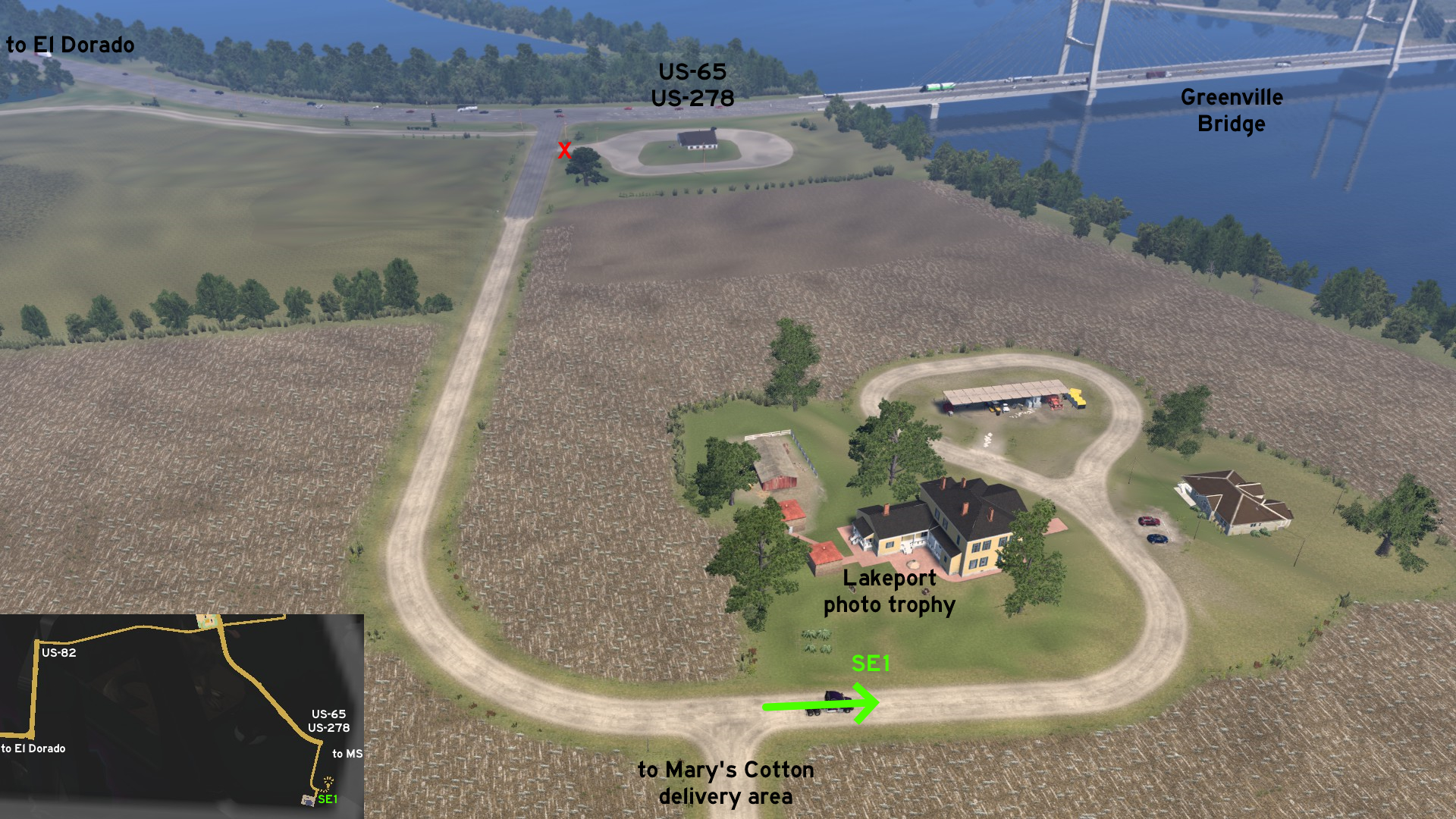 On Lakeport Plantation, found on US-65 / US-278 near Greenville Bridge and Mississippi border, there's a loop before the delivery area where you can drive through and take a better picture for the trophy. Just don't confuse it with the loop near the entrance, which isn't accessible.
 Southeast 2 - One Way In, One Way Out
Category: shortcutDiscovery: TechTWP
Update: Applecorn
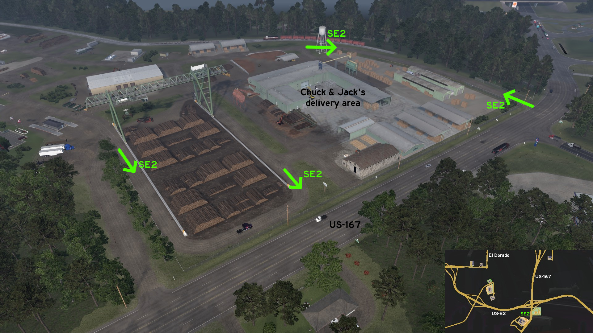 Head to Chuck & Jack's southeast of El Dorado. You can access the depot from two extra routes. One starts near the weigh stations, and runs around the logs and the crane tracks. The other is an one-way path that connects the main entrance directly back to US-167 - but apparently you won't get a ticket for driving the opposite direction.
Fort Smith
East 1 - Three Ways To Nuclear One
Category: shortcut, markableDiscovery: Applecorn
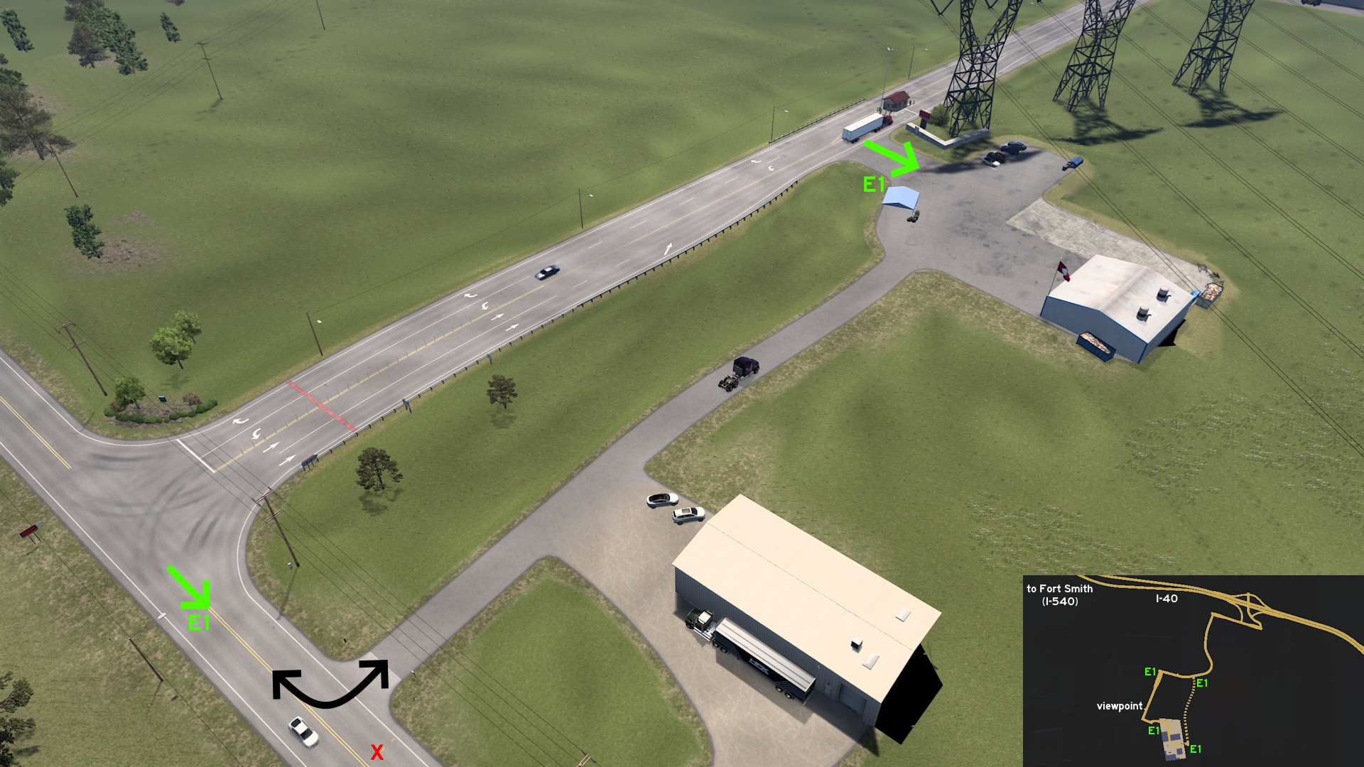 Head to Faraday substation area on Nuclear One, east of Fort Smith. Some meters before the viewpoint, there's an unmarkable small service area near the power lines that can be used.
 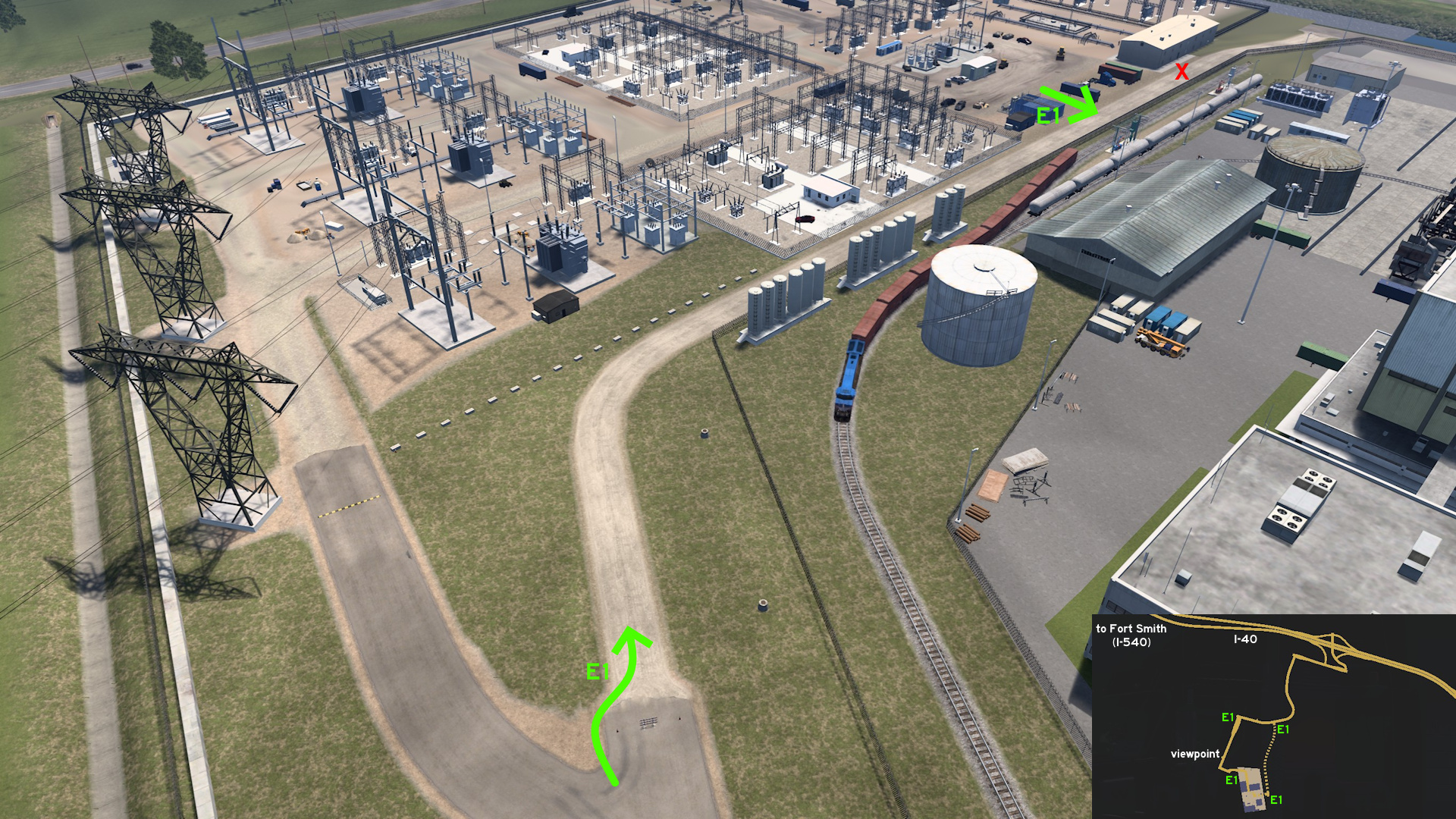 Some meters before the substation main entrance, the route splits into two. Take the unmarkable right one to go directly to where some trailers are parked.
 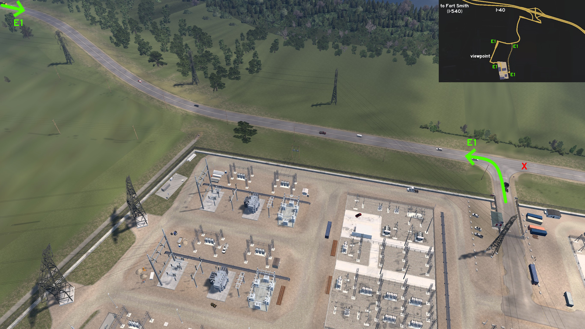 East of substation, there's a markable secondary entrance, which can take you directly to I-40 exit.
 South 1 - Loop Around Vortex
Category: sceneryDiscovery: Applecorn
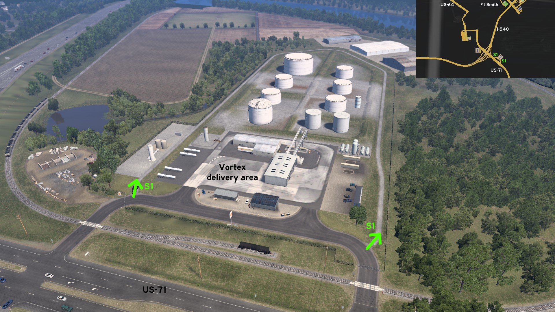 Close to each entrance of Vortex, found south of Fort Smith, there's a narrow dirt path that runs around the property perimeter.
Harrison
Center 1 - Pick The Best Route
Category: shortcutDiscovery: dfad1ripe
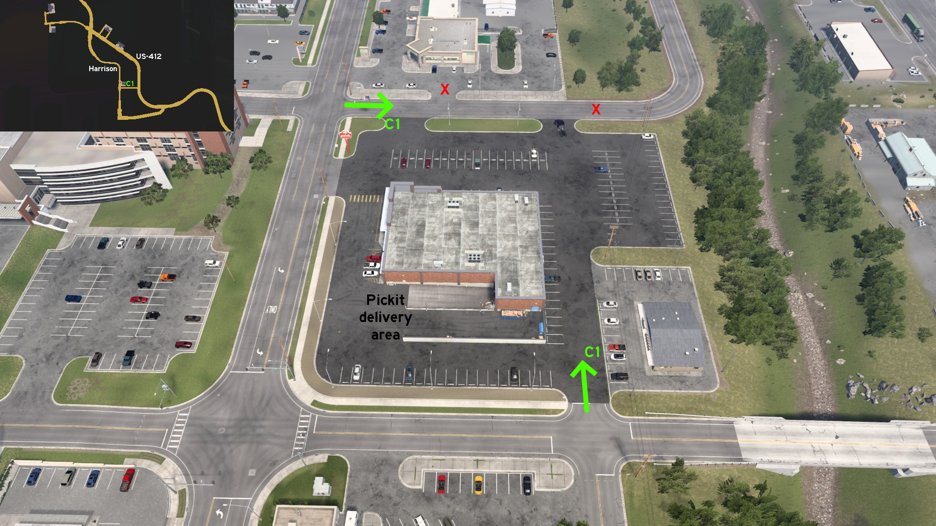 Around Pickit market on Harrison, you can drive all the way from the street north to the parking lot east, and choose the easiest way to access or leave the area.
Hot Springs
Northeast 1 - Better Picture Of Mountain Tower
Category: scenery, markableDiscovery: Applecorn, Silent Storm
Note: it's not required to drive this road to find and acquire the Photo Trophy, it can be done from the marked road
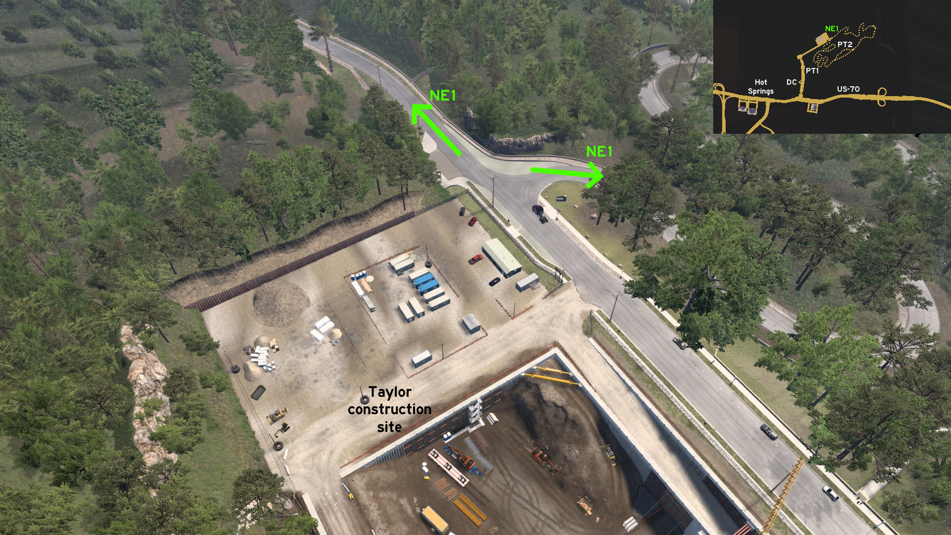 In the end of the road to Taylor construction site, after the city Director's Cut (DC) and the Photo Trophy for the Bathhouses (PT1), you find the 2 ends of the road leading to Mountain Tower (PT2). Be warned that it's a long crooked narrow route.
 Southeast 1 - No Big Vehicles Allowed
Category: scenery, markableDiscovery: Applecorn
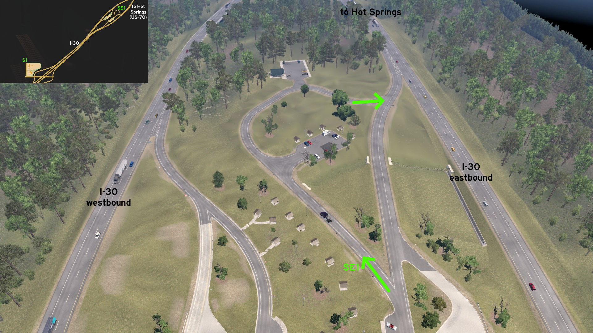 On eastbound side of I-30, there's a short loop bordered by parking lots for smaller vehicles almost at the northeast end of the rest area. It can't be accessed from westbond side legally, unless you drive on the grass.
 West 1 - Yet Another Forest Shortcut
Category: shortcut, markableDiscovery: DDogg, OWLCAT
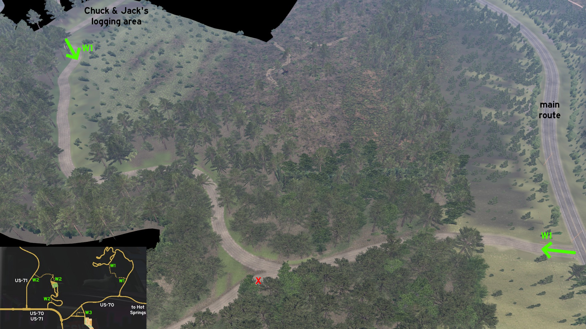 Some miles before Chuck & Jack's logging area west of Hot Springs, there's a dirt road leading directly to one of the delivery and loading spots.
 West 2 - That Route Is Mine
Category: shortcut, markableDiscovery: Applecorn, OWLCAT, dfad1ripe
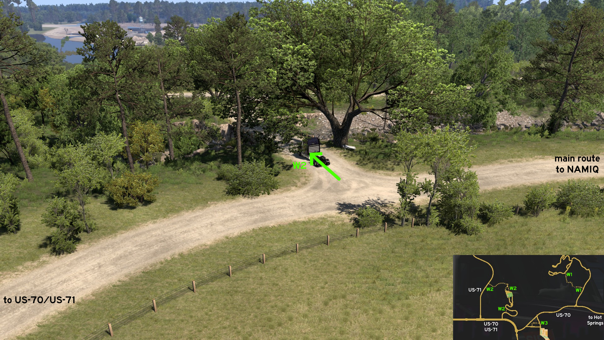 Close to NAMIQ main entrance, where US-70 and US-71 run along, there's a bridge down the road that can be used to avoid the longer curve. It seems someone hasn't seen the company sign when trying to drive here before.
 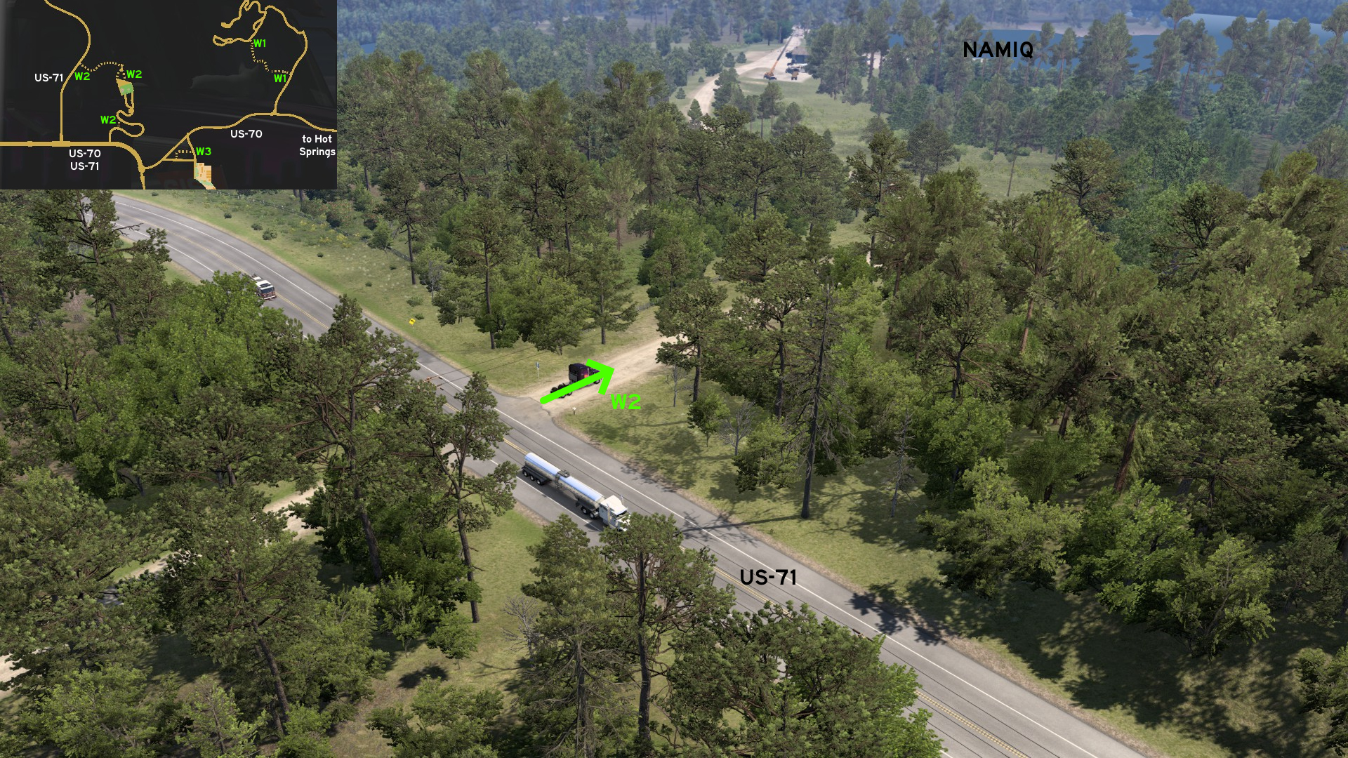 Starting where US-71 splits from US-70, you can drive directly to the mine through an almost hidden dusty path.
 West 3 - Among The Cattle
Category: shortcut, markableDiscovery: OWLCAT
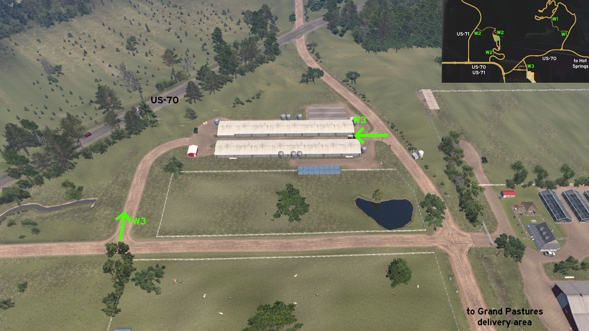 Between the 2 dirt paths leading to Grand Pastures delivery area, there's a path connecting both, that can be used for easier manuevering. Just be careful if pulling wide trailers.
Jonesboro
Northwest 1 - Easy Way On Hardy
Category: shortcut, markableDiscovery: Applecorn, Half-man half-amazing
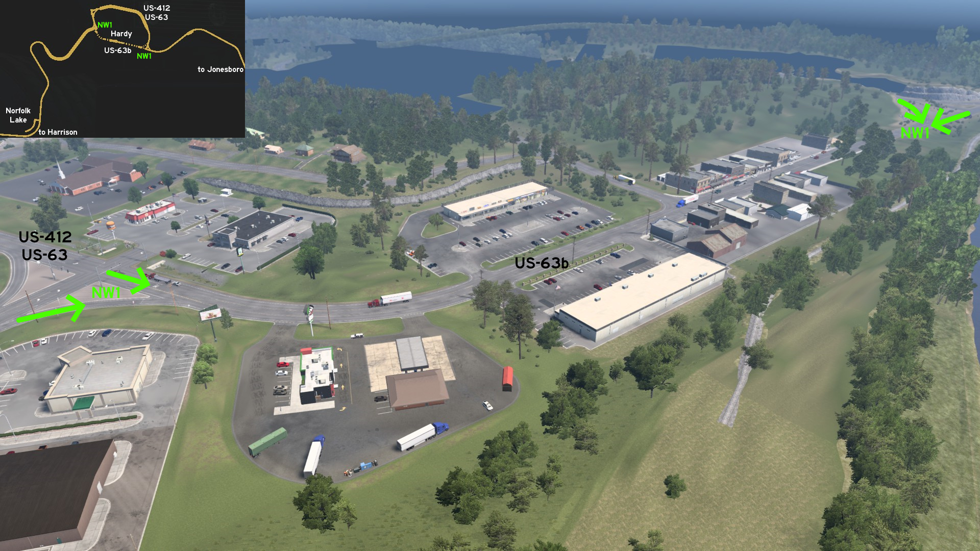 Northwest of Jonesboro, almost halfway to Harrison, and northeast of Norfolk Lake viewpoint, you'll find the unmarked town of Hardy. You can take US-63 business route (Main Street) across the town to avoid the longer loop north.
Little Rock 🏛️
Northeast 1 - Light Moment, Heavy Machinery
Category: shortcut, markableDiscovery: Applecorn
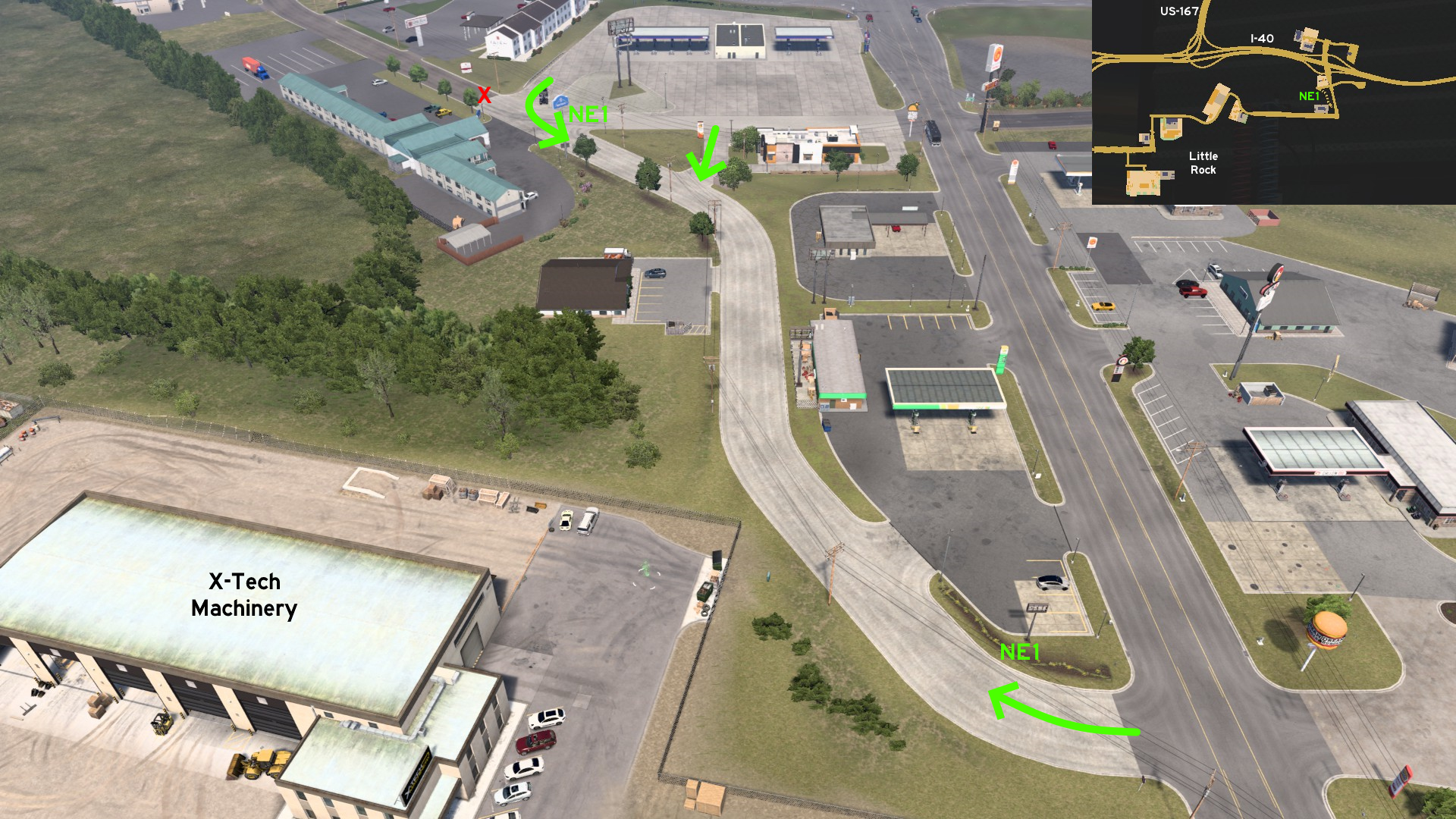 Northeast Little Rock, a back street links the rest stop and motels to the main road, at the backside of X-Tech Machinery depot.
 Northeast 2 - Man Versus Wild
Category: scenery, markableDiscovery: Applecorn
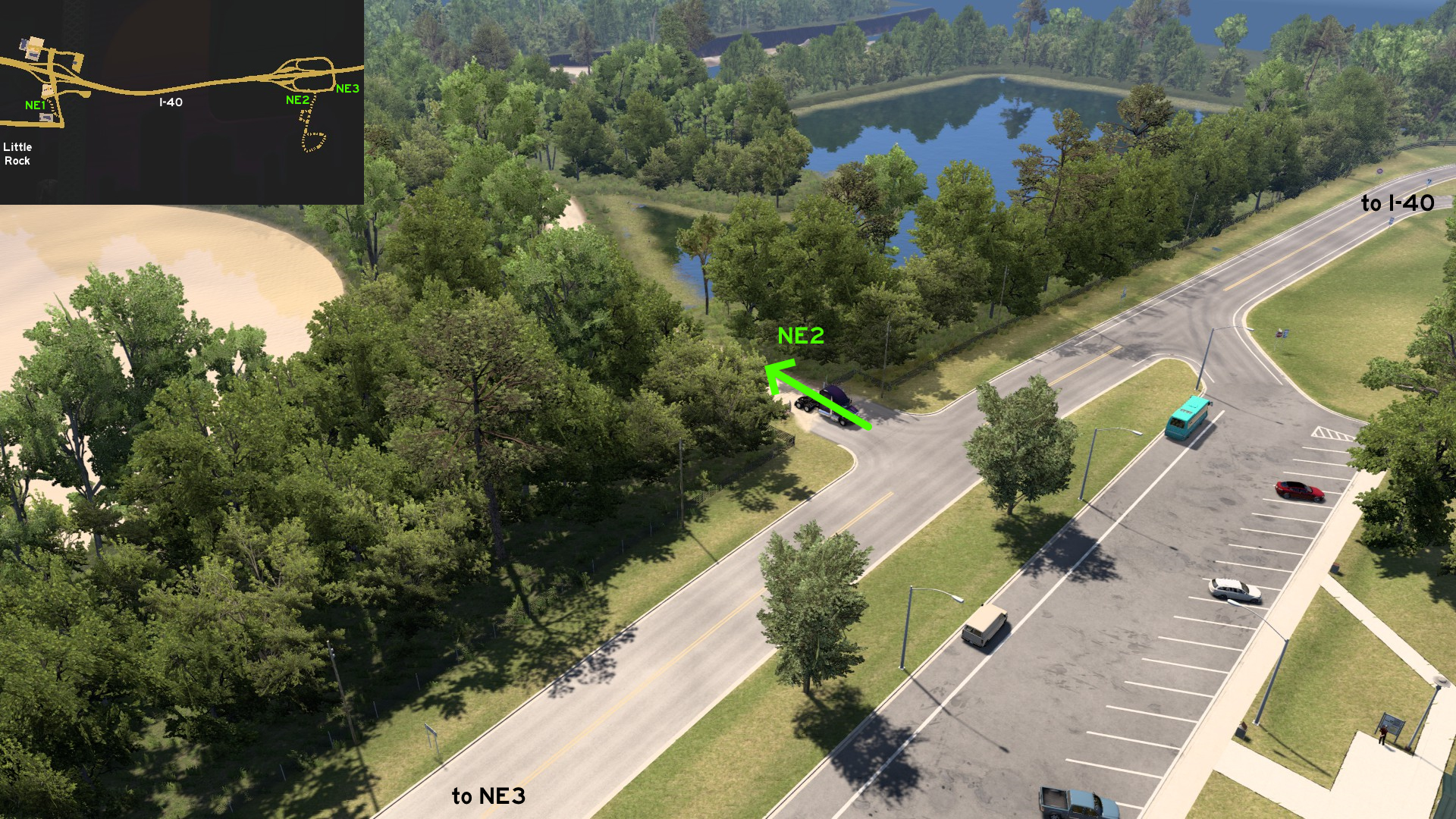 On truck stop northeast of Little Rock, some miles before US-79, you can find a dirt path starting on the eastbound area. It leads to a swamp where you can view the wild life, but also some area escavated with heavy machinery. Watch for cliffs barely sustained by logs and makeshift bridges.
 Northeast 3 - Only A Fool Will Find This Place
Category: easter-eggDiscovery: Applecorn
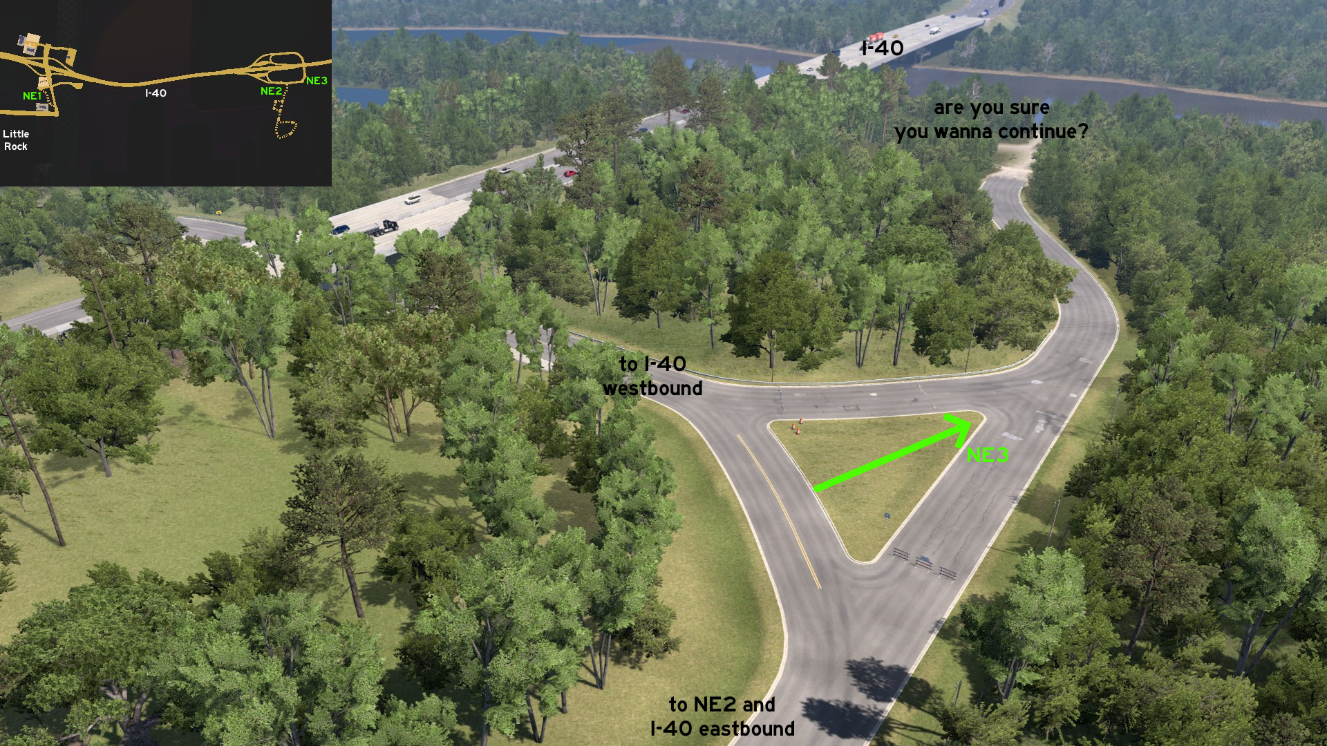 On the same truck stop, there's a strange closed road that can be accessed through the grass island. It narrows down to a dusty path to a river, and to a suspect place left. Enter at your own risk!
 Northwest 1 - Increase And Fix Your Fleet
Category: shortcut, markableDiscovery: Applecorn, TechTWP
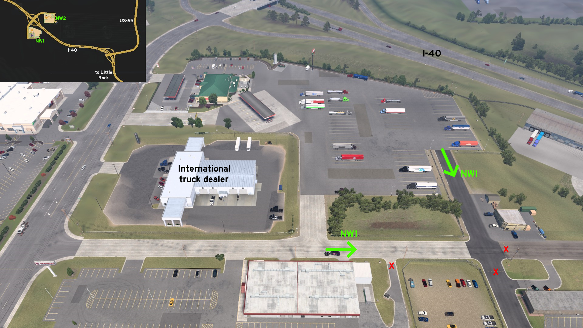 Northwest of Little Rock, on eastbound side of I-40, there's a street connecting the corner of International truck dealer and the back access of the truck stop.
 South 1 - Easy Access, Restricted Area
Category: shortcut, markableDiscovery: DDogg
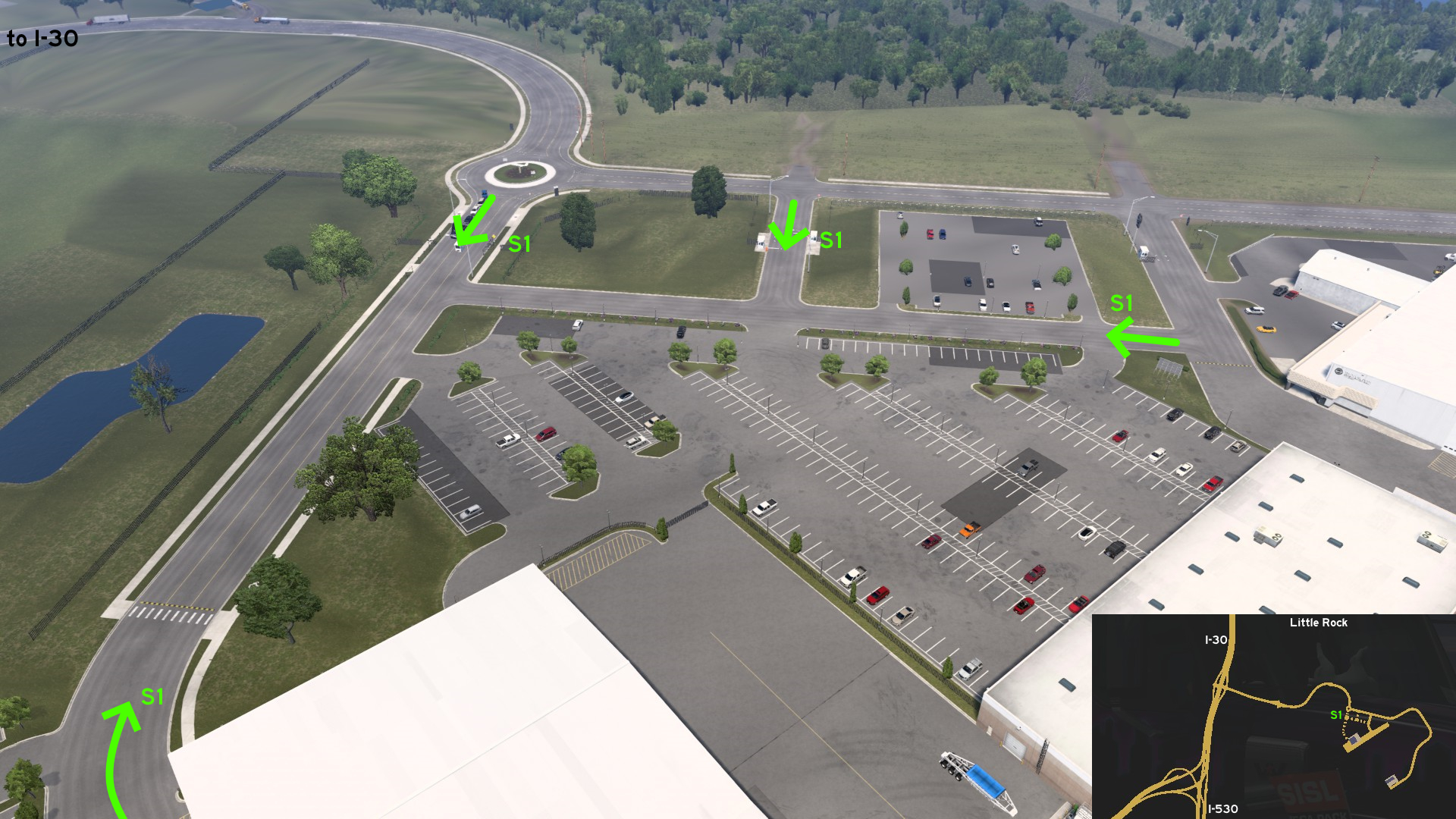 Right before the main entrance to Bill and Hillary Clinton National Airport, there are 2 service entrances to delivery area. The first is actually hard to miss, as it's straight after the roundabout on road coming from I-30.
 West 1 - Avoiding The Busy Route
Category: shortcutDiscovery: Applecorn, dfad1ripe
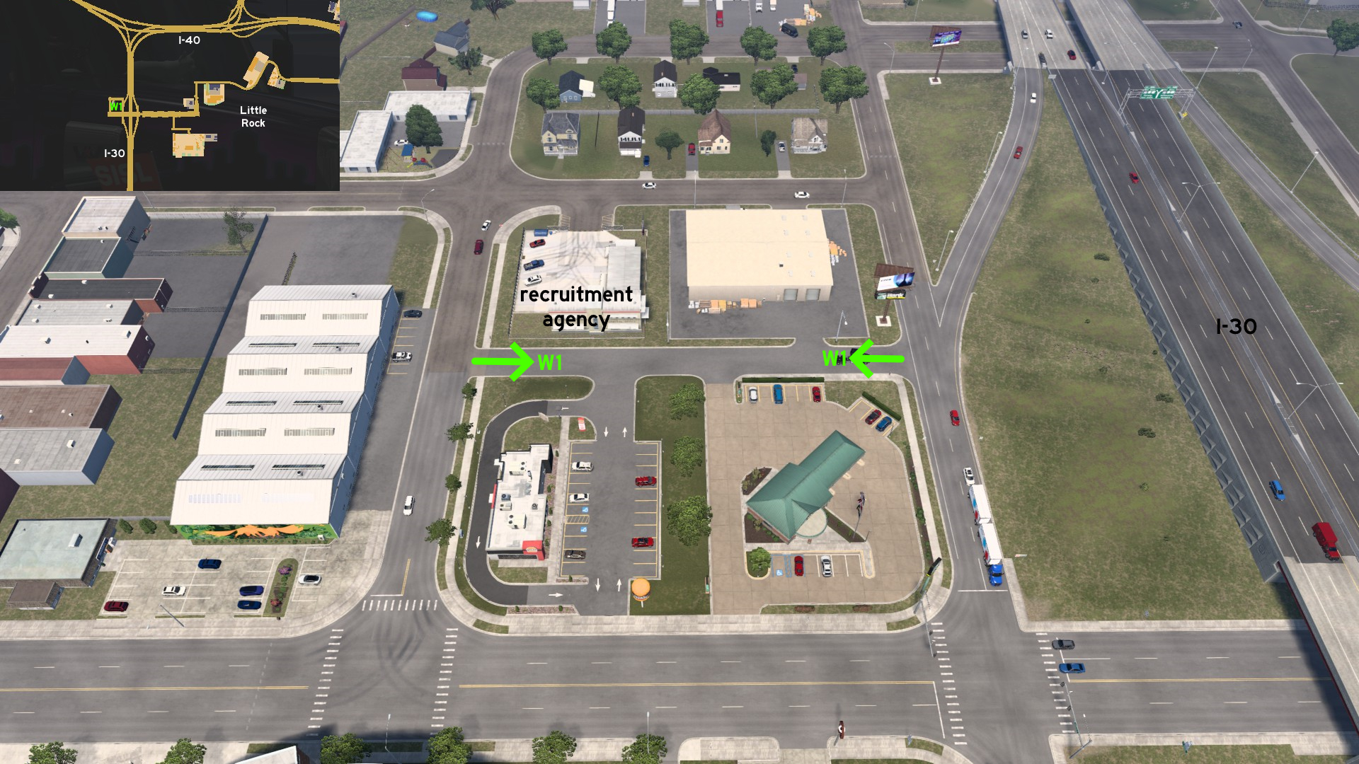 Behind the recruitment agency on west Little Rock, you can drive through an almost traffic-less street back to the exit ramps from/to I-30 and avoid the busy crossings.
Pine Bluff
Northeast 1 - Under Viaduct
Category: shortcut, markableDiscovery: Applecorn
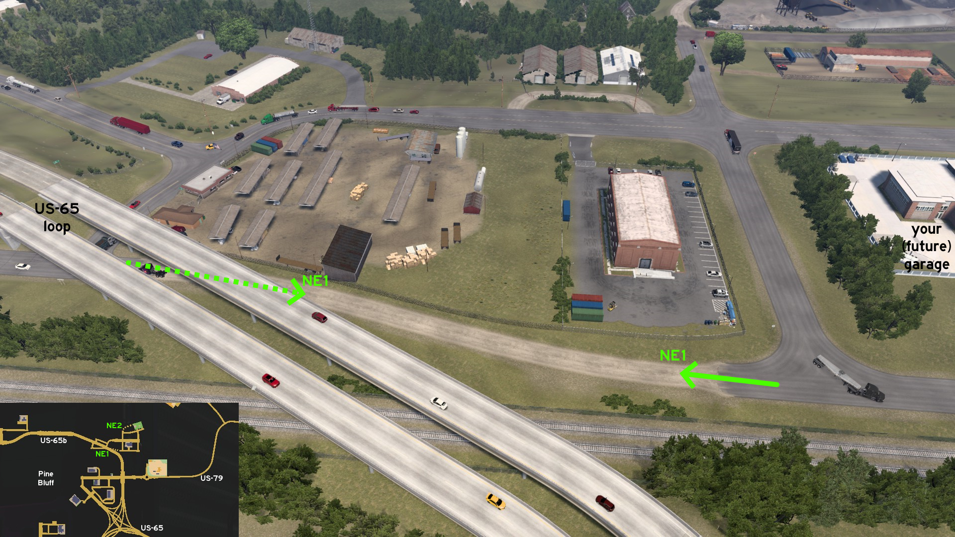 West of your (future) garage on Pine Bluff, you can drive under US-65 business loop viaduct direct to the ramps back to the route.
 Northeast 2 - Dust To Dust
Category: shortcut, markableDiscovery: OWLCAT
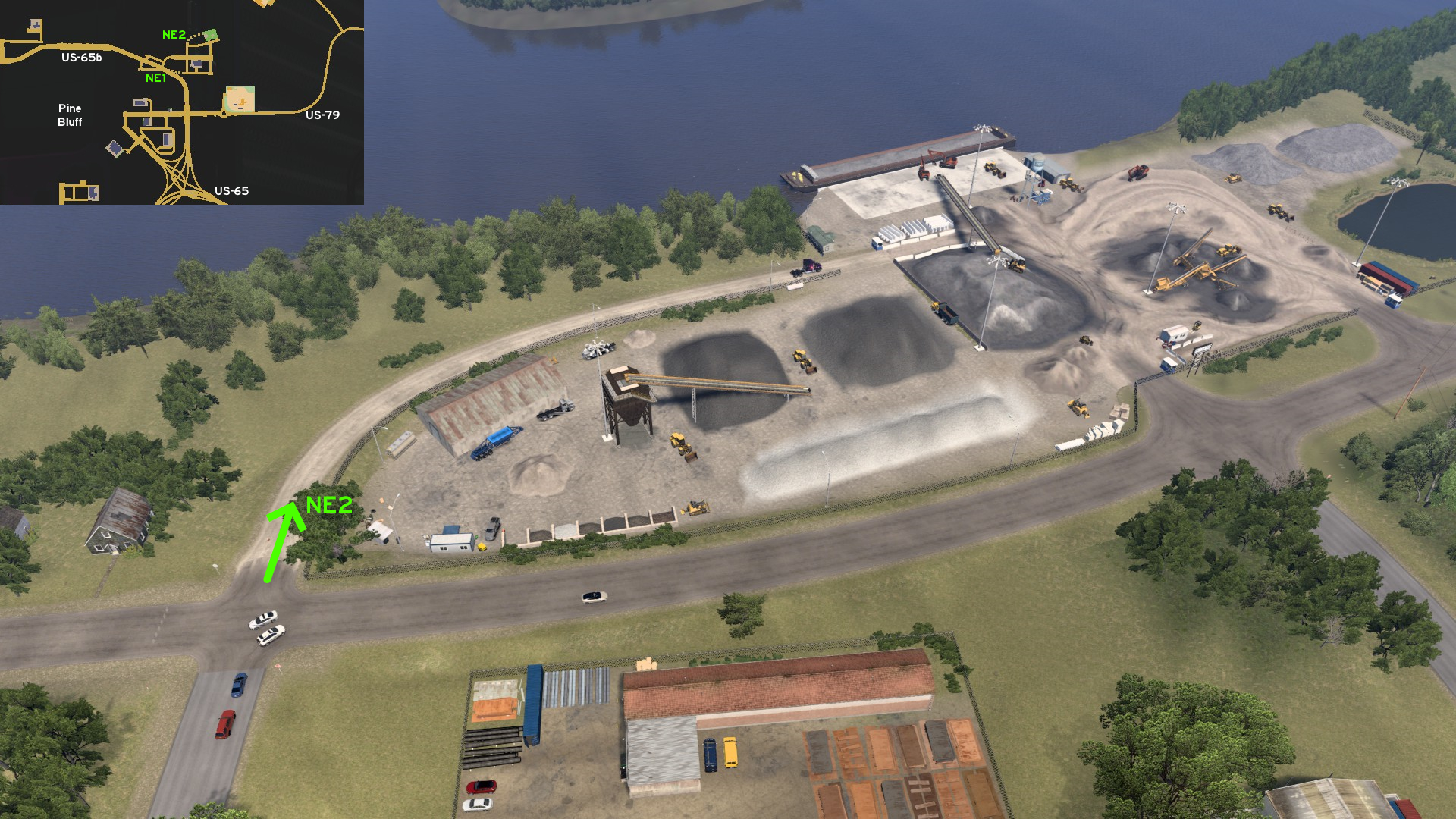 West of NAMIQ main entrance, there's a path blocked by some cones. Drive around or through them, and reach the depot back entrance.
 Northeast 3 - Through The Golden Fields
Category: shortcut, markableDiscovery: OWLCAT, dfad1ripe
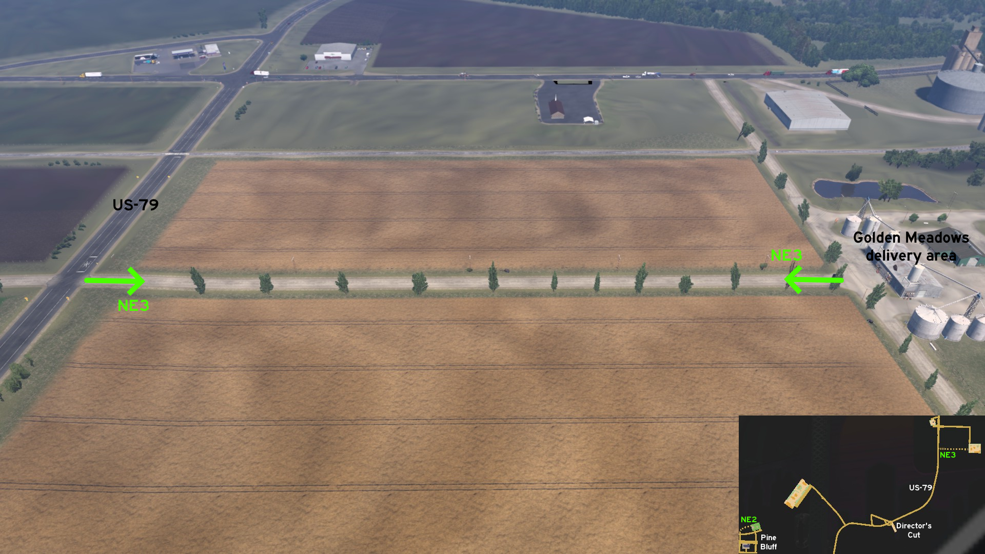 South of the main route to Golden Meadows northeast of Pine Bluff Lock & Dam 4 viewpoint, you can drive the dusty route through the fields, directly to delivery area, to avoid two railroad crossings at once.
 Southeast 1 - Return To City
Category: shortcutDiscovery: Applecorn
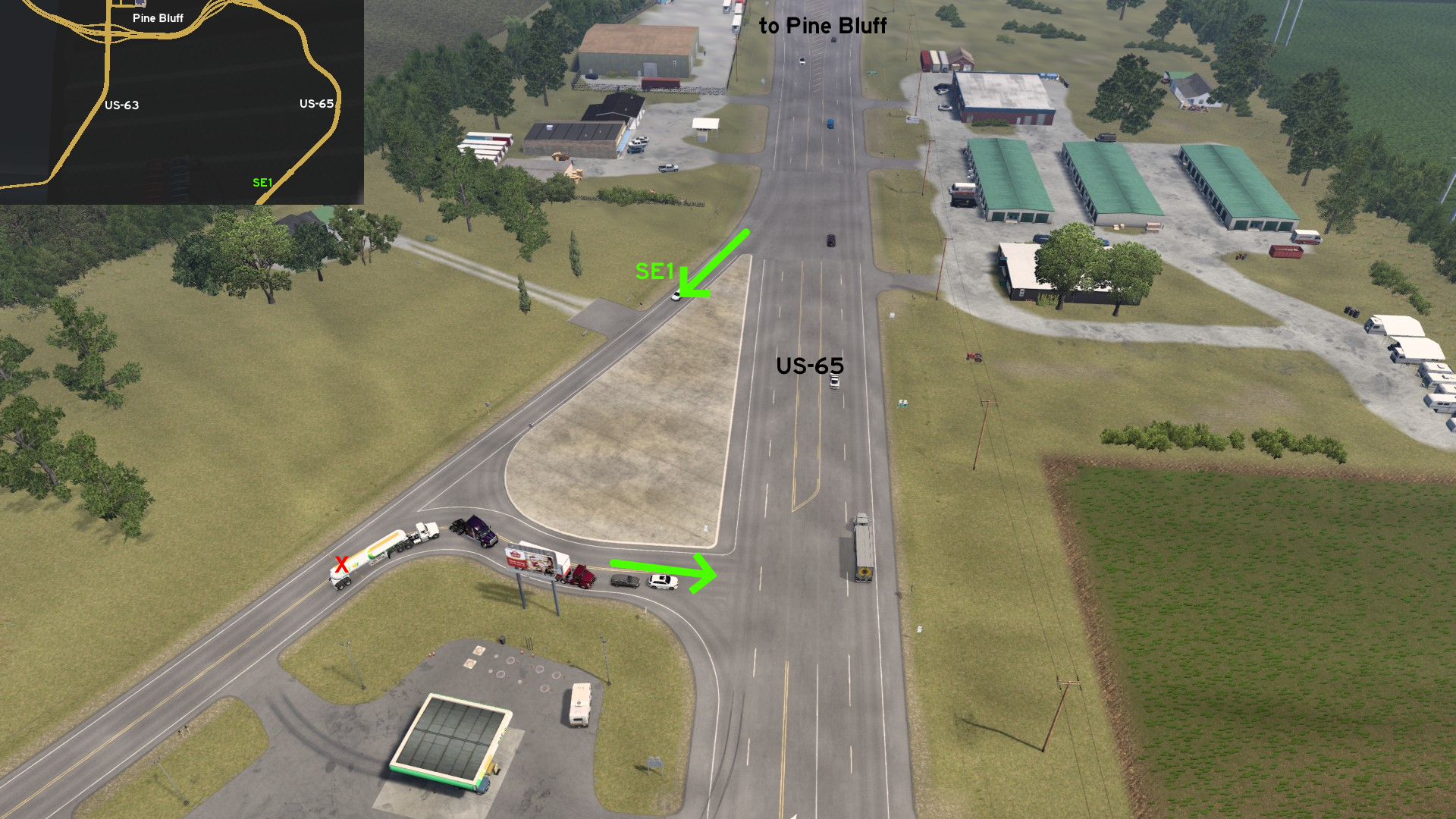 Southeast of Pine Bluff, there's a diagonal intersection before a fuel station that can be used as a detour back to the city.
Springdale
East 1 - Technology And Flavor
Category: shortcut, markableDiscovery: Epic Trucker Arch
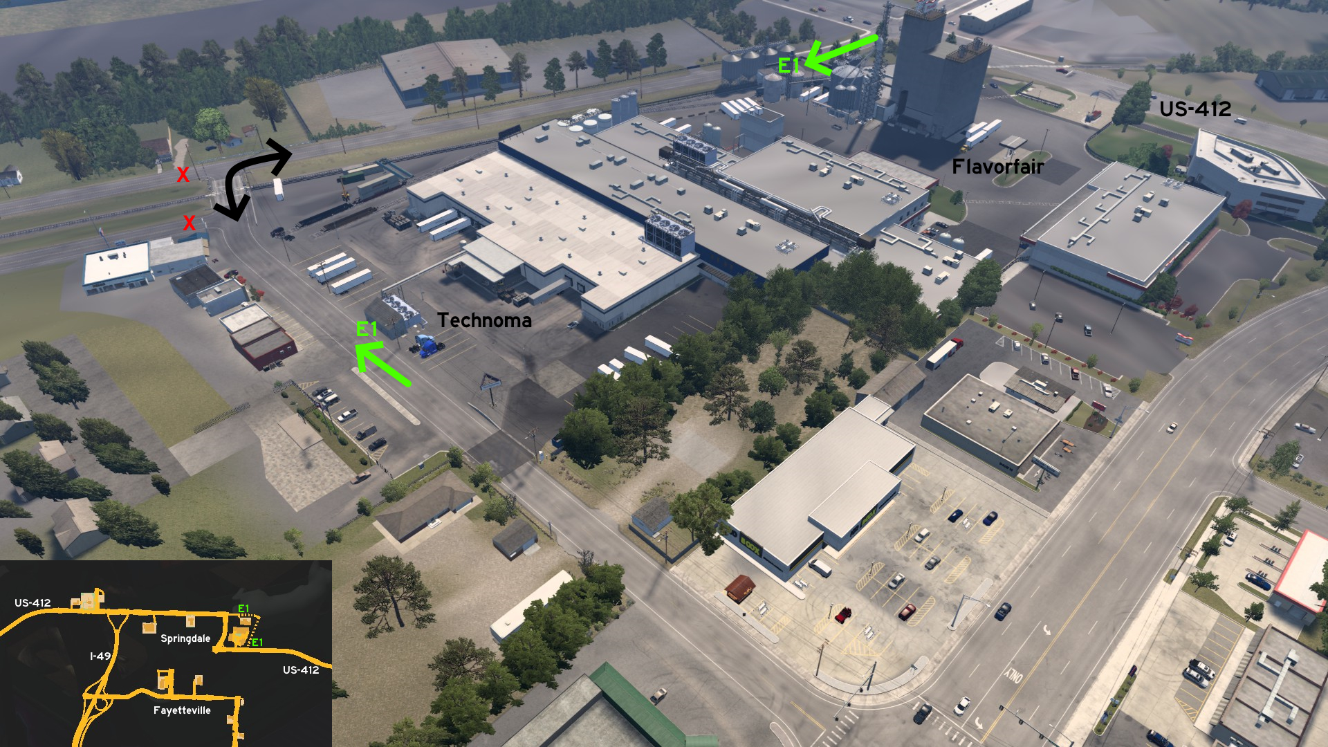 On Springdale east end, there's an alternative route around the industrial complex. One end is east of Flavorfair entrance on US-421. The other end is exactly at the entrance of Technoma, you may even find it by accident. Just be careful at the northeast corner, as there's a railroad crossing sandwich between two road crossings.
Texarkana
See also Texarkana on Texas
Discovery: Applecorn
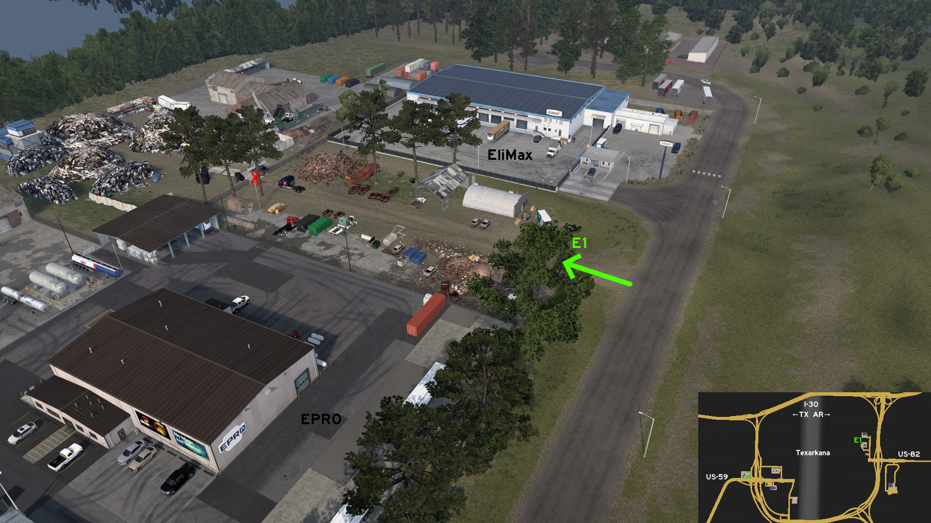 Head east Texarkana, where EliMax and EPRO depots are found. A dirt road separate both depots, and leads to the closed entrance of a junkyard.
East 1 - The Way To Junkyard
Category: sceneryDiscovery: Applecorn
Head east Texarkana, where EliMax and EPRO depots are found. A dirt road separate both depots, and leads to the closed entrance of a junkyard.
17th DLC, 2025 December 04
Baton Rouge 🏛️
Central 1 - Energy For Cardio
Category: shortcutDiscovery: FelipeVinhao
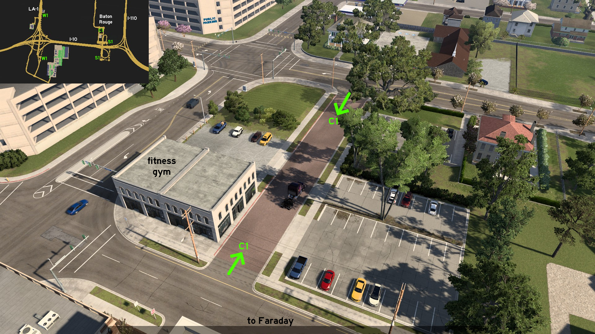 Go downtown Baton Rouge, where Faraday substation is found. If you drive all around north, you'll find a fitness gym. Between this building and the substation, there's a red brick road that can be used for maneuvering.
 North 1 - No Time To Waste
Category: shortcutDiscovery: FelipeVinhao
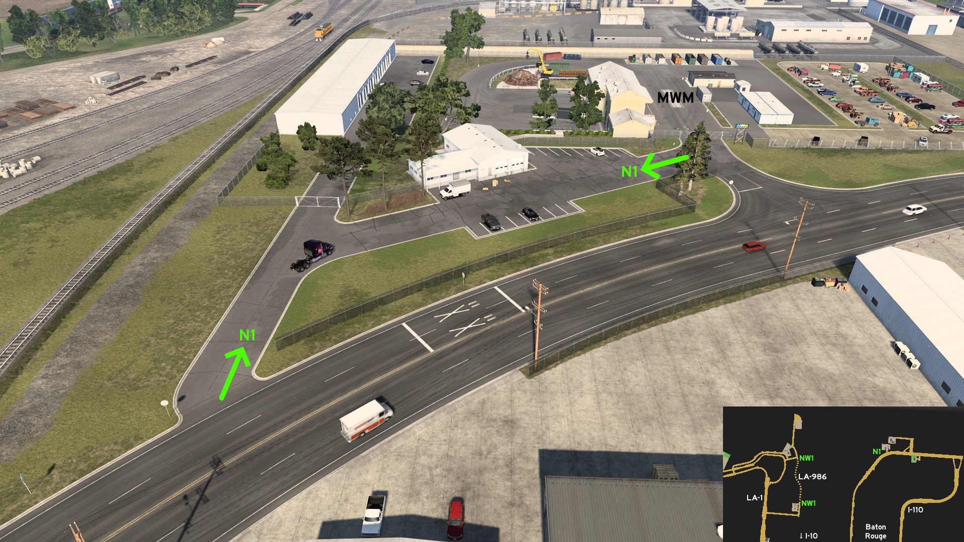 Head north Baton Rouge to Municipal Waste Management. On southwest corner of depot, you can use the parking lot to return to main roads.
 Northwest 1 - Refined Route
Category: shortcut, markableDiscovery: olm823249
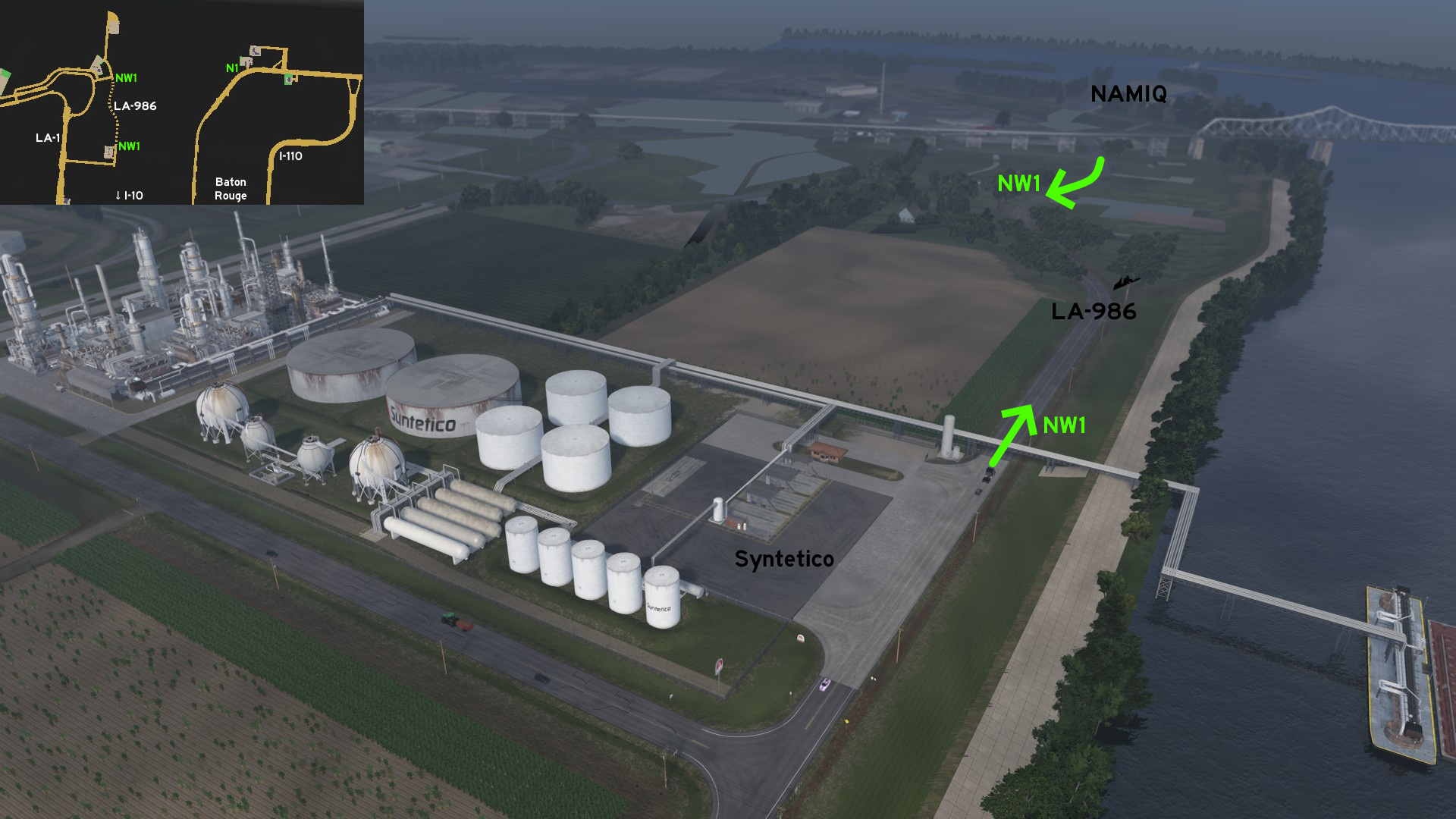 Leave Baton Rouge through LA-1 northbound. Head to Syntetico refinery on LA-986. If you continue straight, you can go to NAMIQ without returning to busy main route.
 South 1 - Triple Exit
Category: shortcut, markableDiscovery: MikMinevi
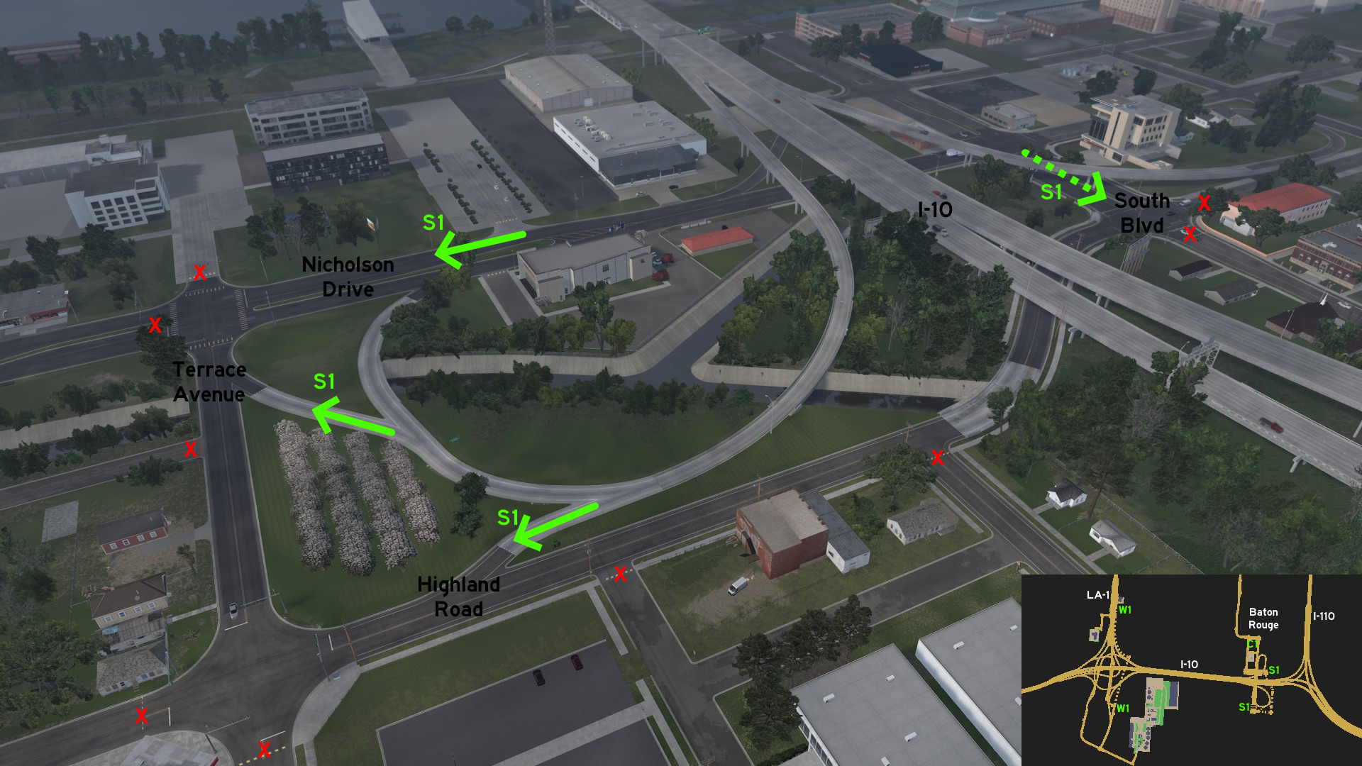 Leave I-10 eastbound to downtown Baton Rouge, where Faraday substation is found. The ramp connects to other two roads (Highland Road and Terrace Avenue) besides the marked one (Nicholson Drive). You can also start your tour north of this intersection, on South Boulevard.
 West 1 - Direct To Customer
Category: shortcut, markableDiscovery: olm823249
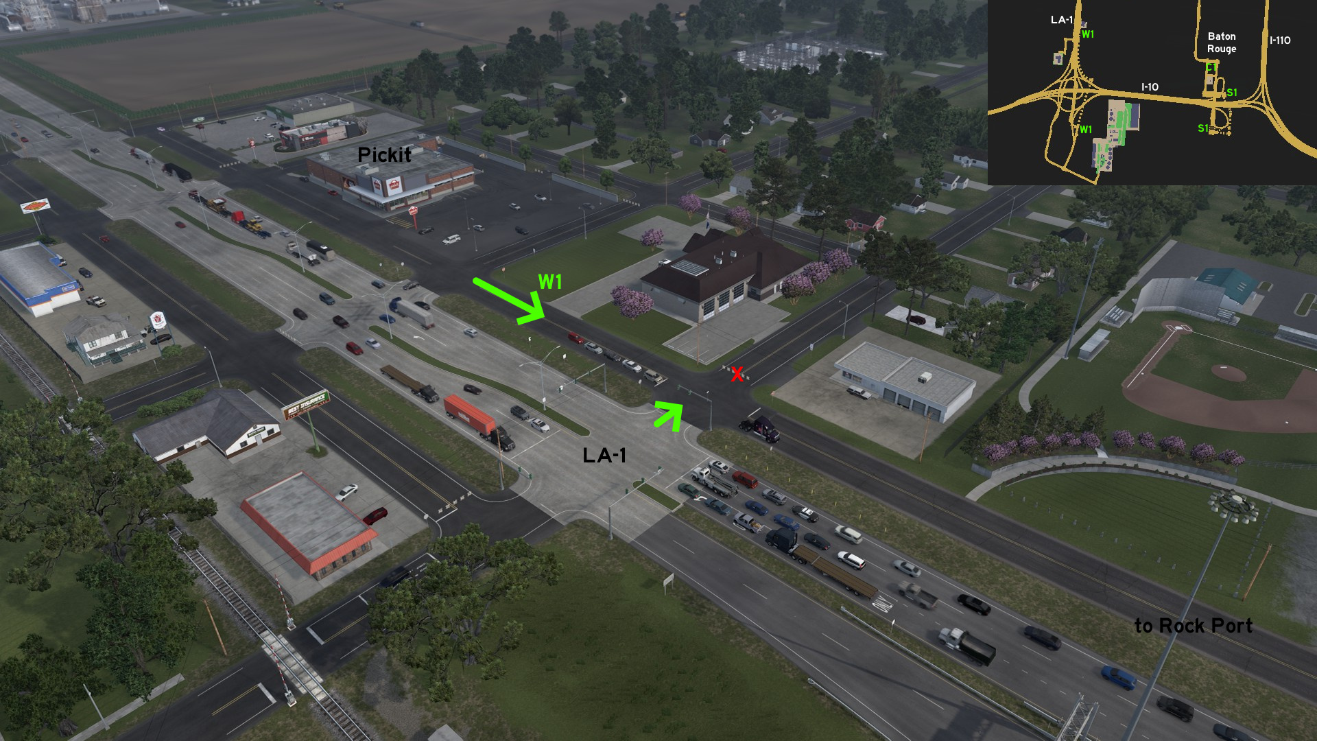 Head west Baton Rouge to LA-1. There's an auxiliary route connecting Rock Port directly to Pickit. Simply continue straight on side roads instead of returning to LA-1.
DeRidder
East 1 - Parallel Electric Lines
Category: shortcut, markableDiscovery: FelipeVinhao
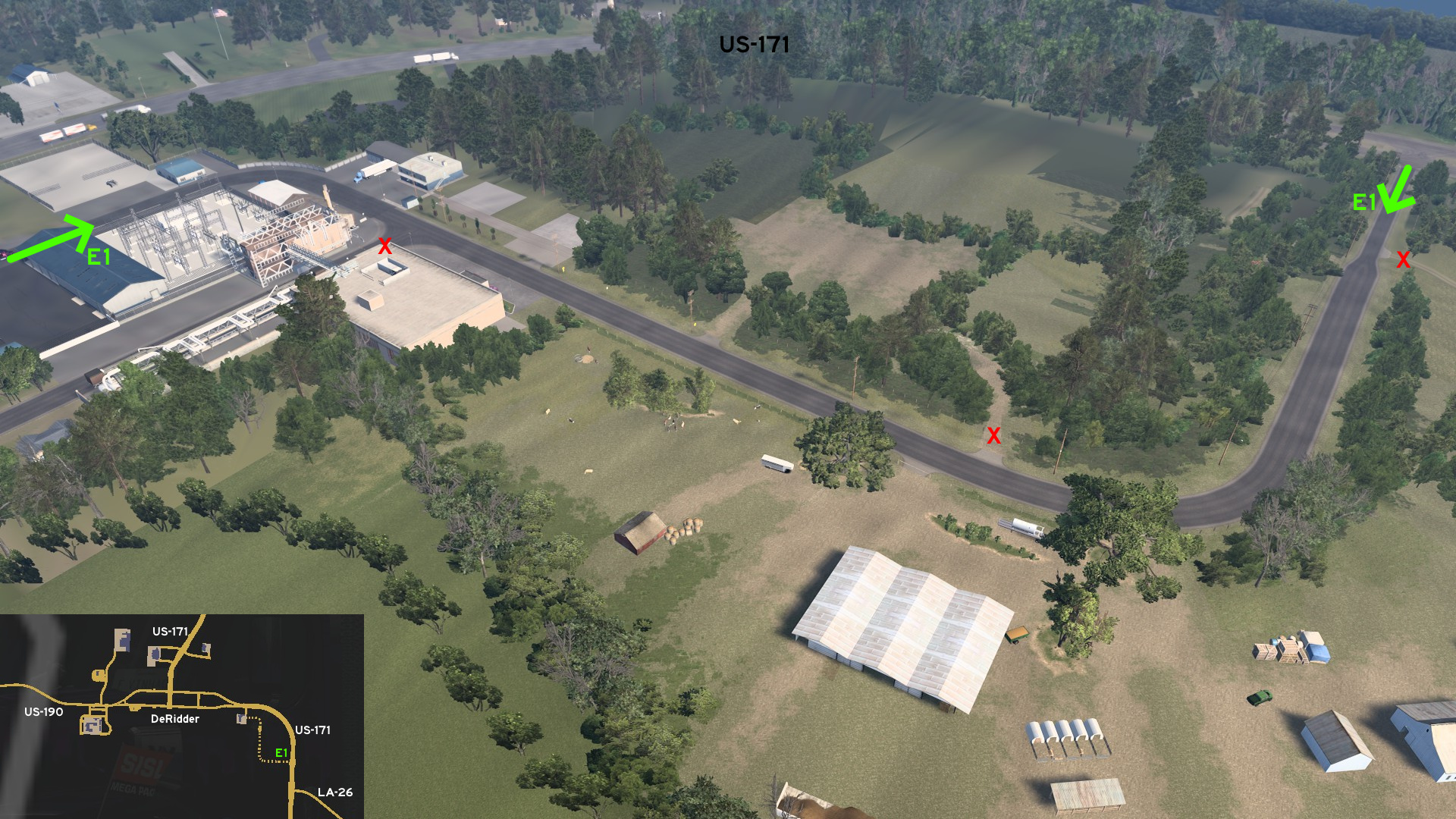 From Faraday substation on east DeRidder, take the east route right after the main entrance. The route runs along US-171, before narrowing and crossing with it, some meters before LA-26 junction.
Lafayette
Southeast 1 - Hot Tour
Category: scenery, markableDiscovery: Wide Kemo
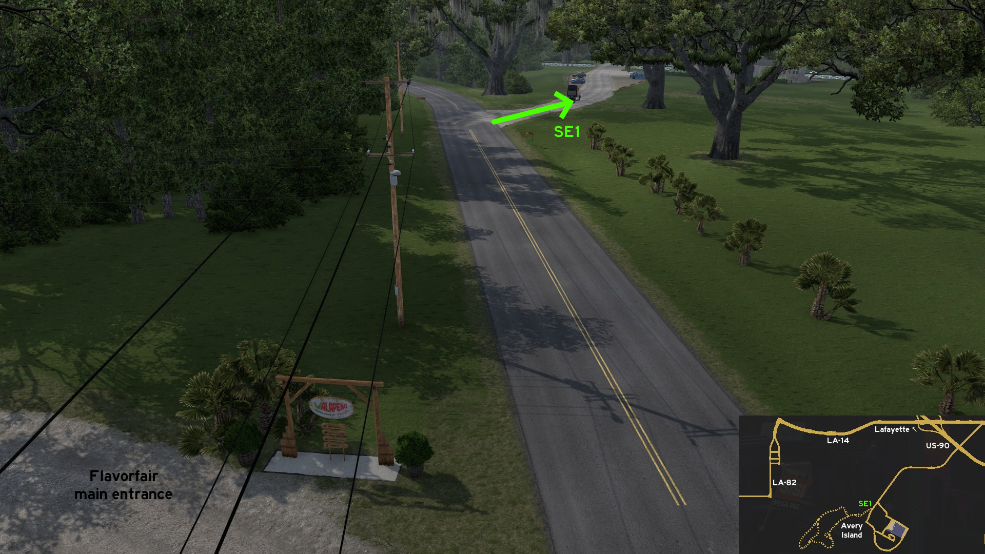 Leave southeast Lafayette through US-90, exit to LA-14 eastbound, then head southwest to Flavorfair Jalapeño factory on Avery Island. Some meters after main entrance, you can take a dirt route to visit the local garden with a diverse view: swamps, crocodiles, birds, flowers, and Asian architecture.
 Southwest 1 - Sinking Road
Category: scenery, markableDiscovery: FelipeVinhao
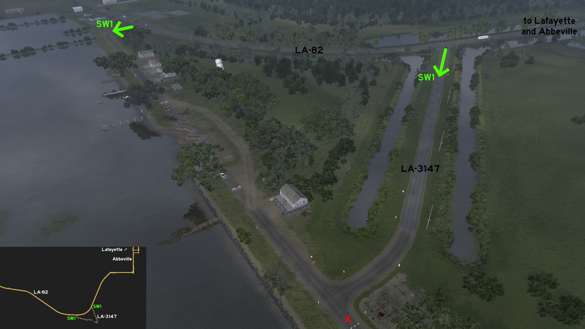 Leave southeast Lafayette through US-90, exit to LA-14 westbound, then head south to unmarked town of Abbeville on LA-82. After leaving town, you'll find LA-3147, which leads to the coast and continues east, which is closed to player. You'll have to head west, where part of the road has collapsed into the water. Drive around the reconstruction area and continue until you return to LA-82.
 West 1 - Tailored Shortcut
Category: shortcut, markableDiscovery: FelipeVinhao
Note: only the actual shortcut is markable
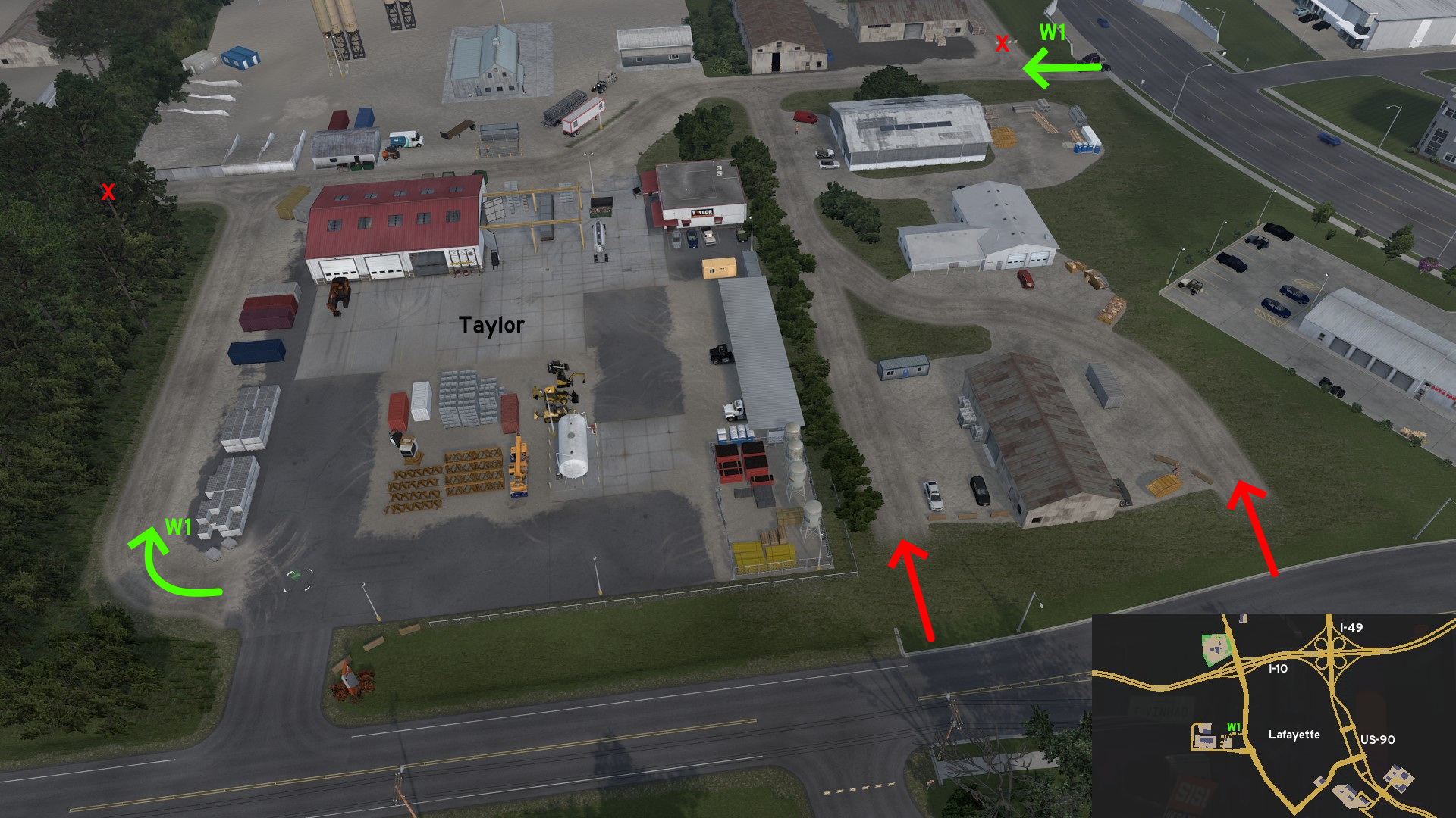 From the main entrance of Taylor depot on west Lafayette, you can take the dusty path around the area to return to city. You can also drive around the nearby warehouses.
Monroe
Central 1 - Just Go Ahead
Category: shortcutDiscovery: Applecorn
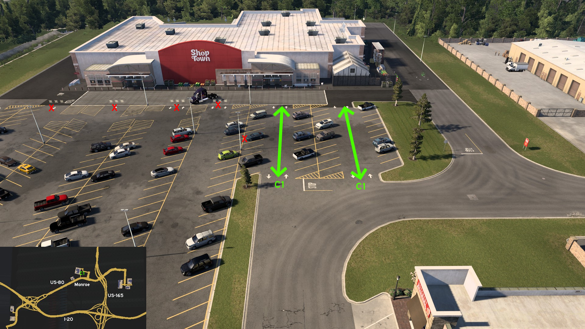 Near the main entrance of ShopTown on Monroe, there are two traversable parking lot lanes. Just don't try to reach any other lane, even if they look accessible.
Natchitoches
East 1 - Through The Swamp
Category: scenery, markableDiscovery: FelipeVinhao
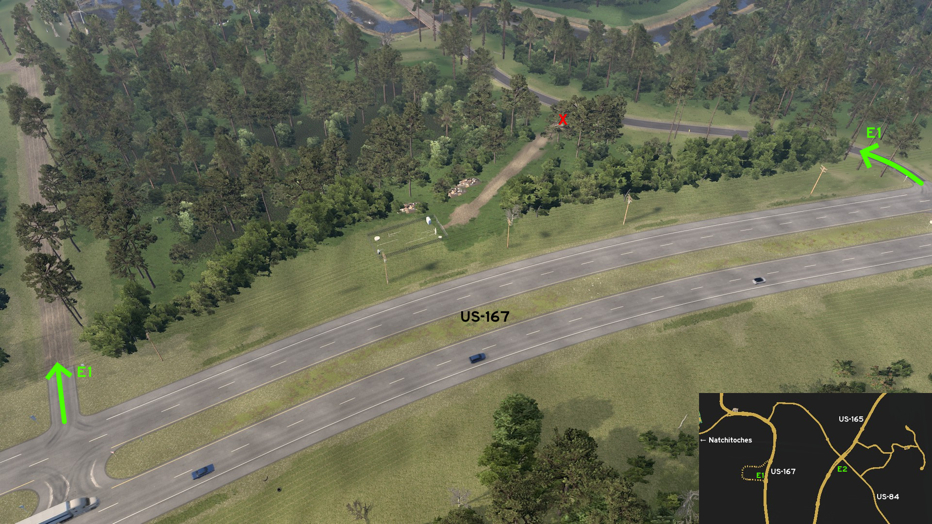 Leave Natchitoches and head east. On US-167, almost opposite to city, there's a partially paved road that run through a swampy area. At the end of loop, there's a deforested area.
 East 2 - One Buck Shortcut
Category: shortcutDiscovery: FelipeVinhao
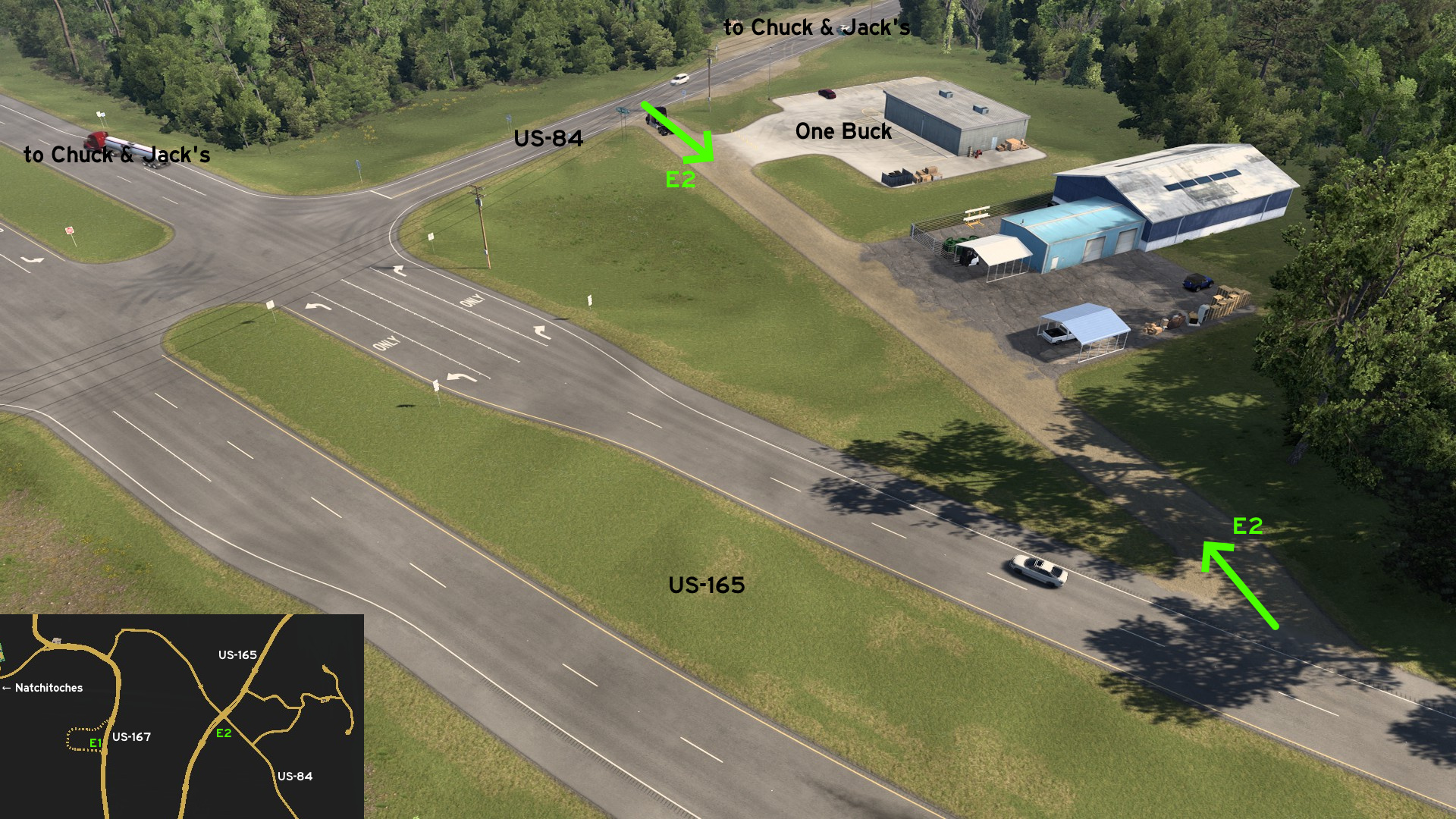 Leave Natchitoches and head east to Chuck & Jack's logging area. On south corner of US-84 and US-165, there's a dirt path connecting both and an One Buck market and a warehouse.
New Orleans
West 1 - Golden Alternative
Category: shortcutDiscovery: FelipeVinhao
Note: farm seems to be closer to Houma, but in game it belongs to New Orleans
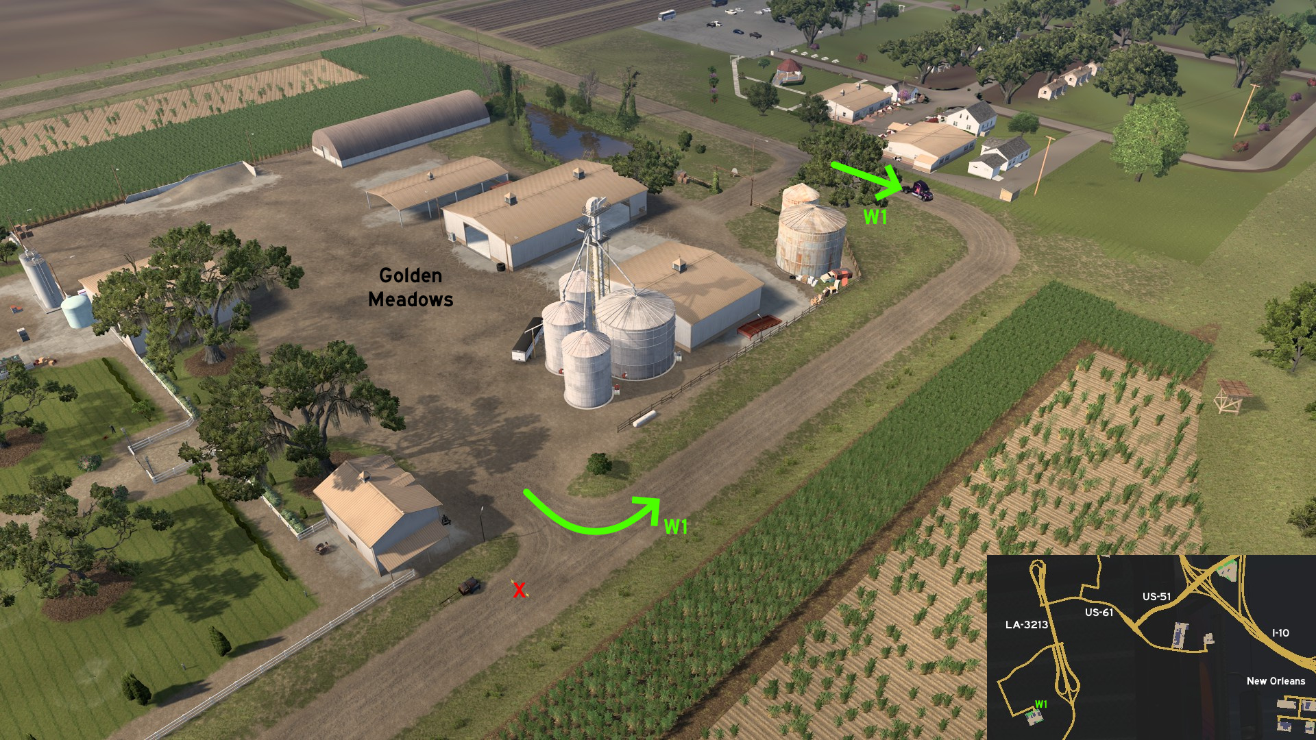 Leave west New Orleans through I-10, exit on US-51, and cross Veterans Memorial Bridge on LA-3213 to reach Golden Meadows farm. Before reaching main entrance, you can go ahead and access the secondary entrance.
Port Fourchon
Central 1 - Under The Unfinished Bridge
Category: scenery, markableDiscovery: olm823249
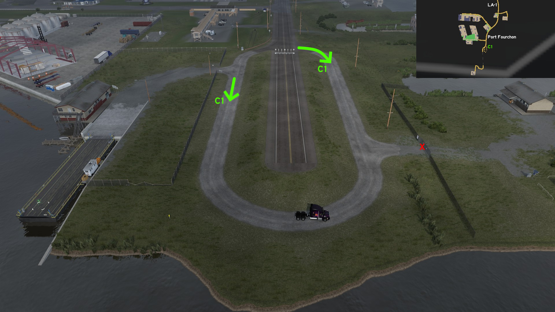 Starting on the access to ferry to Port Fourchon, there's a loop going under the future bridge, to stand up against the hurricanes.
11th DLC, 2023 August 01
Ardmore
East 1 - Business And Food
Category: shortcutDiscovery: Applecorn
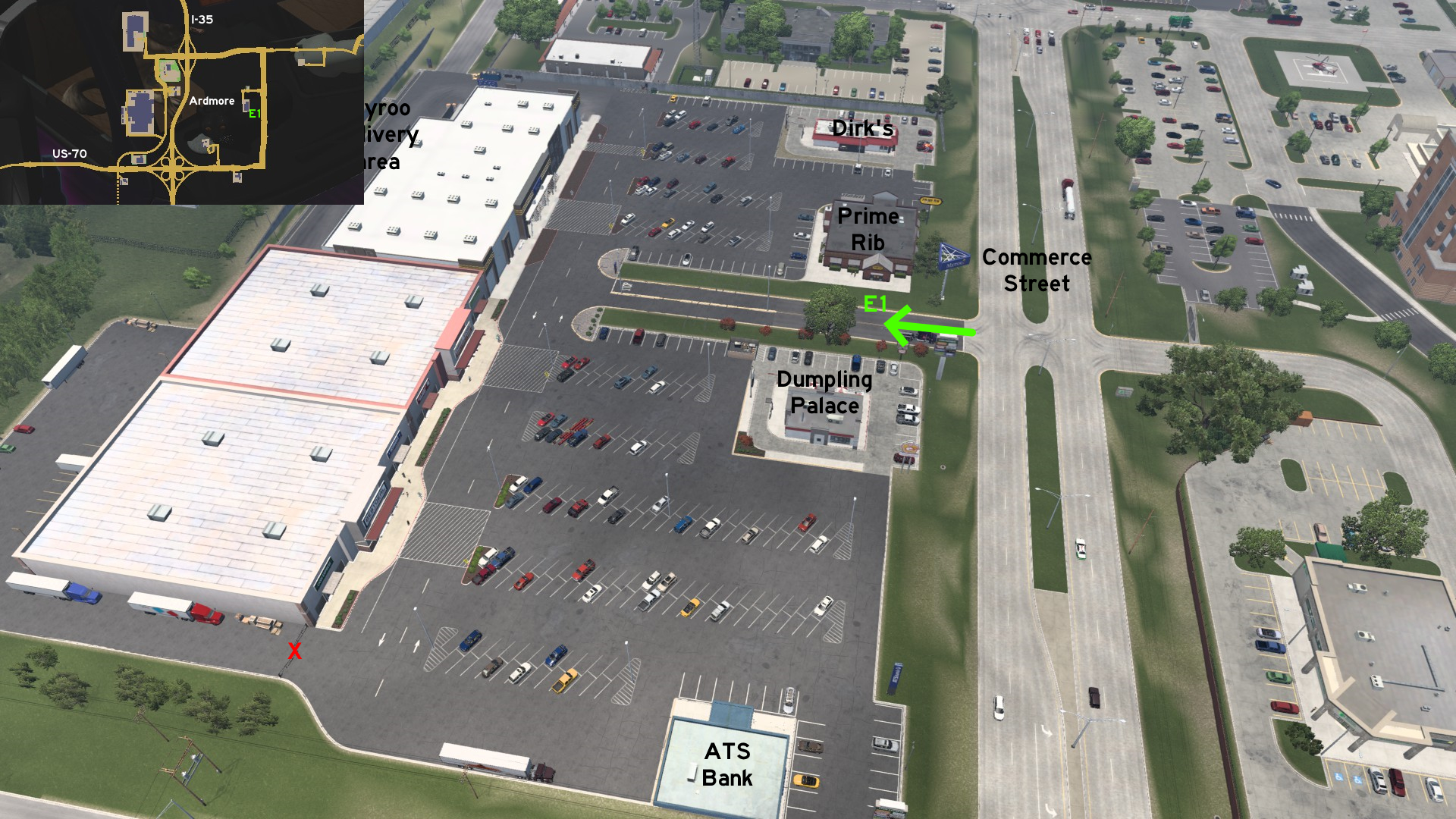 Taking the east exit from Myroo store, you can access the business area parking lot, which features fast food and a bank. Driving between Prime Rib and Dumpling Palace (or through any open grass area) will lead you directly to Commerce Street.
 Southwest 1 - From Mine To Downtown
Category: shortcut, markableDiscovery: hydroxyquinoline
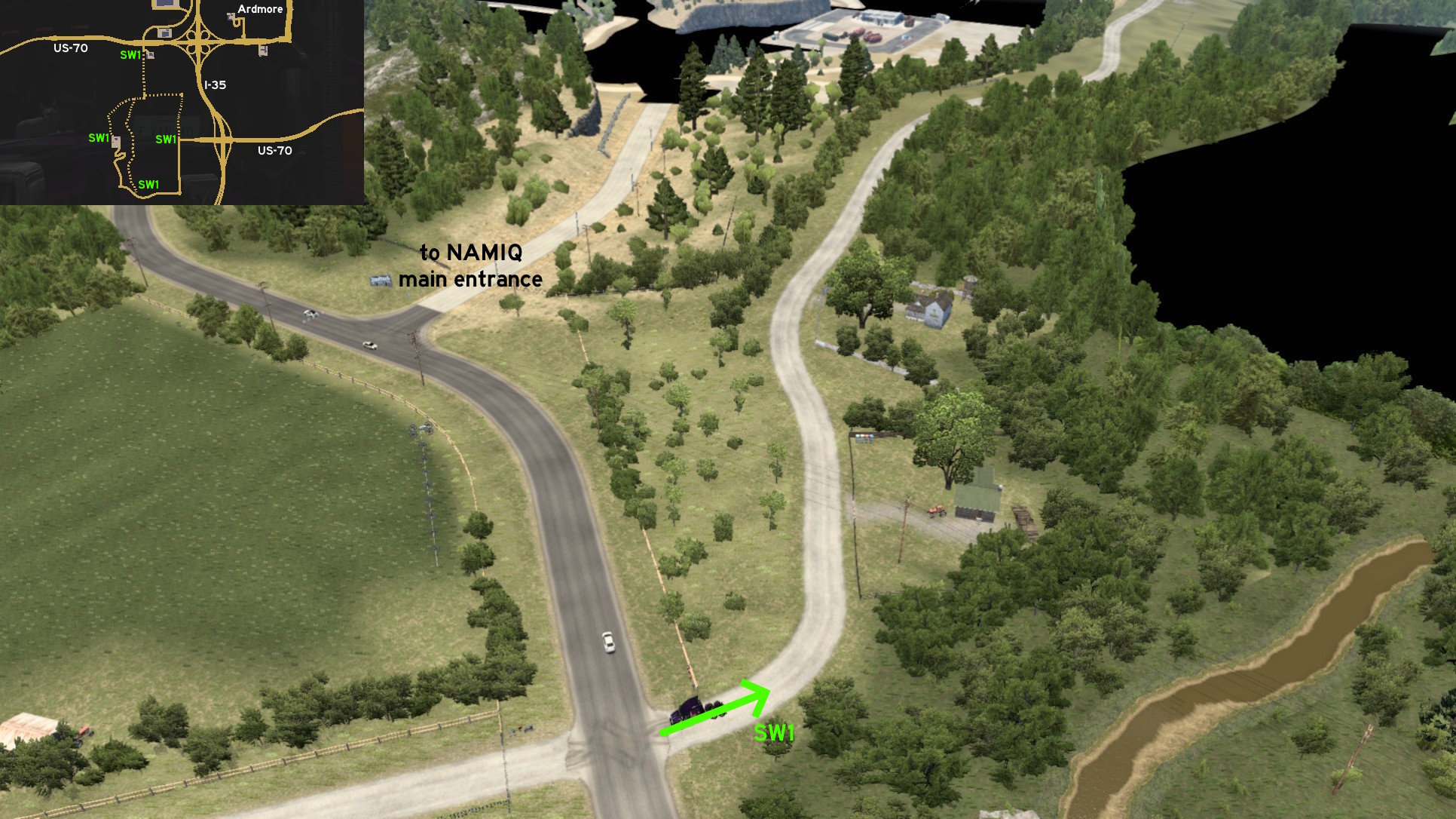 There are three different routes from NAMIQ mine to downtown Ardmore besides the official I-35 and US-70 ones. The first one starts some meters before the dust route leading to NAMIQ main entrance. It can be noticed by the post boxes at its entrance.
 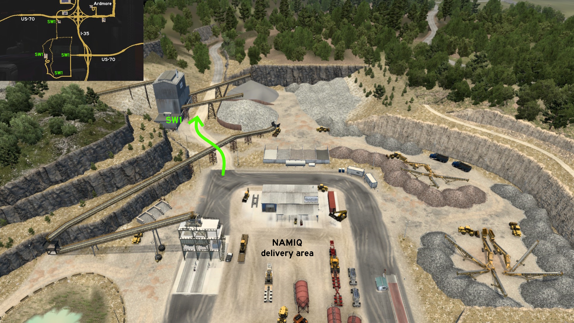 The second one starts on the back entrance of NAMIQ delivery area. The first route ends on it, and this one ends on an asphalt road.
 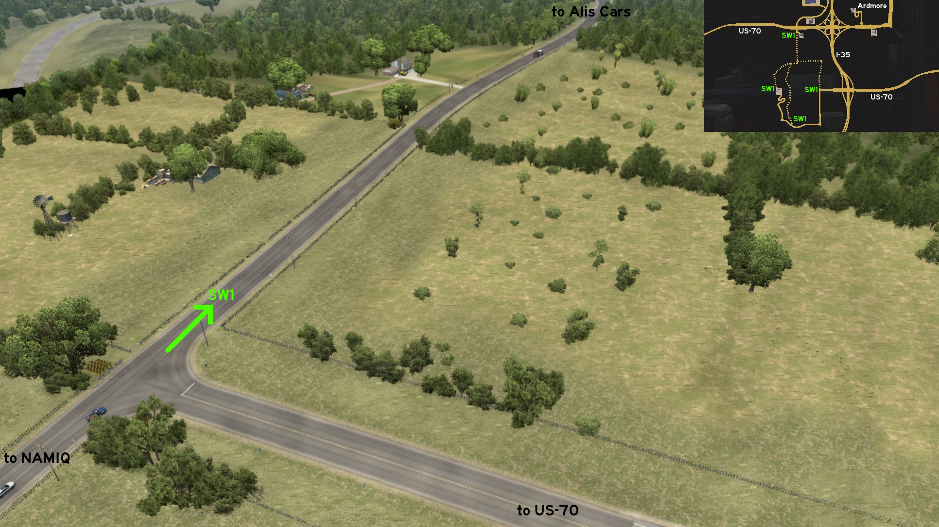 The third one starts on the opposite direction of US-70 intersection, heading west. Drive like heading to NAMIQ, but instead of turning left (south), turn right (north). Continue until reach a blocked way, and turn left (west). Driving this road until its end, and you'll reach the same place as the previous routes. Keep heading north until you reach the entrance of Alis Cars.
Enid
South 1 - Short(cut) Circuit
Category: shortcut, markableDiscovery: Crieris
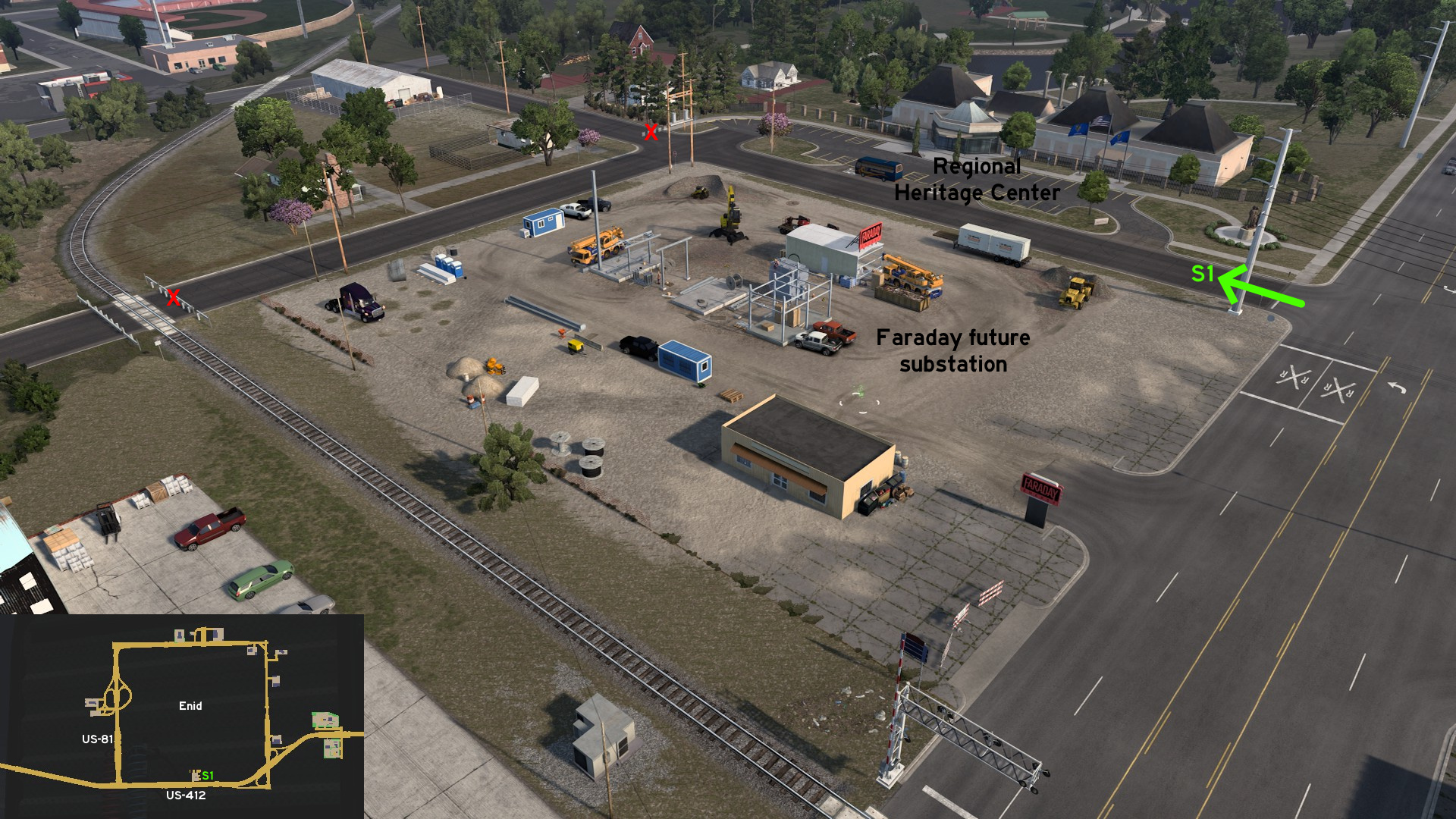 Go to future Faraday substation on south Enid. You can access the back of construction site by driving through the road to Regional Heritage Center. You can drive the back street until its dead end on a closed railroad crossing.
 West 1 - Around The Oil Fields And Farm Fields
Category: scenery, markableDiscovery: LikelyLeon, kaia15, OWLCAT, hydroxyquinoline
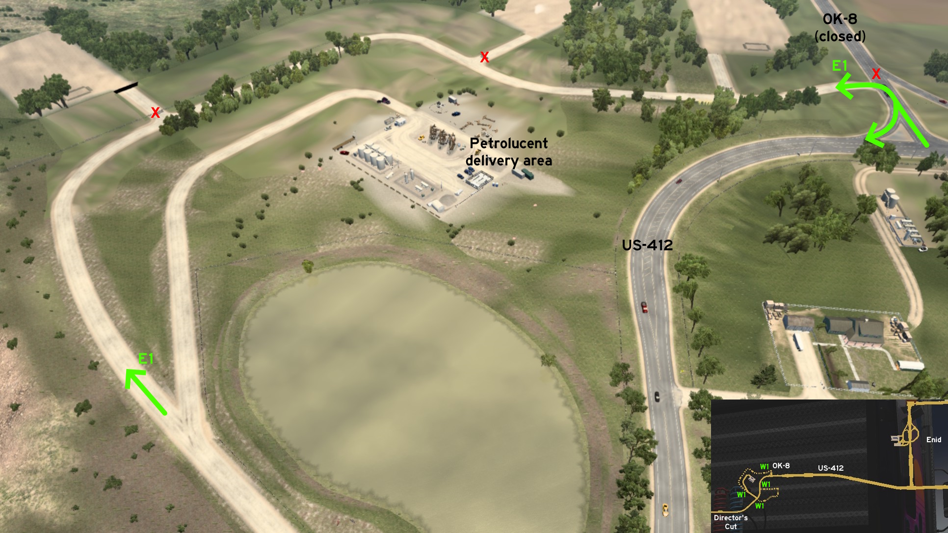 Starting on the route to Petrolucent fields west of Enid on US-412, there's another route that goes around the delivery area and lead to oil pumps (although most of them are fenced). The route ends on a small cut of OK-8
 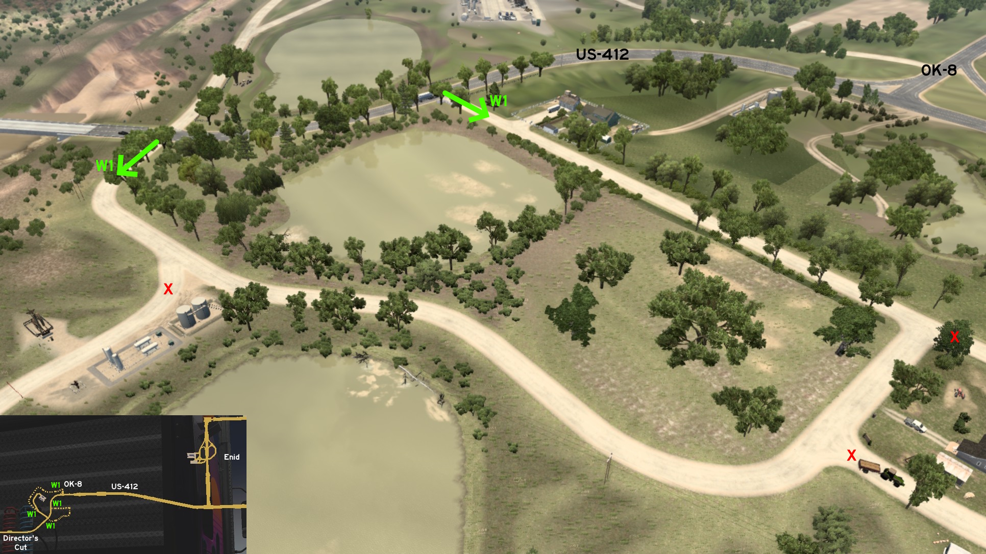 Across the route to Petrolucent, there's another road leading to several private properties, one of them is blocked by a tractor, two people and one dog. It returns to US-412 halfway the OK-8 junction.
Guymon
Central 1 - Between The Houses And The Cemetery
Category: shortcut, markableDiscovery: LikelyLeon, hydroxyquinoline
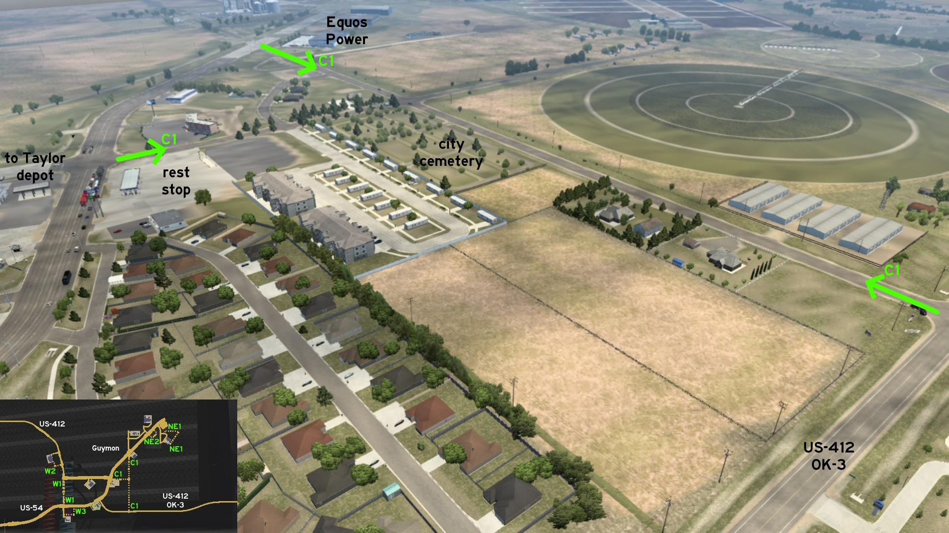 Guymon residential area can be accessed by three different routes. The first one is west of Equos Power warehouse. The second one is across the road that leads to Taylor depot, besides a rest area. The third one starts on US-412 / OK-8. All three routes meet near the city cemetery.
 Northeast 1 - Busy Dusty Roads
Category: shortcut, markableDiscovery: OWLCAT
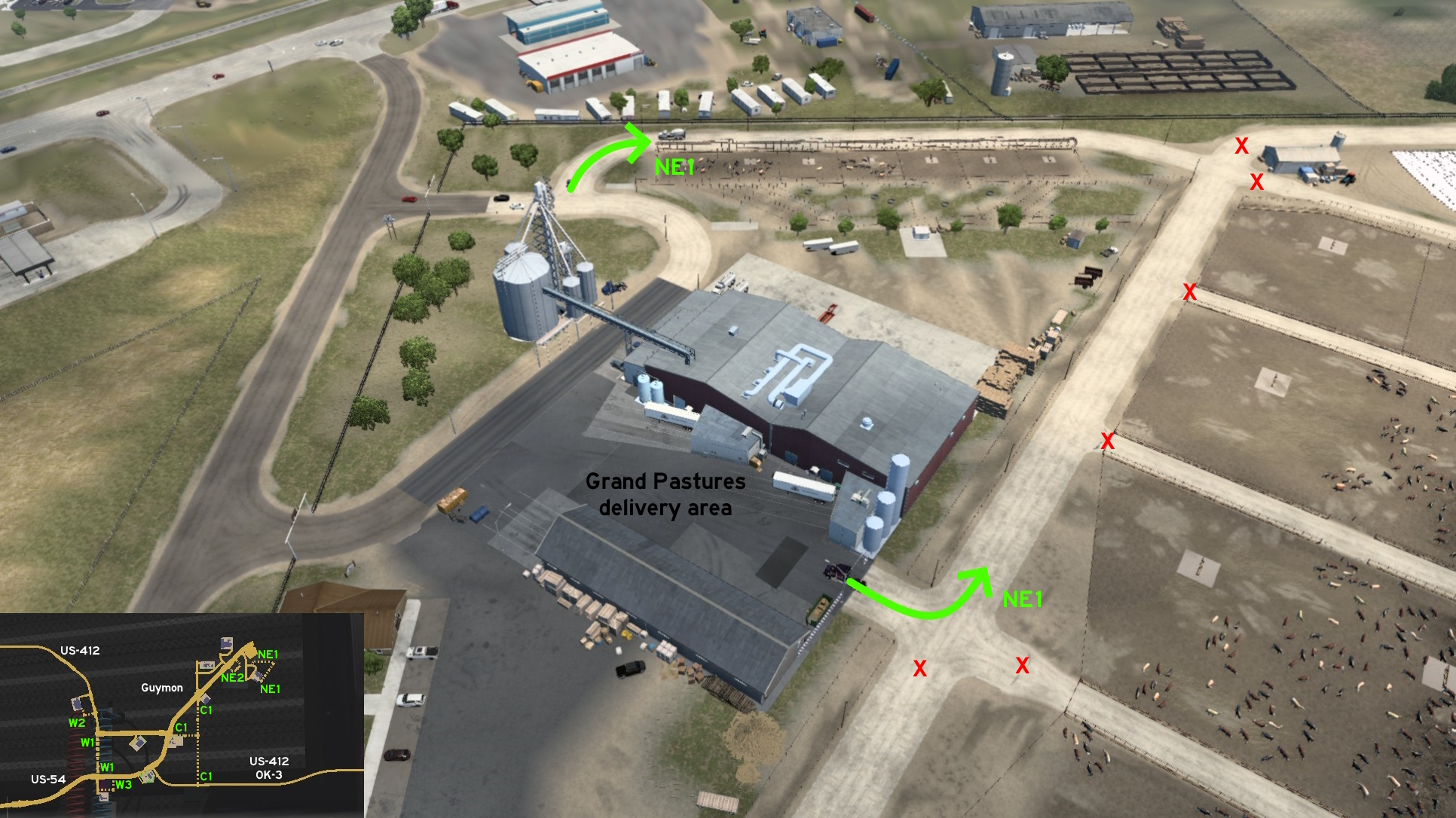 Starting on the road that leads to Grand Pastures, there's a dusty road that goes around the delivery area, along the cattle area, and leads to depot back entrance. Just drive carefully, as different from the usual dirt roads on this game, this one actual have traffic.
 Northeast 2 - Hidden Fuel Pumps
Category: scenery, markableDiscovery: kaia15, OWLCAT
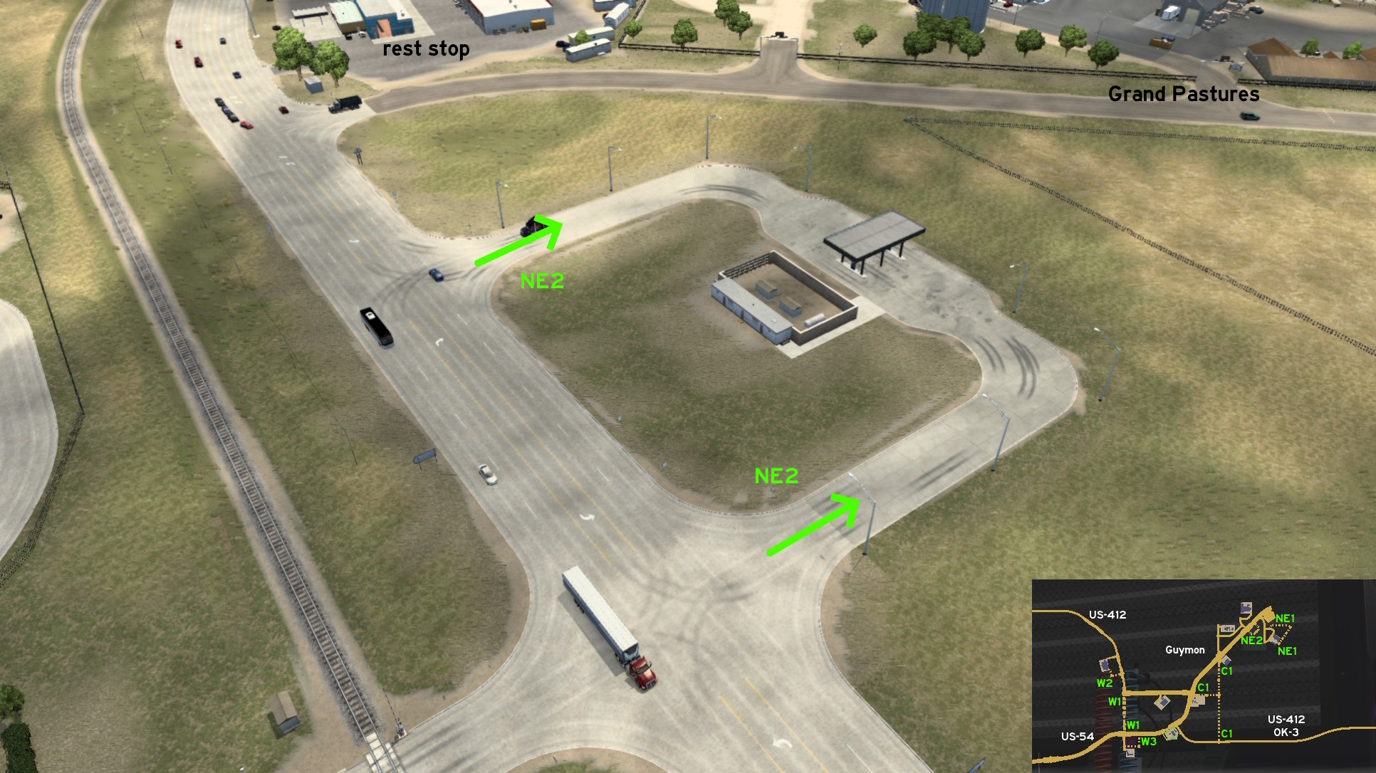 Near a rest area with truck wash and the road that leads to Grand Pastures, there's a little fuel station that almost looks abandoned but it's still functional. As soon as you drive all around the area, the fuel icon also becomes visible.
 West 1 - Red Brick Road
Category: shortcut, markableDiscovery: hydroxyquinoline
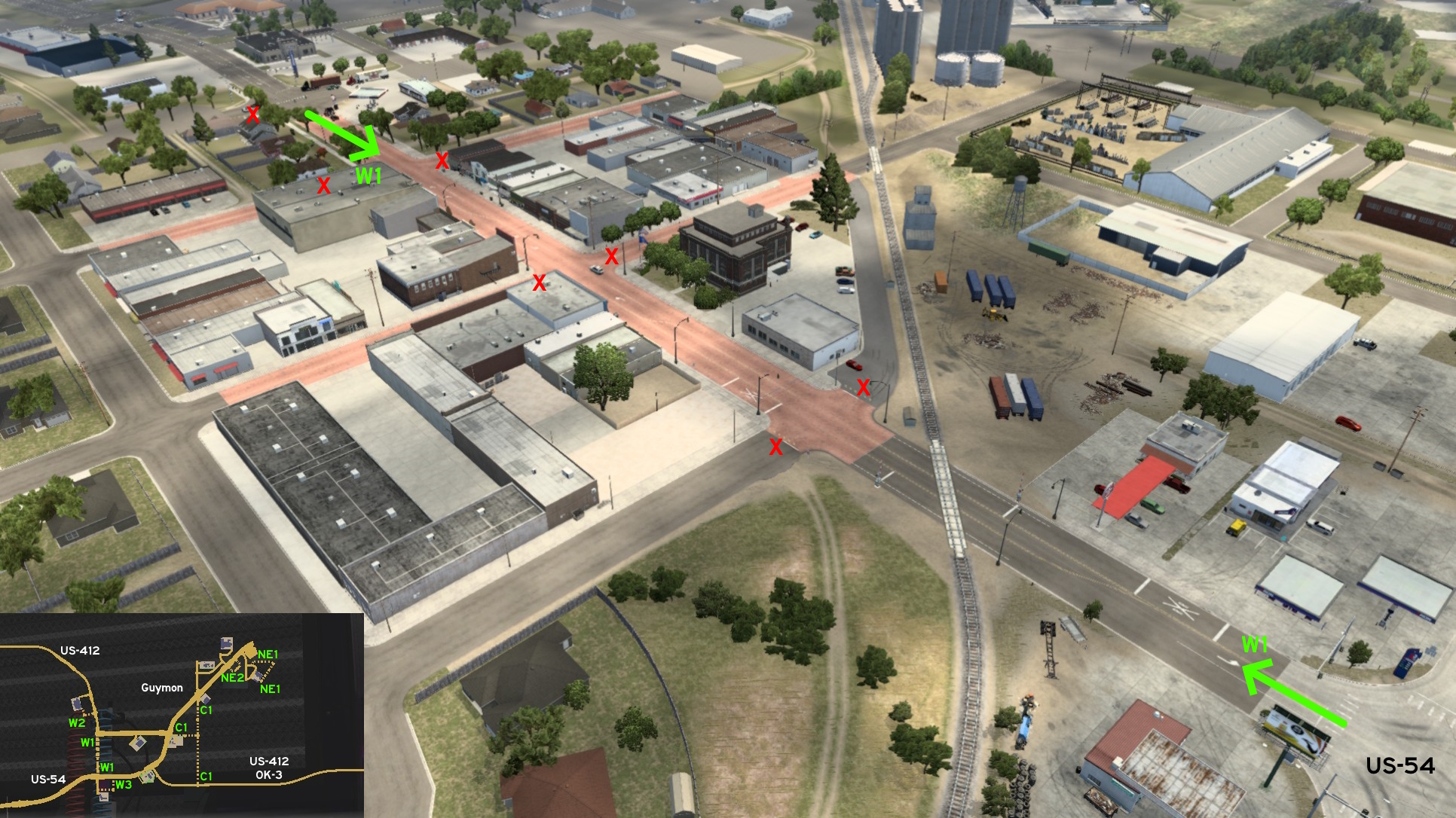 Go west Guymon, north of Faraday depot, and you can drive through the red-tiled Main Street. Signs on both ends warn no trucks are allowed here, but as long as you're not caught you can use it to go from US-53 directly to US-412 westbound or vice-versa.
 West 2 - If It Fits...
Category: shortcut, markableDiscovery: OWLCAT
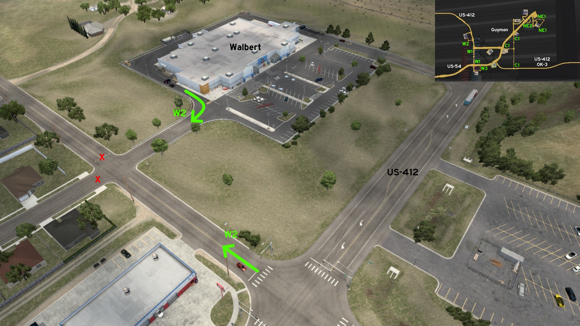 You can leave the delivery area of Walbert supermarket from its south access. Be warned that it seems this street was made for cars access only, so you may get stuck if you don't give enough space between corners.
 West 3 - Out Of Faraday Cage
Category: shortcut, markableDiscovery: Epic Trucker Arch
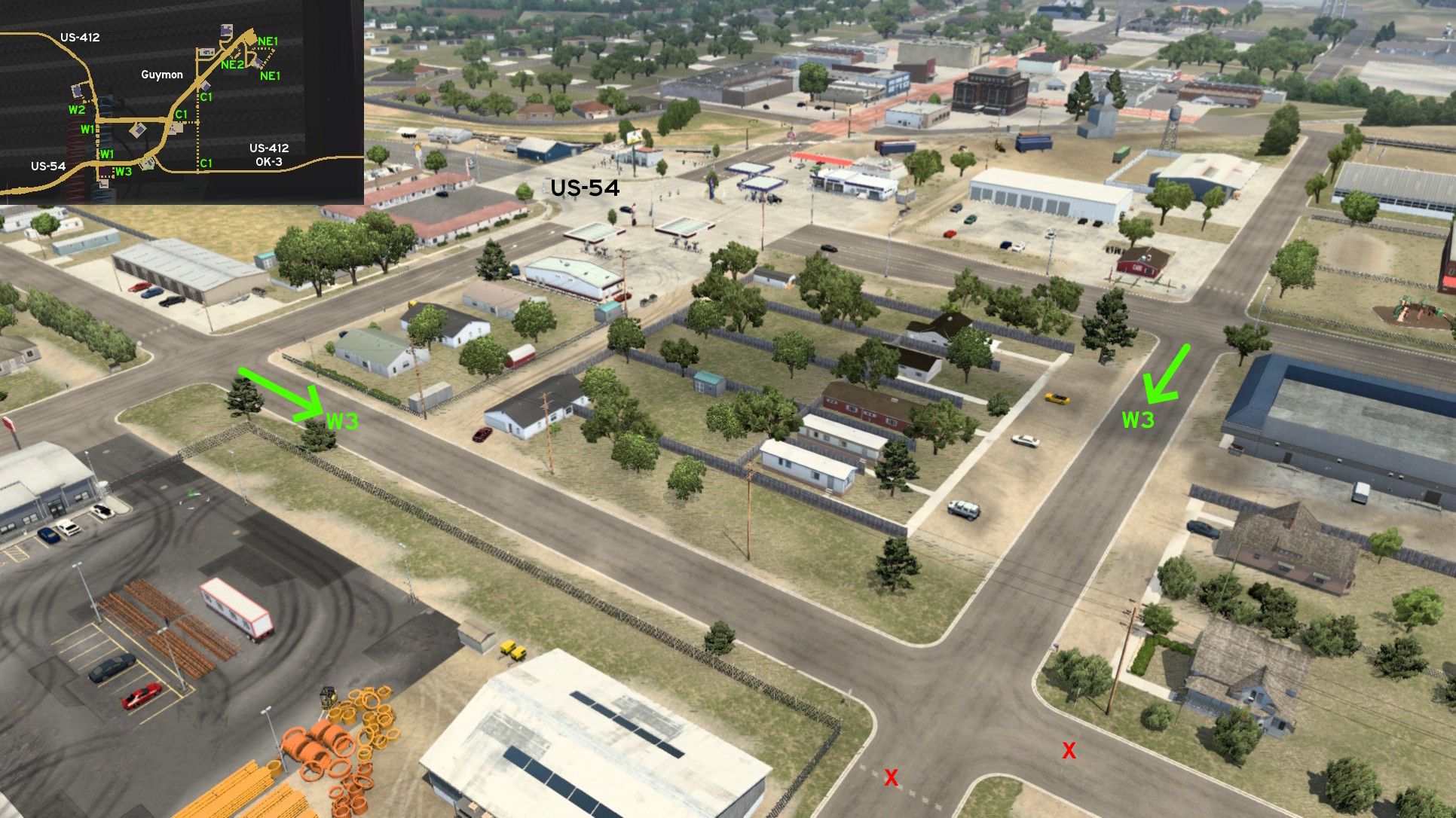 Bordering the north gates of Faraday depot on Guymon, there's an alterative way back to main roads. Maybe not the easiest way to reach or leave the depot, as you'll need to do a 180° no matter the direction, but you can at least avoid the traffic of the main roads for a while.
 West 4 - From The Fields And Across The Rails
Category: shortcut, markableDiscovery: hydroxyquinoline, OWLCAT
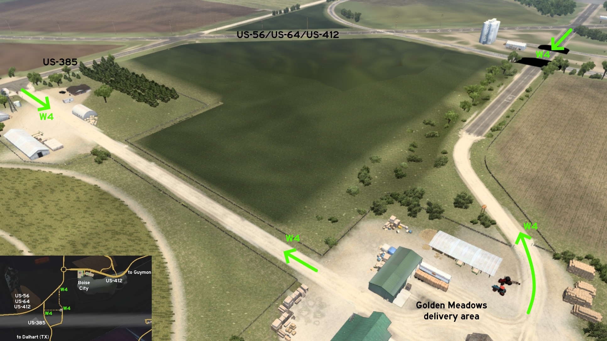 The Golden Meadows west of Guymon and south of the unmarked Boise City has two alternative entrances. One is west of delivery area and leads back to US-385, just like its main entrance. The other goes north through railroad crossings and leads to US-56 / US-64 / US-412, closer to Boise City.
Idabel
North 1 - Cabins In The Woods
Category: scenery, markableDiscovery: OWLCAT
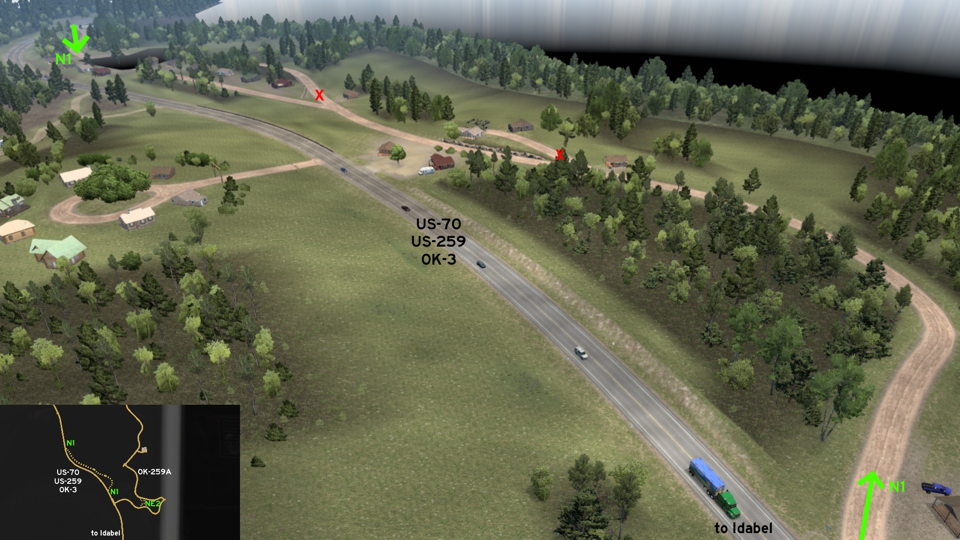 Far north of Idabel, a dirt road splits from US-70 / US-259 / OK-3 and runs along the highway. The place looks nice at first sight, but it may not the most quiet available due to the nearby traffic.
 North 2 - Harder Alternative
Category: scenery, markableDiscovery: OWLCAT
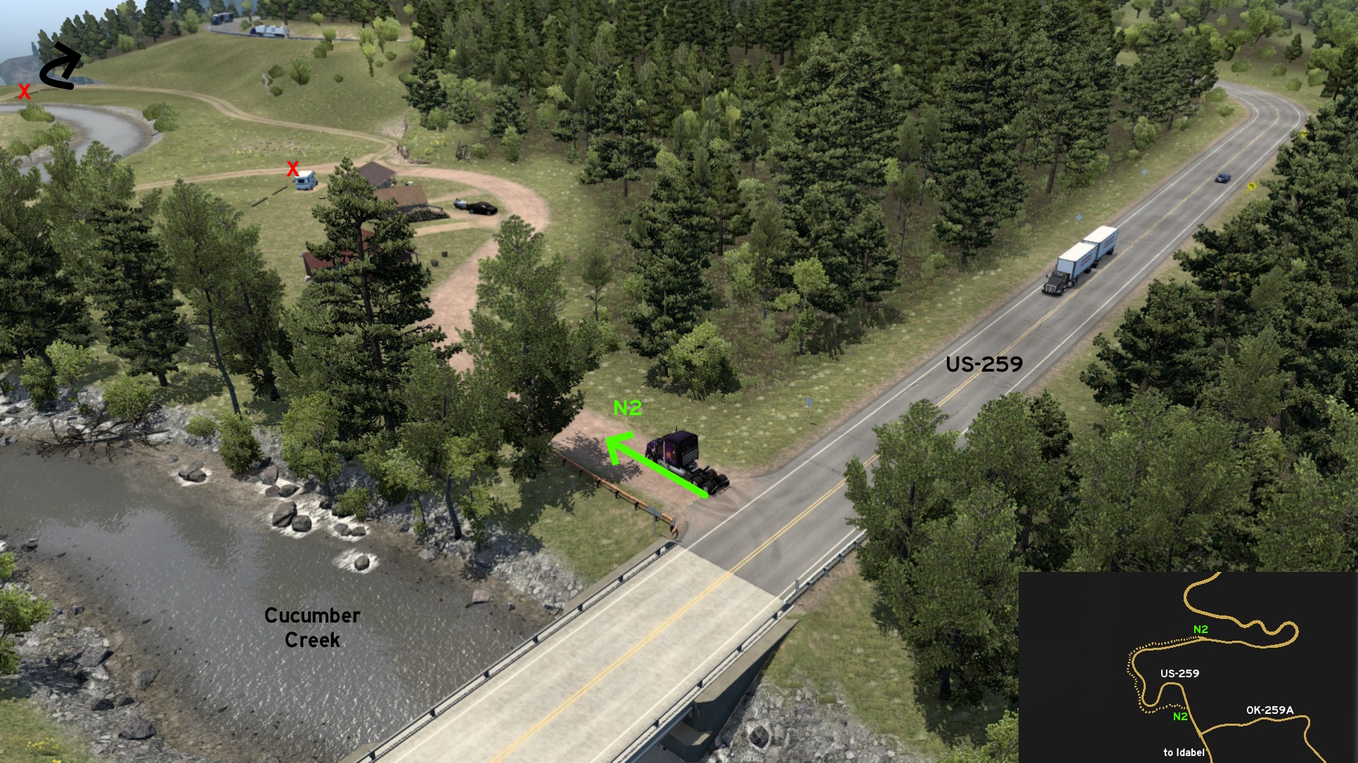 Along US-259 you'll find a scenic view and traffic-less route, but it doesn't make it much easier than the official route. The south access is close to the bridge over Cucumber Creek, and runs along it. There are some paths that go across the creek, but they're blocked.
 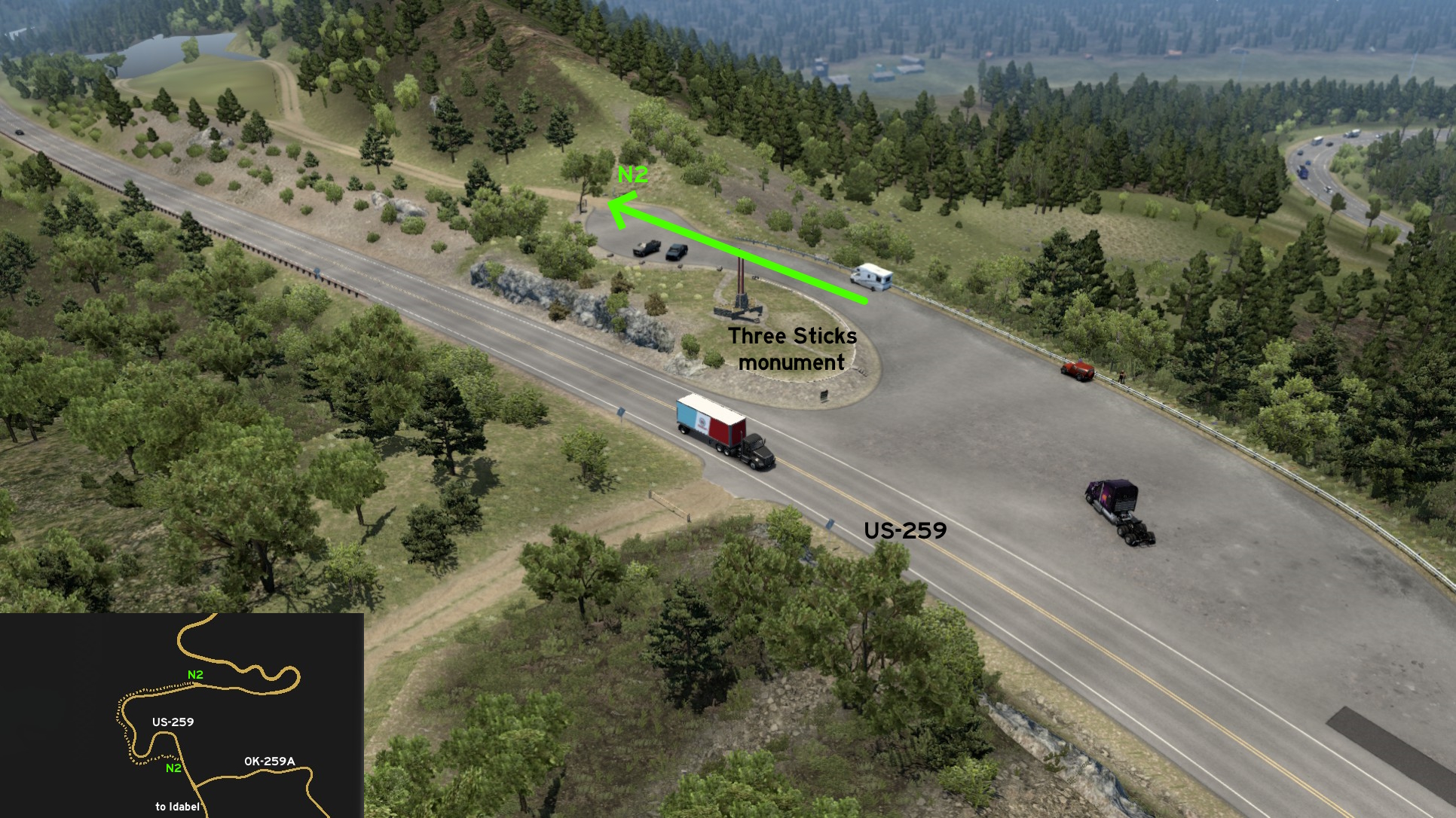 The north access is on the rest area of Three Sticks Monument (which also features a Photo Trophy). It's barely hidden, as simply driving on this area marks the hidden route on map. Don't get distracted by the view, as this area features tight curves and narrow makeshift wooden bridges.
 Northeast 1 - Mine Back Entrance
Category: shortcut, markableDiscovery: OWLCAT
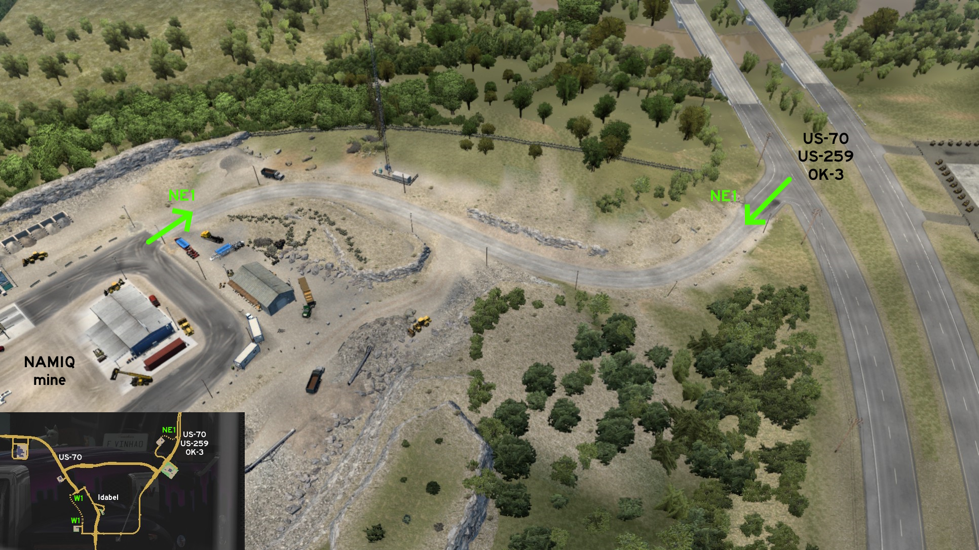 Those reaching Idabel NAMIQ mine from US-70 / US-259 / OK-3 southbound may find this access really useful to reach the delivery area, avoiding a red light and a busy traffic.
 Northeast 2 - Another Forest Shortcut
Category: shortcut, markableDiscovery: hydroxyquinoline
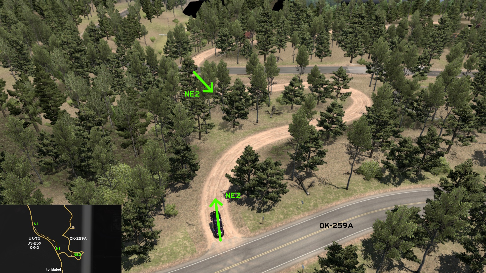 Northeast of Idabel and some miles from Faraday delivery area, there's a shortcut almost hidden in the woods to shorten the journey along the OK-259A.
 West 1 - Wood Piles, Twisted Metal And Goats
Category: shortcut, markableDiscovery: LikelyLeon, hydroxyquinoline
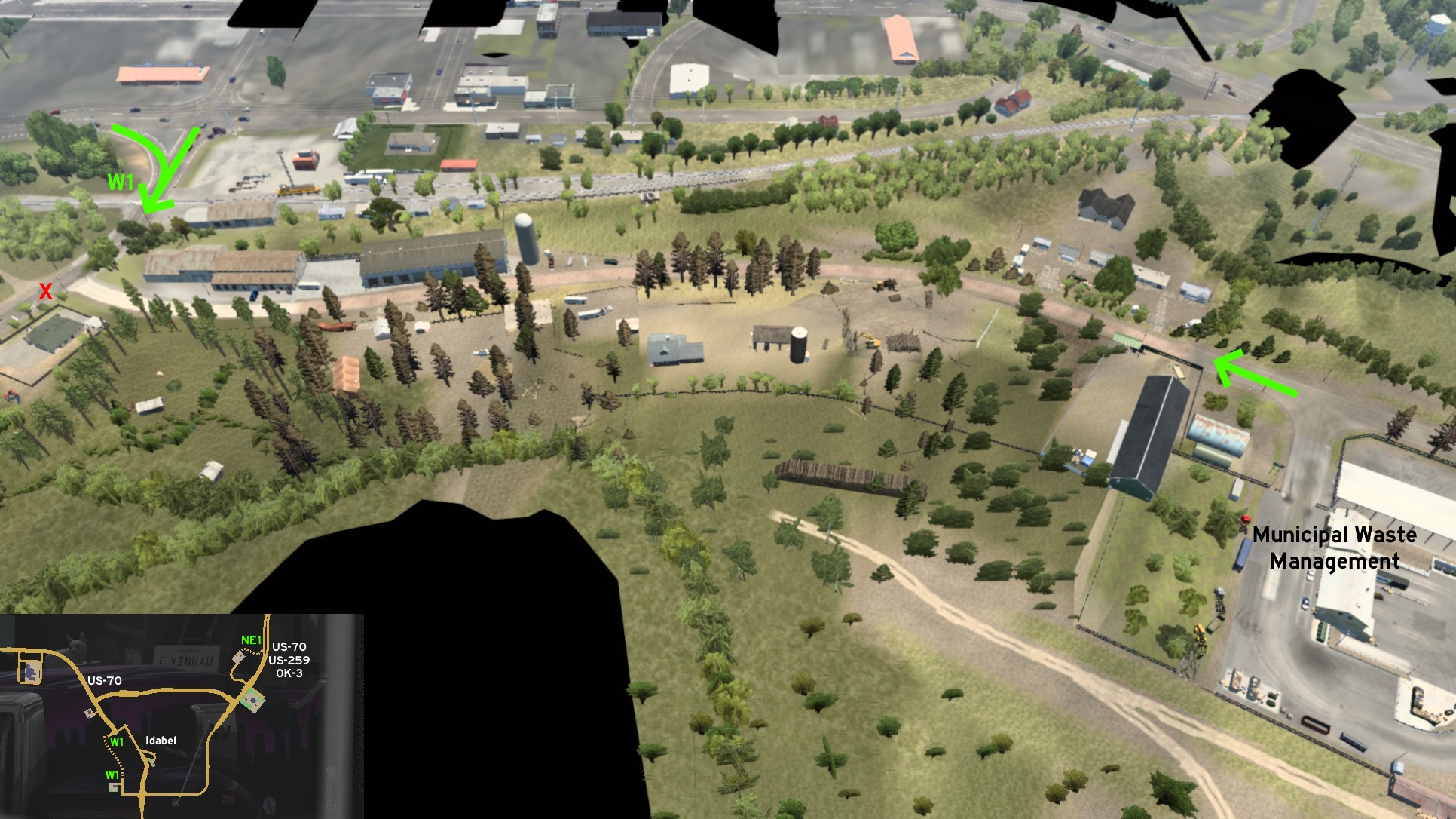 North of Idabel Municipal Waste Management depot, the road turns into a dirt path. Keep heading north and drive along a logging area, a scrapyard with car wrecks and crushed trailers, and a fenced area with several goats. It ends near a railroad crossing that leads back to the city.
McAlester
South 1 - Light And Heavy Machinery
Category: shortcut, markableDiscovery: LikelyLeon, hydroxyquinoline
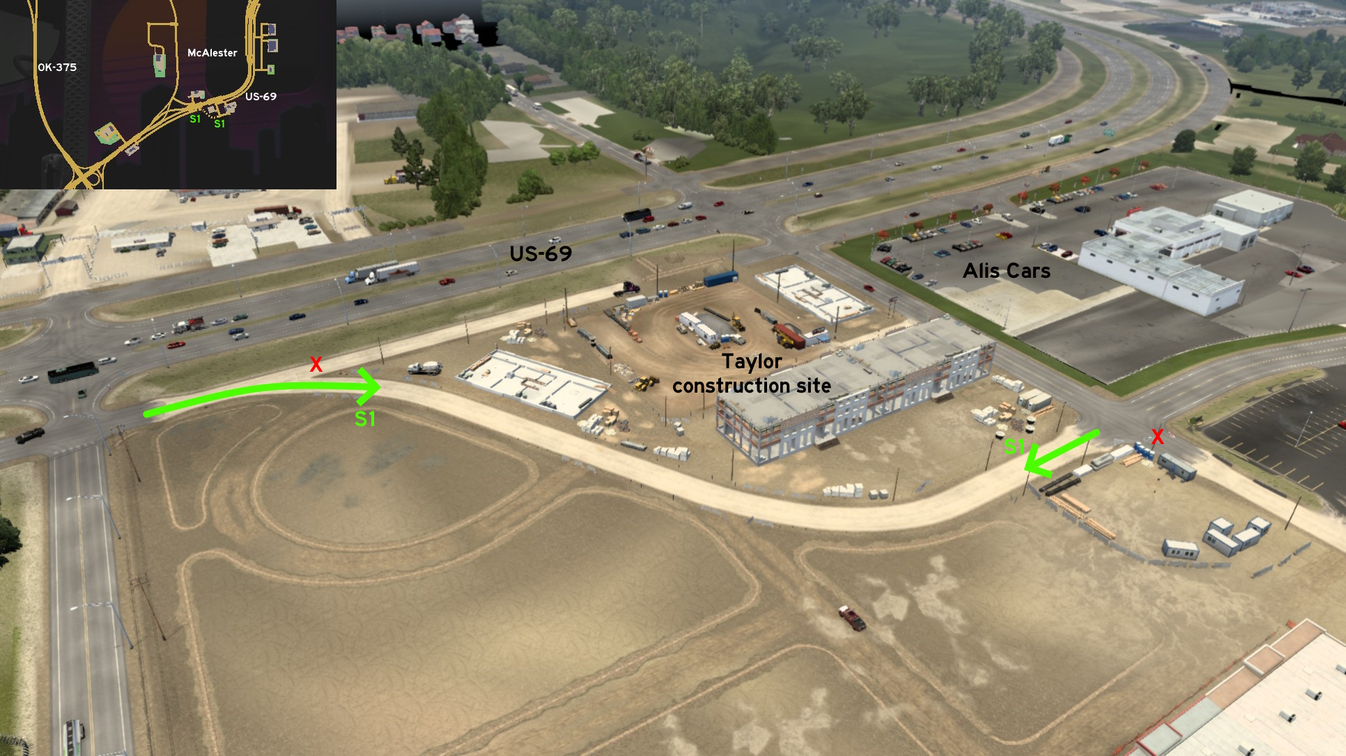 Part of the side road of US-69 on south McAlester is blocked by the nearby Taylor construction side. But you can return to it without going to main road: just take the dusty path right. It goes behind Taylor and takes to the crossing of the road behind Alis Cars and the road leading to Taylor's main entrance.
 South 2 - A Road Only For You
Category: shortcutDiscovery: Applecorn
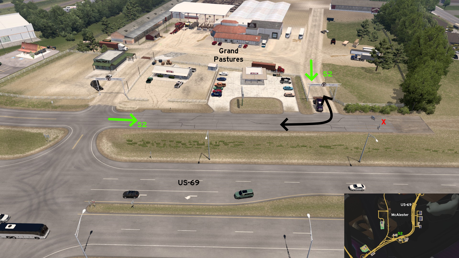 There's a path east of Grand Pastures, leading to a road closed for traffic. But that you can still use it to easily leave the delivery area and head west and return to US-69. Just don't try to head east, or you may get stuck.
Oklahoma City 🏛️
East 1 - Visit Prague (Yes This Is The Correct Guide)
Category: scenery, markableDiscovery: FelipeVinhao
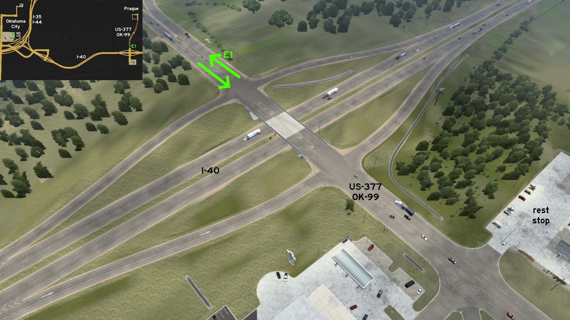 You can visit Prague without having to switch games. Just drive I-40 eastbound from Oklahoma City until you reach the first rest stop. Drive north from it. You'll discover the hidden section of US-377 / OK-99.
 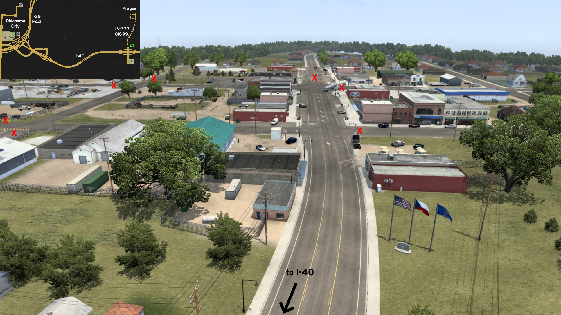 Keep north until you reach the city welcome sign, and the flags of USA, Czech Republic and Oklahoma. Now you can drive as far as the crossing of Jim Thorpe Boulevard and Main Street, and take the west block to return. The city isn't actually in Czech Republic, but it was founded by Czech people.
 West 1 - Busy Alternative
Category: shortcut, markableDiscovery: hydroxyquinoline
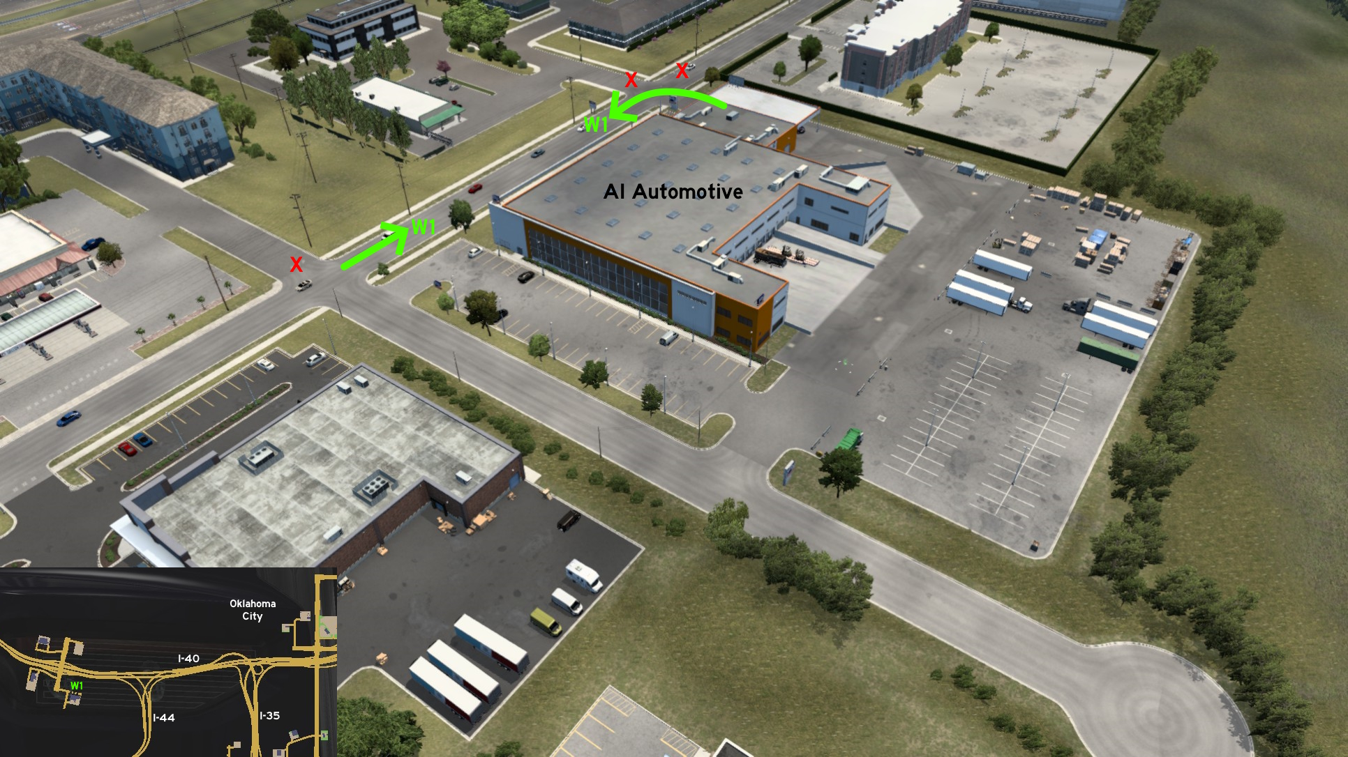 The AI Automotive depot on west Oklahoma City has an alternative entrance if keeping ahead (east) instead of turning to the dead end street (south) that leads to its main entrance. It may be easier to reach the delivery drop-off area depending on which one was marked.
Tulsa
South 1 - Depot Back Entrance
Category: shortcut, markableDiscovery: Washington_County, kaia15, OWLCAT, hydroxyquinoline
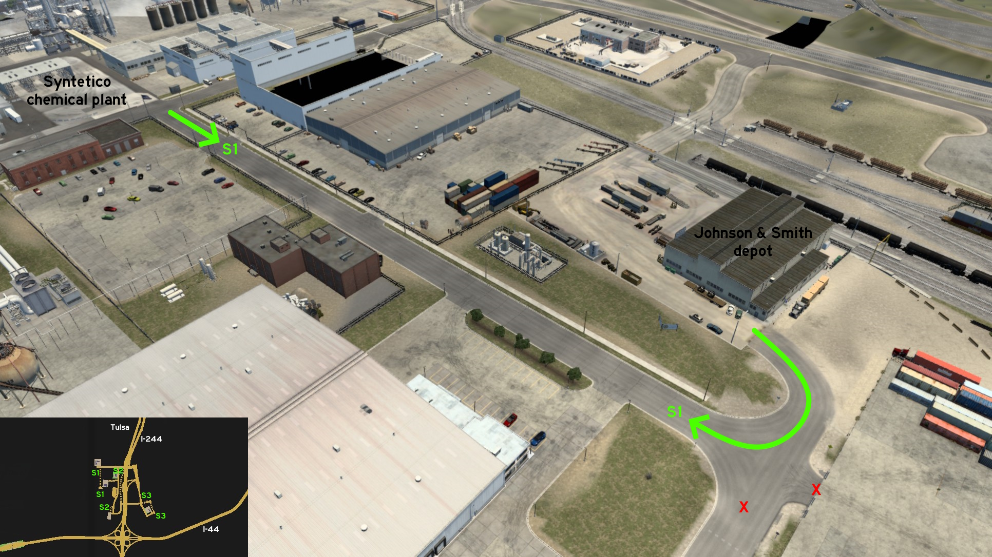 South Tulsa, accessible from I-244, is an area full of companies and with several alternative routes, which may take a while to cover. The first one is a street west of I-244, starting across Syntetico chemical plant, and ending on the back entrance of Johnson & Smith depot.
 South 2 - Closing Roads, Building Railroads
Category: shortcut, markableDiscovery: Washington_County, DDogg
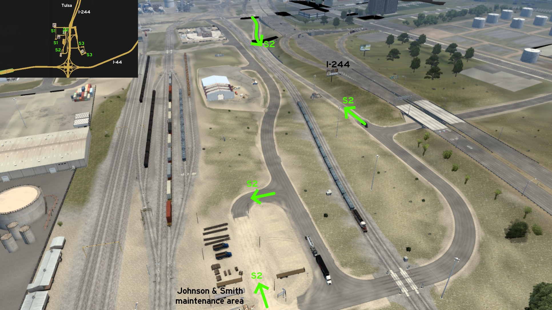 Other two roads are found closer to I-244. One of them is exactly in the end of the ramp coming from I-244 southbound to this area, and runs parallel below to freeway. The north entrance is barely blocked by concrete barriers, but the south one is fully open. The other is an alternative entrance to Johnson & Smith maintenance area.
 South 3 - No Time To Waste
Category: shortcut, markableDiscovery: Washington_County, OWLCAT
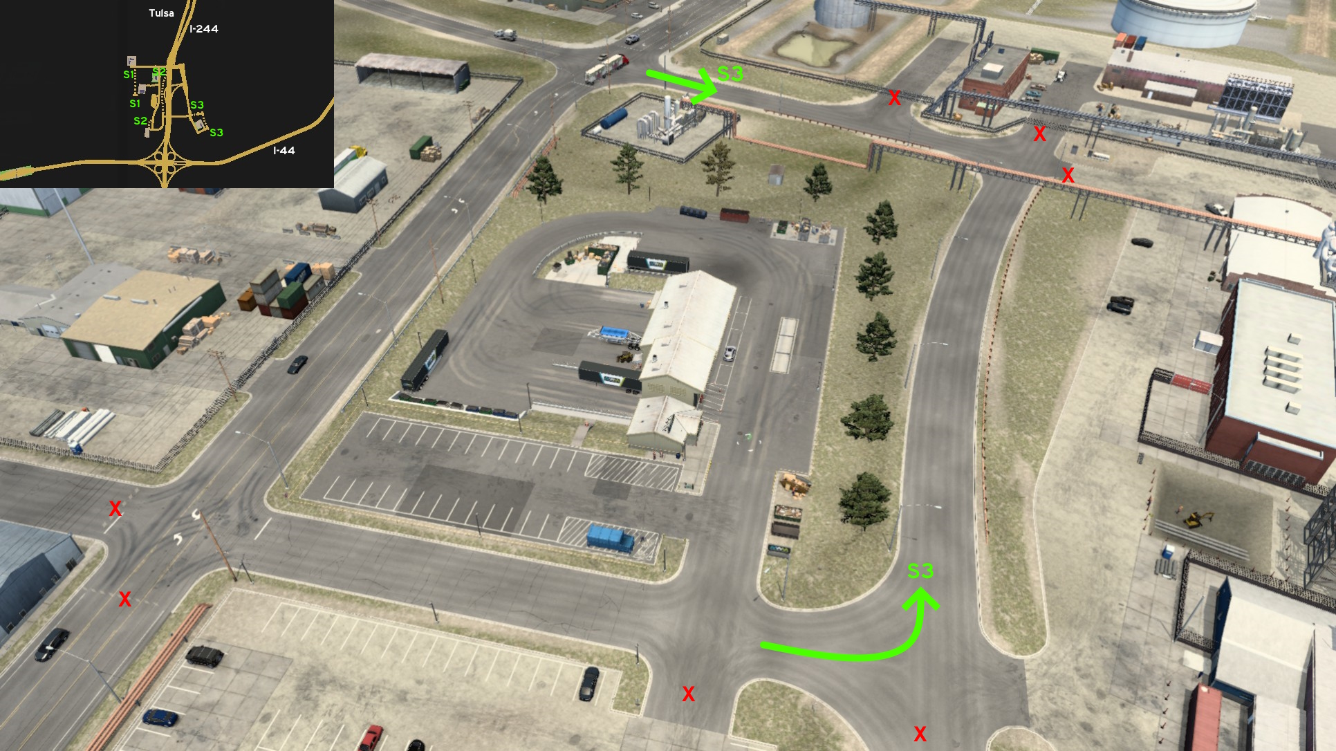 The last one is an alternative access to Tulsa Municipal Waste Management depot east of I-244. The route borders north and east of the depot area.
10th DLC, 2022 November 15
Abilene
East 1 - Burkett Pecan Tree
Category: achievement (Avid Historian), markableDiscovery: CaptainFlint, kaia15
Note: in order to unlock this achievement, you need to find a total of at least 30 similar markers; please refer to this guide by Xeeran in order to find them, and other Texas achievements
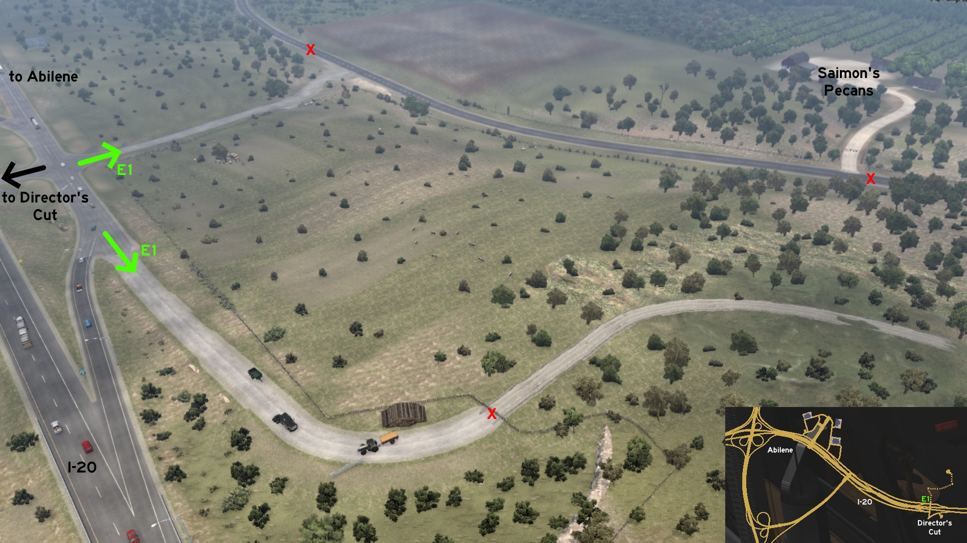 East of Abilene, leaving I-20 through the ramp that leads to a Director's Cut about the Pecan Farm, you can go to the opposite direction to visit it by yourself. Watching the Director's Cut will also give hints on how to reach there. As an extra road, you can also visit a dead end road that seems to lead to a logging area.
 North 1 - Another Chance To Change
Category: shortcut, markableDiscovery: FeteFatale
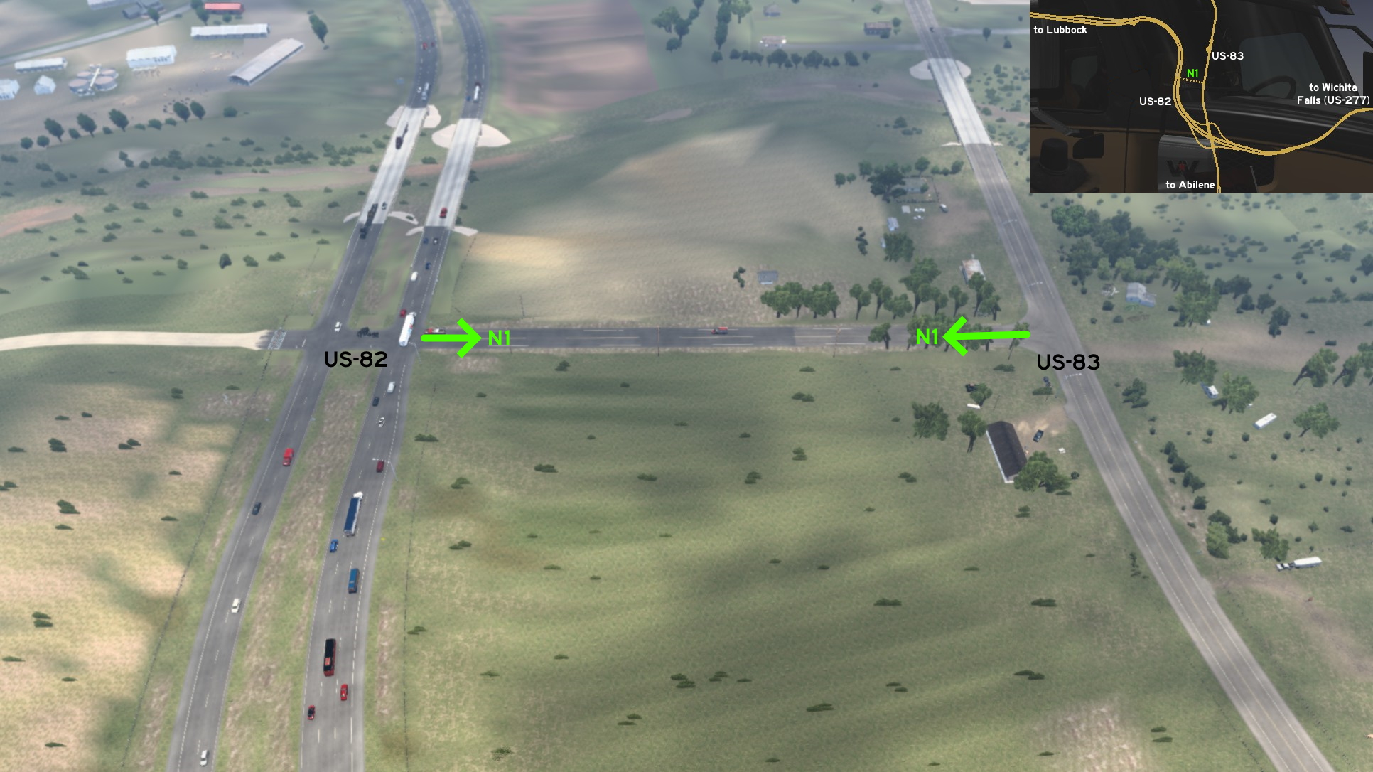 Just north of Abilene, some meters after the main intersection between US-82 and US-83, you'll have another chance to switch between them in case you missed the ramp. Just be careful if you need to use the turnaround on US-82.
Amarillo
South 1 - Cotton Drive
Category: shortcut, markableCredits: FeteFatale, noob168
Discovery: Mary's Cotton is actually closer to Lubbock, but it belongs to Amarillo in game
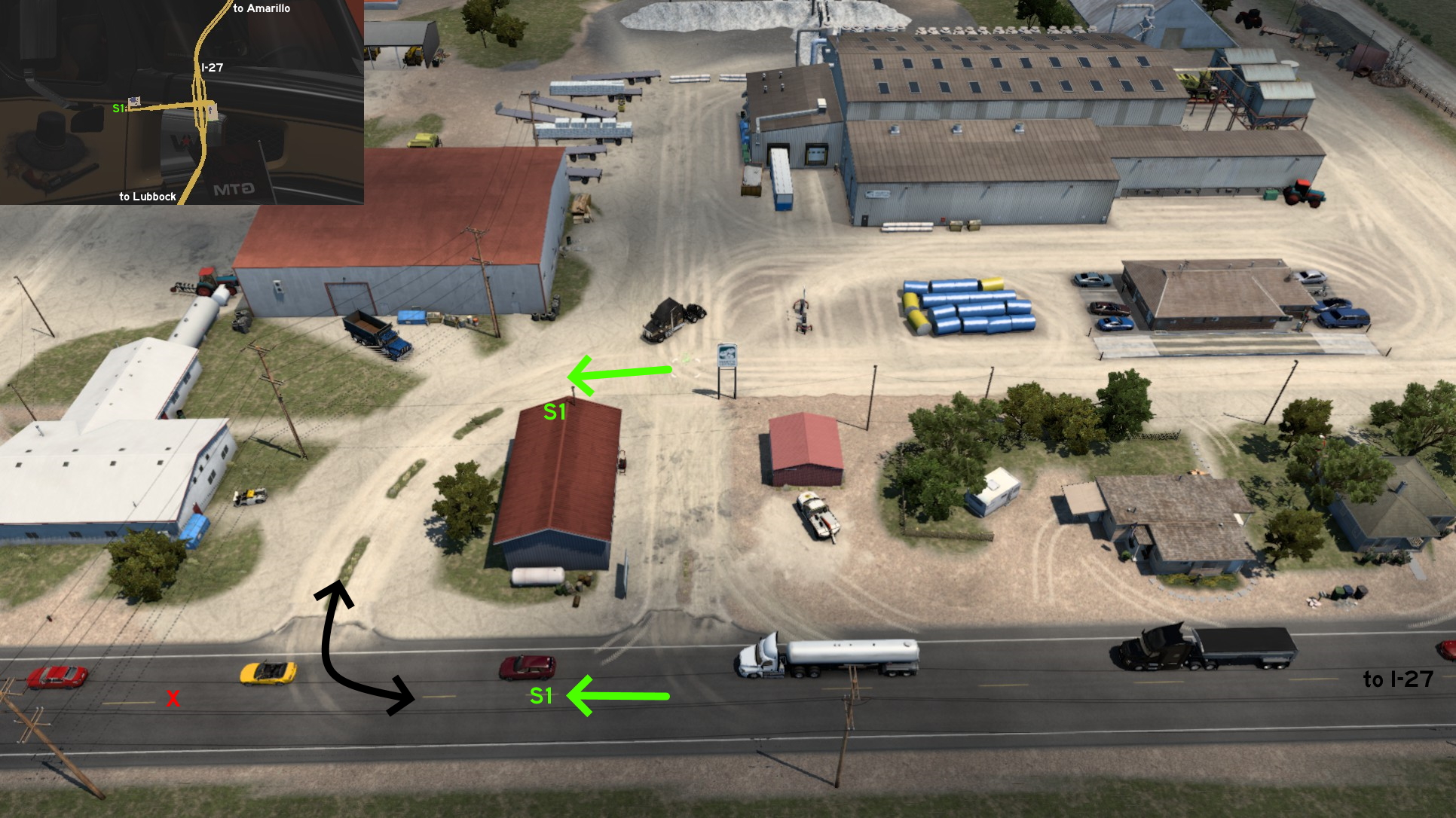 Just ahead of Mary's Cotton main entrance, there's another curved entrance. At first, it doesn't seem to be a good way to access the delivery area. It can't even be considered a real shortcut - it's actually a longer way to reach it. But it may be a lot more useful when leaving it, having an alternative to maneuver longer trailers.
 South 2 - Giant Cowboy
Category: achievement (Avid Historian), markableDiscovery: noob168
Note: in order to unlock this achievement, you need to find a total of at least 30 similar markers; please refer to this guide by Xeeran in order to find them, and other Texas achievements
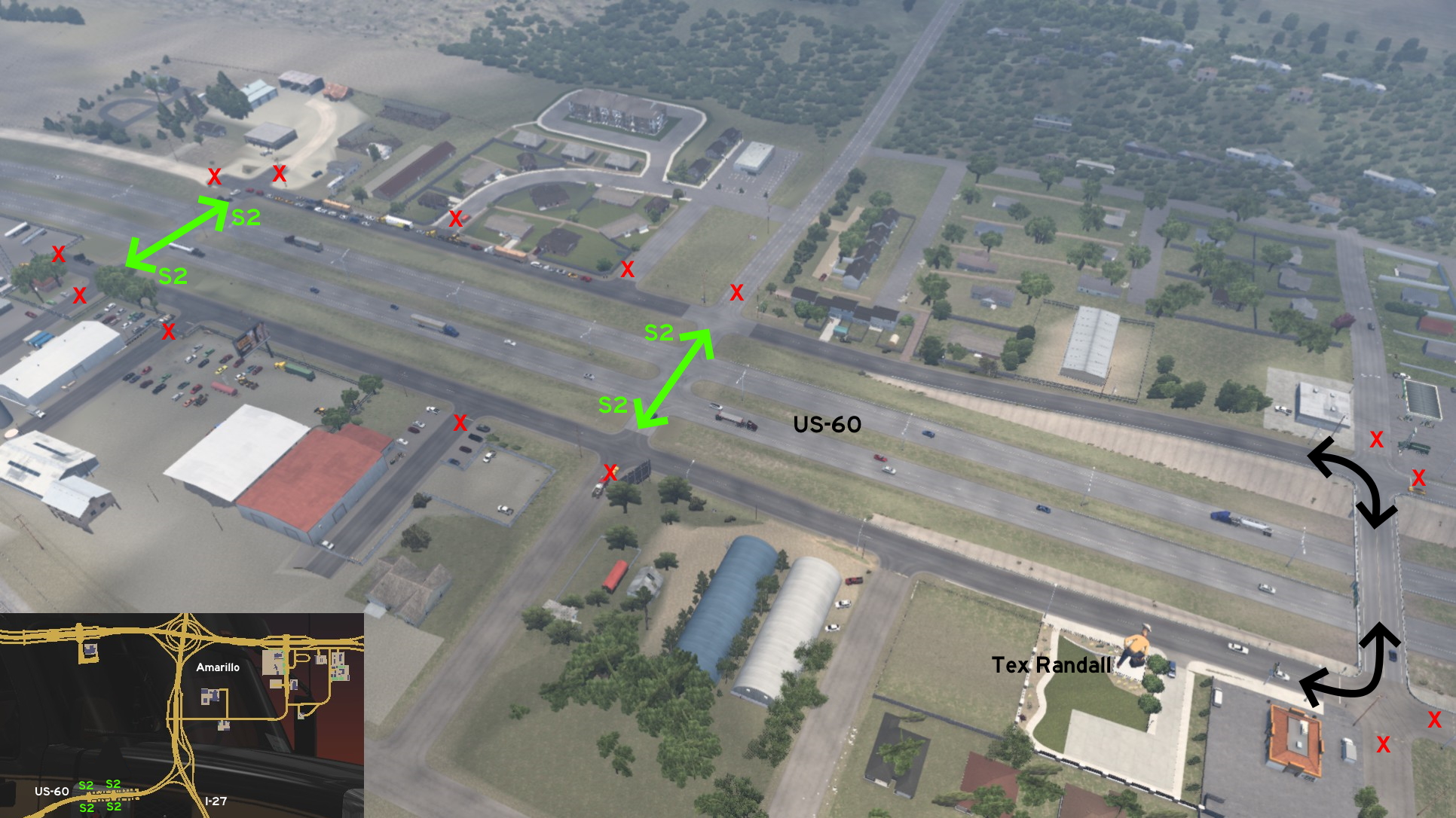 South of Amarillo, you can drive some of US-60 side roads. Although they seem to lead back to I-27, you can't actually reach it. On the south side road, you can visit the Tex Randall statue, a giant cowboy built by Harry Wheeler. You may have some problems to return to main US-60 road though, due to its heavy and speedy traffic.
 West 1 - Around The Pastures
Category: shortcut, markableDiscovery: OWLCAT
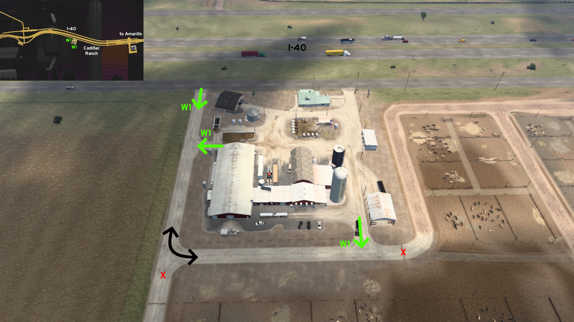 Around the Grand Pastures west of Amarillo, some meters after Cadillac Ranch, you can access its delivery area by 2 other entrances besides the main one.
Austin 🏛️
East 1 - Around The Warehouse
Category: shortcut, markableDiscovery: DDogg
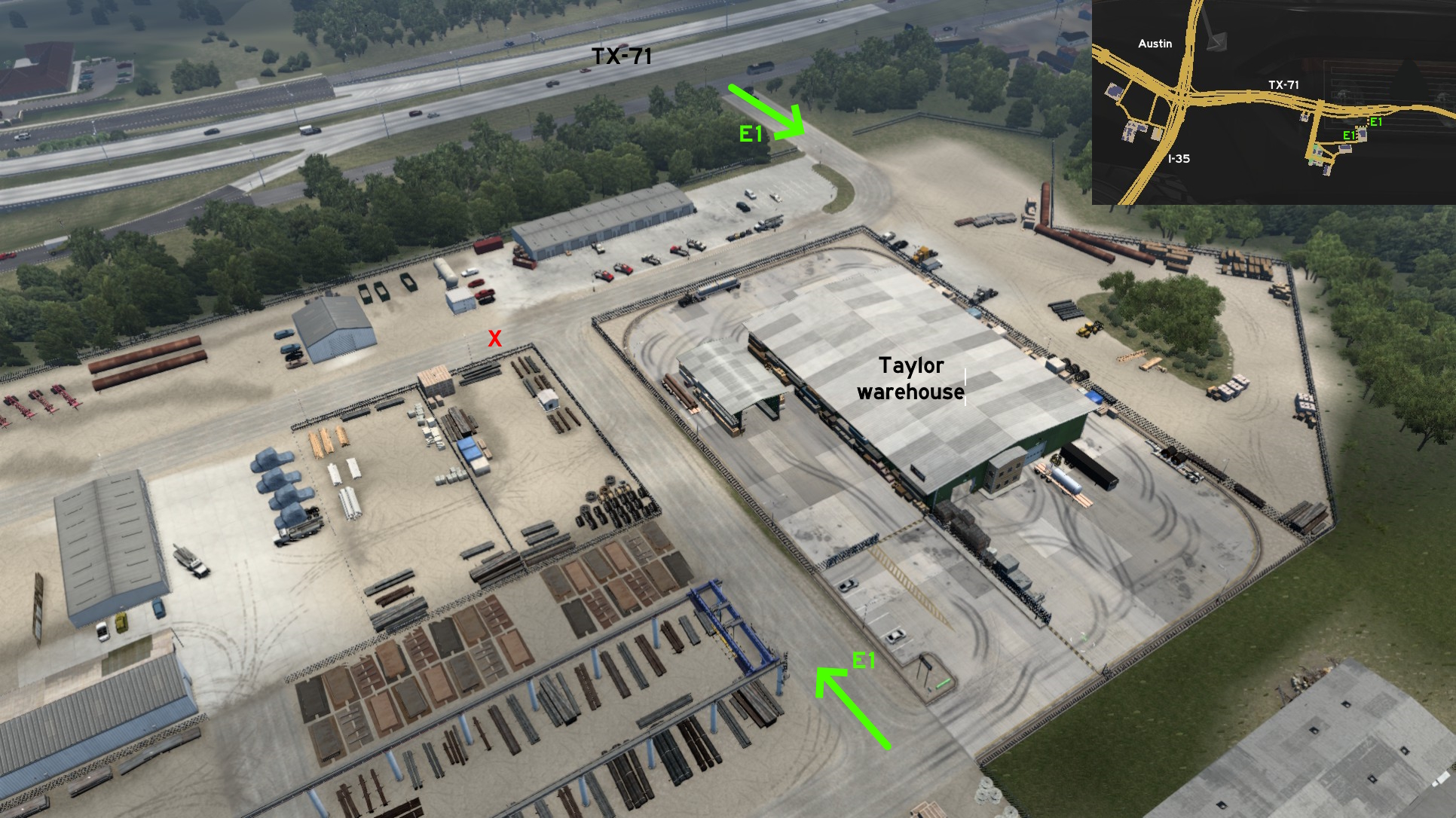 Inside the Taylor property, there's an alternative route from the warehouse direct to TX-71 side road. From the delivey area, keep going north, then turn east, and turn north again.
 North 1 - Plugged Road
Category: shortcut, markableDiscovery: Ice_Tea_Zero
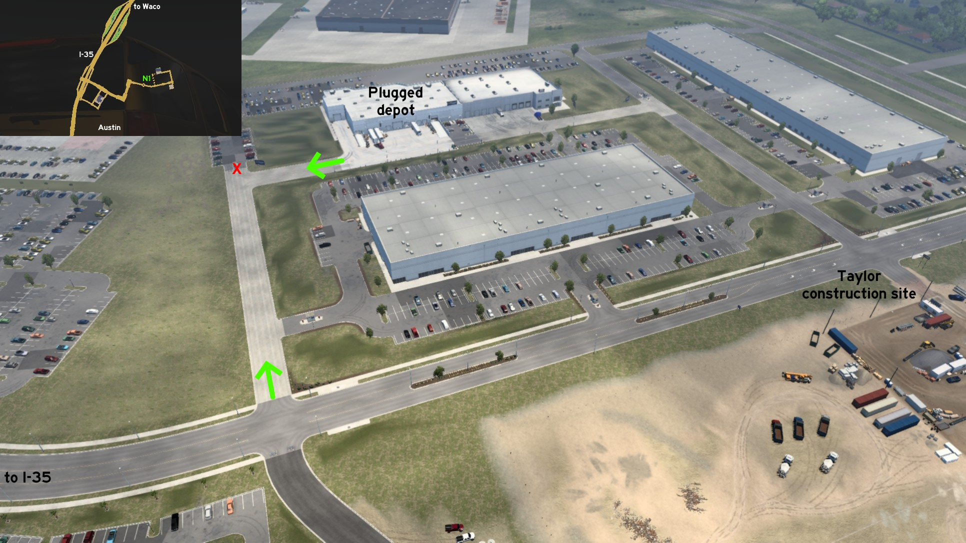 You can access Plugged depot as soon as you leave the roundabout before it. Just turn the first left as soon as you reach it - easy to spot as the road on the opposite side is closed. Before reaching the closed parking lot, turn right and reach the secondary entrance.
 West 1 - Vineyard Loop
Category: scenery, markableDiscovery: FeteFatale
Note: only the west loop is markable
 Near the entrance of Mon Coeur delivery area, west of Austin, there are 2 unmarked dirt paths. The first is a loop on the west side of the entrance. The second is a path starting on the east, leading to a farm house blocked by an old truck, and to another path running close to the vineyards and around the delivery area.
Beaumont
North 1 - Non-Trucking Street
Category: shortcut, markableDiscovery: The Pitts
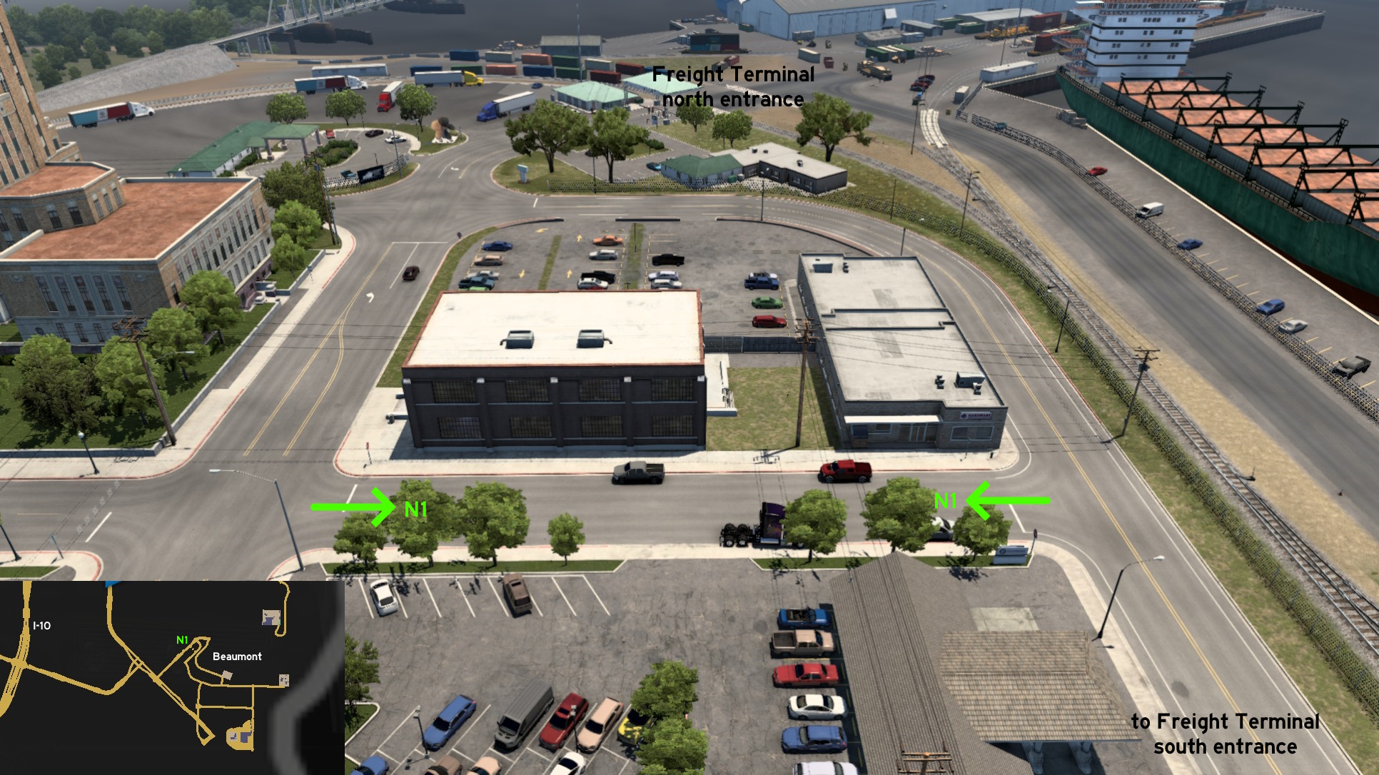 A little before the north entrance to Beaumont Freight Terminal, there's a street that can be used to return to south entrance. Although signs on each of its corners warn you shouldn't be here with your truck.
 Southwest 1 - High Island Beach
Category: sceneryDiscovery: airbornecowboy77
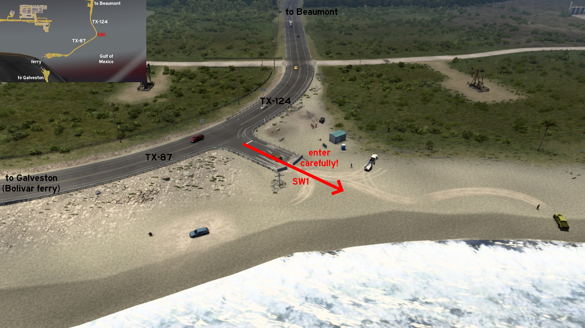 Southwest of Beaumont, where TX-124 and TX-87 meet before taking the ferry to Galveston, you'll find a road marked by a sign indicating the public beach access, and its end marked by a cross and barely blocked by concrete walls. Drive carefully between the two wall pieces, and you can drive the whole beach and over the sea. Feel free to chase the boats!
Corpus Christi
Northwest 1 - From Freeway To Cotton Fields
Category: shortcut, markableDiscovery: FeteFatale
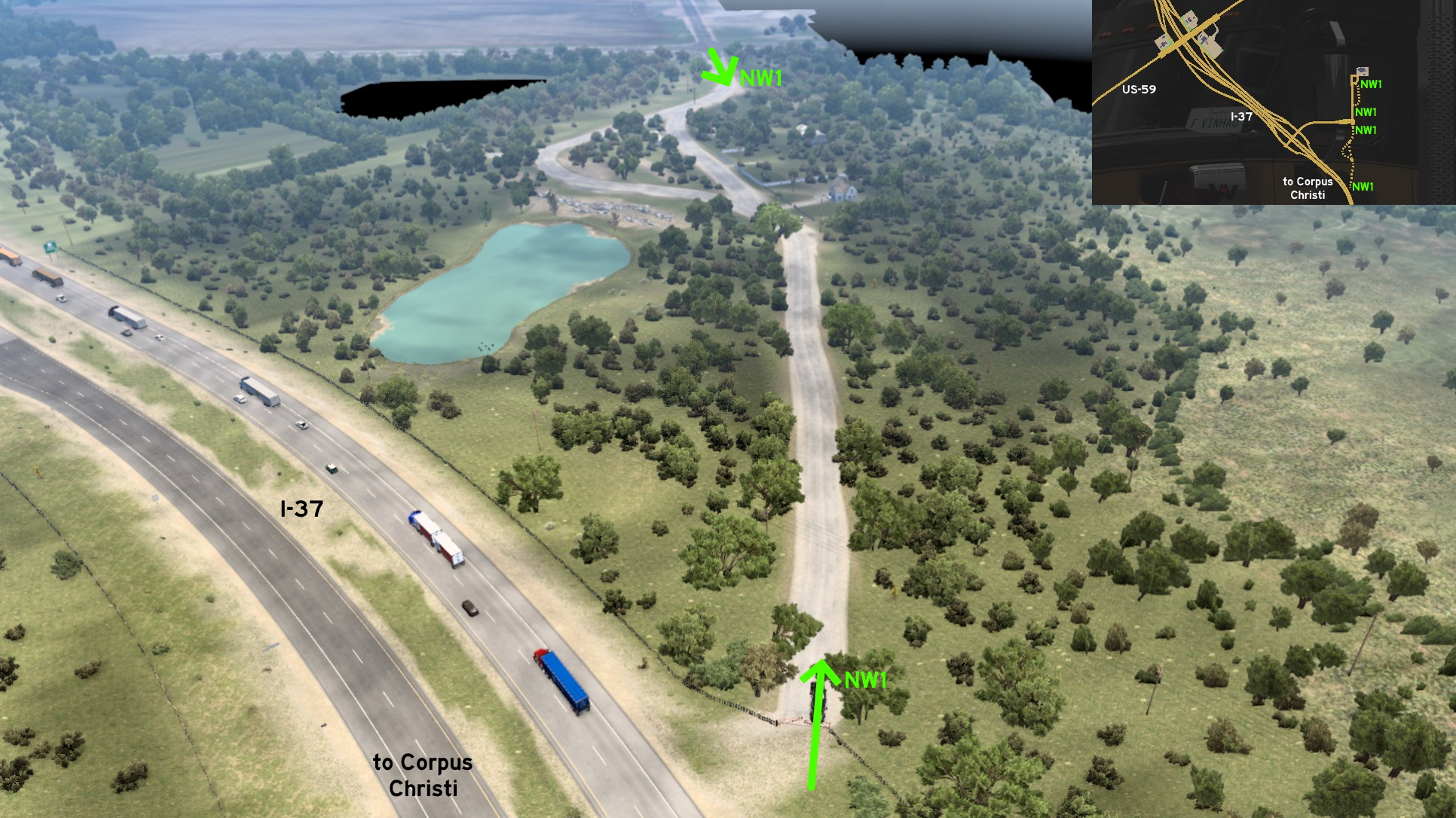 Heading northwest on I-37 from Corpus Christi, you may notice a knocked down gate. If you leave the freeway and cross it, you'll reach a dirt road that splits into 2 and then merges together, before reaching the official route leading to Mary's Cotton.
 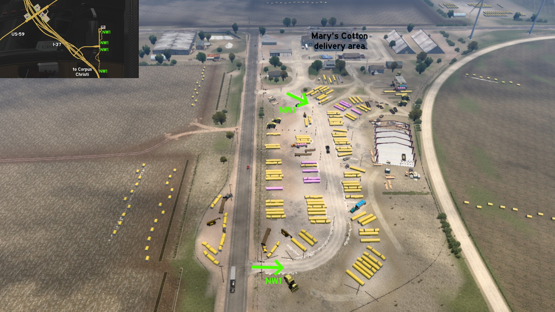 Some meters before reaching the delivery area, you can drive around cotton bales until you reach the company's front gate.
Dalhart
West 1 - Closer To The Cattle
Category: shortcut, markableDiscovery: kaia15
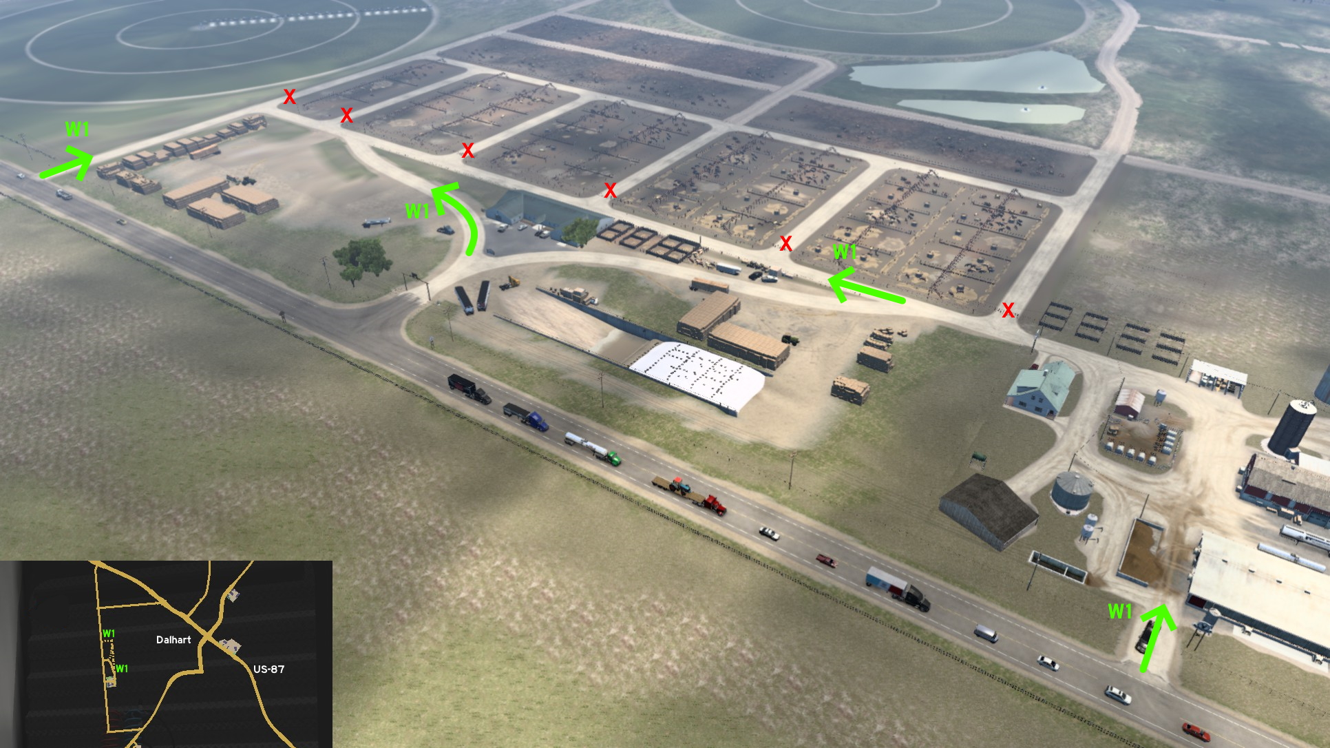 From the Grand Pastures delivery area west of Dalhart, you can drive all way north bordering the actual pastures - you just can't really access them. And as a bonus, the delivery area has an unmarked exit direct to the road.
Dallas
East 1 - Like On The Movies
Category: easter-eggDiscovery: 17F
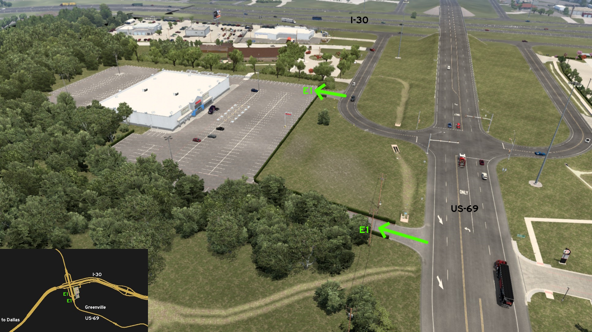 On the unmarked town of Greenville, east of Dallas, there's a cinema parking lot you can access from both the ramp between I-30 and US-69 or from the crossing leading to the nearby rest stop. You can't rest or watch any film here, but make sure to check film titles...
 Southeast 1 - Through Grass To Glass
Category: shortcutDiscovery: kaia15
Note: this area seems to be closer to Tyler or Waco, but it belongs to Dallas in game
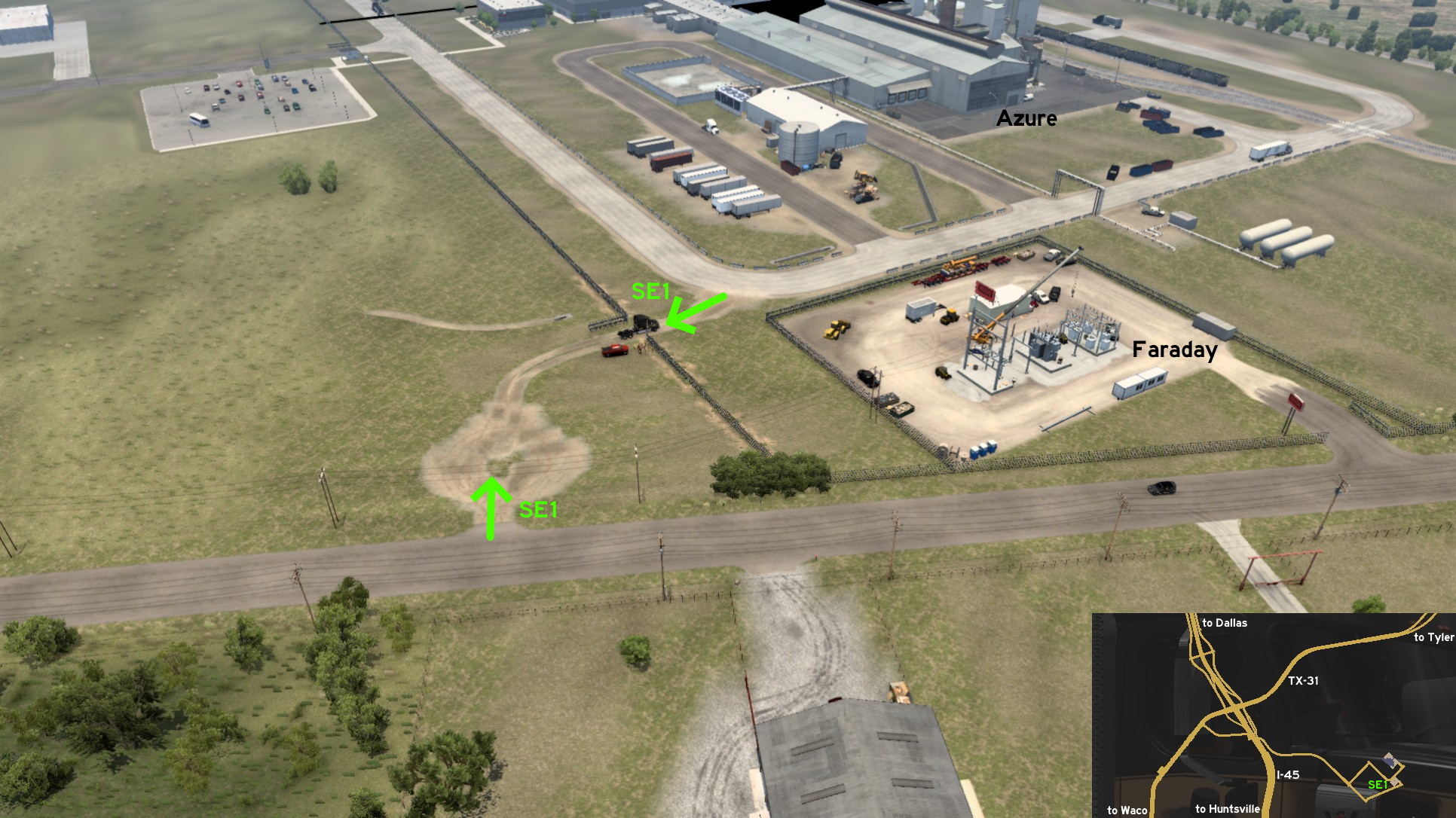 On the area southeast of the intersection between I-45 and TX-31, you can reach Azure Glasswork quicklier through the dirt path near the Faraday substation under construction. There are some workers checking a gas pipe on the other end of the path. You can also drive over the whole open area until the parking lot.
 Southeast 2 - Makeshift Highway Ramp
Category: shortcutDiscovery: Applecorn
Note: this area seems to be closer to Tyler or Waco, but it belongs to Dallas in game
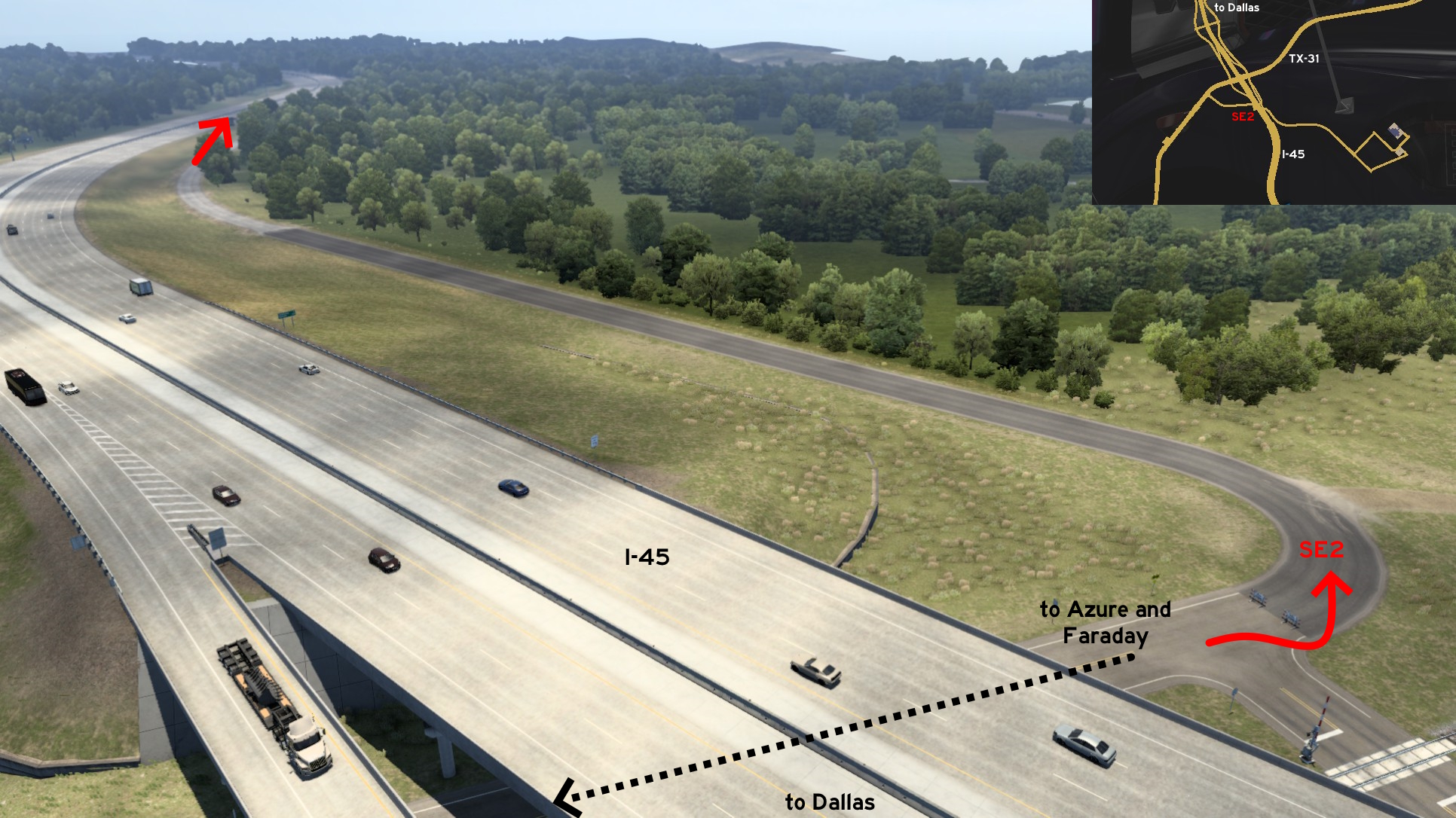 From the road that leads to Azure Glasswork and Faraday, instead of crossing the railroads to head to TX-31 to return to I-45, drive around the signs marking a closed road. When asphalt ends and you reach a dirt path, this means you're close to its end. Slow down and move carefully to I-45 through the grass.
 Southeast 3 - Back To Dead End
Category: sceneryDiscovery: FelipeVinhao
Note: this seems to be closer to Huntsville, but it's only accessible if you're driving from Dallas
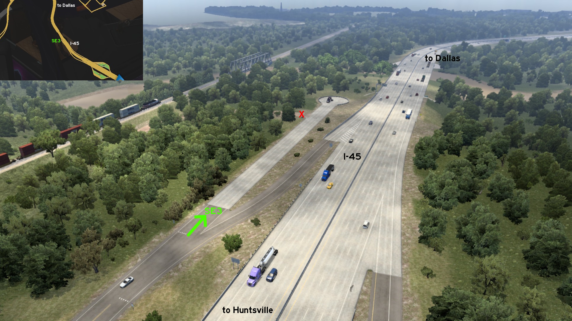 Taking I-45 from Dallas to Huntsville, take the exit to Navarro County Safety Rest Area, but reverse when hitting the side road. It ends on a cul-de-sac. There's also a dirt path before its end, but this one isn't accessible.
Del Rio
Northwest 1 - History And Picnic
Category: scenery, markableDiscovery: kaia15, uratobuic
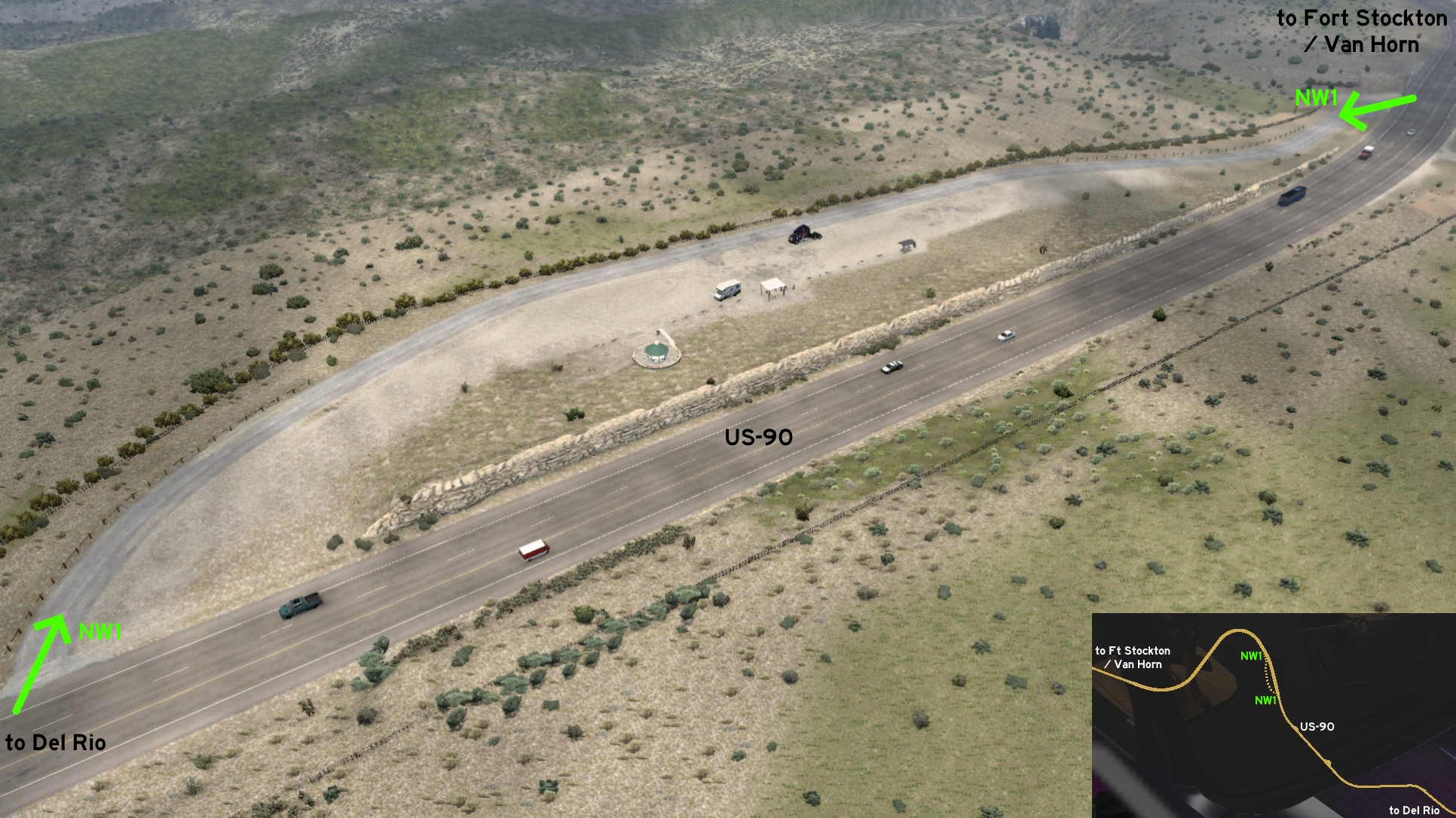 Between Del Rio and Fort Stockton, or more specifically before southeast of the unmarked towns of Dryden and Sunderson, and northwest of Pecos River Director's Cut, there's a small slope which is an historical marker and a picnic area. This one counts as a rest stop.
El Paso
Northeast 1 - The Edge Of Texas
Category: scenery, markableDiscovery: noob168, FeteFatale
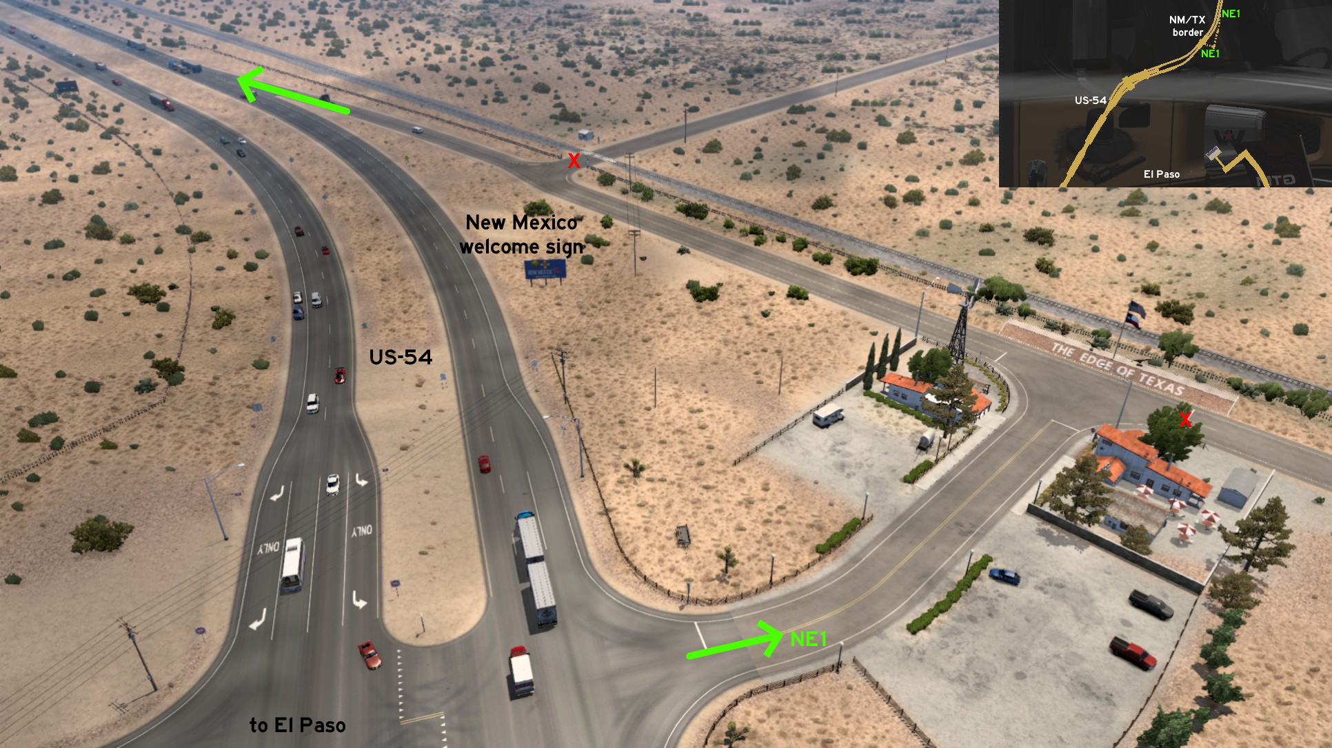 Just northeast of El Paso, near the edge of Texas, you'll find... the Edge of Texas! On road, the crossing is found before New Mexico welcome sign. On GPS, it's a little before the US-54 shield. Here you'll find a steakhouse, and a railroad behind the rock wall, before returning to US-54.
Fort Stockton
East 1 - Getting Pumped
Category: sceneryDiscovery: Applecorn
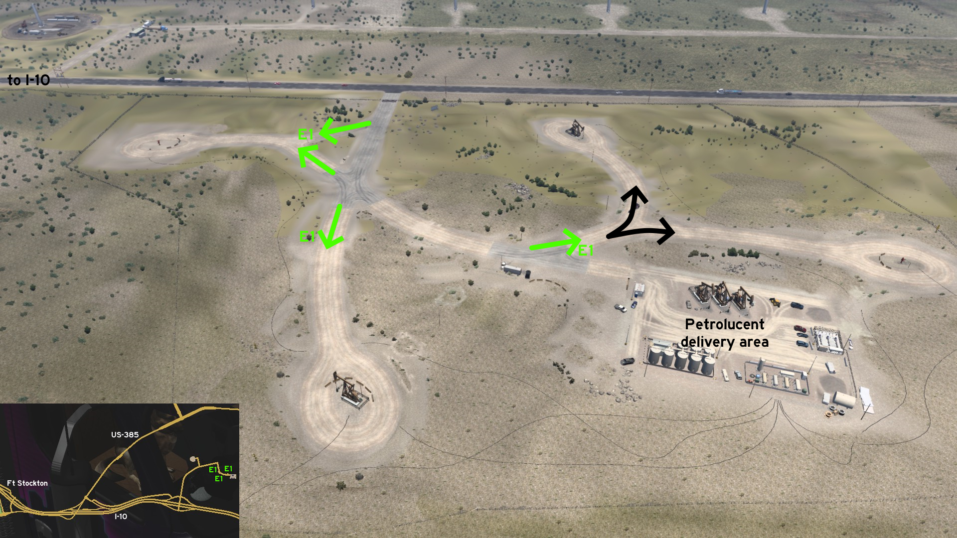 Before reaching Petrolucent delivery area, east of Fort Stockton, you can drive by and around several oil pumps accessible from the main route.
 Northwest 1 - From Freeway To Dusty Plains
Category: shortcut, markableDiscovery: Wide Kemo, kaia15
Update: OWLCAT, Laffey
Note: the "unfinished" exit ramps weren't markable before version 1.48
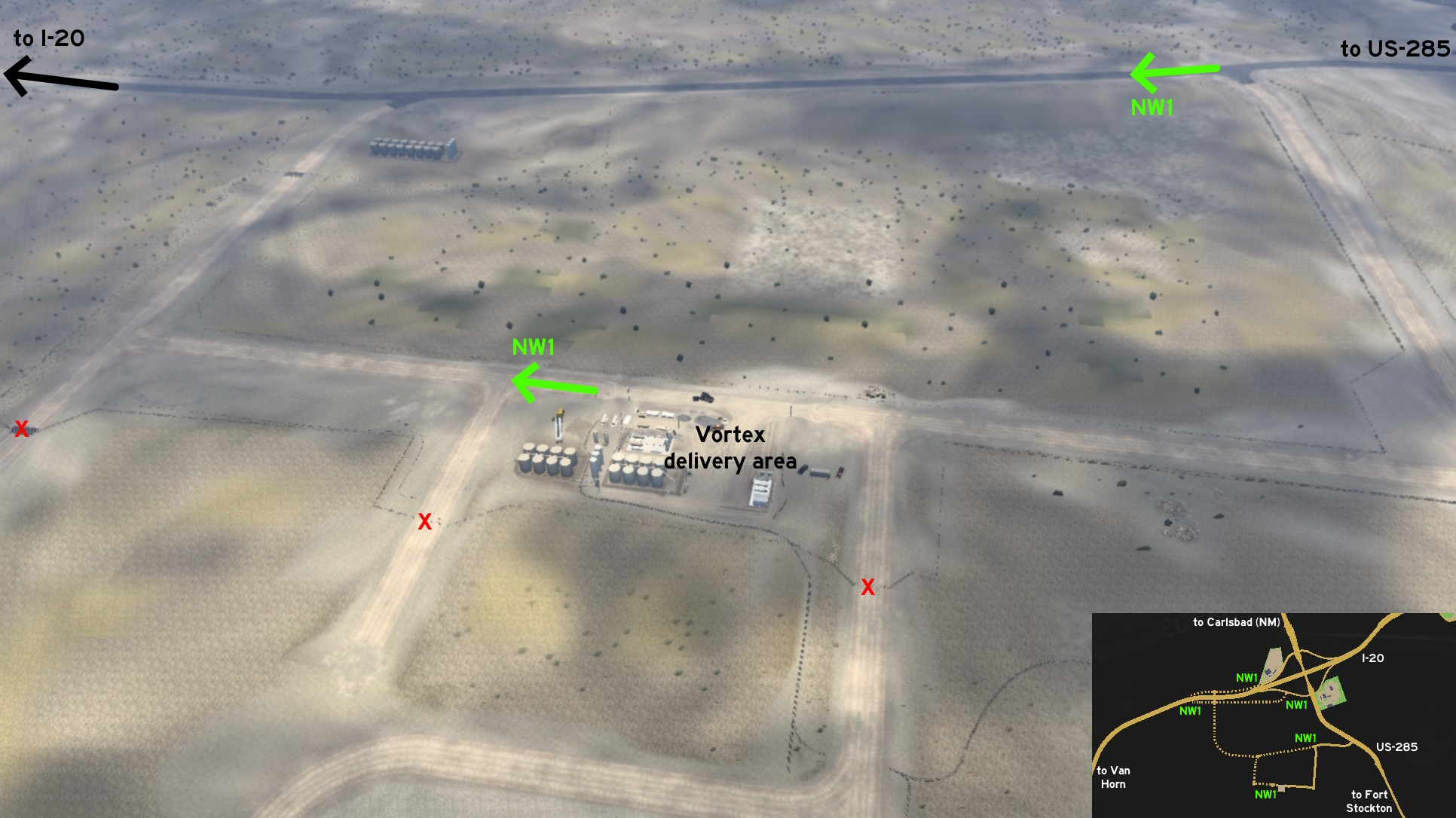 The Vortex found northwest of Fort Stockton can be accessed from 2 different alternative ways. The first is simply keeping yourself on the asphalt and entering the fork to the dusty road - it'll lead to the back entrance.
 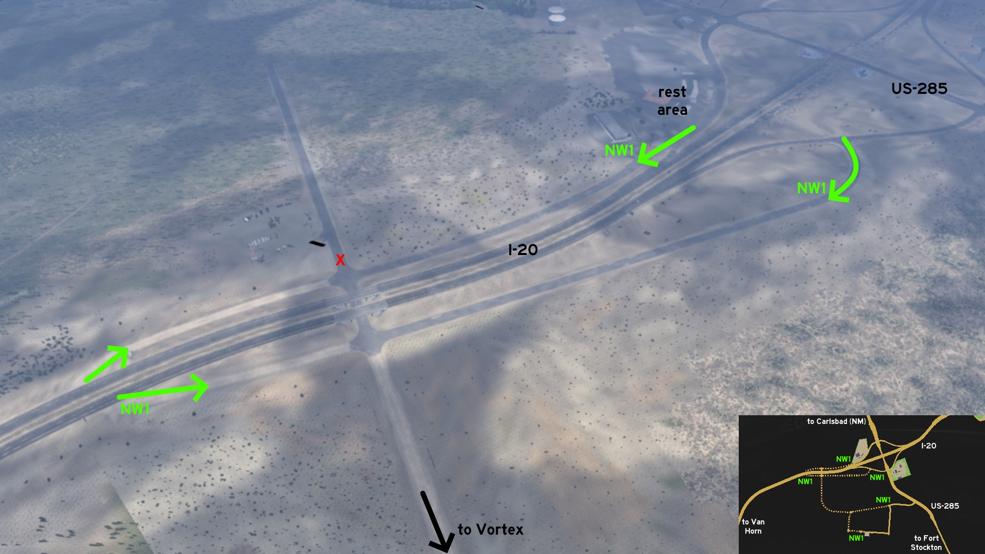 The second is simply keeping yourself on asphalt - it'll lead to the official intersection between I-20 and US-285 on east (which also lead to rest stops), and to what seems to be unfinished exit ramps to I-20 on west.
 Southeast 1 - McDonald Road
Category: shortcut, markableDiscovery: Epic Trucker Arch
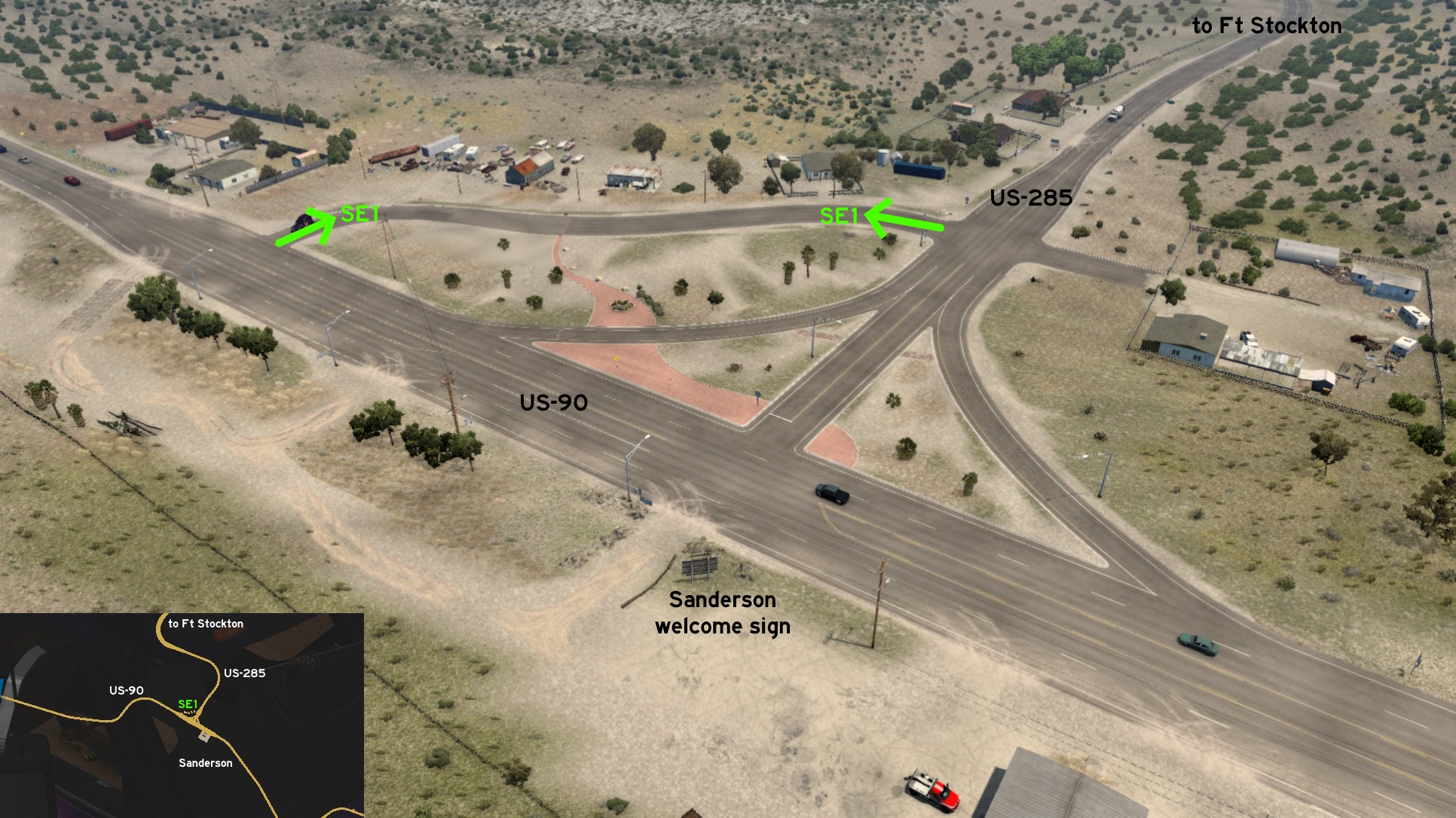 West of the crossing between US-90 and US-285, on the town of Sanderson, you'll find McDonald Road. Maybe not really a shortcut to west US-90, as it's easier to reach it keeping on US-285 lanes, but for sure it's an easier way to take a detour in case you took the wrong road.
 West 1 - Pioneer Stagecoach Stand
Category: achievement (Avid Historian)Discovery: kaia15
Note: in order to unlock this achievement, you need to find a total of at least 30 similar markers; please refer to this guide by Xeeran in order to find them, and other Texas achievements
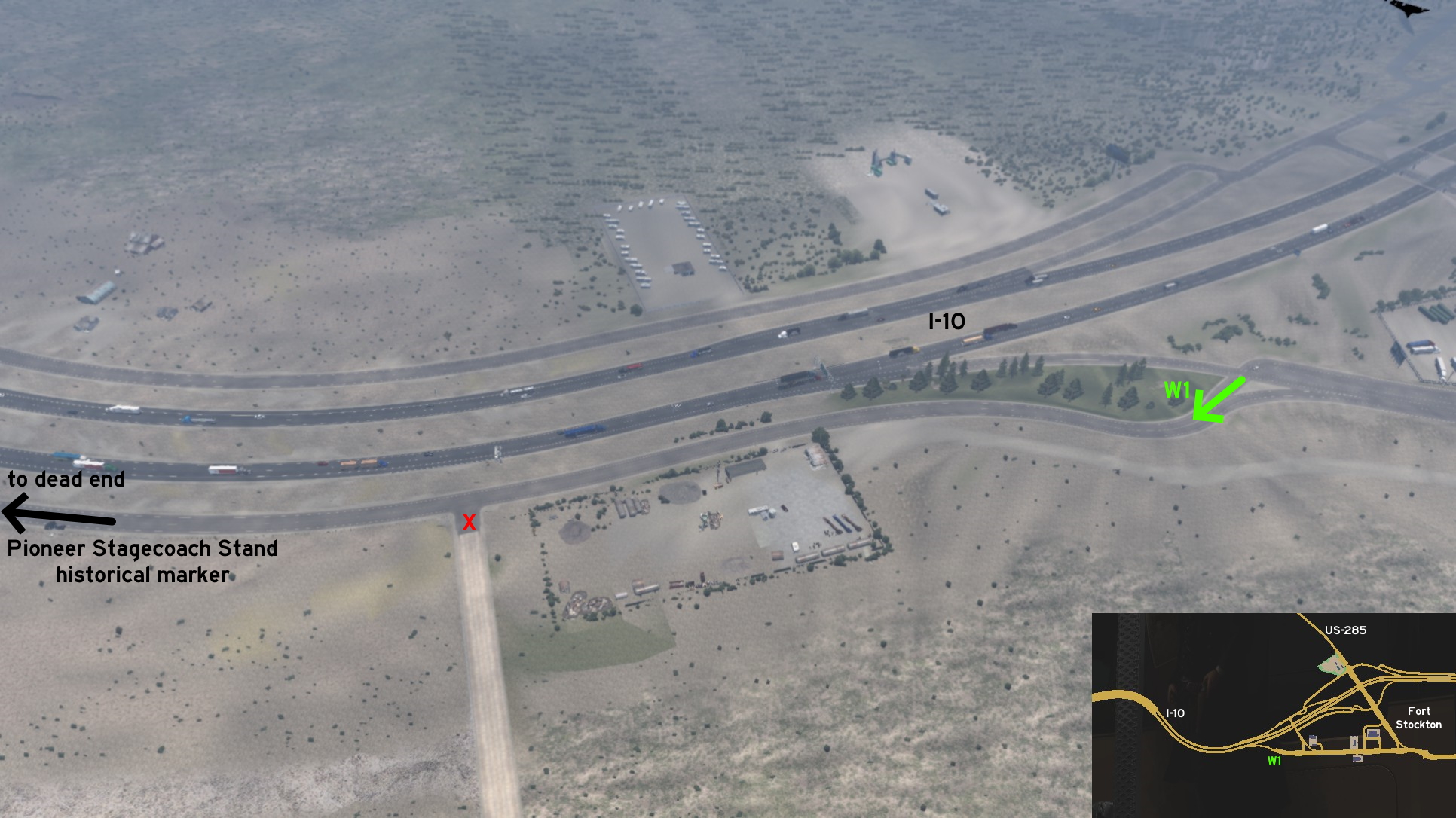 From your (future) garage on Fort Stockton, keep going west. Cross the exit from I-10. Drive by a scrapyard and a dusty road, and you'll reach the Pioneer Stagecoach Stand. You can keep going west, until you reach the asphalt road dead end. From this end, you can leave it through the dusty road, cross a bridge, until you reach another dead end - this time an invisible wall.
Fort Worth
South 1 - Ice Cream At Boot Country
Category: sceneryDiscovery: Applecorn
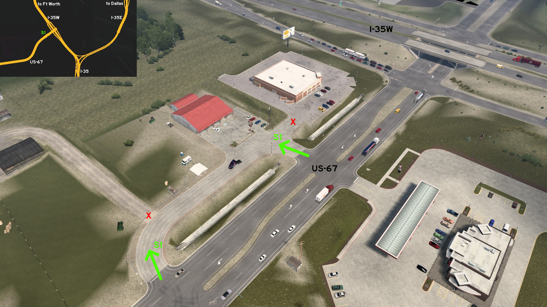 On the intersection of I-35W and US-67, there's a small stop area at Boot Country where you can find some ice cream, but can't stop to rest. You may be tempted to buy some supplies, but the Green Mart parking lot is blocked by a invisible wall.
Houston
North 1 - Race Track
Category: easter-egg, markableDiscovery: Wide Kemo
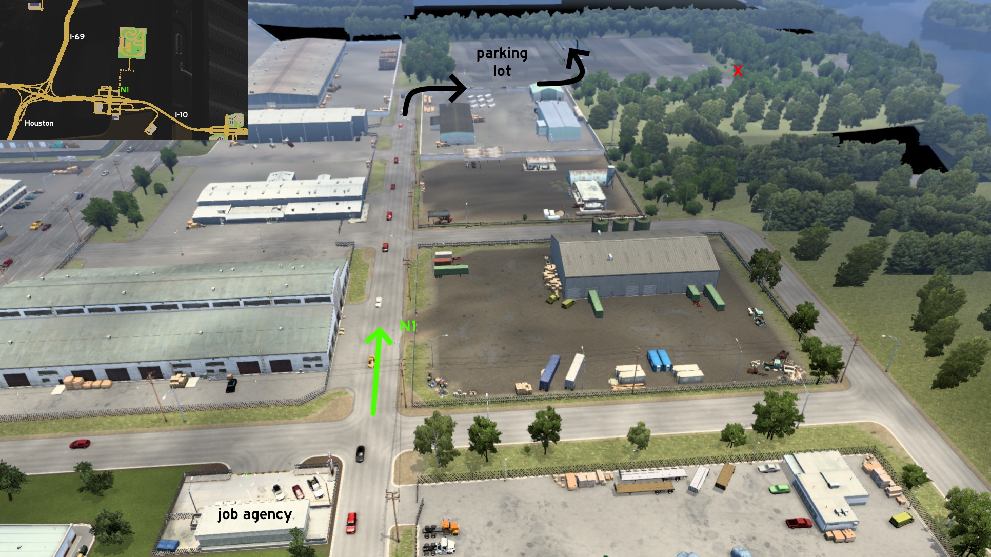 From the recruitment agency on north Houston, just keep following the road heading north until the end, and you'll have to turn right (east). It borders a parking lot, where you can find a tunnel right in the middle of it.
 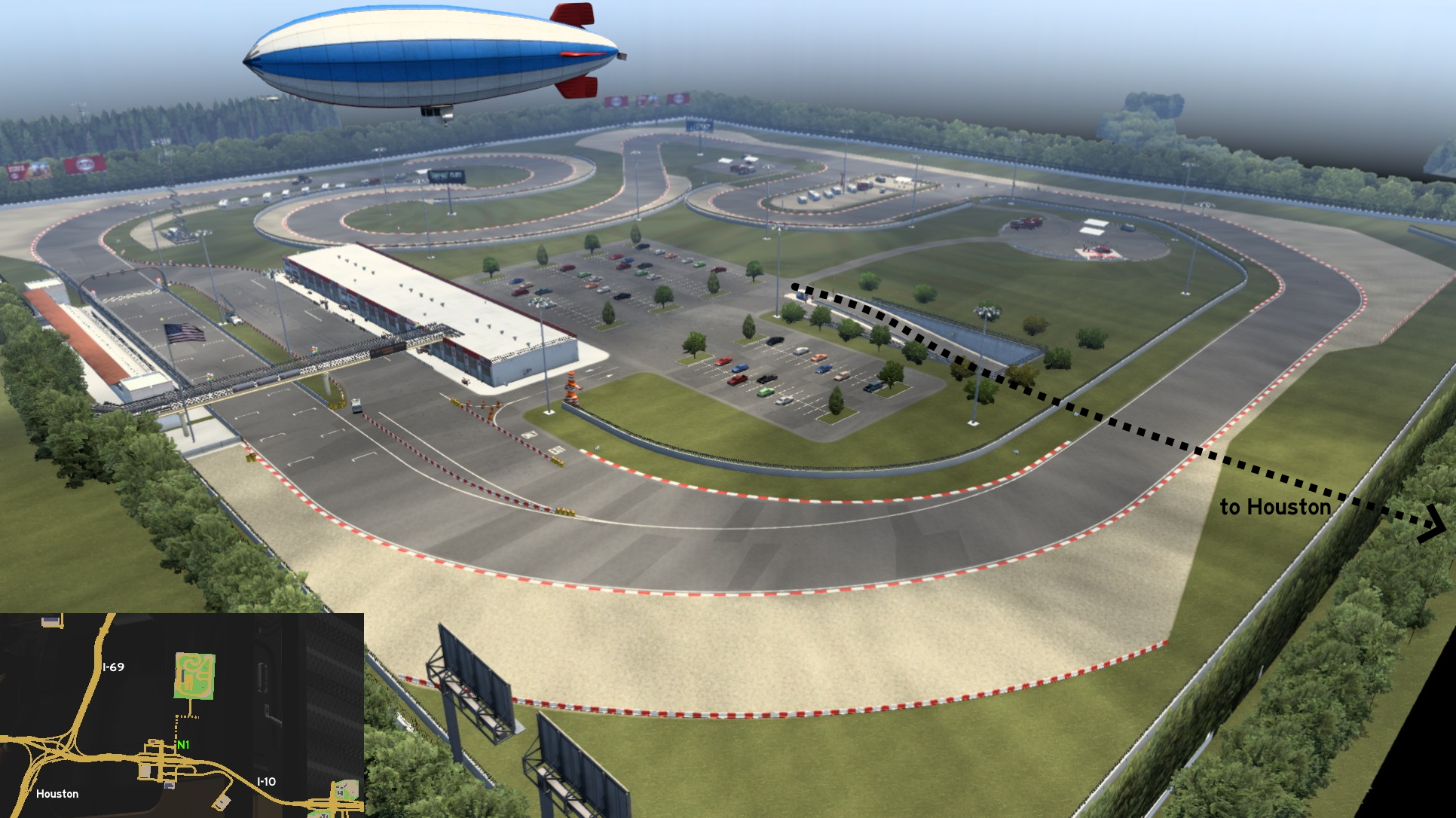 Follow the tunnel until the end, and you'll reach another parking lot. Turn left (west), and you can access the race track through the pit stop area - where you can even fill your tank.
Huntsville
West 1 - The Farm Road
Category: shortcut, markableDiscovery: kaia15, skyfox122
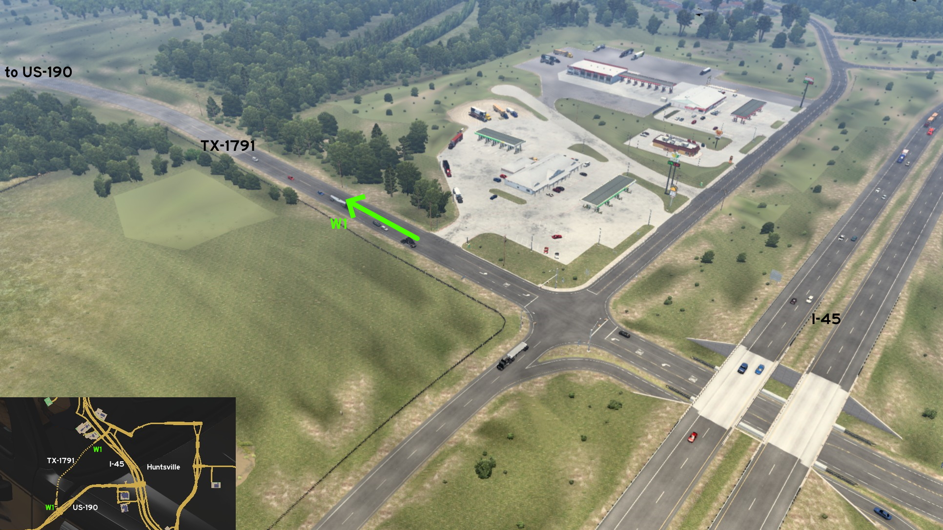 From the double rest area bordering I-45 on west Huntsville, you can access TX-1791, a farm-to-market road. From the city, it can be accessed directly after the rest area exit.
 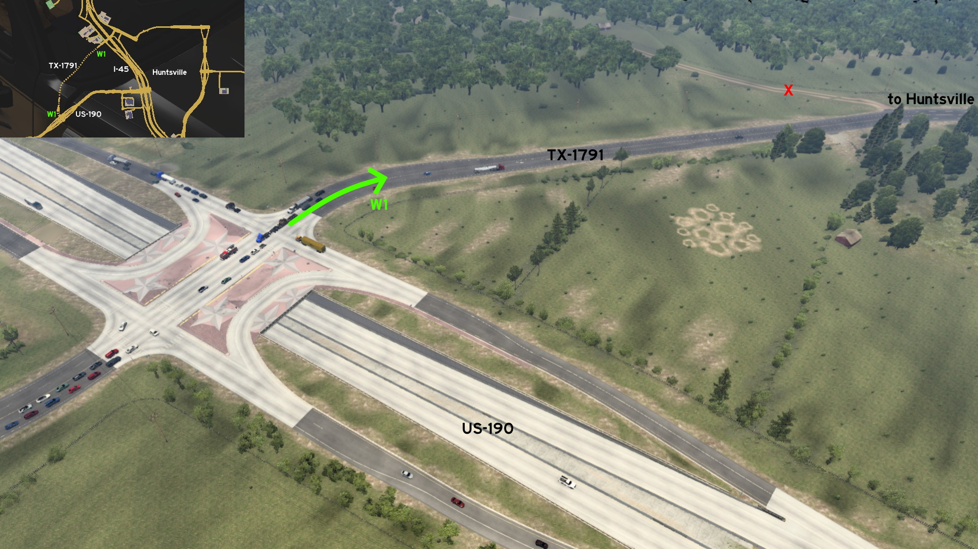 As expected, it runs through several farms, until it reaches its other end on the intersection of US-190.
Junction
West 1 - Avoiding The Red Light
Category: shortcutDiscovery: Applecorn
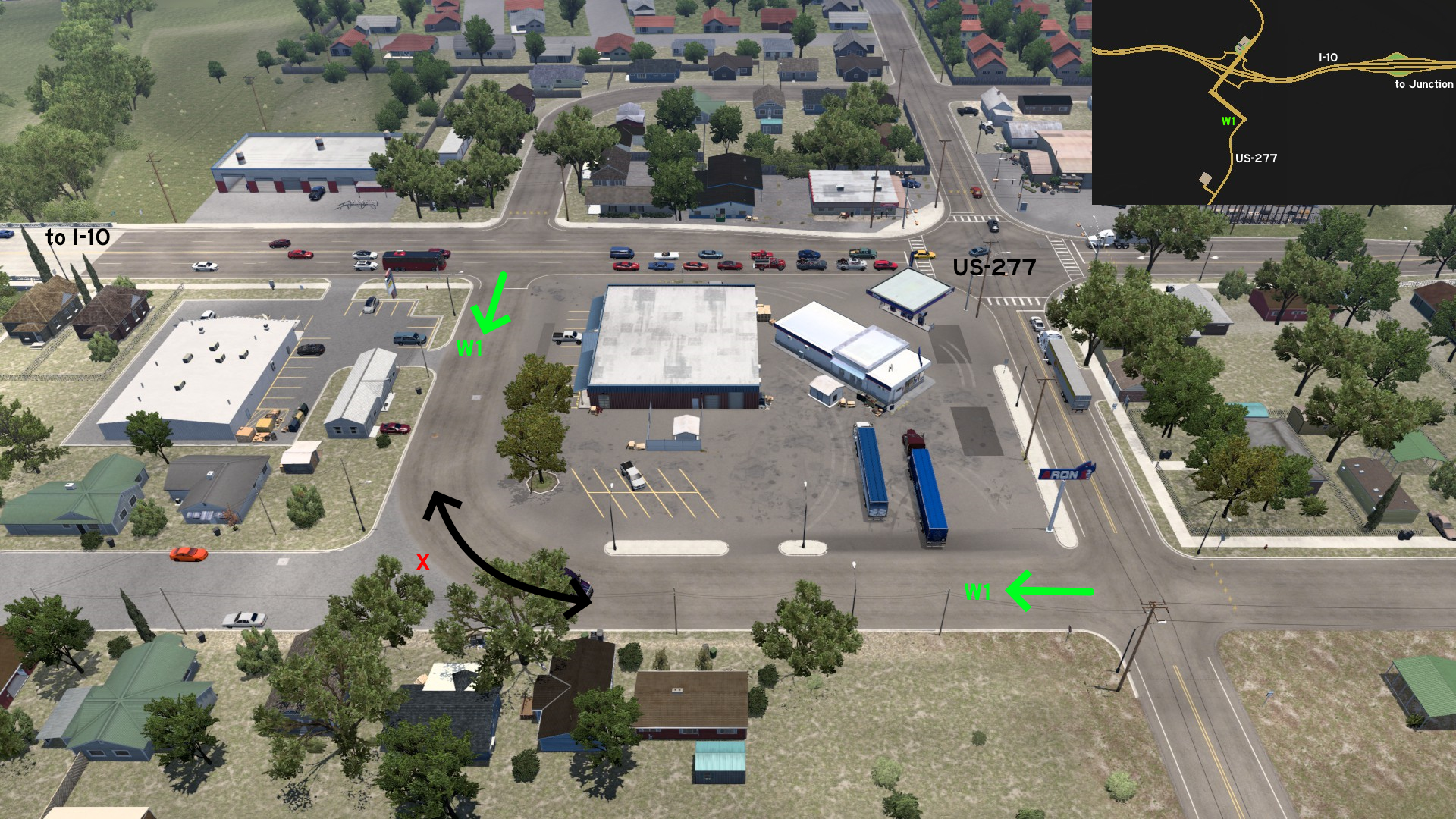 Leaving I-10 and heading US-277 southbound, there's a gas station. Although you can't fill your tank nor rest here, you can use the road around it to avoid the traffic light.
Laredo
East 1 - Side Entrance
Category: shortcut, markableDiscovery: Binary
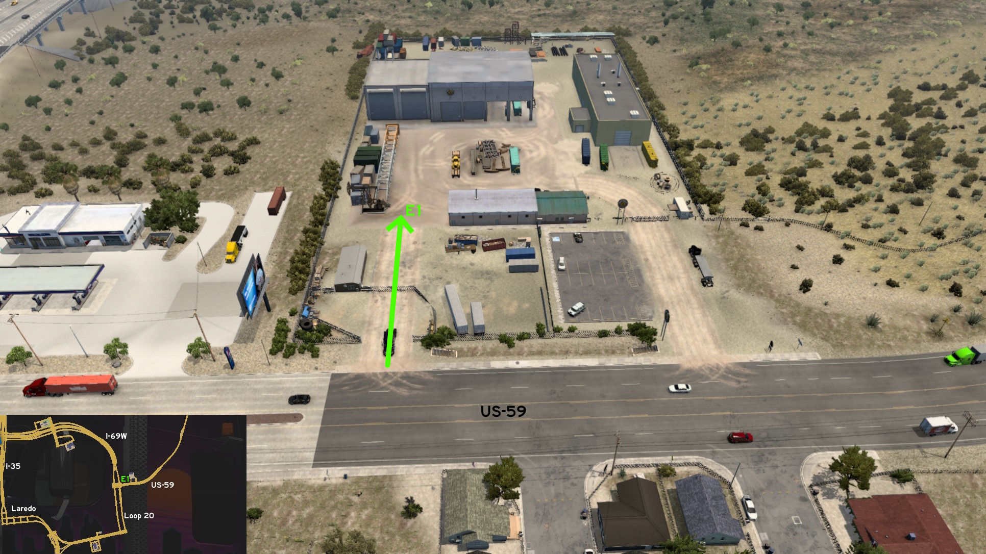 The Deep Wells depot east of Laredo has 2 entrances. The unmarked one is the westernmost, easy to recognize by its fences in bad condition.
 South 1 - South Texas International Raceway
Category: scenery, markableDiscovery: FeteFatale
Update: dfad1ripe
Note: the west end of the track doesn't seem to be connected to entrance, but it can still be accessed from there
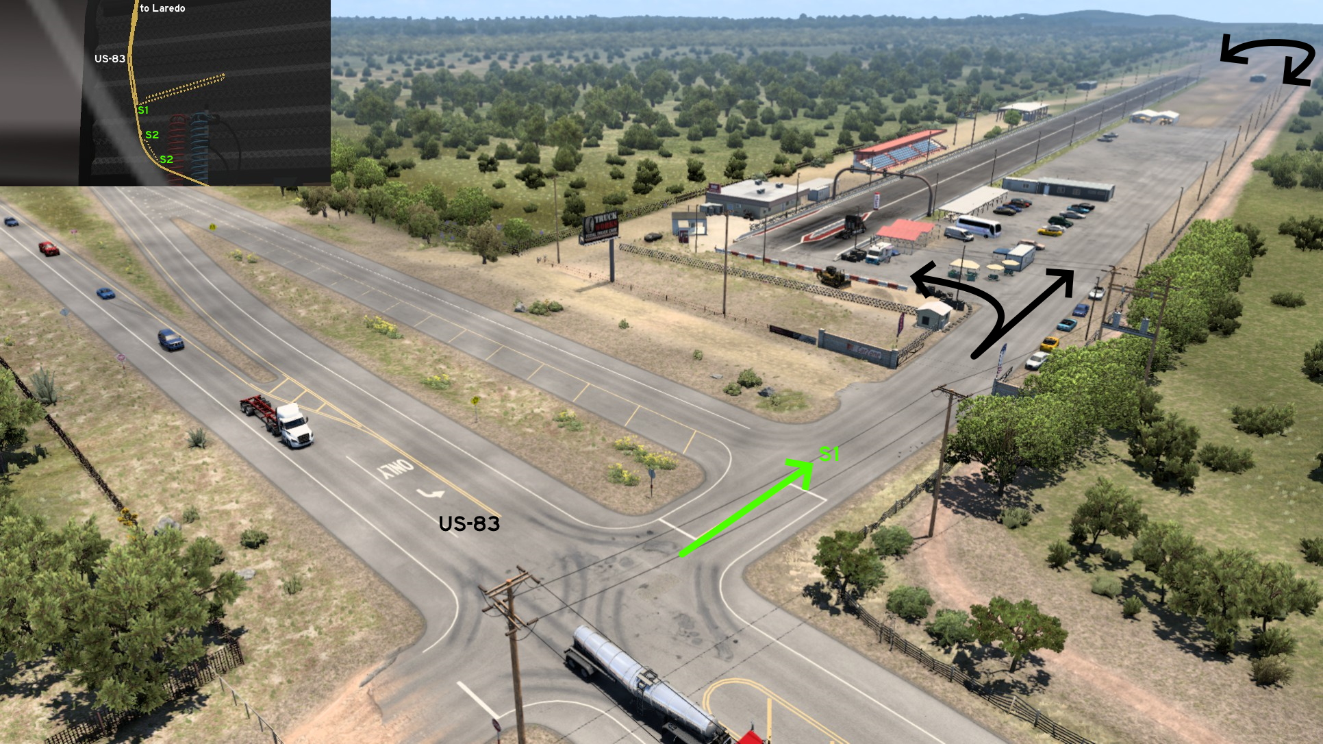 South of Laredo, on US-83, you can find South Texas International Raceway. Its entrance is easy to notice, as it's exactly where the road lanes merge. Drive carefully if you want to go to the starting lane right from its entrance.
 South 2 - Double Historical Knowledge
Category: achievement (Avid Historian), markableDiscovery: FeteFatale
Update: dfad1ripe
Note: in order to unlock this achievement, you need to find a total of at least 30 similar markers; please refer to this guide by Xeeran in order to find them, and other Texas achievements
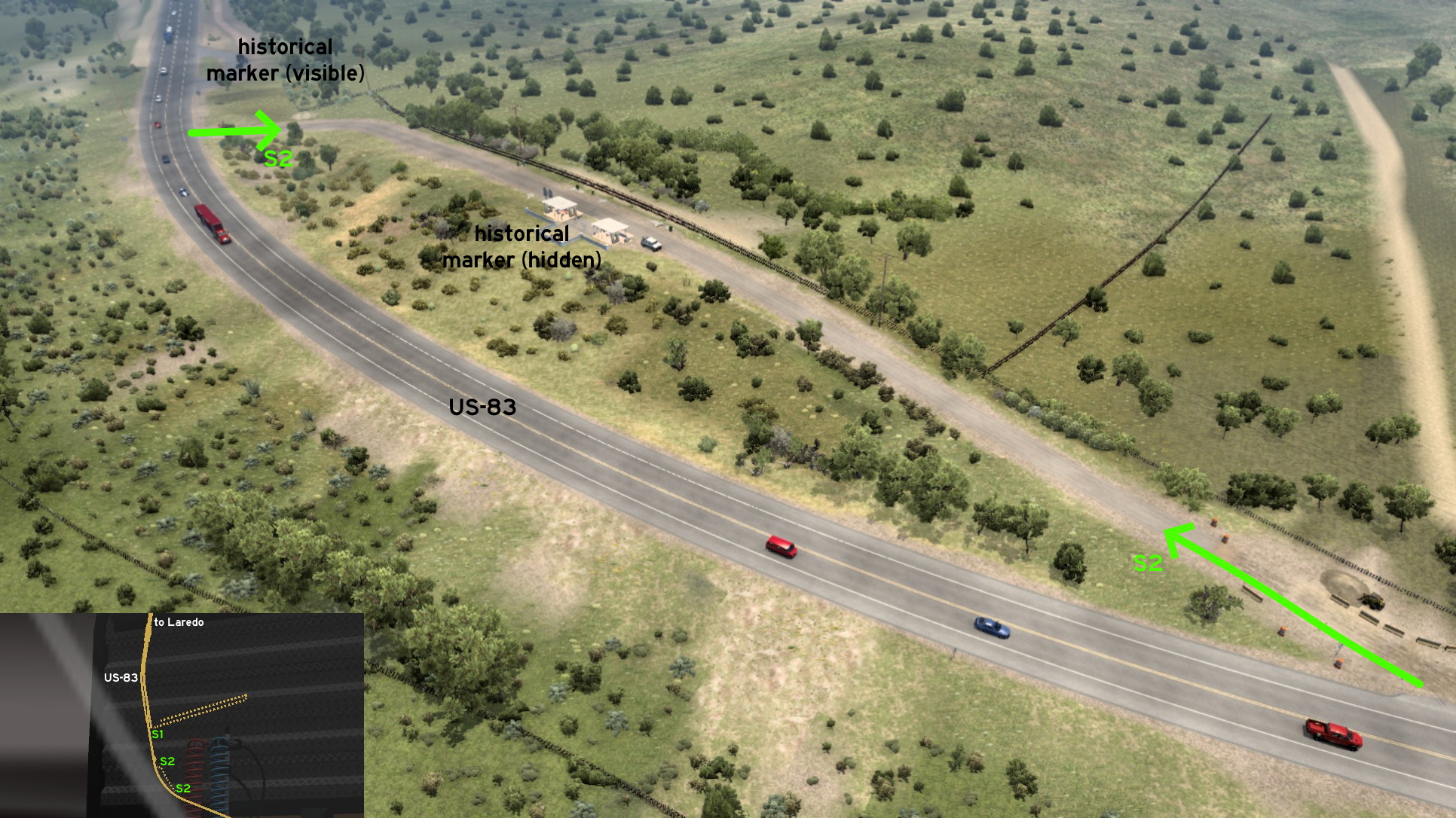 South of the Raceway on US-83, there are 2 historical markers. The visible one (similar to a rest stop) is about Zapata County. South of it, the marker about the Site of Uribeño is hidden, and can be found on top of the hill.
Longview
East 1 - From Dust To Rest
Category: shortcut, markableDiscovery: kaia15
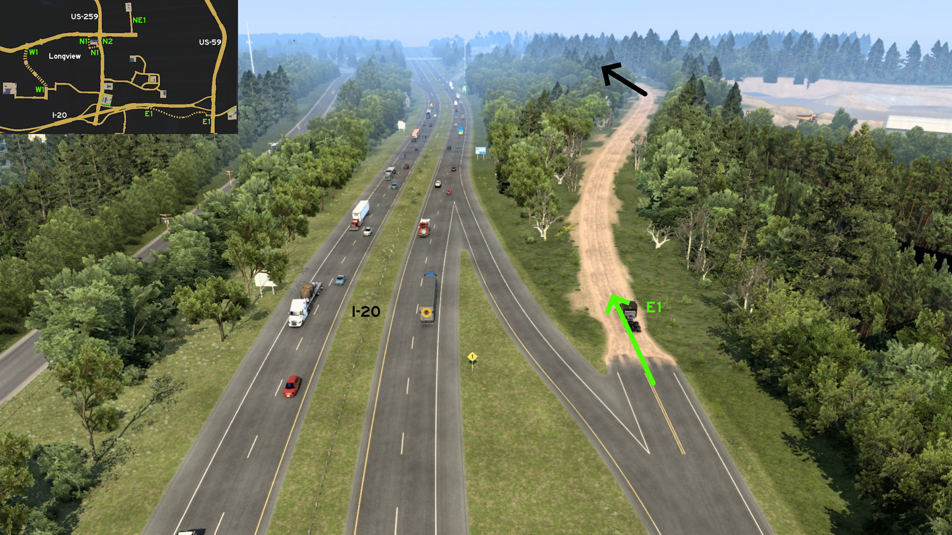 Starting on the crossing that leads to Sintetico and Faraday, head east until the end of the I-20 side road. Keep forward into the dusty road, until you reach a hotel, a hardware store and donut shop. The crossing leads to the rest stop on US-59.
 North 1 - Around Venture
Category: shortcut, markableDiscovery: noob168
Update: Applecorn
Note: on version 1.54, Walbert was changed to Venture
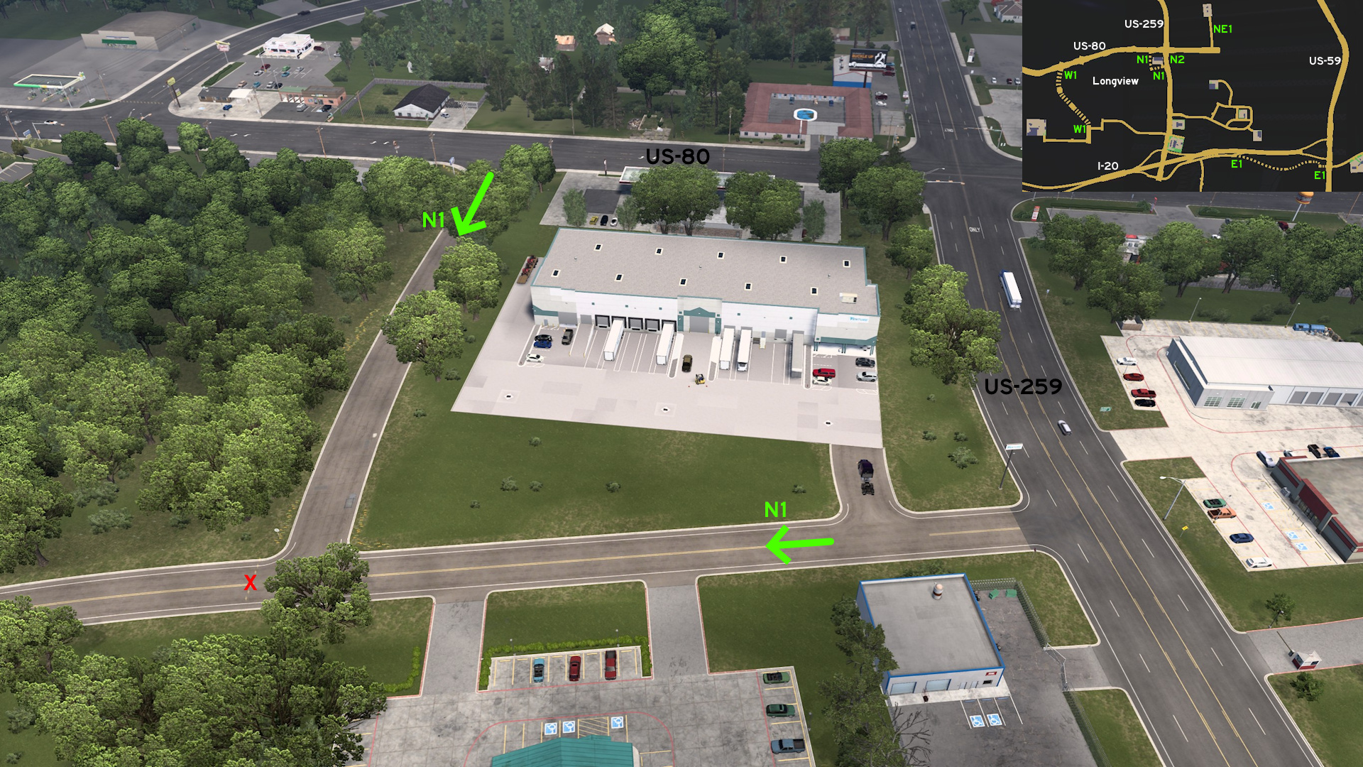 Head to Venture distribution center on north Longview. Instead of turning the crossing of US-80 (Marshall Avenue) and Eastman Road, east of the warehouse, take the road on its west side.
 North 2 - Drive Thru Detour
Category: shortcutDiscovery: Applecorn
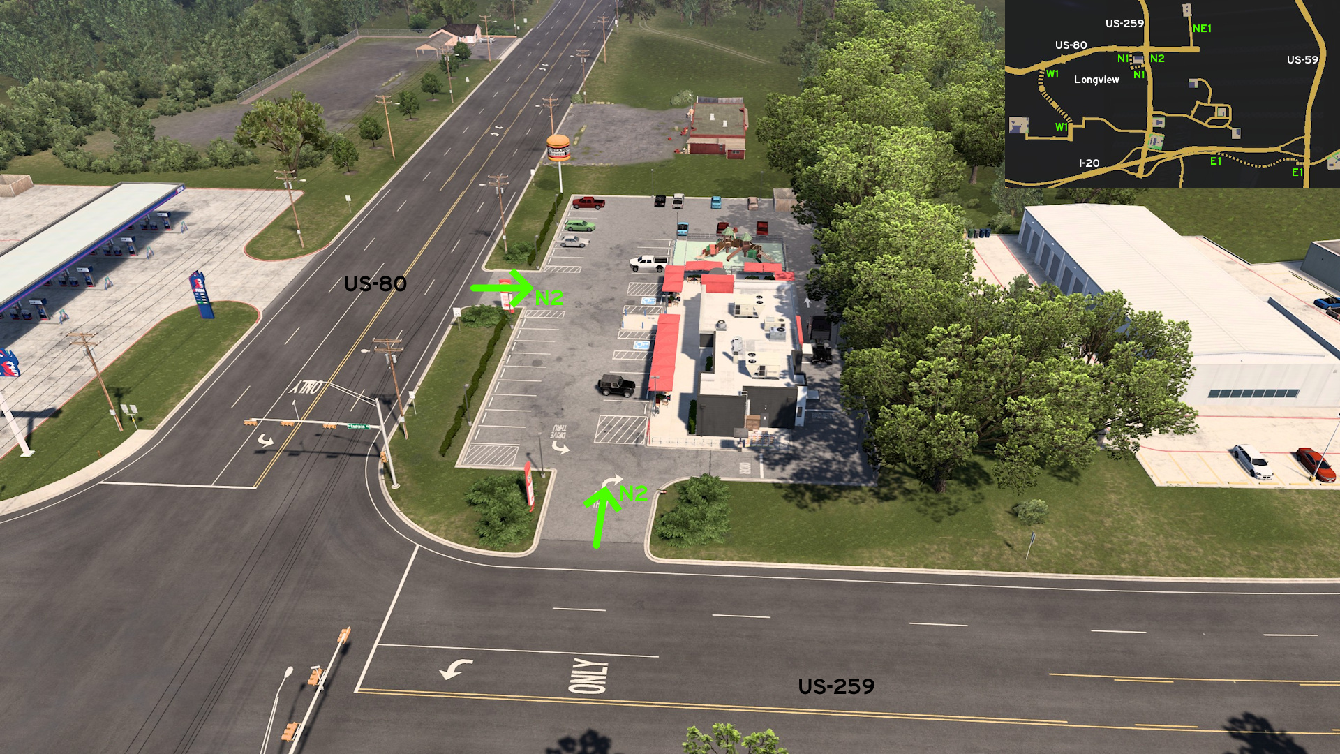 East of Venture distribution center on north Longview, there's a Dream Burger drive thru you can use as a shortcut or detour.
 Northeast 1 - Constructive Drive
Category: sceneryDiscovery: Applecorn
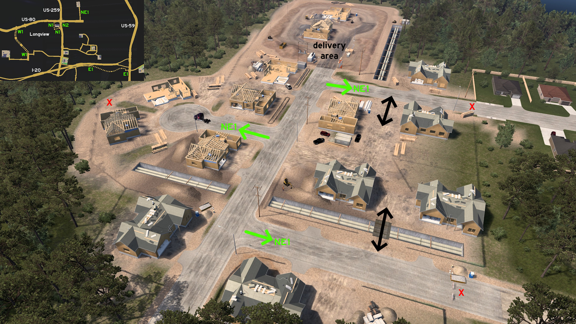 Head to the Taylor construction site northeast Longview. All surrounding roads are accessible as far as you see a concrete block or a fence.
 South 1 - One-Way Shortcut
Category: shortcut, markableDiscovery: noob168
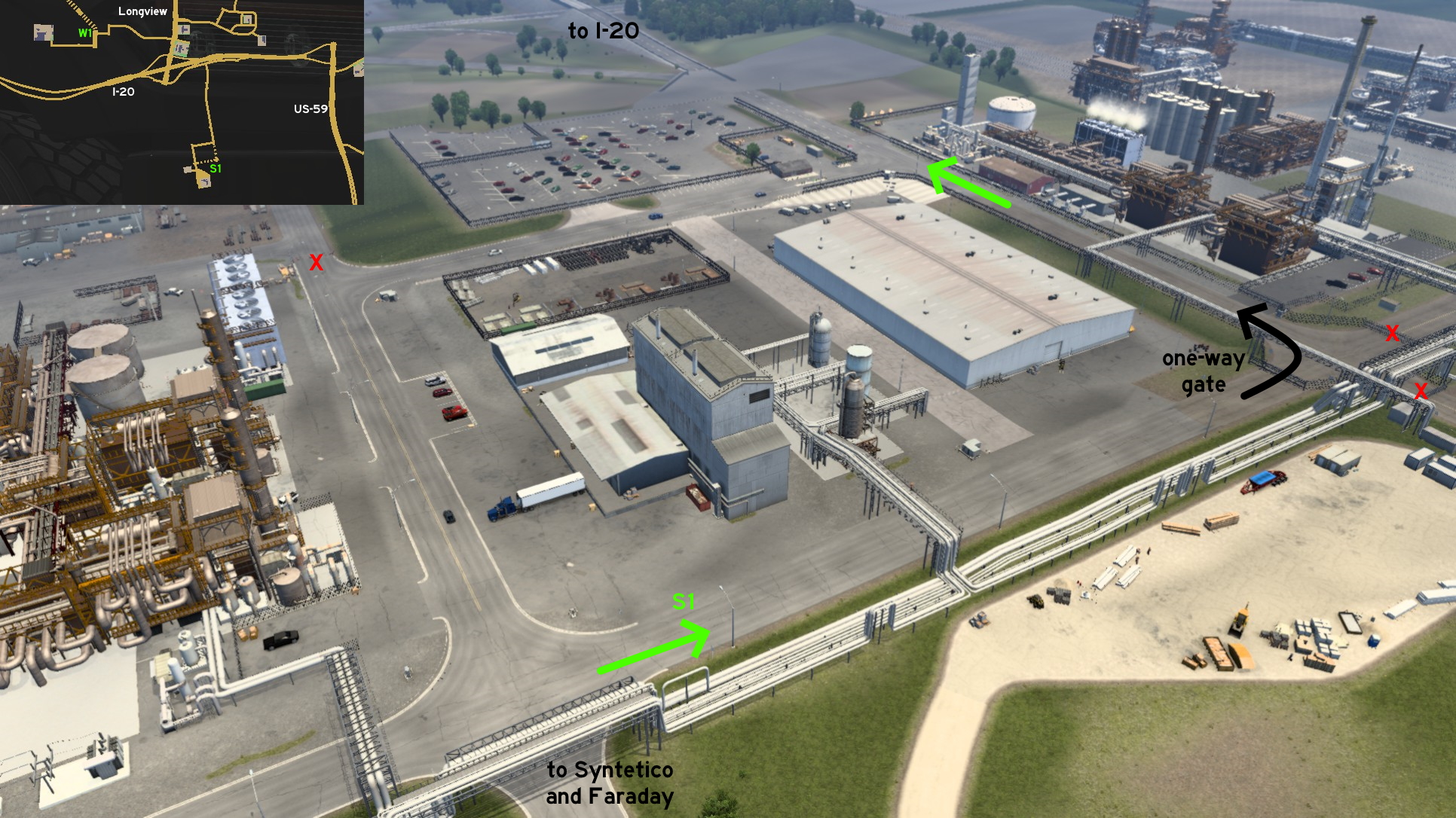 From the entrance of both Syntetico chemical plant and Faraday construction site, there's an one-way alternative route back to I-20. The gate opens only for drivers leaving the facility.
 Southeast 1 - A Fake, An Alternative, And A Real Shortcut
Category: shortcut, markableDiscovery: noob168
Update: spy_track
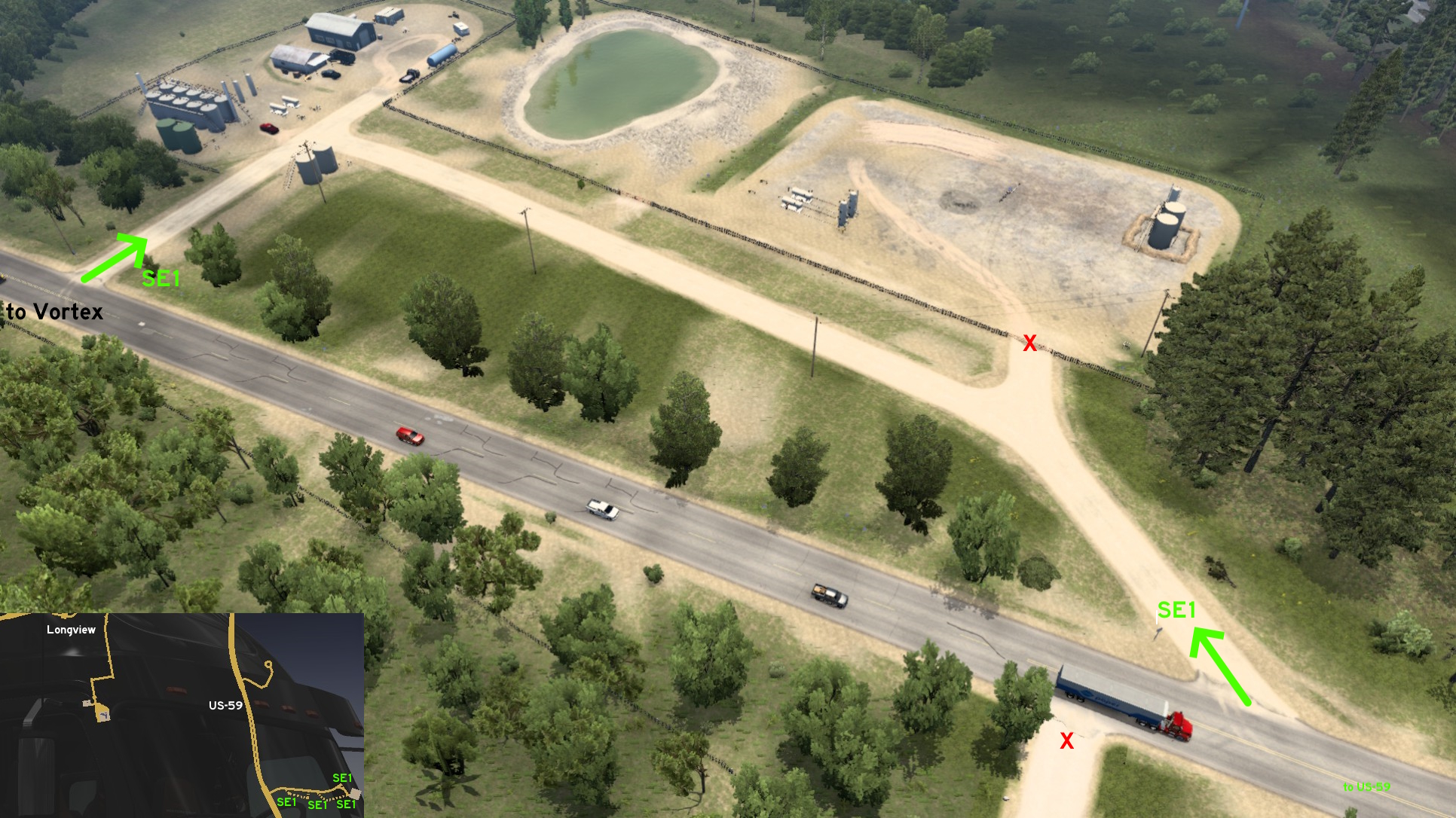 On the road to Vortex oil pumps southeast of Longview, there are some dirt roads that can be accessed. But not all of them lead to the delivery area. The first one you'll find seems to lead the future area for some extra pumps.
 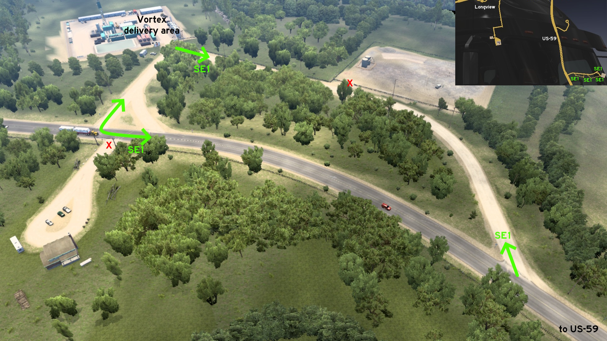 Closer to the delivery area, there are both one alternative way to lead the main road earlier, and another alternative way to leave the area and return to main road.
 West 1 - High Street To Steel
Category: shortcut, markableDiscovery: noob168, kaia15
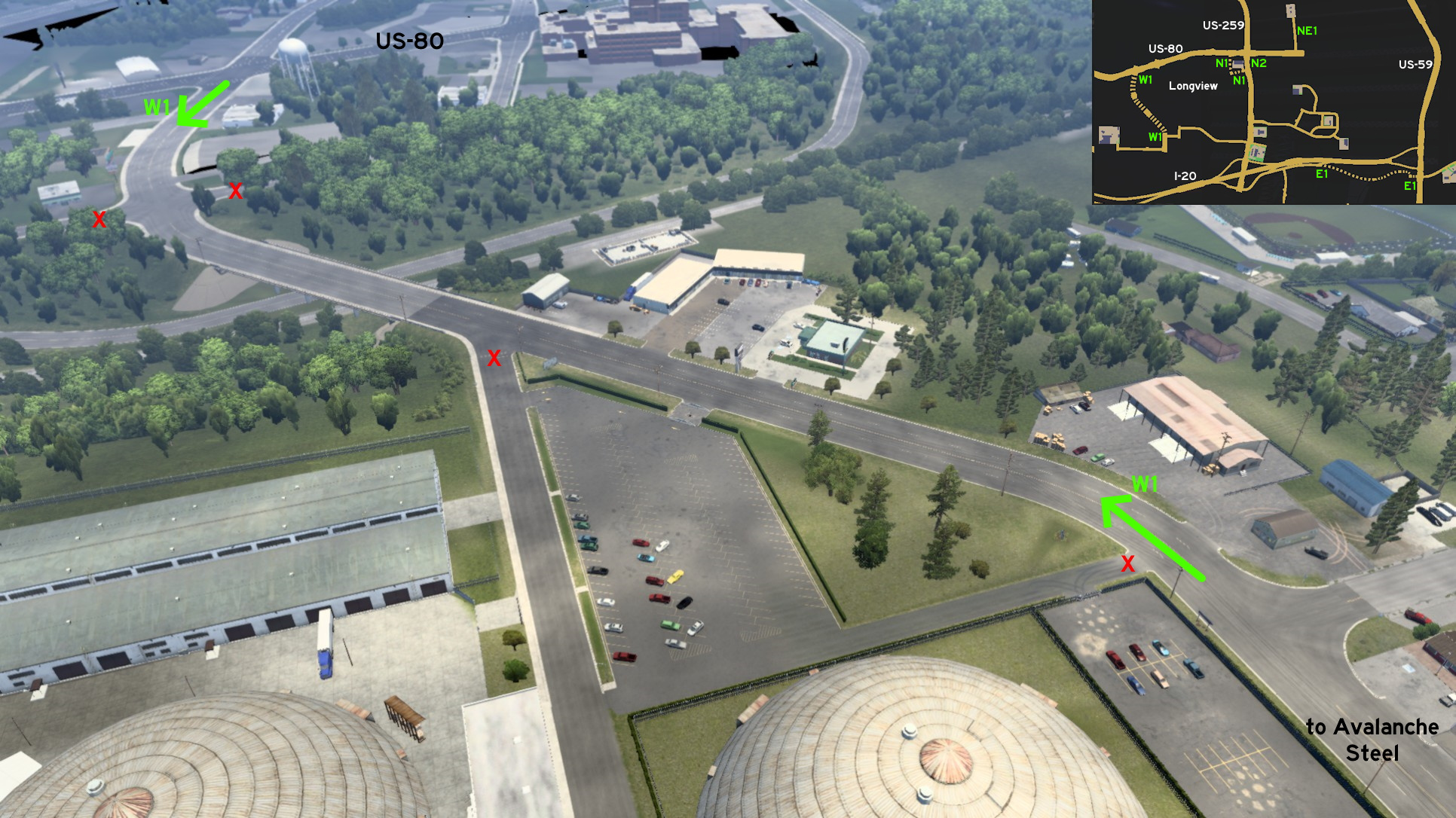 On west Longview, head to US-80 (Marshall Avenue). The shortcut to Avalanche Steel factory is High Street. On GPS, it can be easily located as a crossing west of where the US-80 shield is placed.
Lubbock
South 1 - Triple Alternative
Category: ShortcutDiscovery: Applecorn
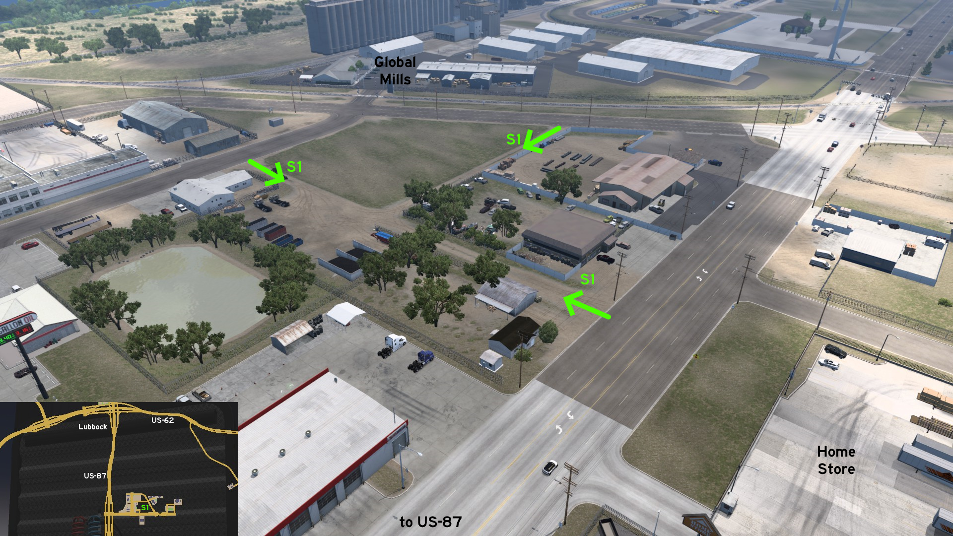 South of Lubbock, there's an open area between Global Mills and Home Store cut by three dusty paths, which can be used as a shortcut between them. Just be careful when crossing the road to Home Store.
Lufkin
East 1 - Rest Spots Out Of The Rest Stop
Category: sceneryDiscovery: DDogg
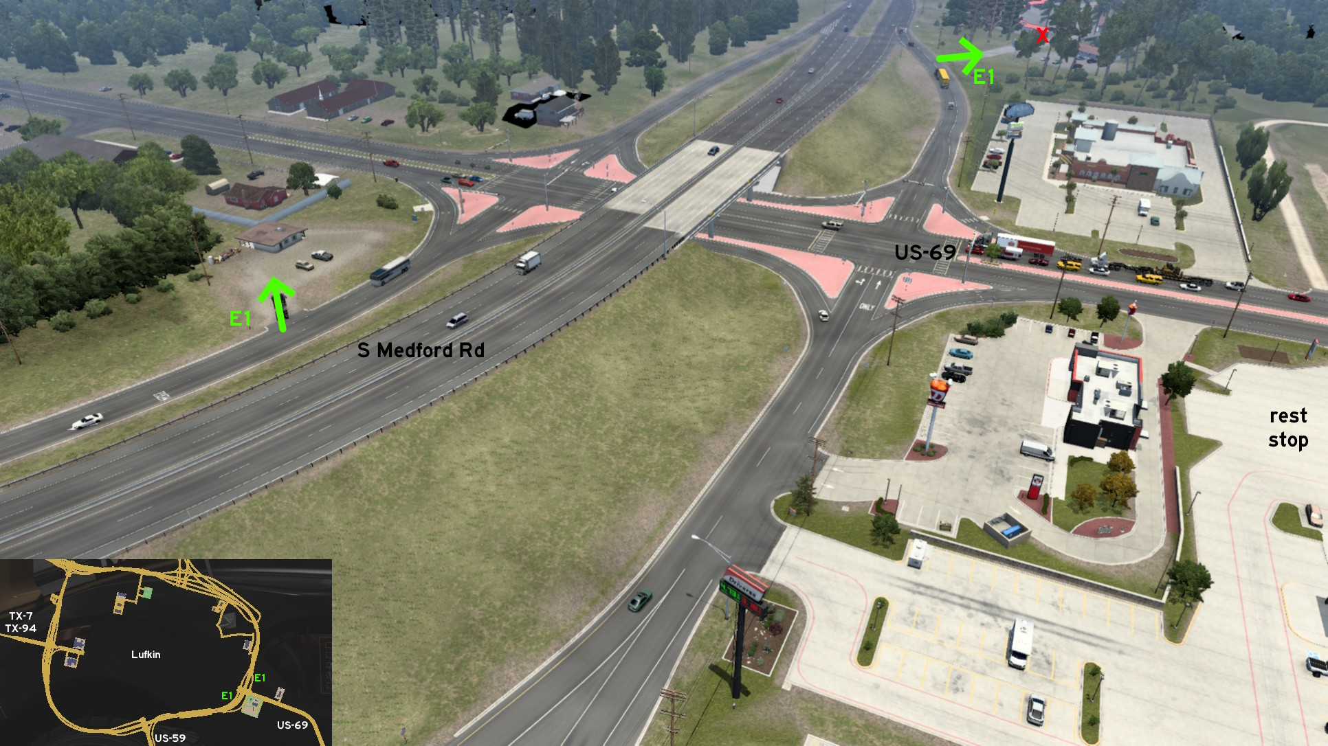 On the ramps connecting US-69 to South Medford Drive, near a X-Tech Machinery depot, there are 2 parking lots where you can stop your truck, but don't count as rest stops. Luckily, this intersection has an official rest stop you can use.
 Southeast 1 - Logging In
Category: shortcut, markableDiscovery: kaia15
Update: skyfox122
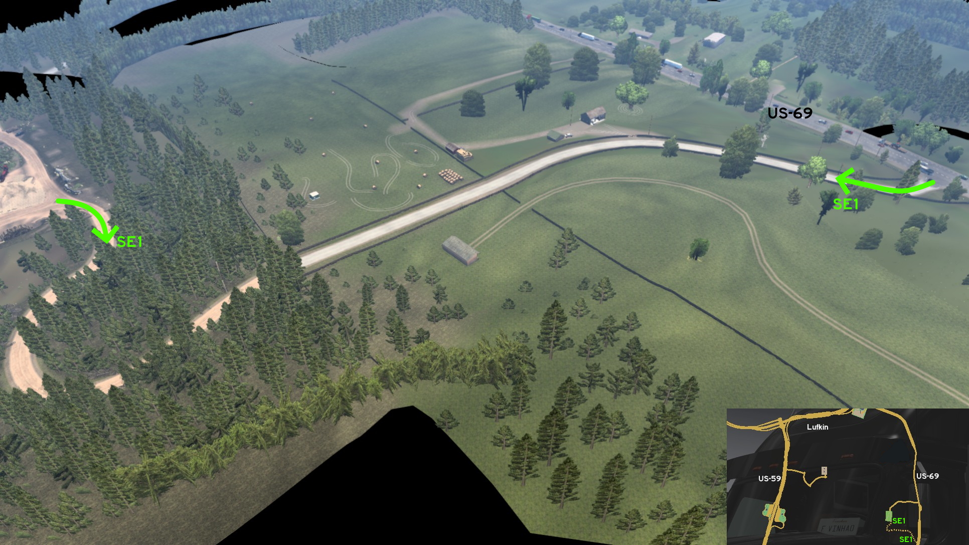 From the Chuck & Jack's logging area southeast of Lufkin, another dirt road from the south side of the area can be accessed to return to US-69, just take the easternmost exit. Just be careful, as the dense forest area is narrow, and some stumps and fallen trees are found close to the path.
 Southeast 2 - Annie's Campground
Category: scenery, markableDiscovery: skyfox122
Update: spy_track
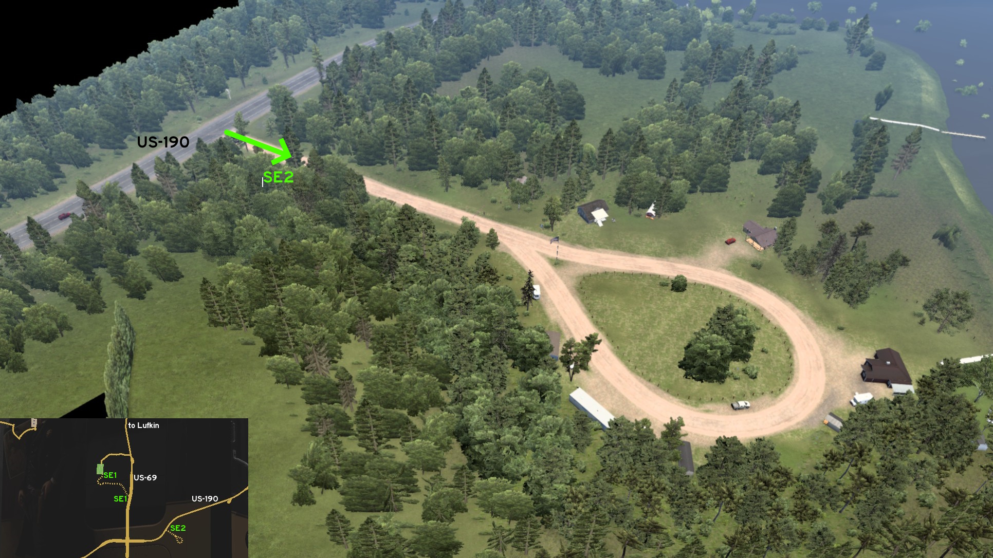 About some miles east of the crossing with US-69, there's a dirt road starting on US-190. There's a dead end sign at the entrance, and a sign with the name of the camping area and a wooden cowboy as well. There's a lasso-shaped detour at the end, where you can stop your truck. It just doesn't count as rest stop, but you can still bring your picnic basket and enjoy the lake view.
Odessa
East 1 - From Oil To Wind
Category: shortcut, markableDiscovery: kaia15, skyfox122
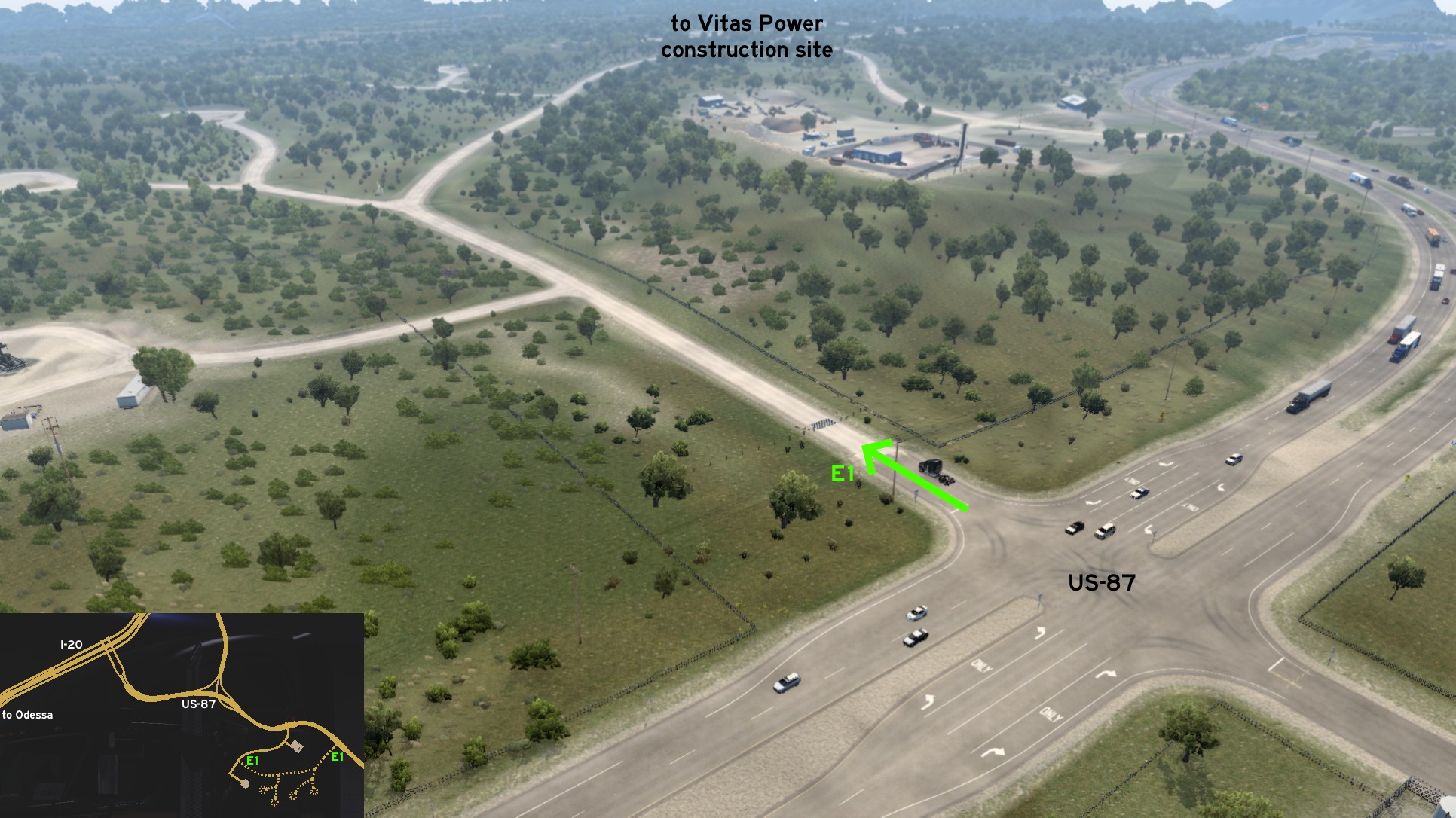 East of Odessa, you can reach the Vitas Power construction site leaving US-87 earlier, in case you're driving from Victoria. The crossing is fully open and even features turning lanes.
 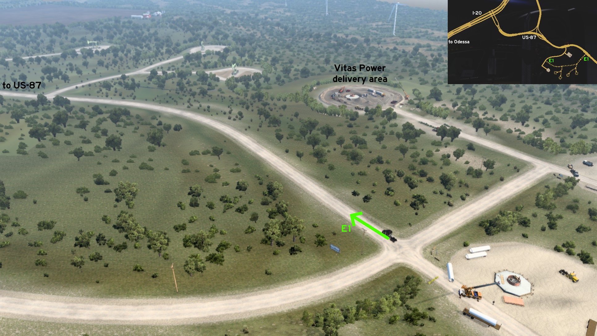 Drive behind the nearby NAMIQ depot, and around oil pumps - that curiously doesn't have any job for you. The dirt road ends on the official marked road to the Vitas Power delivery area.
 Southeast 1 - No Shortcut Nor Rest Stop
Category: scenery, markableDiscovery: kaia15
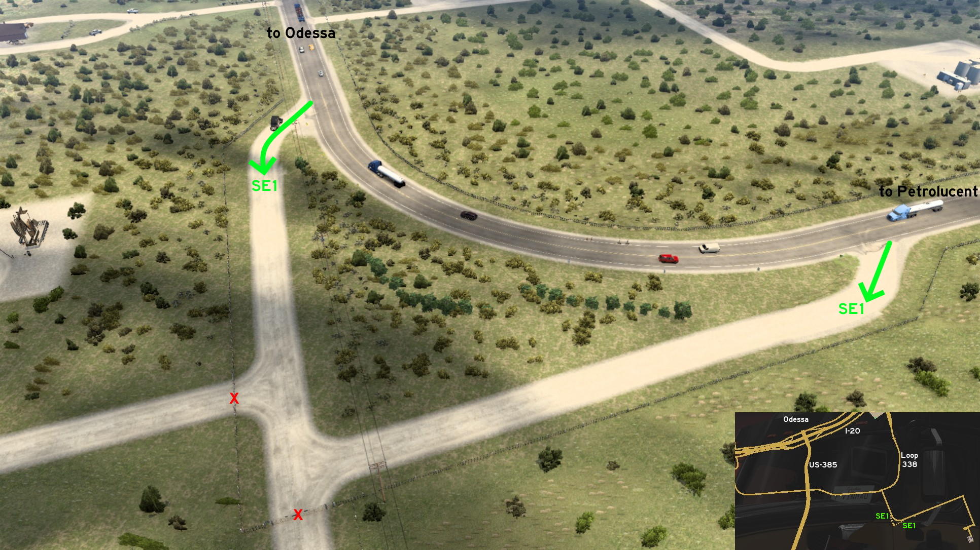 Just southeast of the Loop 338 around Odessa, on the way to Petrolucent, there are some dusty paths near the oil pumps. But they can't be used as shortcut to them, nor as a rest stop. Only an alternative way to turn around, or just enjoy the view.
San Angelo
South 1 - City Tour
Category: scenery, markableDiscovery: kaia15
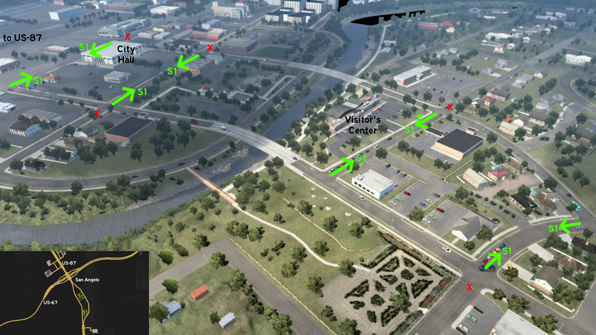 On the south area of San Angelo, where the road splits into 2, all roads and parking lots connecting the 2 halves are accessible, allowing you to visit the fast food chains at north, the city hall and the visitor's center in the middle, and a residential area at south.
 West 1 - Pump Loop
Category: scenery, markableDiscovery: uratobuic
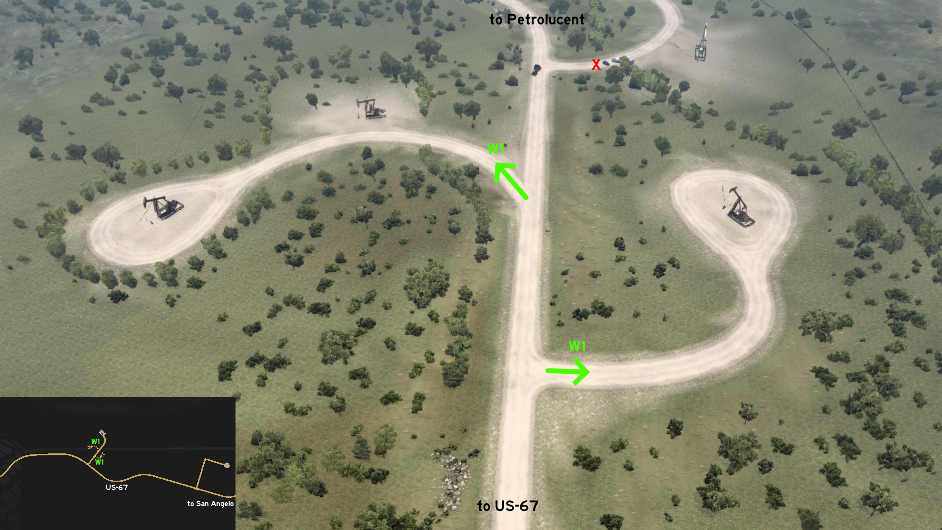 On the way to Petrolucent west of San Angelo, there are 3 crossings. The 2 first lead to a loop around an oil pump each. The last one before the depot is open until you'll reach some parked cars, where an invisible wall protect them.
San Antonio
South 1 - Interview And Test Drive
Category: easter-egg, markableDiscovery: skyfox122
Note: only the test drive area is markable
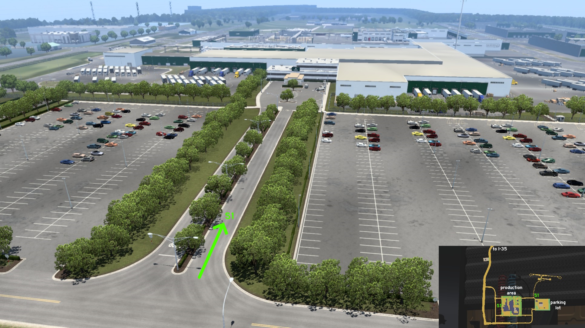 On the Asuma manufacturing south of San Antonio, there are 2 secret accessible areas. The first is the employees entrance on the production building (the westernmost area), where an interview is taking place - a new car is being released?
 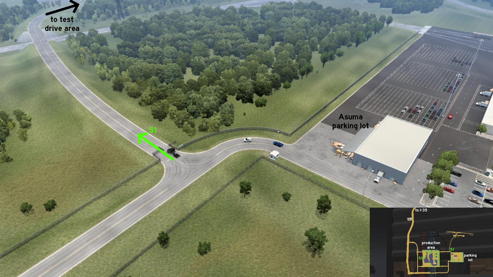 The second is the test drive area, found near the entrance of the parking lot (the easternmost area). There's a sign saying it's a dangerous area, and only authorized personnel can go through - apparently you are. Most of the obstacle found there are harder for smaller vehicles for sure.
 Southeast 1 - Side Of Pastures
Category: shortcut, markable (kind of)Discovery: DDogg
Update: kettcardriverprofi
Note: road is very short so it's hard to see if it gets marked, but if you reach it the first time the message will be triggered
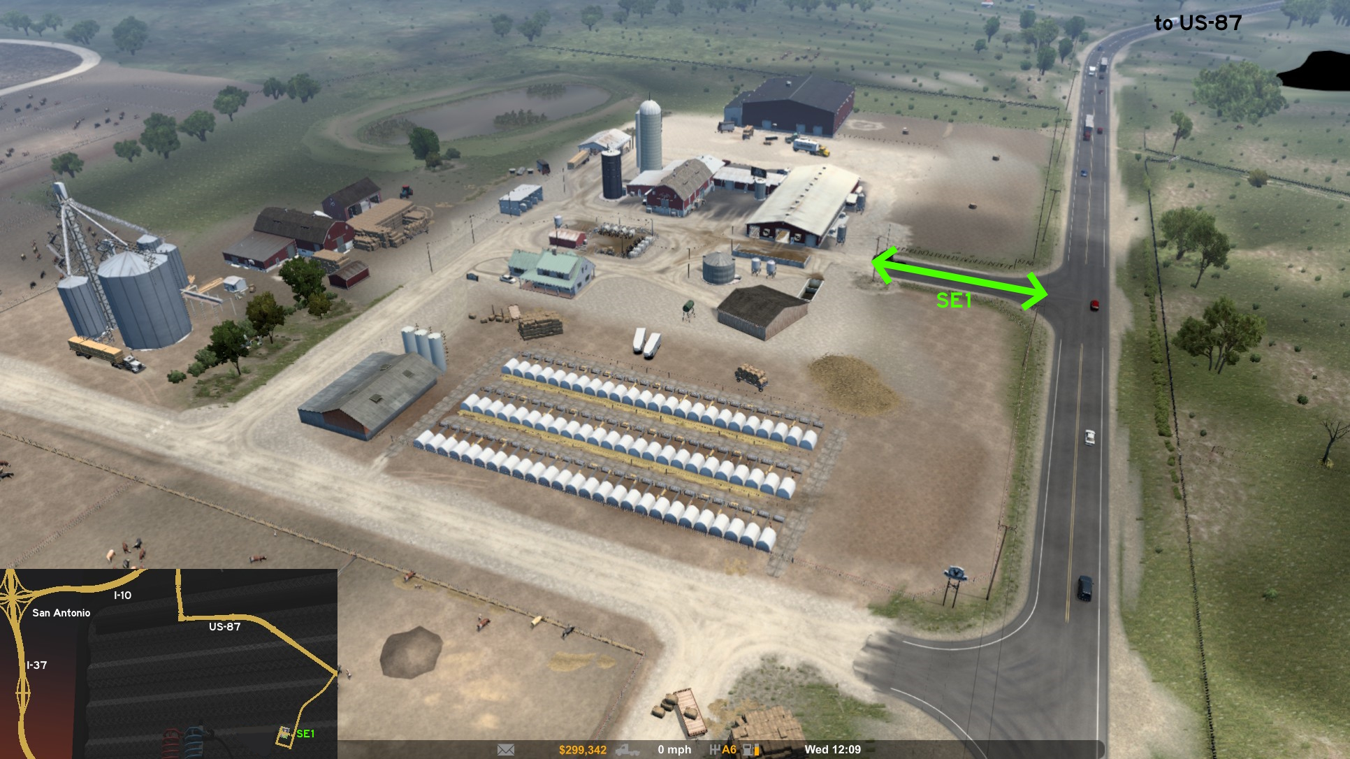 On Grand Pastures southeast of San Antonio, you can also leave the delivery area from its east path directly to main road.
Texarkana
See also Texarkana on Arkansas
Discovery: 17F
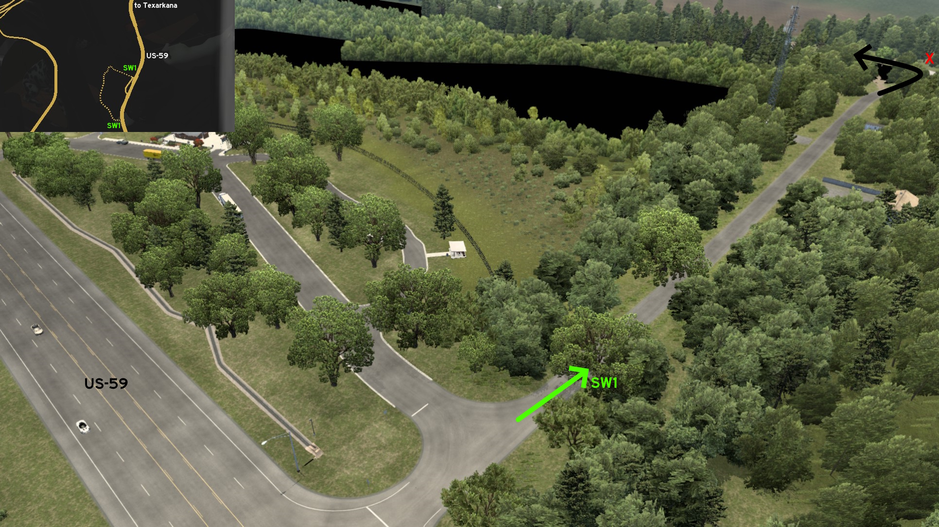 Drive to the small rest stop southwest of Texarkana, on US-59. A dusty road starts on its northmost entrance. It's marked by a misleading dead end sign. Just keep driving, paying attention to signs along your journey, and turn left (south) to discover another secret road.
 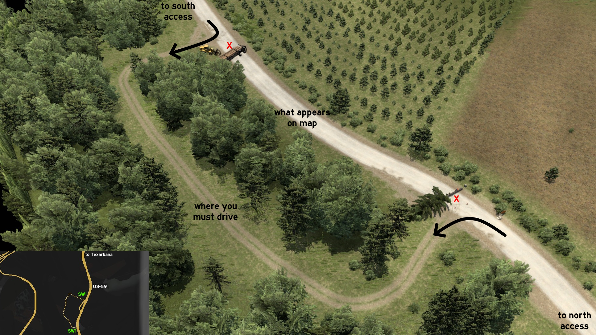 Drive really careful if you're here at night. Apparently a wizard is on this area, knocking down trees and trucks to block the way. You must take a detour through a gap in the woods to return to the marked route. Keep driving slowly, and soon you'll be back to US-59, some miles south of the rest stop.
Discovery: 17F
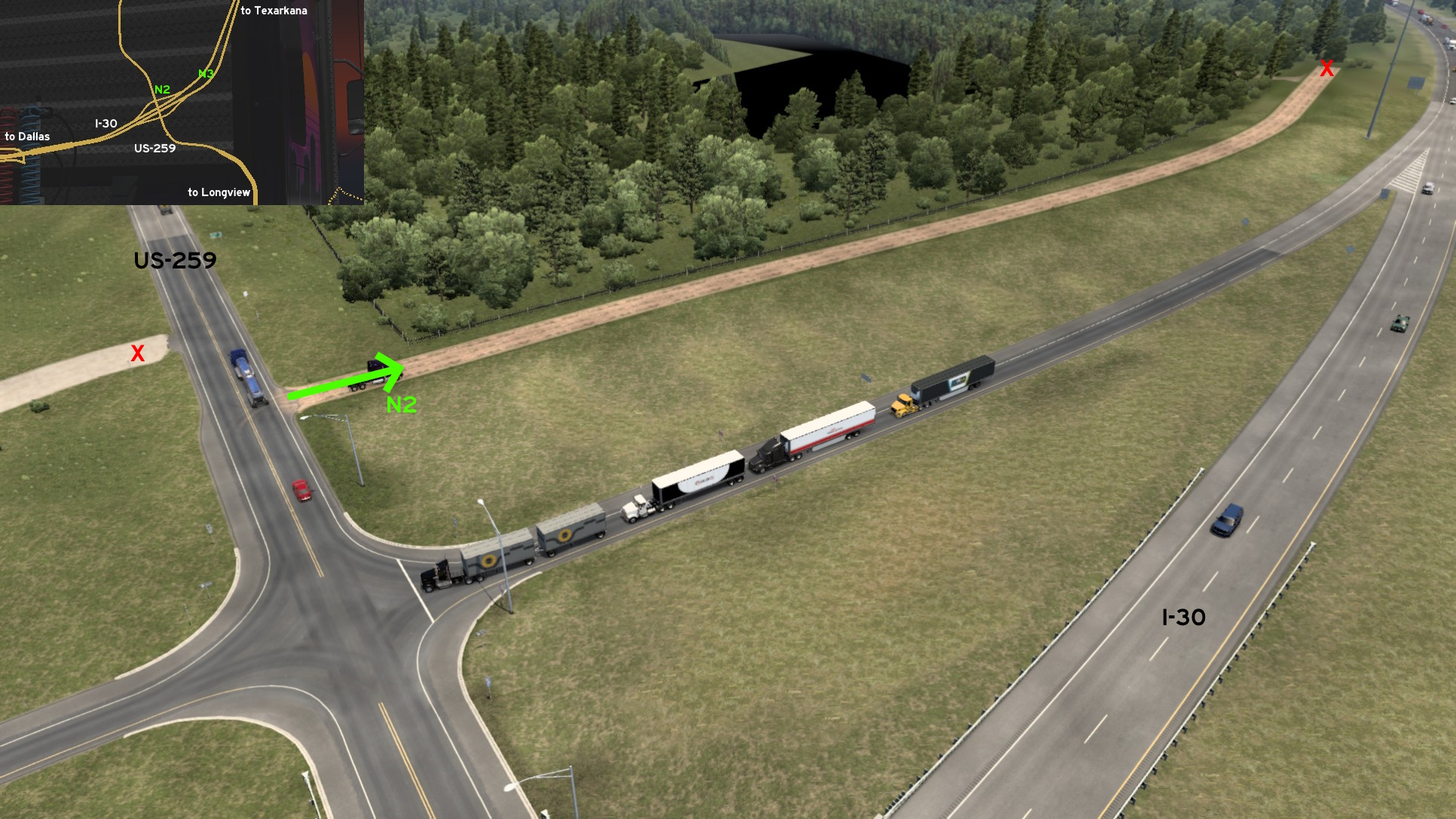 Near the intersection of I-30 and US-259, there's a dirty path running along the northeast ramp that simply reach to the trees. Drive carefully!
Discovery: 17F
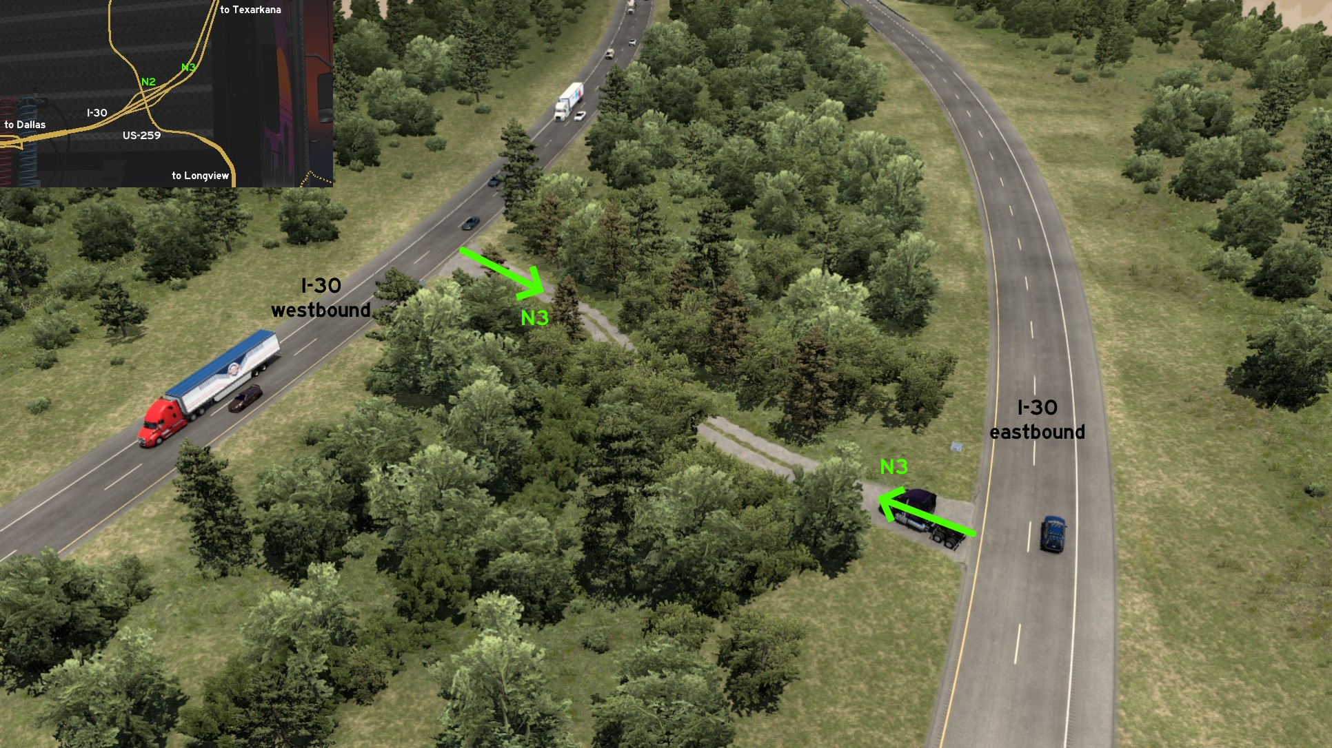 East of the intersection of I-30 and US-259, there's a service path connecting both directions of the interstate. There's a warning that it must be used by official or emergency vehicles only. But nothing will happen if you use it yourself. Return to freeway carefully.
Southwest 1 - You've Been Warned... Five Times
Category: easter-egg, markableDiscovery: 17F
Drive to the small rest stop southwest of Texarkana, on US-59. A dusty road starts on its northmost entrance. It's marked by a misleading dead end sign. Just keep driving, paying attention to signs along your journey, and turn left (south) to discover another secret road. Drive really careful if you're here at night. Apparently a wizard is on this area, knocking down trees and trucks to block the way. You must take a detour through a gap in the woods to return to the marked route. Keep driving slowly, and soon you'll be back to US-59, some miles south of the rest stop. Southwest 2 - Road To Nowhere
Category: sceneryDiscovery: 17F
Near the intersection of I-30 and US-259, there's a dirty path running along the northeast ramp that simply reach to the trees. Drive carefully! Southwest 3 - Road To Somewhere
Category: shortcutDiscovery: 17F
East of the intersection of I-30 and US-259, there's a service path connecting both directions of the interstate. There's a warning that it must be used by official or emergency vehicles only. But nothing will happen if you use it yourself. Return to freeway carefully.
Tyler
North 1 - Ready To Rock
Category: shortcutDiscovery: noob168
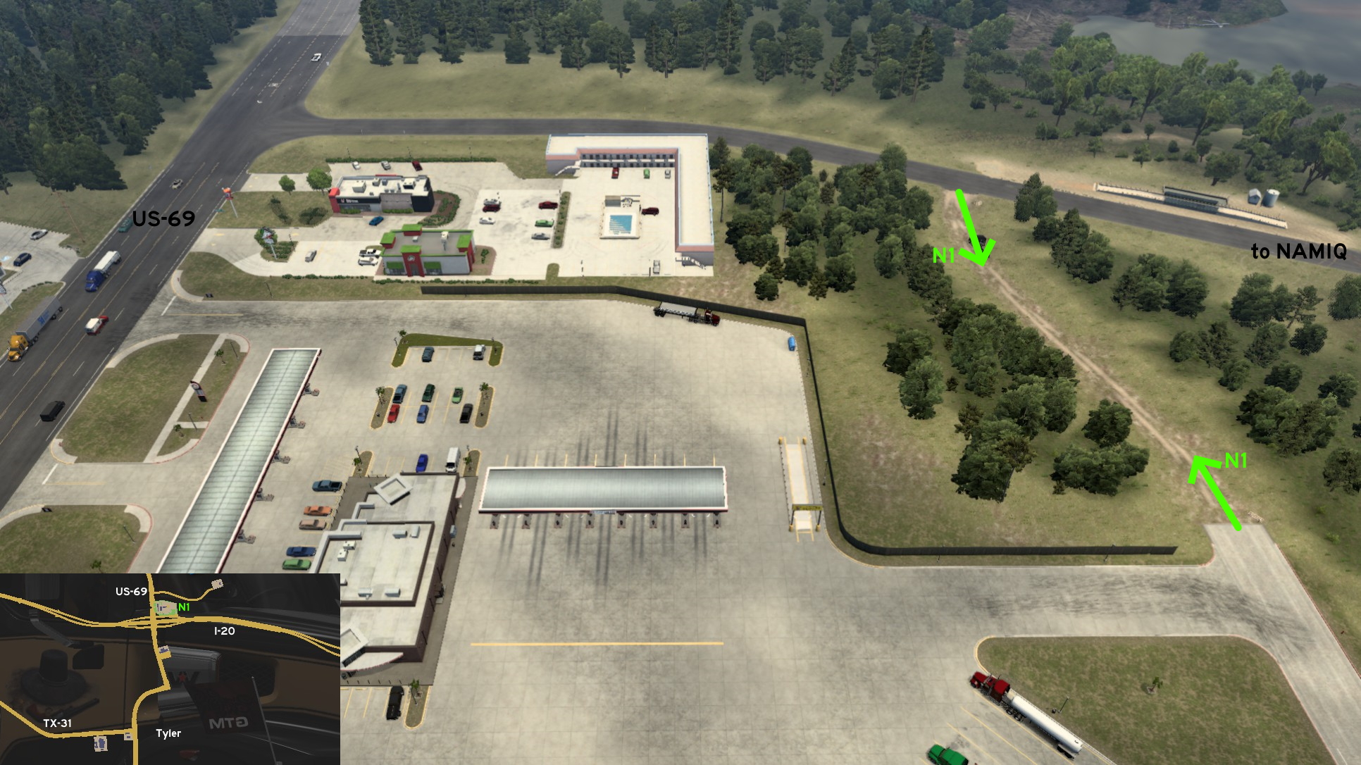 From the back of the rest stop north of Tyler, on the intersection between I-20 and US-69, you can find a small dirt path to the road leading to NAMIQ mining area, so you can avoid returning to the main road after resting and refueling.
 North 2 - A Breath Of Fresh Air
Category: scenery, markable (?)Discovery: Applecorn
Note: the area itself is visible, but the rest area may not appear as such before driving there at least once, so it's tagged as markable
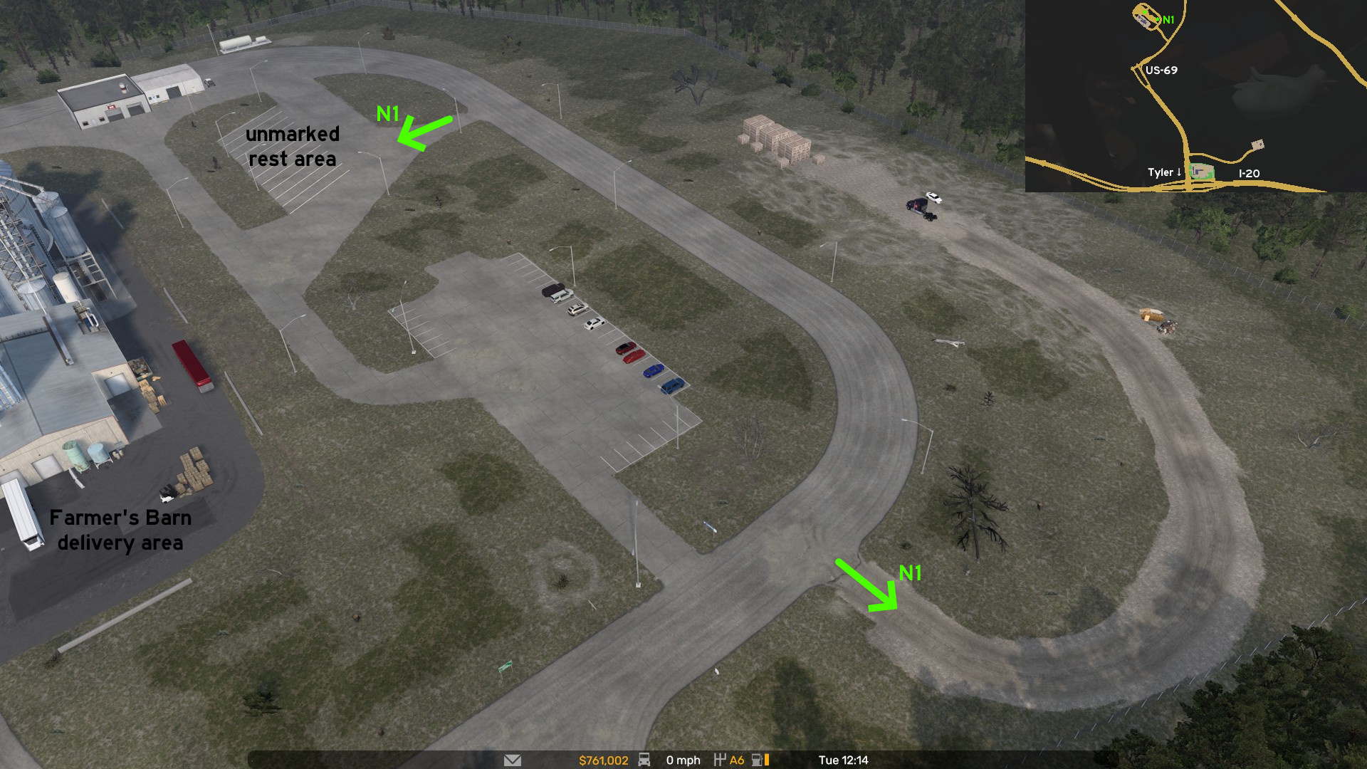 On Farmer's Barn north of Tyler, on US-69, there's a dirt path leading to pallets, boxes and trash containers. On the opposite direction far away enough from it, there's a truck stop you can use before your next job.
Victoria
Southeast 1 - Waterfront Of Palacios
Category: scenery, markableDiscovery: FeteFatale, kaia15
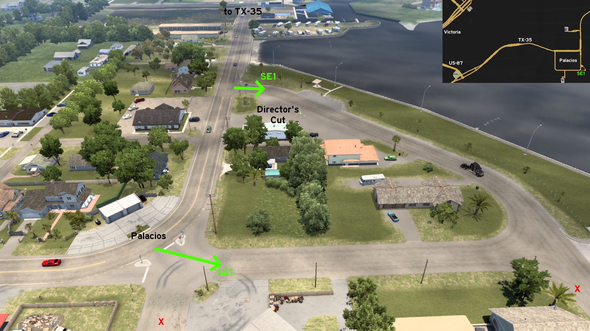 Southeast of Victoria, specifically on the unmarked city of Palacios, you can visit the waterfront (at least part of it) by yourself, after watching for the city's Director's Cut. The route may become automatically visible just by visiting the area where the Director's Cut is.
 Southwest 1 - Guadalupe River View
Category: scenery, markableDiscovery: noob168
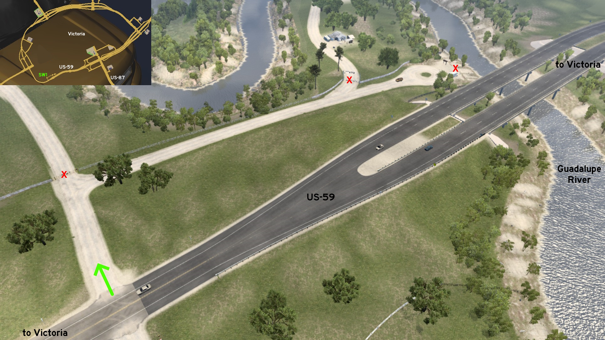 Southwest of the ring around Victoria, there's a dirt road crossing leading to some fields, and to a dead-end near Guadalupe River. Although tempting, don't try to reach the river, as an invisible wall will prevent you to do so.
 Southwest 2 - Ring On Ring
Category: scenery, markableDiscovery: residenTR
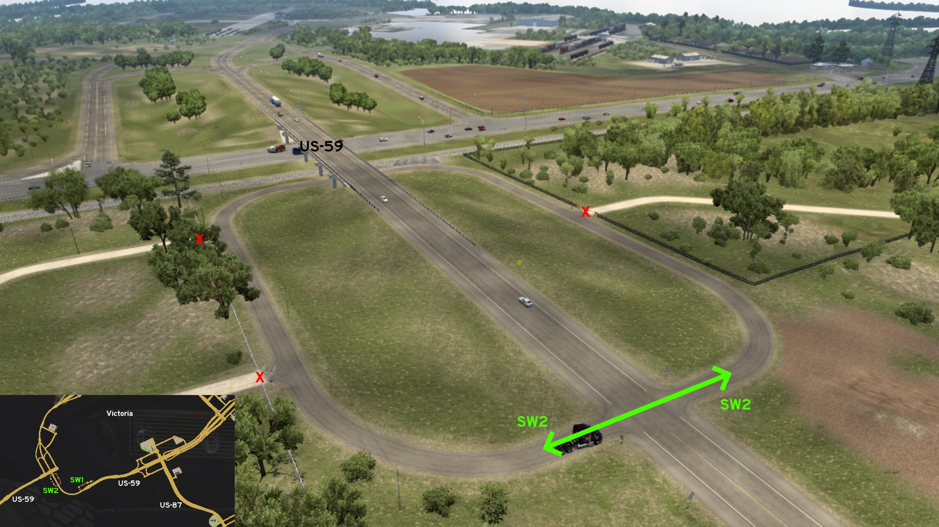 Not far from Guadalupe River view, there's a ring starting and ending on US-59, serving as an access to nearby properties. The path to these properties and the train tracks aren't accessible though.
Waco
Central 1 - Texas Rangers
Category: achievement (Avid Historian), markableDiscovery: Cyanlix
Note: in order to unlock this achievement, you need to find a total of at least 30 similar markers; please refer to this guide by Xeeran in order to find them, and other Texas achievements
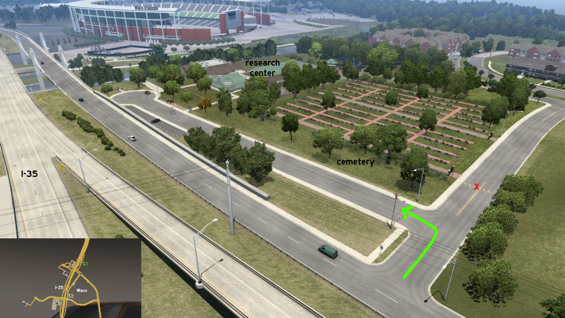 On the side road on the opposite side of Farm's Barn, there's a short run right before you must turn left. The road goes between I-35 side road and the city cemetery, and ends on a cul-de-sac near Texas Rangers Research Center. The landmark sign is found a little before the cul-de-sac.
 Southeast 1 - Rear Road
Category: shortcut, markableDiscovery: FeteFatale
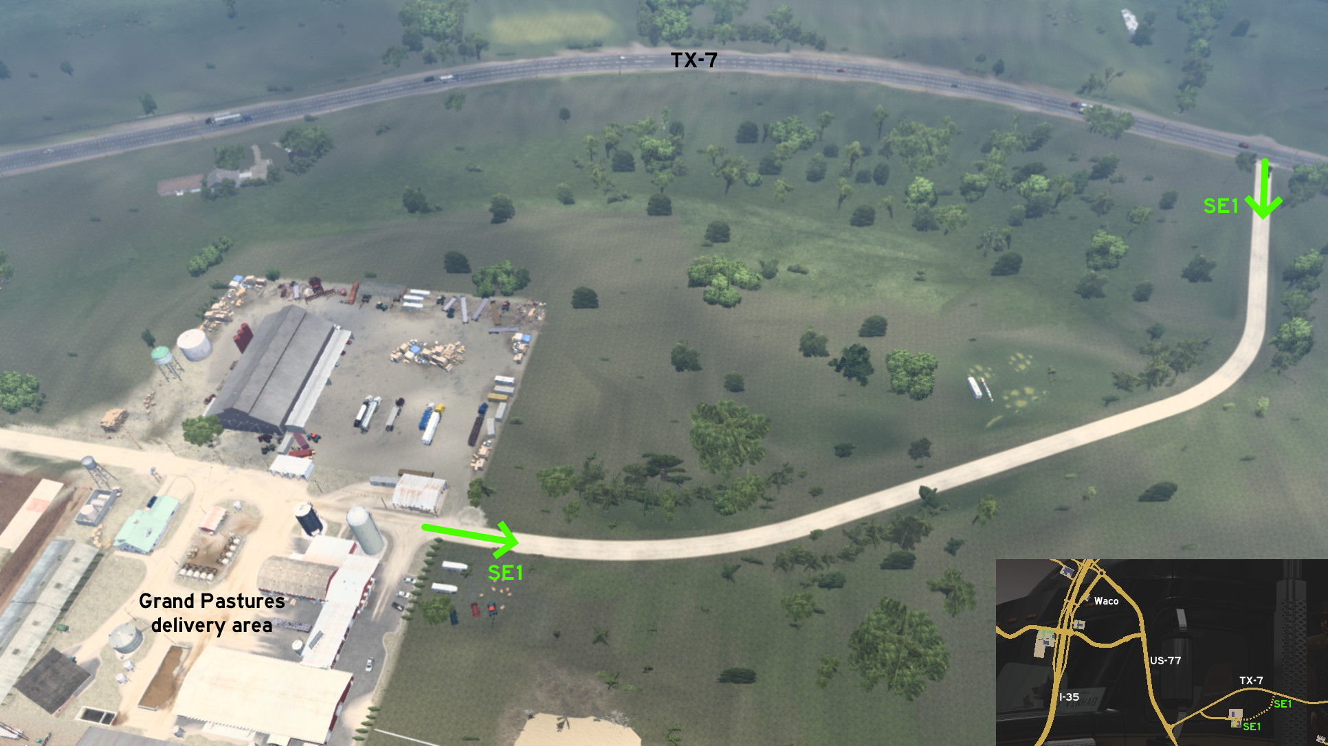 On the Grand Pastures southeast of Waco, you can access the delivery area from its rear end. Please avoid the bad puns...
 West 1 - Avoiding The Zigzag Drive
Category: shortcut, markableDiscovery: FelipeVinhao
Update: Epic Trucker Arch
Note: road became markable on version 1.49
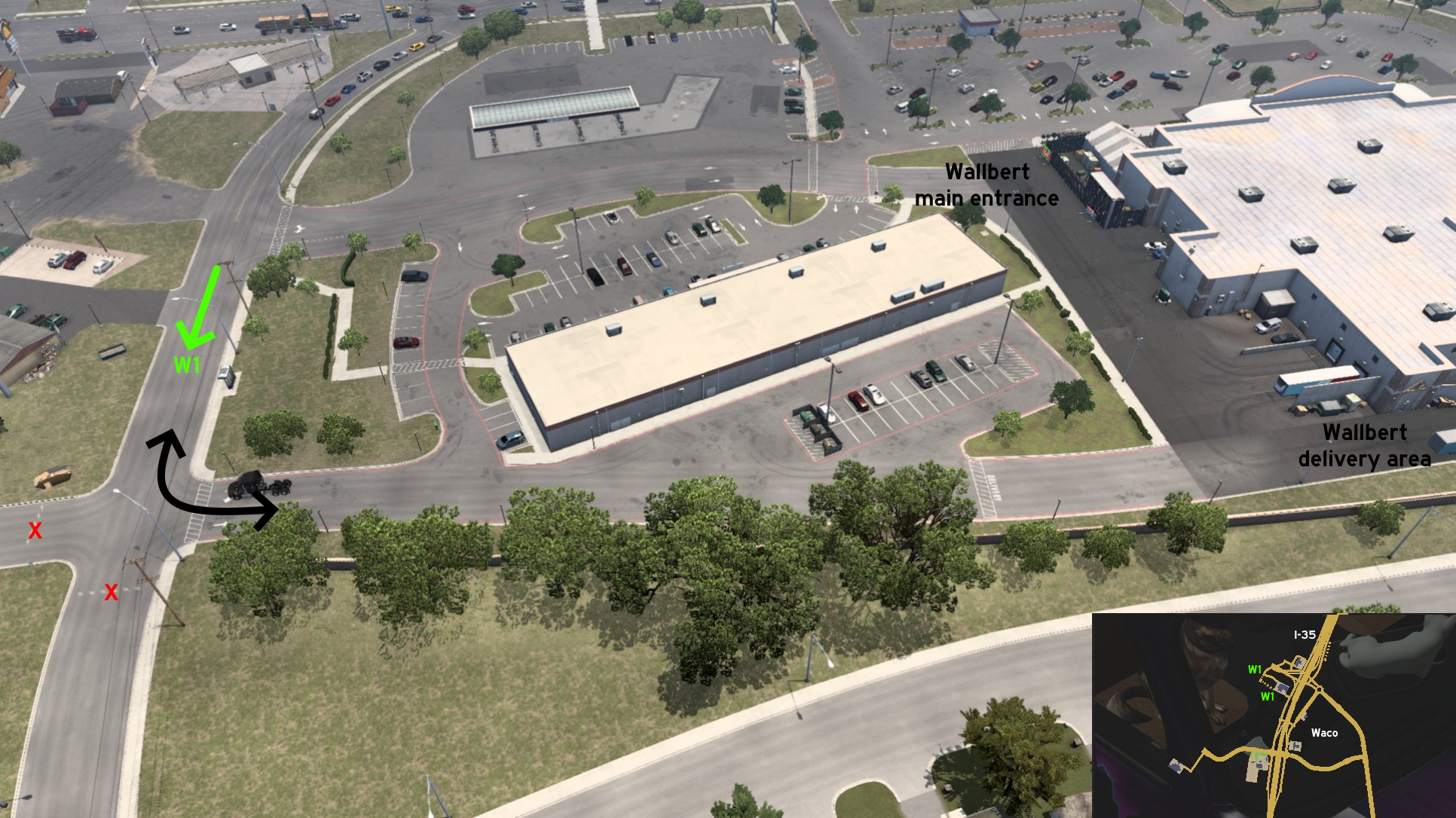 Instead of using the official route to reach Wallbert warehouse on west Waco, you can keep ahead (south) and reach the secondary entrance directly to the delivery area, avoiding the zigzag of the marked route.
 West 2 - San Saba Peak View
Category: achievement (Avid Historian), markableDiscovery: kaia15
Note: in order to unlock this achievement, you need to find a total of at least 30 similar markers; please refer to this guide by Xeeran in order to find them, and other Texas achievements
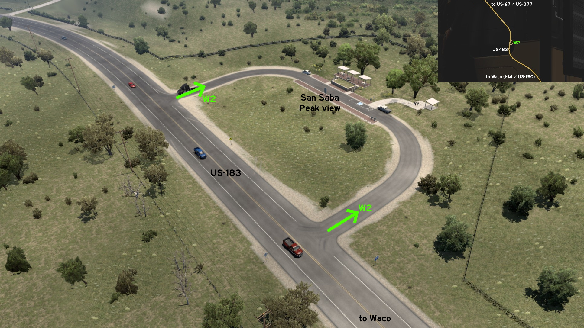 Far west from Waco, on US-183, there's a picnic area where you can view San Saba Peak. Just be careful as the path to it is a little narrow.
Several truck wash locations were added to American Truck Simulator, possibly hinting a new feature. But different from the bus terminals and stops on Euro Truck Simulator 2, they were added as unmarked places here. This section will stay here until the related feature is released.
Arkansas
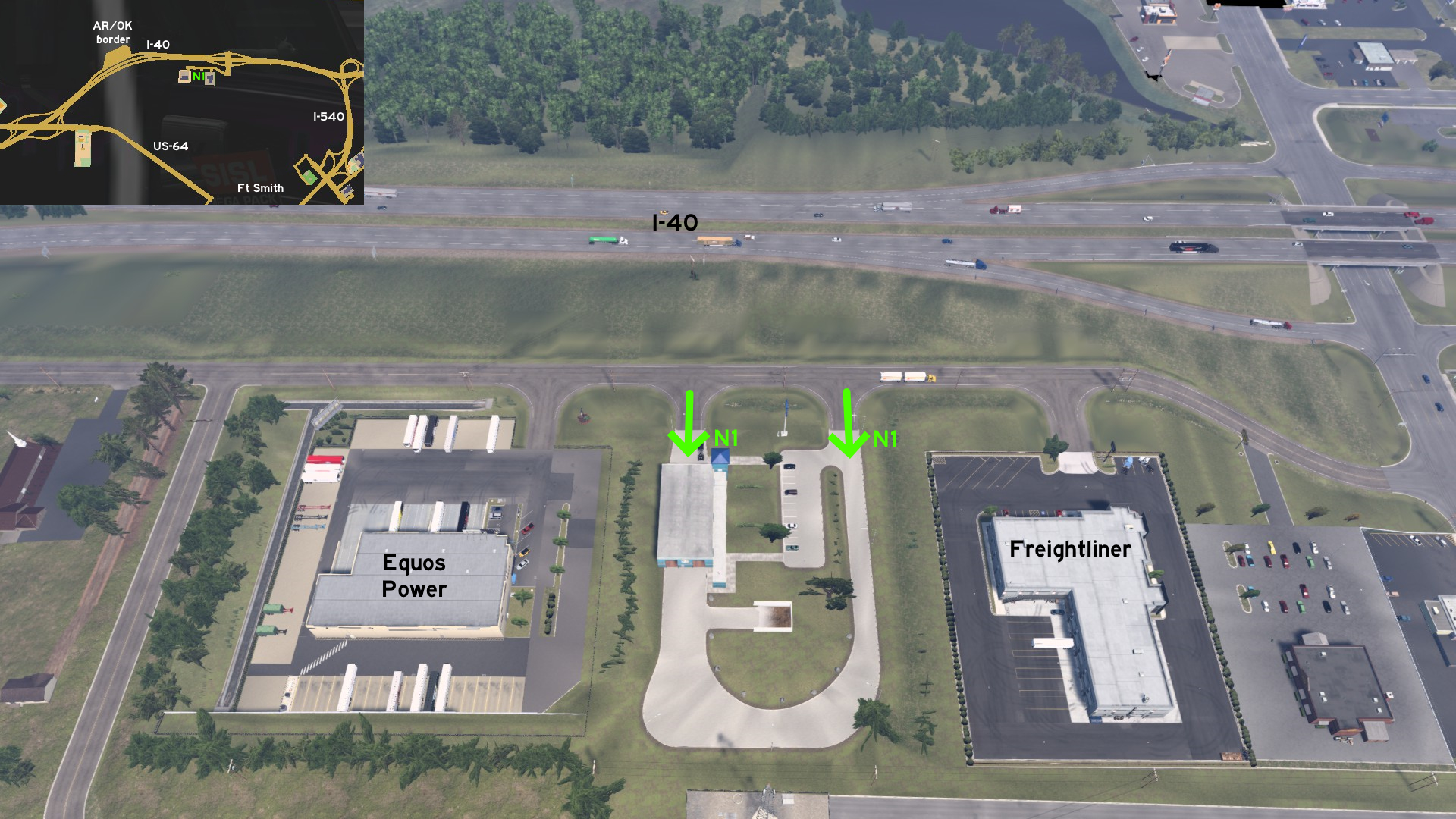 Fort Smith
North, on I-40
Credits: Applecorn
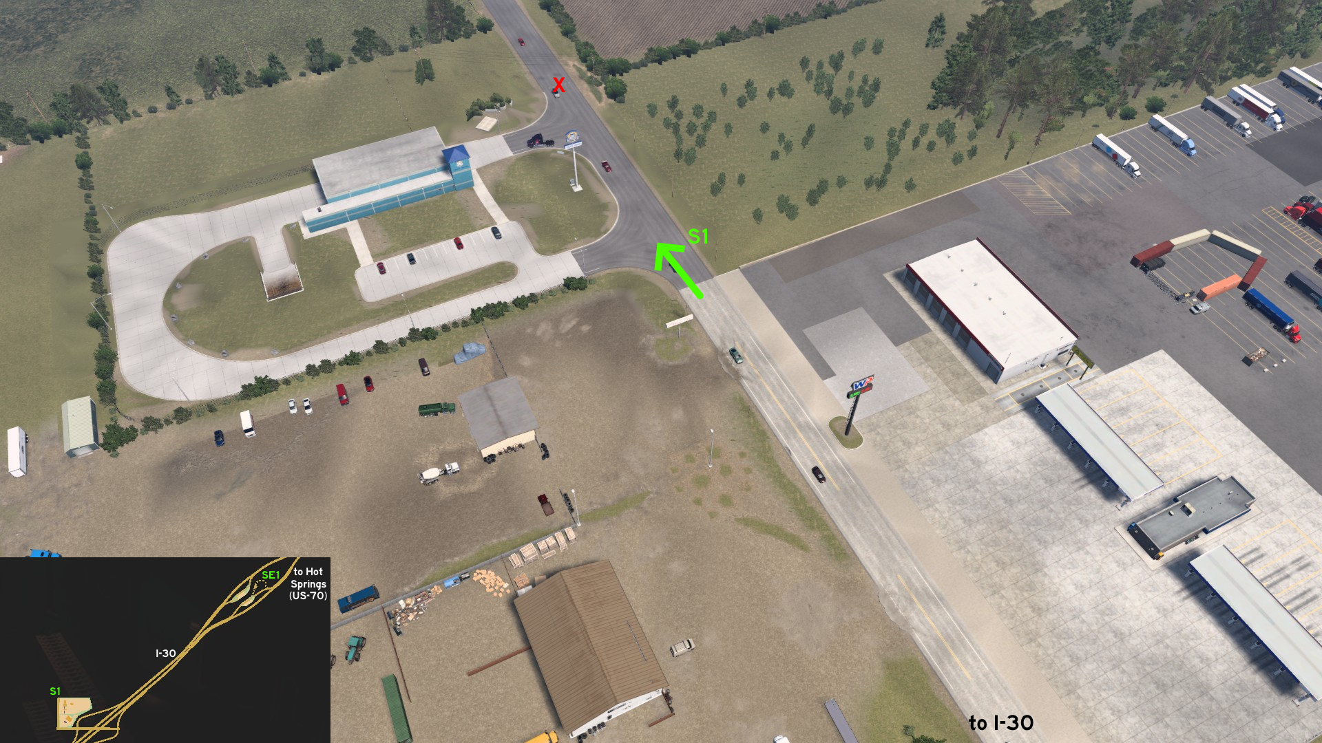 Hot Springs
South, on I-30
Credits: Applecorn
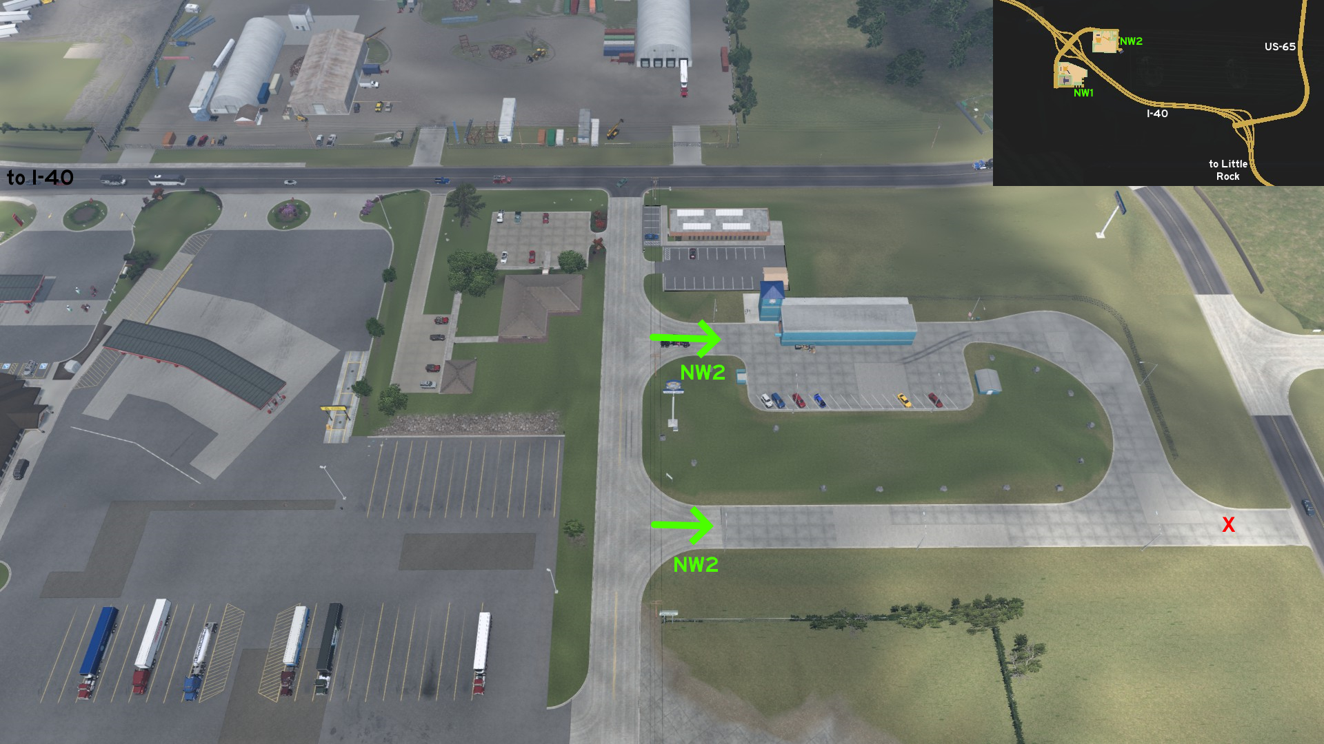 Little Rock
Northwest, on I-40
Credits: dfad1ripe
Texas
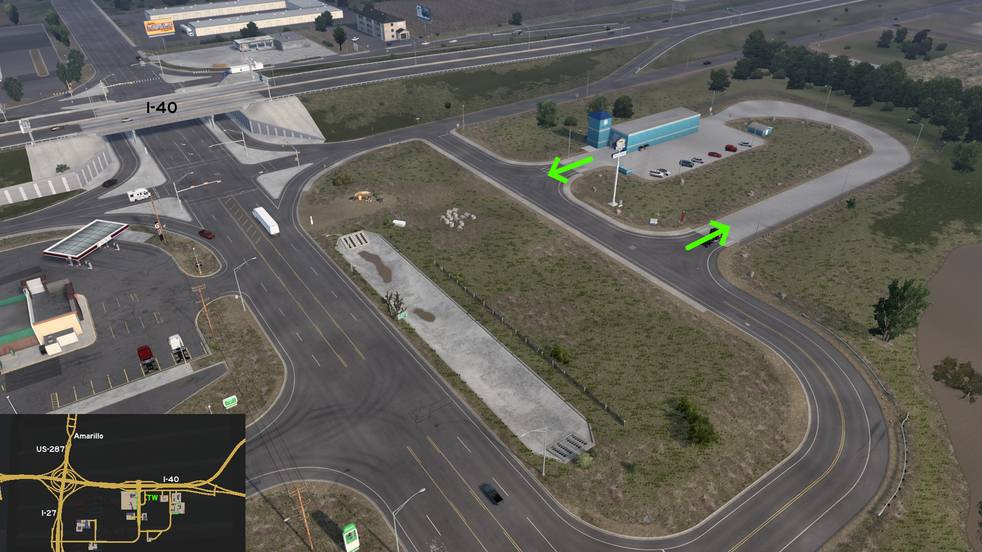 Amarillo
Southeast, across the truck stop, on I-40
Credits: FelipeVinhao
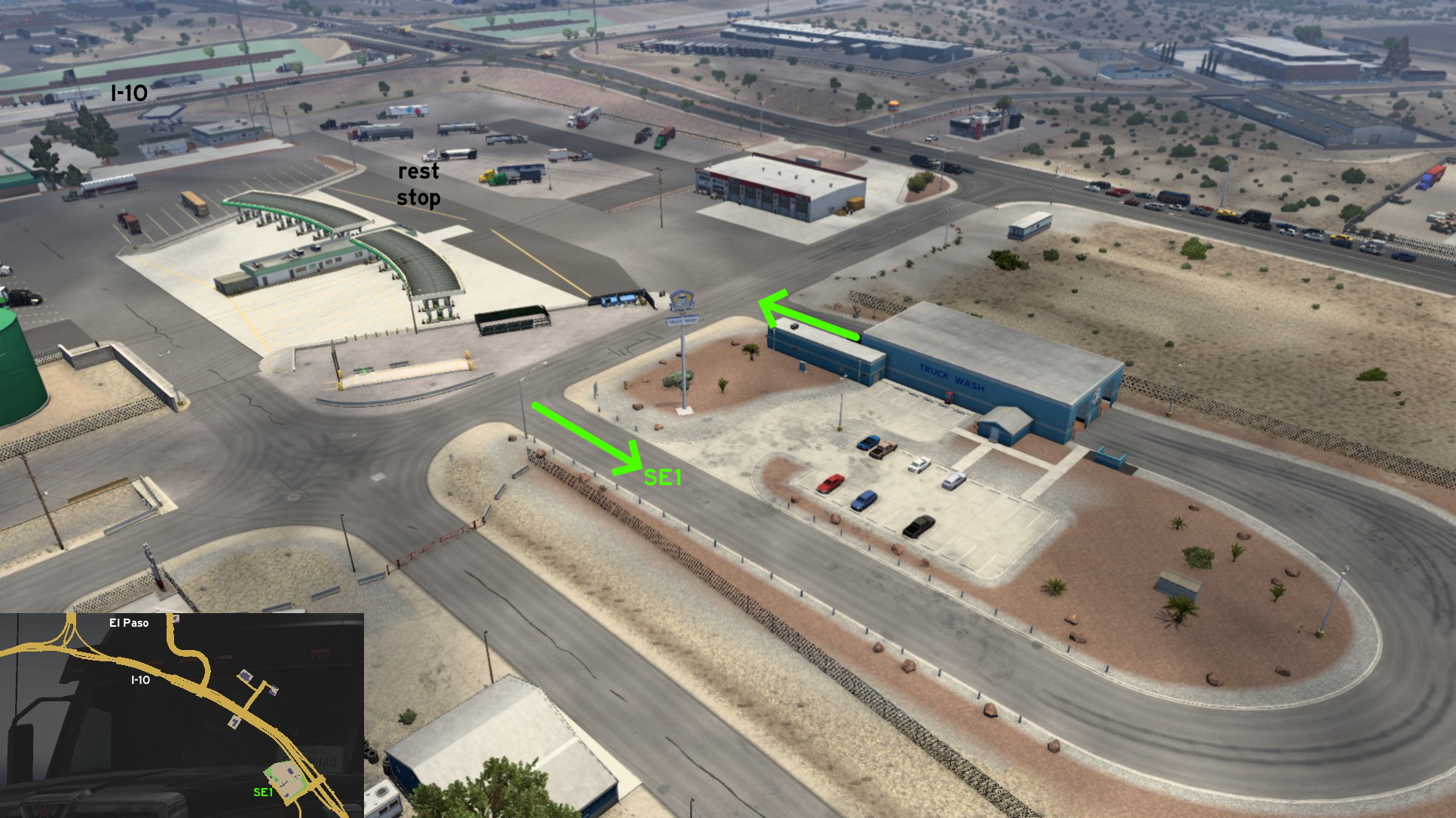 El Paso
Southeast, on I-10
Credits: noob168
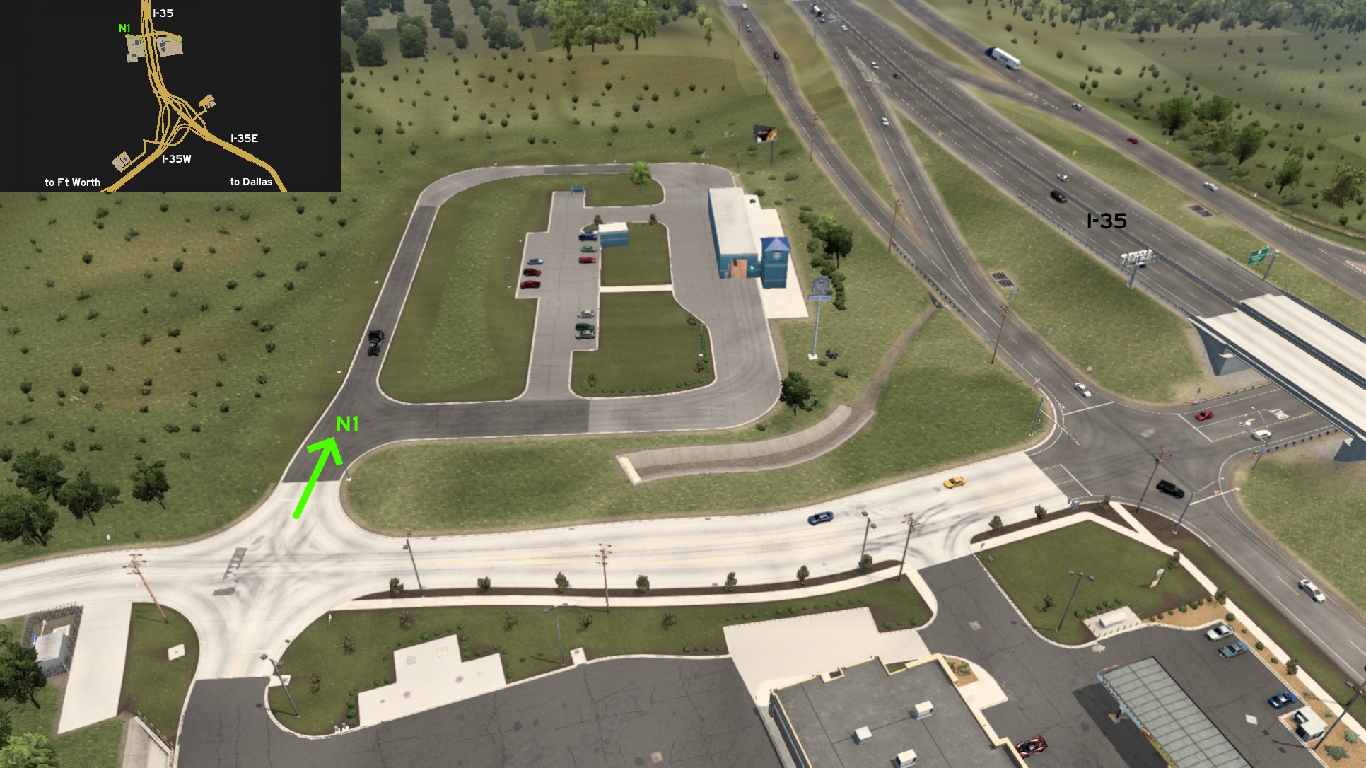 Fort Worth
North, on I-35
Credits: 17F
The people who helped finding the unmarked roads listed here are in the credits for each city. Here's a list of all users helped us. Also thanks all users who aren't listed here, but paid us a visit.
17F
aarondinius
aclements
Ae3qe27u
airbornecowboy77
Alex Monamochamuch
AlfaPhoxtrot
A. P. 101 Gaming
ApatheticGorilla
Applecorn
aqweasd7
beta1hit
Binary
Birckablock
biromesyservilletas
blaze72003
buffalo_pete
CaptainFlint
Corran Horn
CrazyLithuanianHacker
crazy rocker
Crieris
Cyanlix
Cyclone
DDogg
dfad1ripe
DPT Wanderer
dutchheavener
aarondinius
aclements
Ae3qe27u
airbornecowboy77
Alex Monamochamuch
AlfaPhoxtrot
A. P. 101 Gaming
ApatheticGorilla
Applecorn
aqweasd7
beta1hit
Binary
Birckablock
biromesyservilletas
blaze72003
buffalo_pete
CaptainFlint
Corran Horn
CrazyLithuanianHacker
crazy rocker
Crieris
Cyanlix
Cyclone
DDogg
dfad1ripe
DPT Wanderer
dutchheavener
emeryradio
Epic Trucker Arch
ernst-ulrich.reichelt
ExaminerIan
FeteFatale
Foonty
Gardevoir
Genesai G
gg bb
Half-man half-amazing
Hedwig xo
Helen Keller
henrzman
House of Orange
HuskyDynamics
hydroxyquinoline
Ice_Tea_Zero
interlaken
jackabox miller
Jasper
JediCowboy
Jérôme
JSG4361
joshuatree37
kaia15
kettcardriverprofi
knightshift
Epic Trucker Arch
ernst-ulrich.reichelt
ExaminerIan
FeteFatale
Foonty
Gardevoir
Genesai G
gg bb
Half-man half-amazing
Hedwig xo
Helen Keller
henrzman
House of Orange
HuskyDynamics
hydroxyquinoline
Ice_Tea_Zero
interlaken
jackabox miller
Jasper
JediCowboy
Jérôme
JSG4361
joshuatree37
kaia15
kettcardriverprofi
knightshift
kubrick6719
kwolf55
Laffey
Lausambaychua
LikelyLeon
lizzard29rus
Makeleth
mattbman
Maxis2012
MikMinevi
mizho_himats1538
nathan67003
NEMEZIS
noob168
nywiigshachristian
olm823249
omni2226
Oni
OWLCAT
Ozzy
PaynZz ツ
phonixl
punkito
PWSmith1
residenTR
Richard_Stamos
RIP_C.Bennington#LP_Forever
kwolf55
Laffey
Lausambaychua
LikelyLeon
lizzard29rus
Makeleth
mattbman
Maxis2012
MikMinevi
mizho_himats1538
nathan67003
NEMEZIS
noob168
nywiigshachristian
olm823249
omni2226
Oni
OWLCAT
Ozzy
PaynZz ツ
phonixl
punkito
PWSmith1
residenTR
Richard_Stamos
RIP_C.Bennington#LP_Forever
Royal Fyre
[ru64] el giraffe
Silent Storm
Skorpionik
skunk940
skyfox122
Slovak Eagle
spiceenybaby
spy_track
sunlight
Supernovae
TechTWP
termin8r
TGM
thechief
TheElderThing
The Pitts
TheTexanHusky
THO-XVI
TruckerCarlos
TW
uratobuic
Volvo_EG
Washington_County
Wide Kemo
Zaroski
Zest
[ru64] el giraffe
Silent Storm
Skorpionik
skunk940
skyfox122
Slovak Eagle
spiceenybaby
spy_track
sunlight
Supernovae
TechTWP
termin8r
TGM
thechief
TheElderThing
The Pitts
TheTexanHusky
THO-XVI
TruckerCarlos
TW
uratobuic
Volvo_EG
Washington_County
Wide Kemo
Zaroski
Zest
More American Truck Simulator guides
- Hidden and unmarked roads - USA - WEST - updated 2026/02/20★ 5 (1.3k)38k views1.9k ♥73 minUpdated Feb 19
- The American Truckers Guide to everything!★ 5 (960)34k views1.5k ♥53 minUpdated Aug 16, 2020
- American Truck Simulator 100% Achievement-Guide [ENG]★ 5 (704)15k views1.3k ♥8 minUpdated May 16
- Все достижения American Truck Simulator + все DLC [100% Achievement-Guide] [upd: 15.05.26]★ 5 (1.2k)14k views1.7k ♥42 minRussianUpdated Jul 12
- Texas 100% Achievement-Guide [ENG]★ 5 (443)12k views595 ♥7 minUpdated May 16
- Washington - 100% Achievement-Guide [ENG]★ 5 (503)12k views532 ♥2 minUpdated Mar 24, 2023



This guide was created by its original author on the Steam Community. Are you the author and want it removed? Request removal.