Hidden and unmarked roads - USA - WEST - updated 2026/02/20
This guide contains only Arizona, California, Colorado, Idaho, Montana, Nevada, New Mexico, Oregon, Utah, Washington, Wyoming. For other locations, please refer for the other guides: https://steamcommunity.com/sharedfiles/filedetails/?id=3629081644 https://steamcommunity.com/sharedfiles/filedetails/?id=3082451616 https://steamcommunity.com/sharedfiles/filedetails/?id=2129261150
This is a list of all drivable roads not marked on the map and accessible without any mod or console commands, and the walkthrough on how to reach them.
It assumes you have ALL map DLCs released until now. So those hidden roads near the border that are physically located on one state, but it depends on the other state to be accessible, are listed under the state it's located.
It isn't supposed to be a guide to EASTER EGGS, although in some cases the unmarked roads lead to them.
It isn't supposed to be a guide to complete 100% of ACHIEVEMENTS either, but some of the unmarked roads are related to some of them. In these cases, the walkthrough will be marked as spoiler and you must hover the pointer over the black mask to show picture and description, LIKE THIS.
NOTE: if the achievement is directly related to hidden roads (for example, "Can You Keep a Secret?" in Kansas), then it's not marked as spoiler. That's why you are here after all.
This guide is organized by STATES and then by CITIES alphabetically. When the unmarked road isn't located in a city, the closest one will be used as reference.
Each screenshot has a map, with the unmarked road written on GREEN or RED, and the same colors are used on arrows and notes on the screenshots.
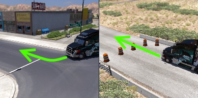 GREEN: the road doesn't have any UI roadblocks (glowing arrows or Xs where only AI drivers are allowed), invisible walls or hard objects blocking it, it's just not marked on map. Some times only easy-to-move objects (cones or signs, for example) are blocking it. You can go through it without problems - even when they have "no trucks allowed" signs. In some cases, these roads can be marked on map after discovered.
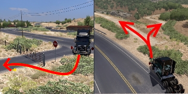 RED: the road's blocked by UI roadblocks or hard objects, or simply aren't connected to the playable area. That is, the ones the players weren't supposed to be - they're supposed to be scenery only. You must use breaches and devs' oversights to explore these areas. In most cases, these breaches are fixed after some time.
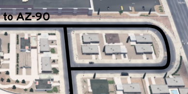 BLACK: the lines indicate the route player can drive after accessing the road. The text indicates points of reference, like landmarks, roads and cities - the same references listed on the walkthrough.
Each unmarked road can be on one or more of the following categories:
SCENERY: it's supposed to be eye-candy only, without any real use besides taking a cool screenshot in a different place. Of course, any of the other categories are implicitily scenery too.
SHORTCUT: it's an alternative route connecting two or more marked roads. Just note that, besides the name, it isn't always the shortest or the easiest route.
EASTER-EGG: it's a message or joke left by the devs, or even a pop culture reference. Notice that only easter eggs related to unmarked roads are listed here, you must check other guides to find other easter eggs.
ACHIEVEMENT: an achievement will be unlocked after hitting a certain spot of the unmarked road. The achievement name is written besides this category. Again, only the ones related to unmarked roads are listed here.
MARKABLE: it's an unmarked road that appears as a dotted path on map after discovered, so it can be easily found later. It's a feature added on version 1.44.
This is a list of all drivable roads not marked on the map and accessible without any mod or console commands, and the walkthrough on how to reach them.
It assumes you have ALL map DLCs released until now. So those hidden roads near the border that are physically located on one state, but it depends on the other state to be accessible, are listed under the state it's located.
It isn't supposed to be a guide to EASTER EGGS, although in some cases the unmarked roads lead to them.
It isn't supposed to be a guide to complete 100% of ACHIEVEMENTS either, but some of the unmarked roads are related to some of them. In these cases, the walkthrough will be marked as spoiler and you must hover the pointer over the black mask to show picture and description, LIKE THIS.
NOTE: if the achievement is directly related to hidden roads (for example, "Can You Keep a Secret?" in Kansas), then it's not marked as spoiler. That's why you are here after all.
This guide is organized by STATES and then by CITIES alphabetically. When the unmarked road isn't located in a city, the closest one will be used as reference.
Each screenshot has a map, with the unmarked road written on GREEN or RED, and the same colors are used on arrows and notes on the screenshots.
GREEN: the road doesn't have any UI roadblocks (glowing arrows or Xs where only AI drivers are allowed), invisible walls or hard objects blocking it, it's just not marked on map. Some times only easy-to-move objects (cones or signs, for example) are blocking it. You can go through it without problems - even when they have "no trucks allowed" signs. In some cases, these roads can be marked on map after discovered. RED: the road's blocked by UI roadblocks or hard objects, or simply aren't connected to the playable area. That is, the ones the players weren't supposed to be - they're supposed to be scenery only. You must use breaches and devs' oversights to explore these areas. In most cases, these breaches are fixed after some time. BLACK: the lines indicate the route player can drive after accessing the road. The text indicates points of reference, like landmarks, roads and cities - the same references listed on the walkthrough.Each unmarked road can be on one or more of the following categories:
SCENERY: it's supposed to be eye-candy only, without any real use besides taking a cool screenshot in a different place. Of course, any of the other categories are implicitily scenery too.
SHORTCUT: it's an alternative route connecting two or more marked roads. Just note that, besides the name, it isn't always the shortest or the easiest route.
EASTER-EGG: it's a message or joke left by the devs, or even a pop culture reference. Notice that only easter eggs related to unmarked roads are listed here, you must check other guides to find other easter eggs.
ACHIEVEMENT: an achievement will be unlocked after hitting a certain spot of the unmarked road. The achievement name is written besides this category. Again, only the ones related to unmarked roads are listed here.
MARKABLE: it's an unmarked road that appears as a dotted path on map after discovered, so it can be easily found later. It's a feature added on version 1.44.
1st DLC, 2016 June 06
Camp Verde
East 1 - Around Sawblades
Category: shortcut, markableDiscovery: FelipeVinhao
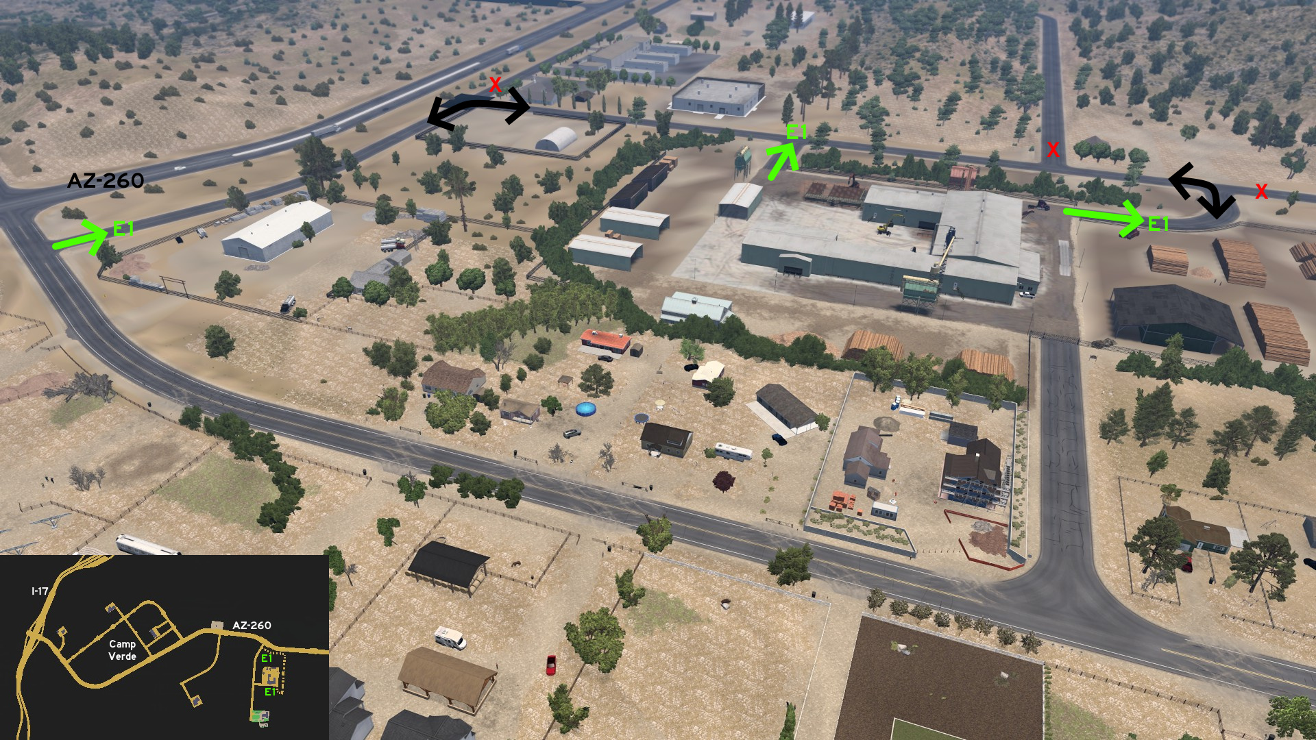 Head to Deepgrove on east Camp Verde. There's a road running almost parallel to AZ-260, connected to another road that can be used to access the back entrance of the sawmill.
Flagstaff
Southwest 1 - Interstate Gap
Category: scenery, markableDiscovery: FelipeVinhao
Note: the area is exactly halfway to Camp Verde, but it's easier to be accessed when leaving Flagstaff
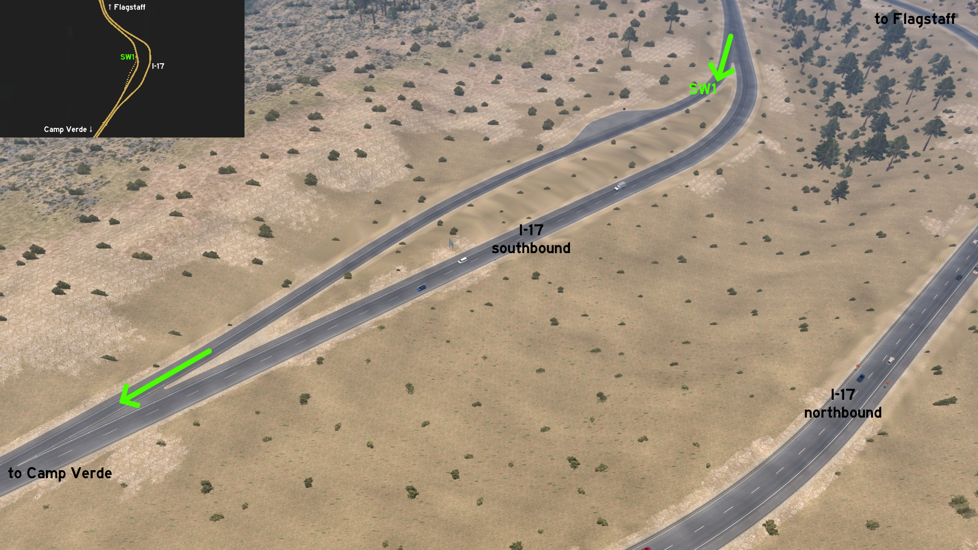 Leaving Flagstaff through I-17 southbound, an unmarked rest area is found halfway to Camp Verde. On map, it's easy to be noticed as it's located where there's a huge gap between the lanes of the interstate.
Grand Canyon Village
South 1 - Visiting The Bears
Category: shortcut, markableDiscovery: punkito
Video (link): trucksim
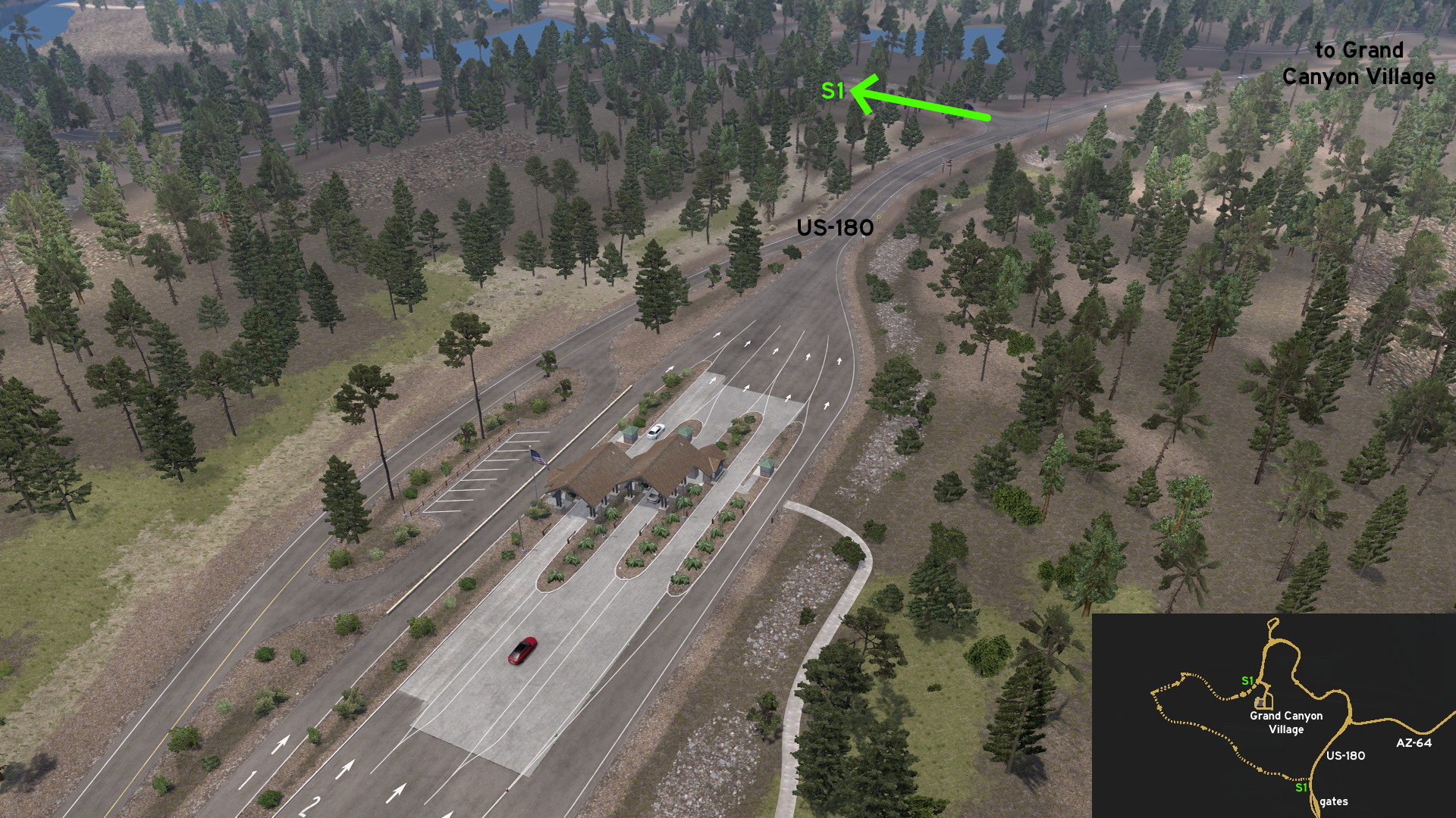 Some meter after the gates to Grand Canyon National Park on US-180, take the road west. The alternative route to Grand Canyon Village goes through lodges, campgrounds, training centers and bears. Keep your food safe.
Kayenta
Central 1 - New Shop In Town
Category: shortcut, markableDiscovery: MikMinevi
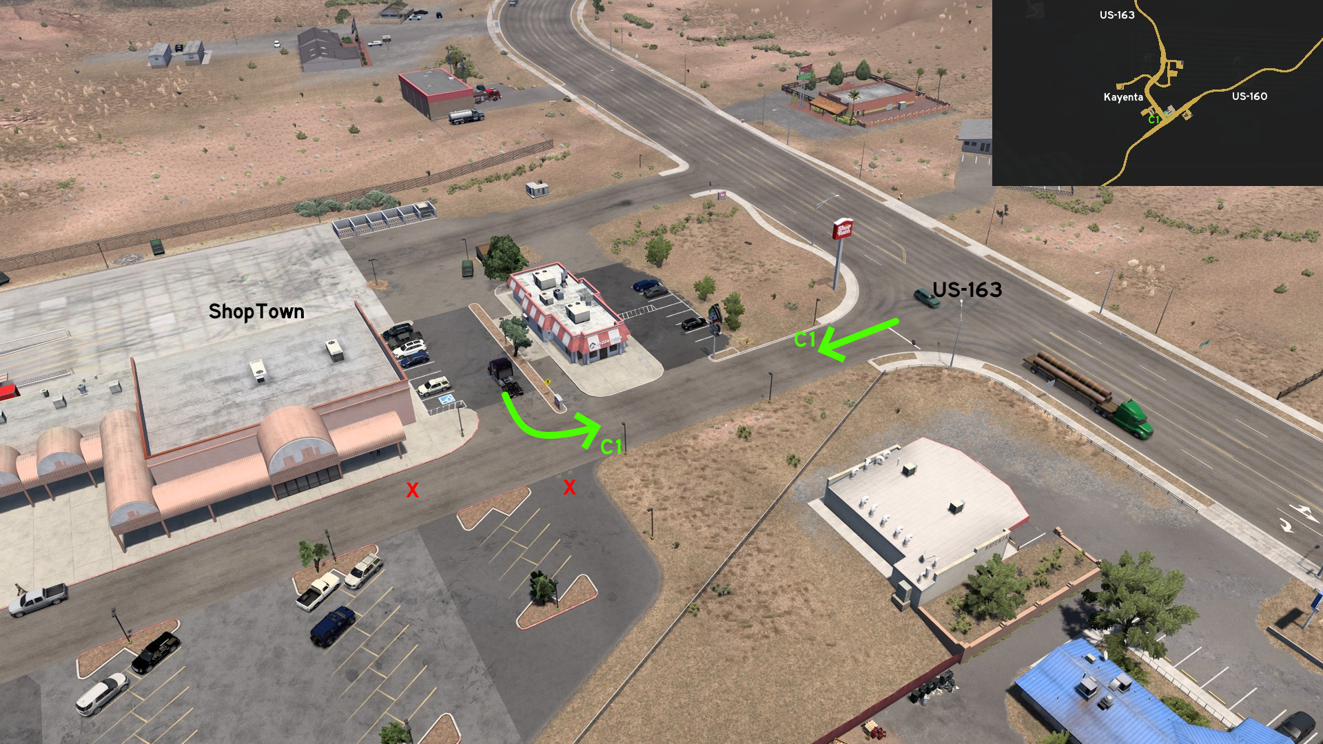 Just south of delivery entrance to ShopTown on Kayenta, you can drive around the market parking lot and the Pizza House nearby.
Kingman
Northeast 1 - Cars, Caverns and Dinosaurs
Category: sceneryDiscovery: Richard_Stamos
Update: punkito
Video (link): trucksim
Note: route became markable and Dinosaur Crossing was added on version 1.58
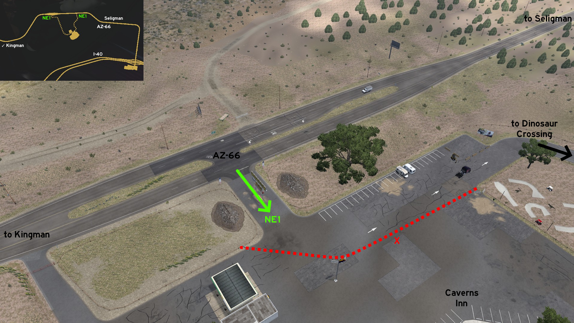 Leave northeast Kingman through AZ-66. Some miles before the unmarked town of Seligman, you'll find a huge sign to Caverns Inn. Drive around the blocked parking lot and the minigolf area, and drive through the Dinousaur Crossing. The route ends closer to Seligman.
 Northwest 1 - From Mother Road To Home Store
Category: shortcut, markableDiscovery: punkito
Video (link): trucksim
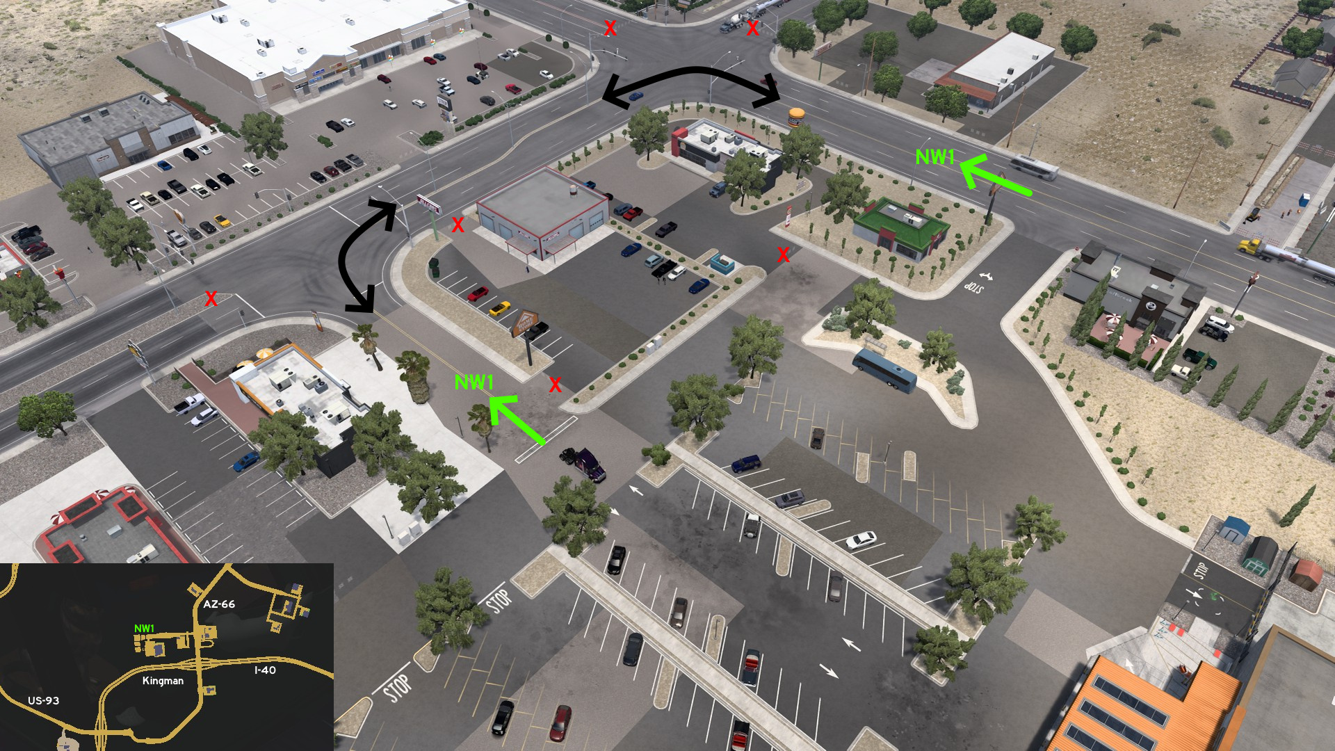 Head to Home Store on Kingman. You can continue from the crossing that leads to main entrance, and drive south around the block to an alternative entrance, through the small vehicles parking lot.
Nogales
North 1 - City Overlook
Category: sceneryDiscovery: dutchheavener
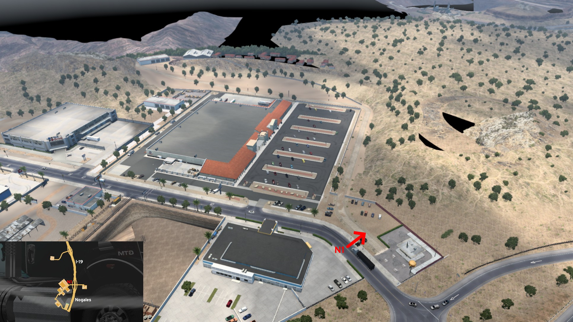 Heading Nogales, leave I-19 like you were going to Wallbert supermarket, but stop by the burger shop instead. Drive between the red poles, and go to the dirt road left of where the tables are. Drive around Wallbert, and climb the hill until you reach the warehouse at the top. Enjoy the view!
 South 1 - Road To... Nogales
Category: sceneryDiscovery: FelipeVinhao
Update: airbornecowboy77
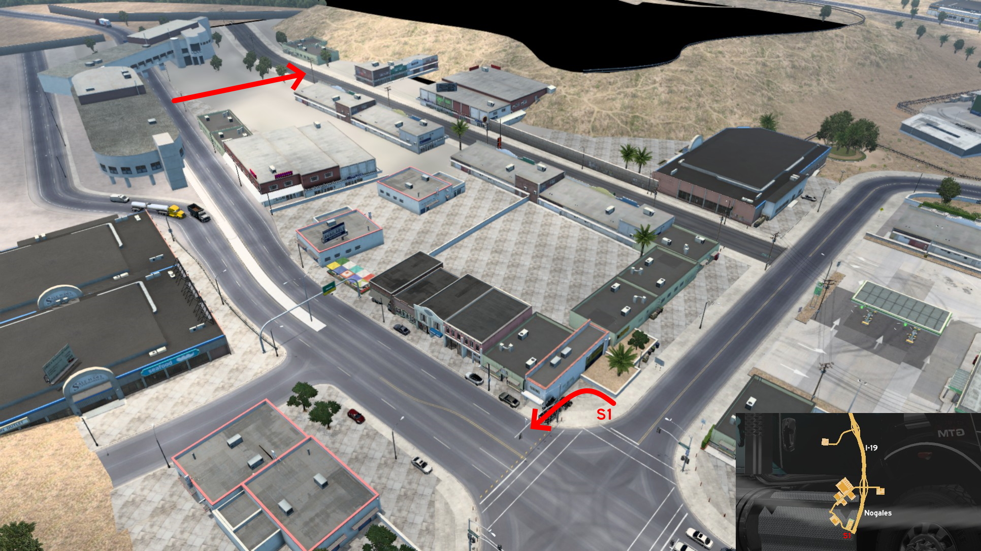 Go to the southernmost crossing of Nogales. Place your truck as parallel as possible to the corner building, and squeeze between it and the traffic light. Now you can pass through the customs building (it's not solid) and go a little after the wall... to find nothing. You can also access the blocked road found near the truck stop.
Phoenix 🏛️
Northwest 1 - Uncle Milan Is Watching You
Category: easter-eggDiscovery: blaze72003
Update: Royal Fyre
Note: the useless UI roadblock over the 2nd entrance was removed (version 1.31)
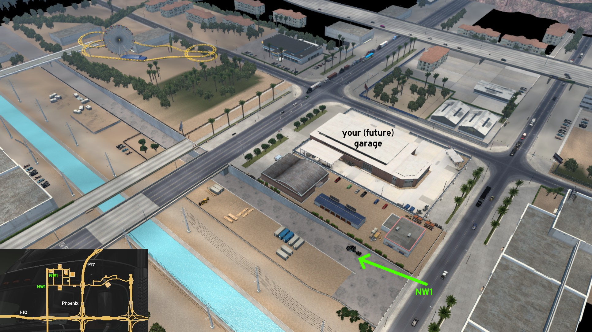 This isn't exactly a hidden road, but it was clearly made to be explored. Phoenix flood control system has two entrances. One of them is behind your (future) garage northwest of the city. It's protected by a chains and pillars and a single traffic cone. Push the cone slowly and you're in.
 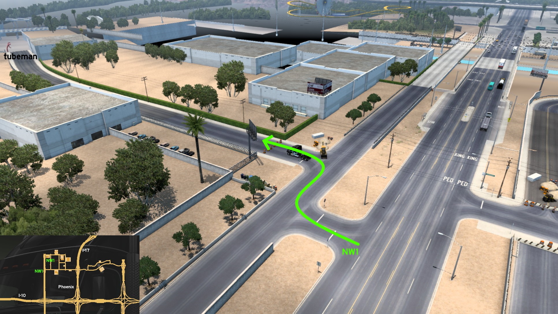 The other entrance is on the westernmost avenue available in game: it's near the crossing of 35th Avenue and Thomas Road. You'll cross a side road, and its both ends are blocked by invisible walls. Go to the road blocked with traffic cones. Push them slowly or drive around them, drive by a tubeman, and follow it to the end.
 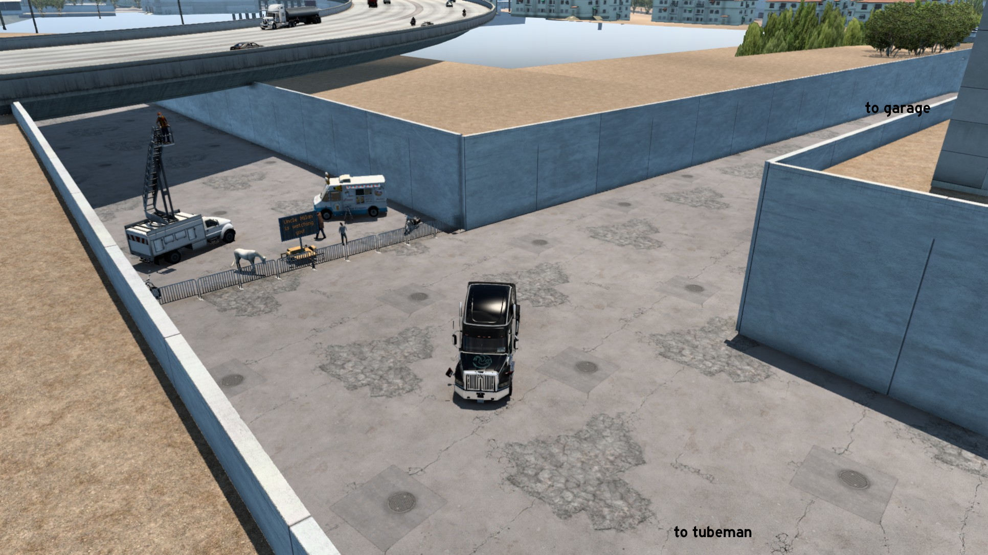 Turning left (south) from first entrance will lead to the second one. Turning right (north) from it, or driving the second one will both end here. We don't have idea what's going here, but we know Uncle Milan is watching us.
 Southeast 1 - Airport Service Road
Category: sceneryDiscovery: blaze72003
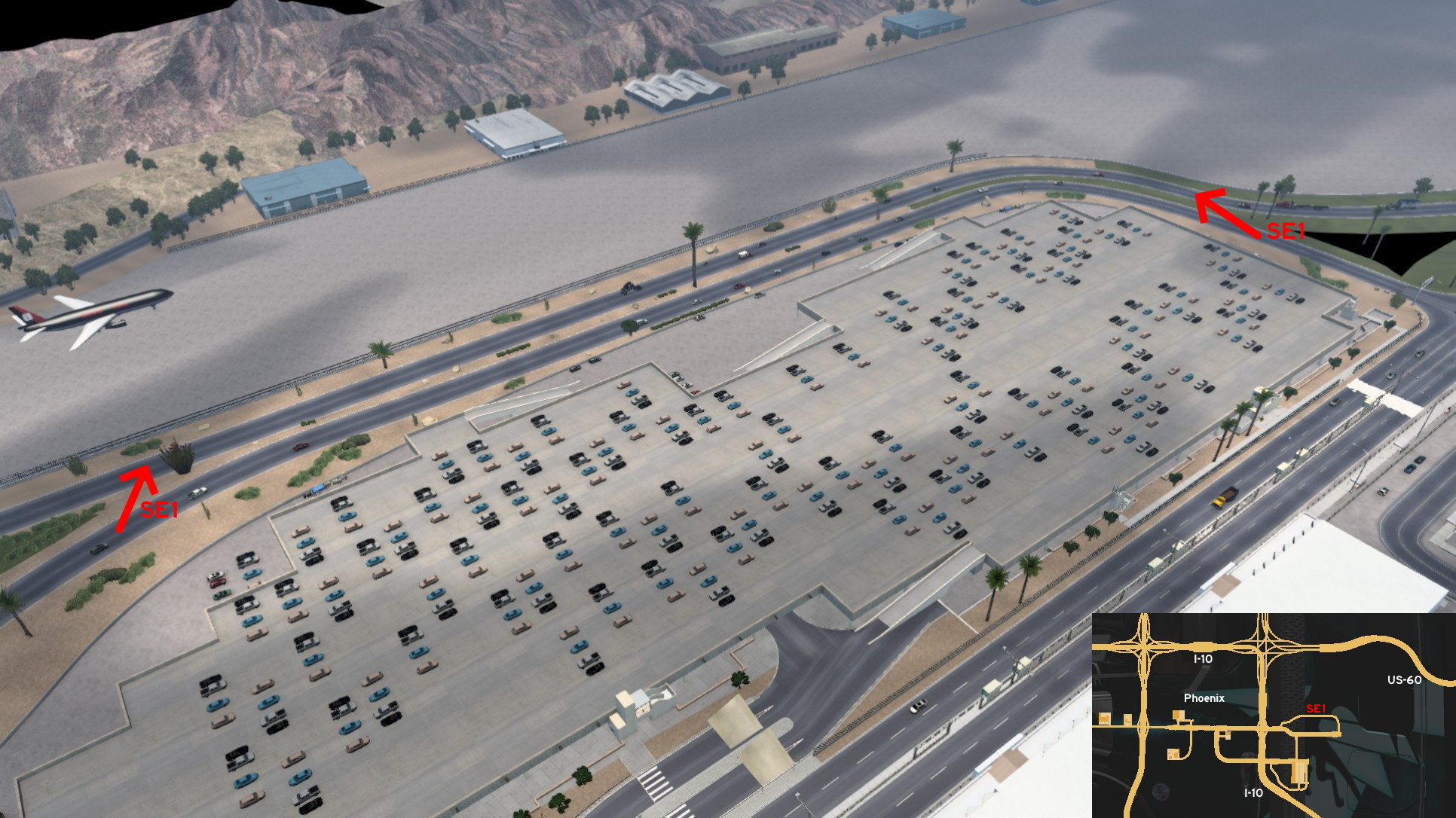 Southeast Phoenix, north of the Airport delivery area, there's a detour road. Bordering it, there's some kind of service road before the airstrip. Just drive over the grass strip from the detour road to the service road. The service road is blocked by invisible walls on both ends: west is blocked where the real wall starts; east is blocked near a pair of palm trees.
Show Low
Southeast 1 - Venturing Into New Routes
Category: shortcut, markableDiscovery: Crieris
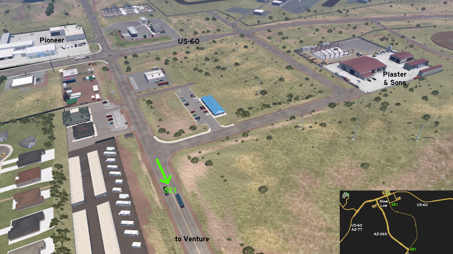 Starting on Show Low, from the same stretch of road that connects Pioneer entrance and the junction with Plaster & Sons road, you can continue south until it ends on the crossing to Venture entrance. The route runs almost along AZ-260 until it ends on it.
Sierra Vista
Central 1 - Whole City Is Accessible
Category: shortcut, markableDiscovery: ilchiodi
Update: ernst-ulrich.reichelt
Note: roads became markable on version 1.53, except for Bitumen back entrance
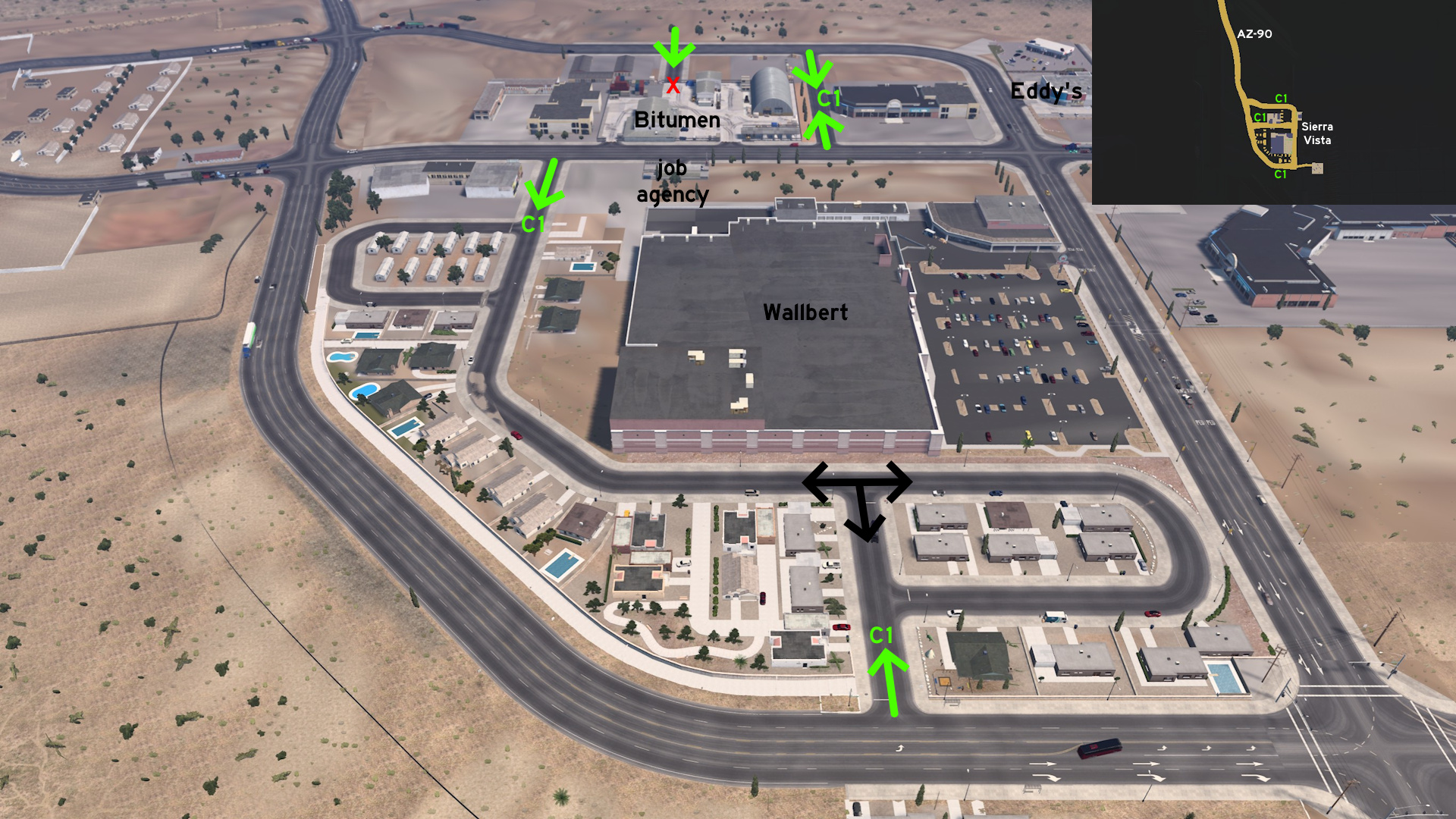 Simply head to Sierra Vista and explore! If you see a road and it doesn't have UI roadblocks, you can go there. Only pay attention to the path to Bitumen back entrance, which is accessible but depot gates are closed.
Tucson
West 1 - A Race Track And "A" Mountain
Category: achievement (Start Your Engine!), markableDiscovery: PWSmith1, ilchiodi
Update: FelipeVinhao, Ae3qe27u
Note 1: the road to "A" Mountain was visible on map before 1.44, and it's not related to achievement
Note 2: race track itself remains unmarkable
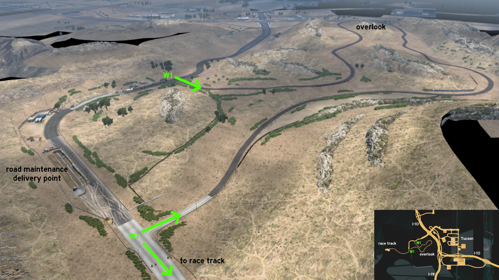 Go west Tucson, where there are some stretches of road under maintenance, and you can have a nice view of the city east of it, on top of "A" Mountain. Go to the crossing where there's a Bitumen delivery point, head south. Go through the traffic cones and continue forward.
 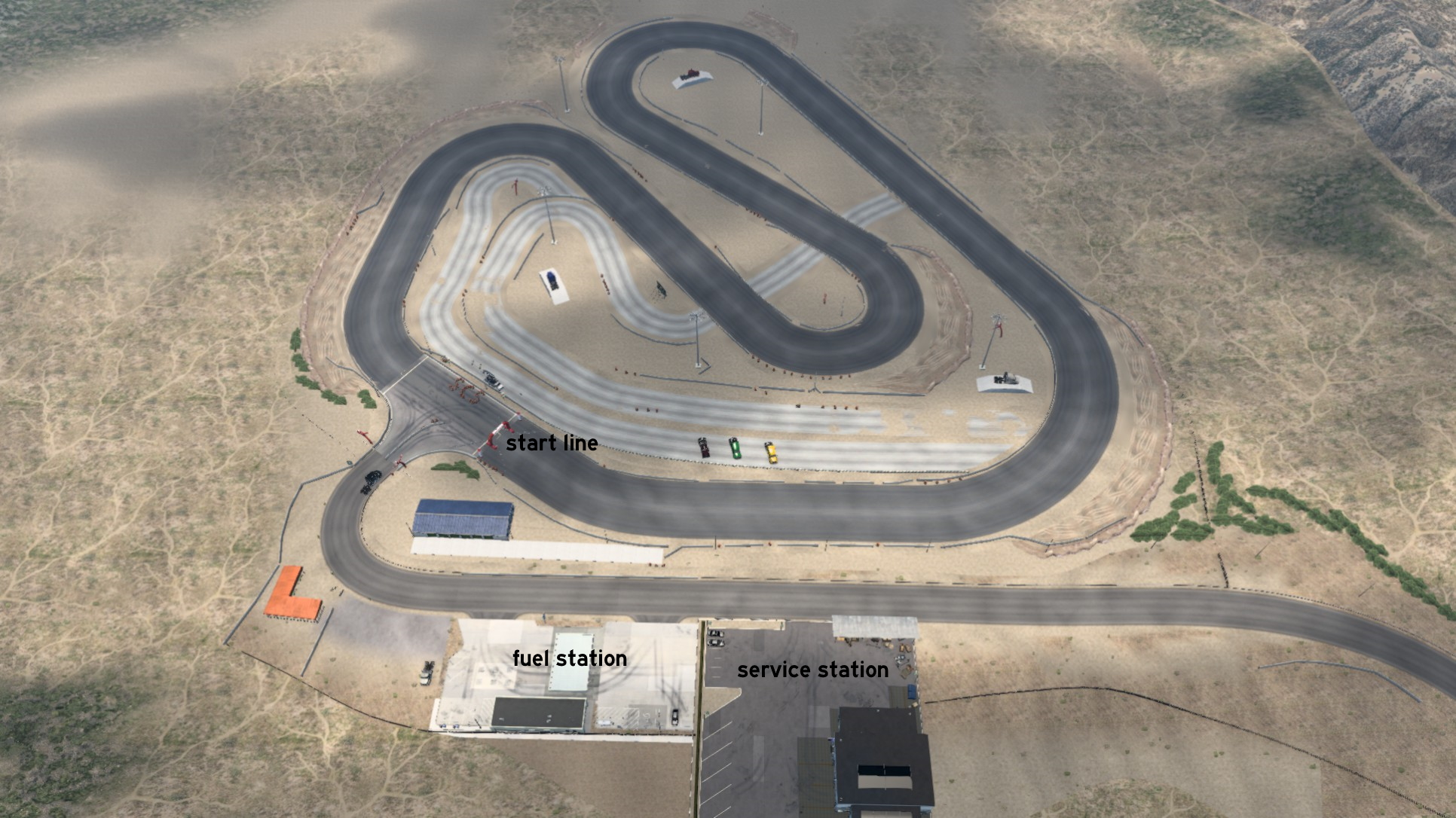 You'll first come across a service and a fuel station - both are markable like the road. Drive a little further and get ready on the starting line! Here you'll find the devs self advertisement, and the always present Oscar dancing nearby. Time to put the convoy feature into a different use.
Winslow
Central 1 - Separate Ways
Category: shortcut, markableDiscovery: punkito
Video (link): trucksim
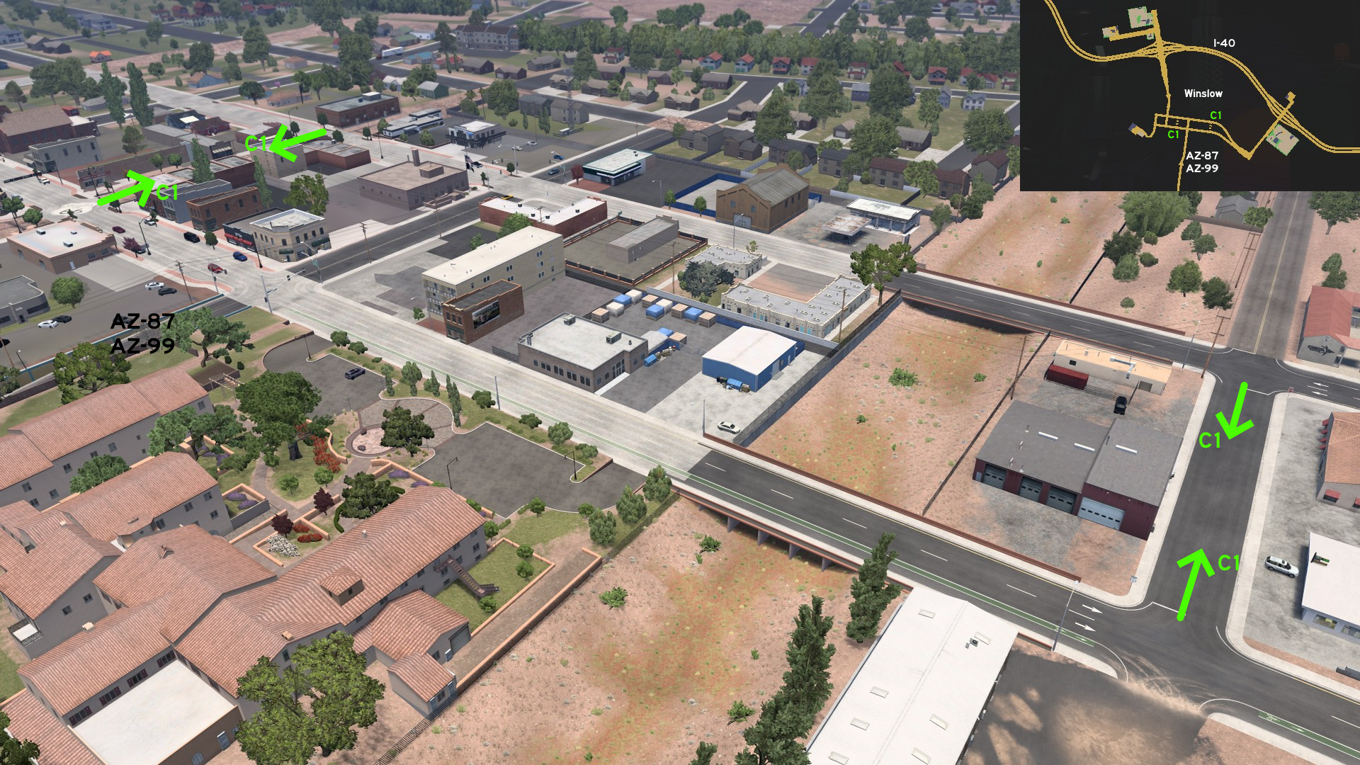 On central Winslow, two separate roads connect the two halves of Historic Route 66. One is east of the junction with AZ-87 / AZ-99, running along Ruby Wash. The other is west of it, easy to be spotted by the huge painted Route 66 shield on crossing.
 East 1 - Not Just An Arizona Street
Category: shortcut, markableDiscovery: punkito
Video (link): trucksim
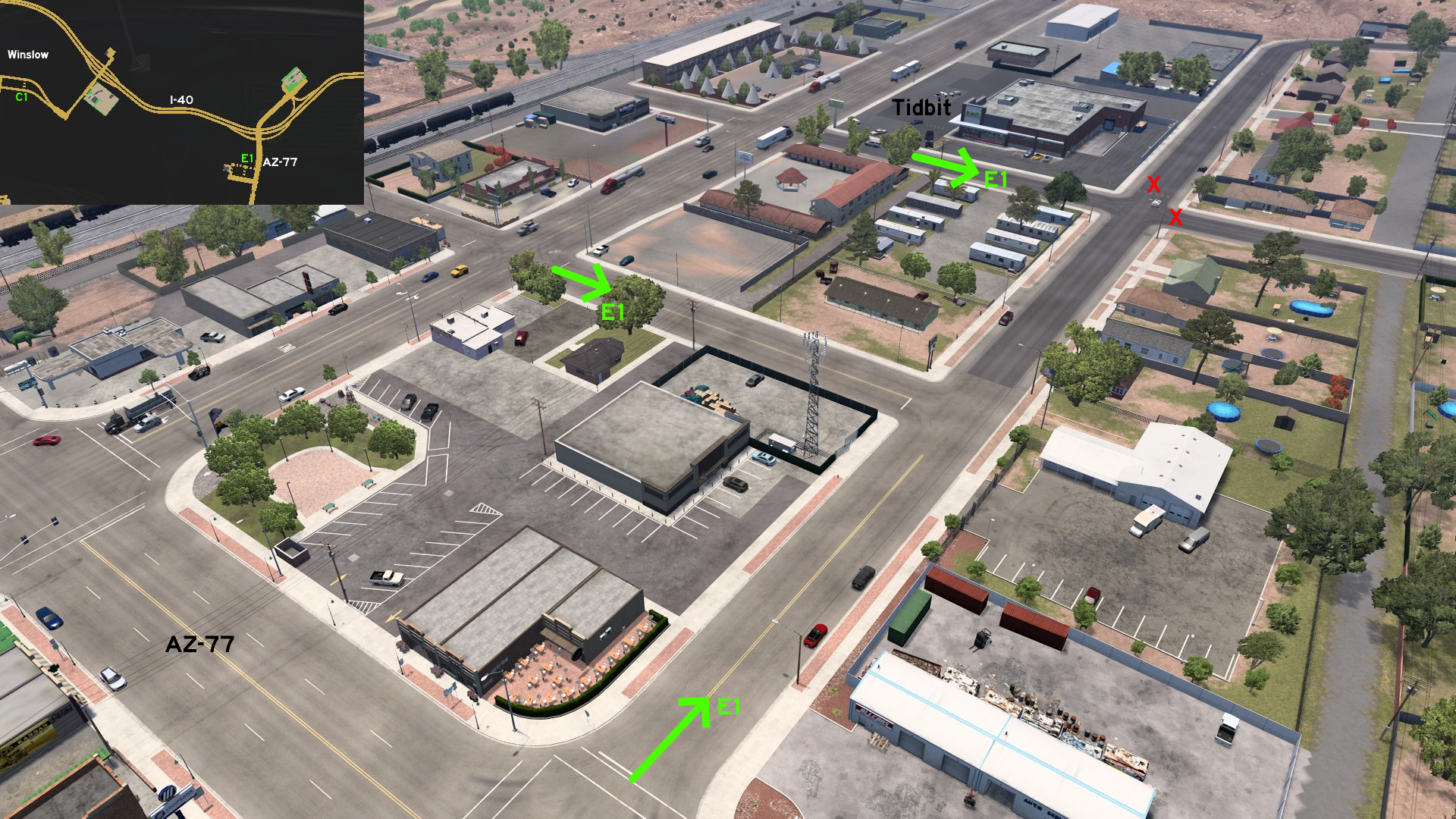 Leave Winslow through I-40 eastbound, and exit on AZ-77 to the unmarked town of Holbrook. The Tidbit market can be accessed by Arizona Street, running parallel to the marked Hopi Drive.
Base game, 2016 February 02
Barstow
East 1 - Get Your Kicks... Out Of Interstate 40
Category: scenery, markableDiscovery: OWLCAT, Applecorn
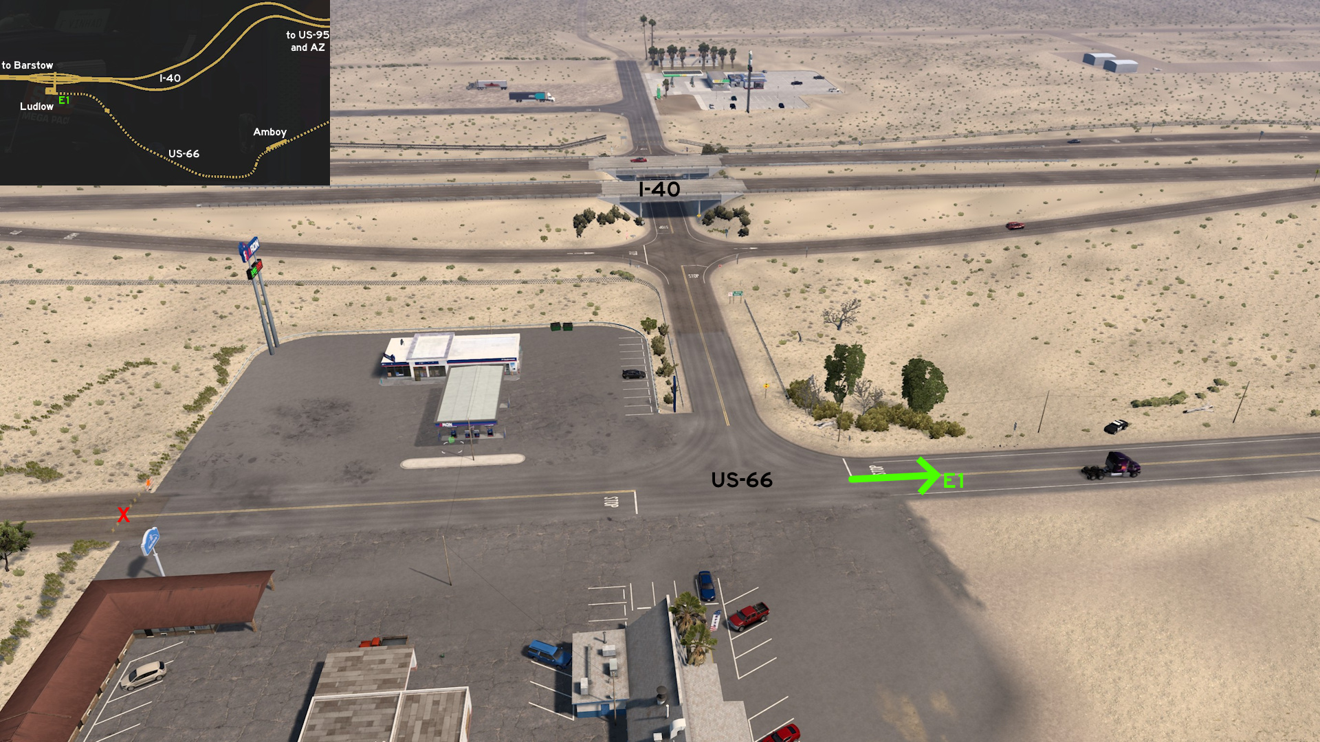 Leave east Barstow through I-40. Leave freeway as soon as you find the first fuel stop on unmarked town of Ludlow. Just keep east on historic US-66 instead of returning to I-40. Drive though a railroad crossing and another fuel stop on unmarked town of Amboy. It ends between I-40 rest stop and US-95 intersection.
 Northwest 1 - From Mine To Viewpoint
Category: scenery, markableDiscovery: Crieris, OWLCAT, ernst-ulrich.reichelt
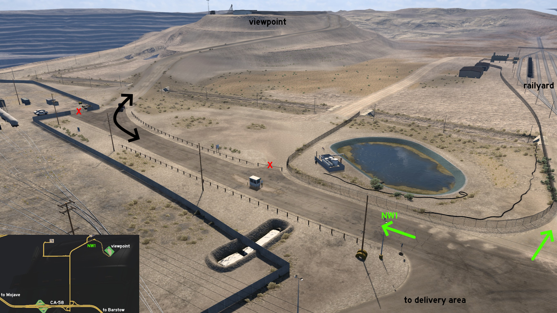 If you head to Coastline Mining out of CA-58, northwest of Barstow, there's a viewpoint that seem to be unaccessible. Simply go ahead instead of turning left into delivery area, and you'll find a way to it. As a bonus, you can also enter the railyard right.
 West 1 - All The Way To Lenwood Road
Category: shortcut, markableDiscovery: OWLCAT, ernst-ulrich.reichelt, Applecorn
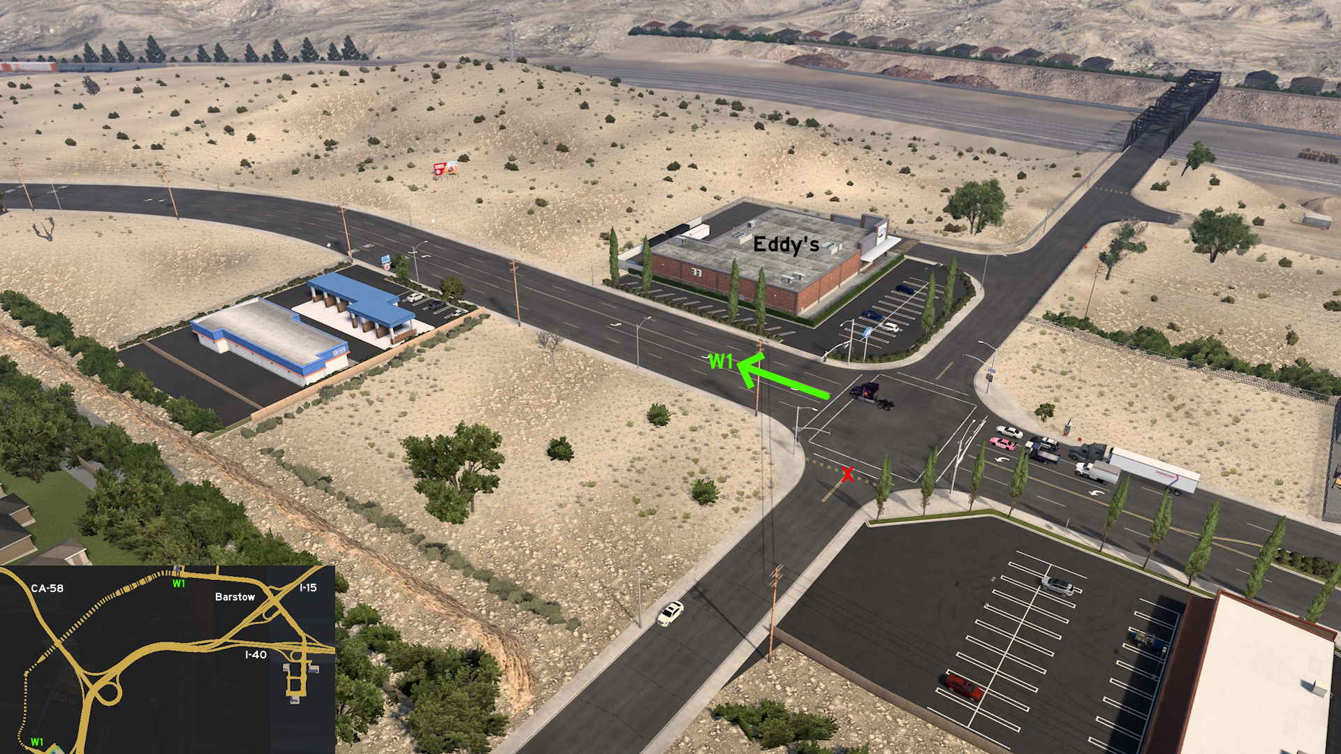 Head west Barstow. Instead of turning north to Eddy's, simply go ahead. The route goes below CA-58, and then turns south into the rest area on Lenwood Road, close to I-15 intersection. Note a truck wash nearby.
Eureka
North 1 - River On Pacific Coast
Category: scenery, markableDiscovery: nathan67003
Update: aqweasd7, OWLCAT
Note: road became markable on version 1.48
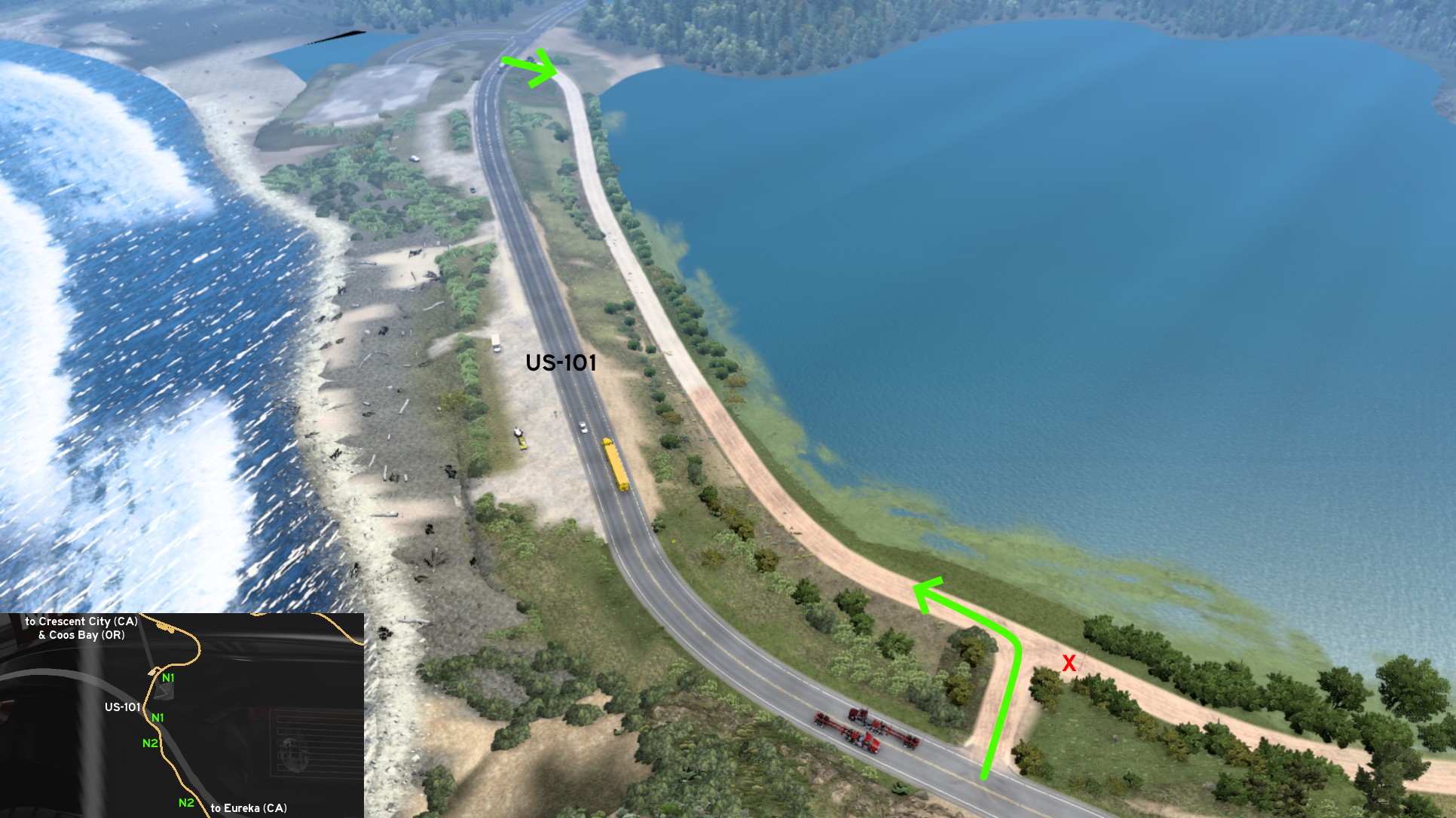 Summer breeze makes you feel fine? North of Eureka, close to unmarked Crescent City, you'll find 2 options to escape the traffic of US-101. The 1st one is easy to find, as it's almost across the smaller rest stop. There's an unreadable touristic information sign close to it. You can drive bordering the river (east) until you find a road block that will make you have to return to US-101.
 North 2 - Small Boat On Marina
Category: scenery, markableDiscovery: nathan67003
Update: aqweasd7, OWLCAT
Note: road became markable on version 1.48
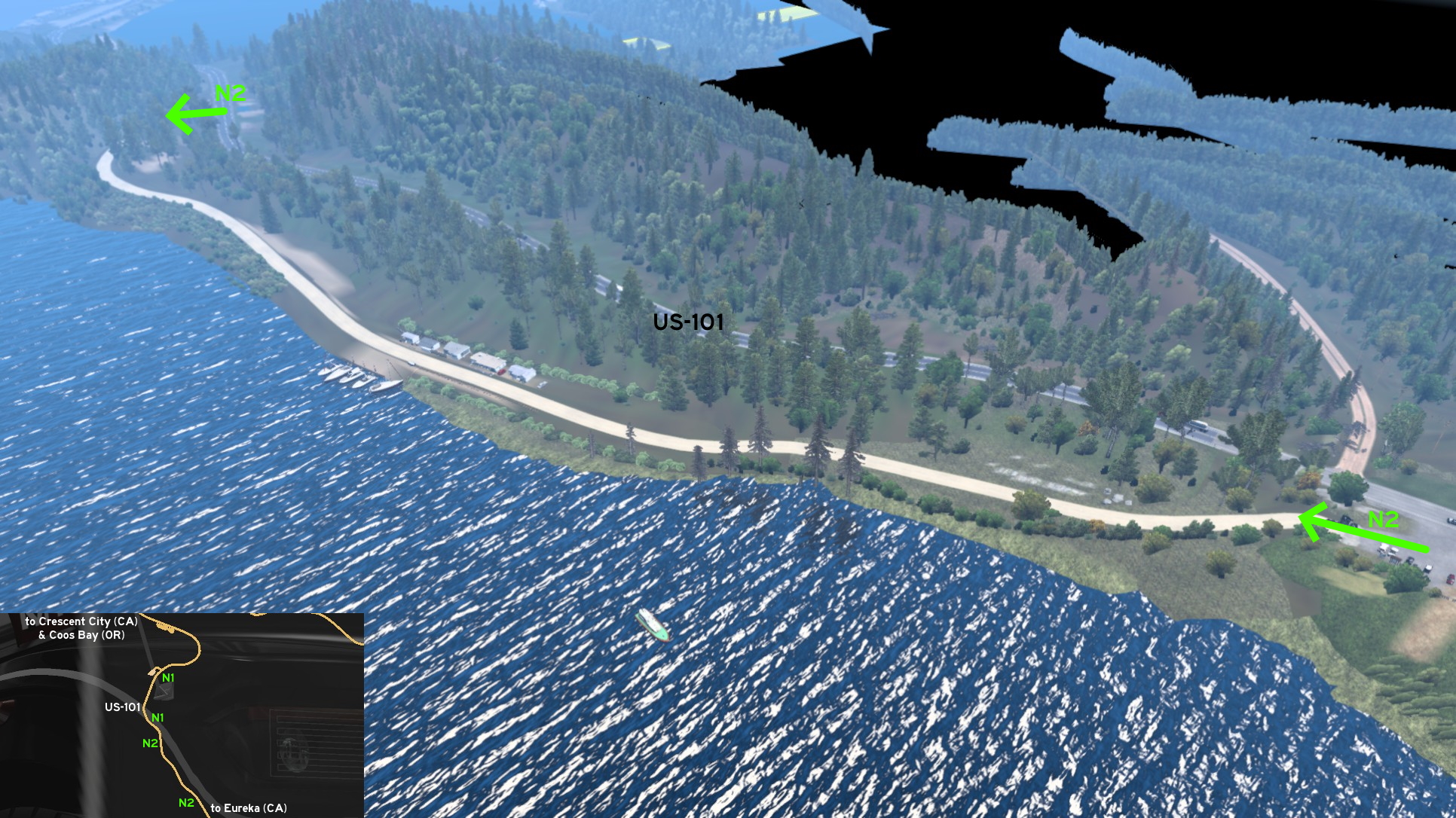 The 2nd one is south of the 1st. Leave US-101 heading to the coast (west). Several beach houses and a marina are found here, and someone playing with a small boat model is found near the marina. The southernmost access may go unnoticed, as it starts on a rest stop for small vehicles.
Fresno
South 1 - City Across Highway
Category: scenery, markableDiscovery: OWLCAT
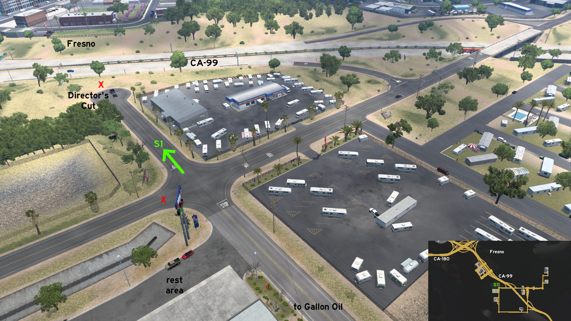 South of Fresno, and north of a Gallon Oil depot and an Aron rest area, there's a dead end street, where you can either stop to view the Fresno skyline, or discover a hidden Director's Cut video to see the city a little closer.
Indio
South 1 - An Alternative From Roundabout
Category: shortcut, markableCredits: Crieris
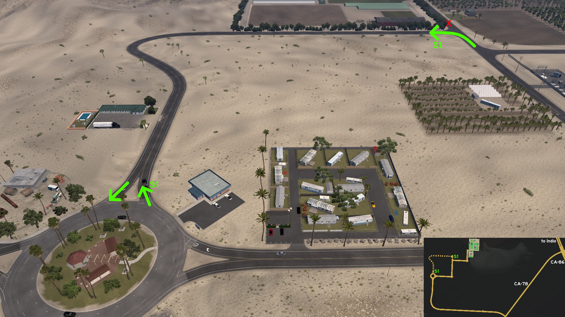 Leave south Indio through CA-86 and turn into CA-78 to head to Sunshine Crops. Instead of following the marked eastroute from the roundabout, continue north. It ends close to depot entrance.
Los Angeles
Central 1 - Coffee Break And Chicken Before Venture
Category: shortcutDiscovery: Applecorn
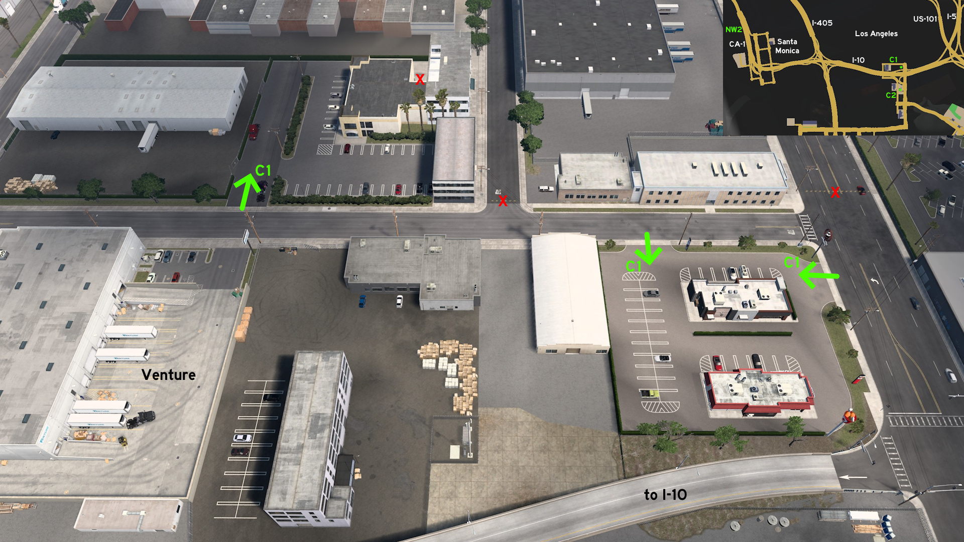 Go to Venture, near I-10 on Los Angeles. On the corner of the road the depot is located, there's an open area with a Cofibreak and a Dirk's. As a bonus, the area across Venture is also accessible, but it's dead end.
 Northwest 2 - Why Did I Move Here?
Category: sceneryDiscovery: AcidSlide
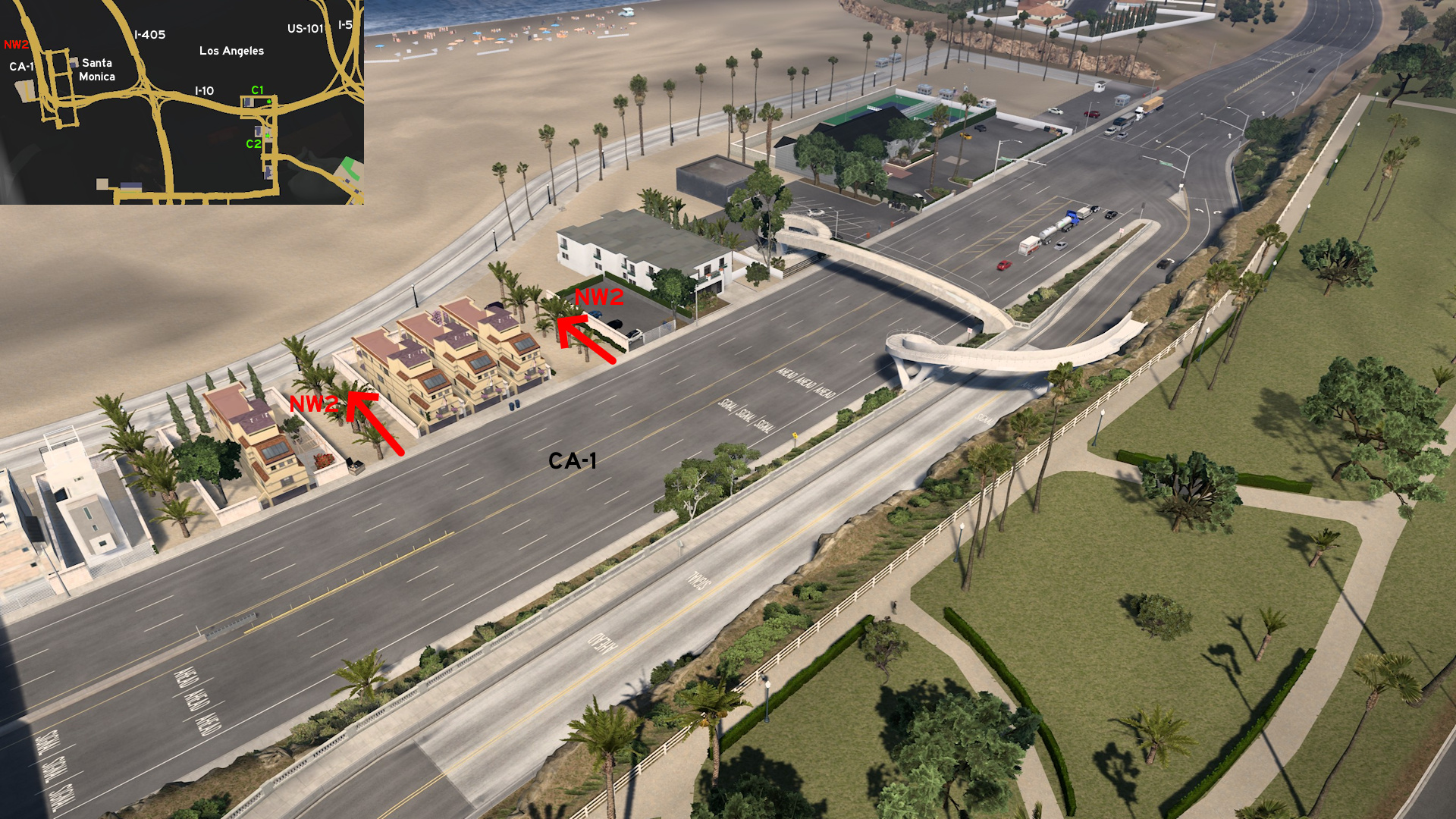 Head to Santa Monica, northwest of Los Angeles. From CA-1, you can reach the beaches through some paths with palm tree lines. You can drive along the bike lanes, and even go further from Santa Monica Pier. Just don't go too far, or else you may fall to the void.
 South 1 - Smells Like Fish
Category: scenery, markableDiscovery: Ozzy
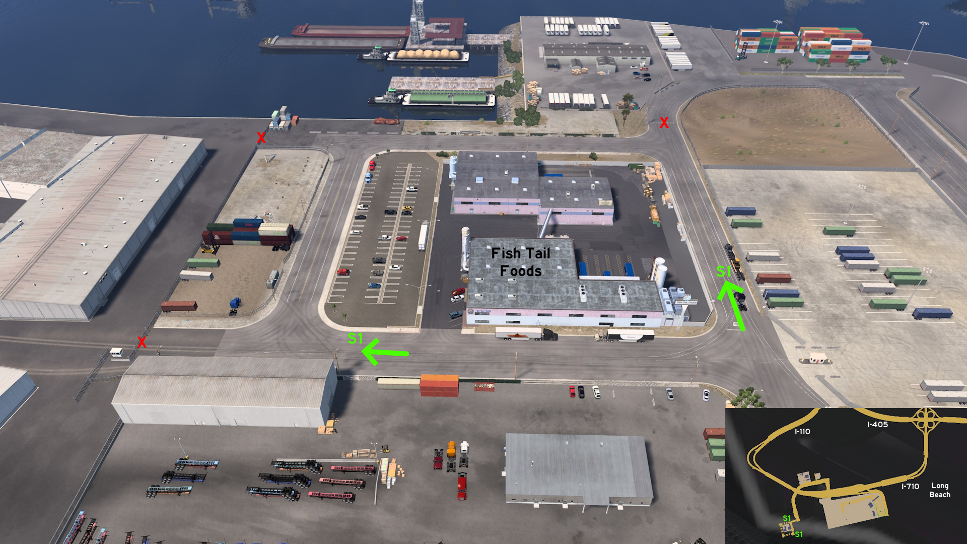 Head to Fish Tail Foods, south Los Angeles. All roads around the depot are accessible.
 HONORABLE MENTION - The Original Hidden Road
Category: shortcut, markableDiscovery: ilchiodi
Update: kettcardriverprofi, Applecorn, Crieris
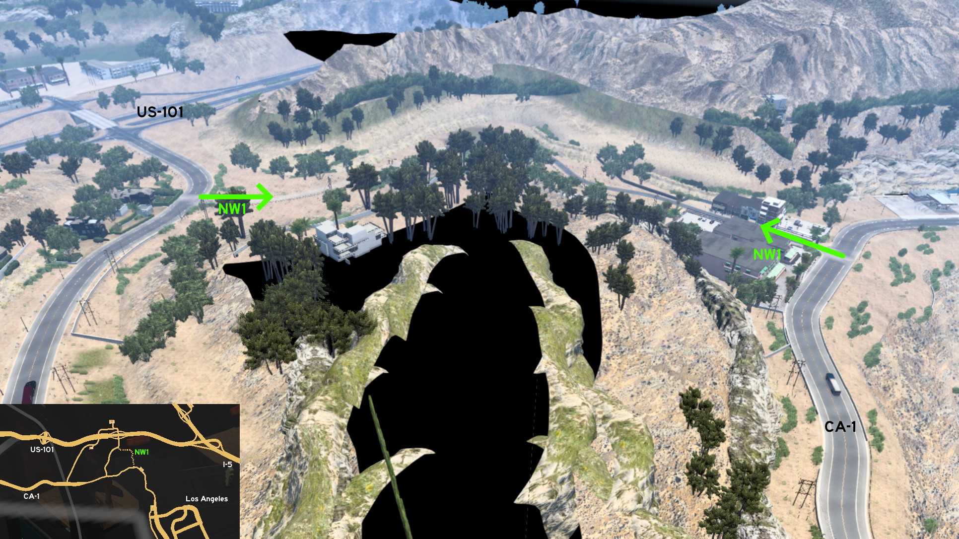 It's the road that illustrates this guide. This was the first hidden road, which existed since the first version of the game. It was located northwest of Los Angeles, and connected CA-1 and US-101. The surrounding area went through several changes over time, until it was completely removed on version 1.54, when California rework was finished.
Modesto
Central 1 - Don't Drink And Drive
Category: shortcut, markableDiscovery: OWLCAT
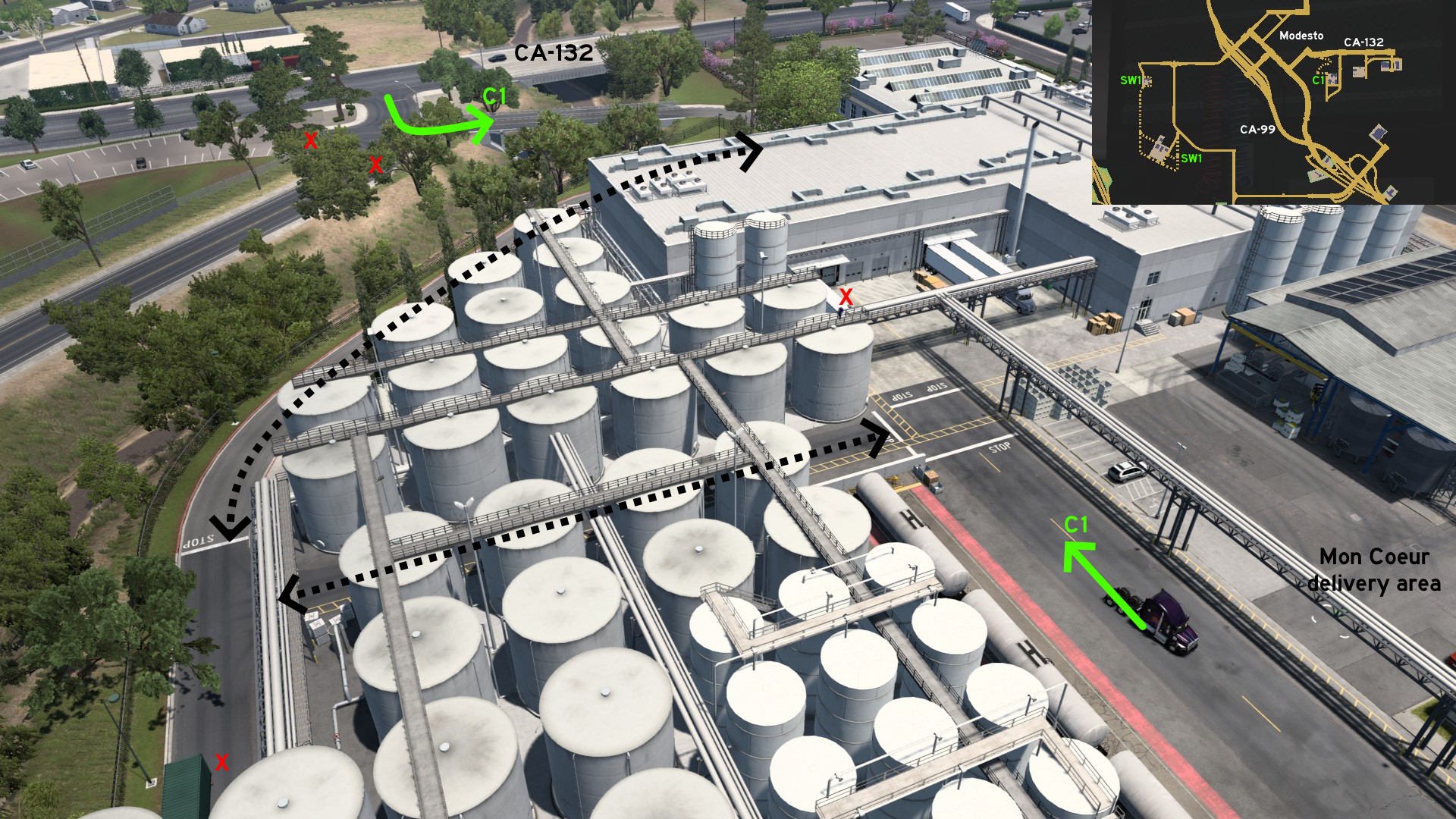 Connecting CA-132 and Mon Coeur delivery area, there's a single-laned windy road passing by Dry Creek, a parking lot, and the winery tanks. Drive extra carefully if pulling long trailers, and not to take a wrong turn.
 South 1 - All Around Walden's
Category: shortcut, markableDiscovery: Cyanlix, Jasper
Note: the path near CA-152 may not trigger the discovery message, but it will still be marked
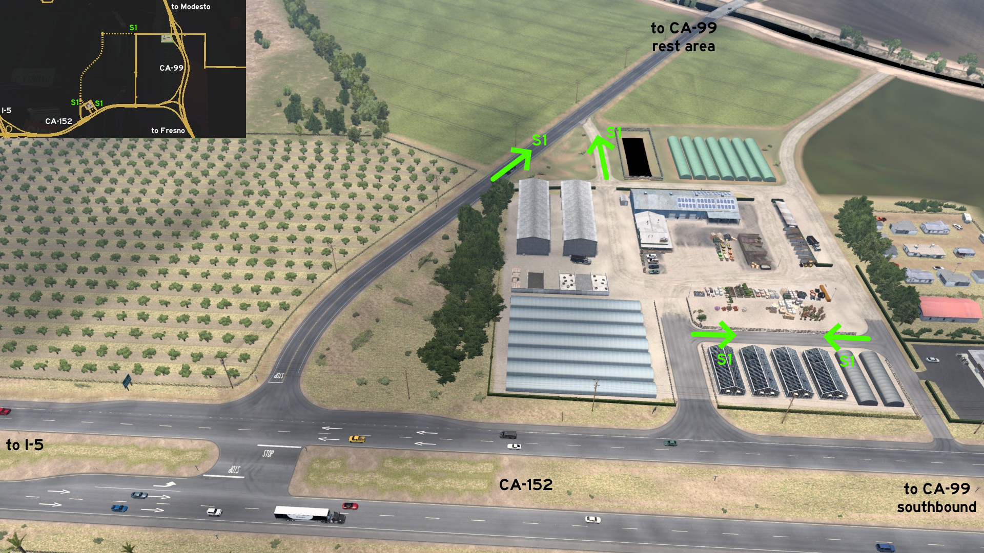 Walden's depot has two alternative routes. The first is a path running between the delivery area and the greenhouses that can be used as a detour. The second is a road leading to the same road where the CA-99 truck stop between the area and Modesto can be found, and the only way to take CA-99 northbound from this depot.
 Southwest 1 - Almond And Sunshine
Category: shortcut, markableDiscovery: Cyanlix, Crieris
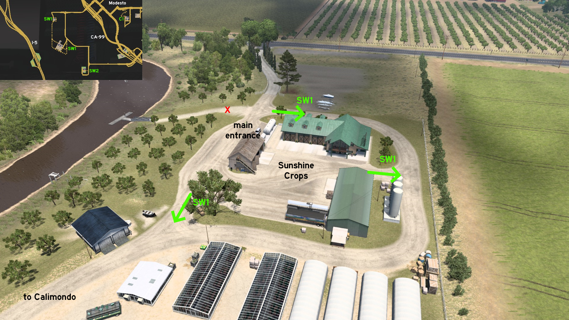 Sunshine Crops and Calimondo farm are connected directly to each other. Starting on Sunshine Crops, the dusty road starts right on main entrance (northwest), and goes all around the delivery area, which can also be accessed east and southwest of it.
 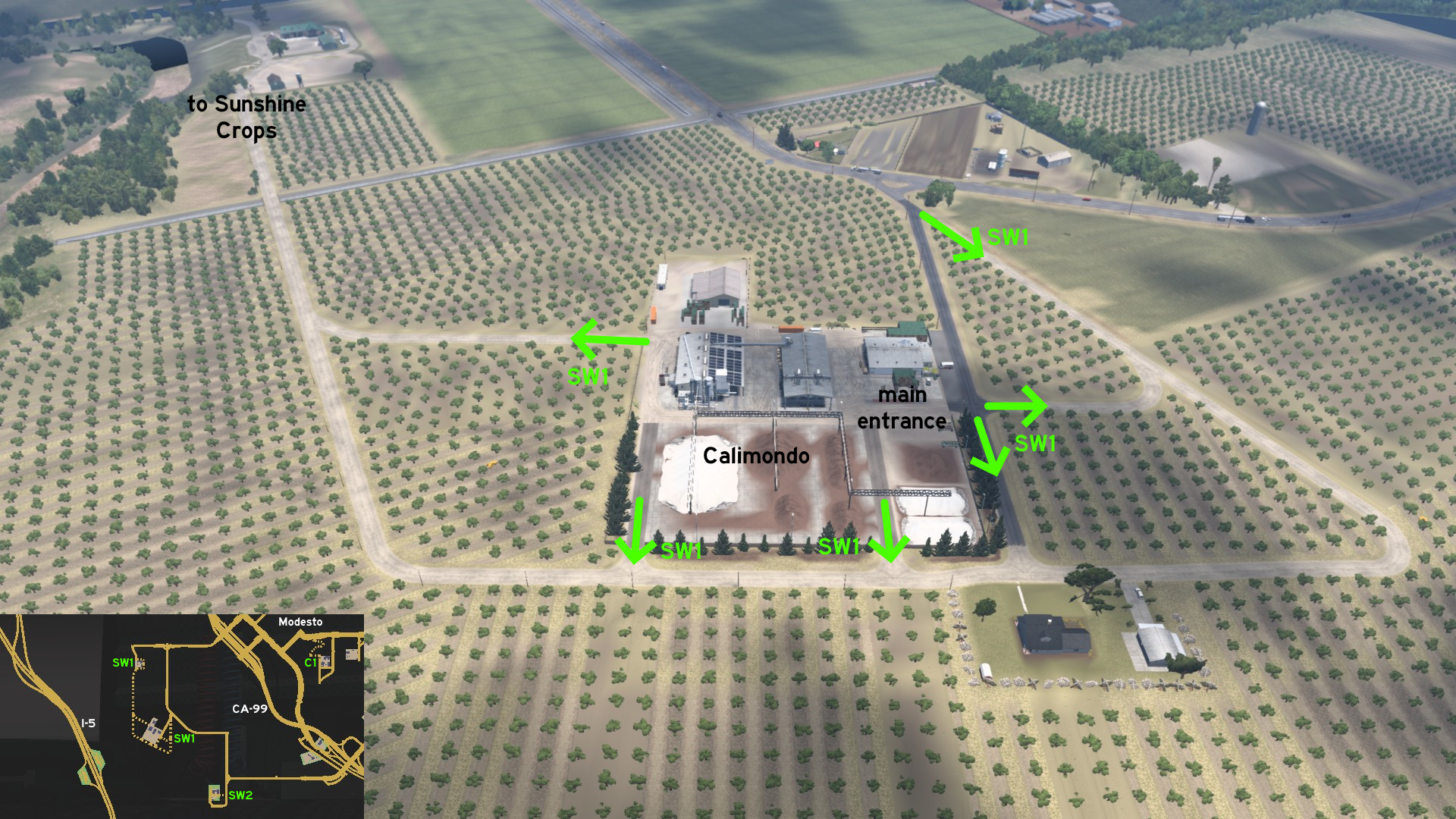 Starting on Calimondo, the shortcut can be accessed right from the front gate (northeast) and the delivery area entrance (east) to two different directions. After that, it can also be accessed by two exits south, and one exit west.
 Southwest 2 - Gotta Go Fast (Or Not)
Category: shortcut, markableDiscovery: OWLCAT, Crieris
Note: only the actual shortcut is markable
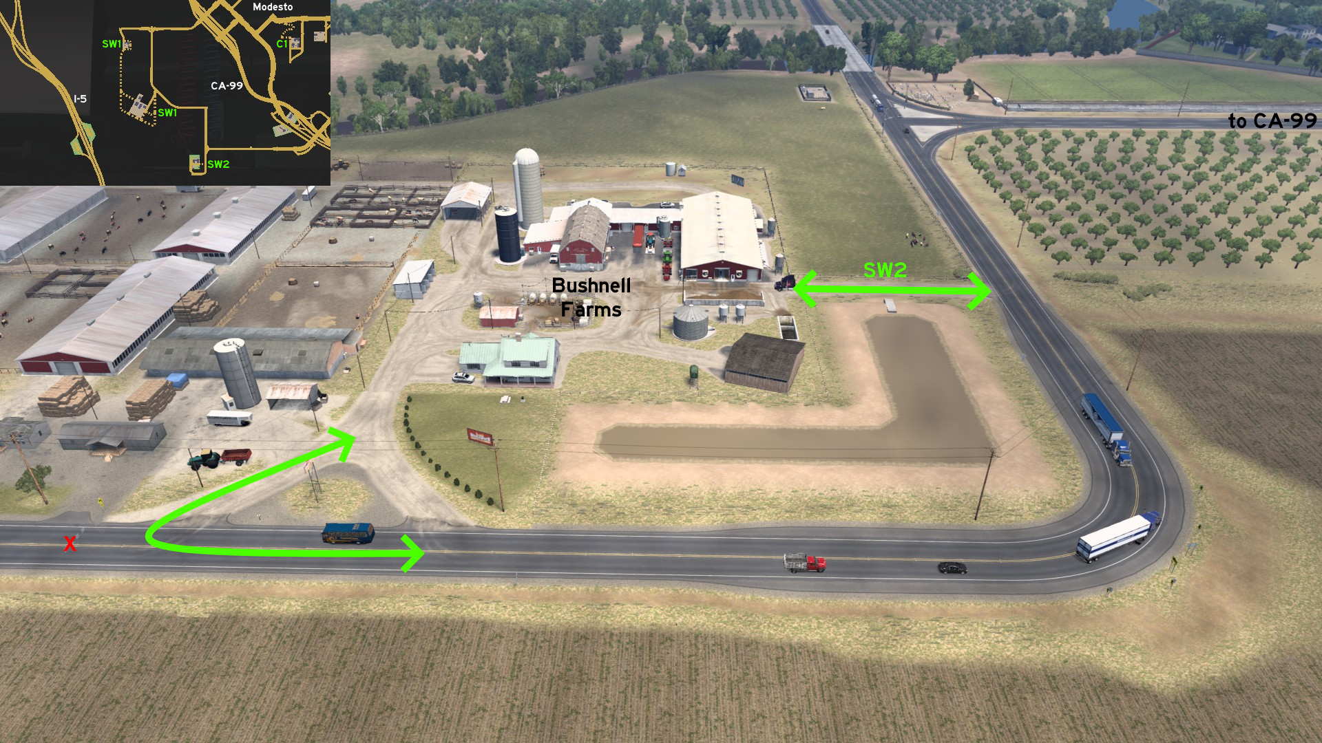 Some meters before reaching Bushnell Farms delivery area, there's a path connecting the main road and running along a muddy pond. From the main entrance, you can also take the exit westbound, but for sure it won't be of much use...
 Southwest 3 - Rest Hideout
Category: scenery, markableDiscovery: Cyanlix, Crieris
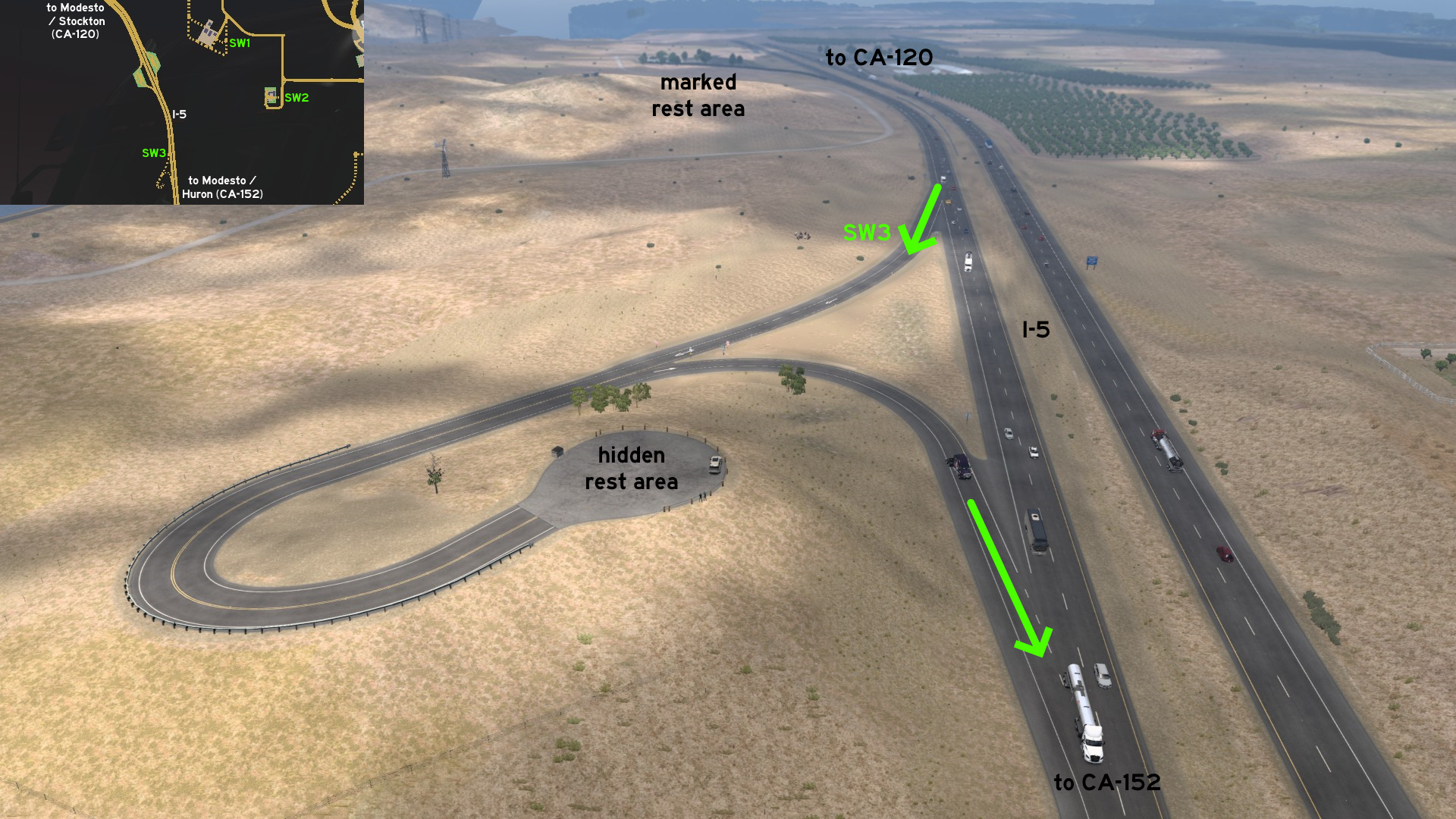 South of a marked rest area on I-5, between CA-120 and CA-152, there's another rest area southbound, which is also a vista point. A better and quieter place for a good rest.
Oakland
Northwest 1 - Gimme Fuel
Category: shortcut, markableDiscovery: Richard_Stamos
Update: ernst-ulrich.reichelt, Cyclone
Note: roads became markable on version 1.53, and Chemso was changed to Gallon Oil
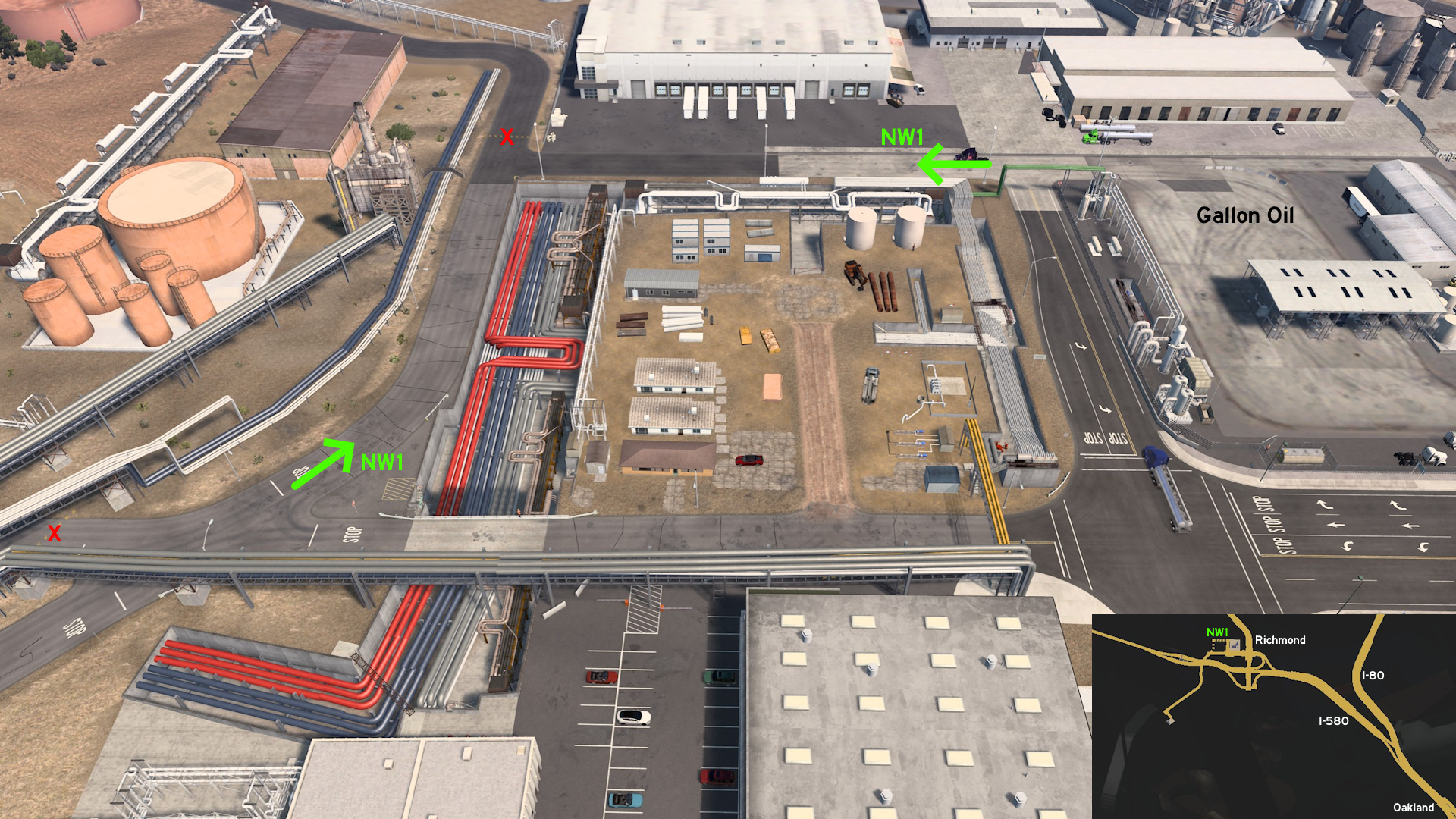 Leave northwest Oakland through I-580, and head to the unmarked town of Richmond. As you leave the delivery area of Gallon Oil refinery, keep forward until you reach the pipes. Follow the pipes to return to marked roads.
Oxnard
South 1 - Food For Imagination
Category: sceneryDiscovery: Applecorn
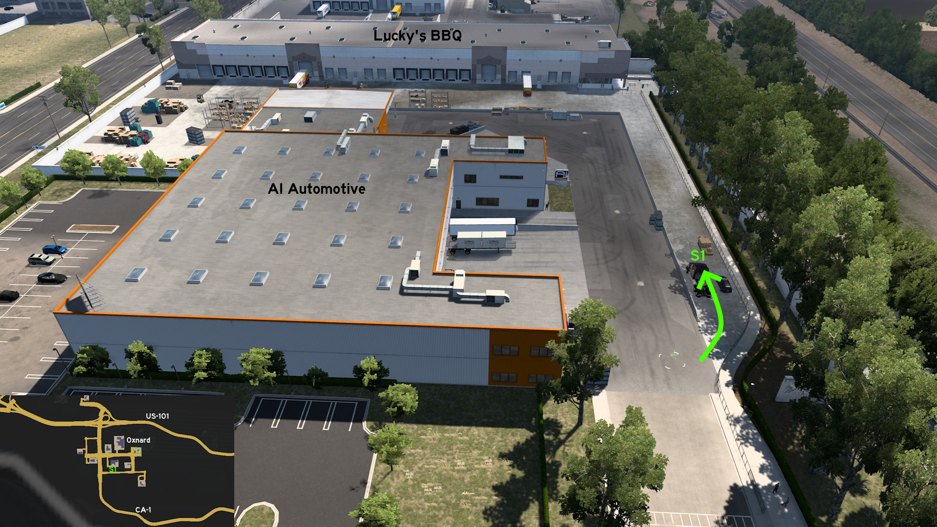 Head to AI Automotive on south Oxnard. As soon as you enter the depot, turn right and continue ahead. You'll reach Lucky's BBQ depot, but without any available job.
Redding
Northeast 1 - Through The Parking Lot
Category: shortcut, markableDiscovery: Zest
Note: parking lot is also accessible, just not markable
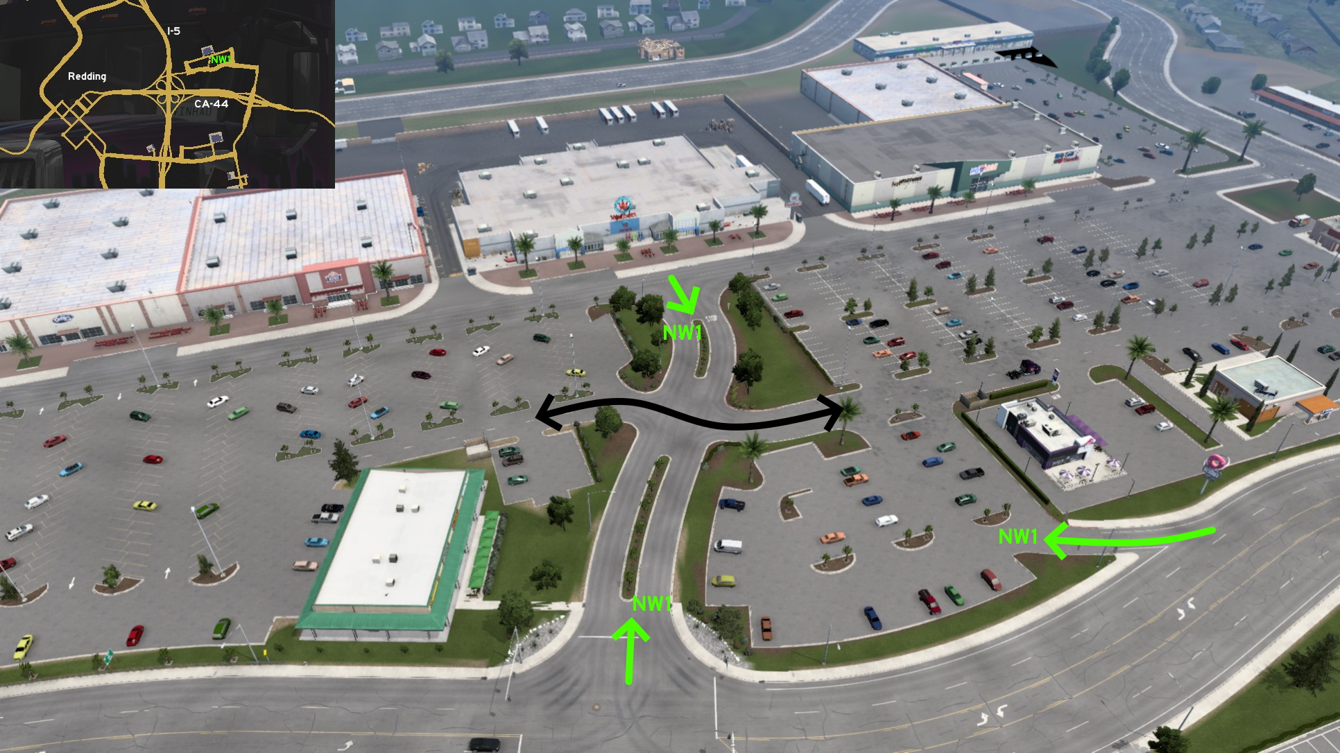 On northeast Redding, where there's a great mall with several companies, but only Wallbert is a delivery spot, there's a short road that cuts the parking lot in half, and leads you direct to the delivery area. The parking lot is also accessible, but not very fitting for your ride.
 Southwest 1 - Cut The Way To Cut Wood
Category: shortcut, markableDiscovery: Binary
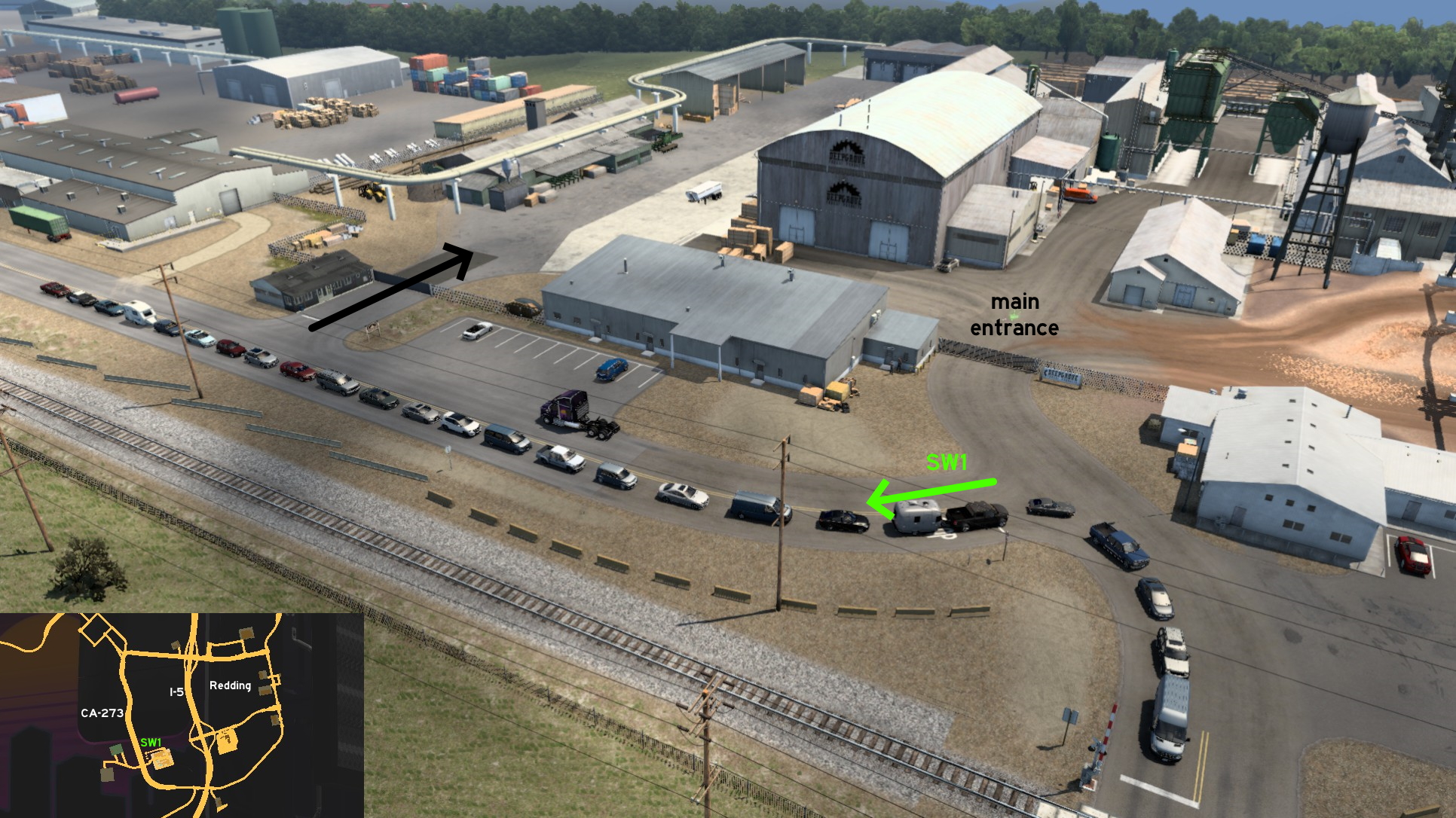 On the Deepgrove sawmill found southwest Redding, you can access a secondary entrance. Just cross the railroad, but instead of going forward to main entrance, turn left (north) instead. After reaching UI roadblocks, turn right (east). Not really the shortest way, but you may find this area good for maneuvering.
Sacramento 🏛️
Southwest 1 - Farmer's Shortcut
Category: shortcut, markableDescription: farmer's shortcut
Discovery: NEMEZIS
Update: kaia15
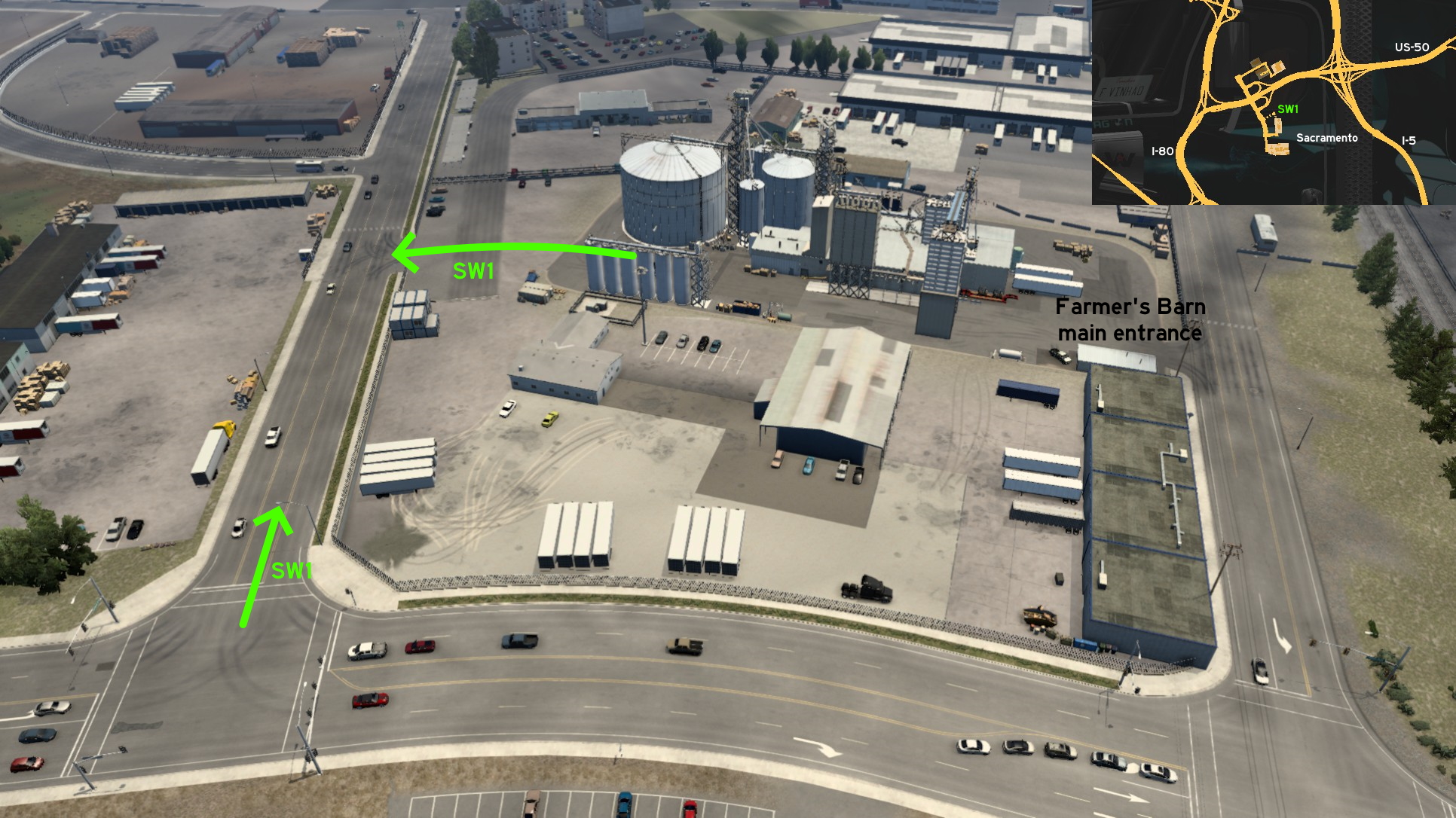 If you go to Farmer's Barn depot southwest Sacramento, you can also access it from its back entrance (north). Just go to the entrance opposite to the main one (south), and you'll find the open Del Monte Street. Just drive until you find a roadblock in front of you, and turn right (south). This street looks like a mirror version of the main entrance street.
San Diego
East 1 - Direct-To-Business
Category: shortcut, markableDiscovery: FelipeVinhao
Update: Cyanlix
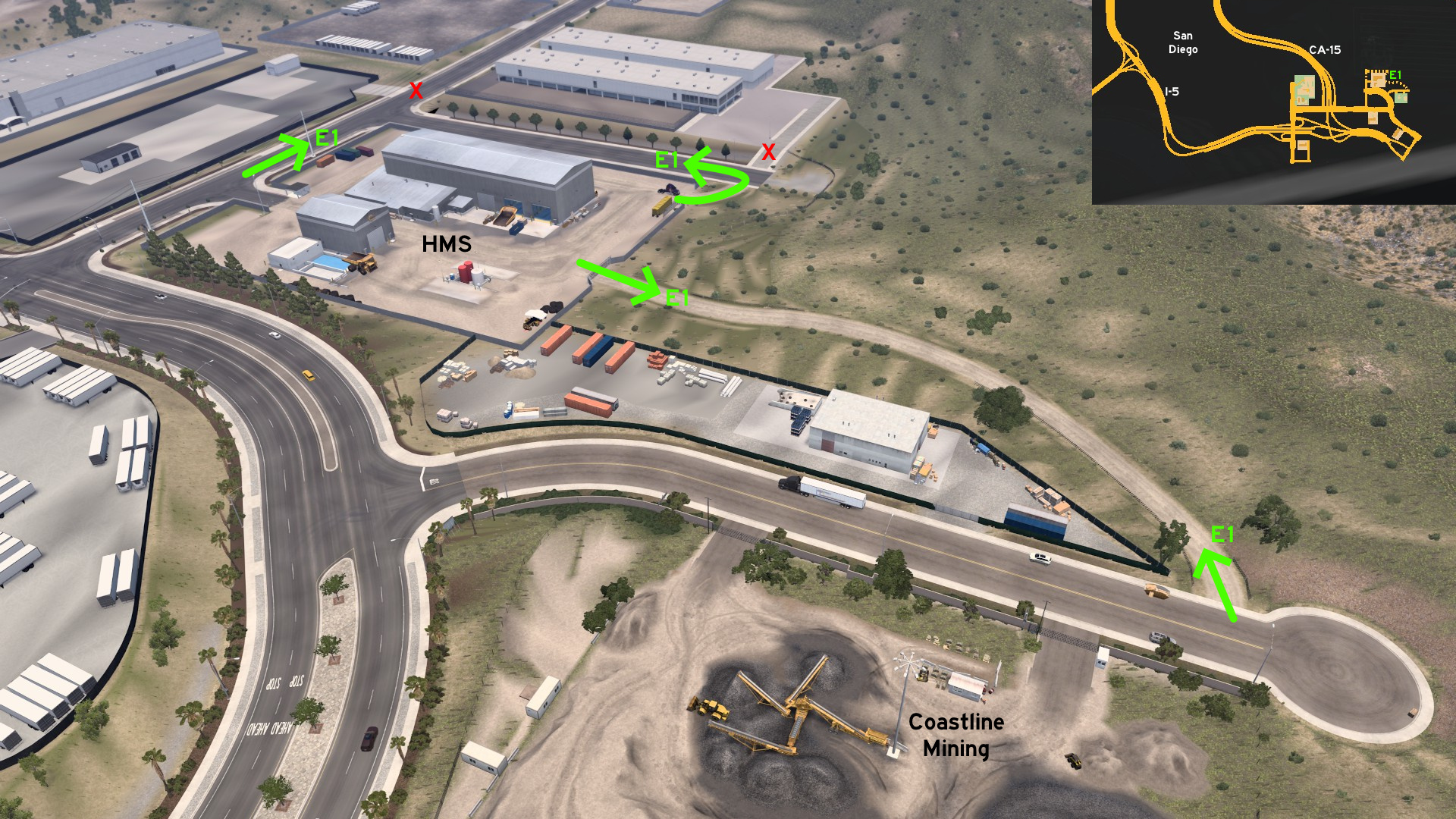 Go to east San Diego. From the back entrance of HMS you can go south directly to the dead end street where Coastline Mining is located, or go to the unfinished road north of depot.
 North 1 - Enjoy The Ride
Category: scenery, markableDiscovery: Crieris, Applecorn
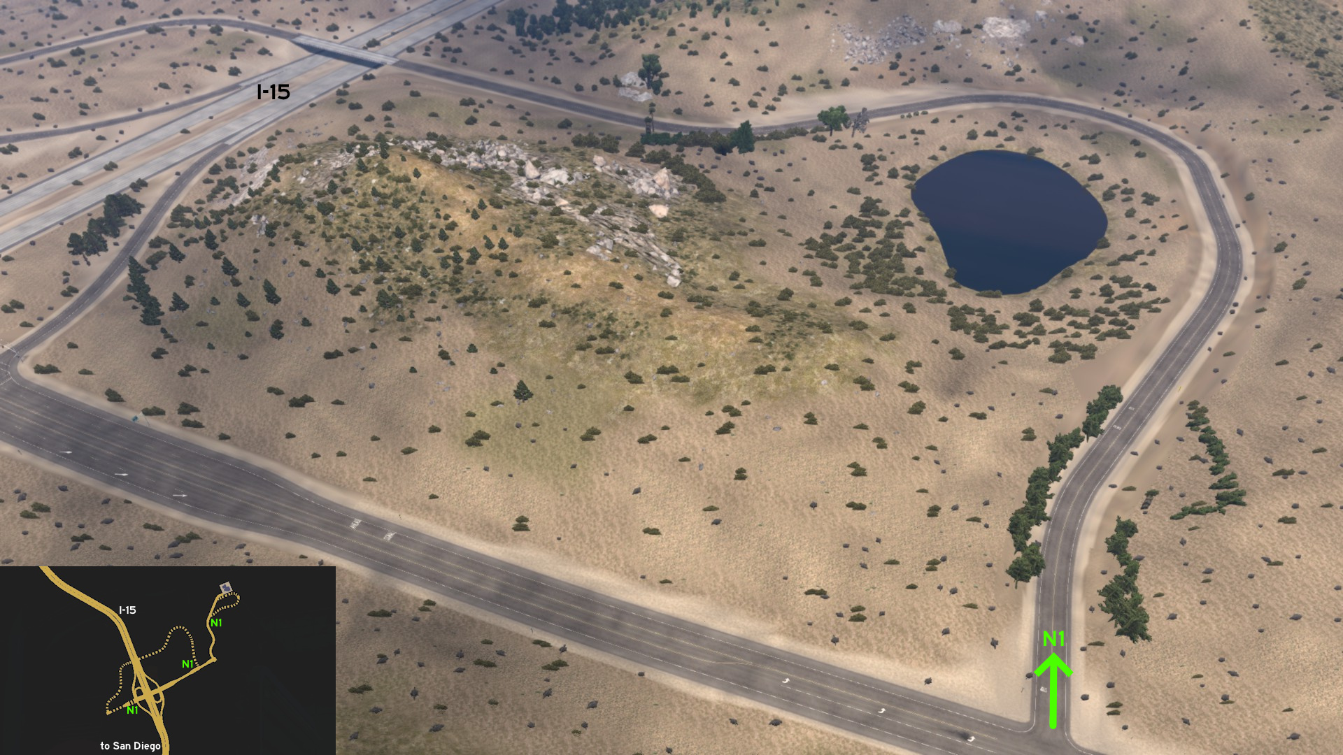 Leave north San Diego through I-15 / CA-15 and head to Mon Coeur. The first route is found as soon as you leave I-15, it starts west and loops around north back to marked road.
 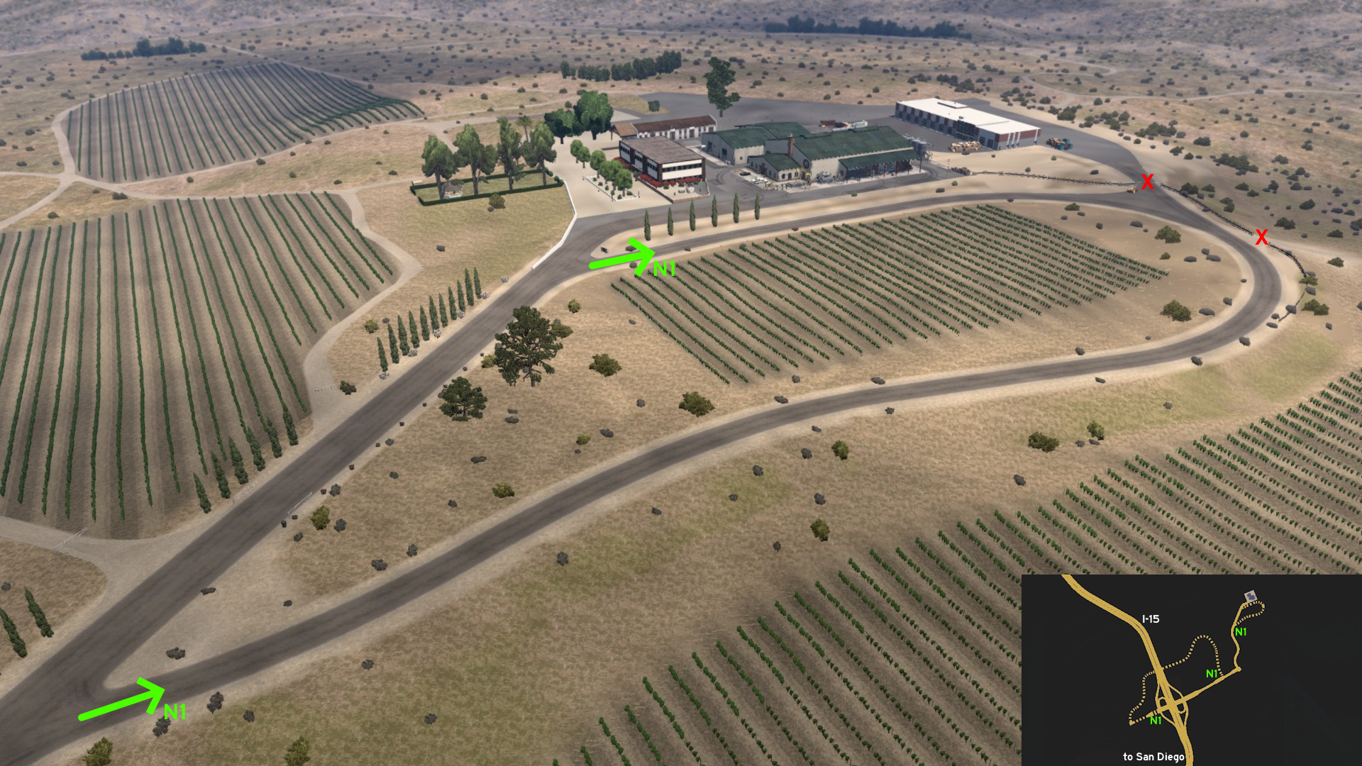 The second route seems to be a shortcut to delivery area, but it simply leads back to the road it starts, as back entrance is blocked.
San Francisco
Central 1 - Steepest And Crookedest Tour
Category: scenery, markableDiscovery: OWLCAT
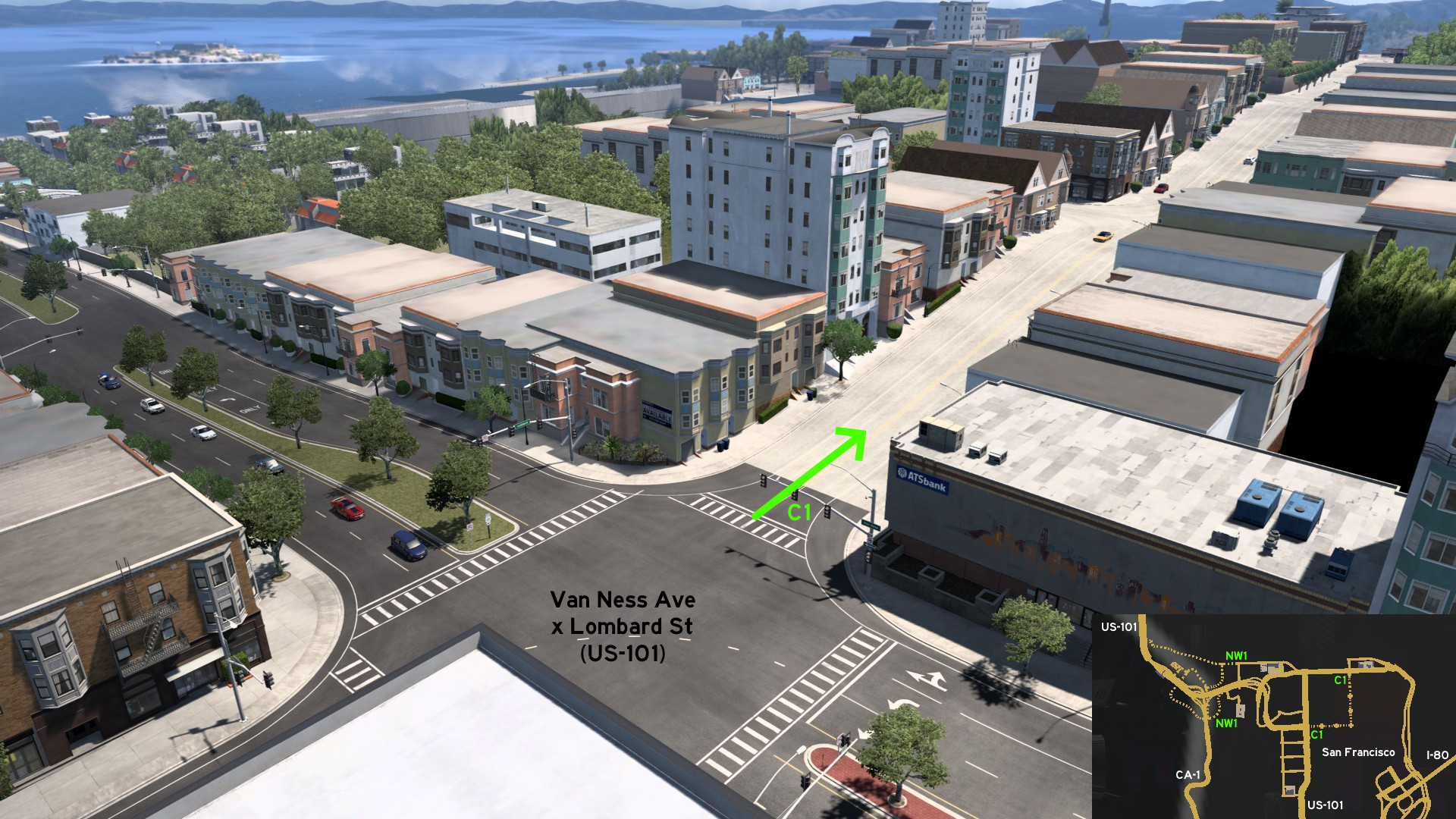 Starting on the crossing of Van Ness Avenue and Lombard Street, head east. You'll climb the steep Russian Hill.
 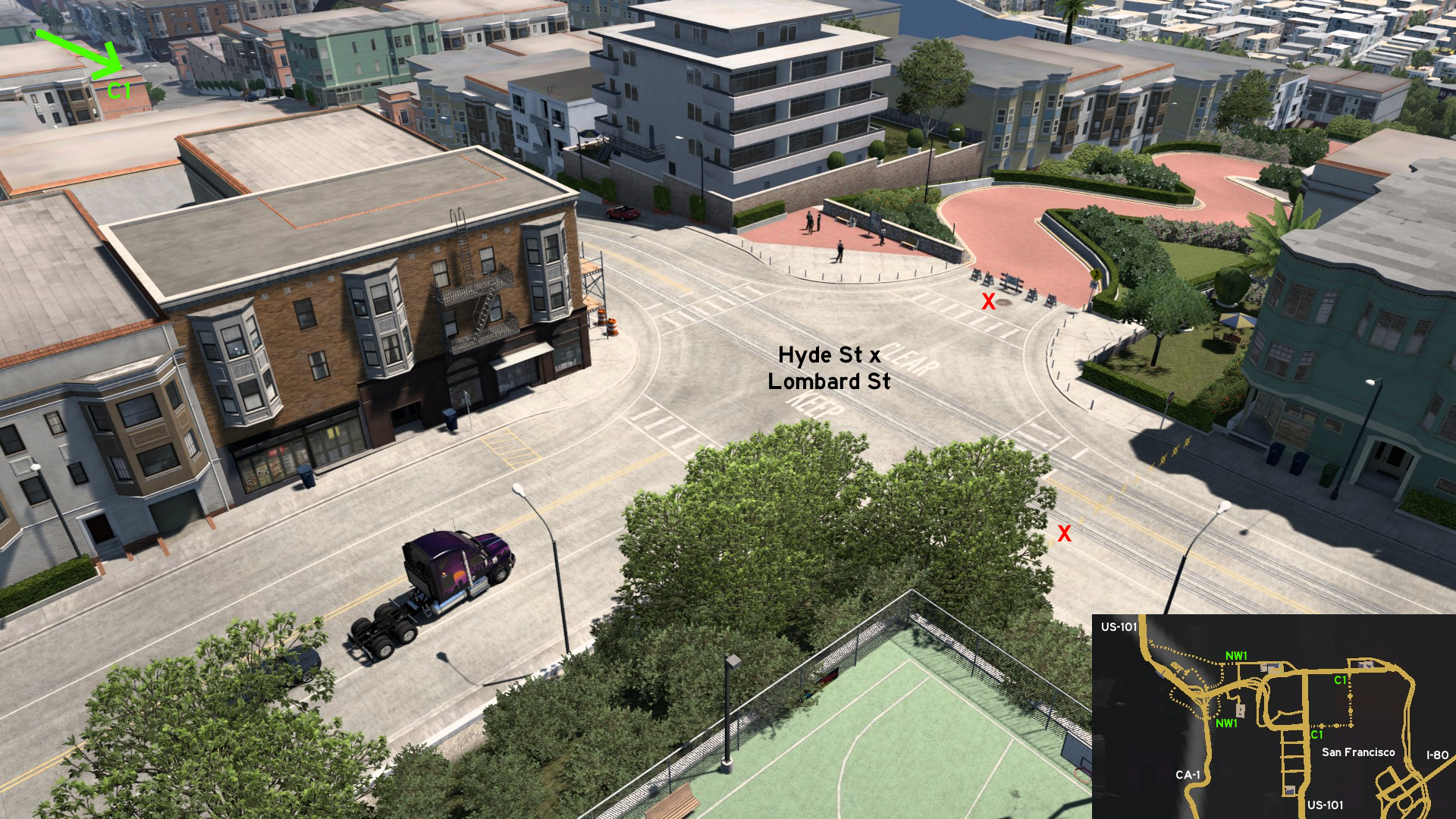 When you reach the top on the crossing of Hyde Street, you can view the crooked section of Lombard Street (but obviously can't go ahead, for safety reasons) and the Coit Tower far away. Turn left to drive along the cable cars, until you reach the other end, where you can view the Cable Car Turntable, the Hyde Street Pier and Alcatraz Island straight ahead.
 Northwest 1 - Presidio Tour
Category: scenery, markableDescription: Presidio tour
Discovery: Cyanlix
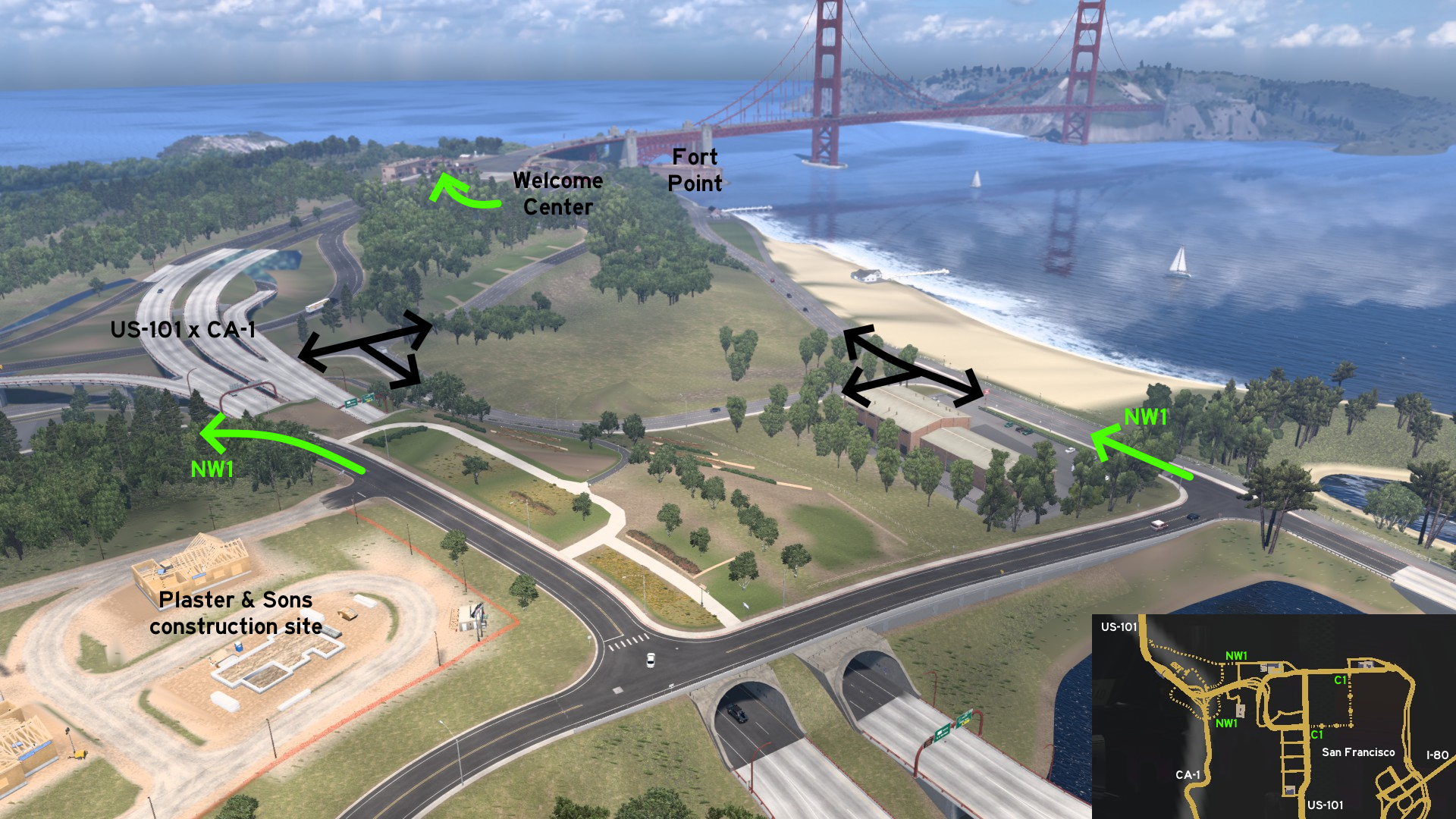 You can visit the Presidio from two different routes: north starting on Marina Boulevard, and south near a Plaster & Sons construction site. You can drive northwest until Fort Point, and then return to Golden Gate Welcome Center, where you can watch the bridge Director's Cut. From there, you can either go direct to the toll gates, or drive below the intersection of US-101 and CA-1.
 South 1 - Devil's Slide Trail
Category: scenery, markableDiscovery: Cyanlix
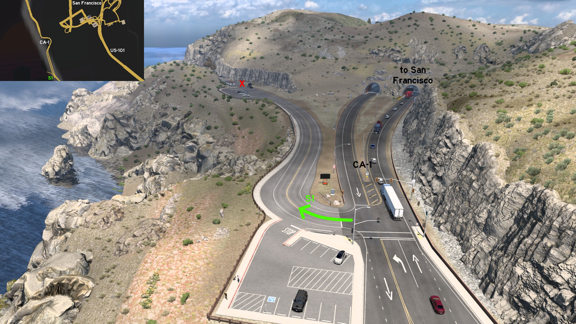 South of San Francisco and the CA-1 tunnels, turn west. You can drive until Devil's Slide Trail south parking lot. You can't really rest here, nor continue to the trail, but you can find a nice spot to see the Pacific Ocean.
San Jose
Northeast 1 - Electrical Connection
Category: shortcut, markableDiscovery: Crieris
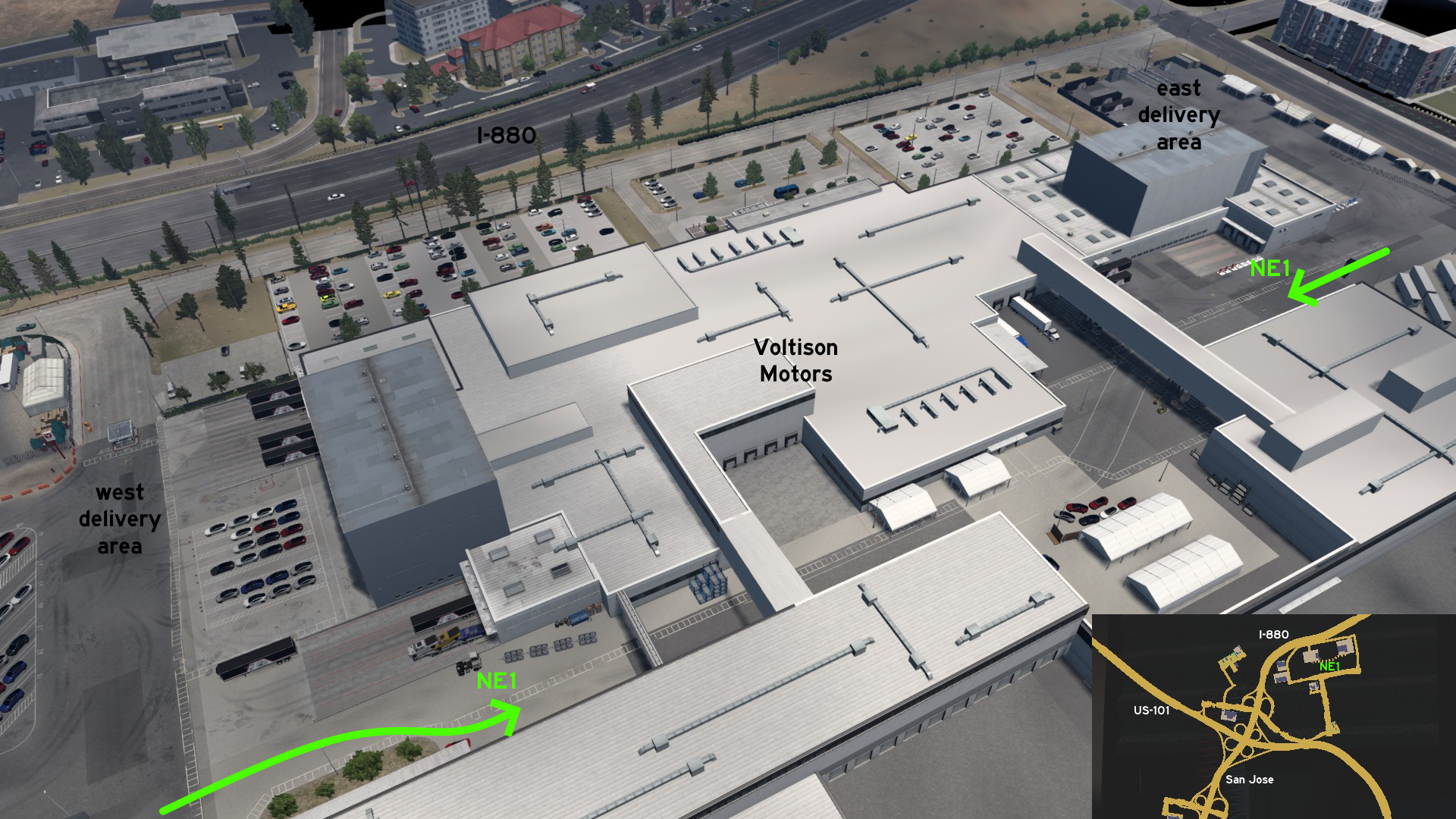 Behind the Voltison Motors facility, there's a marked path connecting the two delivery areas.
Santa Cruz
Central 1 - Santa Cruz Light House
Category: scenery, markableDiscovery: Cyanlix, Crieris
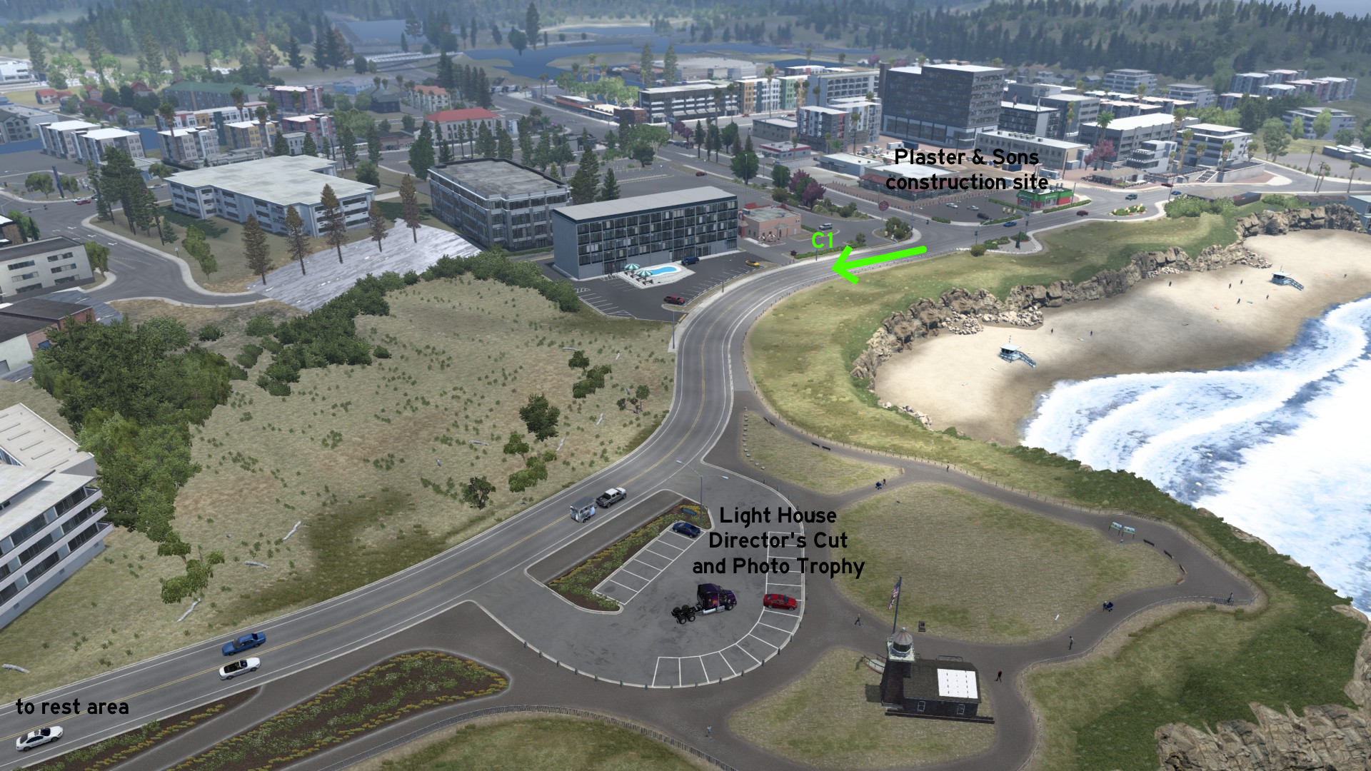 Starting on the rest area on west side near CA-1, take the road heading south. It gets narrower as getting close to the coast, and runs along it until it reaches the Plaster & Sons construction site on the east side. Close to its east end, a hidden Director's Cut and a Photo Trophy for the Light House can be found.
Ukiah
Southeast 1 - From Bitumen To Wine
Category: shortcut, markableDiscovery: ExaminerIan
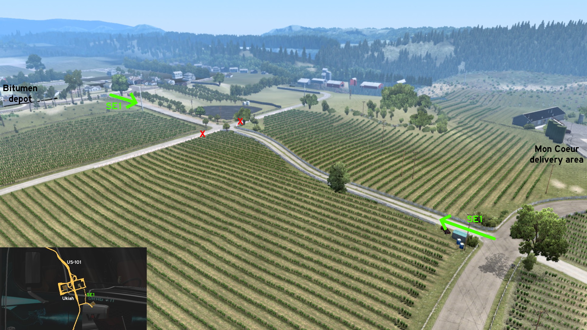 On Ukiah, you can go directly from downtown to the vineyards without taking the busy US-101. Just across a Bitumen depot, access the dirt road - the whole area belongs to Mon Coeur. You'll find a crossing halfway, but none of the sides can be accessed. Drive it until the end, turn left, and you arrive the vineyard delivery area.
7th DLC, 2020 November 12
Alamosa
West 1 - Off-Roading, Logging, Sinking, Building
Category: scenery, markableDiscovery: kwolf55
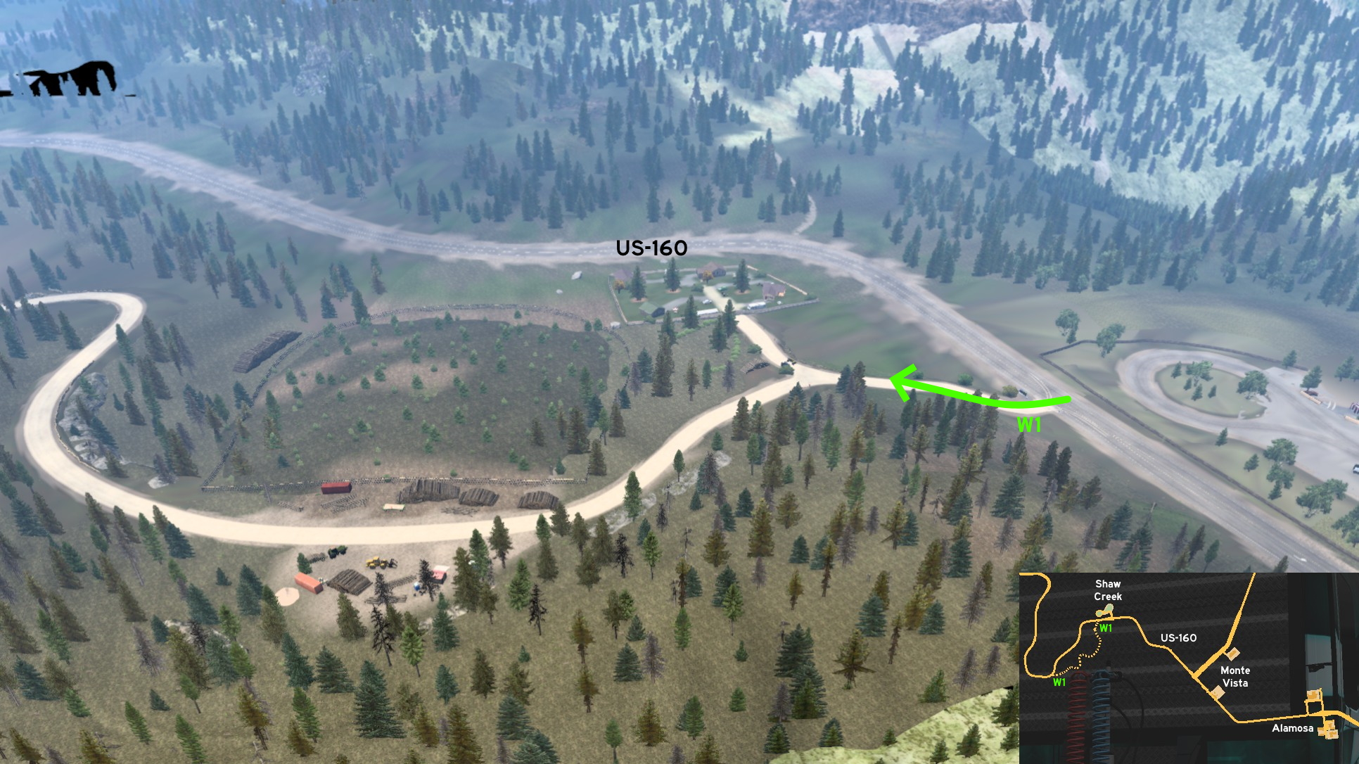 West of Alamosa and the unmarked town of Monte Vista, you'll find this dirt road some meters after of Shaw Creek rest stop. Both ends have signs warning you shouldn't be here. As soon as you enter, there's a road to a resort blocked by some ATVs. Going ahead, there's a logging area, but without jobs for you.
 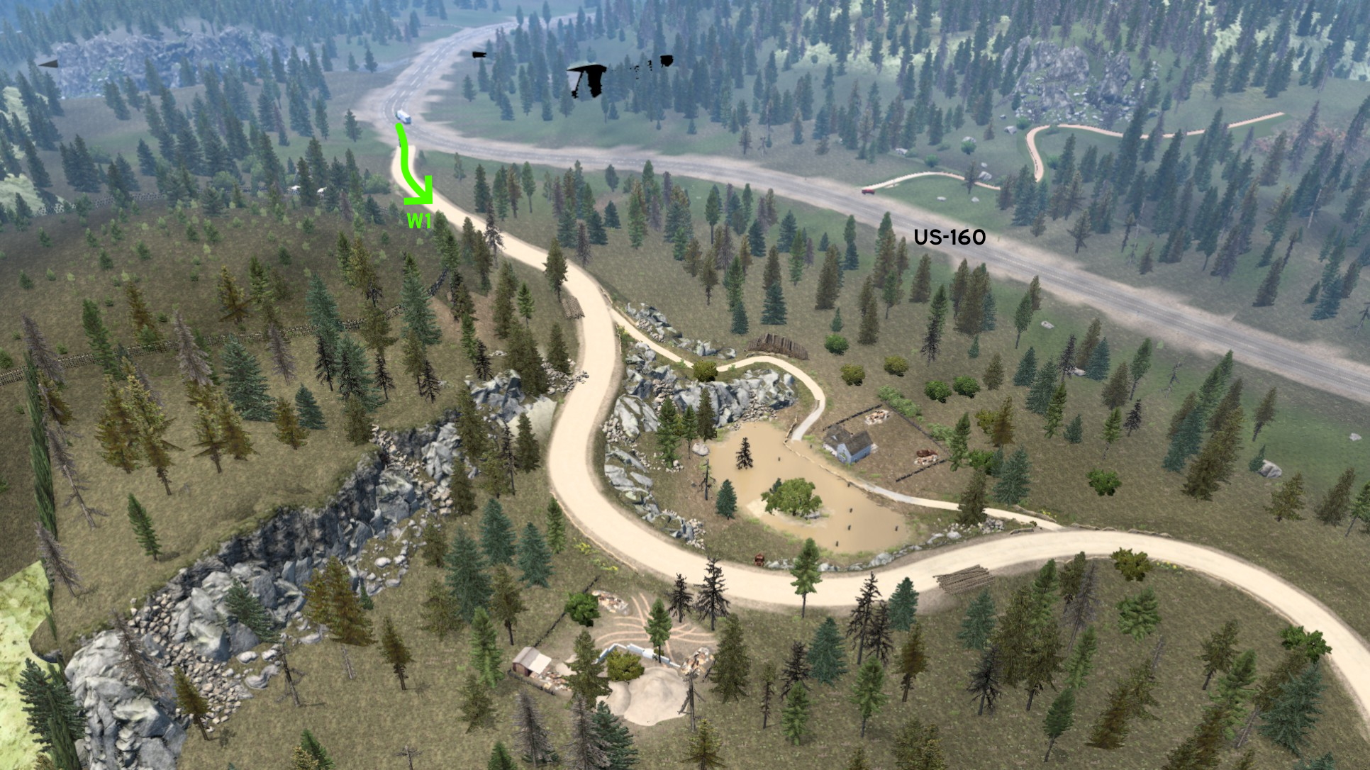 On the other end of the road, you'll see a creepy crumbling house that seems to be sinking on a pond. Don't try to reach it, as you may get stuck on the narrow path. Another house is being built on the opposite side of the crumbling house.
Colorado Springs
West 1 - Garden Of The Gods
Category: scenery, markableDiscovery: kwolf55
Update: TW, TheTexanHusky
Note: road became markable on version 1.47
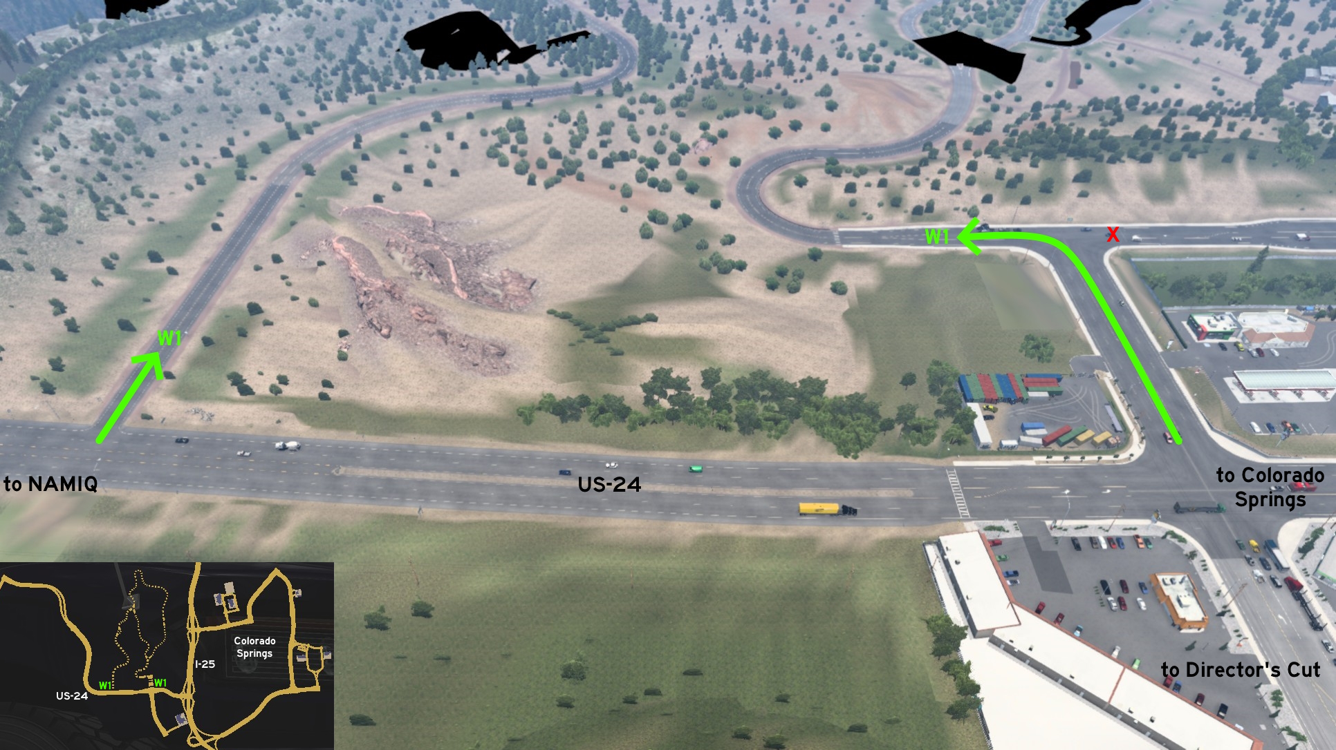 After watching Director's Cut near Wallbert, you can see the Garden of the Gods by yourself. Both entrances are near each other. After leaving Colorado Springs heading to NAMIQ, turn right after seeing a Pizza House, then turn left. Right road leading back to Colorado Springs is blocked.
 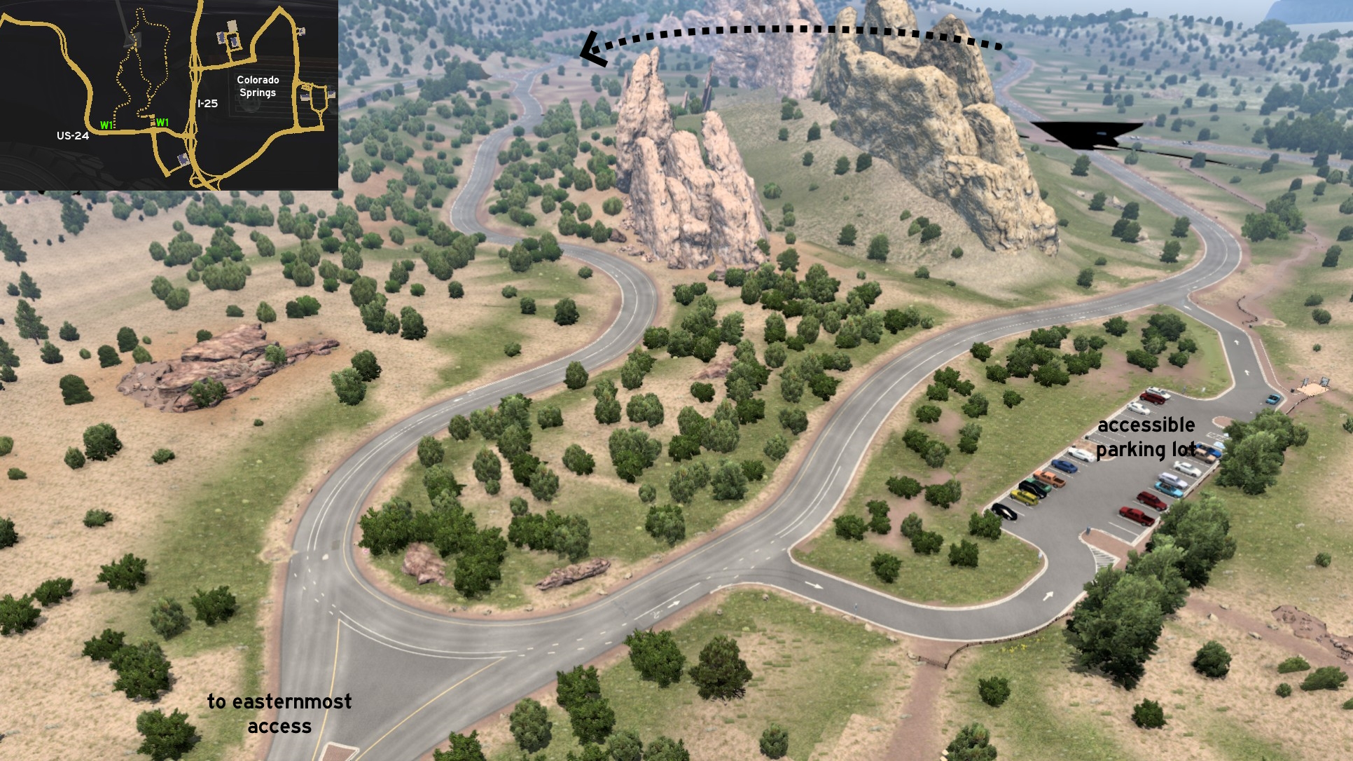 When you reach an intersection, keep right if you don't wanna get a ticket! You can continue ahead, or stop on a parking lot to take some pictures - it just doesn't count as a rest stop. Keep going until you reach a closed merging road. Don't try to hit the pedestrians here, they're protected by the Gods! There's another parking lot behind the rock formation, but this one is closed.
 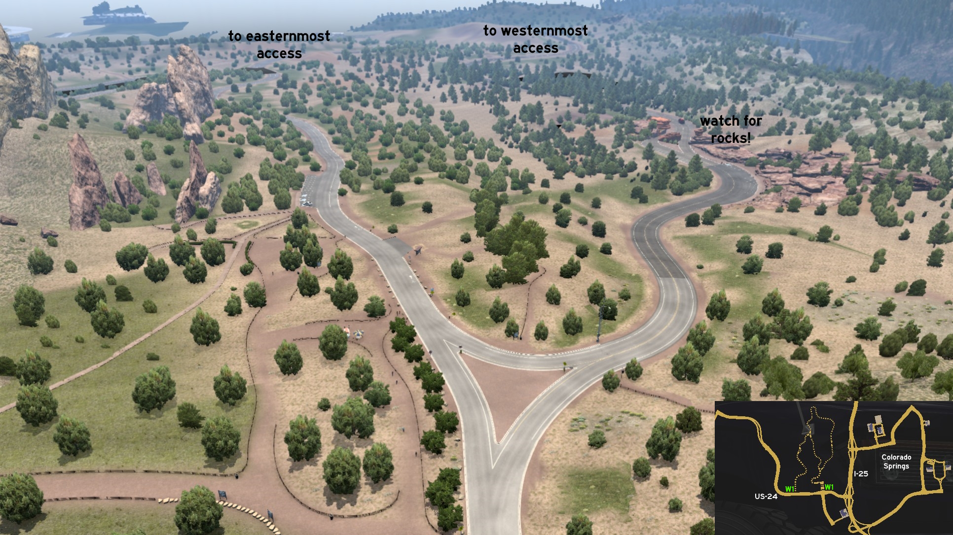 You'll find another intersection. You can keep left to easternmost entrance or have another walk around the rock formations, or you can head right to go to westernmost entrance. Drive slowly and carefully: the rock formations are very close to road here, making it narrower.
Denver 🏛️
Northeast 1 - Truck On Airstrip
Category: sceneryDiscovery: PaynZz ツ
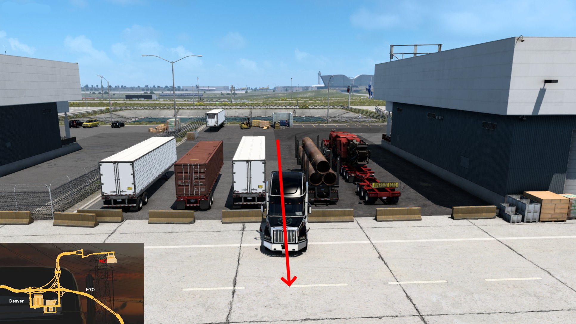 Next time you visit Denver Airport, you can go a little further. After entering the airport delivery area (not where the cargo plane is), turn right until you reach some parked trailers. Squeeze between the two most on center, and then drive slowly through the concrete barriers. You can go through all airstrip, just don't go too far or you may fall to the "void".
 Southwest 1 - Town Of Fairplay
Category: easter-eggDiscovery: FelipeVinhao
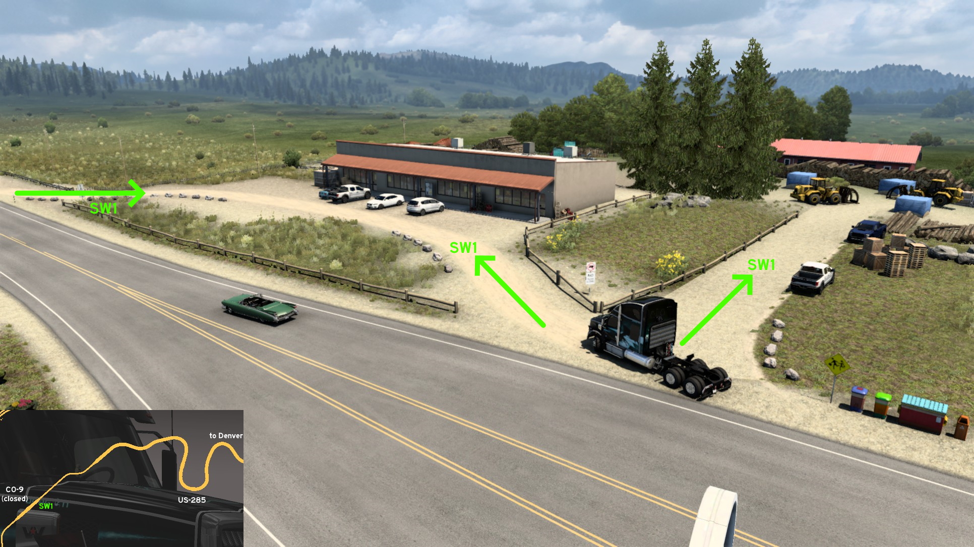 Southwest of Denver, on US-285, you'll find the town of Fairplay - you probably know it for the region name it's located instead. You can't access the town itself, but you can enter a heavy machinery depot and a local market. Before the crossing to the closed CO-9, you'll find some familiar looking trash bins. Both paths are fully open, just drive carefully when reaching the heavy machinery area.
 West 1 - Eisenhower-Johnson Memorial Tunnel Brake Test
Category: shortcut, markableDiscovery: FelipeVinhao
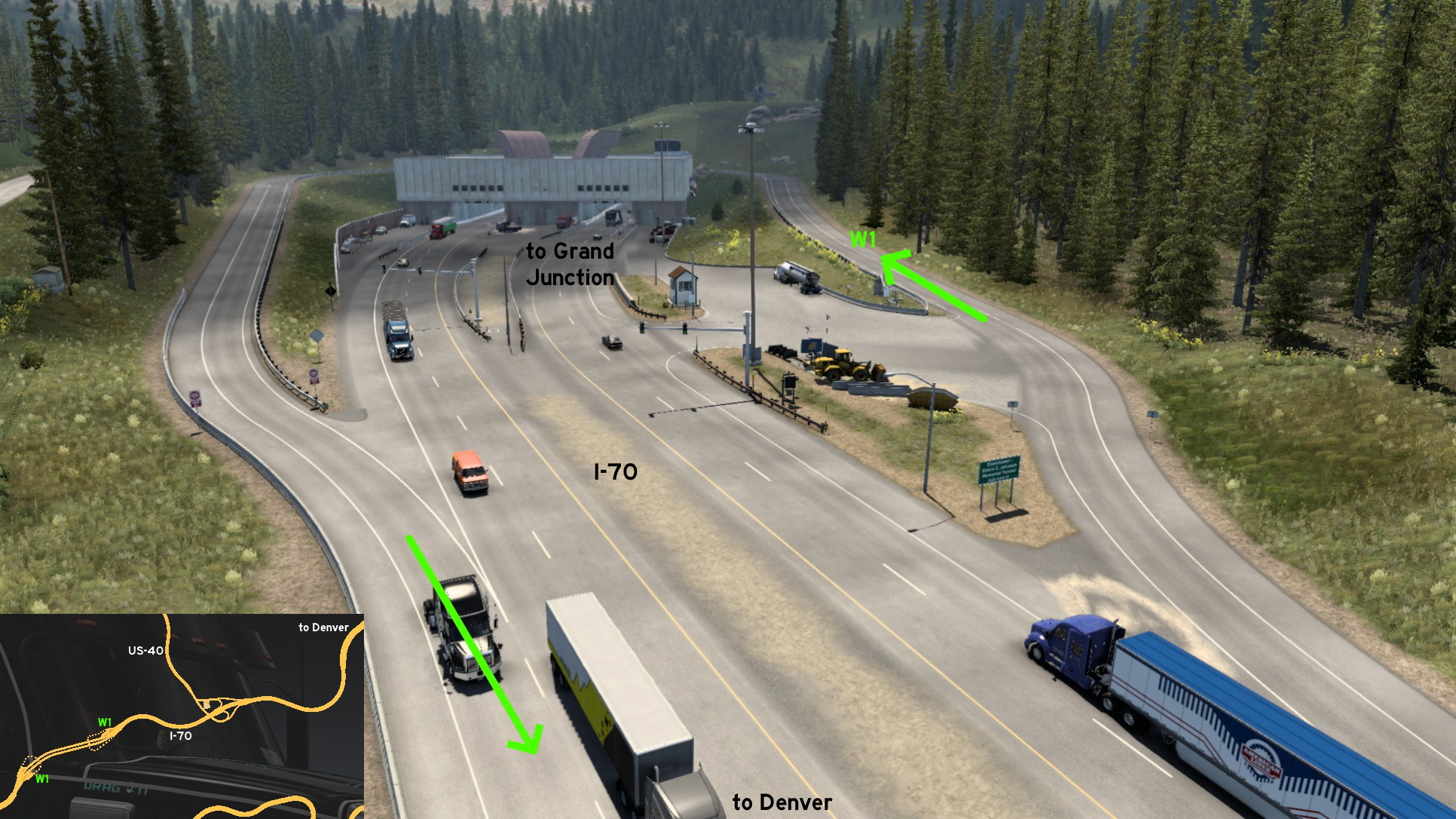 Both ends of Eisenhower-Johnson Memorial Tunnel have unmarked detour lanes, and both start on brake test areas - which are marked on map. On Denver end of tunnel, only the starting point has a brake test area. The ending points goes directly to freeway.
 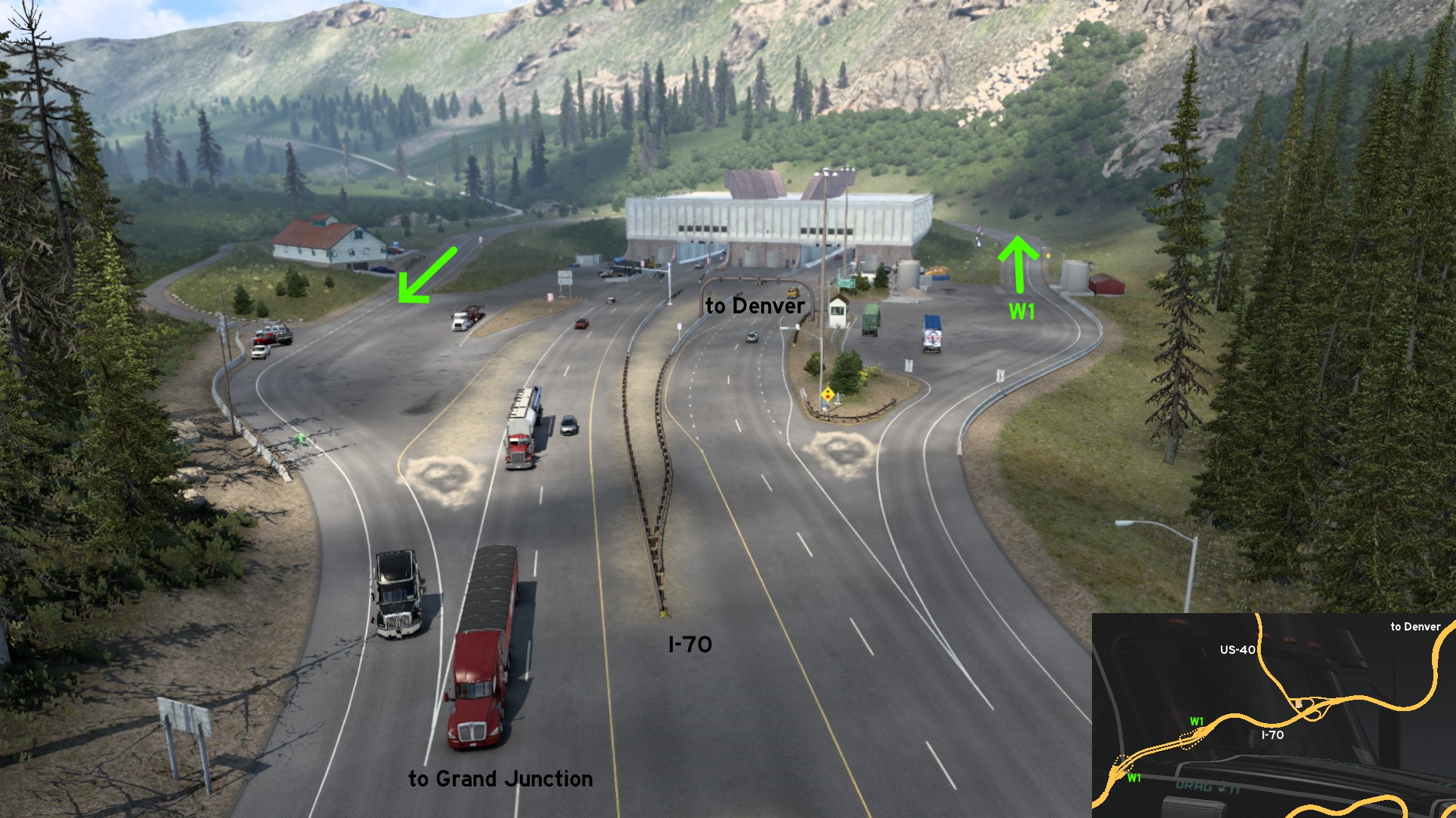 On Grand Junction end of tunnel, both starting and ending of detour lane have test areas, and on Grand Junction direction you'll find a Director's Cut. It's very useful if you wanna watch Director's Cut but are driving to Denver - the detour lane is marked as one way road, but as there's no traffic here, you can use it to return to Denver.
Durango
East 1 - Dusty Farm Road
Category: scenery, markableDiscovery: [ru64] el giraffe
Update: Makeleth, gg bb
Note: road became markable on version 1.49
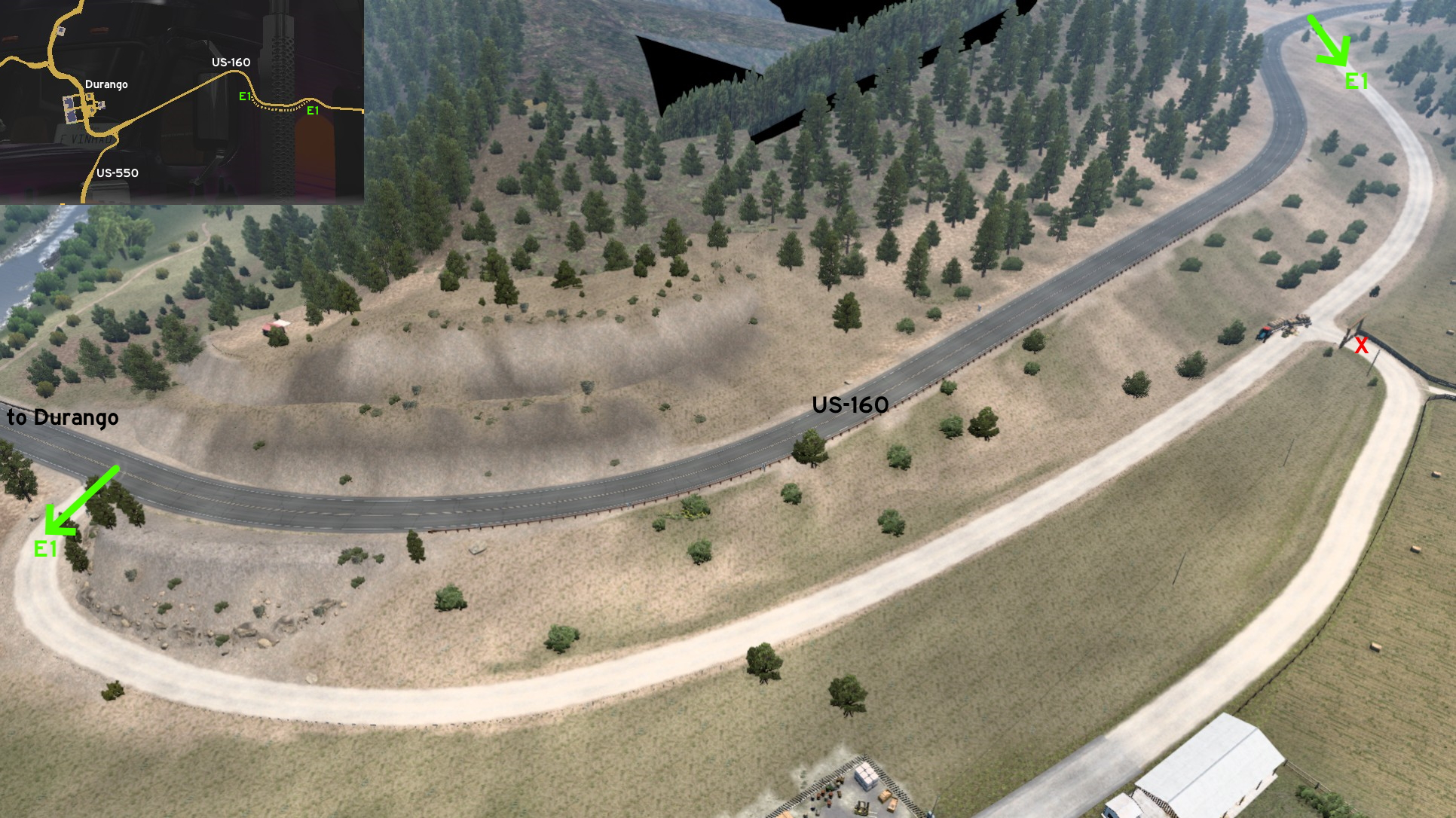 East of Durango on US-160, halfway to the intersection with US-84, there's a farm road with 2 entrances. The westernmost one has a friendly warning about not allowing trucks here. Drive carefully to other entrance: there's a tractor unloading hay bales near the farm closed entrance.
 East 2 - Along The Fields
Category: sceneryDiscovery: Applecorn
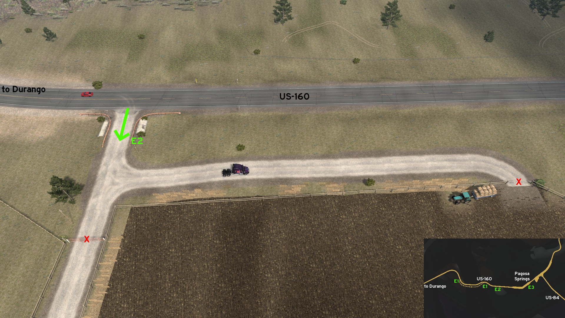 East of Durango on US-160, halfway to the intersection with US-84, there's a smaller path, between 2 gates, bordering a small field. Nothing has been planted yet though.
 East 3 - Springs View
Category: sceneryDiscovery: Applecorn
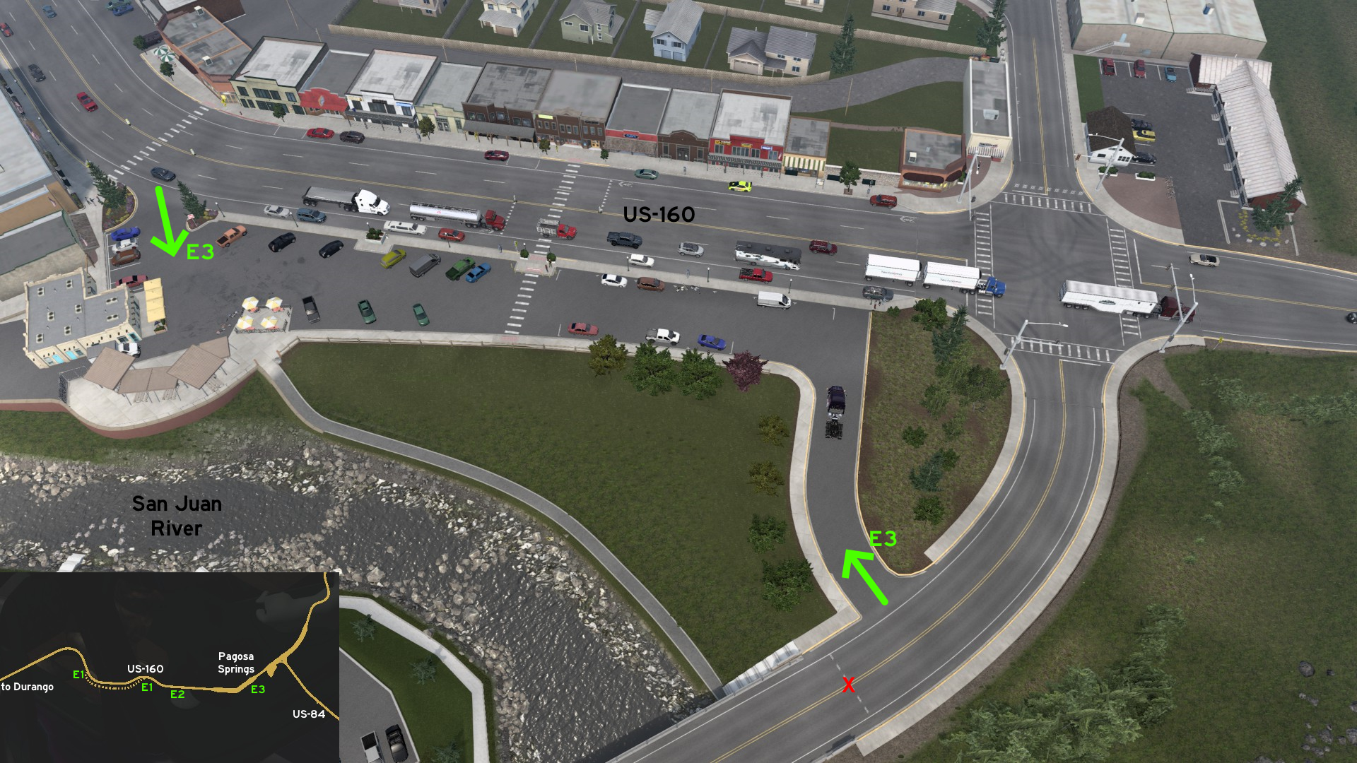 East of Durango on US-160, on the unmarked town of Pagosa Springs, there's a parking lot at the corner of the main road and the road leading to the actual springs. You can stop there to see it across San Juan River. You can't rest here, but you can do it on the nearby corner of US-84.
 North 1 - Red Mountain Environment Restoration
Category: scenery, markableDiscovery: FelipeVinhao
Note: this road was visible on map before version 1.44
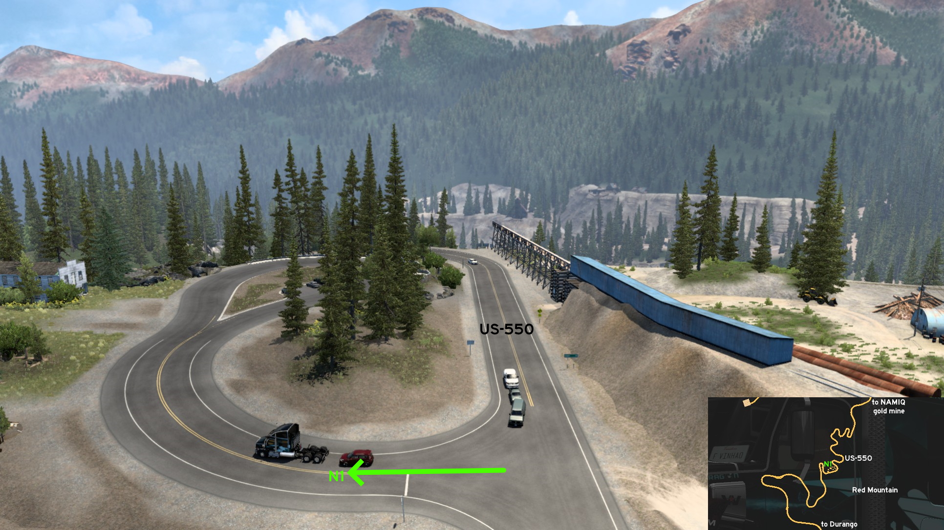 North of Durango on US-550, some miles before NAMIQ gold mine, you'll find the remains of a mine on Red Mountain. Across the road, there's an open road that lead to some old houses and a nice view of the mountain. You can find real life information about the place on signs all over the area.
 Southwest 1 - Ute Mountain Visitor Center
Category: scenery, markableDiscovery: ernst-ulrich.reichelt
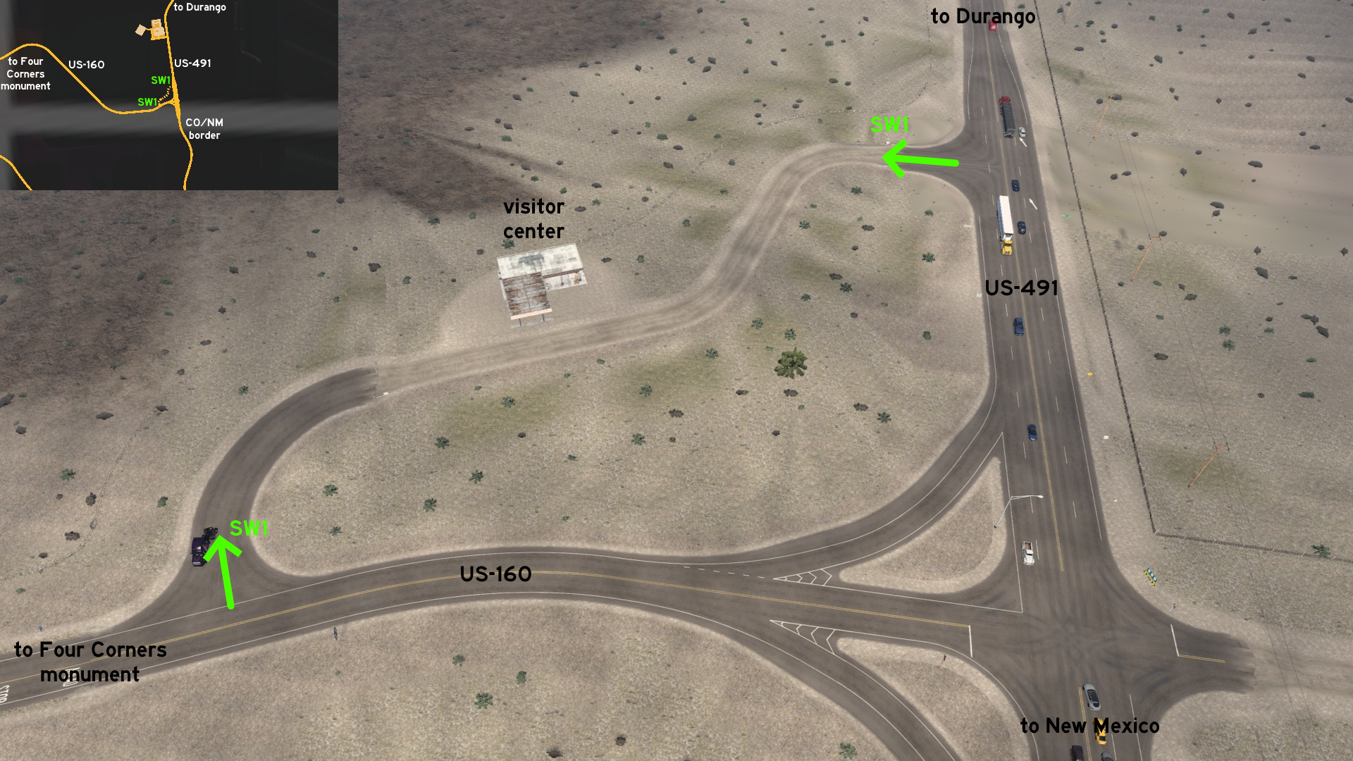 Leaving southwest Durango, near the New Mexico border and some miles from the Four Corners monument, there's a small building that looks like an abandoned fuel station, but it's the visitor center for Ute Mountain.
Grand Junction
South 1 - Drive Thru... Literally
Category: sceneryDiscovery: kwolf55
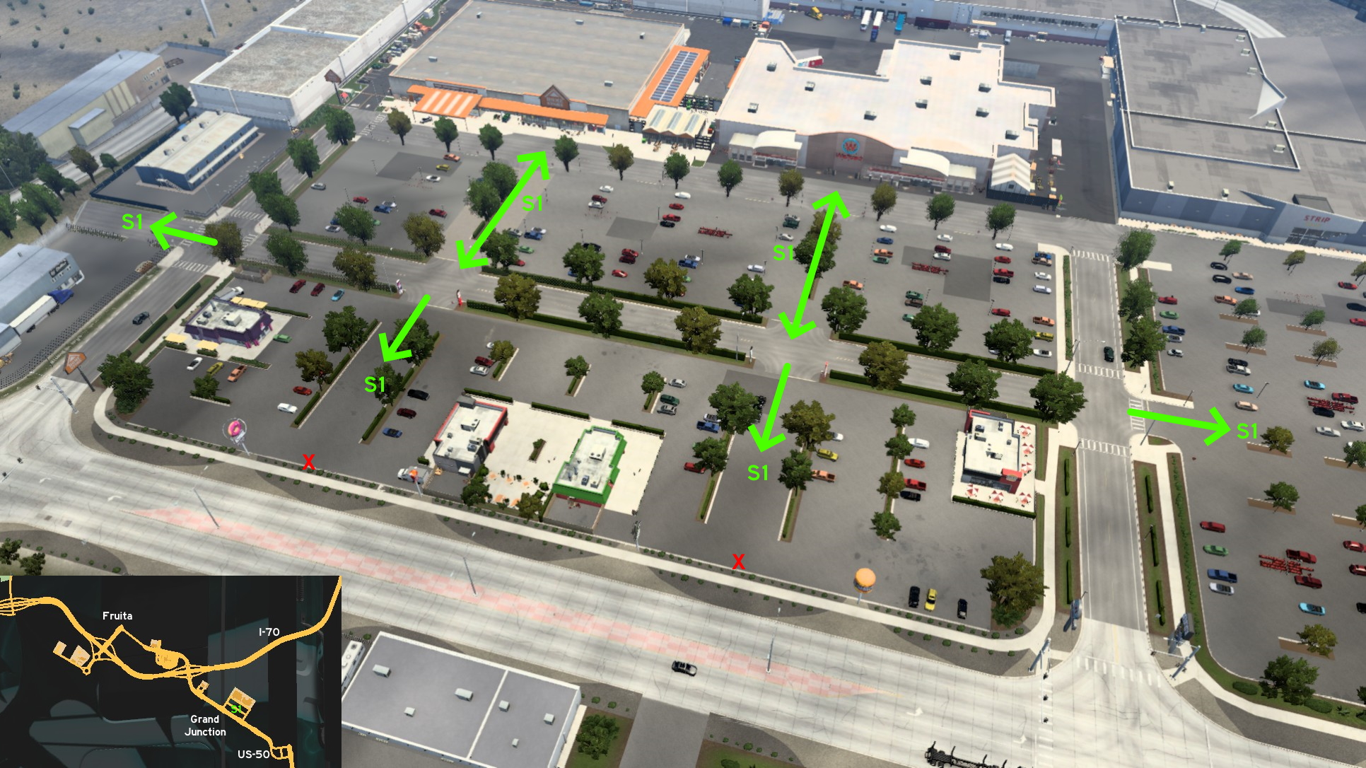 If you're looking for a place to rest... well, maybe this isn't the place. But on the block you find Home Depot and Wallbert you'll find a giant parking lot with several fast food chains, that can be used as detour lanes in case you missed the correct entrance. You just can't return directly to main street from them.
 South 3 - Dead End Street
Category: sceneryDiscovery: kwolf55
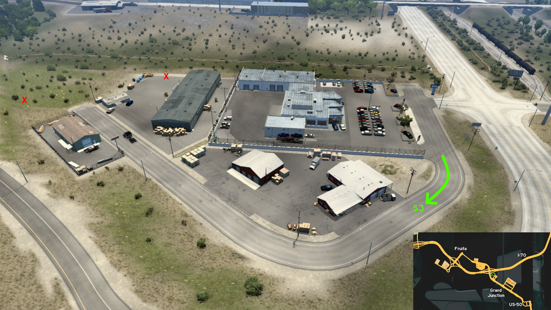 Right after the secondary entrance of Drake car dealer, there's a small dead end road that leads to some warehouses. Just don't try to use it as a shortcut to I-70: it's blocked by steep ramps and an invisible wall.
Montrose
East 1 - Dirt Roads And Crumbling Mines
Category: scenery, markableDiscovery: knightshift
Update: OWLCAT
Note: road became markable on version 1.47
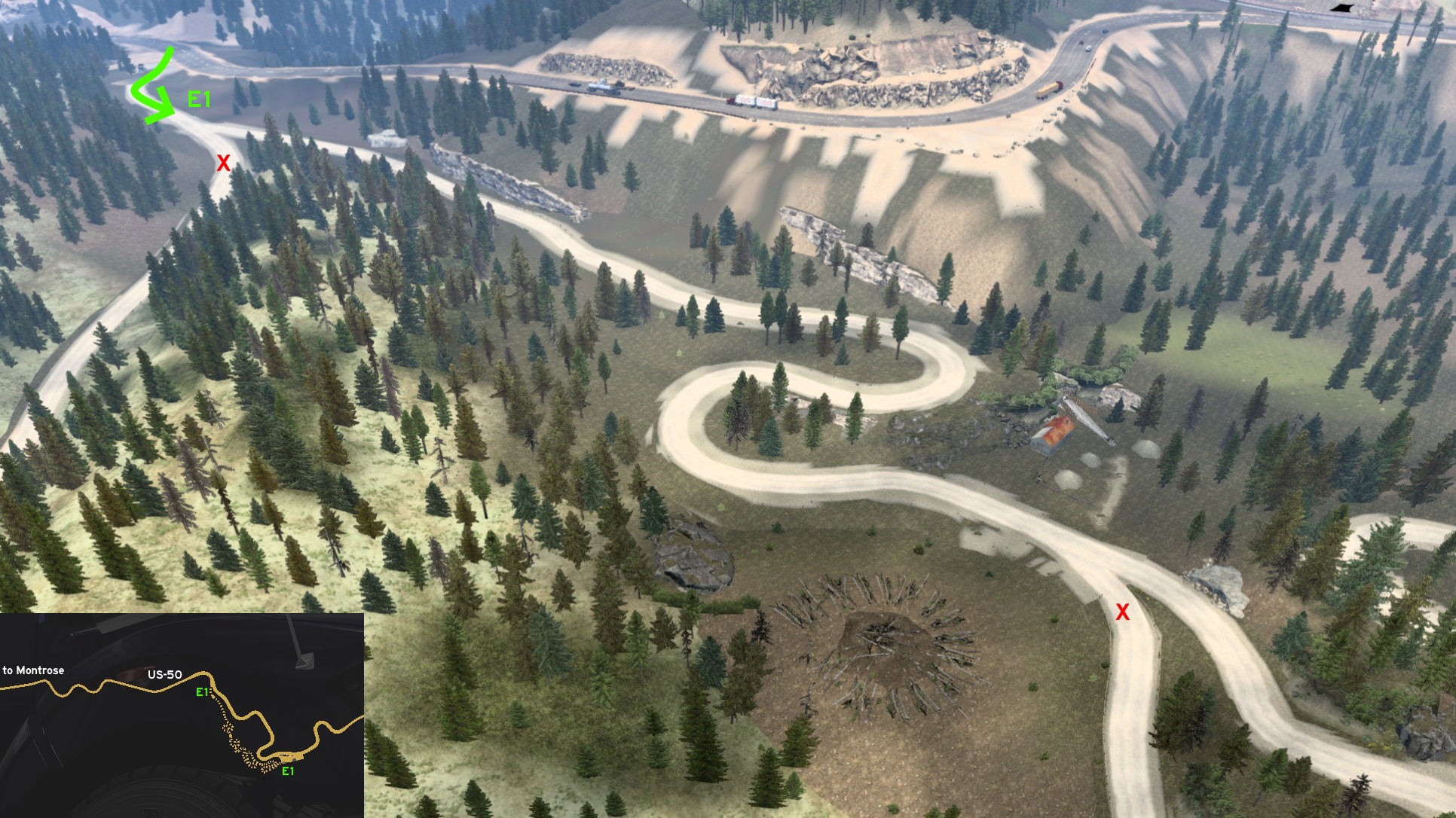 East of Montrose, there's a dirt road that runs along US-50 which connects to abandoned mines. It's easy to spot when coming from Montrose, as it starts on a rest stop (for cars only). It's almost impossible to get lost, as all crossings on right are blocked, so you must keep left. One is near one of the crumbling mines. The other is near a strange circle of cut trees.
 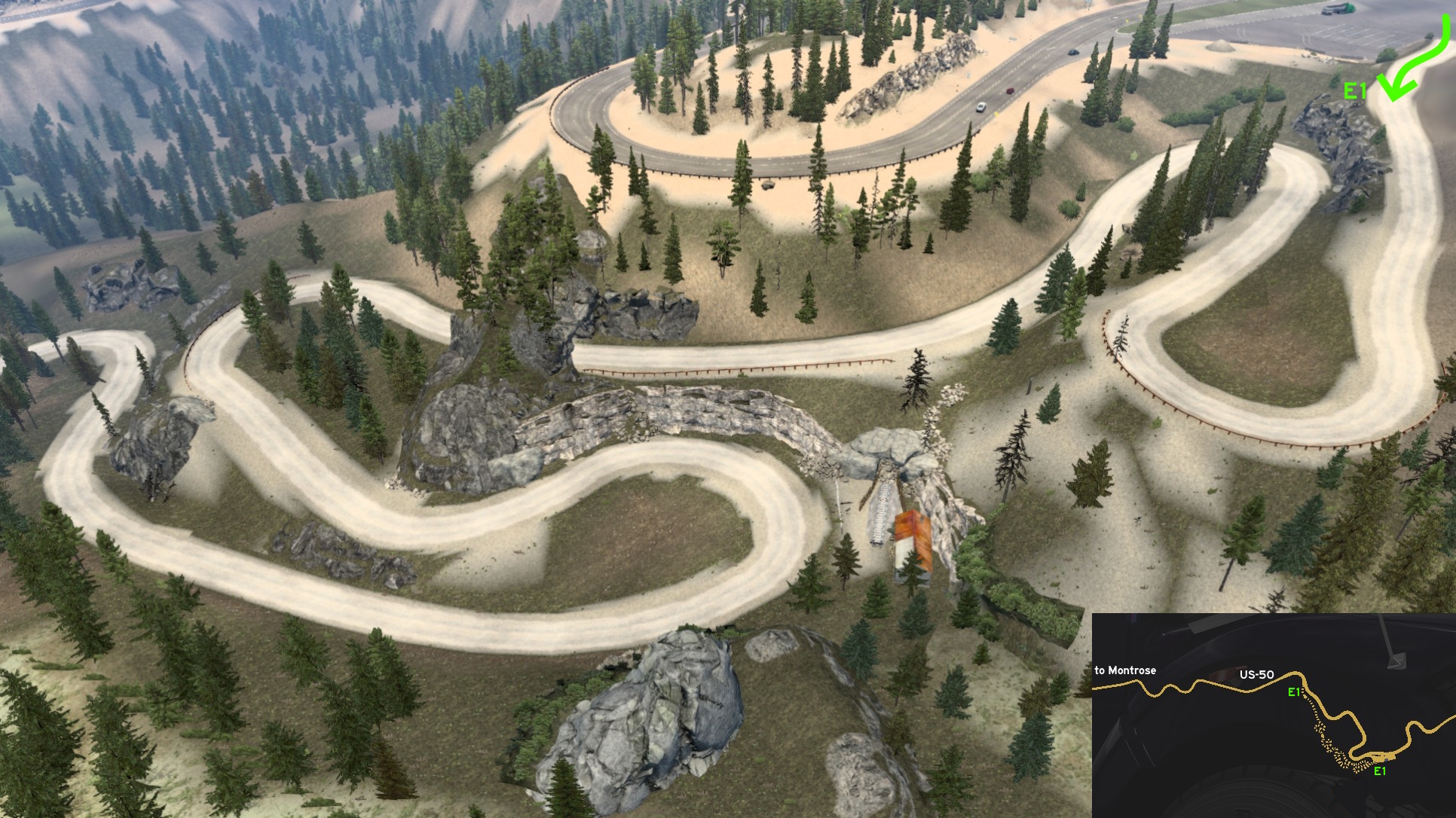 The other end is a little hard to notice, due to the size of Monarch Pass rest stop: it's found southwest of the area. From here you'll find a really crooked route and another crumbling mine.
 South 1 - Gold Mine Employee Area
Category: sceneryDiscovery: FelipeVinhao
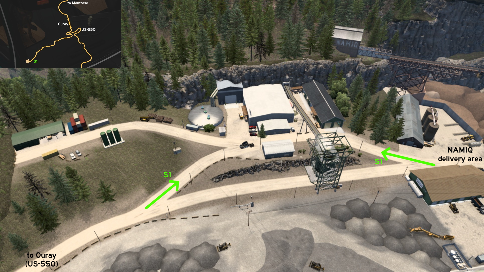 On NAMIQ gold mine south of Montrose (more specifically on Ouray), there are some roads that seems to connect warehouses and employee areas. Both entrances are fully open. You actually must be careful to not enter here by accident, as it's only hidden on map, but it's actually pretty visible. You may have some problems if pulling a trailer in this case.
 West 1 - From Work To Home
Category: shortcutDiscovery: kwolf55
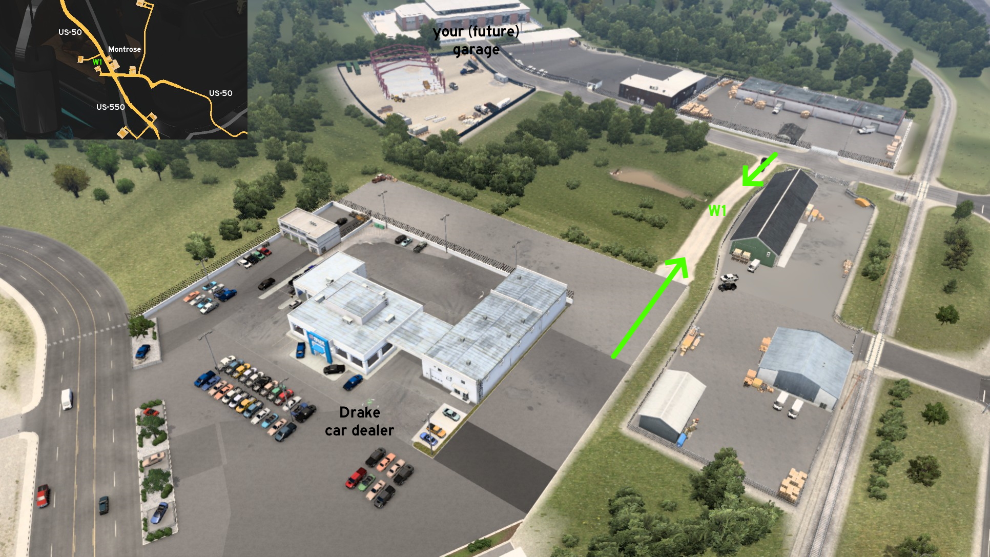 If you wanna go to your (future) garage after a delivery to Drake car dealer but don't wanna face the busy US-50, just drive around the delivery area until you find a short dirt road. Drive it until the end then turn left. Now just take some rest before your next job.
Pueblo
North 1 - Hardware Store On Dead End Road
Category: sceneryDiscovery: DDogg
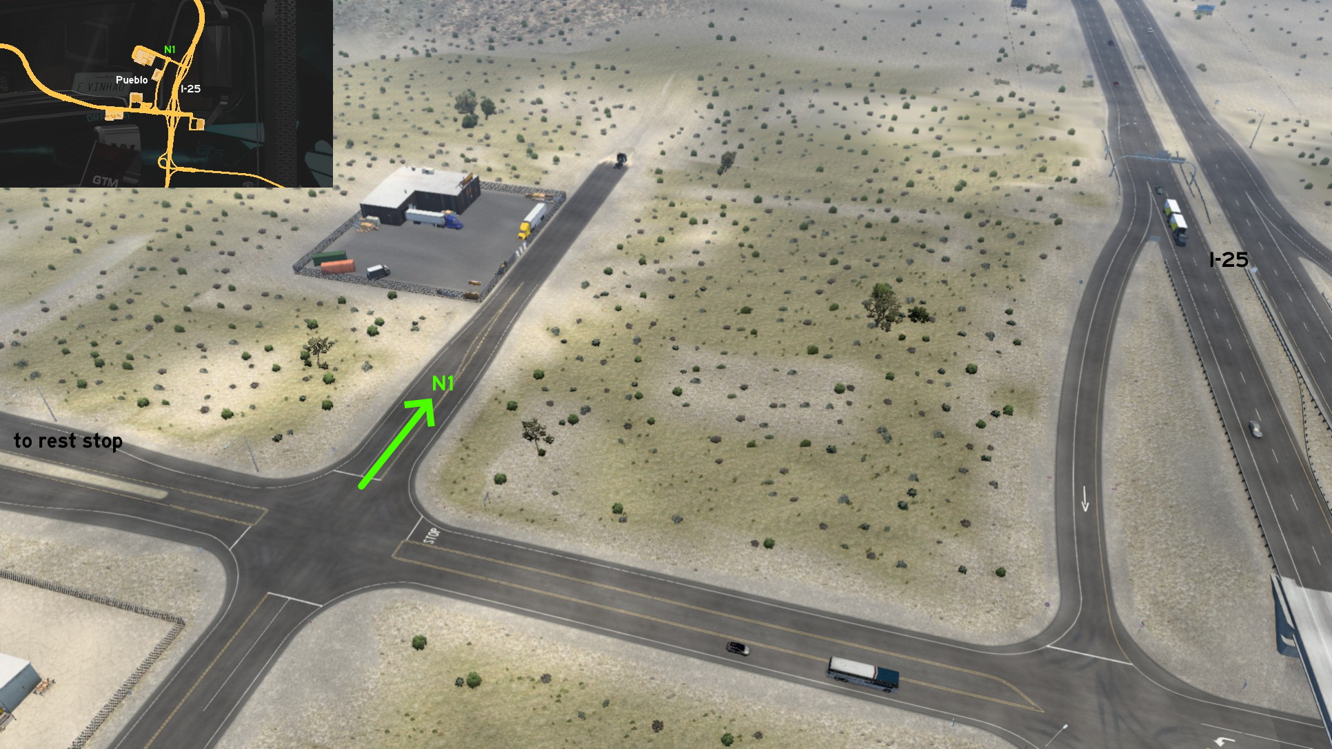 On north Pueblo, on the crossing the connects I-25 to a busy truck stop, there's an accessible dead end road leading to a hardware store. It's a calm road perfect for some rest, but you still need to face the busy truck stop if you wanna do so.
 South 1 - Industrial Complex
Category: shortcut, markableDescription: industrial complex
Discovery: kwolf55
Update: RIP_C.Bennington#LP_Forever
Note: only the actual shortcut became markable on version 1.47
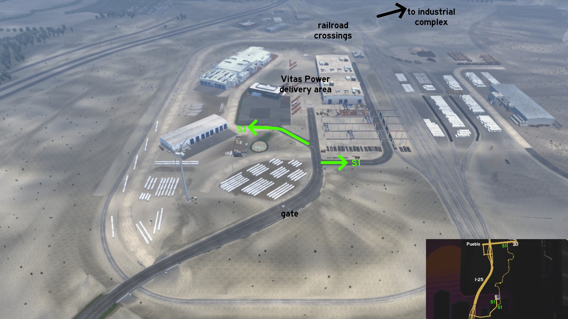 Two of three entrances to industrial complex can be found on Vitas Power depot. Just a little after the gates, you can either turn right where you'll find some wind tower pieces, or turn left to a parking lot and then a dirt road. Both will lead you to a road all around Vitas complex. You can drive on rails if you're feeling adventurous. To continue to the rest of industrial complex, just head north and cross the rails carefully, as there's no light or sound warning here.
 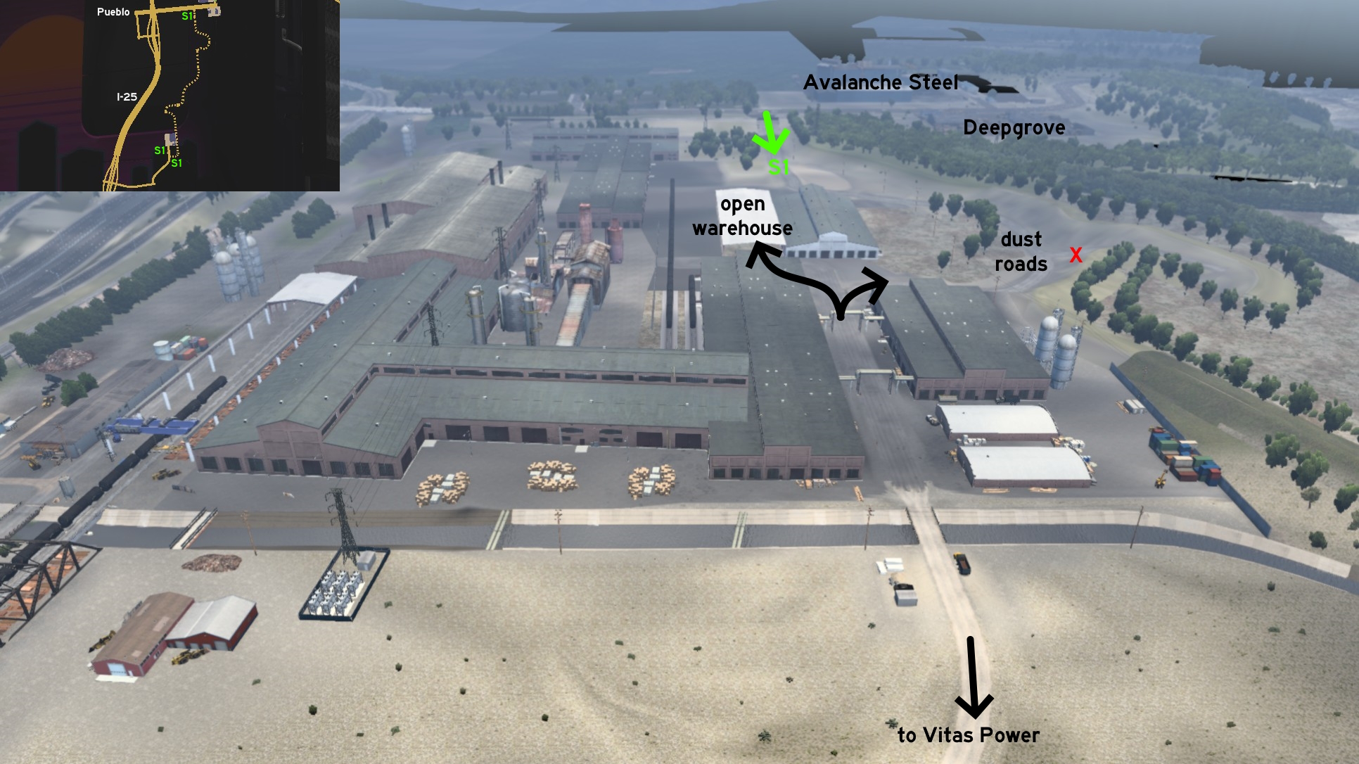 The last entrance is on Northern Avenue, where there are an Avalanche recycling center and a Deepgrove sawmill. Cross the inactive railroad, and you're in. You can drive through a warehouse or the dust roads to continue. Just cross the small bridge if you wanna go back to Vitas Power complex.
Rangely
Northeast 1 - Dust Way On The Desert
Category: sceneryDiscovery: aarondinius
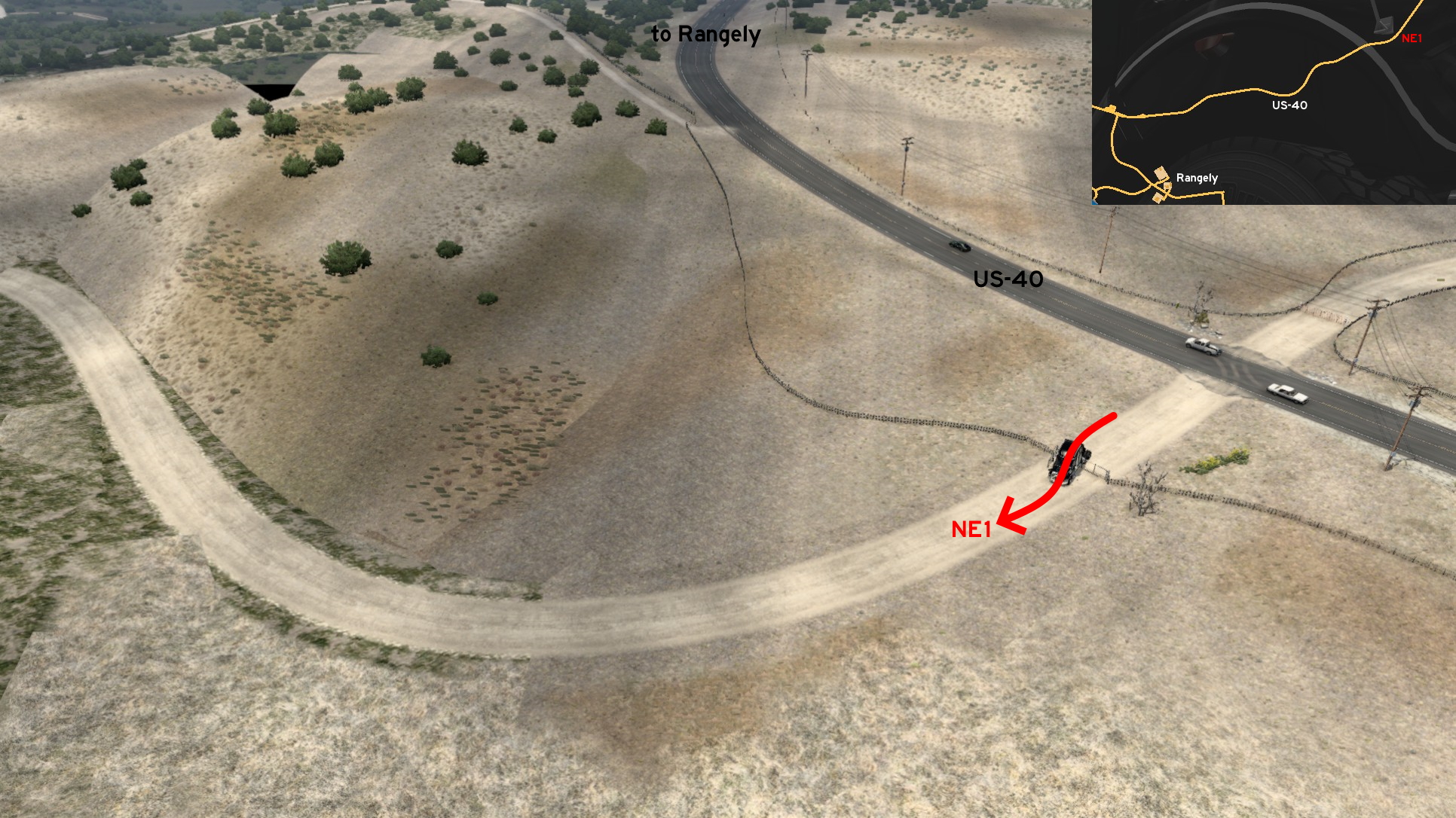 Leaving northeast Rangely through US-40, almost halfway to Steamboat Spring, there's a small dirt road barely blocked by a gate. The gate is stuck and can't be opened, so you must place your truck as parallel to the open side in order to enter and not have it damaged. Now you can admire some desert environment. Don't forget to bring some water!
Raton (New Mexico)
See also Raton on New Mexico
Discovery: kaia15
Update: FelipeVinhao
Note 1: Raton is in New Mexico, not Colorado, but we're using it as the closest reference city; the closest Colorado reference city is Pueblo
Note 2: a gap on west was fixed before Wyoming release (version 1.41)
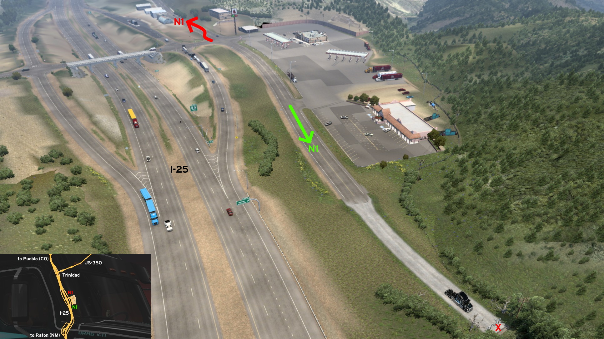 On I-25, just a little north of Raton and a little south of the unmarked town of Trinidad, there is a rest stop. If you head south of the crossing, you'll find a short dirt road. You can have a nice view of the freeway. If you head north, you must drive around the UI roadblock and knock down the stop sign. You can go very close to Trinidad main street (US-350), but road's fully blocked here, so you must return from where you came from.
North 1 - Two For The Price Of One On Trinidad
Category: sceneryDiscovery: kaia15
Update: FelipeVinhao
Note 1: Raton is in New Mexico, not Colorado, but we're using it as the closest reference city; the closest Colorado reference city is Pueblo
Note 2: a gap on west was fixed before Wyoming release (version 1.41)
On I-25, just a little north of Raton and a little south of the unmarked town of Trinidad, there is a rest stop. If you head south of the crossing, you'll find a short dirt road. You can have a nice view of the freeway. If you head north, you must drive around the UI roadblock and knock down the stop sign. You can go very close to Trinidad main street (US-350), but road's fully blocked here, so you must return from where you came from.
Steamboat Springs
Southeast 1 - Resort On US-40
Category: sceneryDiscovery: FelipeVinhao
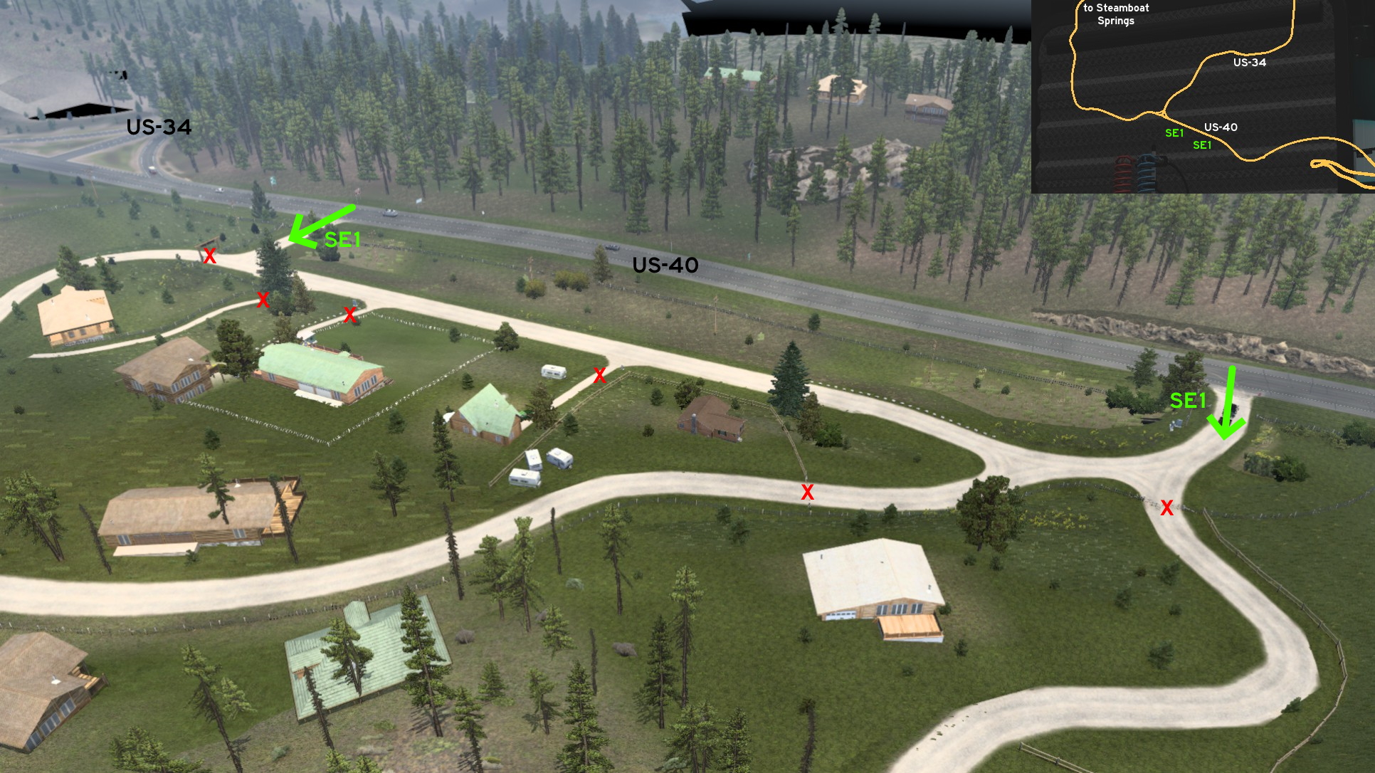 Southeast of Steamboat Springs, near the crossing between US-40 and US-34, you'll find a resort. There are two entrances, and one of them is near the crossing. Side roads are protected by gates. The narrow paths to each house seem to be open, but they're protected by an invisible wall too.
Sterling
Central 1 - From Work To Home
Category: shortcut, markableDiscovery: kwolf55
Update: FelipeVinhao
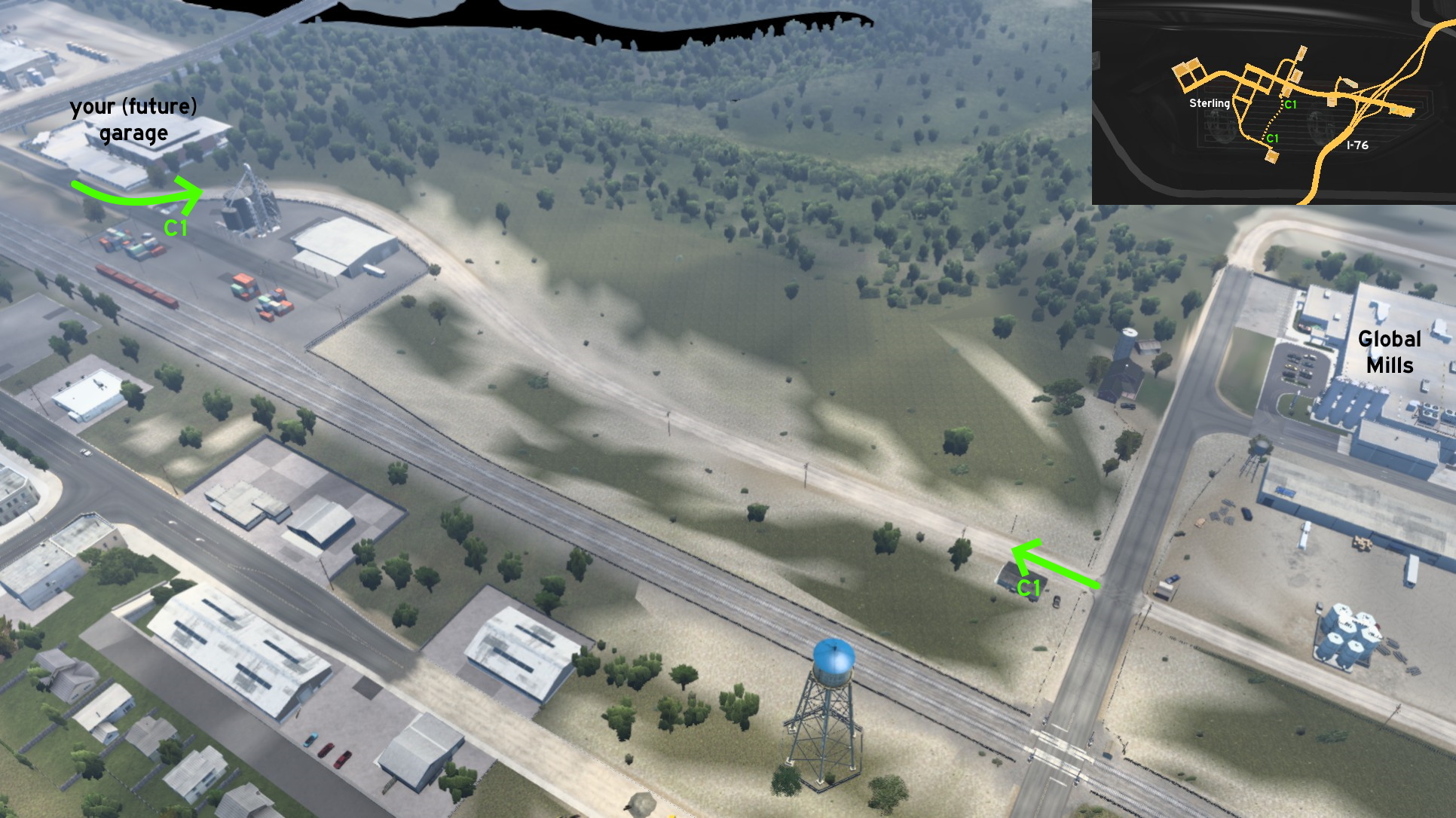 On Sterling, there's a dirt road running parallel to railroad, linking Global Mills and your (future) garage on city, avoiding the long drive through the viaduct, and also the possible long wait caused by the railroad crossing. Just drive it until the end, and after a silo you'll reach the garage. Have a nice rest - you earned it!
6th DLC, 2020 July 16
Boise 🏛️
South 1 - Mountain Home Airport
Category: sceneryDiscovery: FelipeVinhao
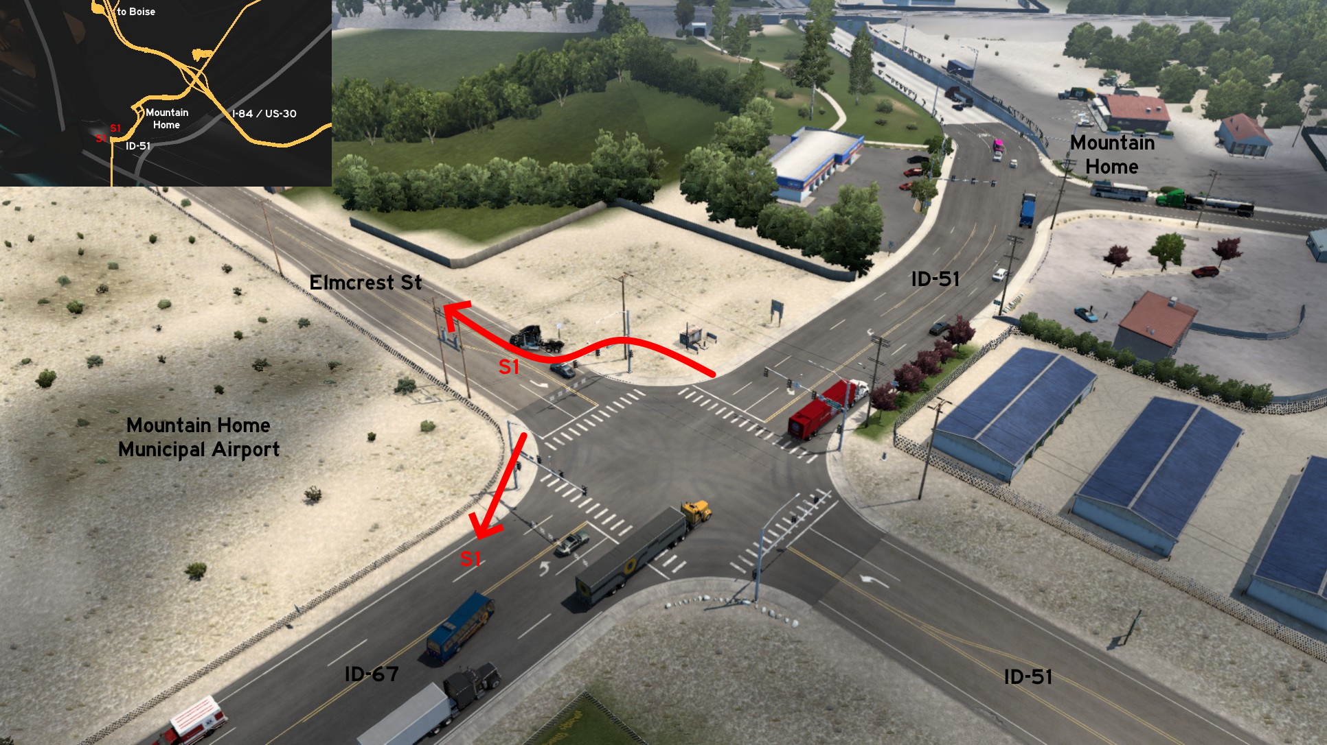 The unmarked town of Mountain Home is just south of Boise. Coming from I-84, you can see the airport as soon as you leave the town, on the crossing with ID-51. You can access two different roads: the safe one is driving between the utility pole and the speed limit sign to reach Elmcrest Street; the one will damage your truck is squeezing between the airport fence and the traffic light to reach ID-67. On both cases, you can't access the airport area itself.
 South 2 - Sleeping With The Ducks
Category: sceneryVideo (link): TGM
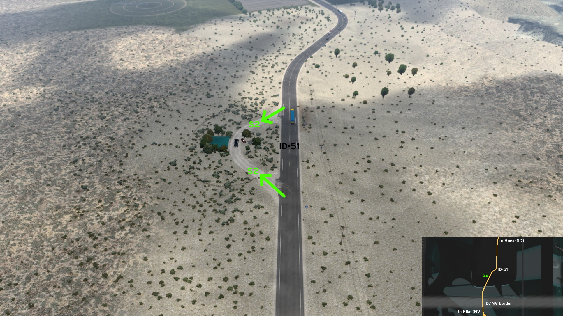 On Duck Valley, on ID-51, near Nevada border, there's a resort. You can't rest here, but it doesn't mean you can't just stop by and take some pictures. The place can be easily accessed from both directions.
Grangeville
Northeast 1 - Wood Chopping
Category: scenery, markableDiscovery: residenTR
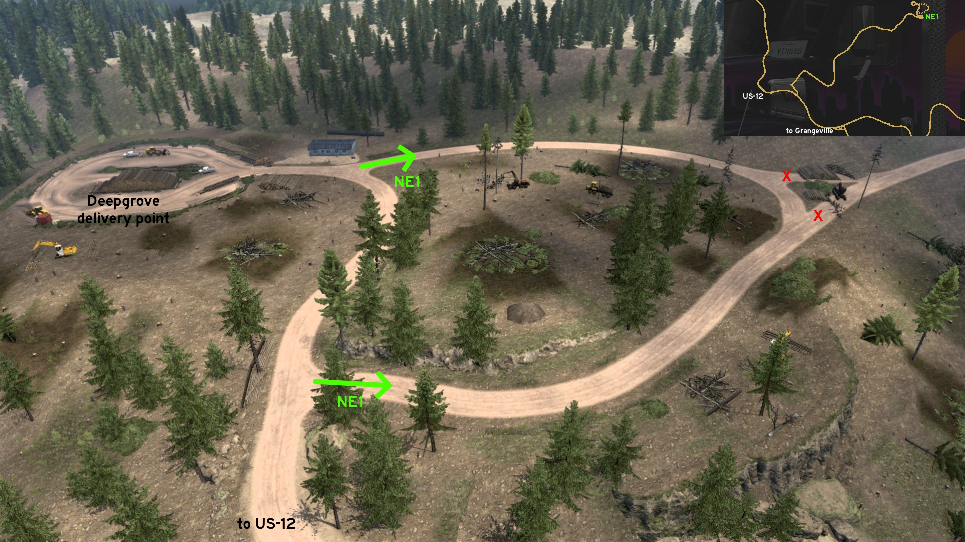 Some meters before Deepgrove logging area, there's a loop through the woods. A road starting in the middle of this loop is blocked by some wood cutting machinery.
Idaho Falls
Northwest 1 - Easy Maneuvering
Category: shortcutDiscovery: kaia15
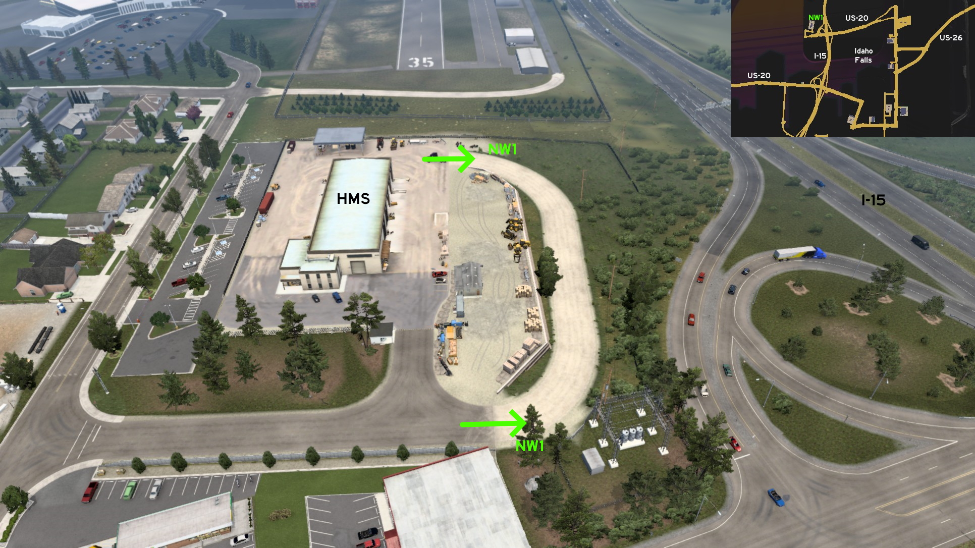 Close to the HMS depot northwest of Idaho Falls, there's a dusty path between the company and the ramp to I-15, connecting the end of the official route directly to the delivery area. It's a wider curve, perfect for maneuvering the huge vehicles in and out easier. Just don't get used to it, as not all similar depots have this feature.
Ketchum
Northeast 1 - Construction Loops
Category: scenery, markableDiscovery: Maxis2012
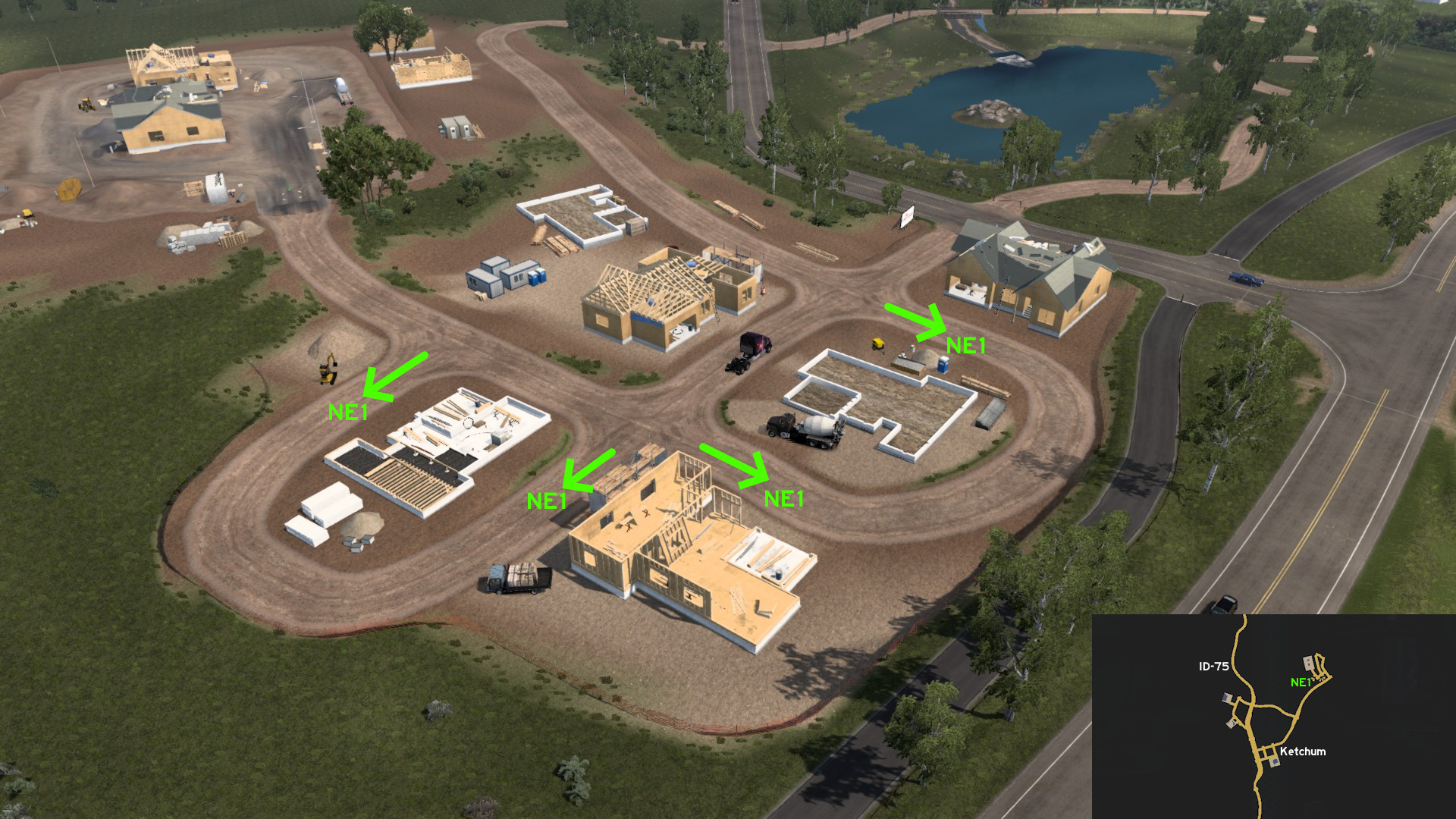 Head to Plaster & Sons construction site northeast Ketchum. You can drive around some of the houses under construction before reaching the delivery area.
 Southeast 1 - Craters Of The Moon On Earth
Category: scenery, markableDiscovery: FelipeVinhao
Video (link): TGM
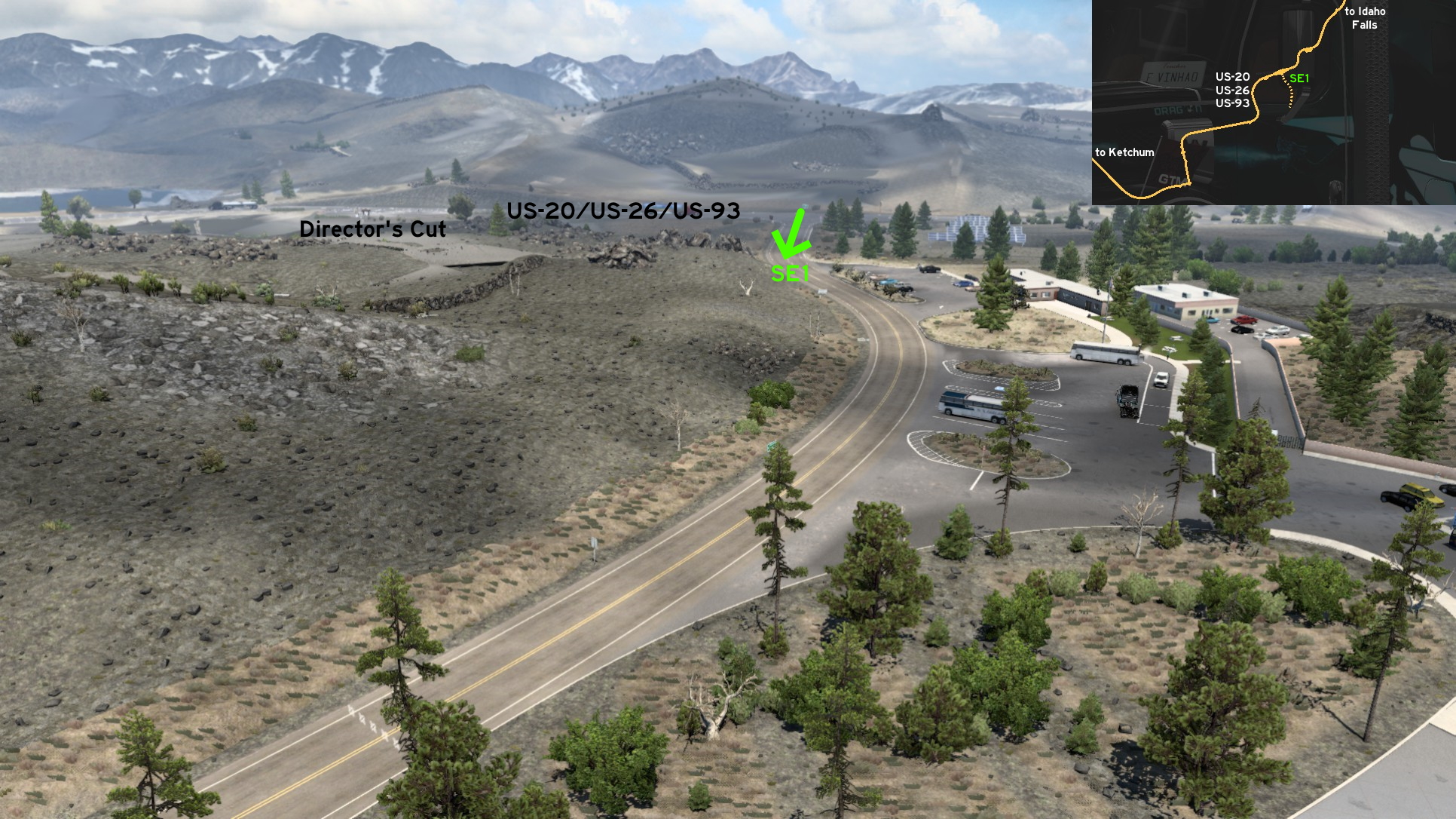 Leave south Ketchum through ID-75 and turn east on US-20. Just some meters after the respective viewpoint for the Craters of the Moon, you can see them for yourself. Just turn next right after the stop, and choose the best spot to see them on one of the parking lots.
Lewiston
North 1 - House On Spiral Highway
Category: shortcut, markableDiscovery: thechief
Video (link): TGM
Update: FelipeVinhao
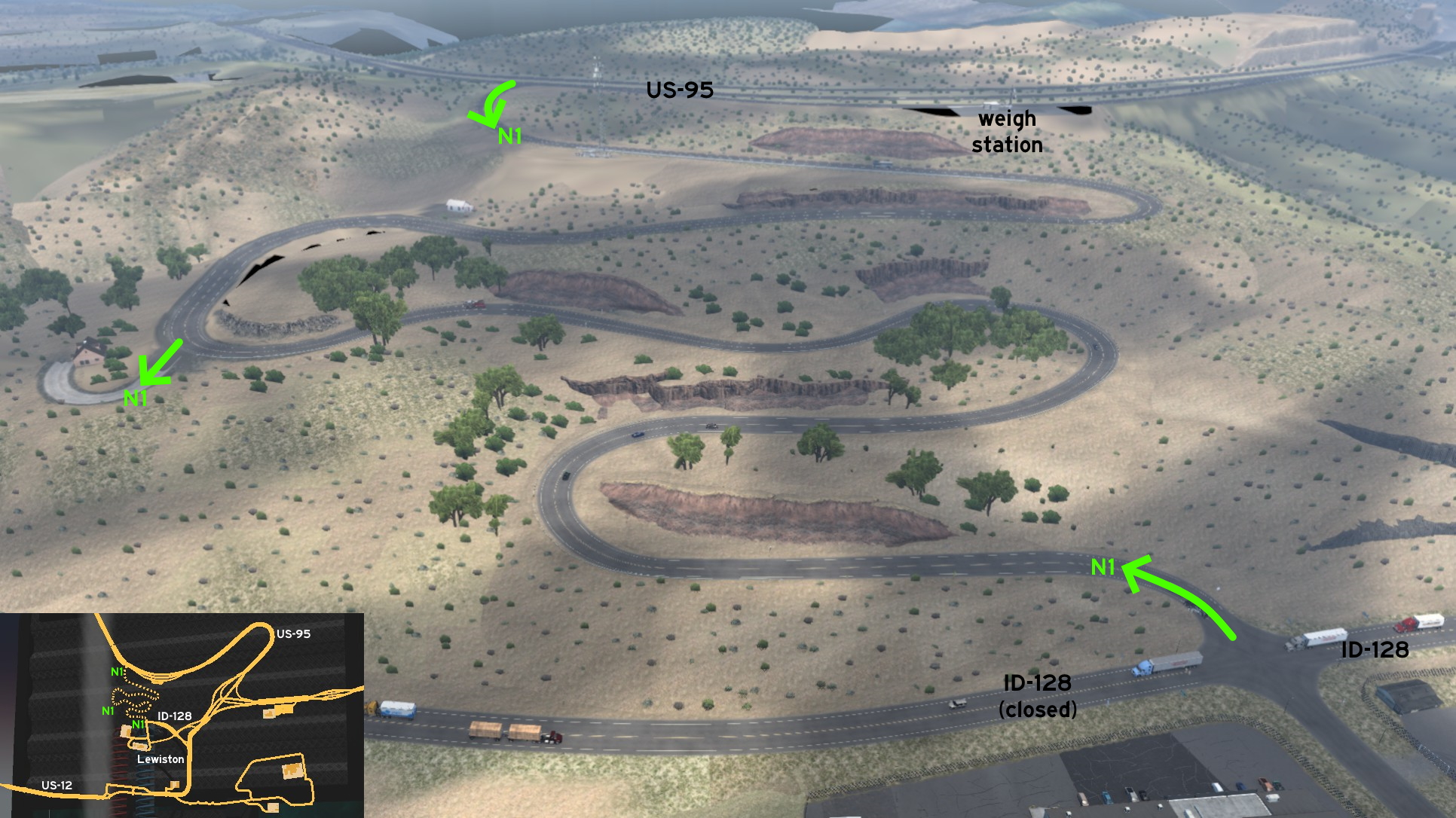 On US-95, some miles before reaching Lewiston from Coeur d'Alene, and some meters before a weigh station, begins Spiral Highway. The routes isn't much shorter than going ahead on US-95, but it can be used to avoid having your weight checked. You can also hide yourself on an abandoned house nearby.
Pocatello
Central 1 - Car's Life Cycle
Category: sceneryDiscovery: FelipeVinhao
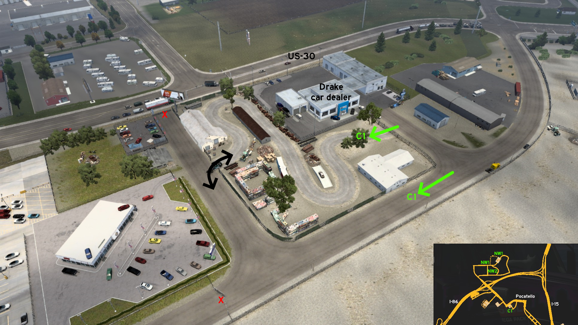 On Pocatello, you'll have the opportunity to see a car's life cycle. That is, you'll find a scrapyard between two car dealers. You may find the entrance by accident (no pun intended) if you arrive here for a job on Drake, as the scrapyard gate will open automatically when you're close. Its other entrance is near another car dealer, this one without jobs for you.
 Northwest 1 - Potato Production
Category: easter-egg, markableVideo (link): TGM
Update: Crieris
Note: road became markable on version 1.51
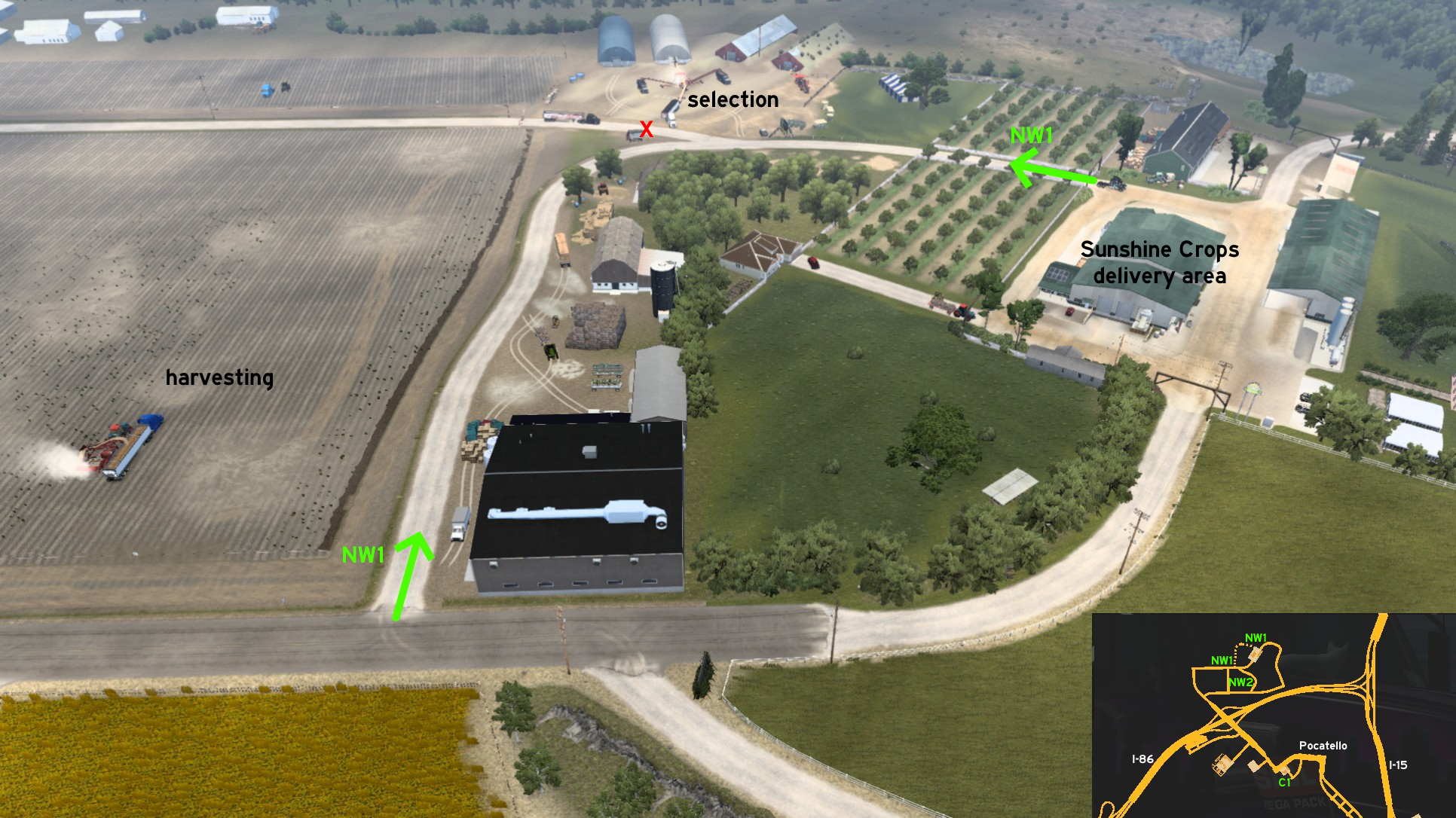 If you wanna see how potatoes are produced, just make a quick stop before reaching Sunshine Crops on Pocatello. Instead of going forward to main entrance, turn left. Look around and you can see the potatoes being harvested. Going further, you can even stop very close to where potatoes are selected. From there, you can go to Sunshine Crops secondary entrance. If you prefer, you can see this from higher ground (see Pocatello, Northwest 2).
 Northwest 2 - Potato Production Overlook
Category: sceneryDiscovery: aqweasd7
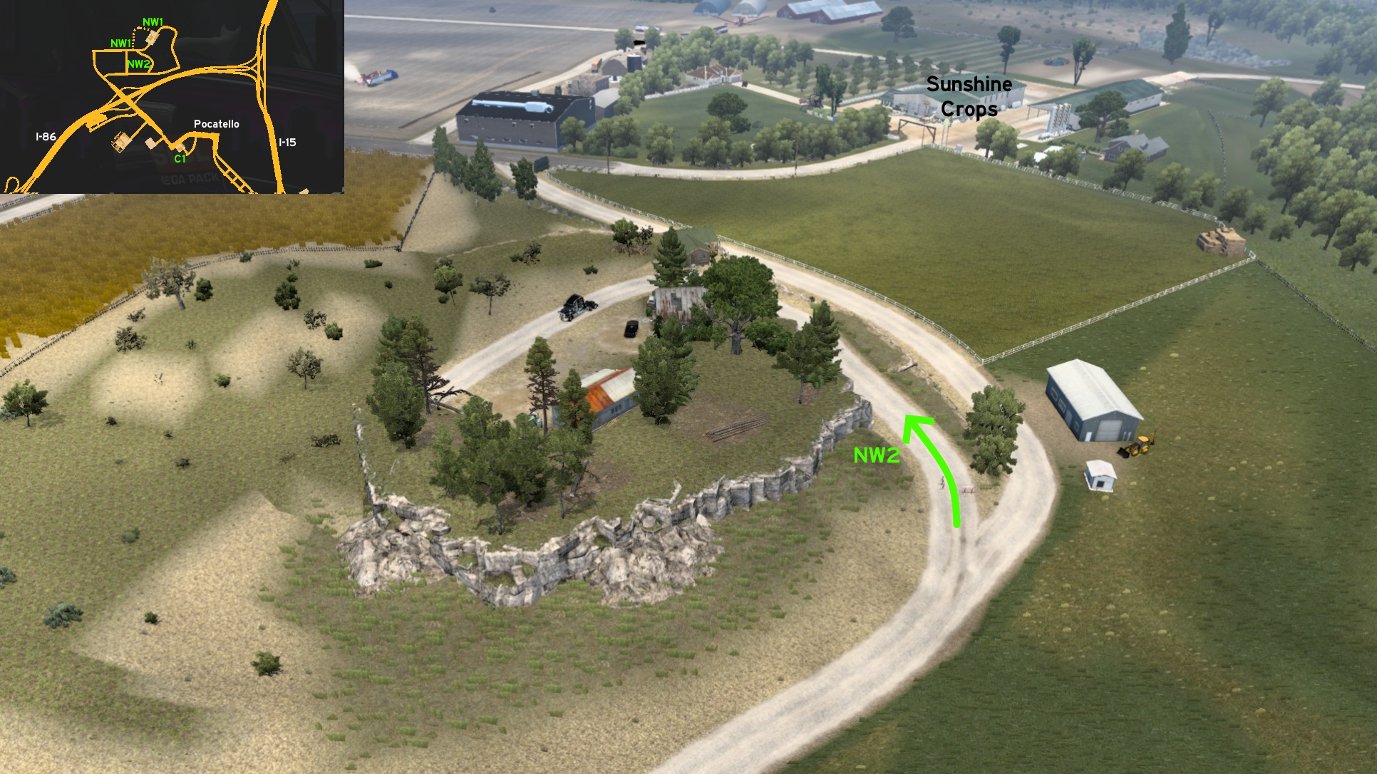 Wanna see the potato production from higher ground? One block before reaching Sunshine Crops, there's a forking dirt road, blocked by some wooden barries. Knock or drive around them, then reach the top. Enjoy the view, and the barbecue. Just don't drink and drive!
Salmon
South 1 - Town Of Ellis
Category: shortcut, markableVideo (link): TGM
Update: FelipeVinhao
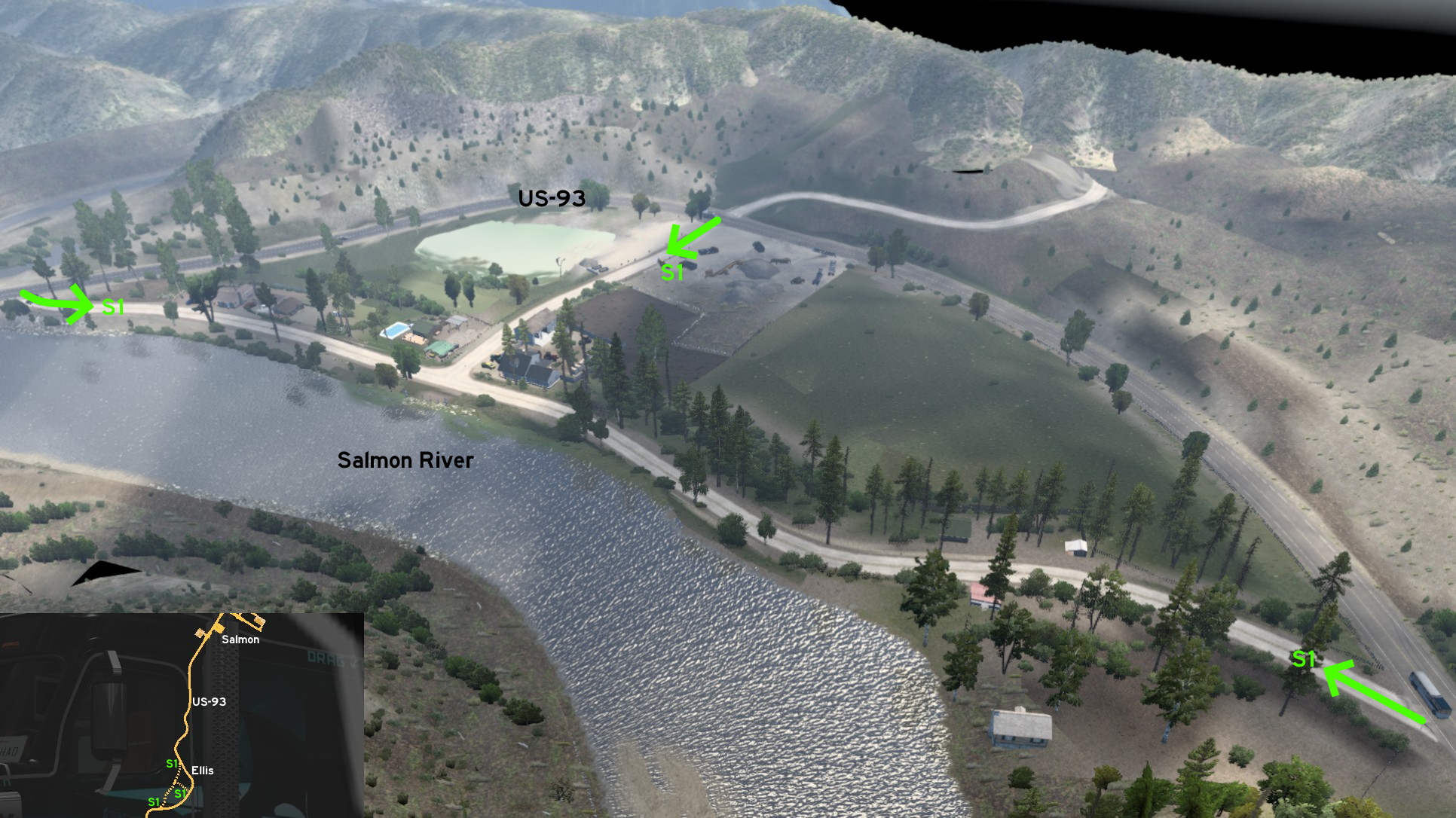 South of Salmon, there are some dirt roads leading to unmarked town of Ellis, bordering Salmon River. It can be used as a "legal" detour, but also as a "shortcut"... although not very useful, as you may have some problems trying to return to US-93 due to its high speed limit.
Sandpoint
Northeast 1 - Moyie River Overlook
Category: scenery, markableDiscovery: hydroxyquinoline
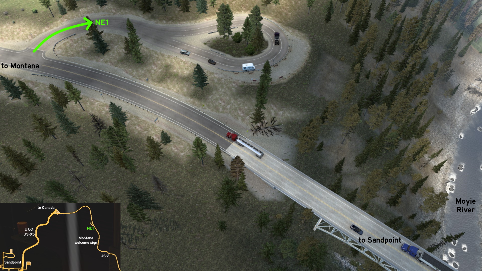 Leaving Sandpoint through US-2 / US-93, some miles before Montana welcome sign, you'll find the bridge over Moyie River, and a small lasso-shaped road to view the river from vantage point. It just doesn't count as a rest stop.
 West 1 - Along The Rails To Deepgrove
Category: shortcut, markableVideo (link): TGM
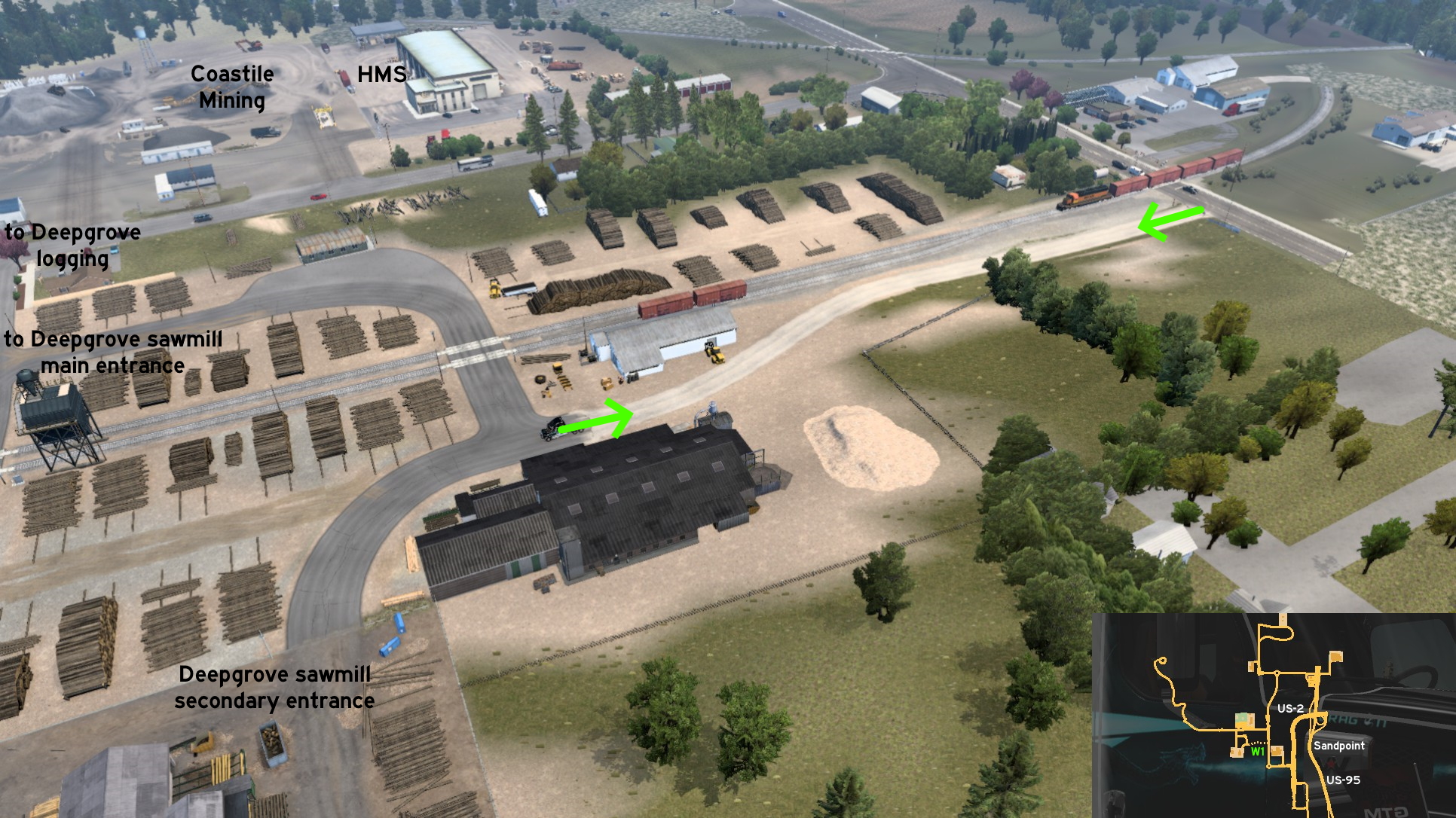 Going to west Sandpoint, you'll find a dirt road bordering the railway connecting downtown to Deepgrove sawmill secondary entrance. The entrance is a little before the railway crossing, so it's very useful if a train is running here exact on the time you're arriving.
Twin Falls
Central 1 - Exploring Old Town
Category: sceneryDiscovery: FelipeVinhao (discovery, update)
Note 1: the park breaches were fixed before Wyoming release (version 1.41)
Note 2: the breach to the area northwest of Shoshone Street was fixed on version 1.43
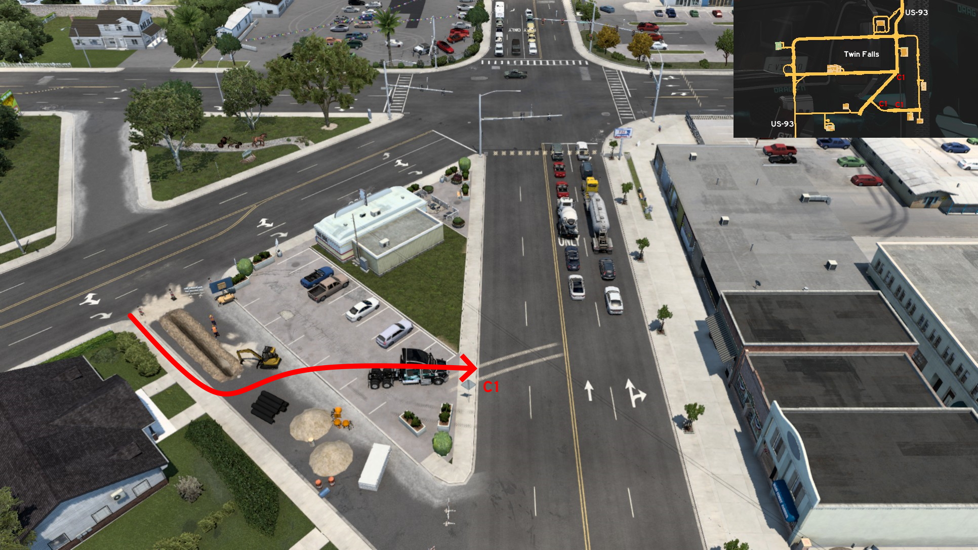 Just south of the five-way crossing between Blue Lakes Boulevard, Shoshone Street and Addison Avenue, you can explore Old Town. The hardest way is exactly near the crossing: from Shoshone Street, enter the road under maintenance through the sidewalk right of the hole on ground, turn left before the black pipes, head to the parking lot and then to Blue Lakes Boulevard.
 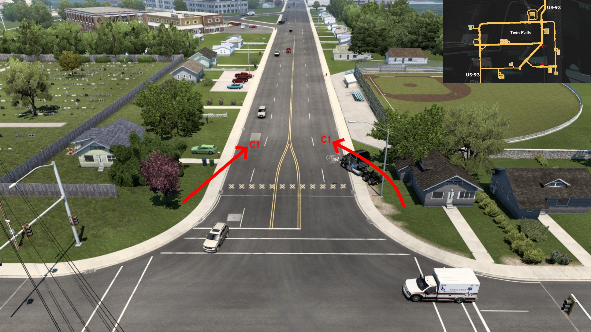 An easier method is driving around the UI roadblock on the crossing of Aspenwood Drive and Kimberly Road. The crossing isn't very similar to real life, but its proximity to Twin Falls Cemetery may give a hint. Also, due to scale limitations, Blue Lakes Boulevard and Aspenwood Drive are the same stretch of road.
 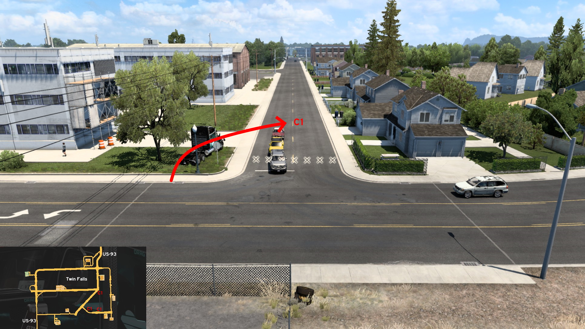 Another easy method is driving around the UI roadblock over the green plaza of this unnamed road west of the other entrance (B). Be warned that as the area is supposed to be scenery only driving some buildings and even roads themselves may flickers when driving this road.
 North 1 - Quick Rest
Category: shortcutDiscovery: kwolf55
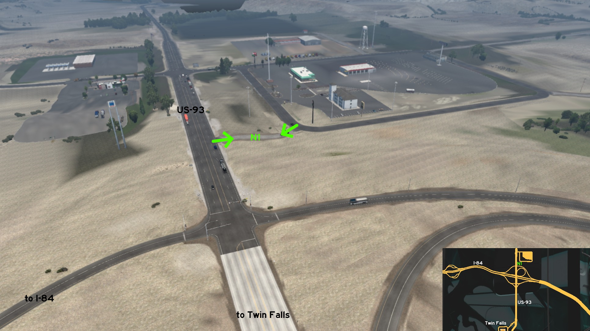 Are you near Twin Falls, after a long drive on I-84? You just want some sleep, food and fuel, but can't wait the long line waiting for the green light? Just drive through this small dirt road near the motel building and you're in! Just be careful if you use the same route to return to main road.
 Northeast 1 - Mortal Jump And Literal Hidden Road
Category: easter-eggDiscovery: PaynZz ツ
Update: termin8r, FelipeVinhao
Note: breach on I-84 is fixed (version 1.43), that is, even if you survive the fall (and aren't using teleporting cheats) you'll still need to call the emergency as you'll be locked on this area
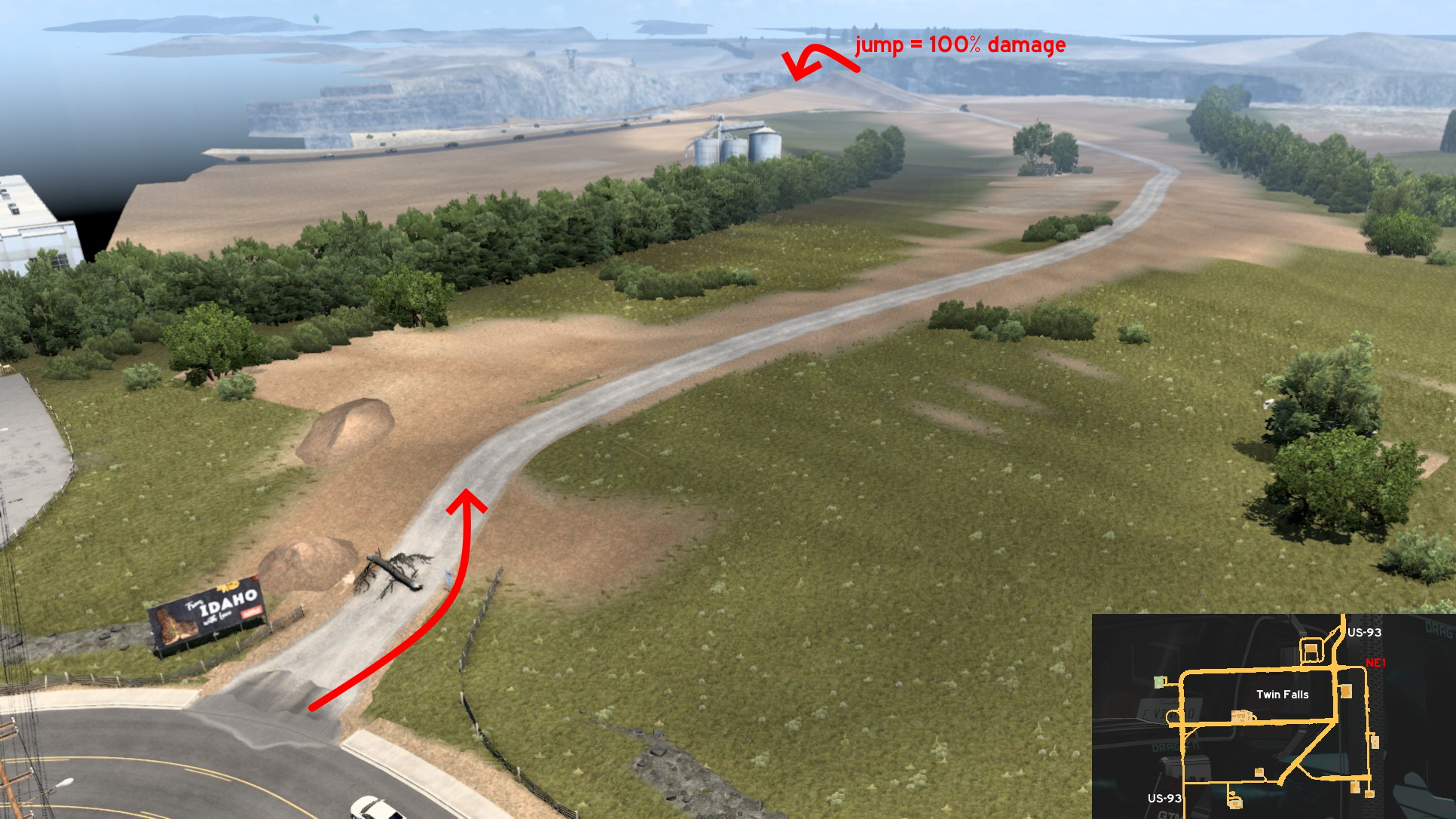 Disclaimer: we're not responsible for your expenses with emergency, truck maintenance and penalty for damaged cargo if you decide to jump the ramp instead of only explore the area. No matter the decision you made, to visit it go to northeast Twin Falls, and opposite to Idaho Temple you'll find this road partially blocked by a fallen tree. Knock down the "no trucks allowed" sign and head to the ramp. If you speed to reach the ramp, probably you won't read the friendly warning about the jump causing 100% of damage.
 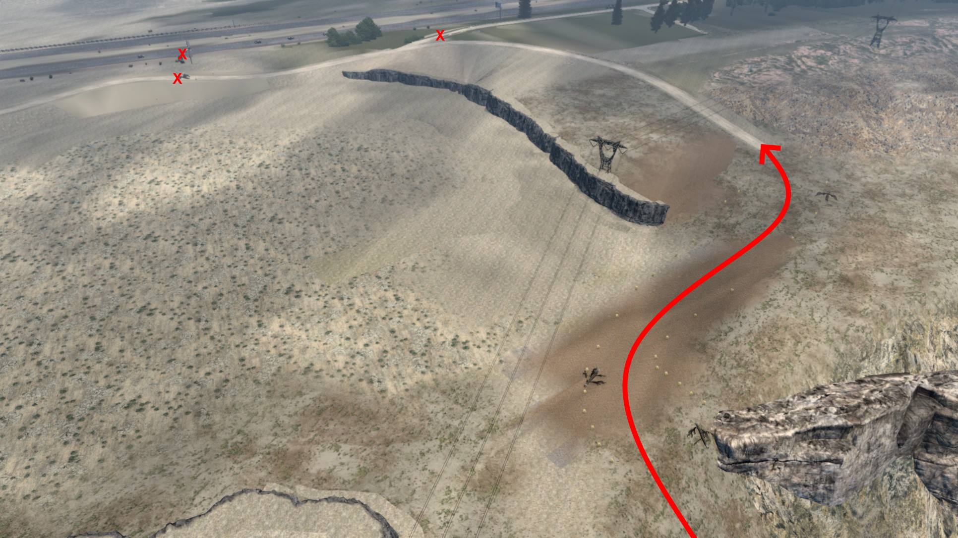 If you survive the fall, you'll find an actual hidden road: it just appears when you're close to it. Climb it until you reach a path marked by weeds. Follow it until you reach a dirt road. The way is marked by fallen trees that resemble arrows pointing the direction. There's another path of weeds near I-84, by a milk advertisement, but the way is blocked by an invisible wall. You'll need to call the emergency to leave here anyway.
 Southeast 1 - Curious Construction Site
Category: sceneryVideo (link): TGM
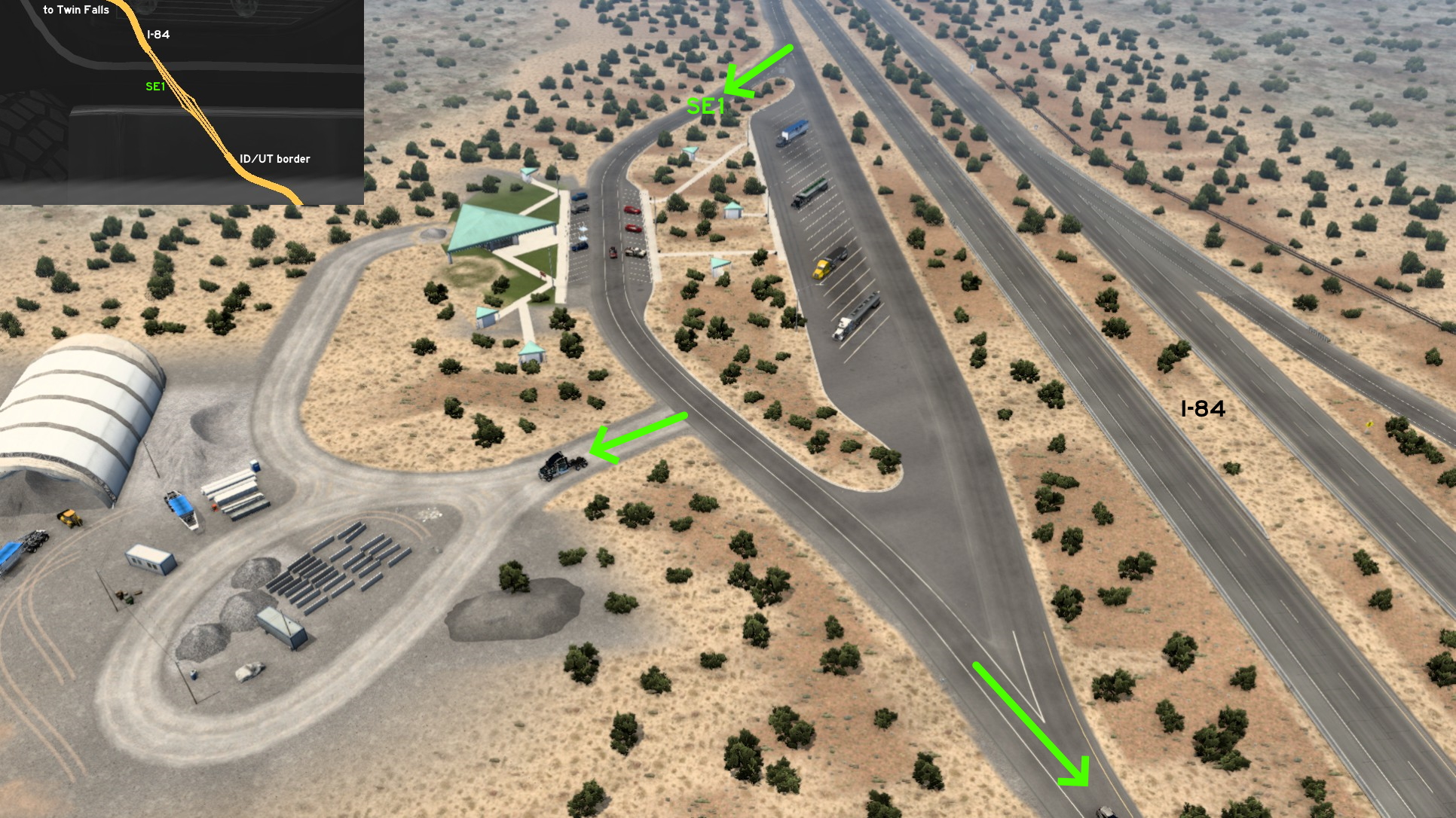 Southeast of Twin Falls, on a rest stop on I-84 some miles before Utah border, there's a construction site southbound. Just leave the freeway as usual, but instead of heading to truck stop left, head to car stop right: it's unmarked but accessible. Some meters before the exit, there's a gravel road. Just enter here, just wondering what's being built here...
9th DLC, 2022 August 04
Billings
Northeast 1 - From Parking Lot To Garage
Category: shortcutDiscovery: DDogg
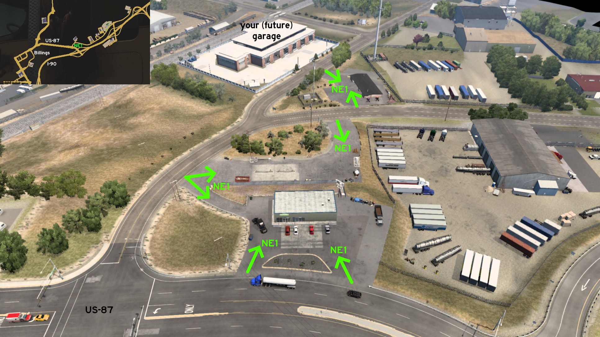 From your (future) garage in Billings, you can drive through all parking lots until you reach the one bordering US-87, which belongs to a grocery store.
 Southwest 1 - Bittersweet Delivery
Category: scenery, markableDiscovery: LikelyLeon
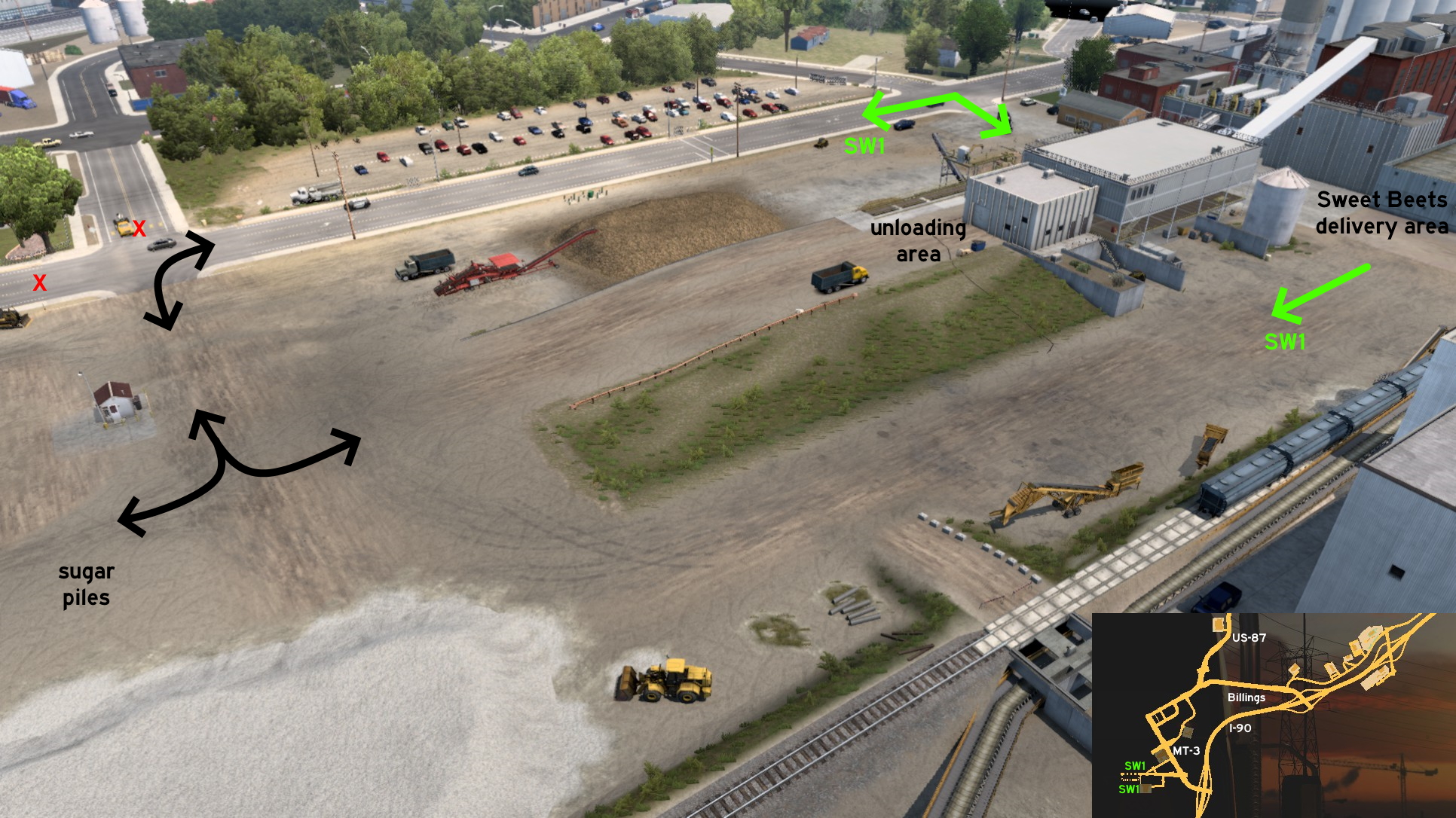 Southwest Billings, you can drive the whole area near Sweet Beets sugar factory. You can access the area some meters after crossing the delivery area gates and turning right (west). Or you can continue from the open unmarked road west, then turn left (south) to the open area where you'll find piles of sugar. From there, return east and drive carefully over the open floor unloading area, or you may get your wheels stucked on it.
Butte
South 1 - Wrong Way Turn
Category: shortcutDiscovery: Richard_Stamos
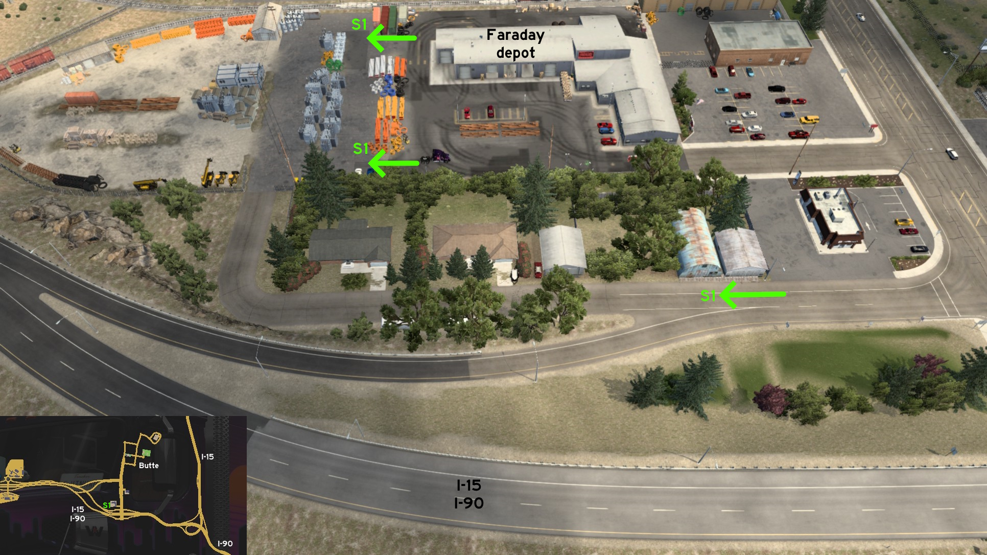 On the ramp from Butte to I-15 / I-90 westbound, if you keep the wrong lane (ironically the right one) you'll reach the rear entrance of Faraday depot. It's a good way to avoid the busy main road, but on the other hand it may be difficult to use it back to freeway, as it's a one-way route.
 Southwest 1 - Jump To Country Roads
Category: sceneryVideo (link): PaynZz ツ
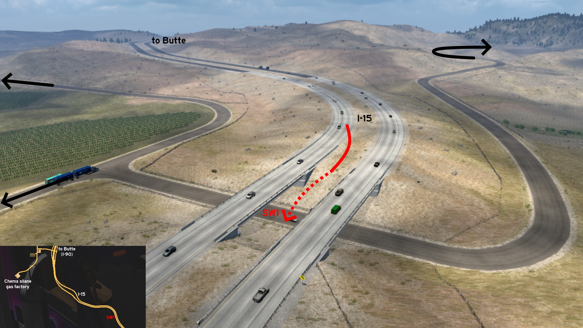 Coming from Butte through I-15, south of Chems silane gas factory, there's an unprotected median before a viaduct. On the correct speed, you'll jump and reach the road below. Several roads through the countryside can be accessed this way. But some warnings first! You may damage your truck seriously, both hitting the fences below, or the ongoing traffic. And you'll need to call the emergency service, as I-15 is fully enclosed.
Glasgow
Southeast 1 - Symmetrical Entrance
Category: shortcut, markableDiscovery: hydroxyquinoline
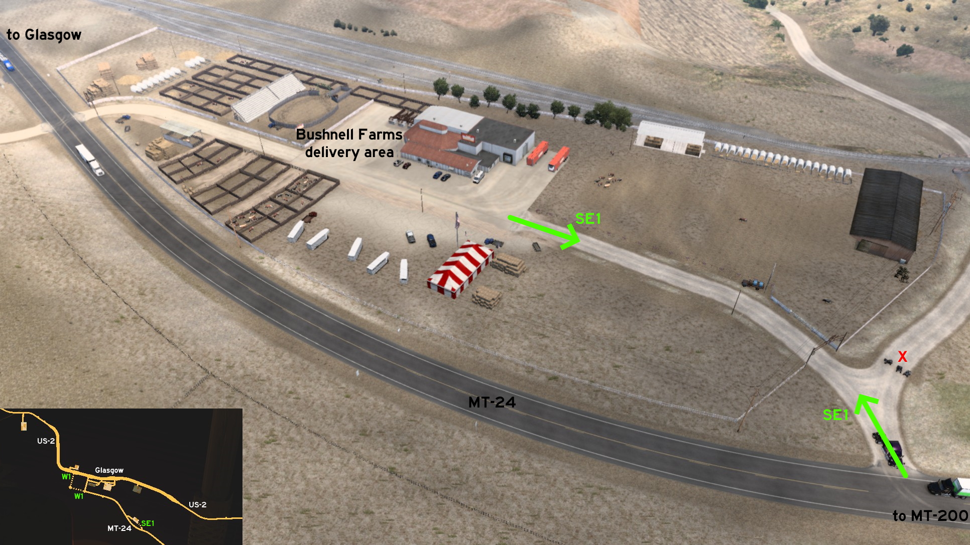 On the Bushnell farm southeast of Glasgow, there's an alternative and symmetrical access to it. The marked (west) one can be used by drivers coming from Glasgow. The unmarked (east) one can be used by drivers coming from Miles City or Glendive (MT-200). This entrance has another path, but blocked by quadbikes.
 West 1 - Around The Station And Below The Tracks
Category: shortcut, markableDiscovery: hydroxyquinoline
Video (link): A. P. 101 Gaming
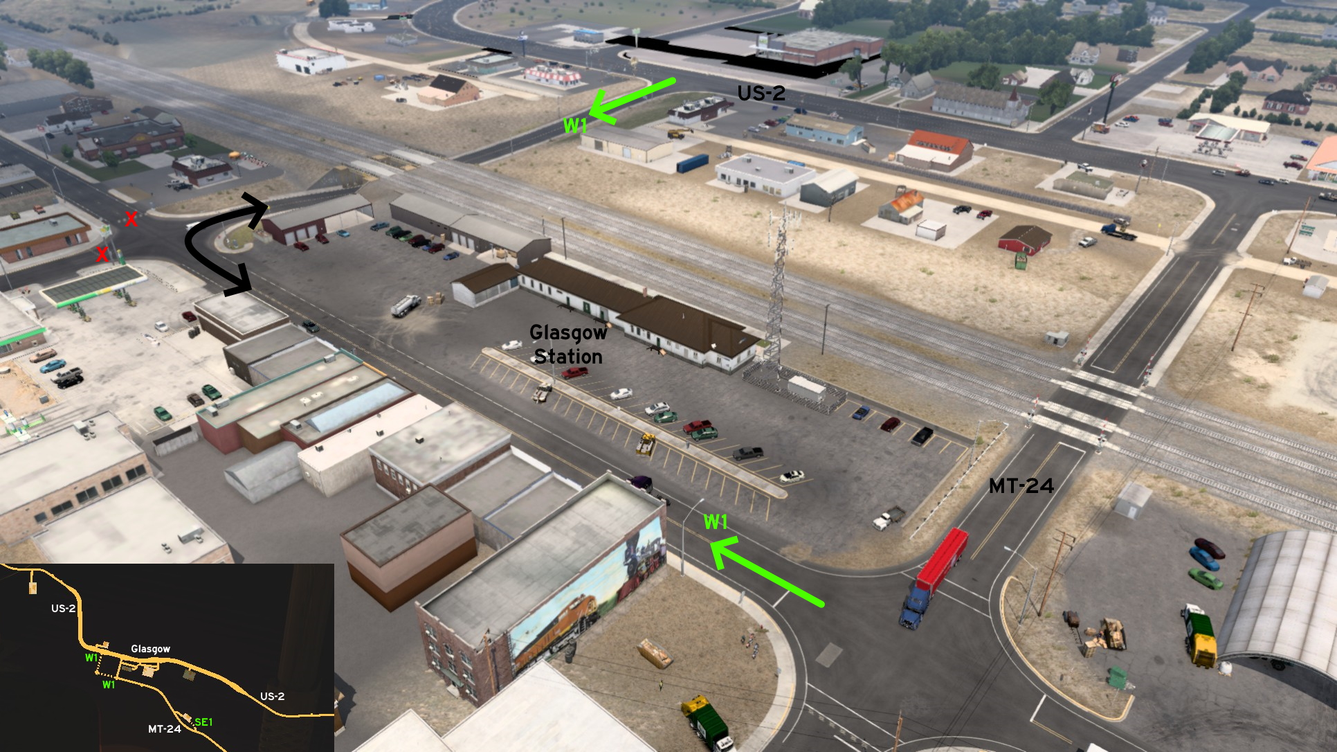 You can drive around Glasgow Station, and avoid the railroad crossing. One of the accesses begins on US-2, and goes below the railroads. The other one begins on MT-24, where one of the corners has a mural about train history.
Great Falls
Southeast 1 - Direct To Delivery Area
Category: shortcut, markableDiscovery: beta1hit
Video (link): A. P. 101 Gaming
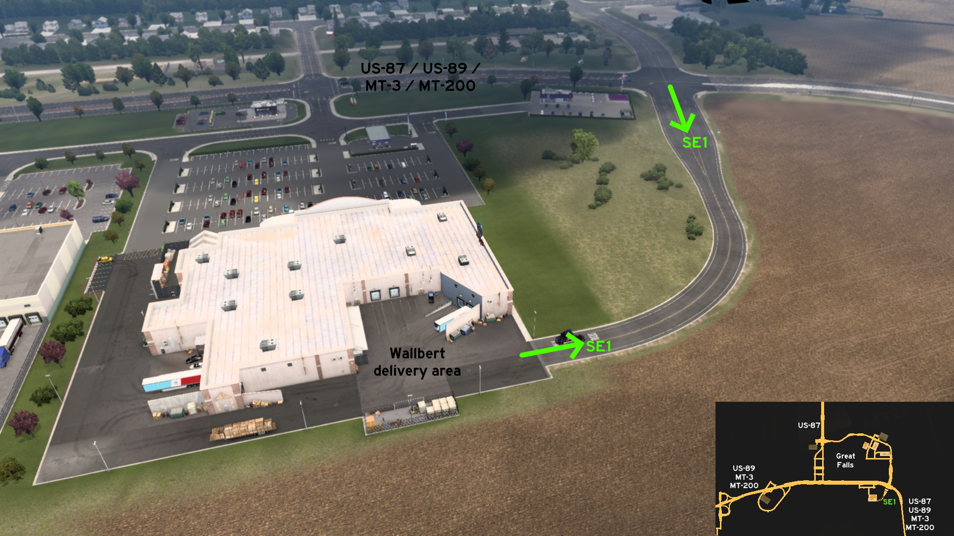 On Great Falls, you can access the delivery area of Wallbert supermarket directly from main roads. On the easternmost crossing of 10th Avenue (US-87 / US-89 / MT-3 / MT-200), head south. The road narrows before reaching delivery area.
Havre
Northeast 1 - Driving Through The Crops
Category: shortcut, markableDiscovery: beta1hit
Video (link): A. P. 101 Gaming
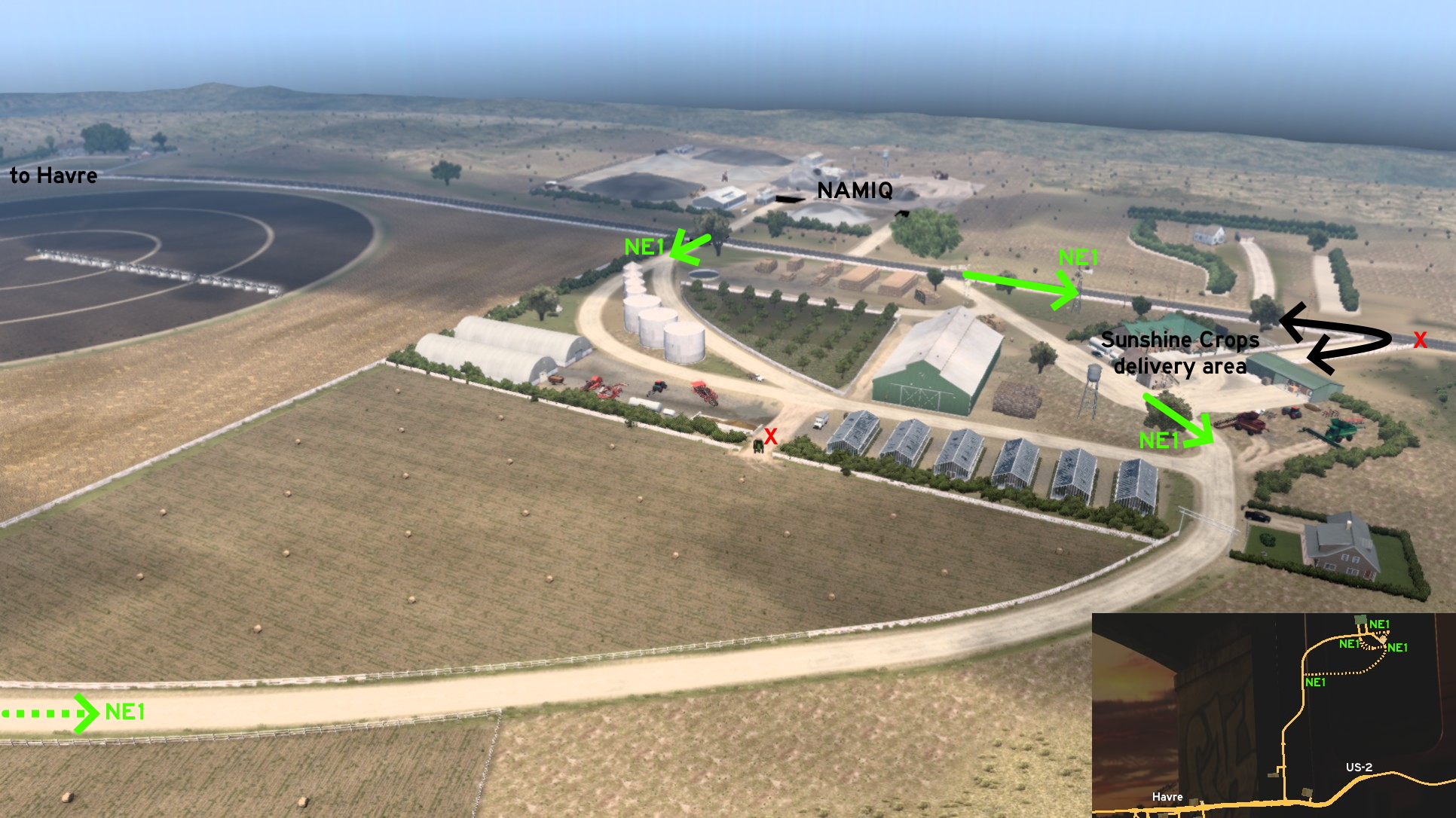 Around Sunshine Crops northeast of Havre, there are some dusty roads that can be used as a shortcut closer to the city, and other just for relaxing. Just be careful when going to the easternmost of these roads, as it may not end so much relaxing if getting stuck on corner.
 West 1 - Driving Through The Cattle
Category: shortcut, markableDiscovery: hydroxyquinoline
Video (link): A. P. 101 Gaming
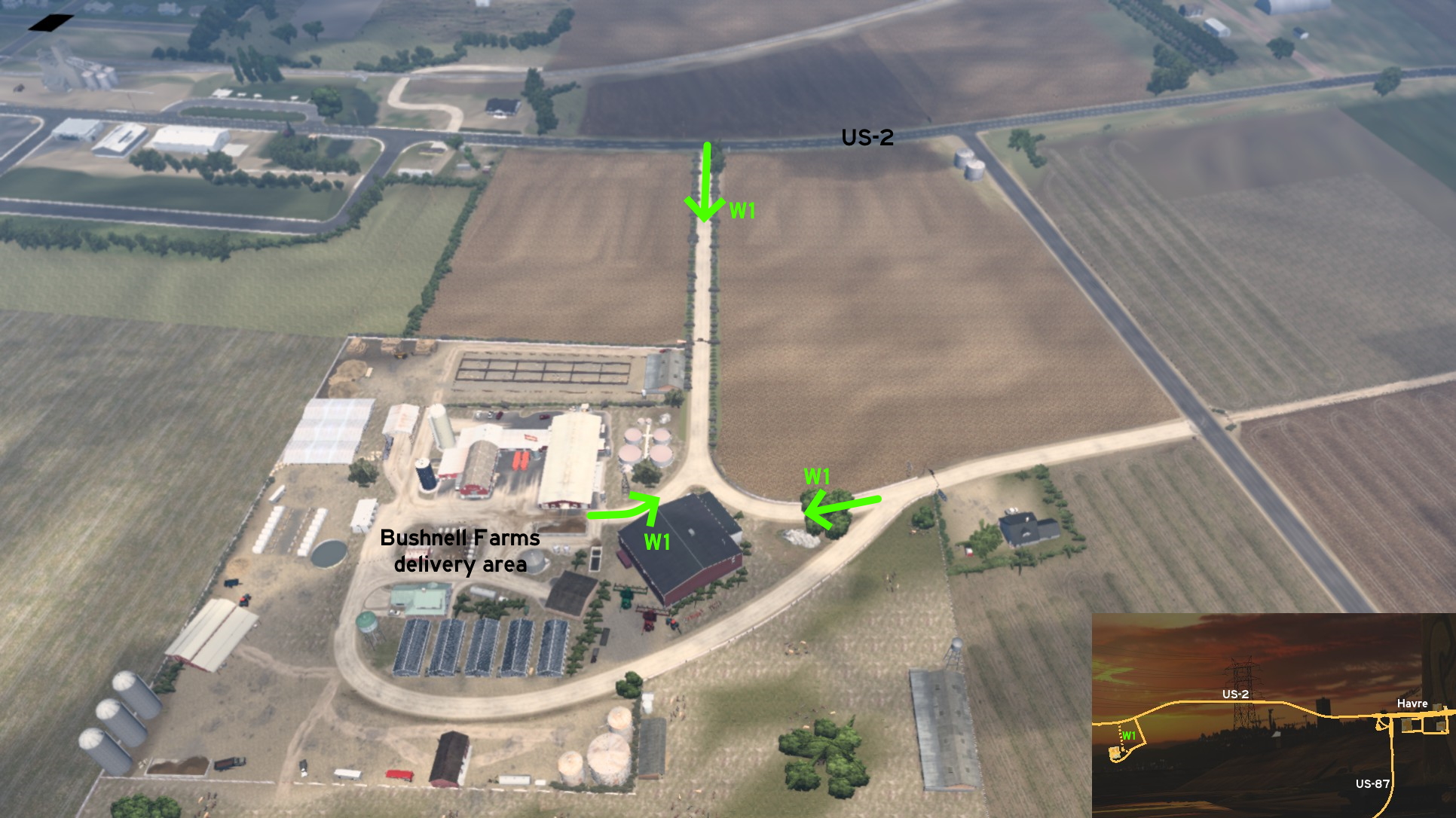 West of Havre, the Bushnell farm can be accessed through a dirt road directly from US-2. It borders the fields and the cattle, and its end can be either used to access the delivery area secondary entrance, or a detour to US-2.
Kalispell
North 1 - Not Double (Railroad) Crossed
Category: shortcutDiscovery: kaia15
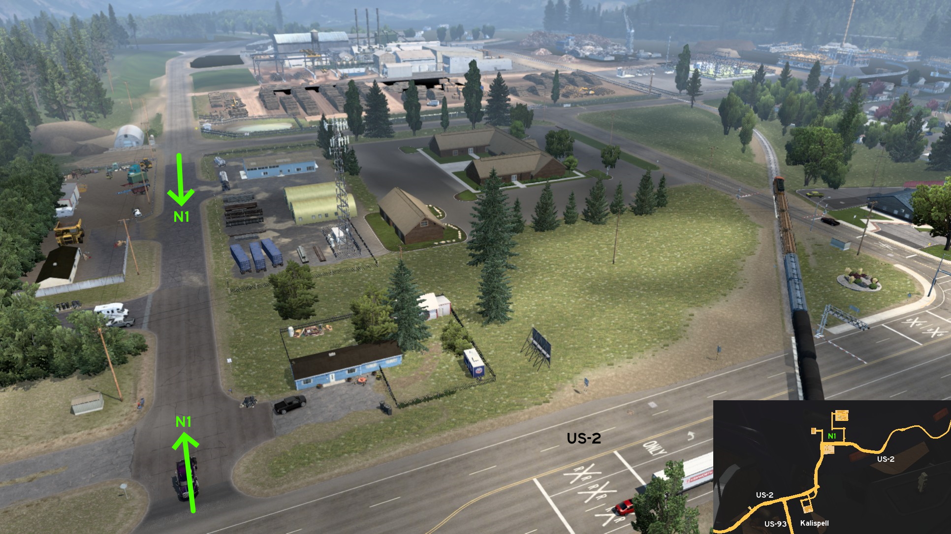 If you need to reach Deepgrove lumbermill north of Kalispell, you'll have a great chance of having to wait for the train and waste precious time... twice. On US-2 coming from the city, a little before the railroad crossing, turn left and you can avoid it completely, to go directly to main entrance. Or you can avoid at least one of the crossings if coming from northeast, skipping the official route and taking the next right.
 South 1 - Homes By Flathead Lake
Category: scenery, markableDiscovery: hydroxyquinoline
Video (link): A. P. 101 Gaming
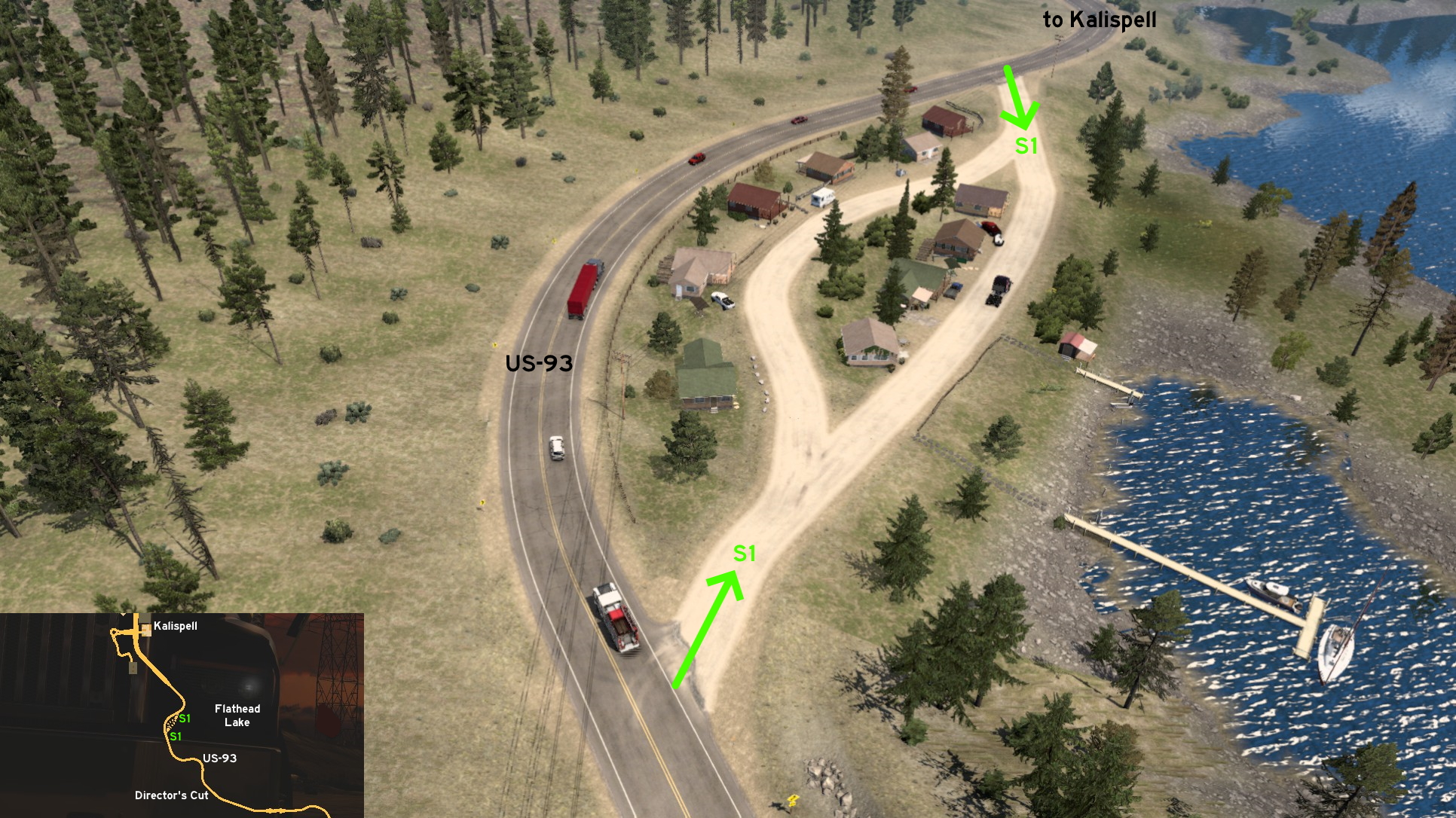 South of Kalispell, some miles before Director's Cut for Flathead Lake, you can visit some houses closer to it, and choose the best view yourself. Both entrances are on US-93, and the dirt road splits into two.
Miles City
East 1 - Donuts Before Shopping
Category: shortcut, markableDiscovery: noob168
Video (link): A. P. 101 Gaming
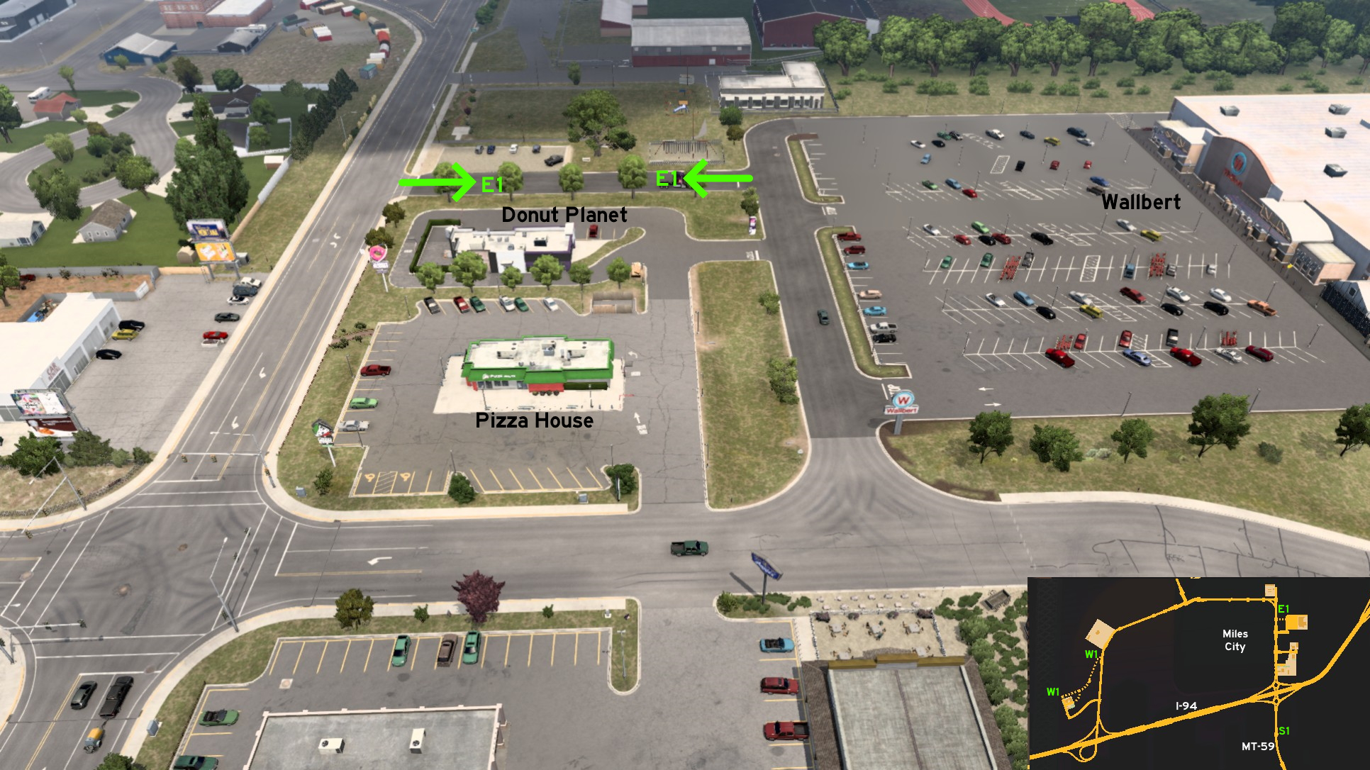 To reach Wallbert supermarket on east Miles City, you can follow 2 different paths. The official one runs close to a Pizza House. The shortcut one, which is closer to delivery area and goes through less traffic, runs close to a Donut Planet.
 South 1 - Last Chance To Turnaround
Category: shortcutDiscovery: Applecorn
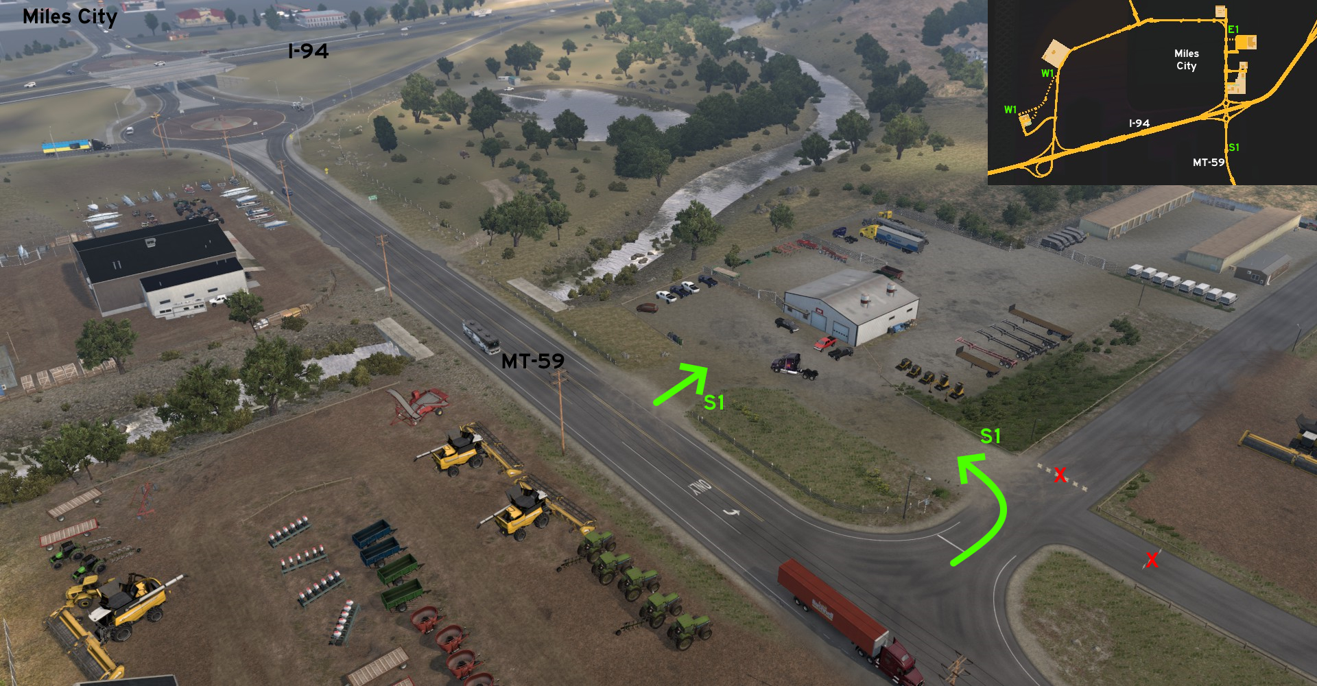 South of the intersection of MT-59 and I-94, there's a small parking lot. Although you can't use it to rest, you can use it as a turnaround, in case you missed the two opportunities on the intersection roundabouts.
 West 1 - From Exchange To Experiments
Category: shortcut, markableDiscovery: LikelyLeon
Video (link): A. P. 101 Gaming
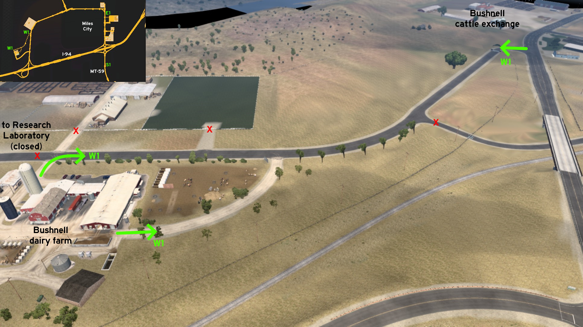 Bushnell cattle exchange and dairy farm west of Miles City are connected by a road that leads to a research laboratory. It's unmarked on map, but it's hardly hidden from your windshield, as there's a big welcome sign at its entrance. The dairy farm has 2 possible entrances from it. You just can't reach the laboratory itself.
Missoula
East 1 - Purple Water
Category: shortcut, markableVideo (link): A. P. 101 Gaming
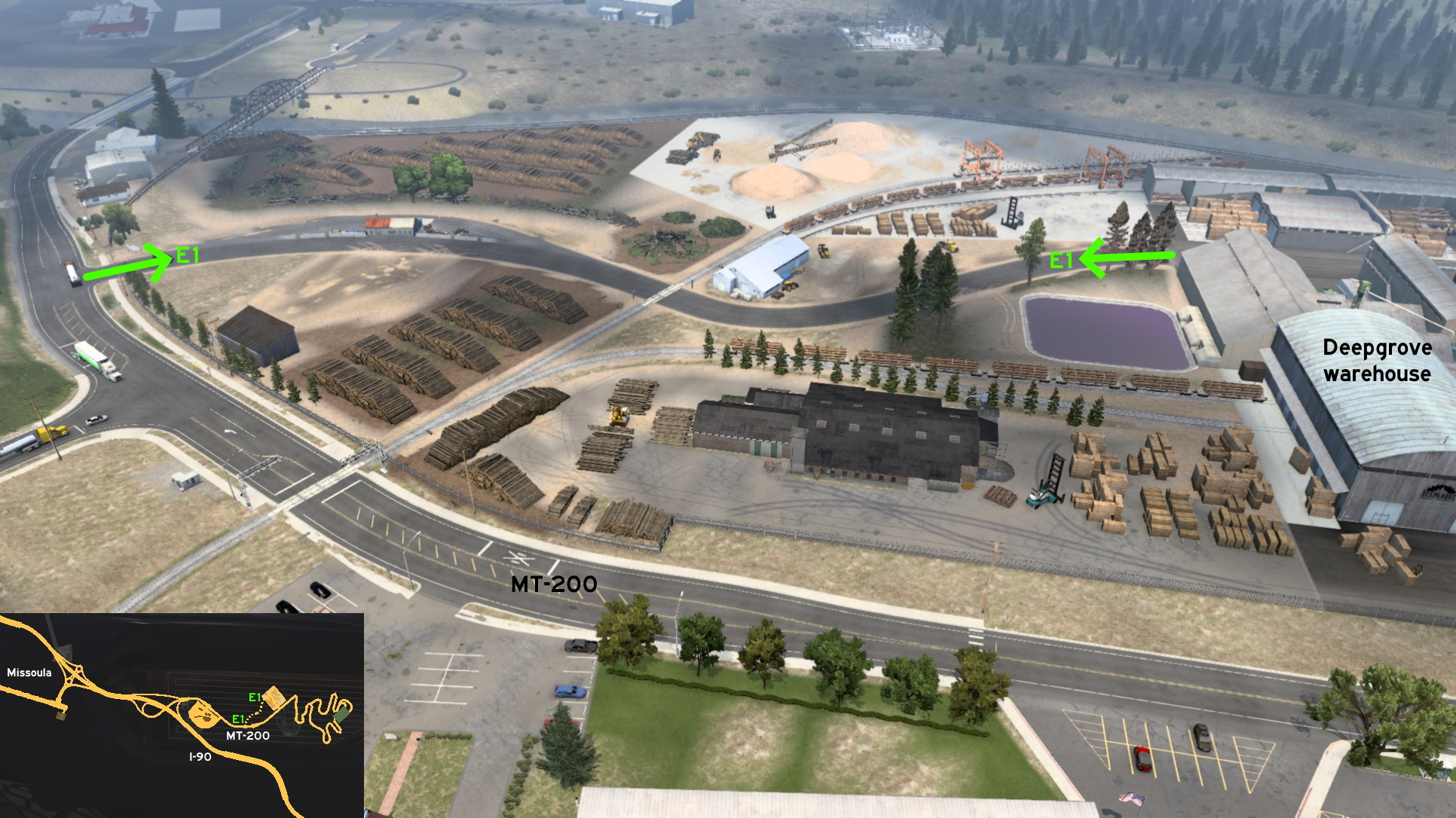 Before reaching the main entrance of Deepgrove warehouse, east of Missoula, there's a gate and a road leading to its secondary entrance. You'll cross a railroad, and drive near a water treatment pound. You can soak your truck on the purple water, but you may have problems getting out of it.
 South 1 - Parking To Landscaping
Category: shortcut, markableVideo (link): A. P. 101 Gaming (video)
Note: All paths near Walden's are accessible, but only the closer one is markable
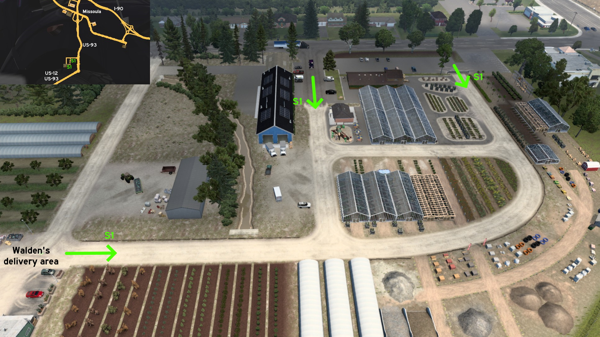 East of Walden's found on south Missoula, you can use both entrances starting on the parking lot for small vehicles, and take a look at the products for decorating your future home.
Sidney
East 1 - Cattle, Food And Sugar
Category: shortcut, markableDiscovery: hydroxyquinoline
Video (links): SCS Software, A. P. 101 Gaming
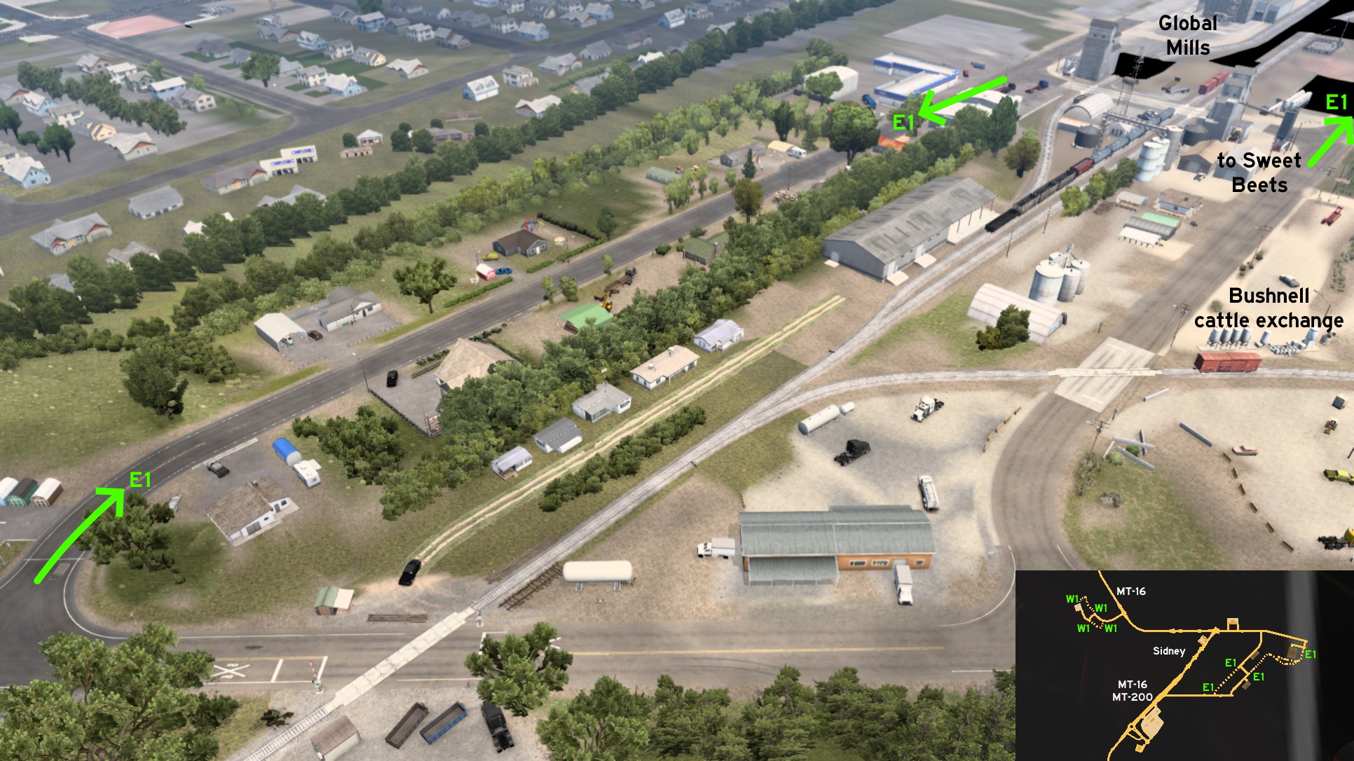 East Sidney, there are 2 unmarked roads that are actually coming straight from the marked ones - you may even discover them by accident because of that. One is parallel to the road to Bushnell cattle exchange, and leads to Global Mills.
 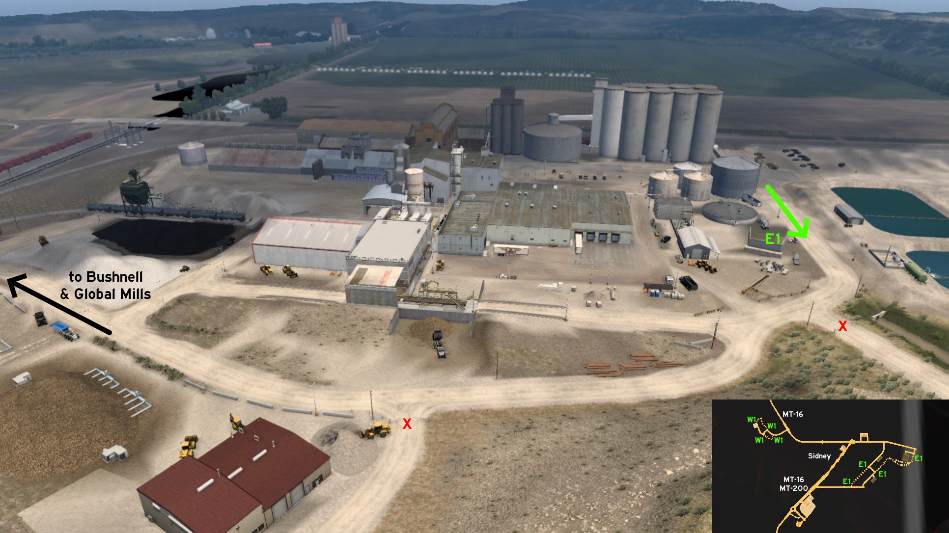 One continues from cattle exchange, and leads to Sweet Beets. Close to the sugar factory, the road splits into 2. One of them leads to an unloading open area, where you must put your wheels carefully.
 Northwest 1 - Roads Around Culbertson
Category: scenery, markableDiscovery: DDogg
Video (link): A. P. 101 Gaming
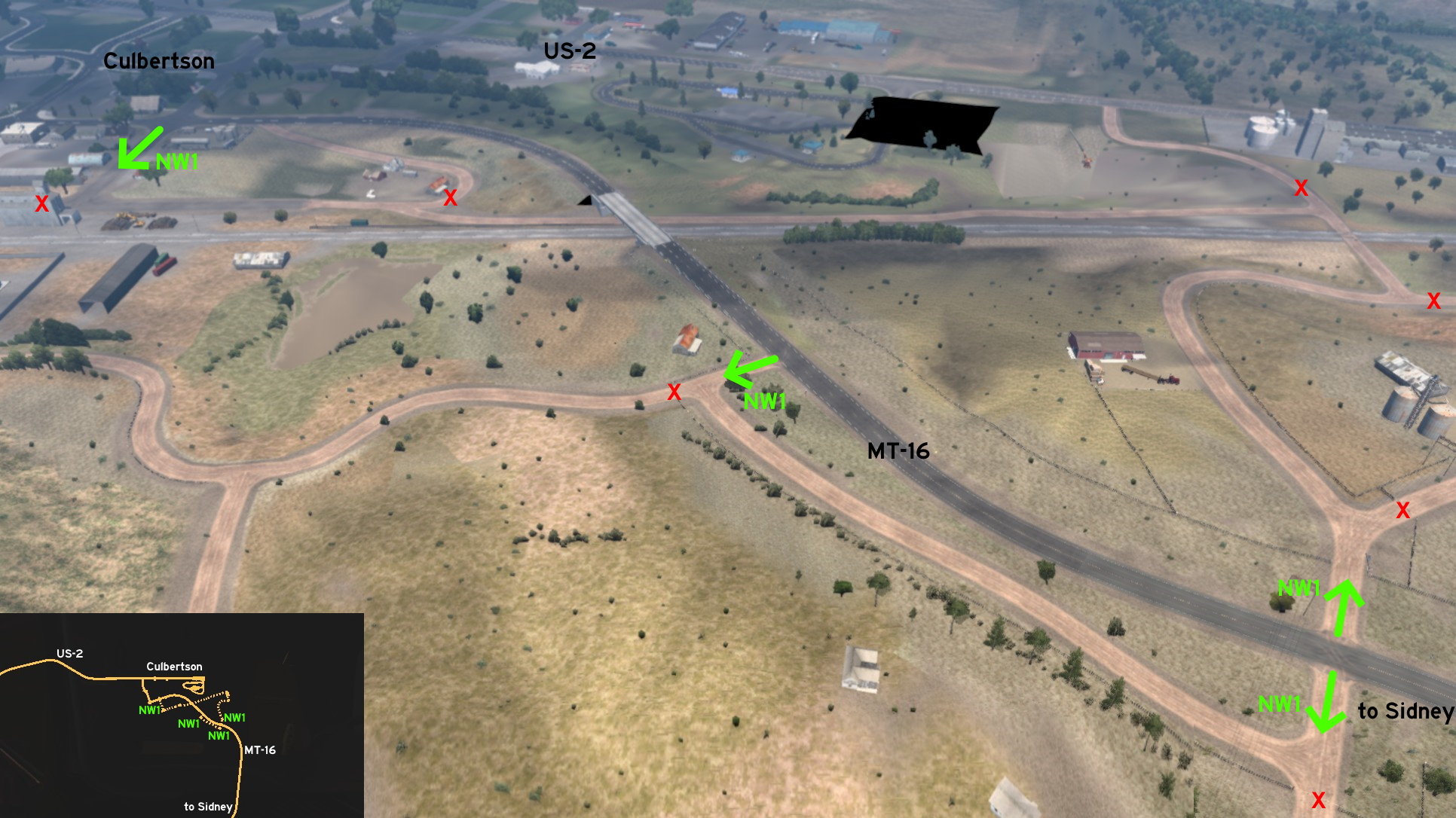 Northwest of Sidney, and southeast of the unmarked town of Culbertson, you find some dirt roads around MT-16. One of them starts and ends on MT-16, and runs parallel to it. The other starts on the same crossing the previous one ends, crosses the railroad tracks, and ends on one of the town streets.
 West 1 - Doing An 8 Around Oil Fields
Category: scenery, markableDiscovery: crazy rocker
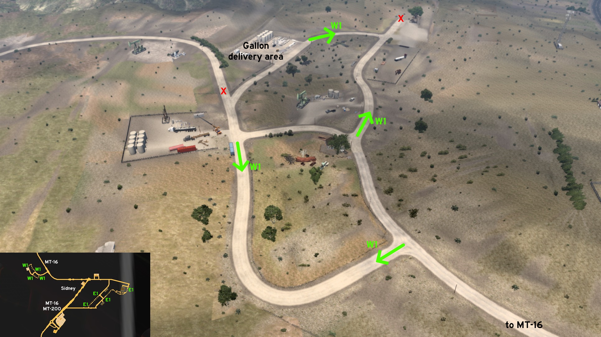 Around Gallon oil fields west of Sidney, the official route draws a zigzag pattern. The unmarked roads start on the corners of the zigzag, drawing a twisted 8-shaped route.
Thompson Falls
Central 1 - Forestry On Rails
Category: shortcut, markableDiscovery: hydroxyquinoline
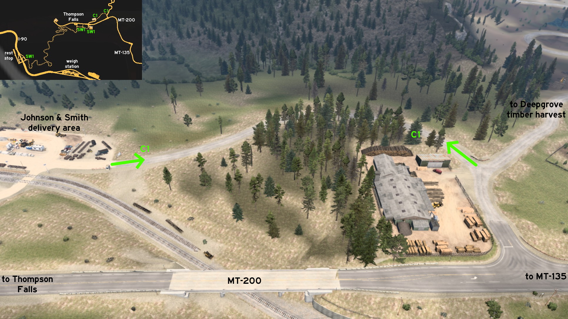 On Thompson Falls, an unmarked dirt road connects the secondary entrance of Johnson & Smith delivery area to the road that leads to Deepgrove timber harvest area, near a wooden warehouse without jobs available.
 Southeast 1 - Sightseeing Near Sawmill
Category: shortcut, markableDiscovery: crazy rocker
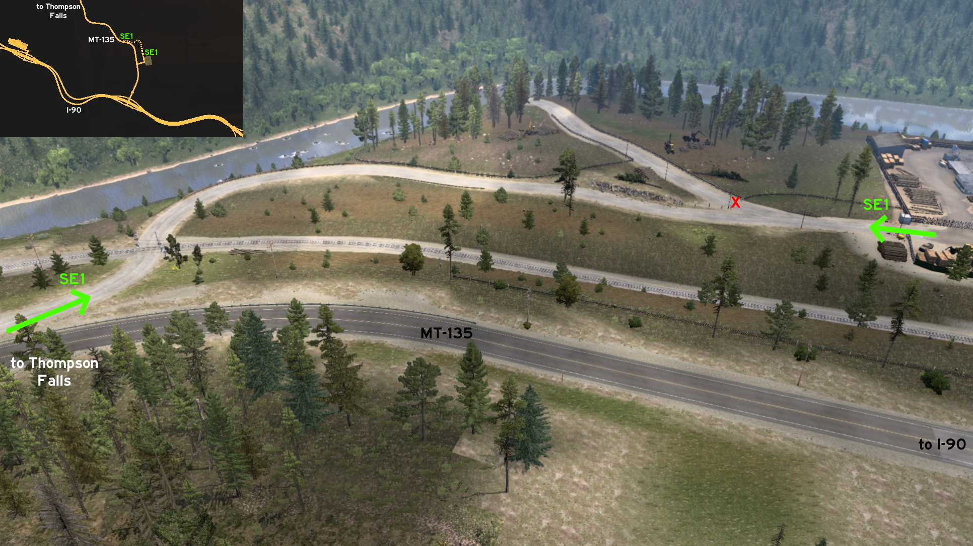 Southeast of Thompson Falls, an extention to the road of Deepgrove sawmill goes a few meters closer to the city. Just keep north, and drive across the woods almost parallel to MT-135, until you cross the railroads and reach the main road.
 Southwest 1 - Blast From The Past
Category: shortcut, markableDiscovery: Wide Kemo
Video (link): A. P. 101 Gaming
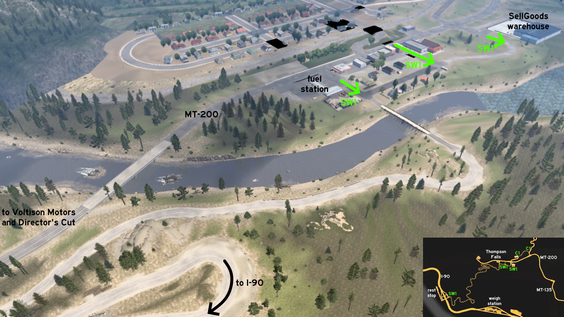 Feeling nostalgic about 18 Wheels Of Steel? An unmarked extreme road connects Thompson Falls to I-90 and mimics the route. From the city, 3 entrances are available: one on the road to SellGoods warehouse, one on an alley a block far from the road to residential area, and one from the fuel station.
 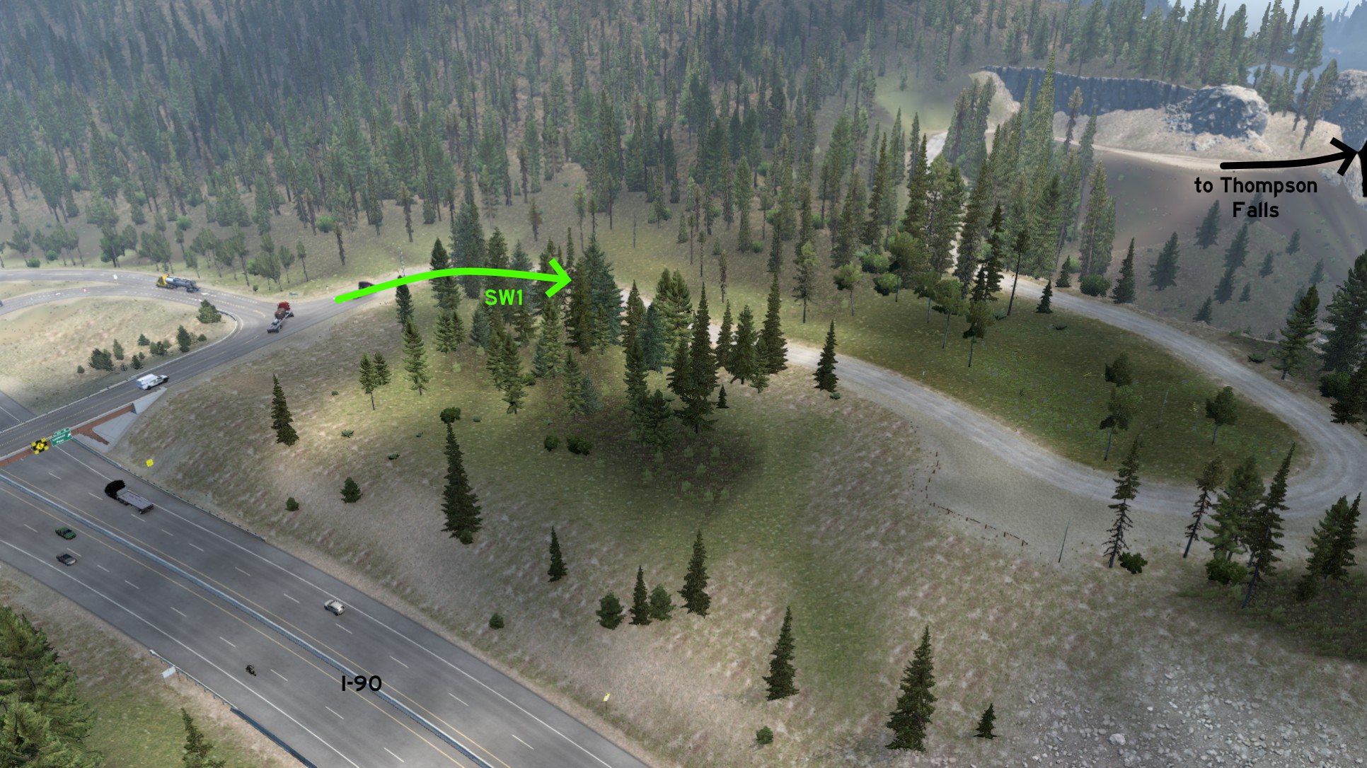 From I-90, only 1 access is available: it's across the first rest area from drivers coming from Idaho. The route itself isn't very similar to Extreme Trucker 2, but has all possible features. Prepare yourself to find narrow roads bordering cliffs, thigh corners, and makeshift bridges.
Base game, 2016 February 02
Carson City 🏛️
North 1 - Back To City
Category: scenery, markableDiscovery: FelipeVinhao
Note: this road was visible on map before version 1.44
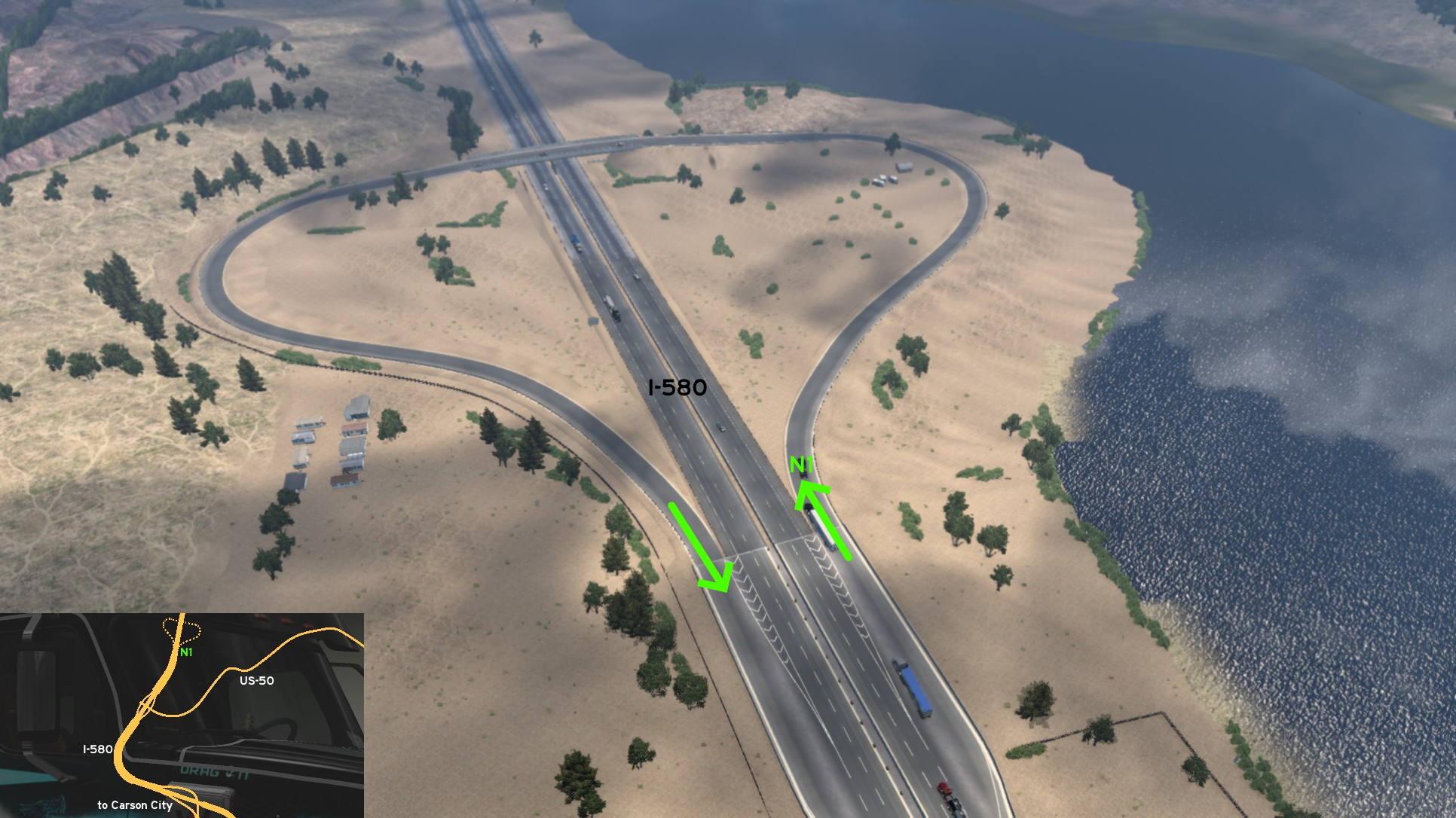 Leave north Carson City through I-580, you'll find a detour to the city halfway to Reno. Of course it's to be used if you took the wrong direction, but it can be also used as a Washoe Lake overlook. Just be warned that some drivers behind you may not be happy if you do so.
Ely
Southeast 1 - Dirt Tracks
Category: sceneryDiscovery: ilchiodi
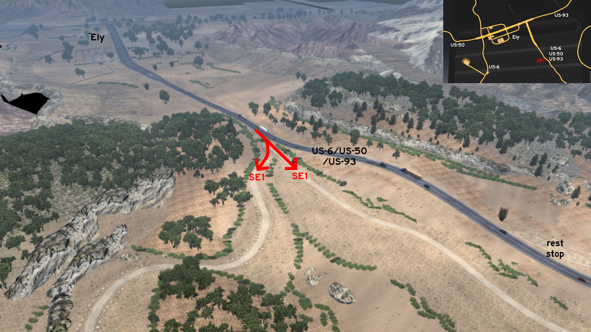 Leave southeast Ely through US-6 / US-50 / US-93, heading Pioche. A little before a rest stop, look right and you'll find two dirt roads behind some bushes. They're actually both ends of the same road. It looks like a rally or motocross track. You'll find tight turns and steep ramps. It's not impossible to drive here even if you're pulling a trailer, but some attention is required in this case.
Las Vegas
East 1 - Dam Good Viewpoint
Category: scenery, markableDiscovery: punkito
Video (link): trucksim
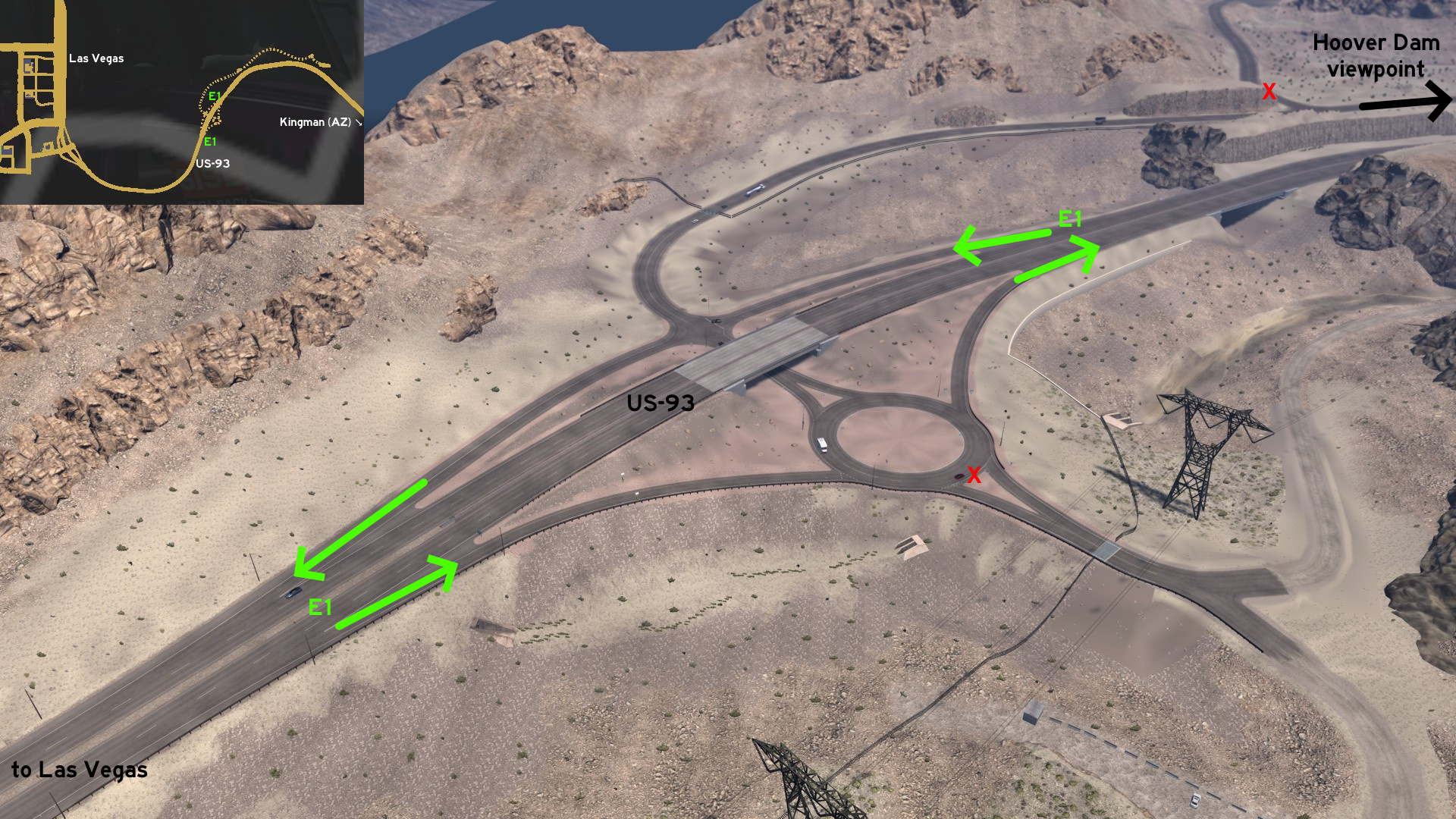 Leave east Las Vegas through US-93 heading to Kingman (Arizona). Before reaching Hoover Dam and the state border, there are exit ramps leading to the dam viewpoint - its visible icon on map may not make this route so secret.
 West 1 - Missed Delivery Area
Category: sceneryDiscovery: Applecorn
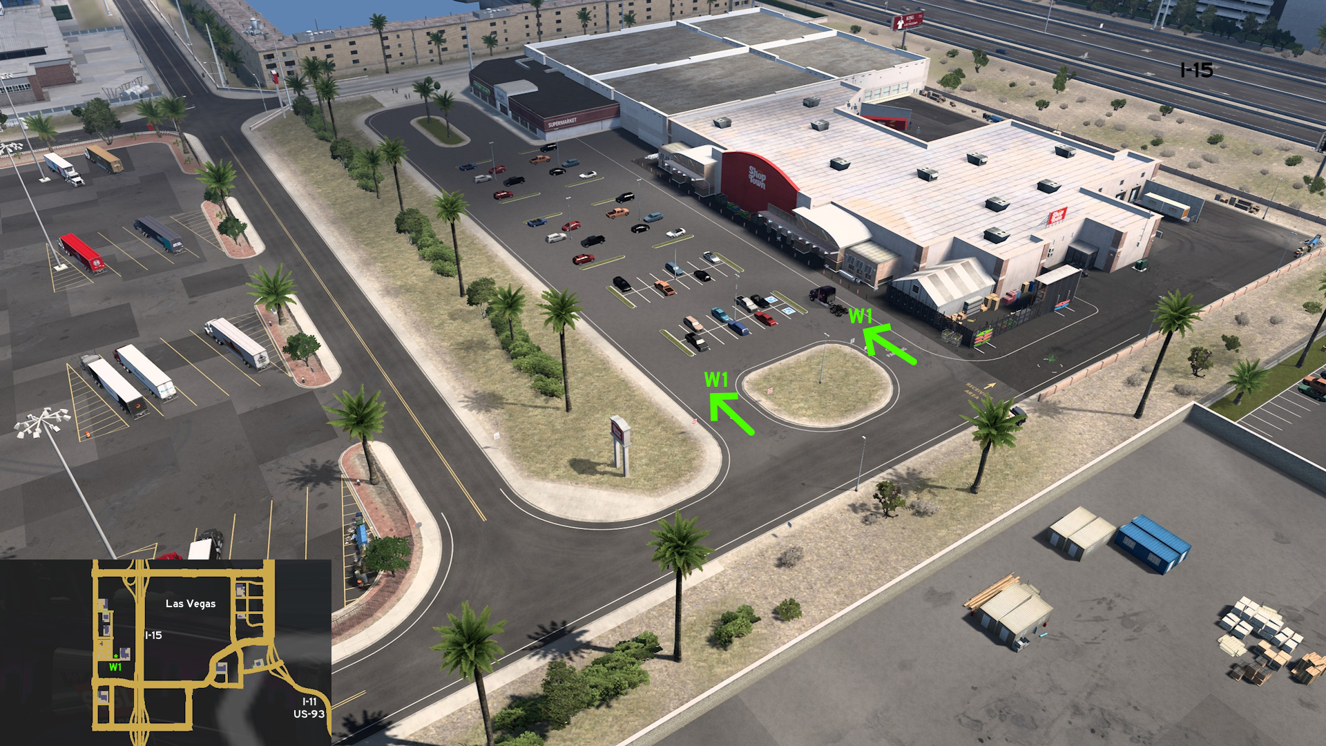 Go to Shop Town, west Las Vegas. Before reaching the delivery area, you can drive around the parking lot for cars.
Reno
Southwest 1 - Reno Bus Terminal
Category: sceneryDiscovery: Birckablock
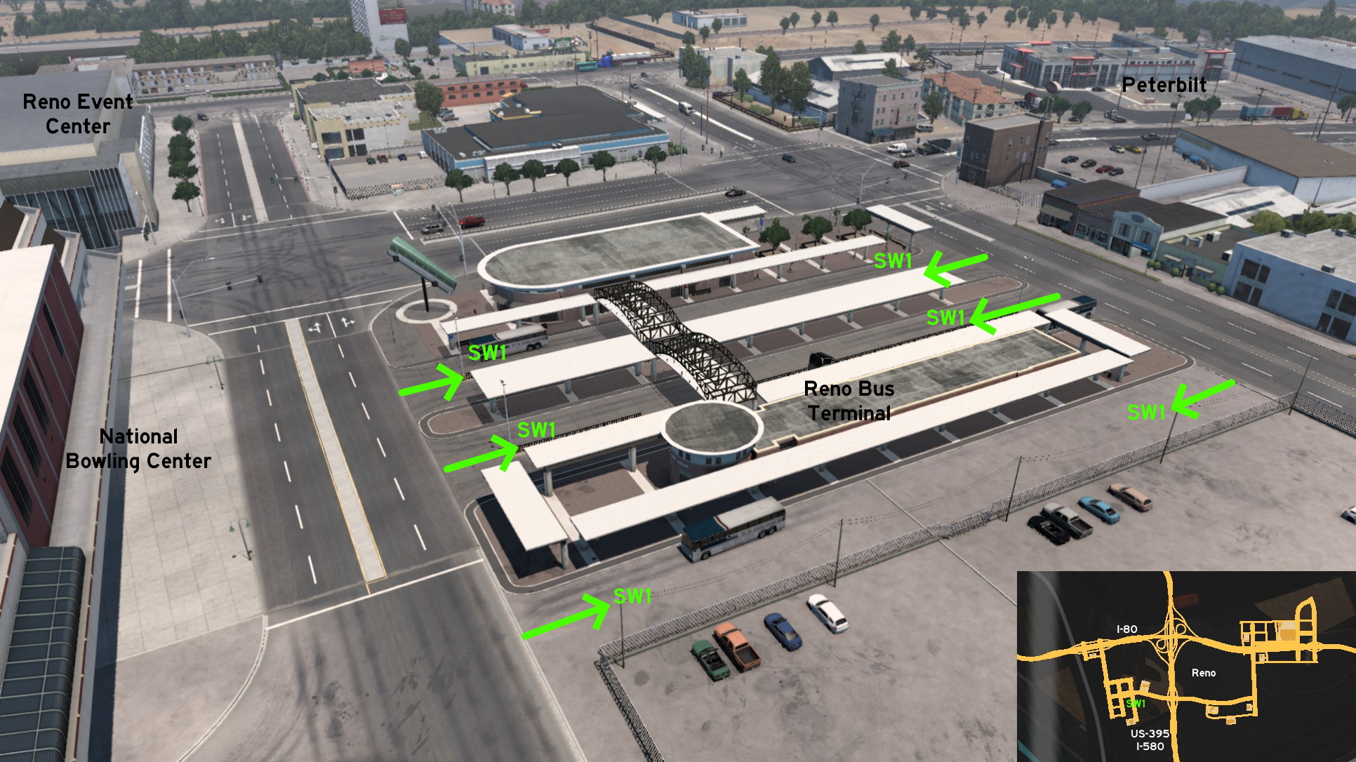 Go Reno, southwest of the intersection of I-80 and I-580 / US-395, and west of Peterbilt truck dealer. You'll find the city Bus Terminal right before the National Bowling Stadium and Reno Events Center. We can say we can use them as shortcuts, but only if the interest is about visiting local landmarks.
Winnemucca
Northwest 1 - Avoiding The Junction
Category: shortcutDiscovery: Richard_Stamos
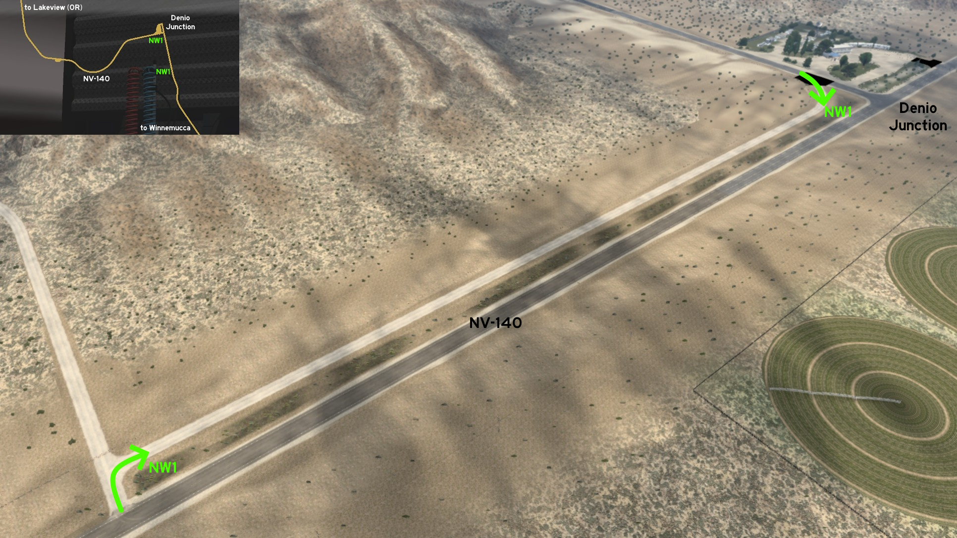 Northwest of Winnemucca and south of the rest stop on the unmarked town of Denio Junction, there's a dusty path that runs along NV-140 that can be used to avoid the crossing.
2nd DLC, 2017 November 09
Alamogordo
South 1 - Good, Bad And Ugly Dead End
Category: easter-eggDiscovery: noob168
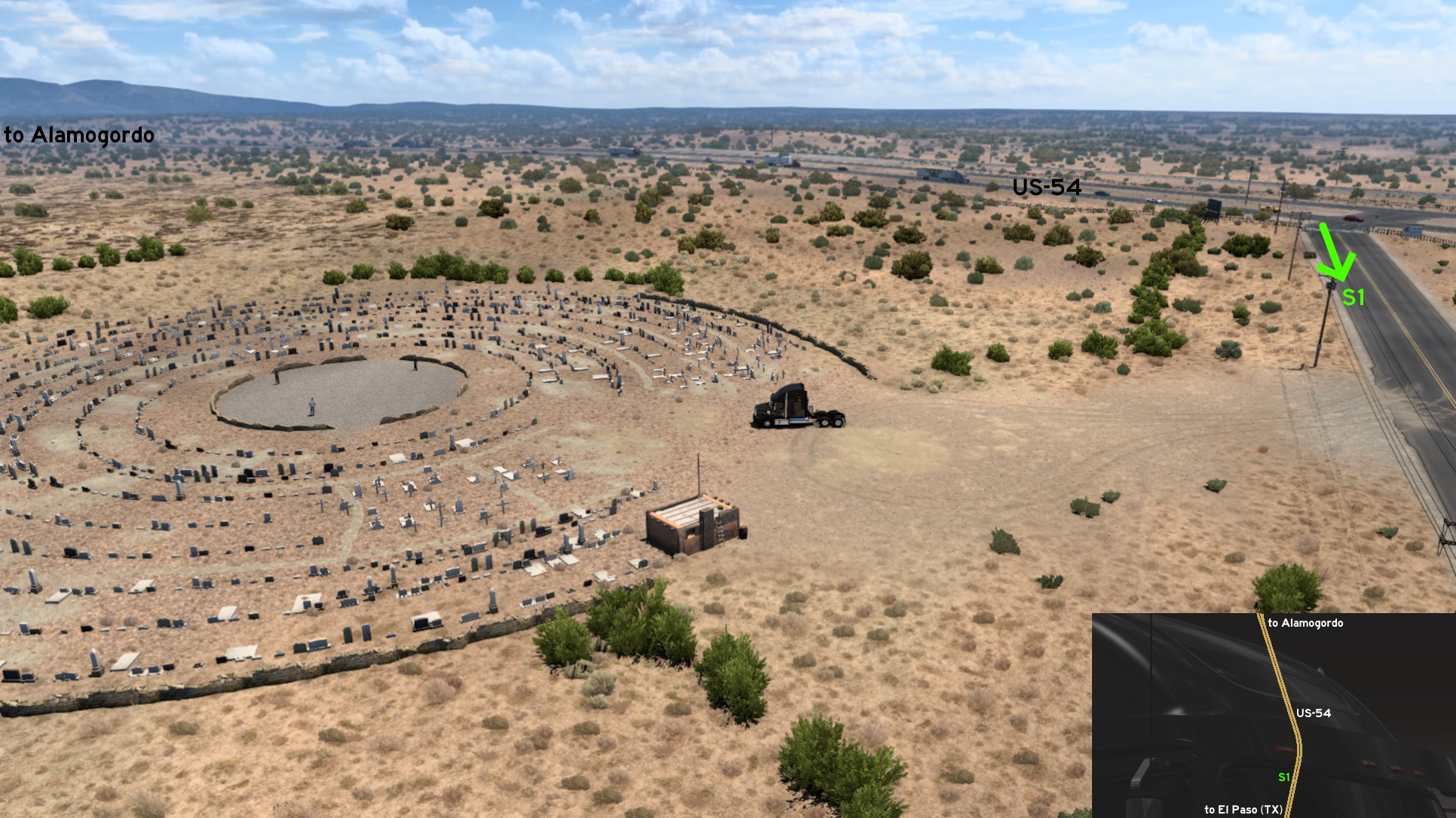 On US-54, south of Alamogordo and halfway to El Paso, there's a crossing after a curve with a partially down barrier. Drive some meters, and you'll find a bazaar sign and a blocked end of road. But it's not over - look right, and you'll see a circular cemetery and 3 men in the center of it, similar to a famous western movie scene.
Albuquerque
East 1 - Musical Road
Category: easter-egg, markableUpdate: DPT Wanderer, MikMinevi
Note: this road was visible on map before version 1.44, and the whole area changed on version 1.58
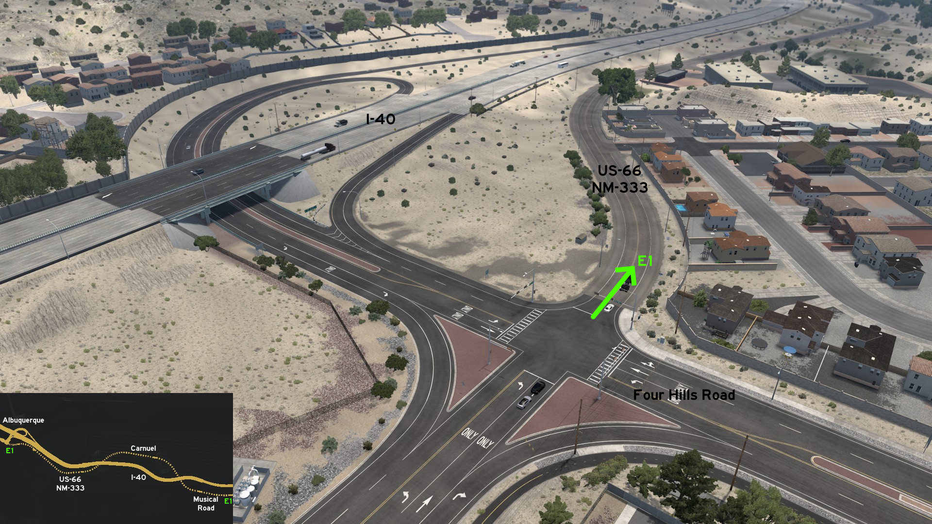 Leave east Albuquerque, where Apade and Pioneer depots are found. Cross Four Hills Road and head to US-66 / NM-333. Drive above I-40 until you reach the unmarked town of Carnuel. Drive below I-40 to reach the musical road. Signs state you should reduce your speed to 45 MPH to hear the music. Keep your wheels over the side rumble strips to listen to "America The Beautiful". Continue until you reach I-40.
East 3 - Two Companies, One Road
Category: shortcut, markableDiscovery: Zaroski
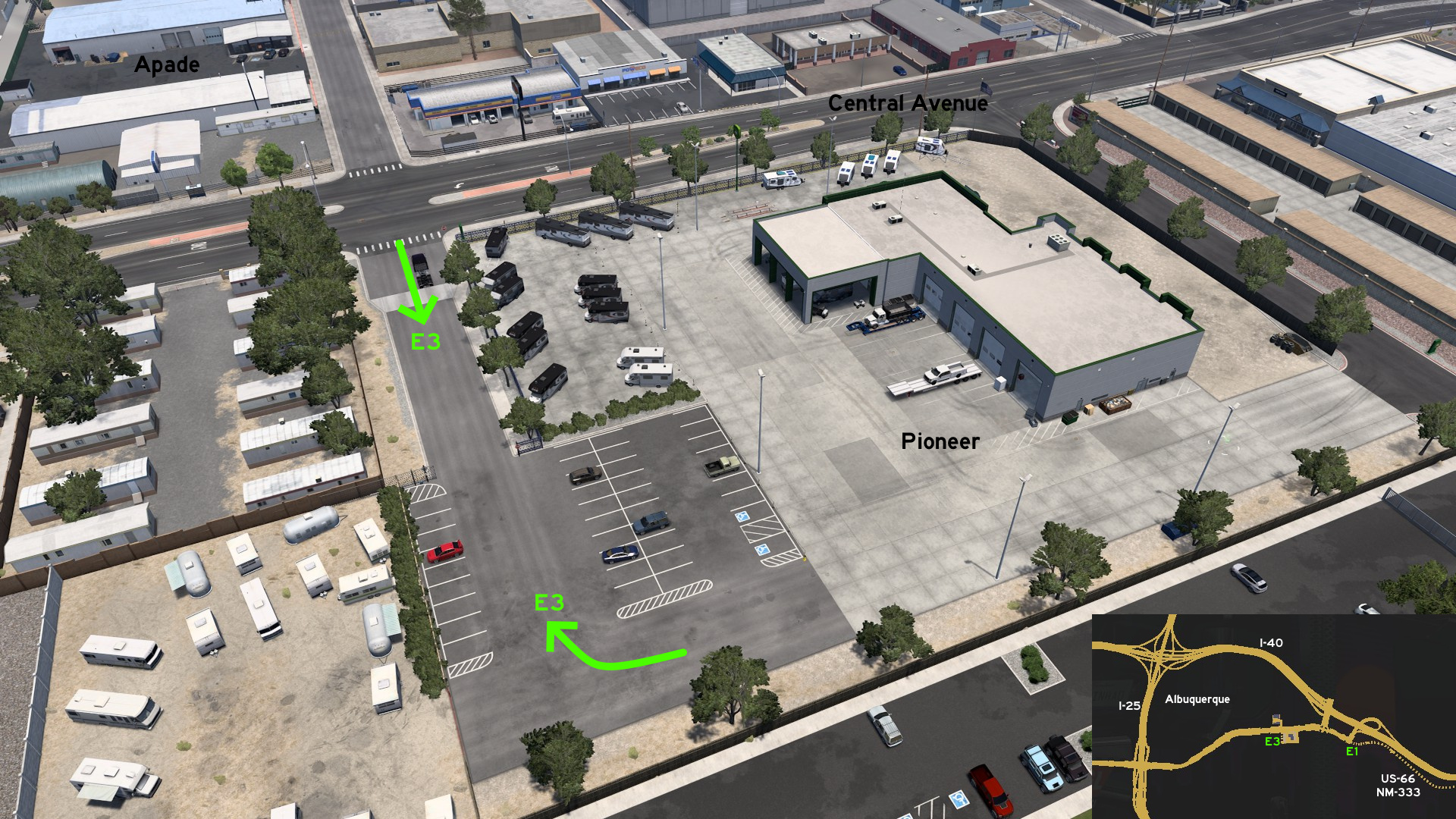 From the back entrance of Pioneer depot on Albuquerque, you can drive through the same stretch of road that can be used to reach Apade depot, across Central Avenue.
 South 1 - Trains And Beverages
Category: shortcut, markableDiscovery: MikMinevi
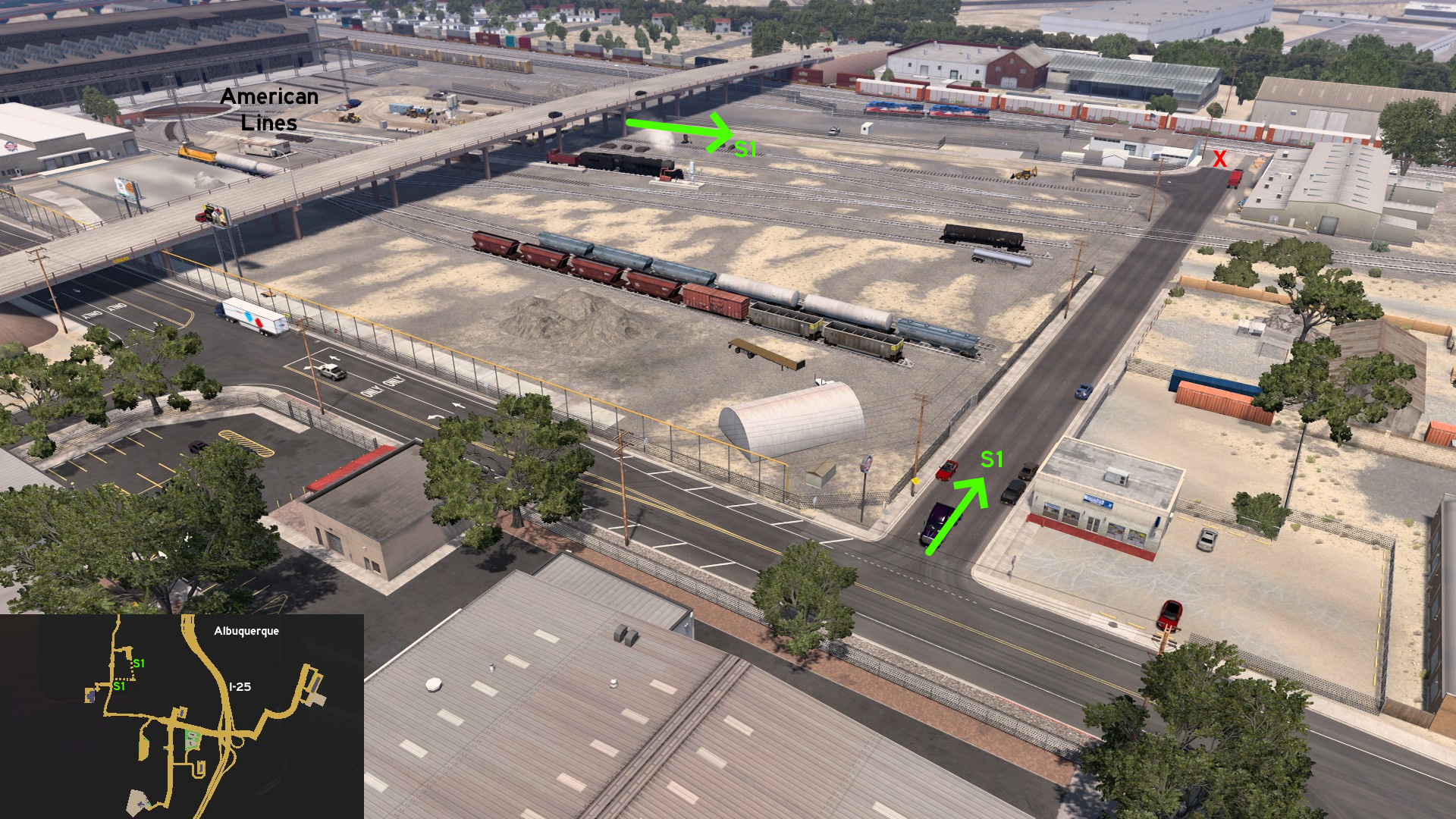 From American Lines depot on south Albuquerque, head south of the area, drive below the viaduct, and turn right (west). The road ends some meters before the entrance of USBB depot.
Gallup
East 1 - Drive To Route 66
Category: scenery, markableDiscovery: MikMinevi, punkito
Video (link): trucksim
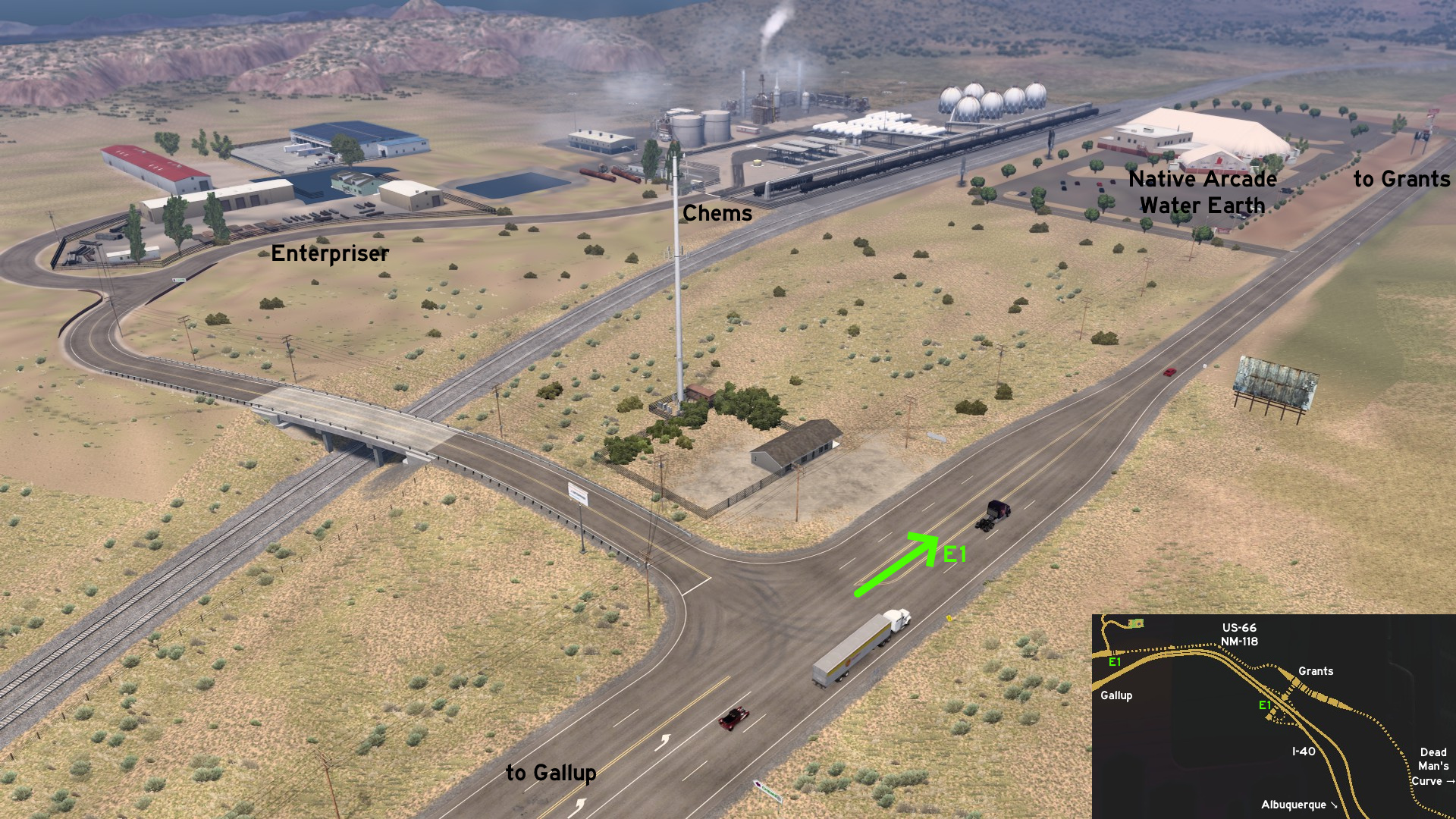 Go east Gallup through NM-118, where Enterpriser and Chems depots are found. Continue straight east to US-66 until you reach the unmarked town of Grants and one of the junctions to I-40. Keep on US-66 to visit Dead Man's Curve and reach the final junction to I-40, near Albuquerque.
 Southwest 1 - Shortcut Across The Border
Category: shortcut, markableDiscovery: MikMinevi, punkito
Video (link): trucksim
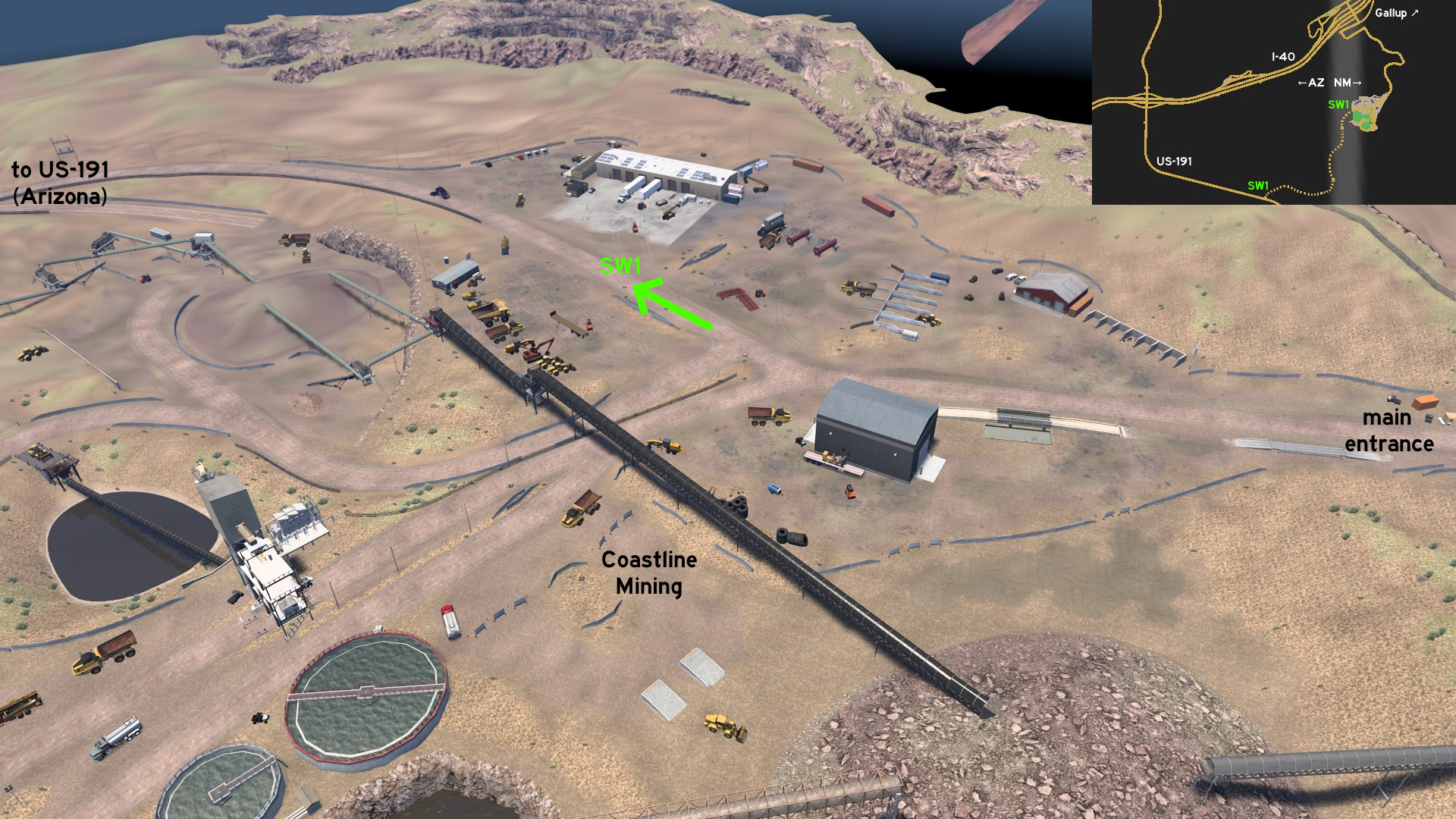 From the Coastline Mining area southwest of Gallup, there's a secondary entrance west, which leads to Arizona, and ends on US-191.
Raton
See also Raton on Colorado
Update: FelipeVinhao
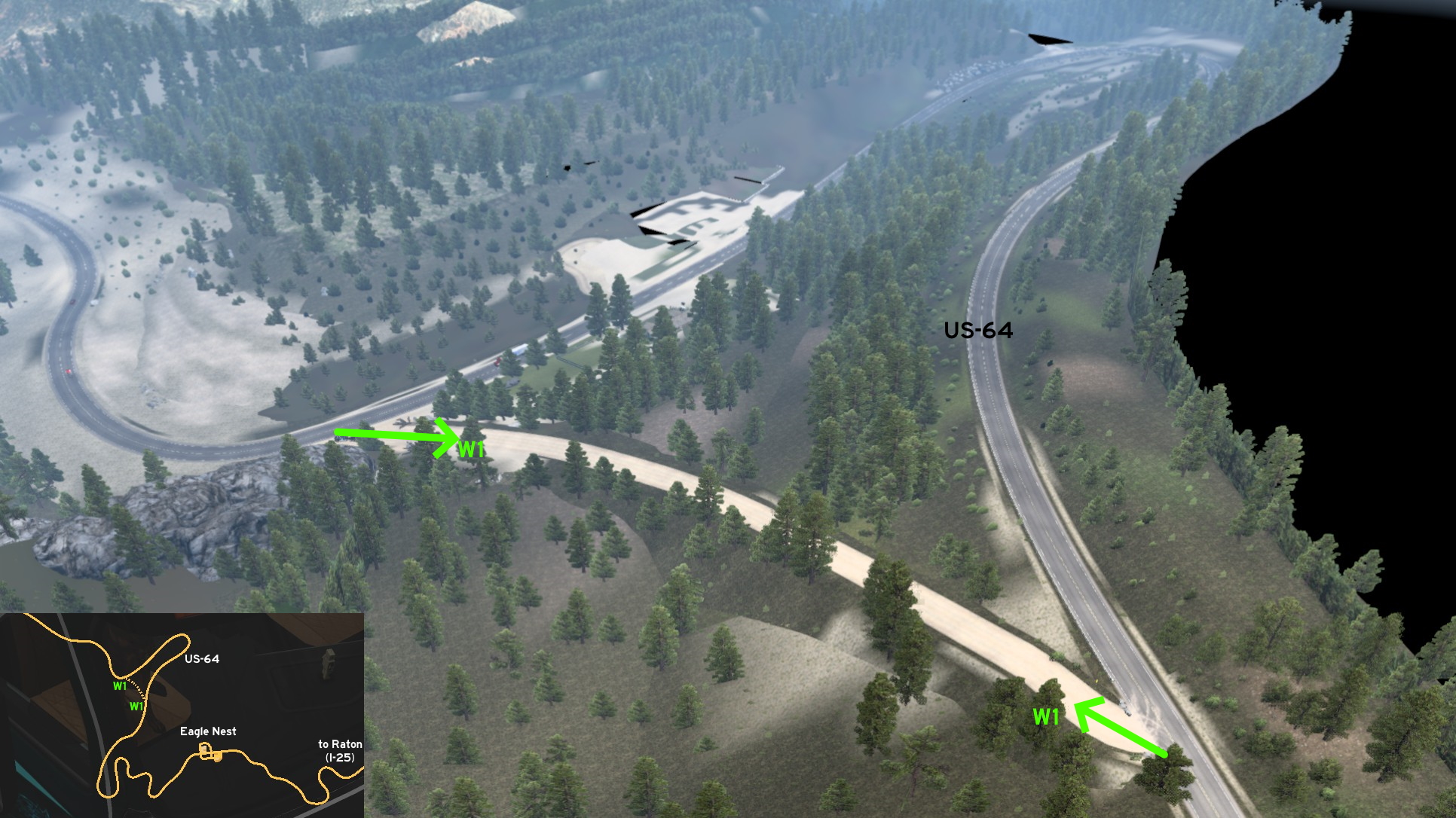 On US-64, northwest of the unmarked town of Eagle Nest (which serves as a rest stop in game), you can avoid the legal long curve. Both ends of the dusty shortcut have signs stating trucks are forbidden. When you're halfway to the otherside, the achievement will be unlocked... and you may also save some precious minutes.
West 1 - US-64 Shortcut
Category: shortcut, achievement (Forest Shortcut), markableUpdate: FelipeVinhao
On US-64, northwest of the unmarked town of Eagle Nest (which serves as a rest stop in game), you can avoid the legal long curve. Both ends of the dusty shortcut have signs stating trucks are forbidden. When you're halfway to the otherside, the achievement will be unlocked... and you may also save some precious minutes.
Tucumcari
North 1 - City Closer To Crops
Category: shortcut, markableDiscovery: Zaroski
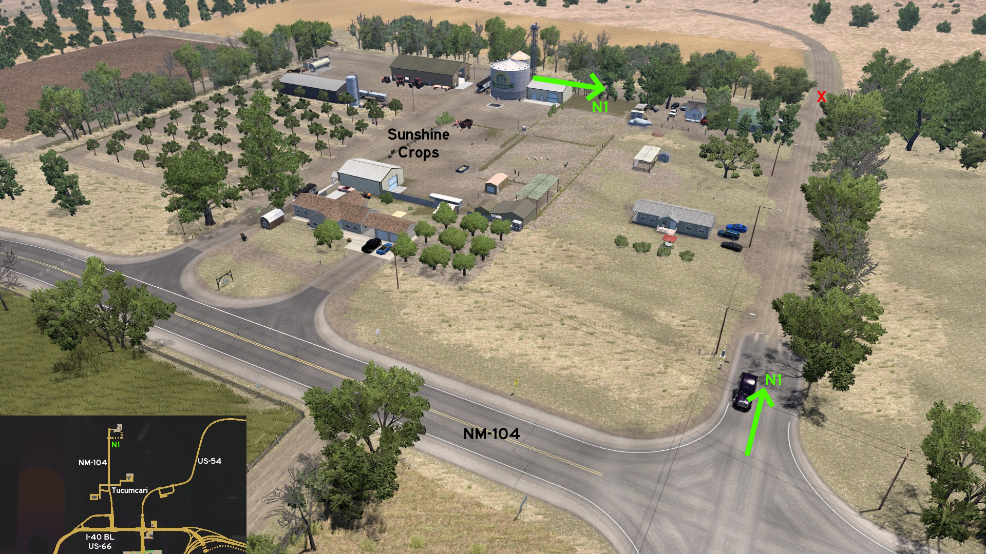 Go to Sunshine Crops north of Tucumcari. Heading south of delivery area, a dusty path leads you back to NM-104.
 Southeast 1 - From New Mexico To Texas Through Route 66
Category: scenery, markableDiscovery: DDogg
Update: FelipeVinhao
Note: route was changed on New Mexico side on version 1.58
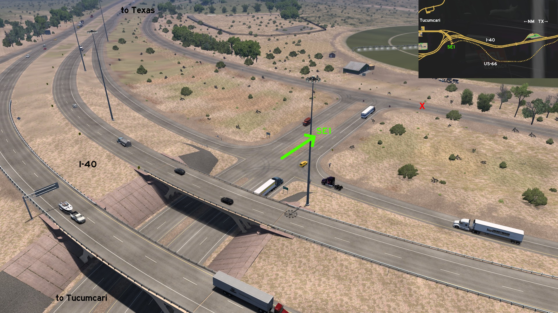 On the easternmost exit of Tucumcari on I-40, just keep heading south to find an open road, and then turn left (east) to access the historic Route 66. Drive over an old bridge until you reach Glenrio on the border of New Mexico and Texas.
 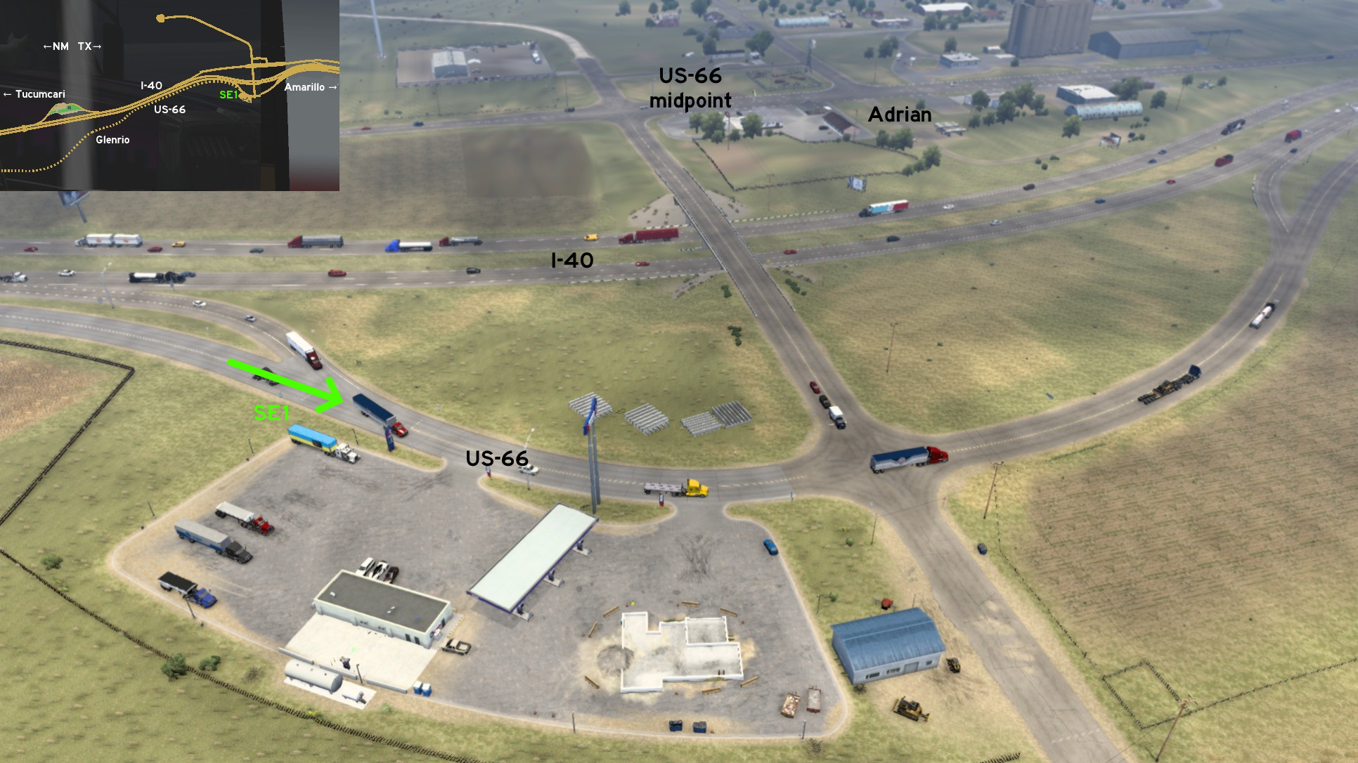 Keep going east until you reach a rest stop halfway to Amarillo, on the unmarked city of Adrian, where you can find the viewpoint stop for it, exactly on the midpoint of Route 66.
3rd DLC, 2018 October 04
Astoria
See also Astoria on Washington
Discovery: aqweasd7
Update: lizzard29rus, Foonty
Note: road became markable on version 1.48
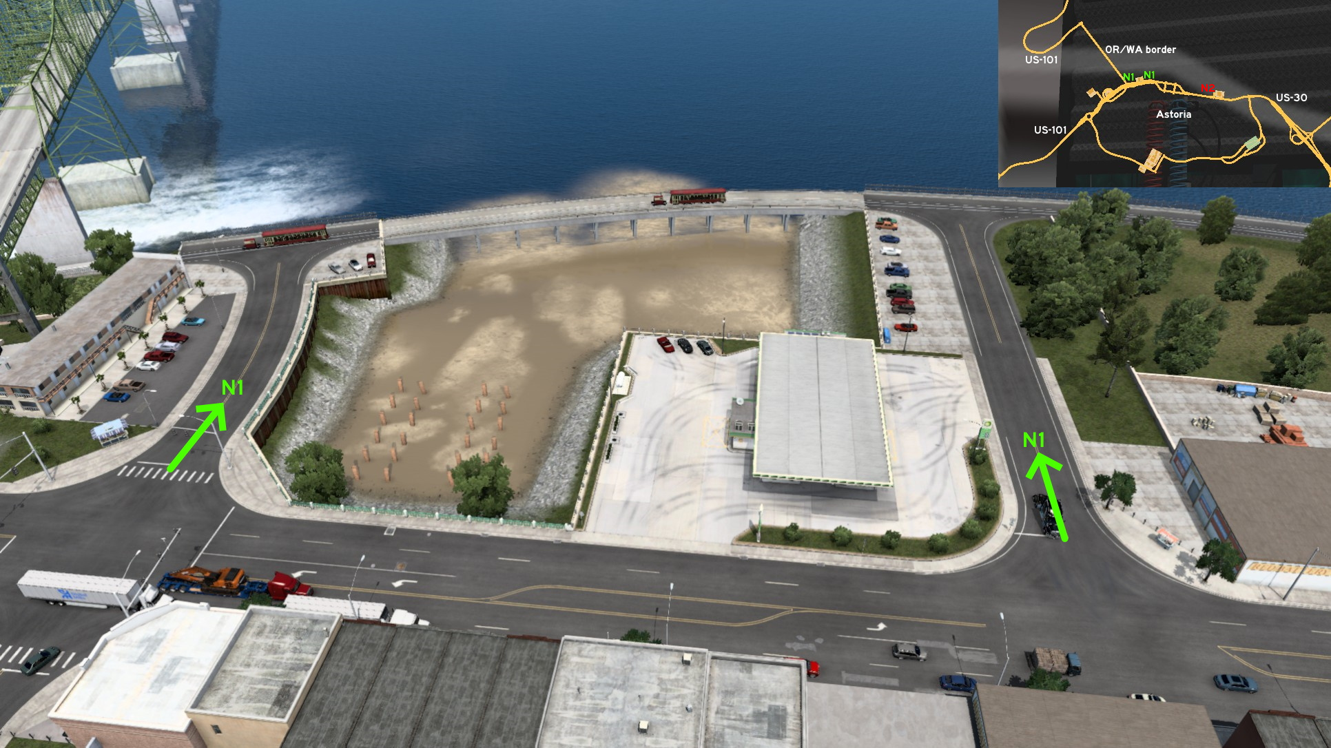 From the block before Astoria-Megler Bridge (US-101), where you can find a fuel station, you can see the rails where the Astoria waterfront trolley runs. Simply drive from any of both roads to reach the rails. The trolley runs from west to east, and rails aren't accessible out of this perimeter, so be careful.
Discovery: Richard_Stamos
Update: FelipeVinhao
Note: on version 1.53, Verison was changed to Apade
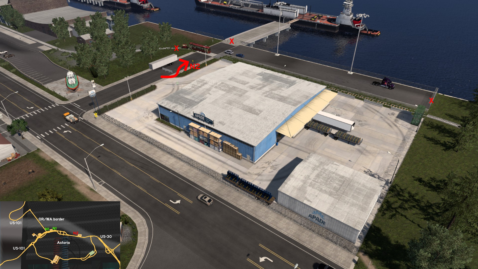 From the way to Apade warehouse, you can drive between the fence and the company sidewalk, or drive around the other side (when there's no truck or trailer parked there), cross the city trolley tracks, and reach the waterfront area. The path to boat is blocked though.
North 1 - Waterfront Rails
Category: scenery, markableDiscovery: aqweasd7
Update: lizzard29rus, Foonty
Note: road became markable on version 1.48
From the block before Astoria-Megler Bridge (US-101), where you can find a fuel station, you can see the rails where the Astoria waterfront trolley runs. Simply drive from any of both roads to reach the rails. The trolley runs from west to east, and rails aren't accessible out of this perimeter, so be careful. North 2 - Across The Tracks To The Boat
Category: sceneryDiscovery: Richard_Stamos
Update: FelipeVinhao
Note: on version 1.53, Verison was changed to Apade
From the way to Apade warehouse, you can drive between the fence and the company sidewalk, or drive around the other side (when there's no truck or trailer parked there), cross the city trolley tracks, and reach the waterfront area. The path to boat is blocked though.
Bend
North 1 - World Famous Mysterious Town
Category: easter-egg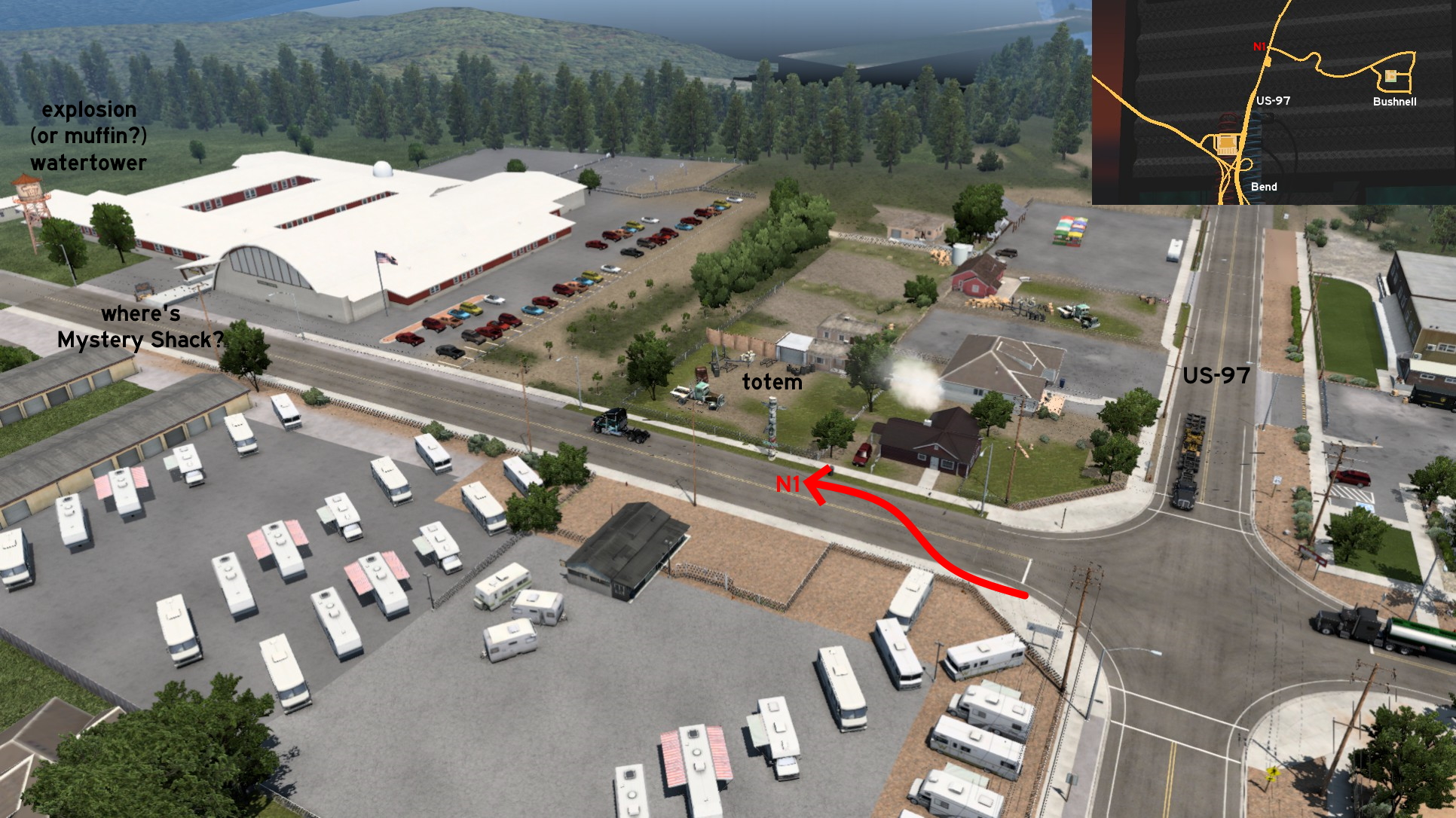 North of Bend, on US-97, opposite to the road leading to Bushnell Farms, there's a road to a mysterious town. Squeeze between the fence and UI roadblock, knocking down the stop sign. The first thing you'll see is a totem pointing the town direction. A little further, there's a sign stating a certain Mystery Shack, and a water tower with an explosion (or a muffin?) grafitti. Stop when you see the road getting narrow.
Eugene
Southeast 1 - Dexter Reservoir Overlook
Category: scenery, markableDiscovery: HuskyDynamics
Update: Laffey
Ñote: road became markable on version 1.48
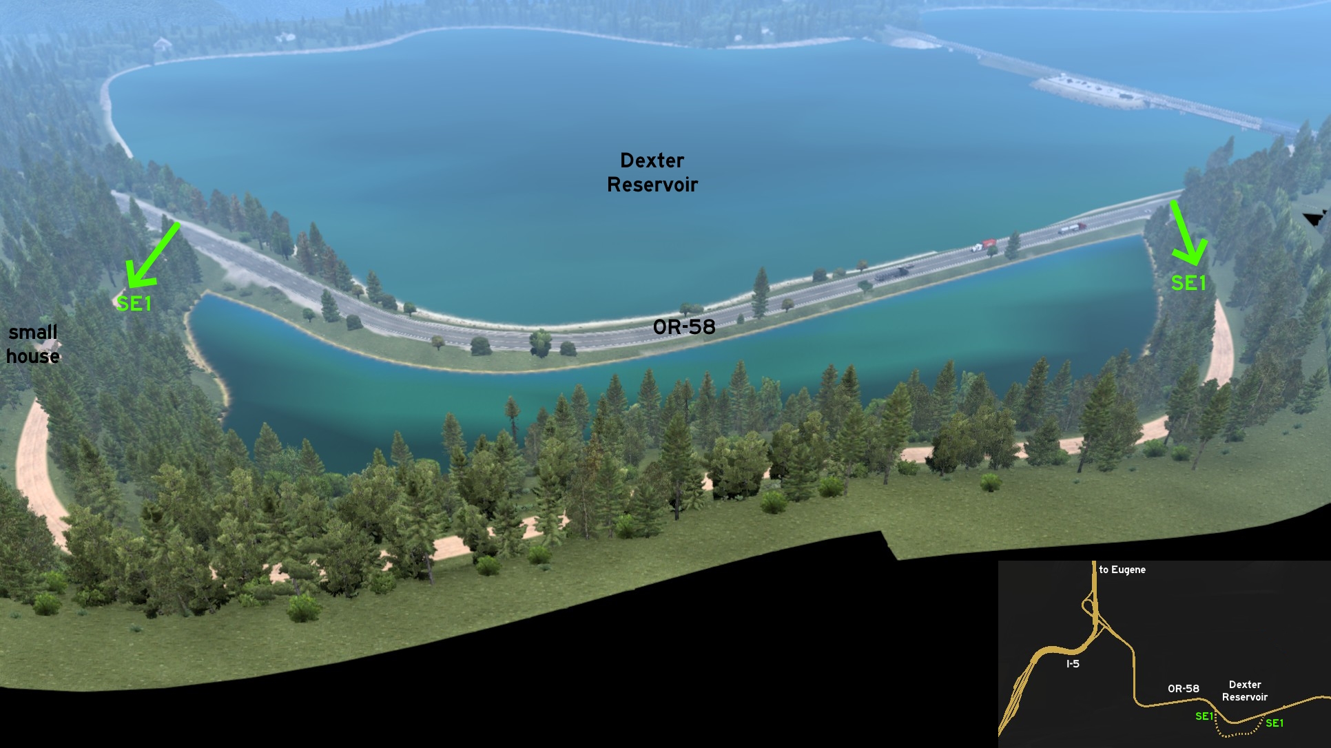 Go to Dexter Reservoir, southeast of Eugene, on OR-58. There's a dirt road with two entrances: the one visible when you come from I-5 has a small house with a car parked nearby, where you can have the best view of the lake. You can go even higher, but the dense forest can make a little more difficult to see it.
Klamath Falls
North 1 - Crater Lake Rim Lookout
Category: achievement (Travel Oregon), markableDiscovery: FelipeVinhao
Note 1: this road was visible on map before version 1.44
Note 2: in order to unlock Travel Oregon achievement, you need to find other 3 landmarks that are on visible roads; please refer to this guide by Xeeran to find all 4 landmarks and other achievements
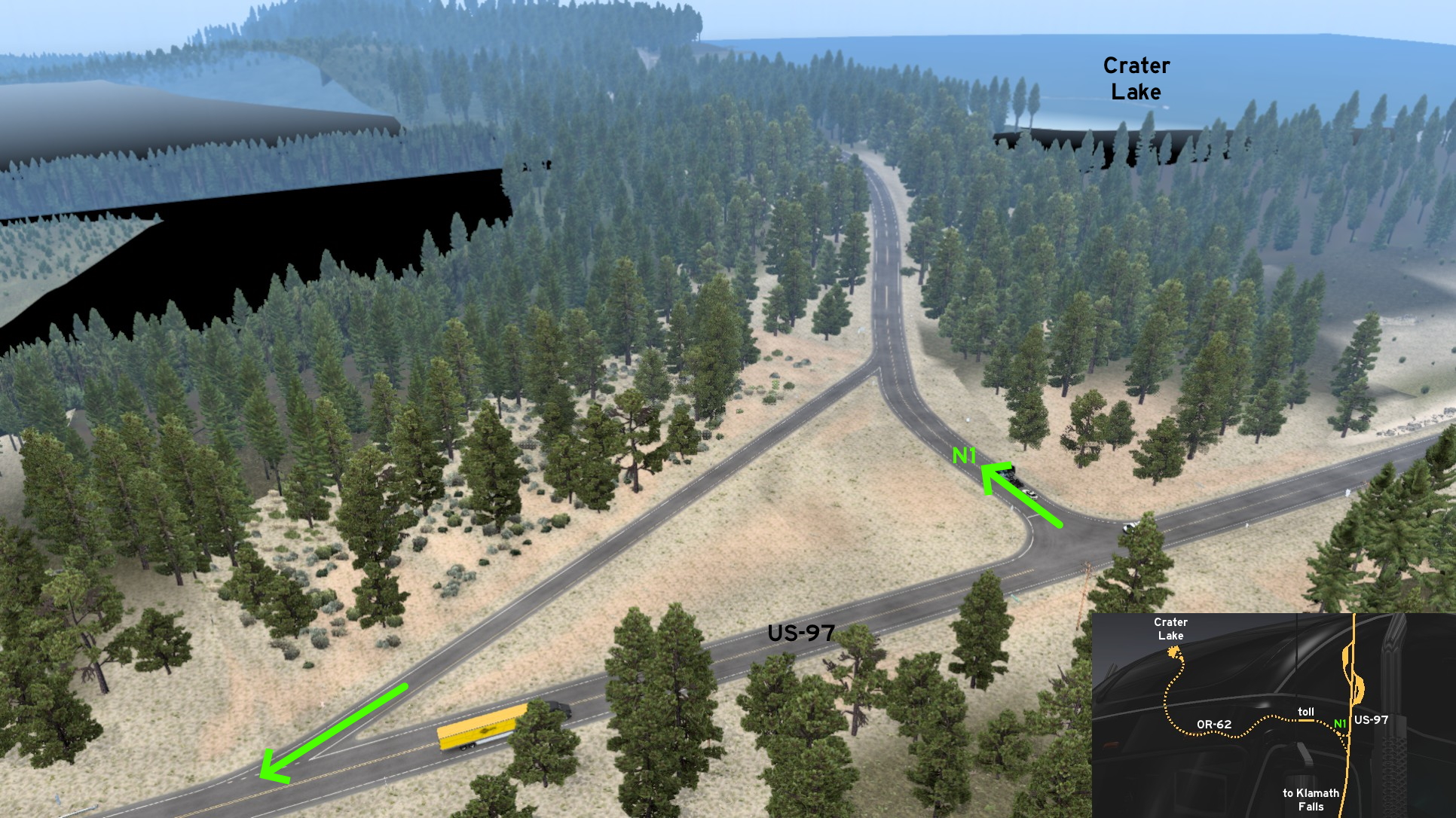 Leave north Klamath Falls through US-97. Some miles after the weigh station and some meters before a rest stop, you'll see the open OR-62 heading west. To visit Crater Lake, you must pay a 25-dollar toll, and drive OR-62 to the end.
Lakeview
East 1 - A Quick View Over Nevada
Category: sceneryDiscovery: Richard_Stamos
 On OR-140, some miles before reaching Nevada, there's a path starting on a rest stop (that you can't use) running along the road and the valley below. There's a truck wreck on the way, and another parking spot in the end you can use to maneuver easier and stop to view the mountains. Drive carefully though: although there's something to avoid falling into the abyss, you'll still need to call for help if you skid here.
 West 1 - Real Estate Visit
Category: sceneryDiscovery: Applecorn
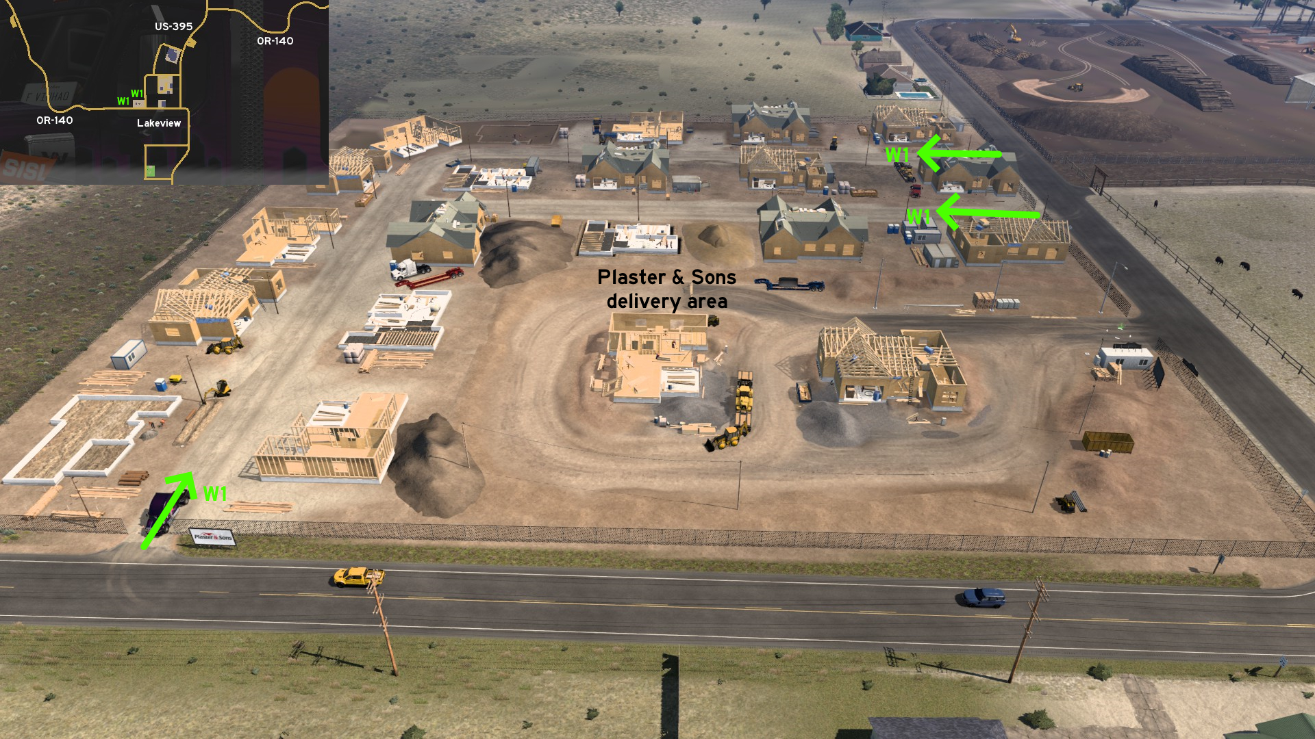 Around the Plaster & Sons delivery site, you can visit the other houses being built. There are three entrances: one south, and two east. Just be warned that they're narrower than the entrance to delivery area.
Newport
North 1 - A Different Point Of View
Category: sceneryDiscovery: Maxis2012
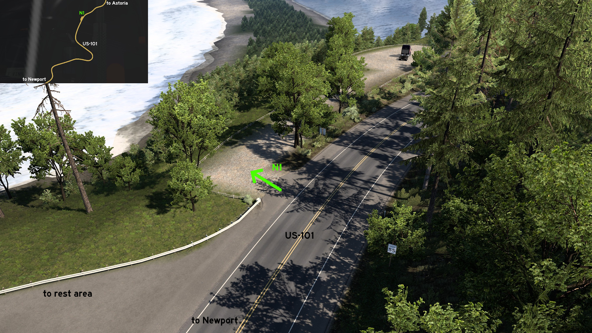 Leave north Newport through US-101. Right after the rest stop halfway to Astoria, there's another area that can be accessed as a Pacific Ocean overlook. It can be easily spotted by the speed limit signs on both directions.
 Northeast 1 - Logging Loop
Category: sceneryDiscovery: Applecorn
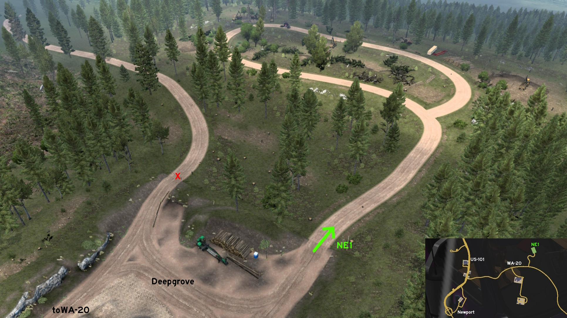 Leave north Newport through US-20 and go to Deepgrove logging area (the one north of the road). A bigger logging area can be accessed north of delivery area. Just be careful about logs and thumps left along the way.
Ontario
Central 1 - Don't Mind The Dust
Category: shortcutDiscovery: Applecorn
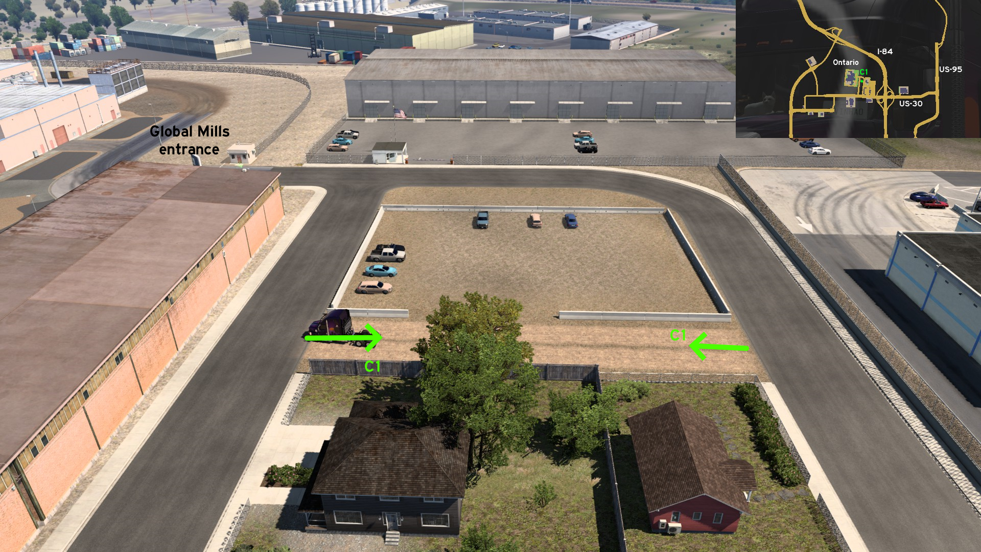 A little before reaching Global Mills entrance, there's a dirt path leading to a small parking lot. Hopefully drivers here haven't just came from car wash...
Portland
East 1 - Forbidden Interstate
Category: sceneryDiscovery: Hedwig xo
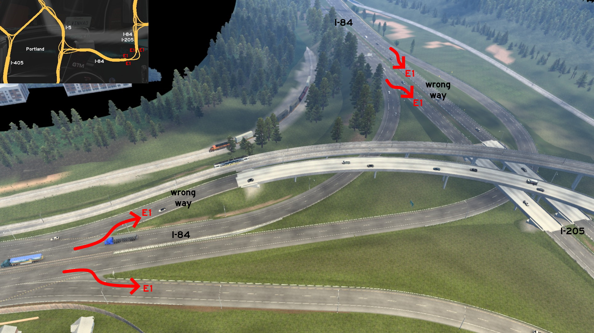 From east Portland, you can access a closed section of I-205 by all 4 ramps - 2 on the wrong way or reversing. Just head to the clear breach on each of the UI roadblocks, be careful about the high speed traffic, and go ahead. Just slow down when you're close to the background hills, to not fall to the "void".
The Dalles
Northeast 1 - Between Trucks And Trains
Category: sceneryDiscovery: aqweasd7
Update: kettcardriverprofi, Applecorn
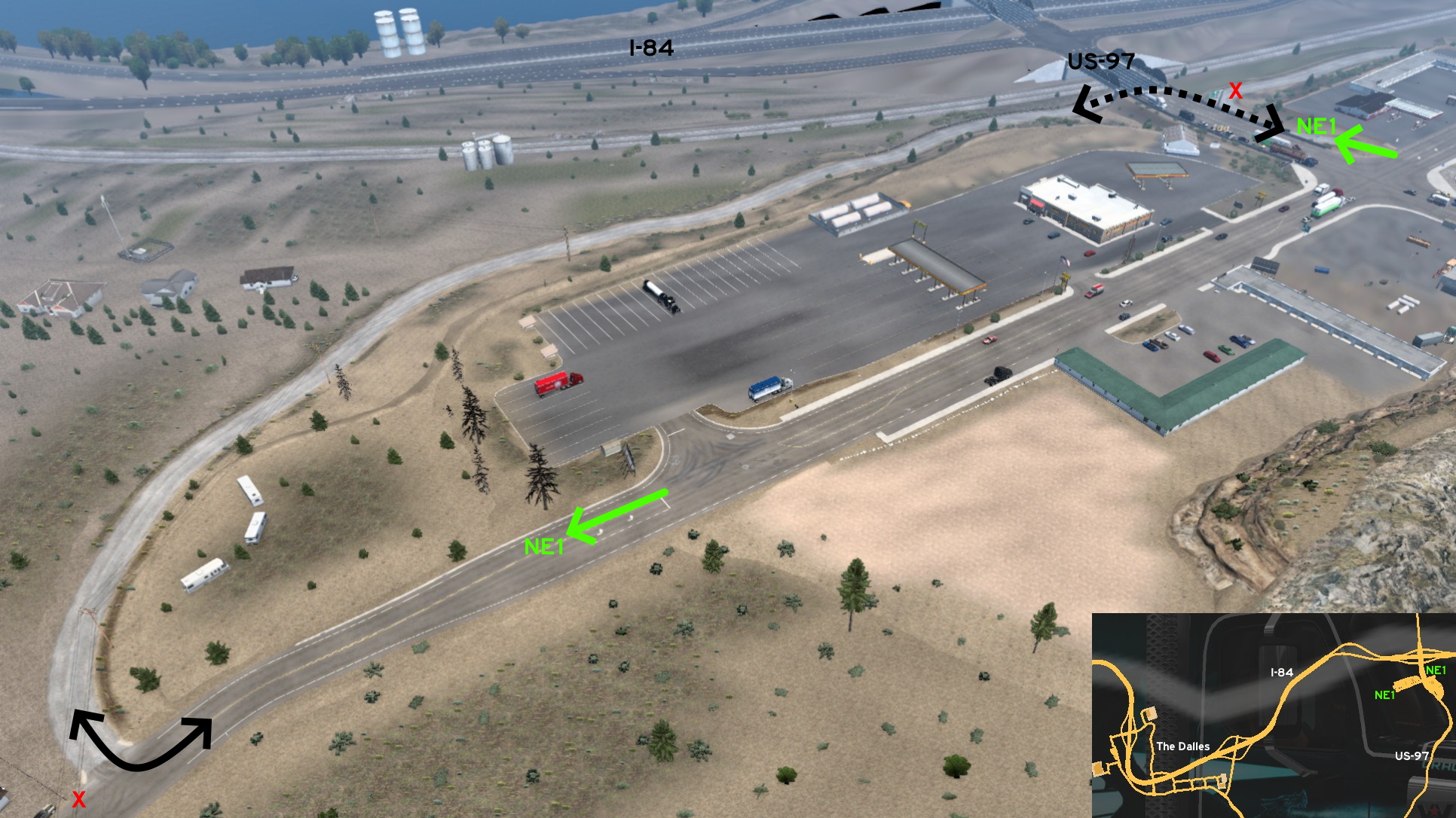 Go to the rest stops on the intersection of I-84 and US-97. One of the entrances to the dirt road is near the crossing where you find the Gallon rest stop: it goes below the US-97 viaduct, after a closed road. The other is after Heart's rest stop: you'll notice there's nothing blocking your way after it, so simply go ahead to find the other entrance to dirt road. Just don't try to reach the rails!
5th DLC, 2019 November 07
Cedar City
West 1 - Over Or Across The Railways
Category: scenery, markableDiscovery: noob168
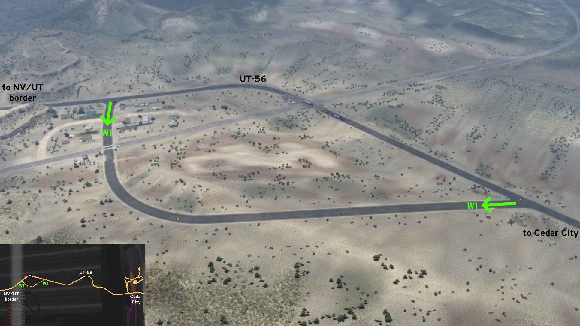 On UT-56, west of Cedar City, near the border with Nevada, you can choose the best place to view the railways. From the marked roads, you can see them from higher ground, on the viaduct. The unmarked roads can be accessed by a fork east of the viaduct, and from a T-crossing west of it, near a small village and scrapyard.
Logan
East 1 - From US-89 To US-89
Category: sceneryDiscovery: Applecorn
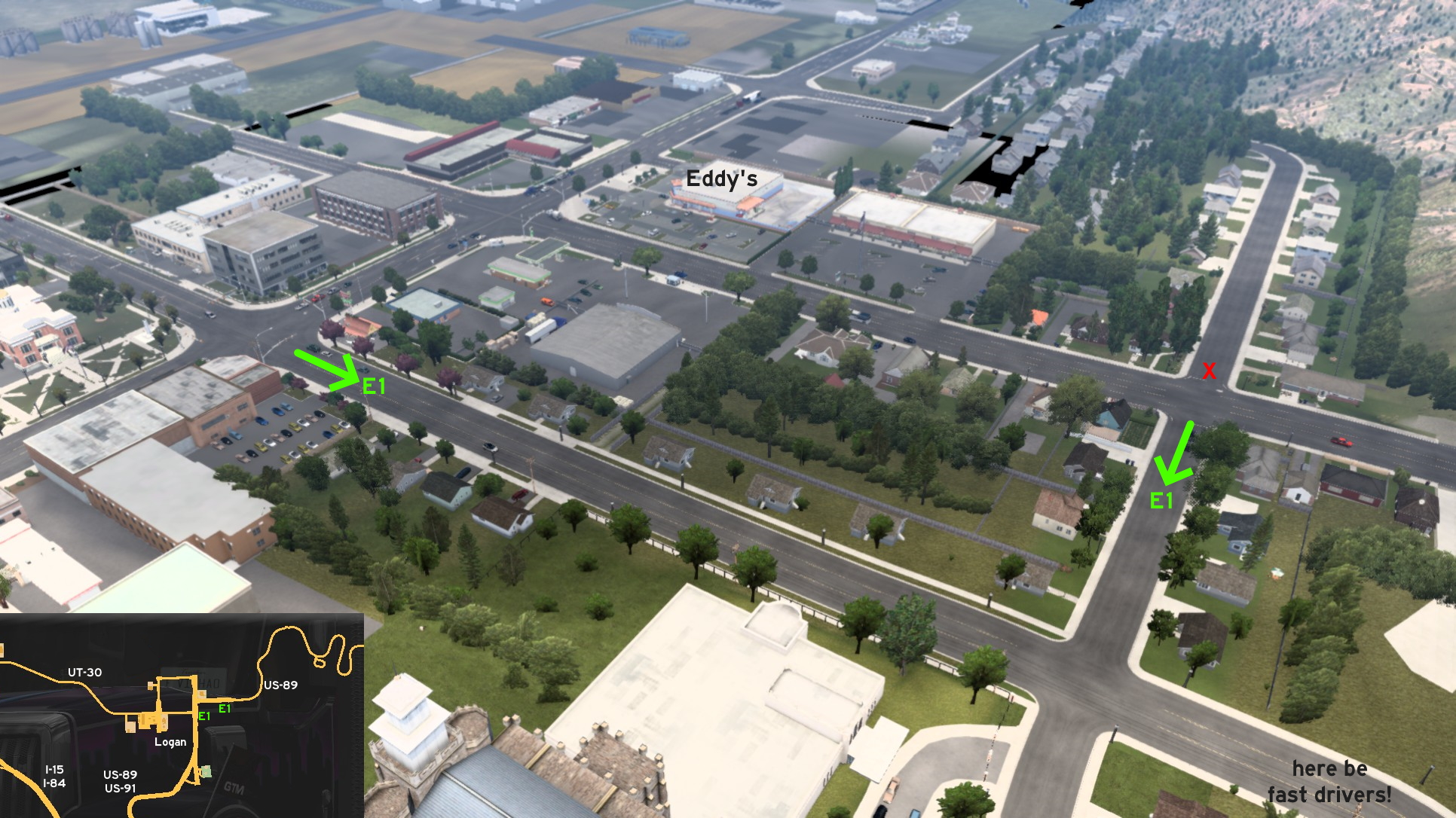 Several unmarked streets can be accessed on east Logan. One of the entrances is north of UT-30, and south of an Eddy's market. The other is near the far east of the city, some meters before US-89 gets narrow. The road across this entrance seems to be open, but it's blocked by an invisible wall. Be careful when reaching the roads without any marks, as drivers run pretty fast on this area.
Moab
South 1 - Town Of Bluff
Category: scenery, markableDiscovery: Lausambaychua
Note: only paved road is markable
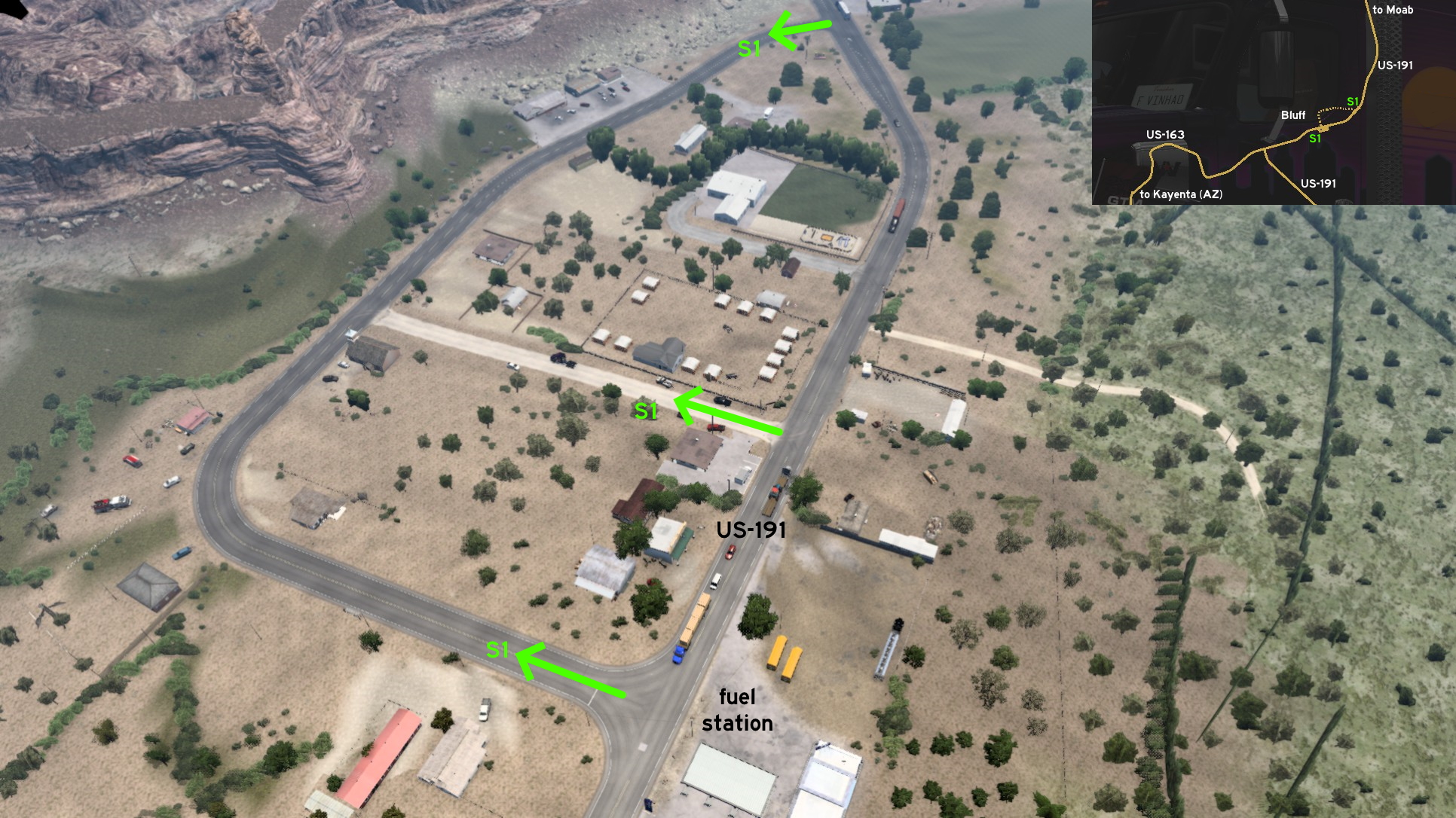 South of Moab, halfway to Kayenta (Arizona), you'll find welcome signs to the town of Bluff. But you can also visit some of its roads. The easiest to notice entrance is right in front of a fuel station, northeast of the intersection between US-191 and US-163. A dirt path between the hidden road and US-191 can also be accessed.
Ogden
Southwest 1 - Obstacle Course
Category: easter-eggDiscovery: skunk940 (original guide)
Update: Epic Trucker Arch
Note: on version 1.54, Wallbert was changed to Enterpriser
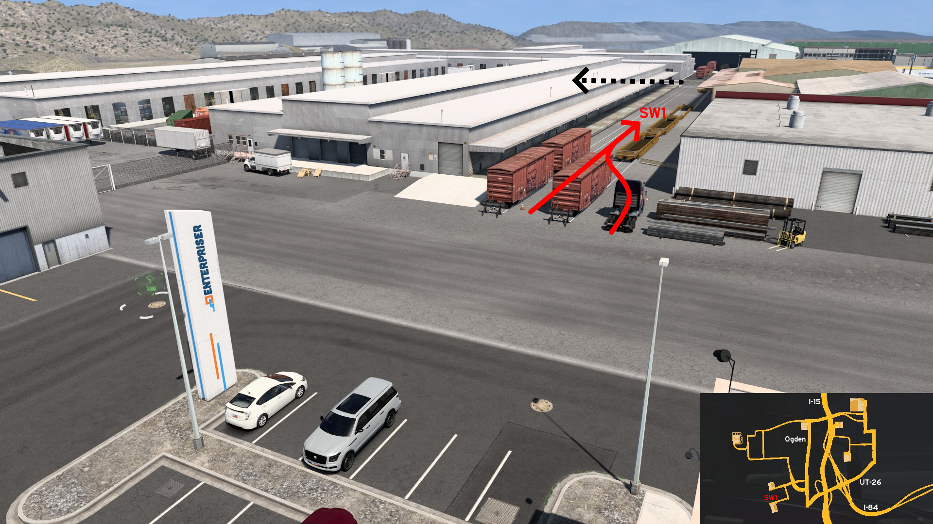 Head to Enterpriser on southwest Ogden. Across the road you'll see some train cars. Knock the heavy cones on the middle, or try to maneuver from the right and start training here. Drive some meters, turn left twice. Go ahead until you reach the obstacle course. Despite what's written on sign, hard and easy are the same circuit. And no automatic counter will start when crossing the line. https://steamcommunity.com/sharedfiles/filedetails/?id=2129291283
Price
West 1 - Tour De Pétrole
Category: scenery, markableDiscovery: LikelyLeon
Note: all roads are markable, except the dead end ones leading to the oil pumps
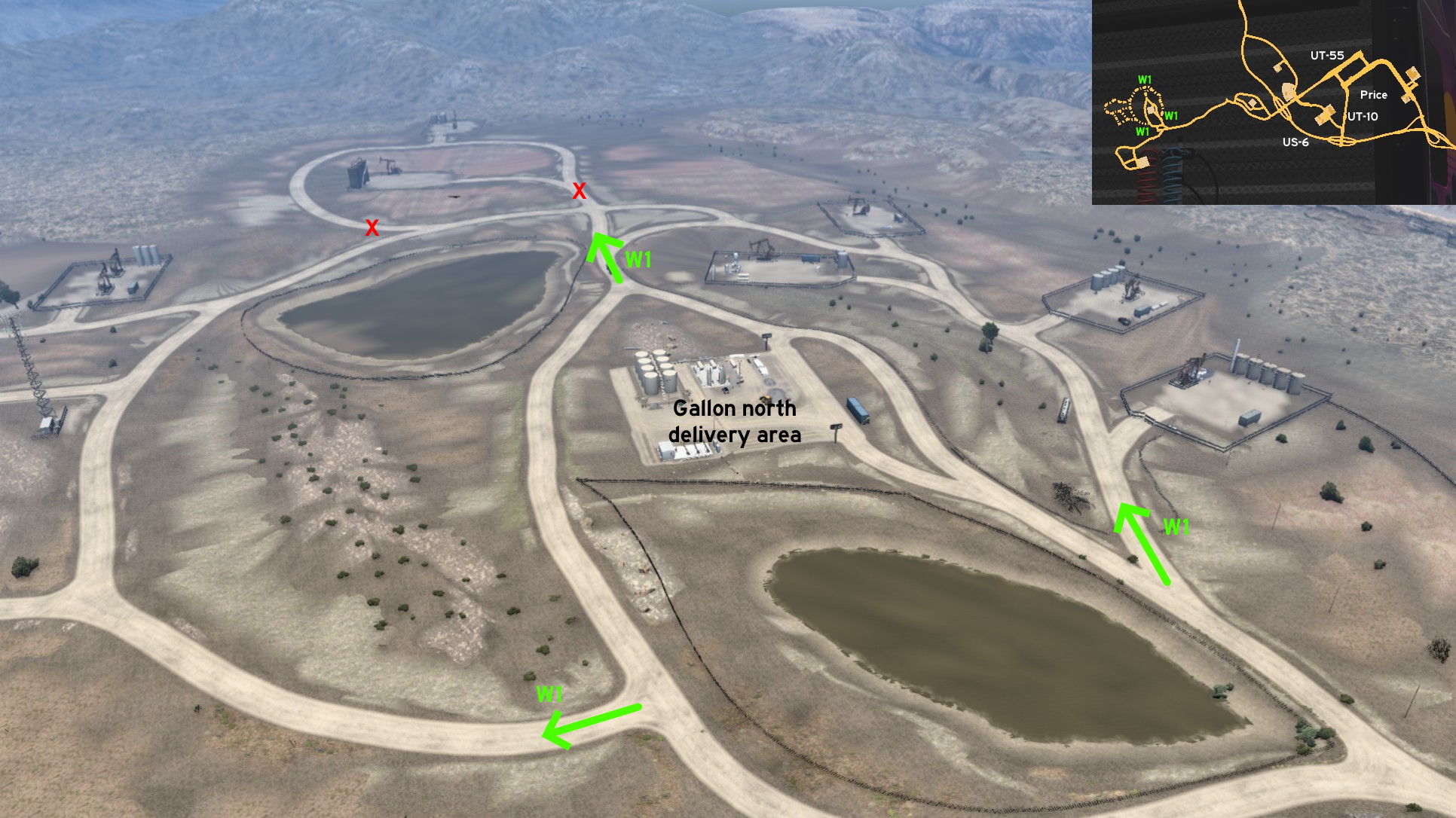 Far west of Price, head to Gallon oil fields. Around the north delivery area, there are 3 possible entrances - west, north and east of it. Several roads are accessible, and allow you to drive even further west. Most of them are markable, except the dead end ones that lead to gated oil pumps.
Provo
Northwest 1 - Utah Lake View
Category: sceneryDiscovery: DDogg
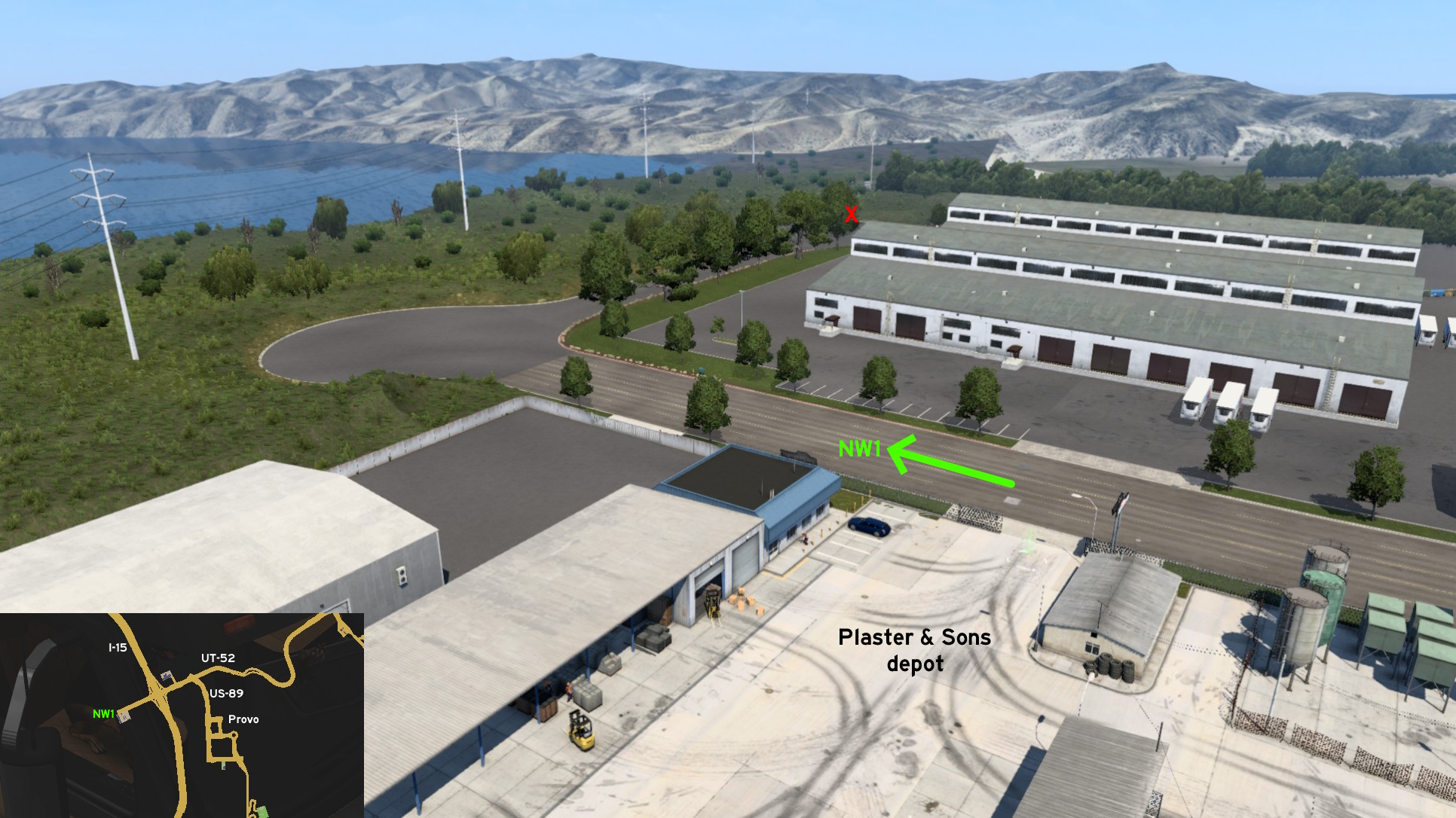 On the west end of UT-52, after Plaster & Sons depot, you can keep on the road until you reach a pair of cul-de-sac, where you can park and enjoy the view of Utah Lake across the trees.
 South 1 - Pumpkin Fields
Category: scenery, markableDiscovery: noob168
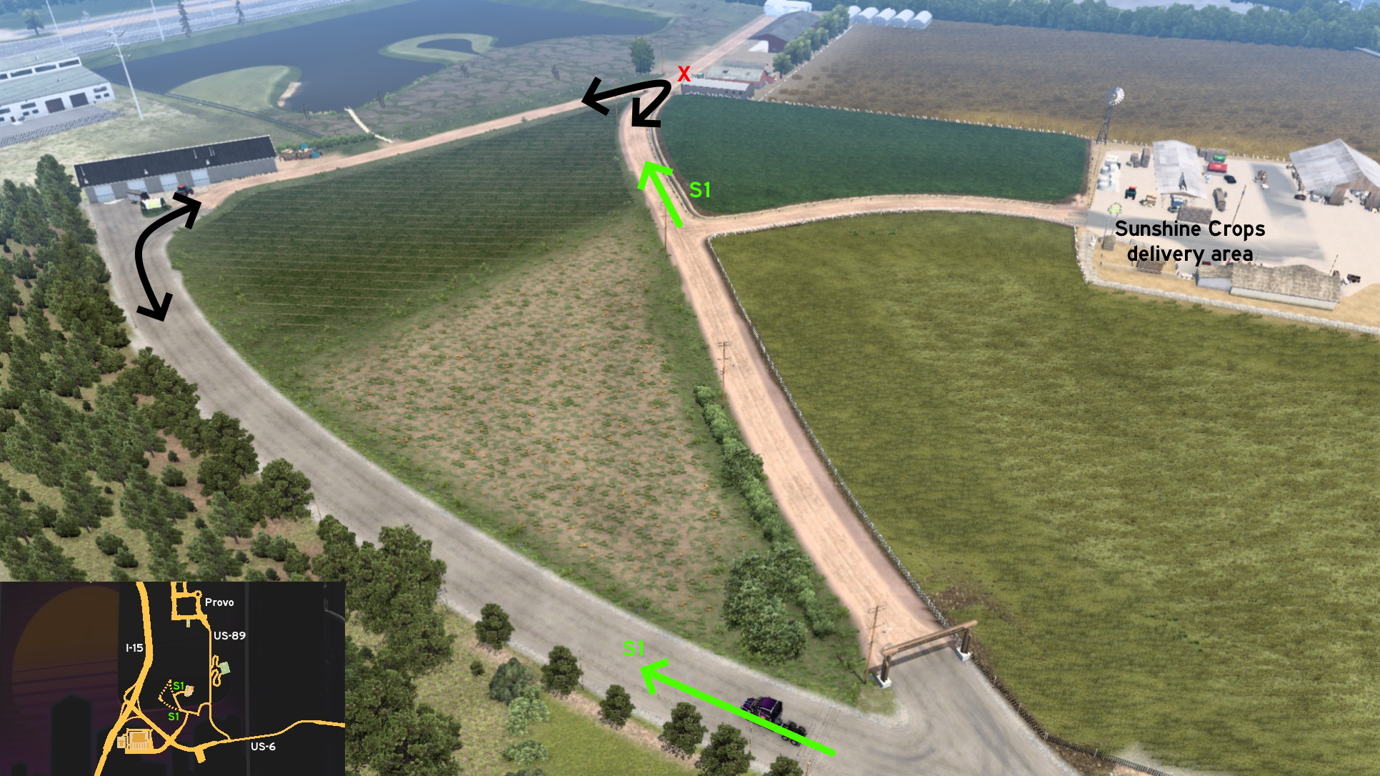 Head south of Provo to Sunshine Crops, between US-6 and US-89. There are 2 possible entrances, both fully accessible. One is close to delivery area entrance, keeping north. The other is south, bordering pumpkin fields. Be careful when reaching the northernmost limit if pulling a long trailer, you must do a tight curve there, and there's a stone that can make you get stuck.
Saint George
East 1 - A Beautiful View And A Sign That Says "Nothing"
Category: achievement (It's Something)Note: please refer to this guide by Xeeran to find other achievements
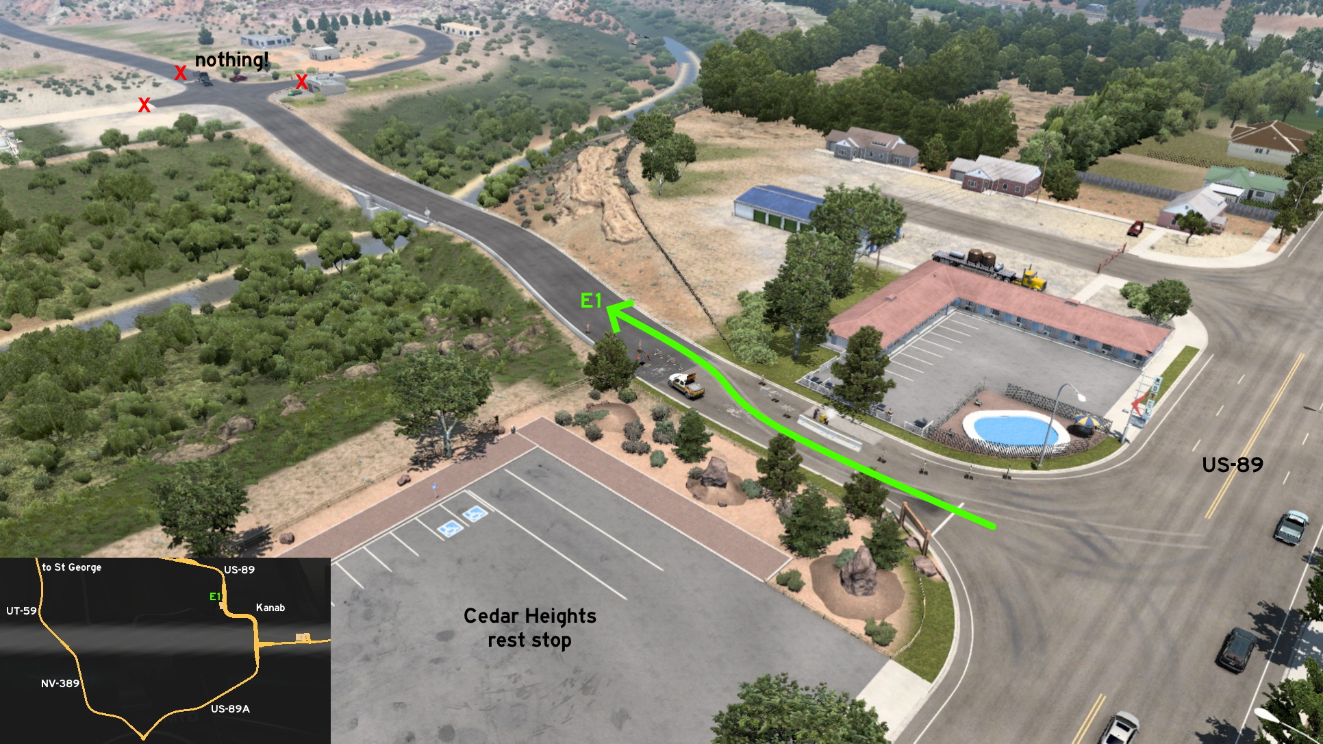 Head to the unmarked town of Kanab, on US-89, east of Saint George (UT) and west of Page (AZ). You'll find Cedar Heights rest stop, bordered by a road under maintenance - that's the road you must enter. Cross the bridge and go ahead until you find a blocked intersection, with a sign at the end. Enjoy the view and your new achievement.
 South 1 - Detour Or Dead End
Category: sceneryDiscovery: kettcardriverprofi
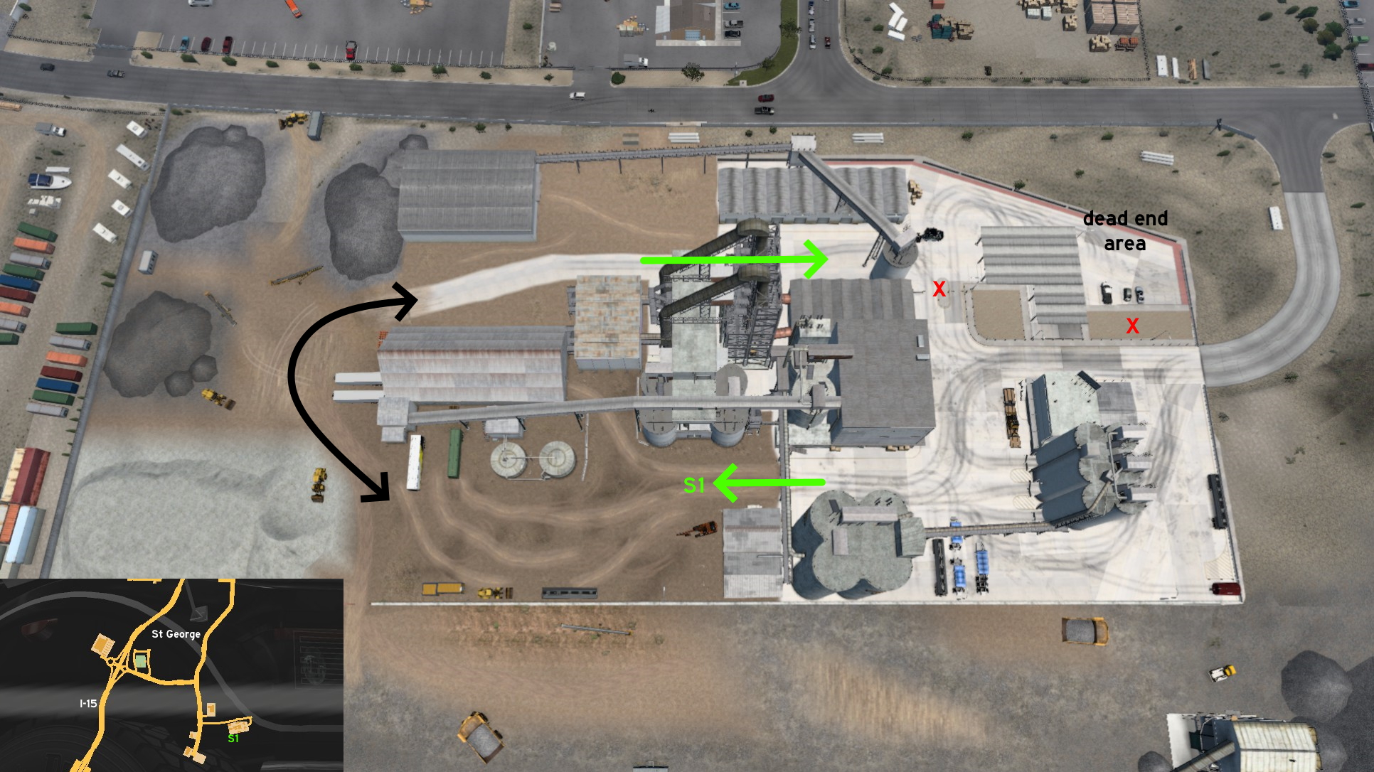 On Coastline Mining depot south Saint George, you can use the back open area of the building to maneuver your truck. Just be careful to not take the wrong exit and going to employee parking lot when pulling a long or artuculated trailer, as it's closed and you may get stuck there.
Salina
East 1 - Watch For Rock
Category: sceneryDiscovery: aqweasd7
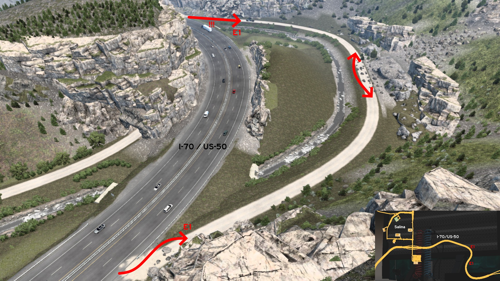 Just east of Salina, there's a dirt road bordering I-70 / US-50 freeway that was closed by fallen rocks. To reach it, you must keep right of crash barrier and left of the fallen rocks. Halfway to other end, there's another pile of rocks. Just keep left of them, just be careful to not go down to creek, or you may not be able to climb back. Trying to return to freeway from the second end may not be a good idea, as there's no safe path to not get stuck. It's better to return to first end.
Salt Lake City 🏛️
Northwest 1 - Closed Business
Category: sceneryDiscovery: DDogg
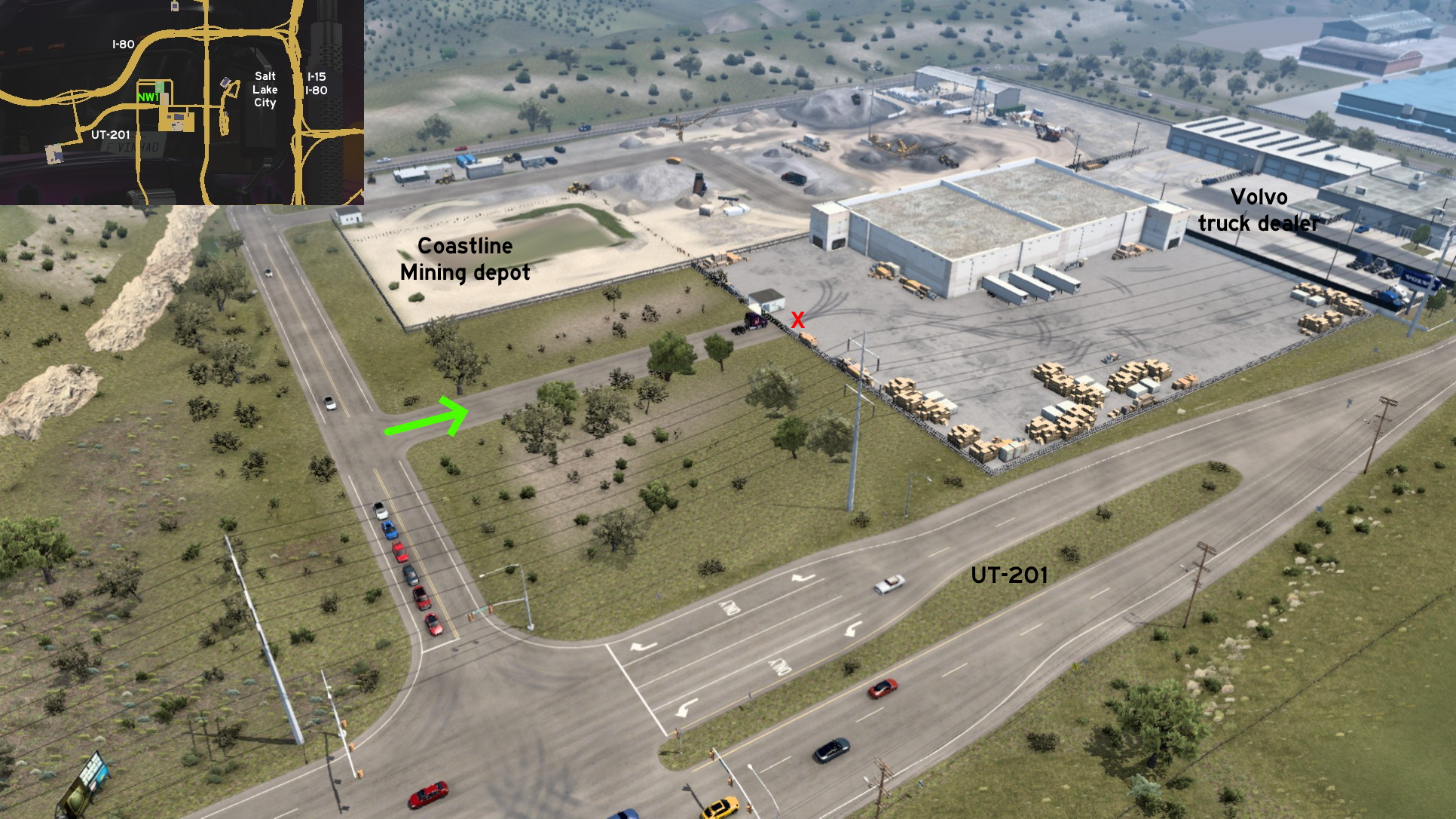 Head northwest Salt Lake City, close to the corner of UT-201 and the road that leads to Coastline Mining depot. There's a road to an unnamed company. You may even enter here by accident if not paying attention to GPS, thinking it's part of Coastline Mining. But the end of the road is closed.
 Northwest 2 - Junkyard Drive
Category: sceneryDiscovery: mattbman
Note: actually the whole Avalanche Steel area is marked on map, but the route itself isn't visible
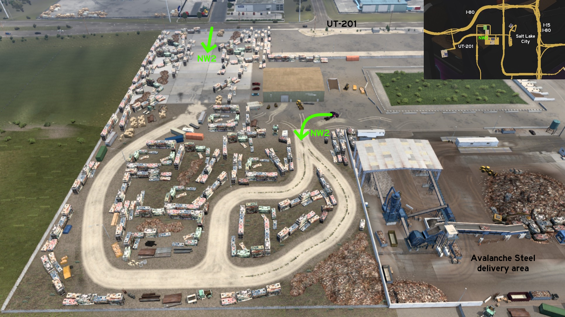 West of Avalanche Steel, the area through the junkyard is fully accessible. Just drive carefully and avoid joining the crushed vehicles!
 Southwest 1 - This View Is Mine
Category: scenery, markableDiscovery: ernst-ulrich.reichelt
Note: it may not trigger the discovery message, but it will still be marked
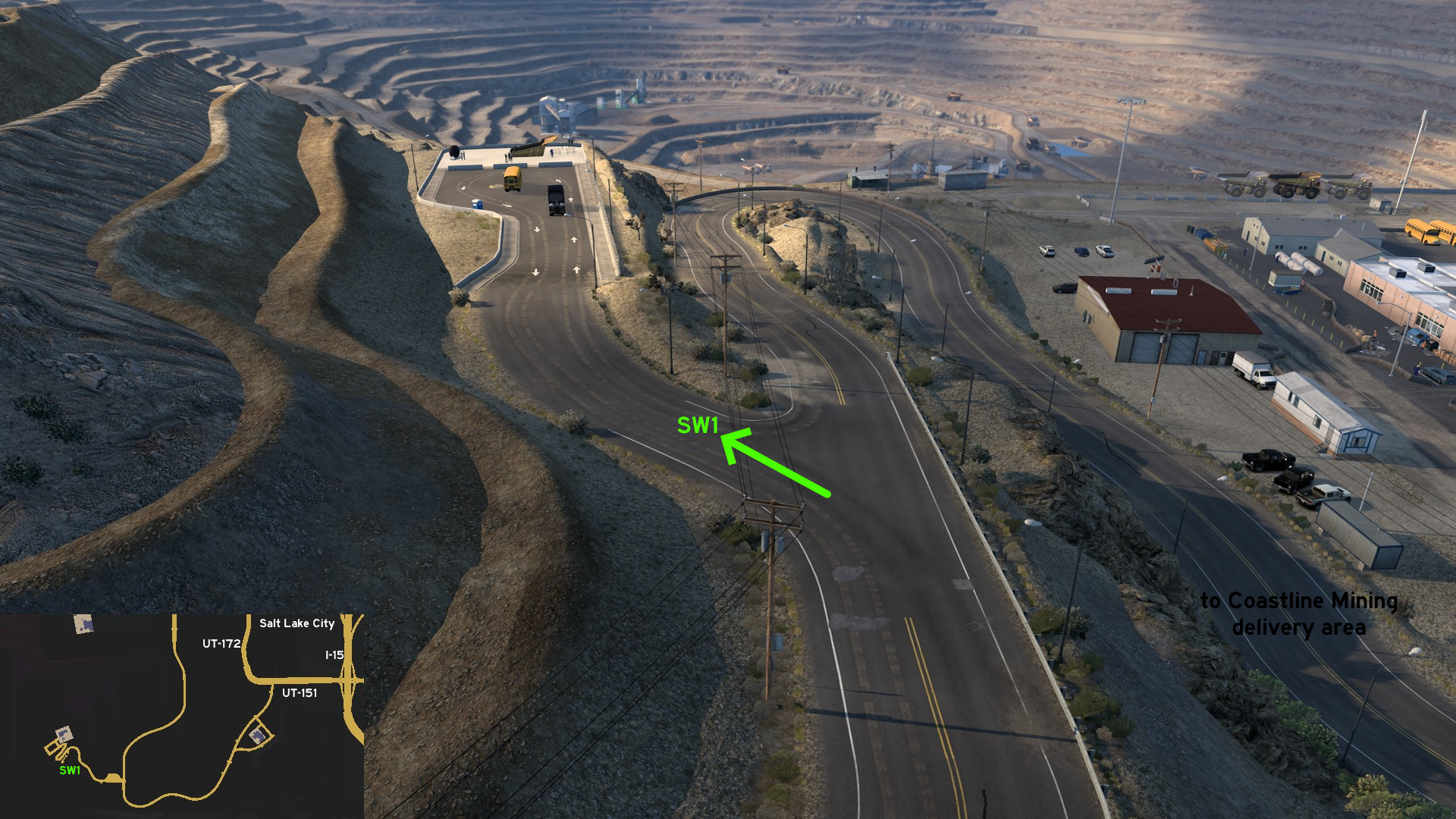 Head to Coastline Mining southwest of Salt Lake City. Before reaching the crooked route down to delivery area, take the split route up to reach the mine overlook area, where some school buses may be parked.
Vernal
Southwest 1 - Drive By And Over Pelican Lake
Category: scenery, markableDiscovery: noob168
Update: FelipeVinhao
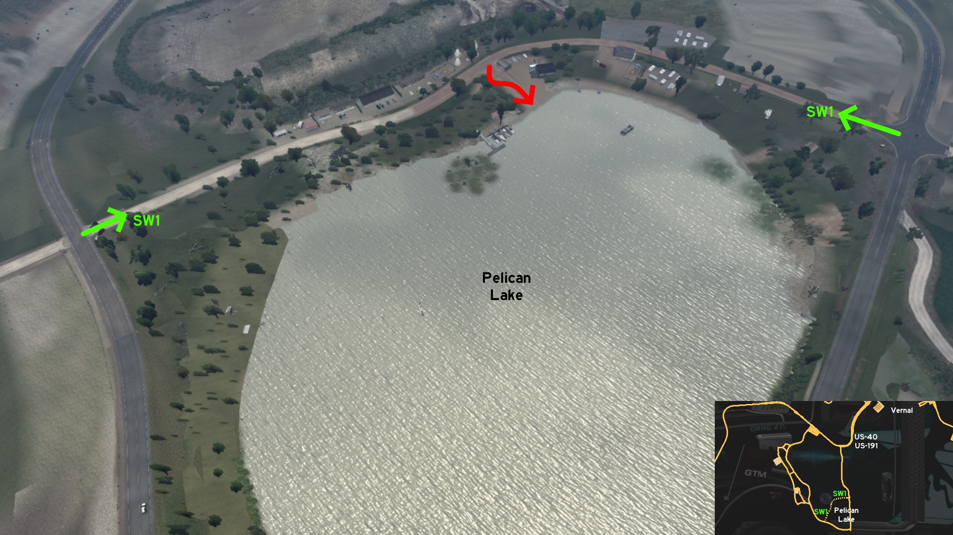 Southwest of Vernal, where you can find Gallon oil pumps, you can also visit Pelican Lake. There's a friendly warning on both ends about not having trucks on this road, and another about minimizing dust. Maybe it's just to keep place calm and silent. Or maybe to keep its secret: you can drive over the lake. Just drive around the wooden barrier halfway and see for yourself.
 West 1 - Chemical Plant Back Entrance
Category: shortcutDiscovery: DDogg
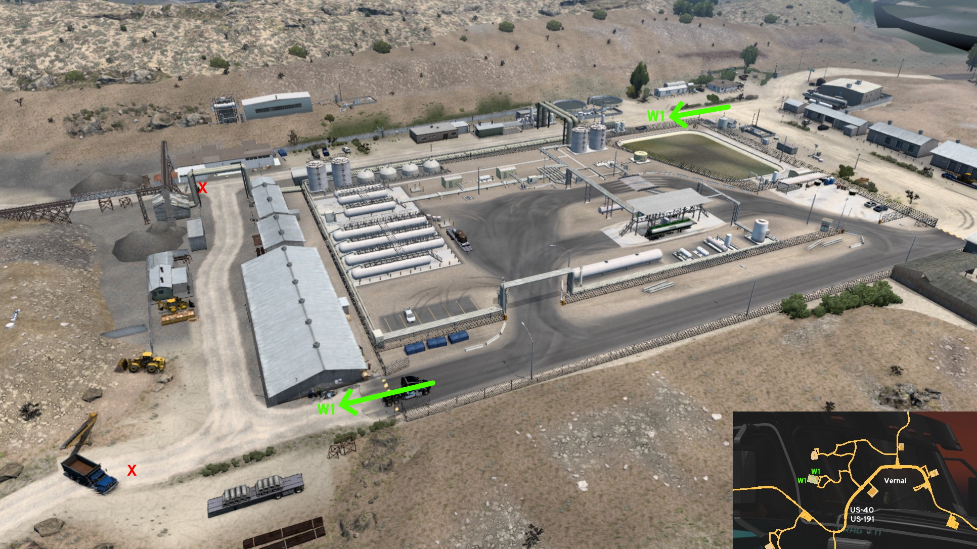 Chems plant west of Vernal has a secondary entrance. Route isn't much shorter than going to main entrance, but it may be easier to use it depending on the cargo you're bringing to or taking from there. Drive like you were going to plant normally, but instead of turning left to main entrance, go forward. Turn left when you see a closed gate, then turn left again to the back entrance. The road works behind the plant are unaccessible though.
4th DLC, 2019 June 11
Astoria (Oregon)
See also Astoria on Oregon
Discovery: noob168
Update: punkito
Note: Astoria is in Oregon, not Washington, but we're using it as the closest reference city; the closest Washington reference city is Aberdeen
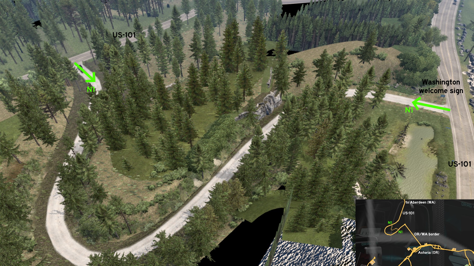 Leave north Astoria through Astoria-Megler Bridge (US-101). Some meters after reaching Washington and turning left, there's a Washington welcome sign. The shortcut is exactly behind the sign and hidden by the tall grass, so it's easy to go unnoticed.
North 1 - Forest Shortcut (But No Achievement Here)
Category: shortcut, markableDiscovery: noob168
Update: punkito
Note: Astoria is in Oregon, not Washington, but we're using it as the closest reference city; the closest Washington reference city is Aberdeen
Leave north Astoria through Astoria-Megler Bridge (US-101). Some meters after reaching Washington and turning left, there's a Washington welcome sign. The shortcut is exactly behind the sign and hidden by the tall grass, so it's easy to go unnoticed.
Bellingham
East 1 - Alternative To Deepgrove
Category: shortcut (?!), markableDiscovery: aclements
Update: FelipeVinhao
Note 1: when Washington was released (version 1.35), this route was blocked by UI roadblocks near the city and by a wooden barrier at the entrance of logging area
Note 2: when Idaho was released (version 1.38), the roadblocks were removed on both ends, but route remained unmarked on map until version 1.44
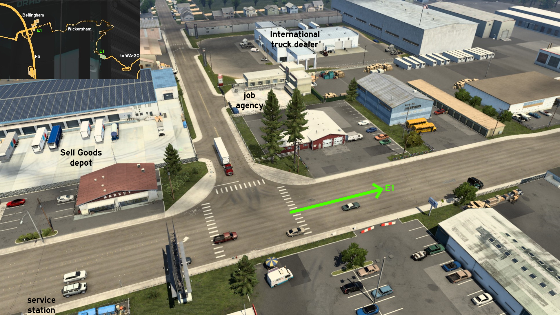 The route is divided into two parts. The paved roads start near Bellingham. Leave the city through easternmost crossing, turn right (south), then left and continue until you reach the unmarked town of Wickersham. Turn right (east) again when you see the Quick Mart. Continue straight until you cross a bridge, then turn left (east) to climb the mountain.
 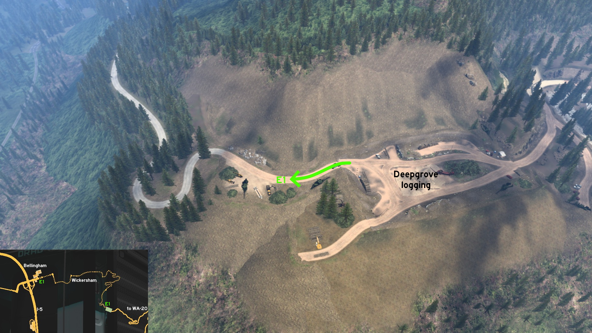 The dirt and gravel road starts on the back entrance of Deepgrove logging area. It's almost impossible to get lost, as all the route has only one blocked crossing. The tight curves are the biggest challenge here no matter what direction you're going. But if you have no problem with the official route, you won't have problems with the alternative one either.
 South 1 - PACCAR Technical Center
Category: easter-egg, markableDiscovery: Supernovae
Note: only the road and the Techinical Center are markable, but the testing grounds remain hidden
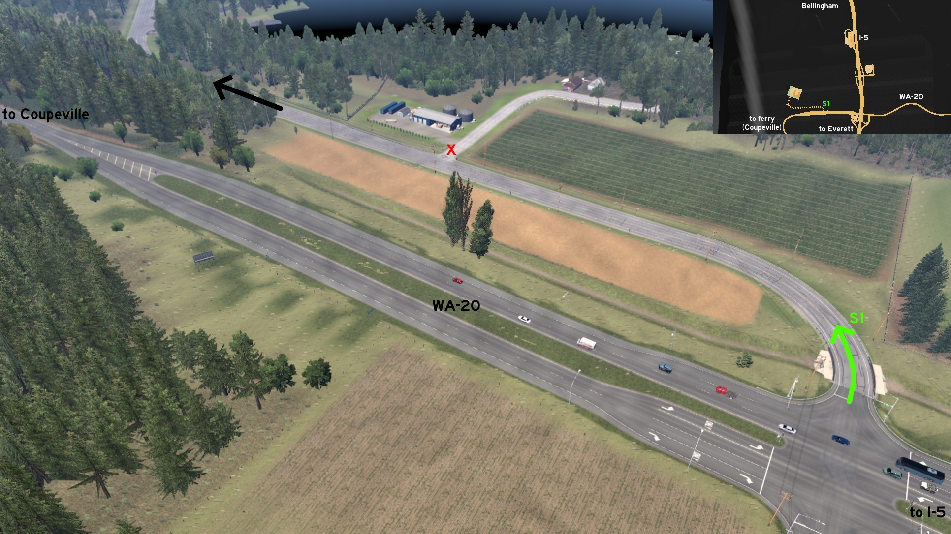 Just west of the intersection of WA-20 and I-5, before Deception Pass and the ferry on the unmarked town of Coupeville, there's another crossing. Turning north will lead to Farm to Market Road. Drive until you reach PACCAR Technical Center entrance.
 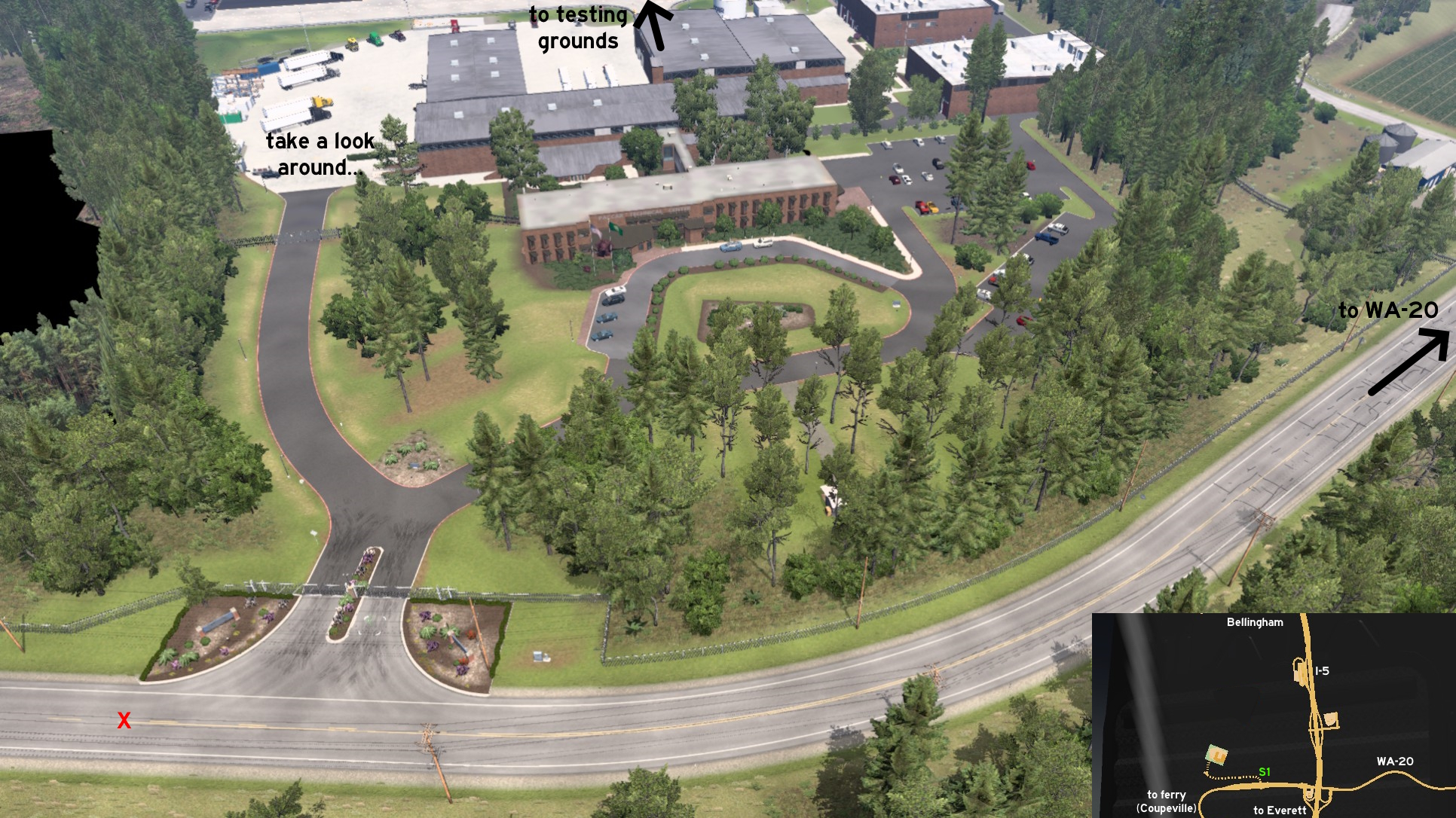 Wait for other employees to enter, do the security check, and cross the gates. The east area is the parking lot for cars. Head west and north instead. You may find something you'd expect to see only on Europe around here. Drive around the building and reach the testing grounds. It features an oval circuit, a hill climbing test, several irregular terrain tracks, and the Skagit Airport on the background.
Colville
West 1 - White Mountain Fire Overlook
Category: sceneryDiscovery: FelipeVinhao
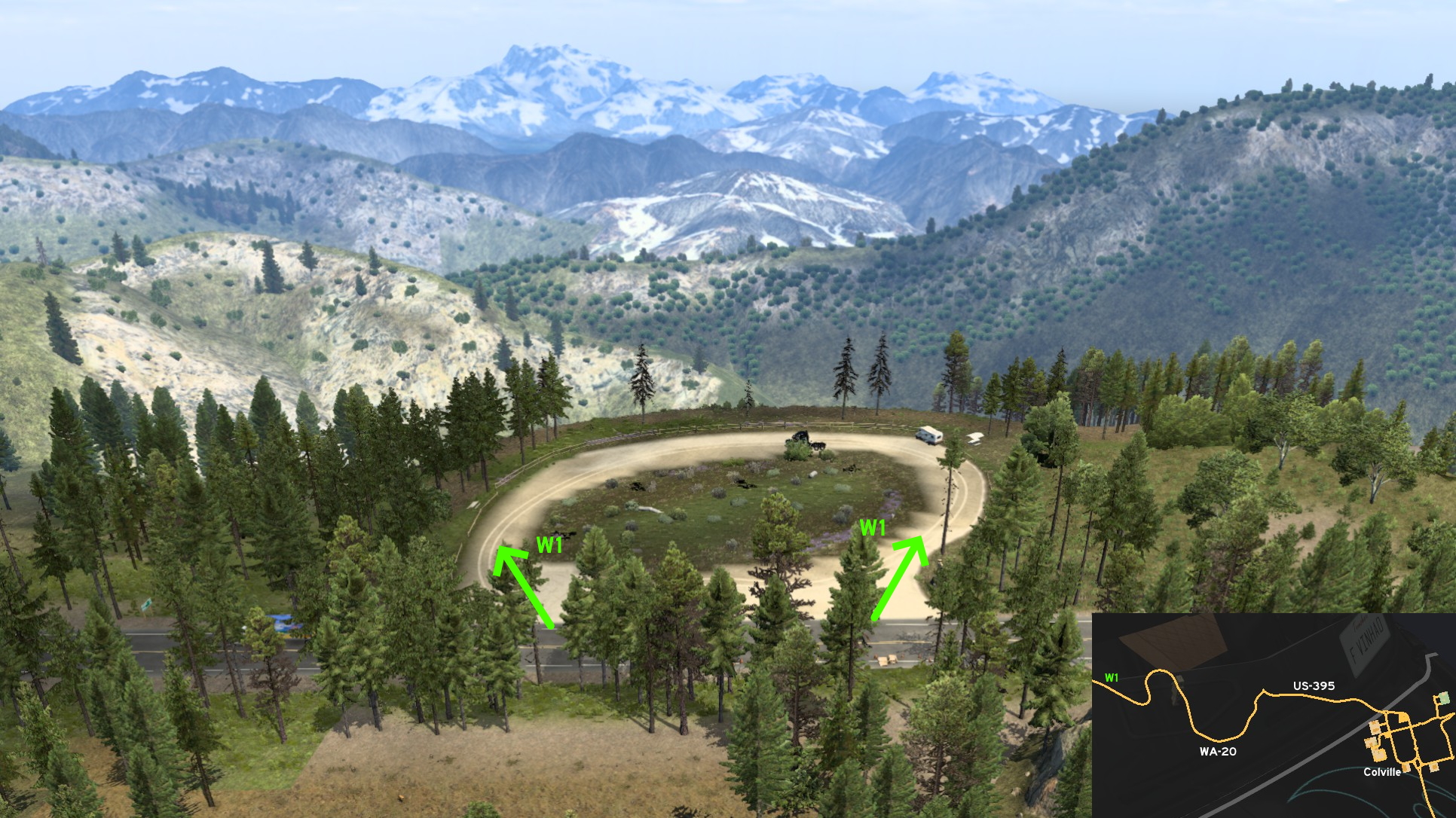 About 50 miles (in reduced scale, of course) west of Colville, there's an S-shaped curve on WA-20. Going a little further, there's this small path. Not actually a road, nor exactly hidden as a sign points its direction (although barely legible), but it's a nice place to stop a little and admire the White Mountain view. It just doesn't count as rest stop.
Grand Coulee
Central 1 - Fake Shortcut
Category: sceneryDiscovery: Applecorn
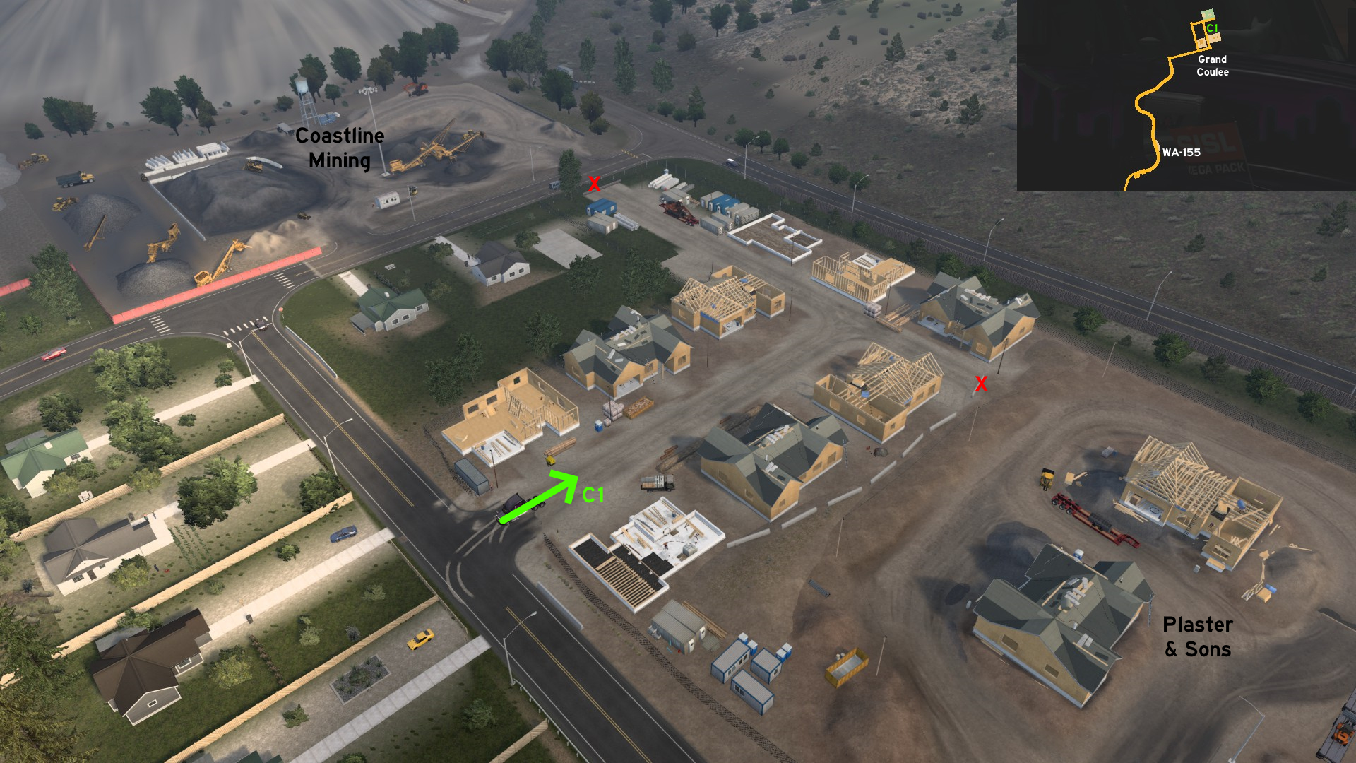 Between Coastline Mining storage area and Plaster & Sons delivery area, there are several houses under construction belonging to the former. The road crosses it and goes as far as both depots, but none are accessible, as fences and concrete barriers are blocking both.
Kennewick
East 1 - Picnic Loop
Category: sceneryDiscovery: Applecorn
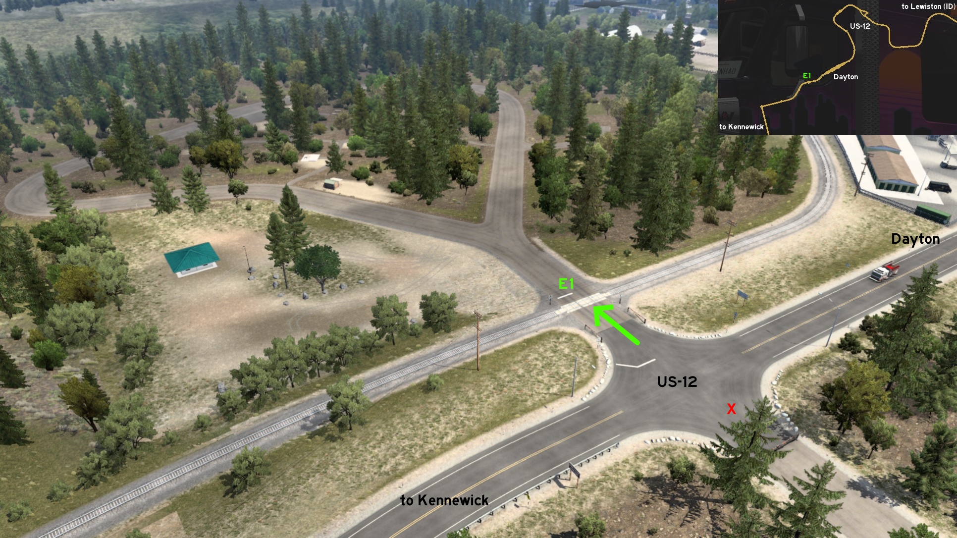 Far east of Kennewick, on US-12, halfway to Lewiston (Idaho) and some meters before the unmarked town of Dayton, there's a crossing you can access a loop picnic area on Lewis & Clark State Park, opposite to a closed dead end road. Just pay attention crossing the railroads, as there's no sound and light warning.
 East 2 - Tower View
Category: sceneryDiscovery: FelipeVinhao
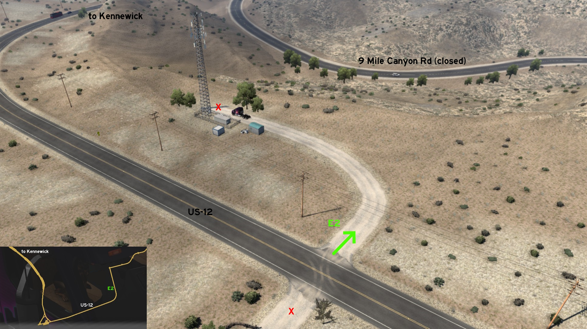 East of Kennewick and the weigh station on US-12, there's a short dusty road leading to a communication tower. From its end, you can have a vantage look over the unaccessible Nine Mile Canyon Road.
 South 1 - Take A Rest Or Another Job
Category: shortcutDiscovery: Maxis2012
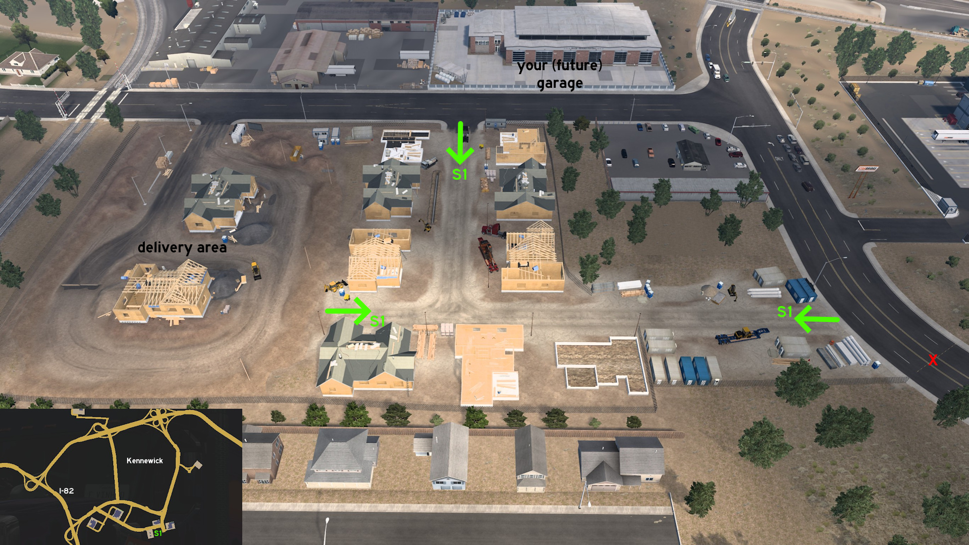 Go to Plaster & Sons construction site, south Kennewick. A dirt path east of delivery area can be accessed, and it splits into two. The first leads back to the same road you were, where your (future) garage is located. The second leads to another road where StarBridge is located.
Omak
West 1 - Sunshine Crops Overlook
Category: sceneryDiscovery: FelipeVinhao
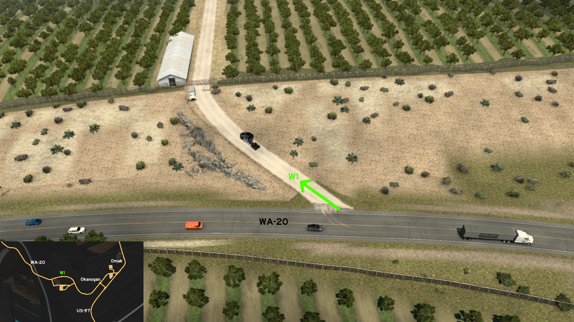 Go west of Omak (or to be more precise, west of the unmarked town of Okanogan), north of Sunshine Crops. You'll find this short open dirt road leading to a farm with closed gates. Enjoy the crops view with your "little cousin".
 West 2 - Diablo Lake Overlook
Category: sceneryDiscovery: FelipeVinhao
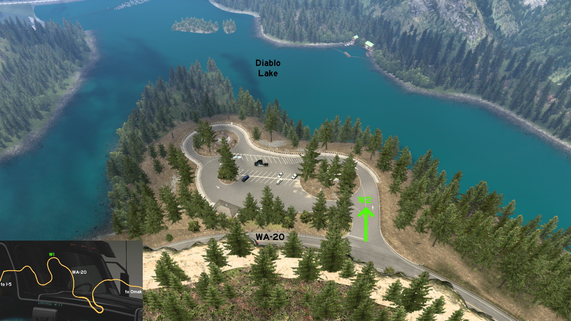 About 90 miles (in reduced scale, of course) west of Omak, you'll find this almost hidden exit on WA-20 on the top of an S-shaped curve. It leads to a rest stop (for cars only) where you can see Diablo Lake, and even find signs with real life information about it.
Port Angeles
Northwest 1 - Coast Guard Air Station
Category: sceneryDiscovery: airbornecowboy77
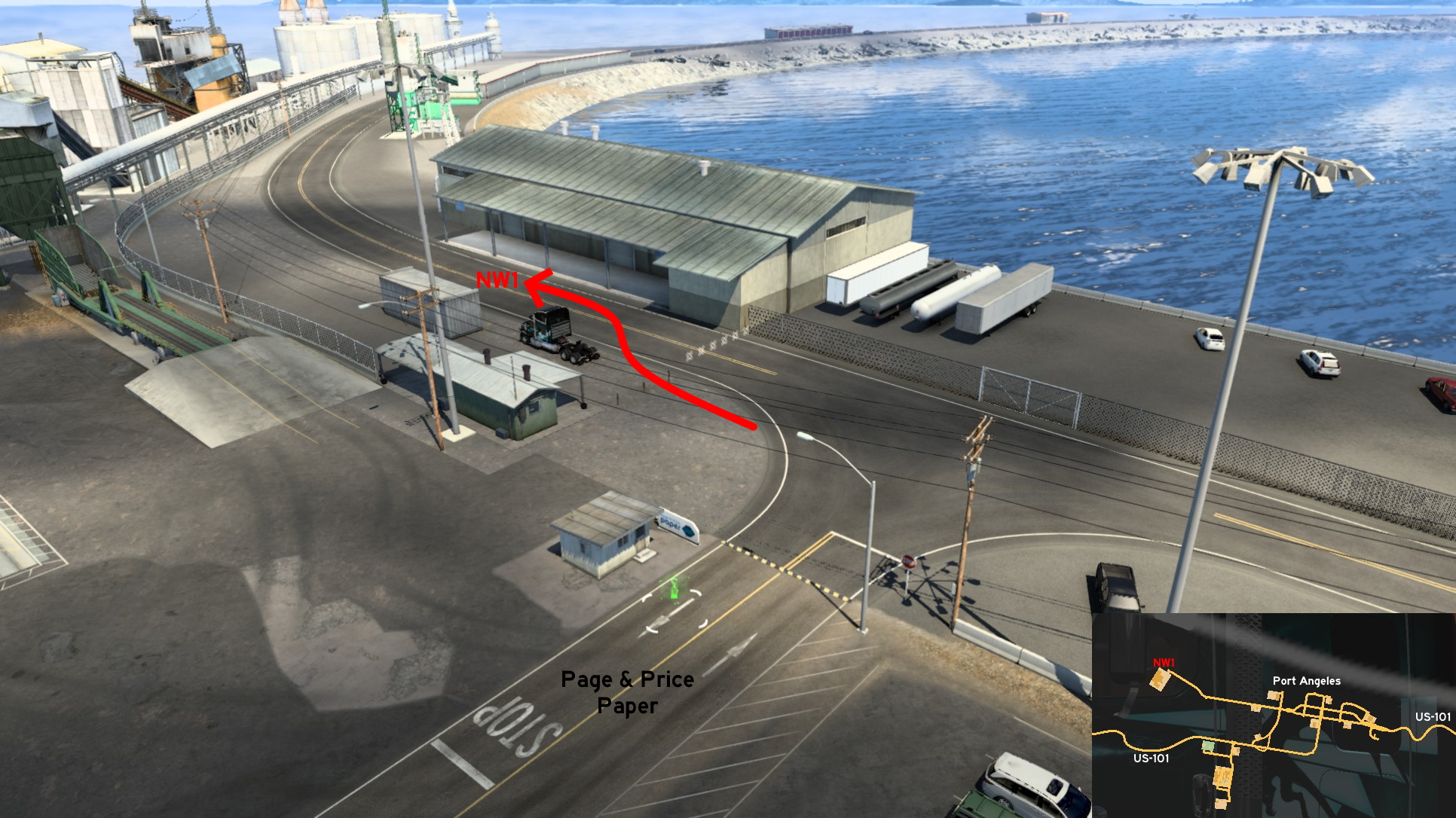 Head northwest Port Angeles, where you can find a Page & Price Paper industry. Instead of entering the delivery area, continue straight, going through the narrow gap between poles. Pulling cargo here may not be a good idea. You can drive as far as the isle where the Coast Guard base is, and you can drive over the water on all areas not "protected" by rock piles.
Vancouver
North 1 - Airport Drive
Category: sceneryDiscovery: aqweasd7
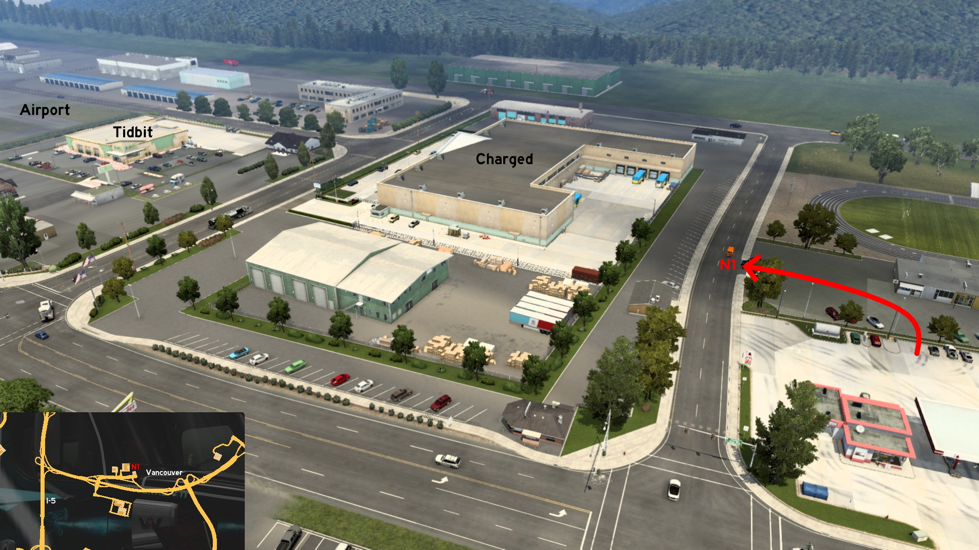 Drive to the fuel station north of Vancouver. North of the pumps, drive over the small bump, turn left and then right. You can access all roads around the marked area. Turning right (east) first will lead you to a loop road that heads back to the fuel station - but you can't return to marked roads from here. Turning left (west) will lead to all roads bordering Charged store, Tidbit supermarked and the airport runaway. Just don't go too far from them to not fall to the "void".
Wenatchee
Southeast 1 - Vantage Bridge From Vantage Point
Category: scenery, markableDiscovery: FelipeVinhao
Update: JSG4361
Note: this road was visible on map before version 1.44
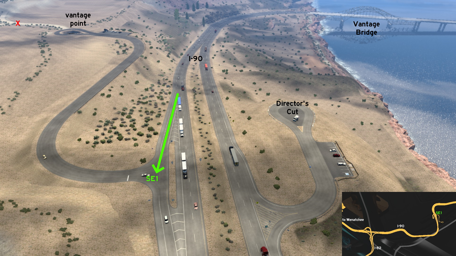 Southeast of Wenatchee, you can cross Columbia River thanks to Vantage Bridge. You can see its details using the Director's Cut stop found on westbound I-90. But you also see it from a vantage point on eastbound I-90. Its access is just across the access to Director's Cut. There's a dirt road starting on the unmarked road, but you can't go far on it.
 West 1 - Waterfall View From Interstate
Category: sceneryDiscovery: airbornecowboy77
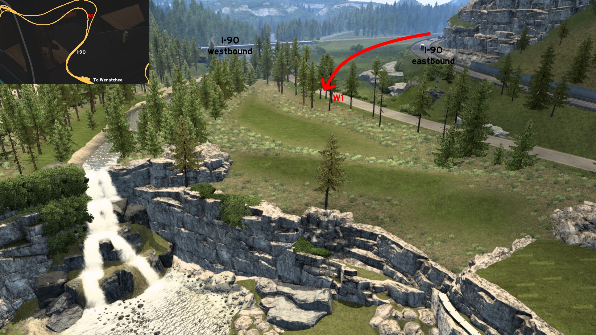 Leaving Wenatchee through I-90 westbound, the freeway splits apart after the weigh station. Head to the median, slowly and carefully due to uneven terrain, until you reach a concrete road. If you head north, you'll have a nice view of the freeway, and you can go as far as the "void". If you head south, you can have a calm view of a waterfall. Just stop driving when you see a transition from concrete to asphalt, or you may fall to the "void" here too.
Yakima
South 1 - Home By The Intersection
Category: sceneryDiscovery: mizho_himats1538
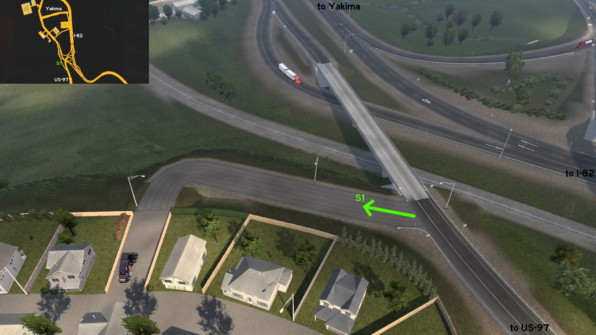 Leave Yakima southbound to I-82 intersection, and head to the ramp to US-97. You'll find a hill road leading to a small residential area. Just don't drive too far from the asphalt, so you don't fall to the "end of world".
8th DLC, 2021 September 07
Casper
Northeast 1 - Faster Chemical Reaction
Category: shortcutVideo (link): TGM
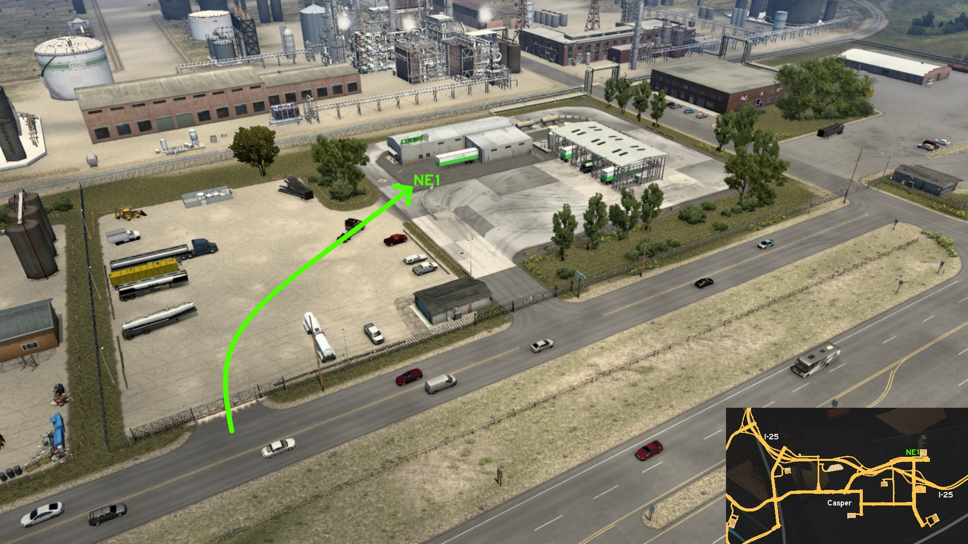 On Chems depot on northeast Casper, you can also access the delivery area through parking lot. You can use this path to avoid the main entrance, where the traffic is usually very high due to short distance between crossings on this area.
 Northwest 1 - Recruitment Agency On Dead End Street
Category: sceneryDiscovery: FelipeVinhao
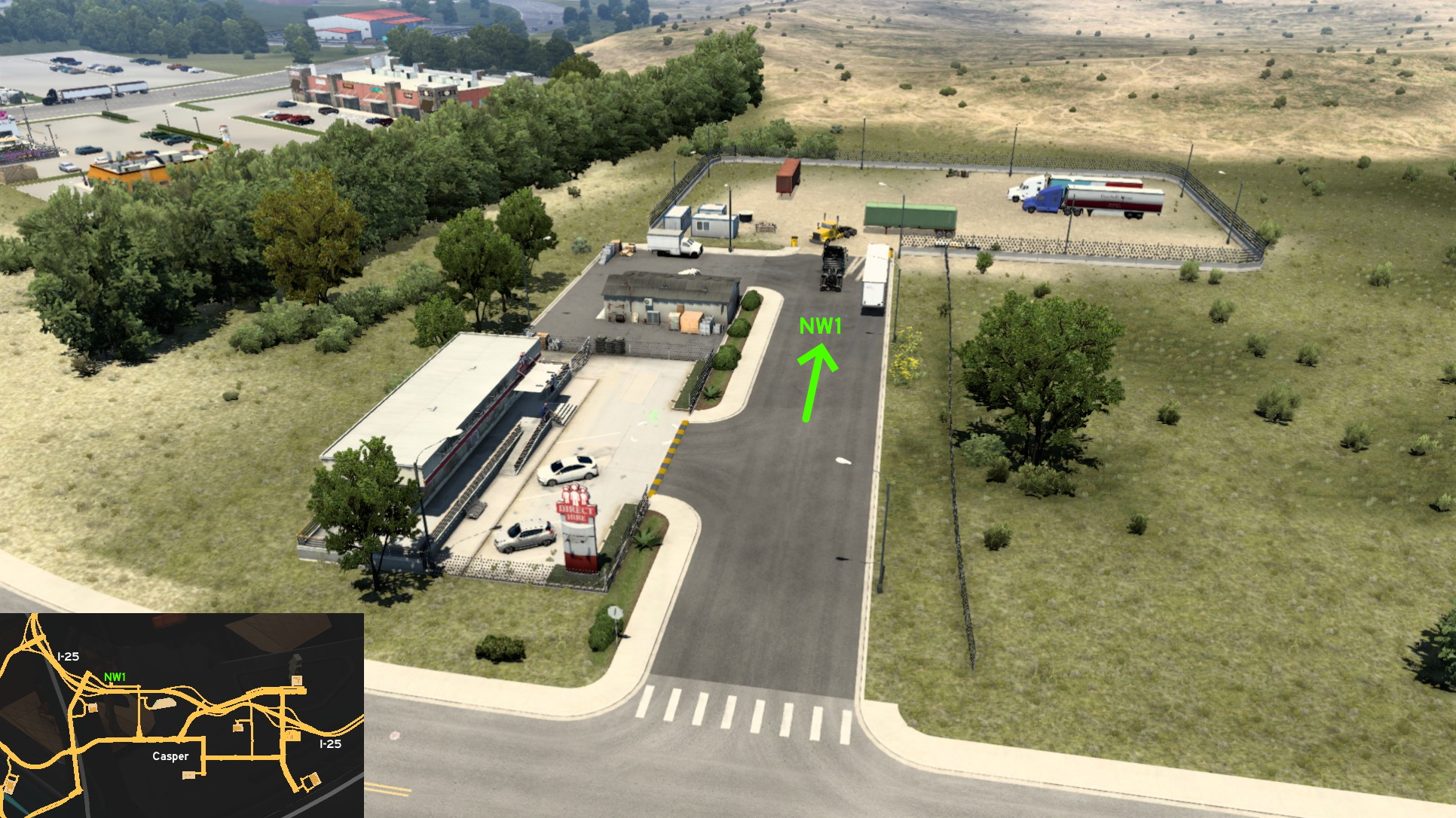 You may go forward this road by accident, as it's hidden on map, but not from your eyes. It goes as far as a blocked rest stop and a parking lot near the agency.
Cheyenne 🏛️
Central 1 - Intersection Overlook
Category: sceneryVideo (link): TGM
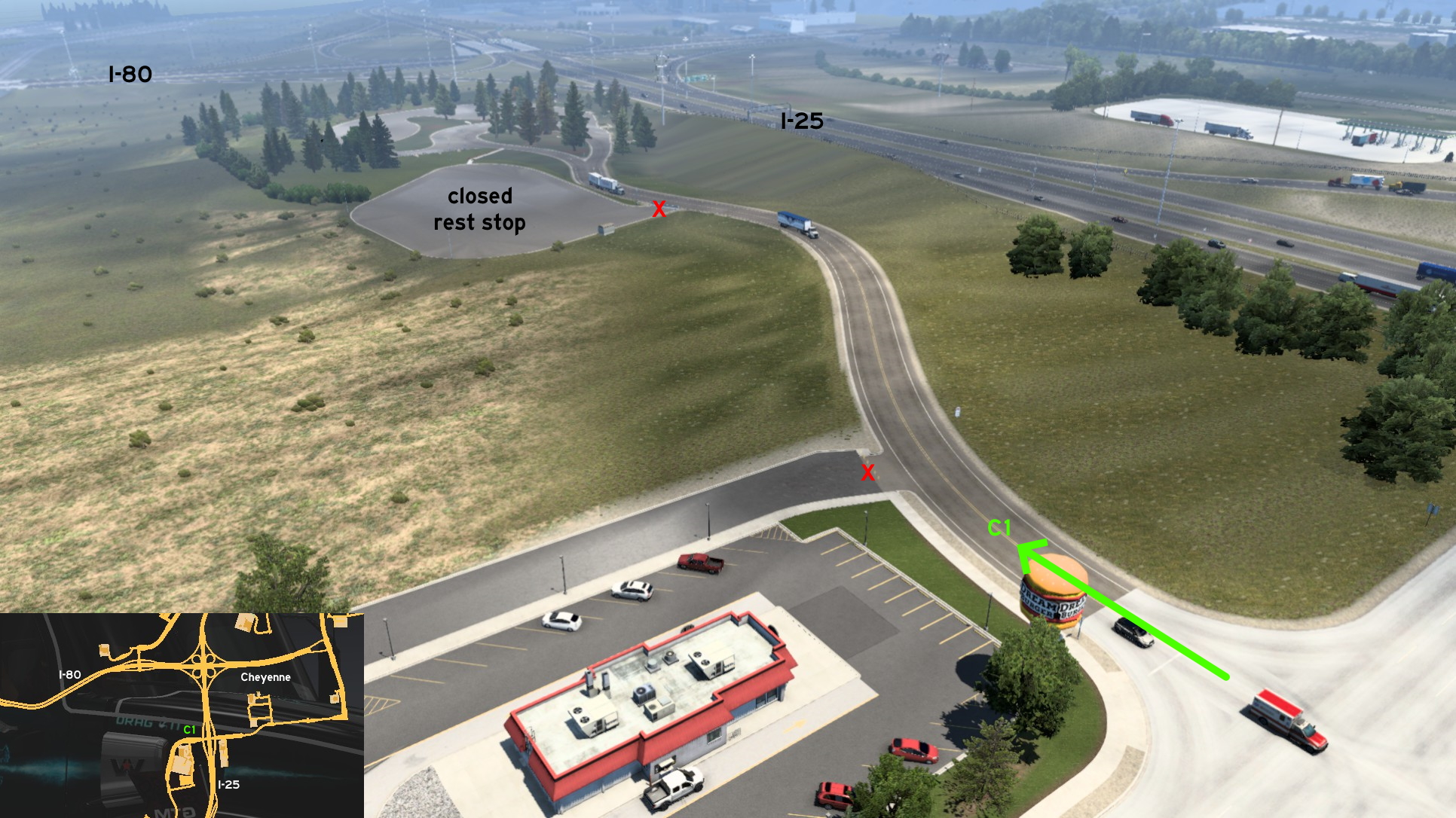 On Cheyenne, southwest of the intersection of I-25 and I-80, head to the truck stops area, drive to the west one (a Driving), but instead of driving to the rest stop, go the opposite direction, where you'll find a Dream Burger on corner. Although there's a "no truck allowed" sign here, this area was clearly used as a truck stop in the past. Just ignore the warning, and head to the overlook. Now enjoy the city and intersection view!
 Northwest 1 - Straight To Fort Warren
Category: sceneryDiscovery: Applecorn
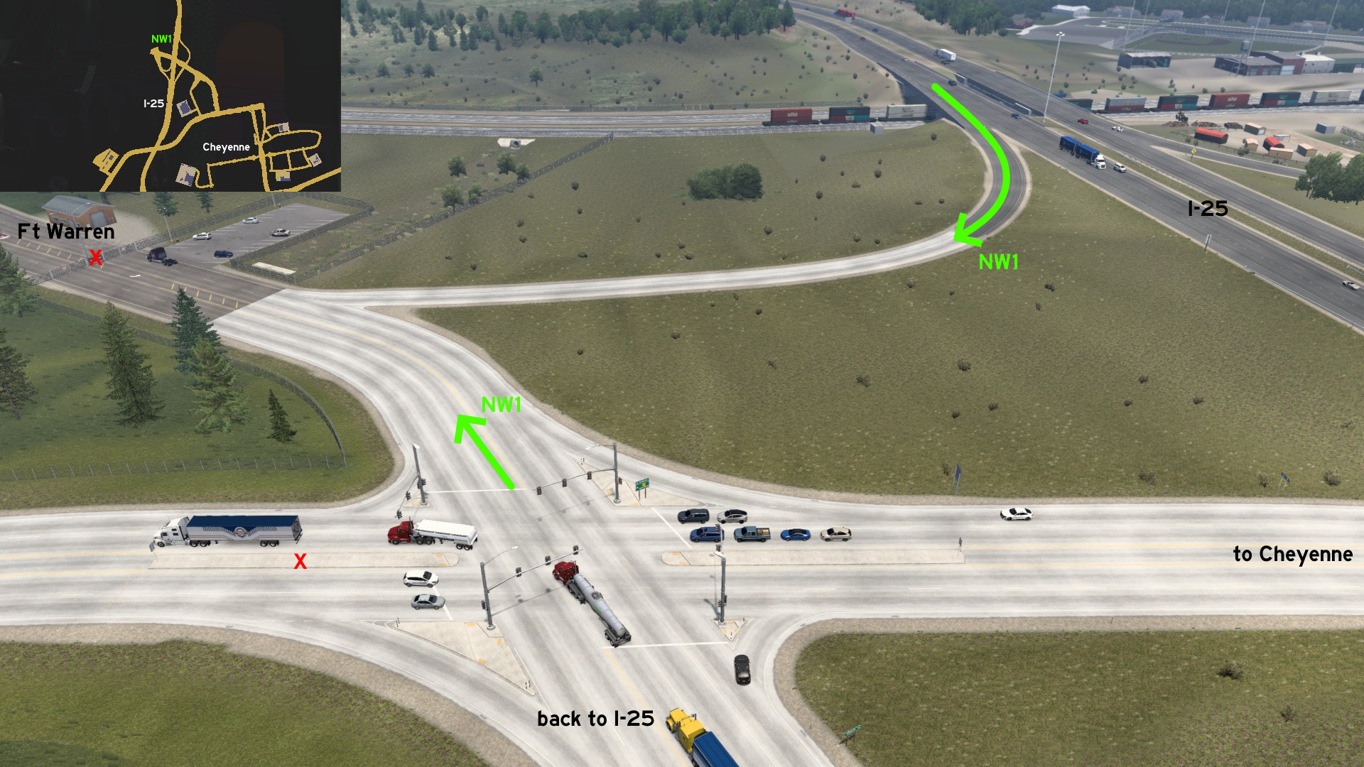 On I-25 southbound, before the first marked exit to Cheyenne, there are some signs barely blocking an unmarked ramp. Drive around them, and the path will lead to Fort Warren Air Force Base. As expected, the gates won't be opened for you here, unless you have some official business.
 West 1 - Town Of Buford
Category: achievement (Population 1), markableDiscovery: DDogg
Video (links): kettcardriverprofi, TGM
Update: Cyanlix
Note 1: please refer to this guide by Xeeran to find other achievements
Note 2: the parking lot near Lincoln monument became markable after version 1.50
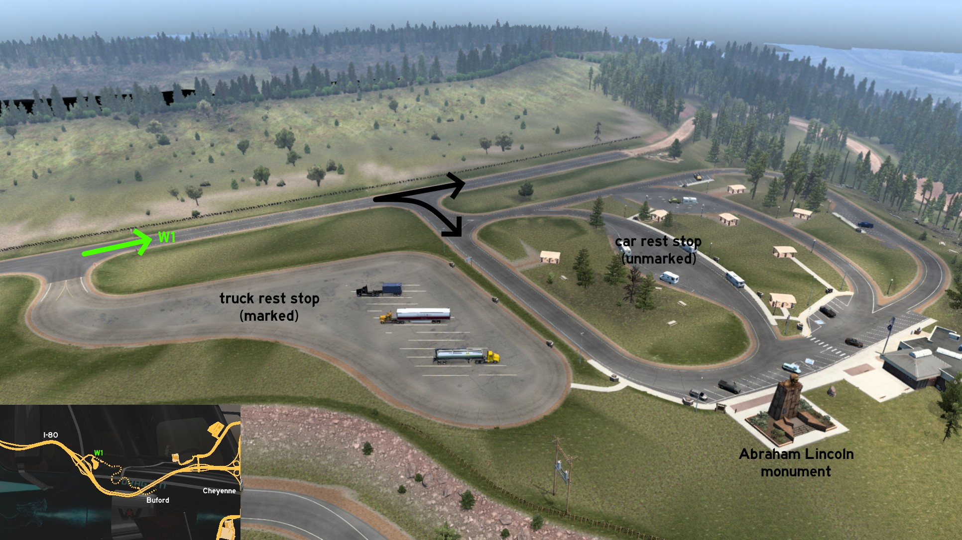 Halfway between Cheyenne and Laramie, on I-80, you'll find this rest stop. Past through the area for trucks, and go to the car rest stop. You can turn right to visit Abraham Lincoln monument, or go ahead to continue to Buford. Keep going forward, until you reach a dirt road, partially blocked by a gate.
 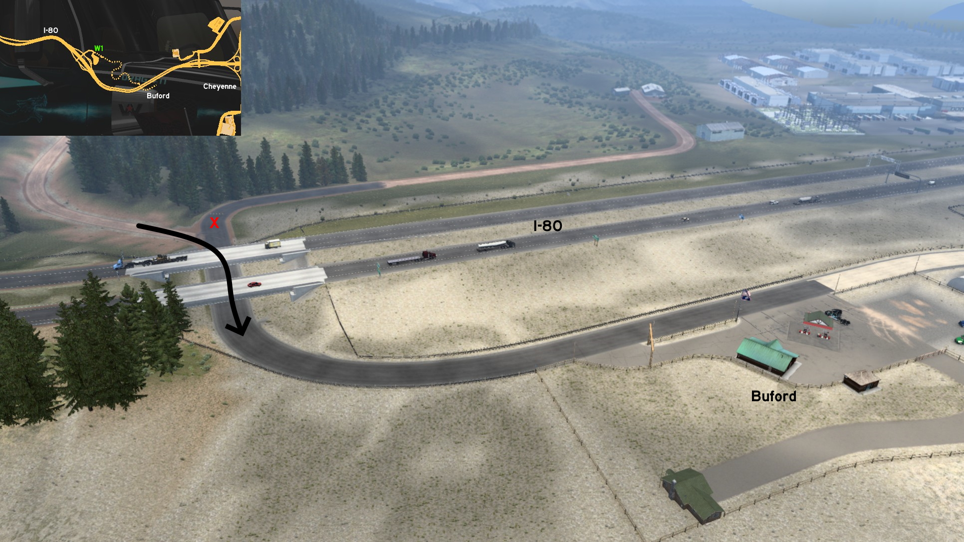 Some meters after the gates, you'll drive by a blocked logging area. Keep forward until you reach asphalt again. Turning left (north) is blocked by UI roadblocks. So you must keep right (south), and drive below I-80. When you reach the town of Buford sign, you'll unlock the achievement. Now town population is temporarily increased by 100%.
Cody
West 1 - Cody Stampede Rodeo
Category: shortcut, markableDiscovery: kaia15, noob168
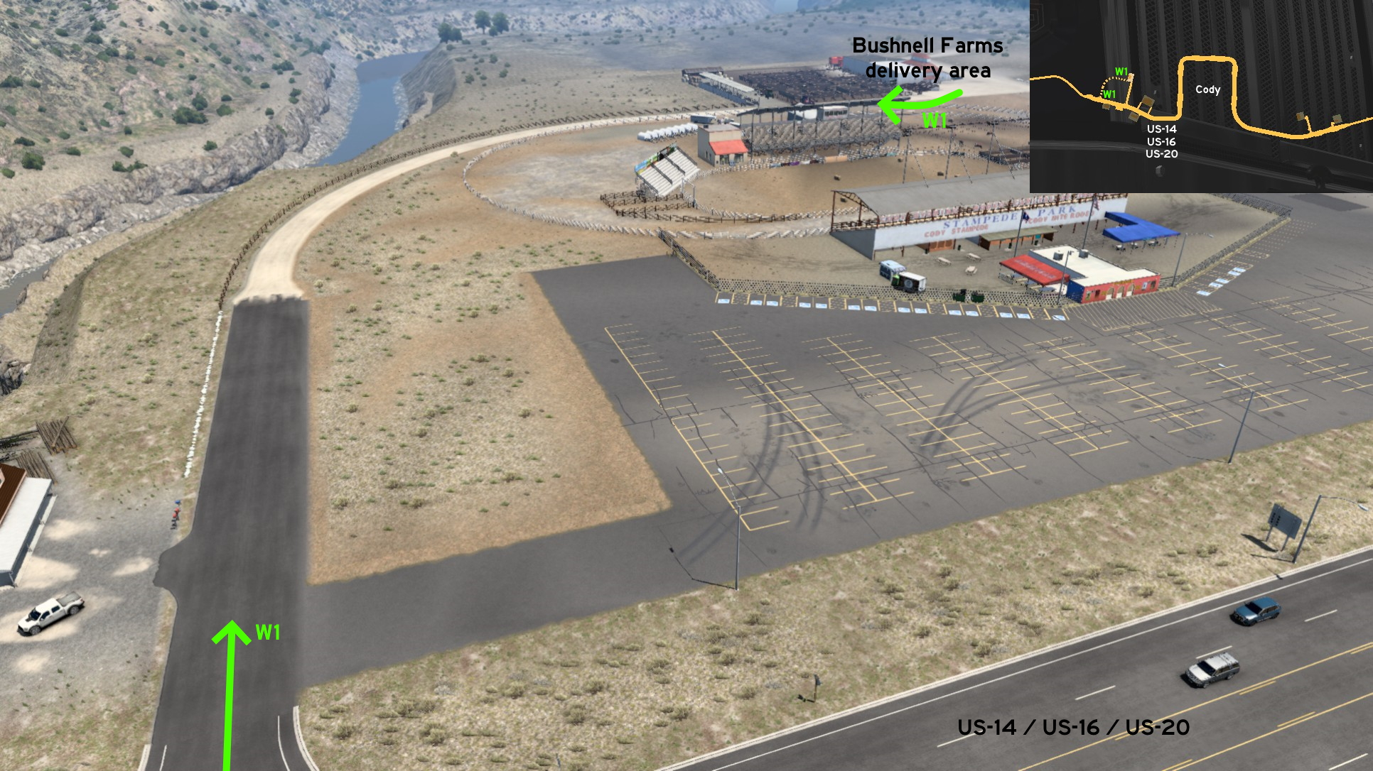 Not a mile west of Cody, there's a Bushnell farm near Cody Stampede Rodeo. West of the rodeo parking lot, there's a half asphalt, half dirt road to a secondary entrance to the delivery area. Drive carefully when reaching the end, as some of the parked trailers may be blocking it.
 West 2 - Lake Butte Overlook
Category: scenery, markableDiscovery: kaia15, noob168
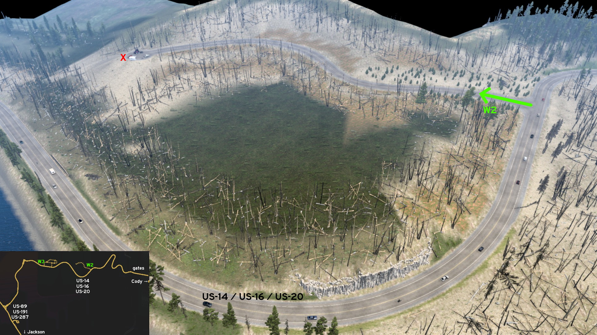 Just some miles into Yellowstone park, west of Cody, there's an open road into an area full of burned and knocked trees. It ends on a cul-de-sac, where you can have a nice view of Yellowstone Lake, and a special thanks to the #BestCommunityEver.
 West 3 - Fishing Bridge General Store
Category: scenery, markableDiscovery: kaia15, aqweasd7
Update: henrzman, Zaroski
Note: only paved roads were markable before version 1.51
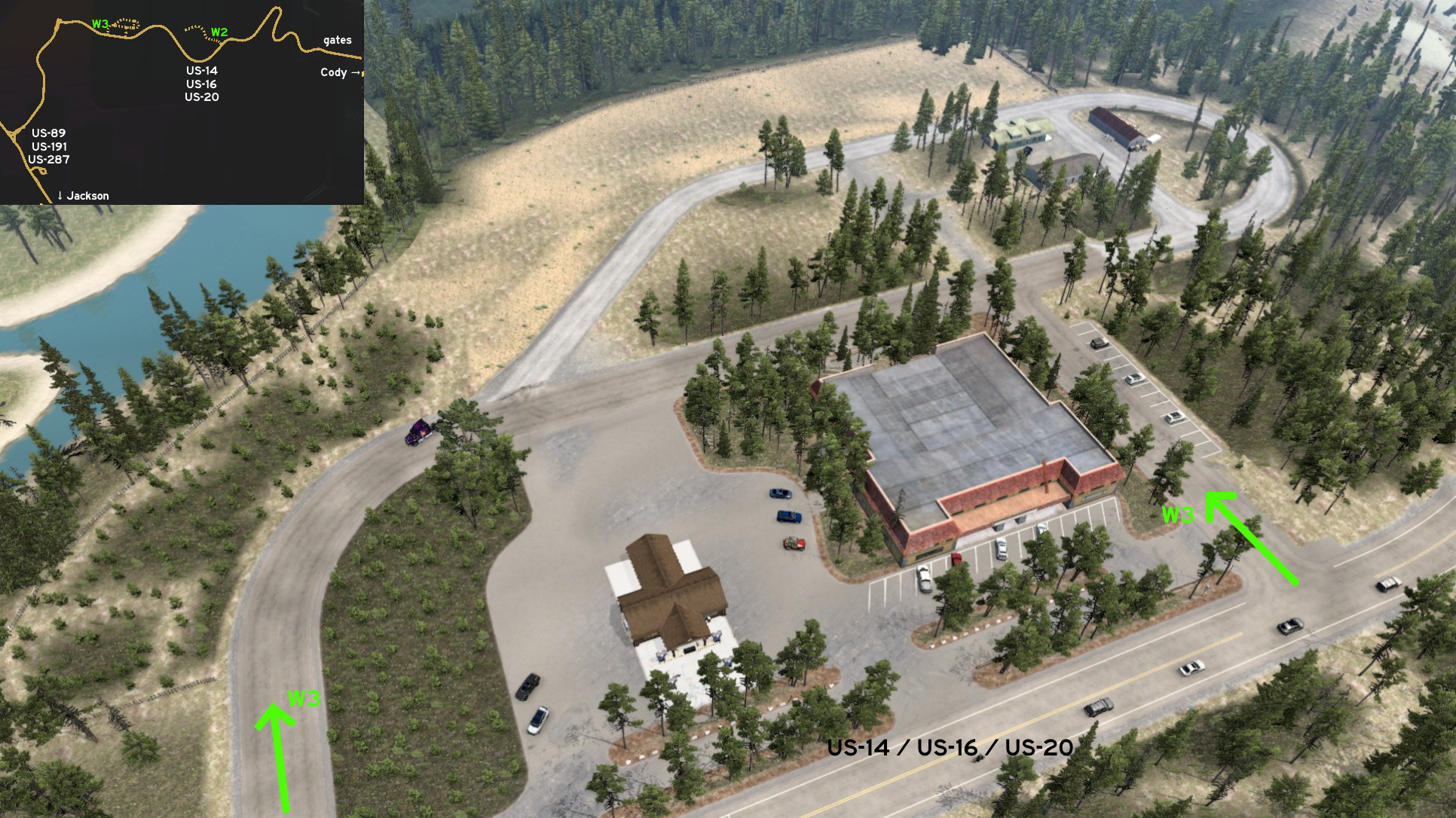 West of Cody and east of Fishing Bridge, on Yellowstone Park, there's a General Store where you can grab some supplies for your vacation here, and a service station, but for small vehicles only. There are several gravel roads around the Store and into the forest. Just as a friendly reminder, you shouldn't bring any trailer here - it's a rest area only!
Evanston
East 1 - Getting On Rails
Category: sceneryDiscovery: airbornecowboy77
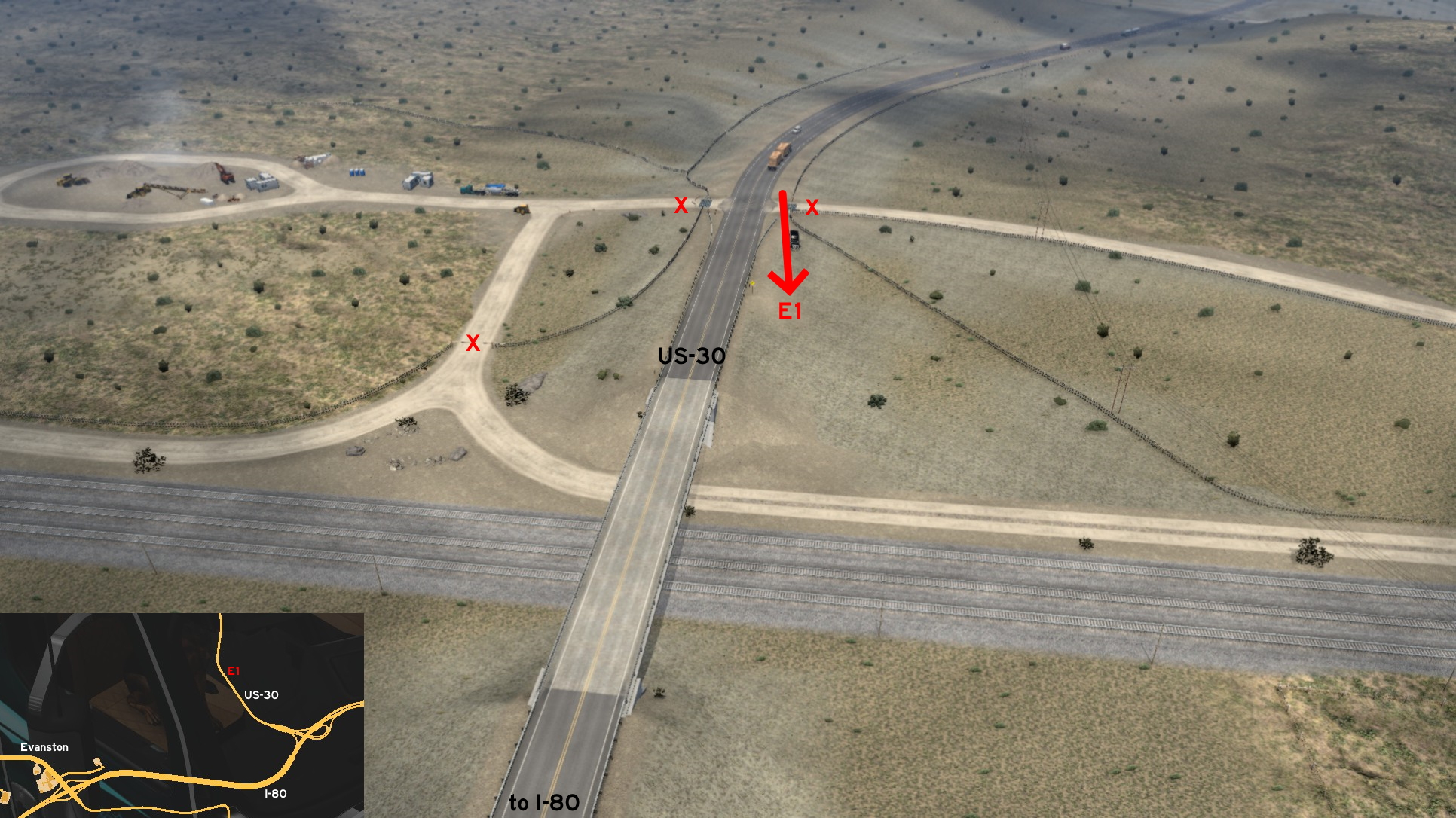 East of Evanston, US-30 crosses with a dirt road that leads to a construction site. On the opposite direction, you can squeeze between the fences and guard rails. Pulling cargo here may not be recommended. You can keep on dirt roads, or go further on train tracks. In any case, be careful to not go too far and fall on the "void". If you decided to go on rails, be careful about oncoming trains.
Gillette
East 1 - Moorcroft Sightseeing
Category: sceneryDiscovery: residenTR
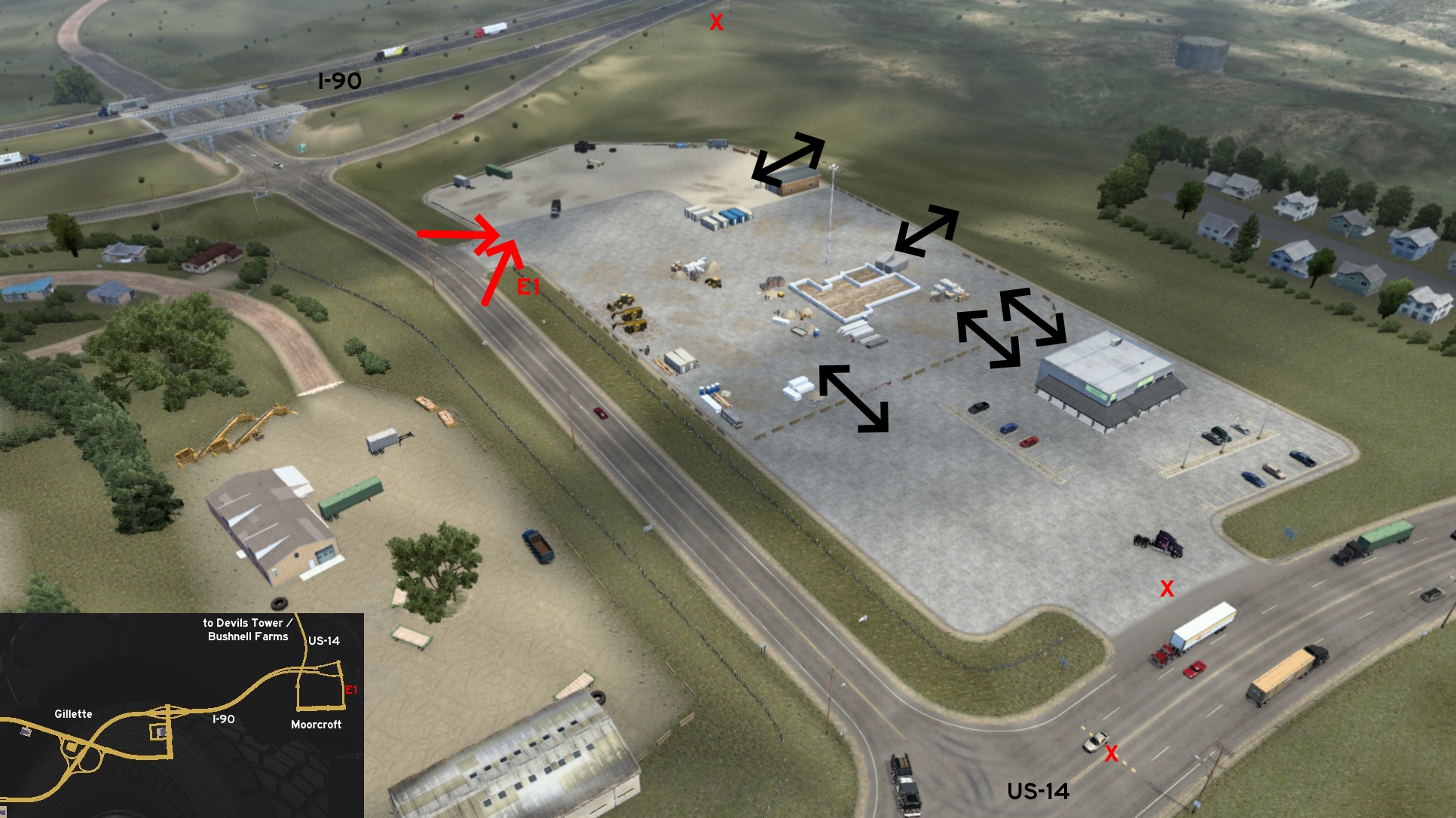 As soon as you leave I-90 on the unmarked town of Moorcroft, to either visit Devils Tower or take a job from Bushnell Farms, there's a rest stop you can't use but at least you can visit. The area around it is prettly plain and can be accessed, but both I-90 and US-14 are blocked by invisible walls.
Jackson
Northeast 1 - Wind River Lake Picnic Area
Category: scenery, markableVideo (link): TGM
Update: FelipeVinhao
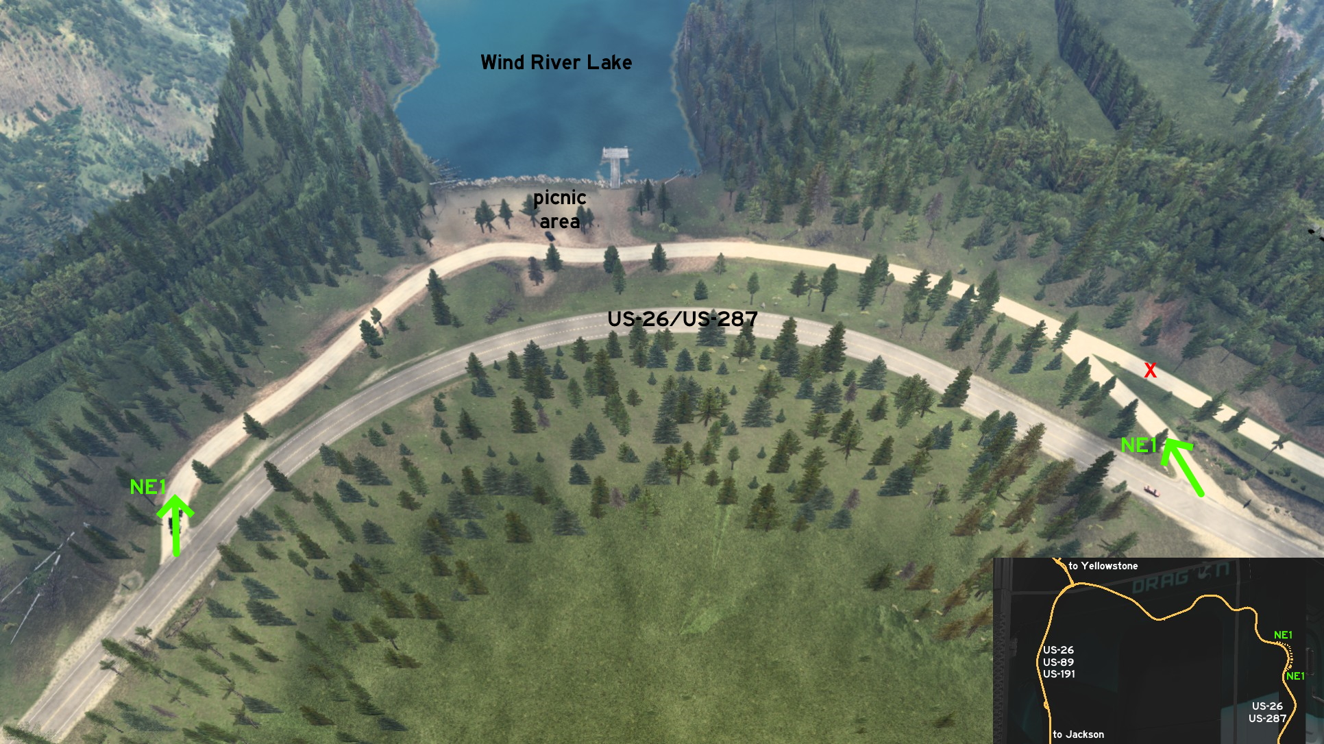 On US-26 / US-287, northeast of Jackson, you can visit Wind River Lake. Coming from Jackson or Yellowstone, entrance is left. Coming from Riverton, entrance is right. The dirt road merging to Riverton entrance can't be accessed. The picnic area can't be used as a rest stop, but has a nice view. If you need some rest, there's one place nearby.
 South 1 - Two Ways, Many Routes
Category: scenery, markableDiscovery: FelipeVinhao
Video (link): TGM
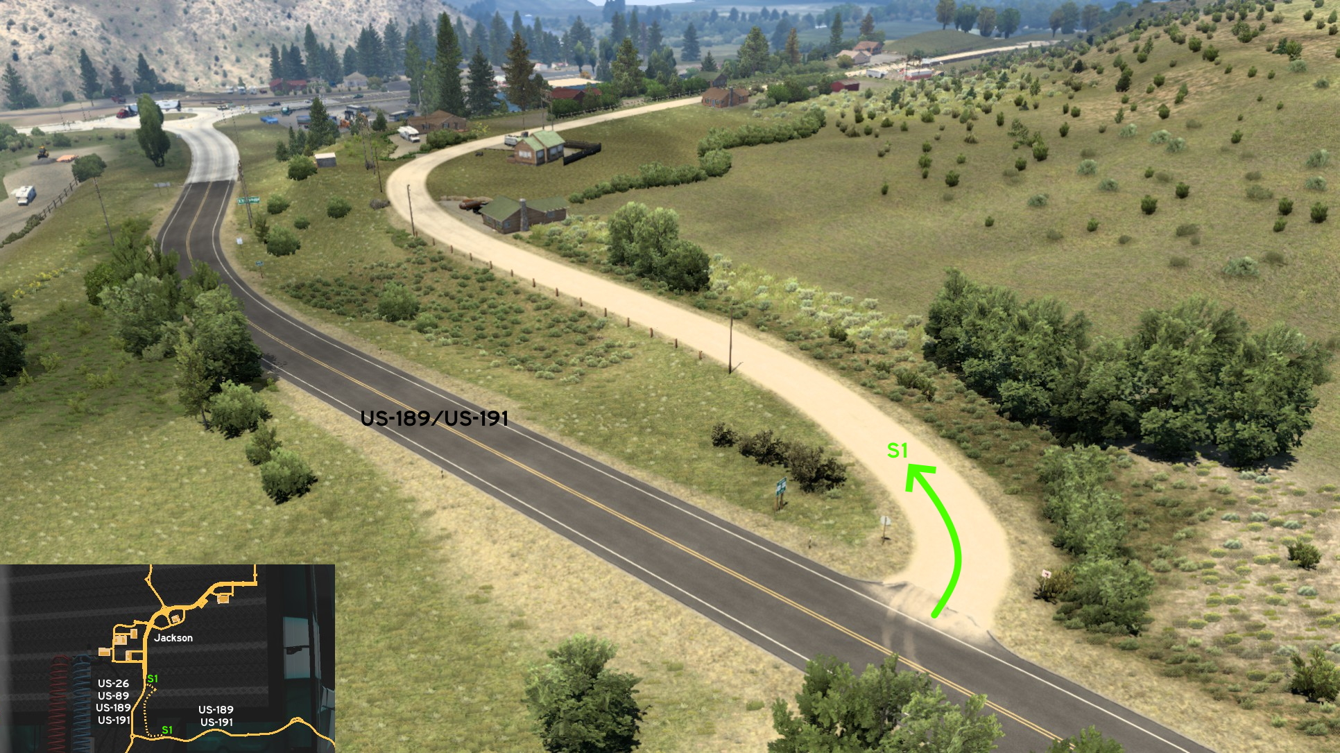 This dirt road south of Jackson has two entrances. One is on US-189 / US-191, before roundabout, marked by a "no trucks allowed" sign. It leads to some farm houses and a farm minizoo.
 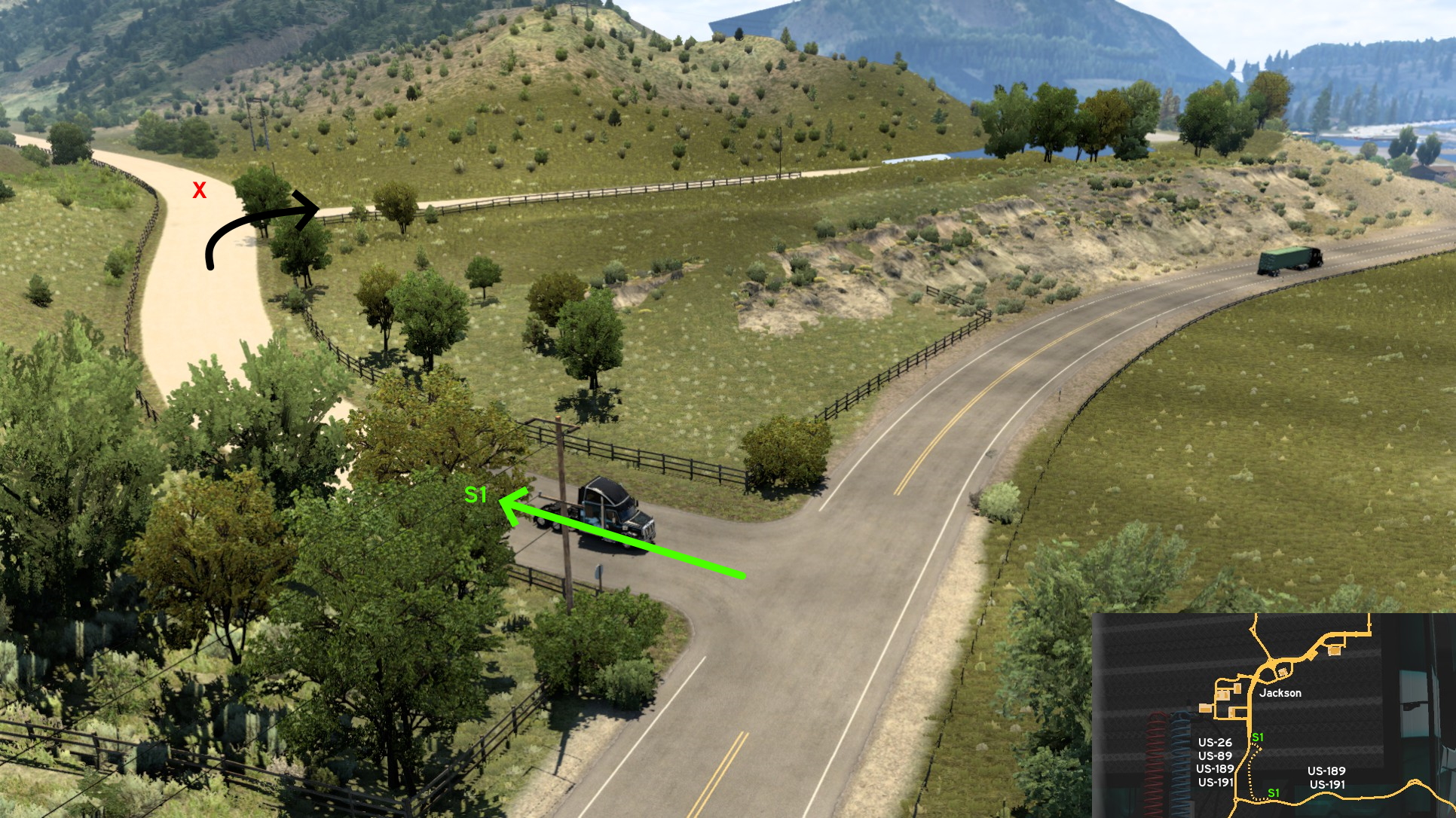 The other is on US-26 / US-89 / US-189 / US-191 (yes, that's only one road), between Jackson and the roundabout. After some meters, going forward is forbidden. So you must keep right, and reach the farm zoo.
 Southwest 1 - Side Roads On Alpine
Category: sceneryVideo (link): TGM
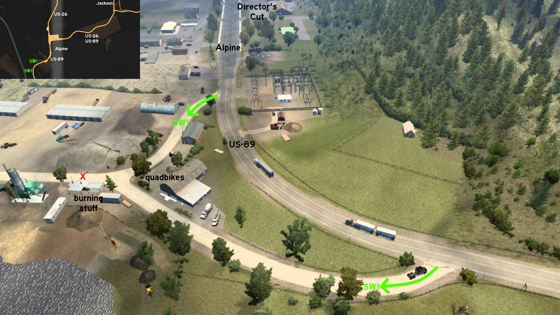 Southwest of Jackson, on the unmarked town of Alpine, you can drive through some back roads. One of the entrances is south of town on US-89. The other is across a power substation, near town's Director's Cut stop. Halfway, you'll find some guys fixing a quadbike and a dog watching their work, and on the opposite side some guys working on something else... or just burning stuff.
 West 1 - Gotta Go Fast
Category: shortuctDiscovery: residenTR
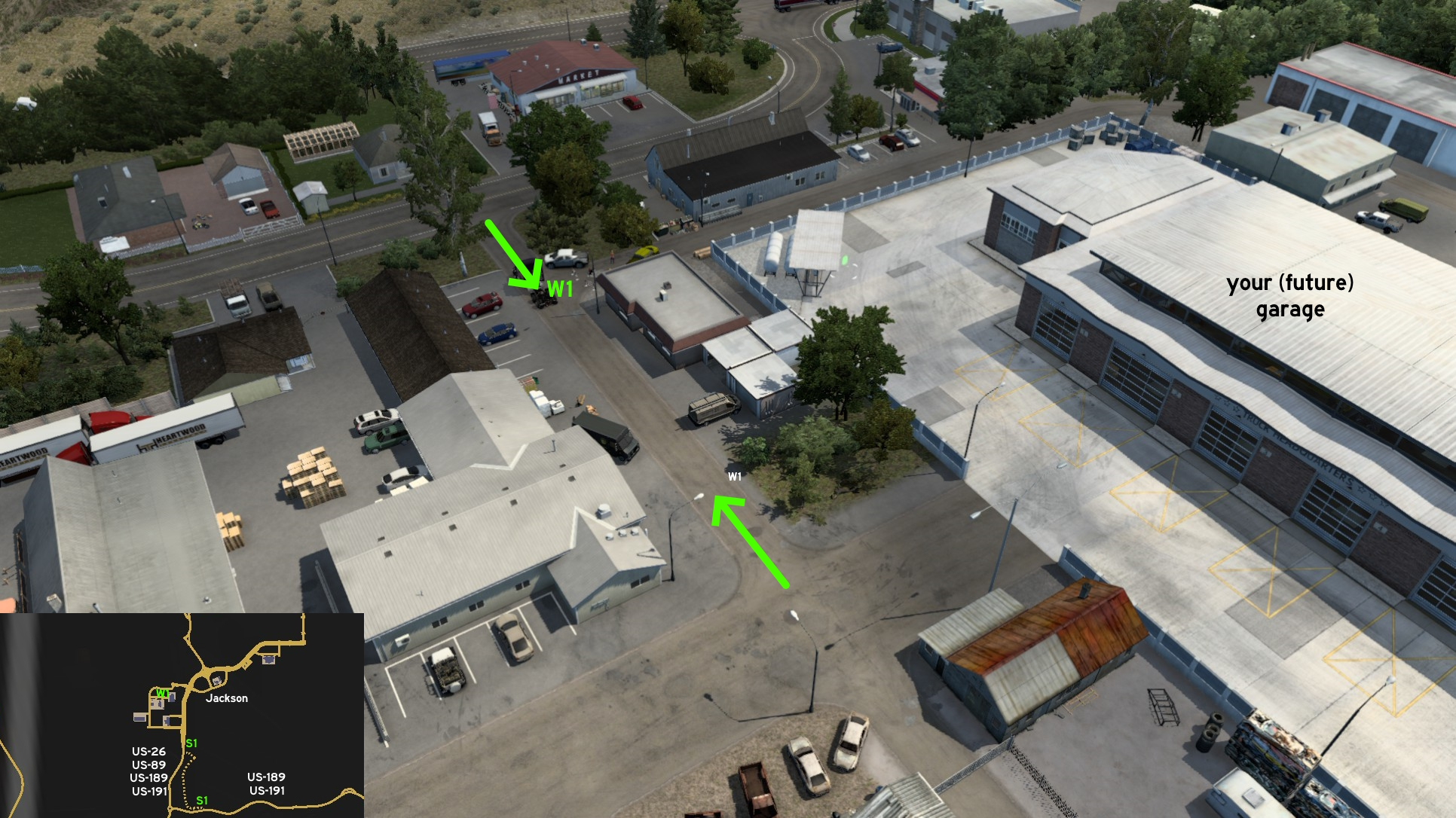 When you finally acquire your garage on Jackson, you can reach downtown faster by avoiding the road which connects it to Deepgrove sawmill. Just take the narrow street instead. It may not be the case here, but drive extra careful if having your own trailer and driving on this street.
Laramie
North 1 - Home Is Where The Heart Is
Category: shortcutDiscovery: FelipeVinhao
Video (link): TGM
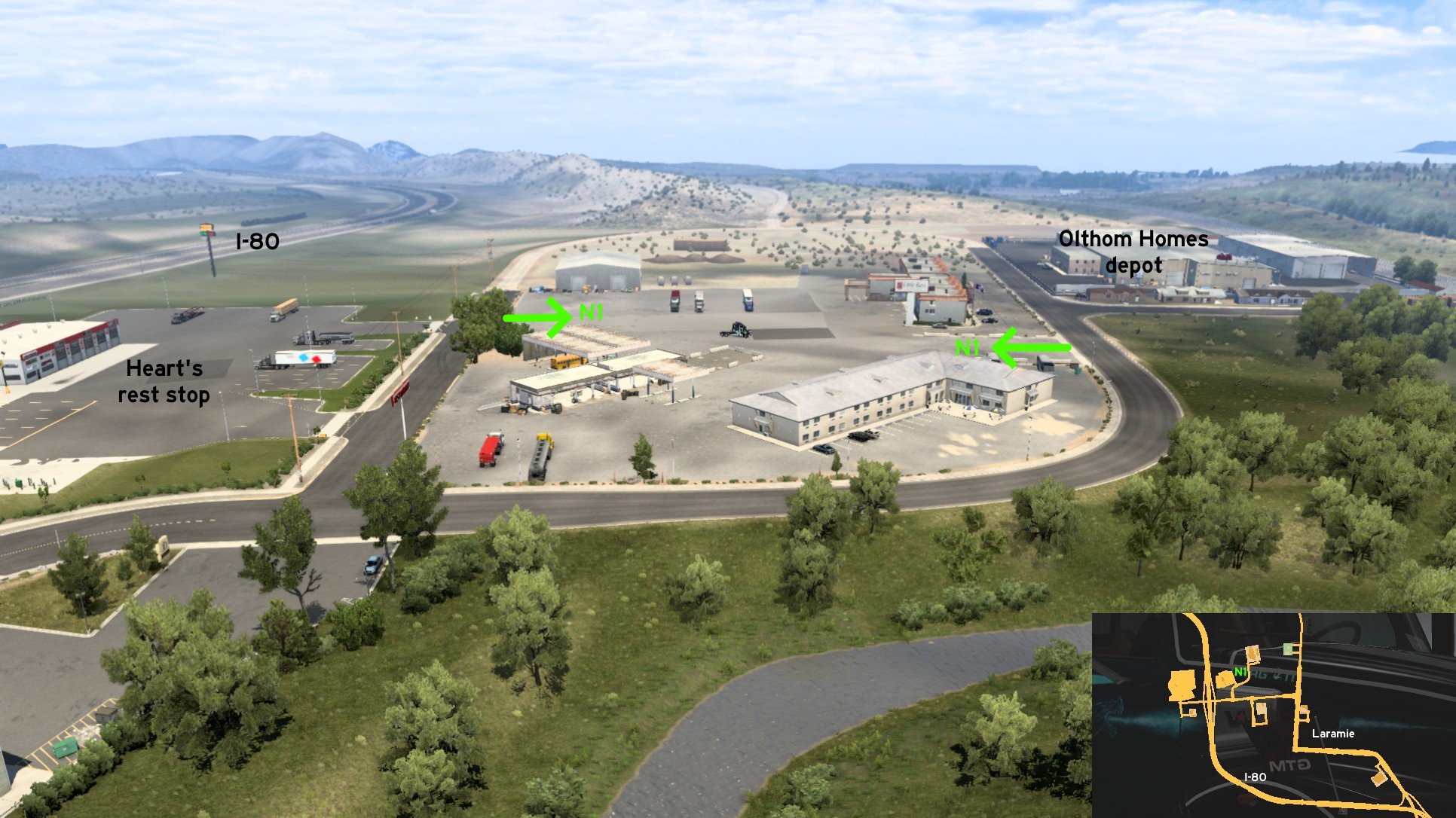 On I-80, you'll find an exit to north Laramie with two rest stops. The east one (a Heart's) is close to a hotel which can be used as a shortcut to a Olthon Homes depot. It's not a hidden road per se, but the whole area around the hotel is accessible. An abandoned fuel station can be found on south of this area.
Rawlins
North 1 - ATV Race Track
Category: scenery, markableVideo (link): TGM
Update: buffalo_pete, OWLCAT, residenTR
Note: road became marked on version 1.47, unmarked again after version 1.48, and markable after version 1.51
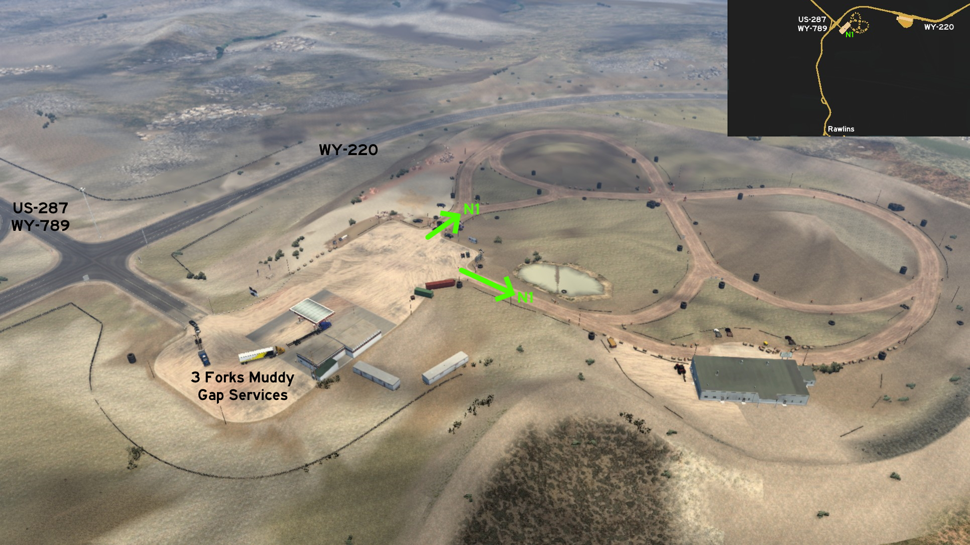 North of Rawlins, go to the fuel station on the crossing of US-287 / WY-789 and WY-220. It's the game version for the 3 Forks Muddy Gap Services. You'll find the entrances to the ATV race track northeast of the open area. One of the entrances is marked by poles and traffic cones, a sheriff pointing the direction, and other people waiting for the race. The other is marked by two flags and huge tires.
 West 1 - Growing City
Category: sceneryDiscovery: FelipeVinhao
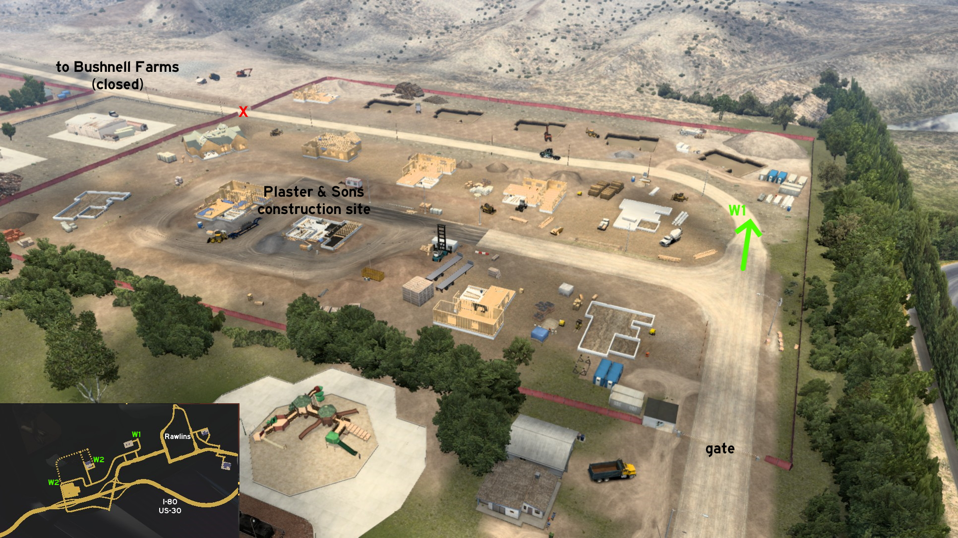 On west Rawlins, where you'll find a Plaster & Sons construction site, you can go a little further, where the houses and road construction is just begining. Instead of turning left where deliveries are done, keep going forward. All north area is accessible, until a closed gate: a road that leads to Bushnell Farms hidden roads (see Rawlins, West 2).
 West 2 - Rodeo Drive... But Not The Famous One
Category: shortcut, markableDescription: rodeo drive, but not the famous one
Discovery: kettcardriverprofi
Video (link): TGM
Update: kaia15, residenTR
Note: road became part marked, and part markable on version 1.51
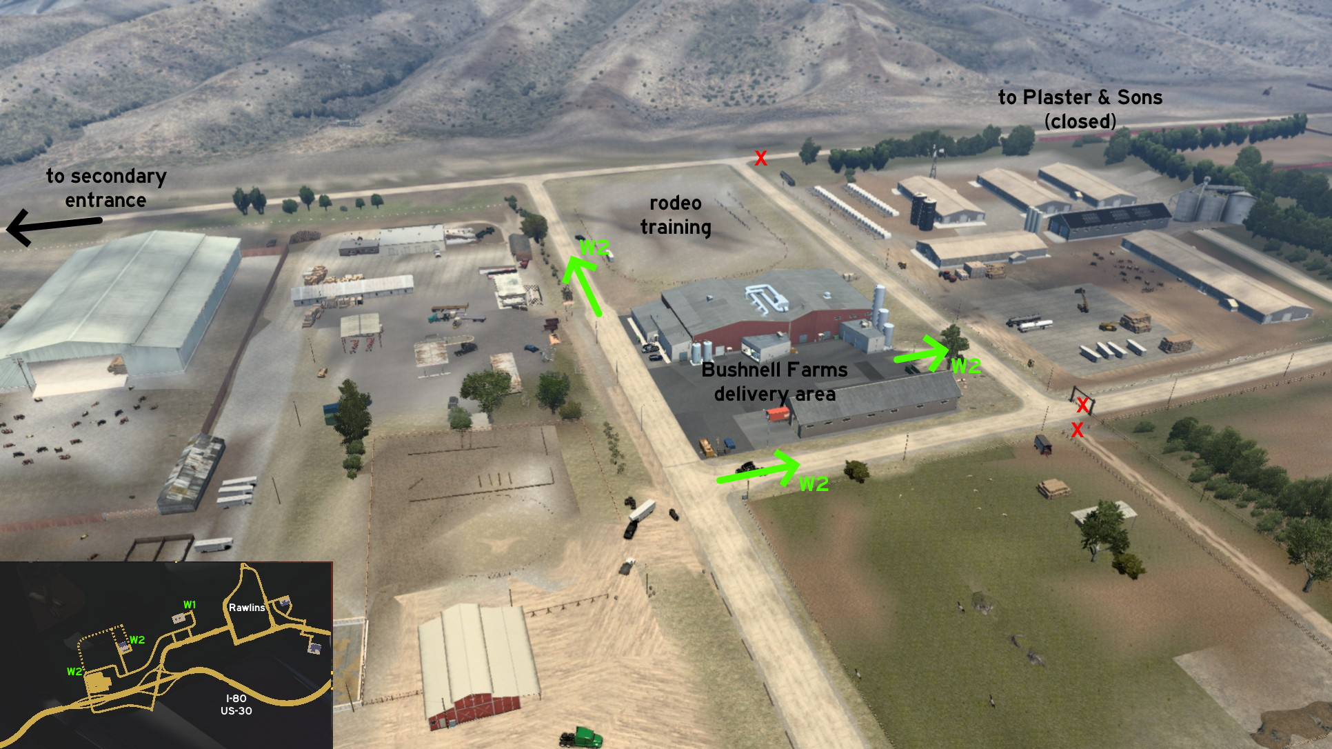 Just west of Rawlins, you can drive all around the Bushnell farm. Three of entrances are near the delivery area. Heading north and then east will lead to a closed road, which leads to Plaster & Sons construction site (see Rawlins, West 1).
 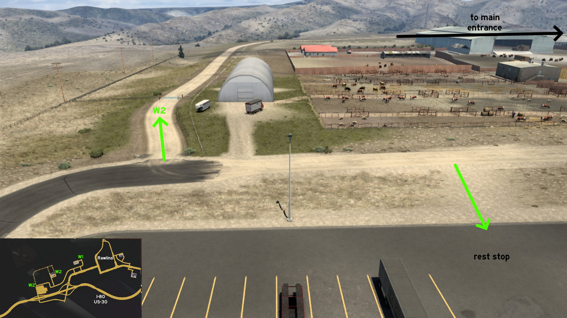 Heading west will lead to the ramps to I-80. There's a dirt path that can be used as a shortcut to the rest stop, without facing any traffic.
Riverton
North 1 - World's Largest Mineral Hot Springs
Category: sceneryDiscovery: kaia15
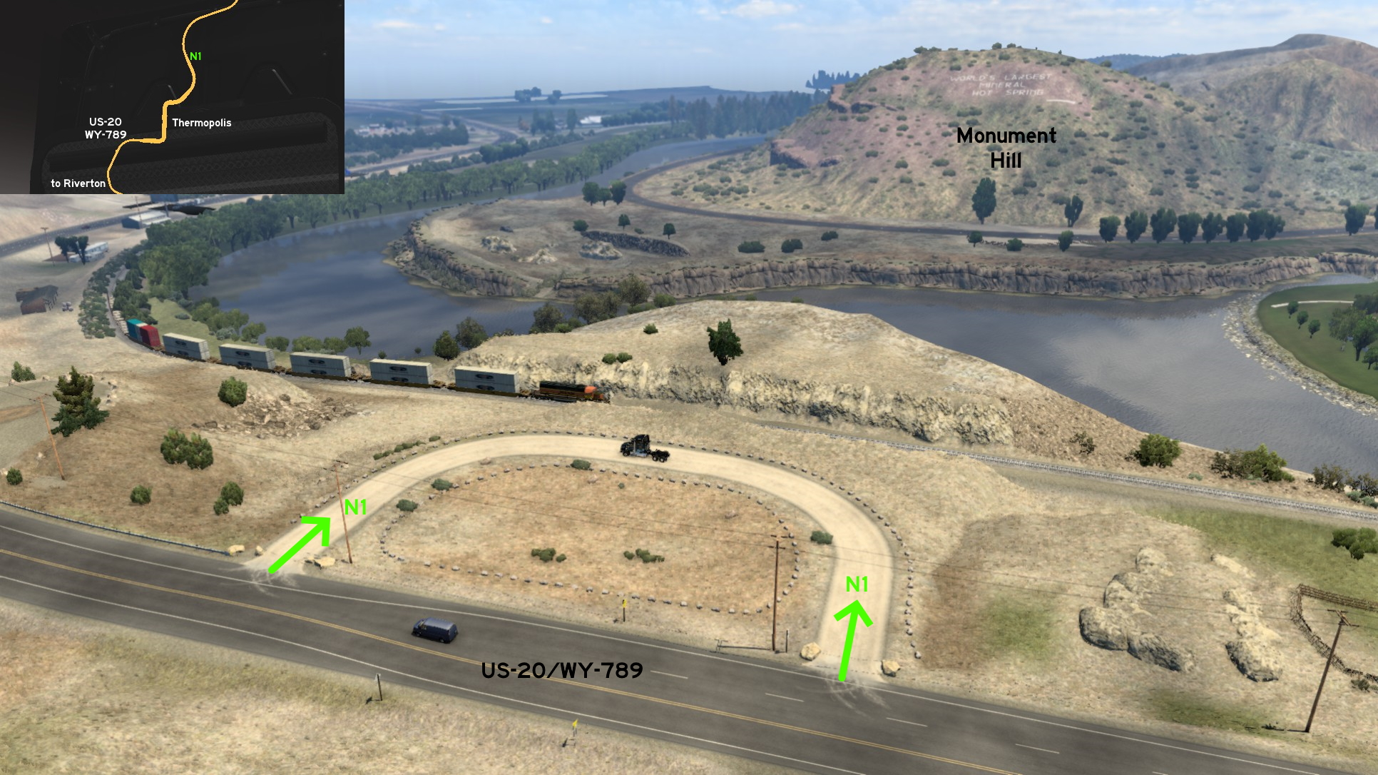 North of Riverton - or more specifically, north of the unmarked town of Thermopolis - you'll find a small loop. Both entrances are marked by bigger stones: one is near a "do not pass" sign, the other is where lanes merge. Enter carefully if pulling a trailer, as they may get stuck. Looking to the other side of train tracks, you'll find Monument Hill pointing the direction of world's largest hot springs.
 South 1 - Faster Bid On Auction
Category: shortcutVideo (link): TGM
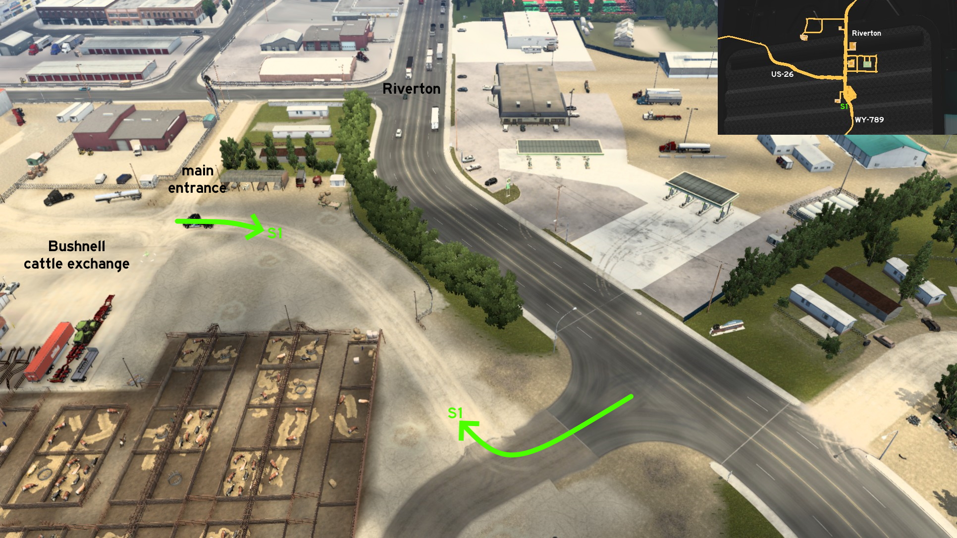 On Bushnell cattle exchange, south Riverton, there's an alternative route back to main roads. The path isn't much shorter than the marked one, but it's less windy and it's free of traffic, thus much safer if you want to move heavy machinery here, or bring live cattle safe and sound.
 Southeast 1 - Beaver Run Scenic View
Category: sceneryVideo (link): TGM
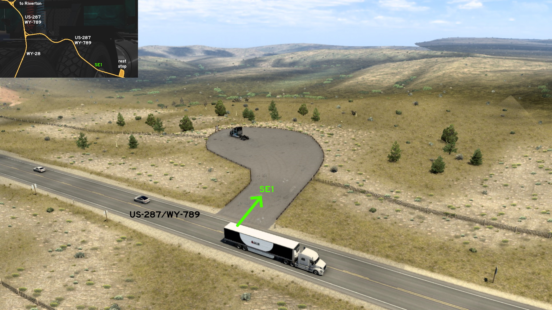 Southeast of Jackson, halfway to Rawlins and Casper, you'll find a small paved area - technically not a road, but it was clearly made for you to stop here. Just leave the road when you see the paved area, and the view to Beaver Run is all yours, literally: usually there's no other vehicle parked here, and there's enough space for the largest cargoes. It just doesn't count as a rest stop, but there's a rest stop nearby if needed.
Rock Springs
Northwest 1 - Around The Oil Fields
Category: scenery, markableDiscovery: Volvo_EG
Note 1: this road was visible on map before version 1.44
Note 2: not all roads are markable on this area, but they're accessible
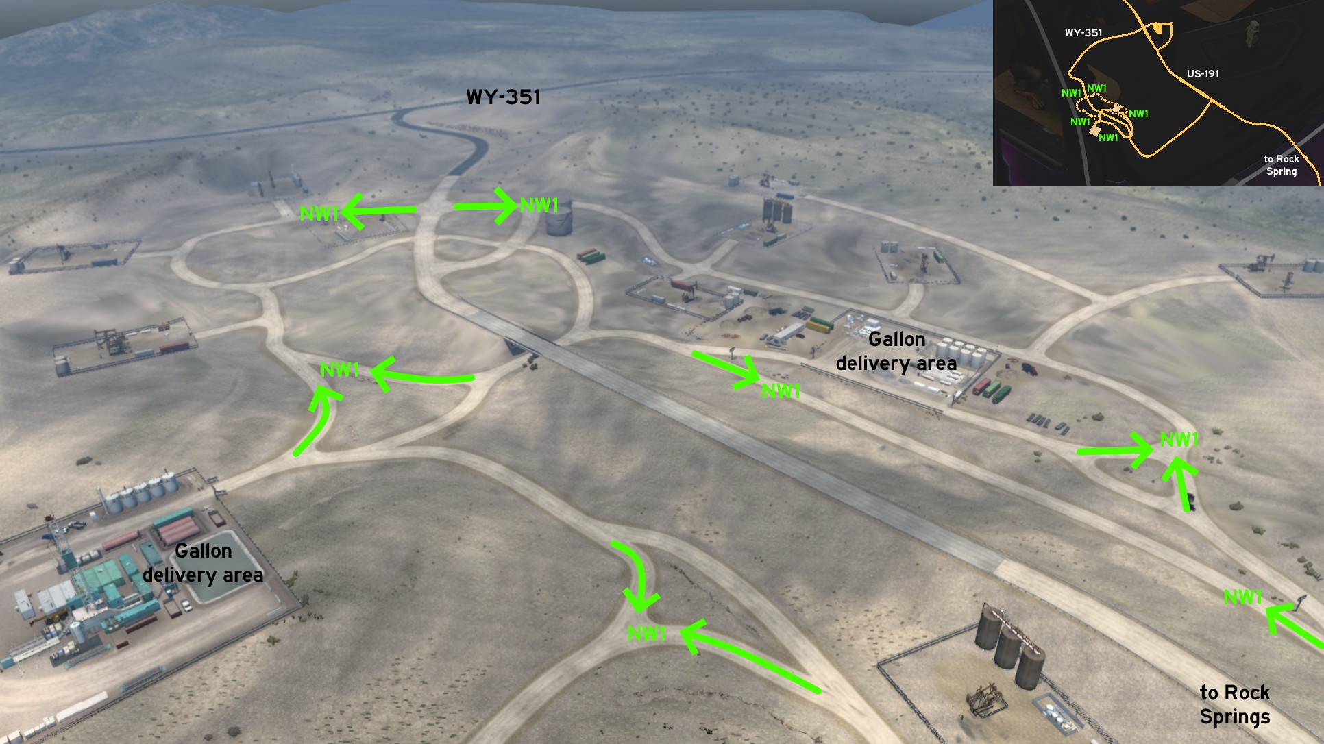 Far northwest of Rock Springs, almost halfway to Jackson, you'll find Gallon oil fields. All entrances to unmarked roads are either near the fields delivery areas, or north of the area close to WY-351, all them fully accessible. The main route circles the area, but some smaller ones have dead ends.
Several truck wash locations were added to American Truck Simulator, possibly hinting a new feature. But different from the bus terminals and stops on Euro Truck Simulator 2, they were added as unmarked places here. This section will stay here until the related feature is released.
California
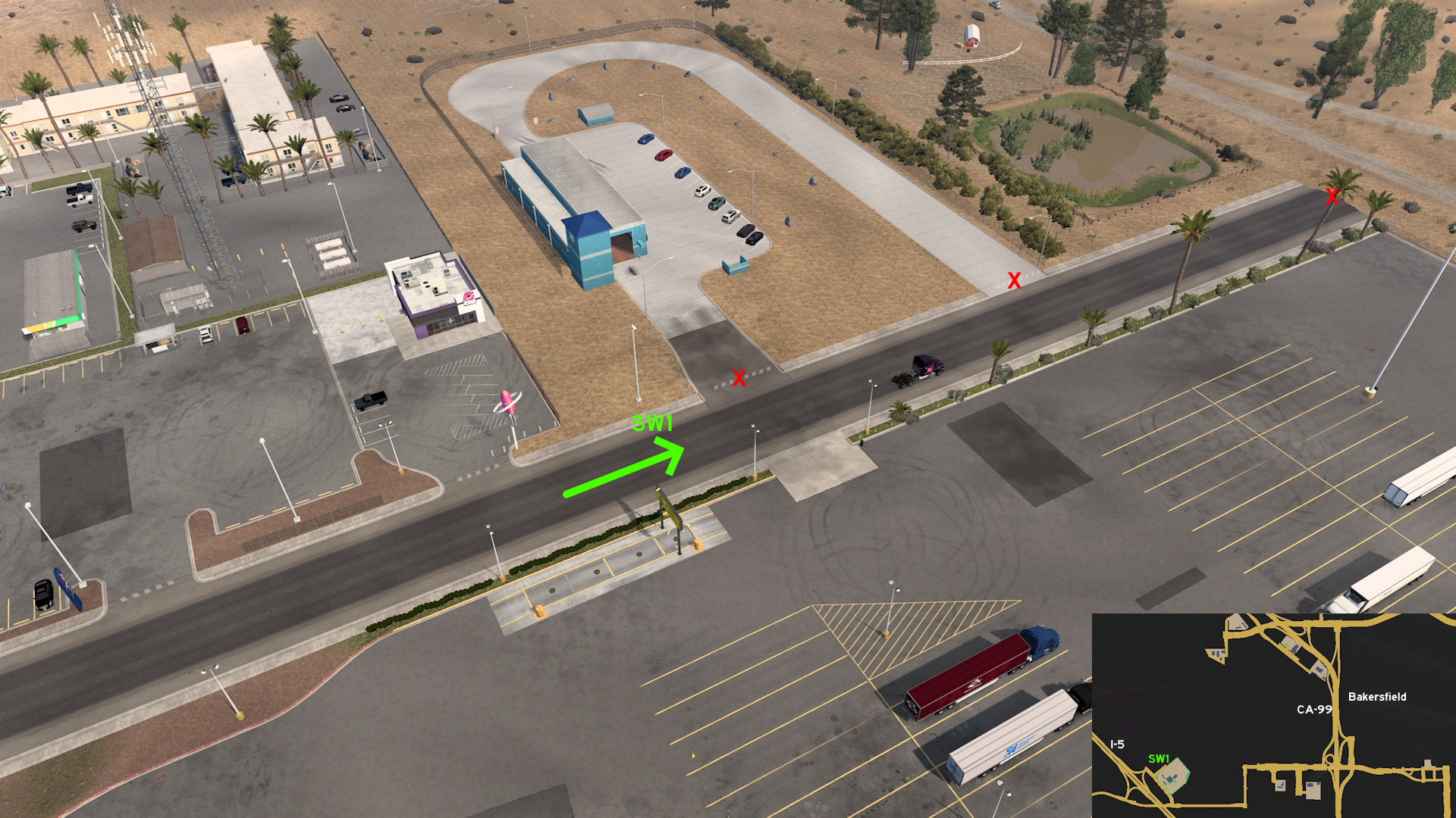 Bakersfield
Southwest, on I-5
Discovery: Crieris
Note: as of 1.54, only the road to it is accessible, but its entrance is blocked
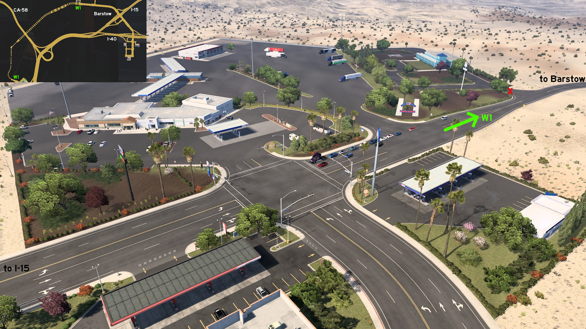 Barstow
West, on I-15
Discovery: OWLCAT, ernst-ulrich.reichelt, Applecorn
Note: as of 1.54, only the road to it is accessible, but its entrance is blocked
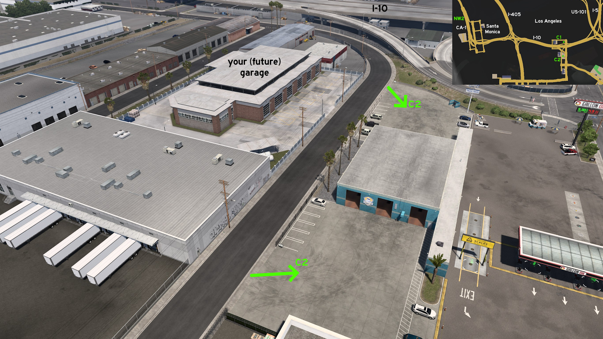 Los Angeles
Across your (future) garage, on I-10
Discovery: Crieris
Montana
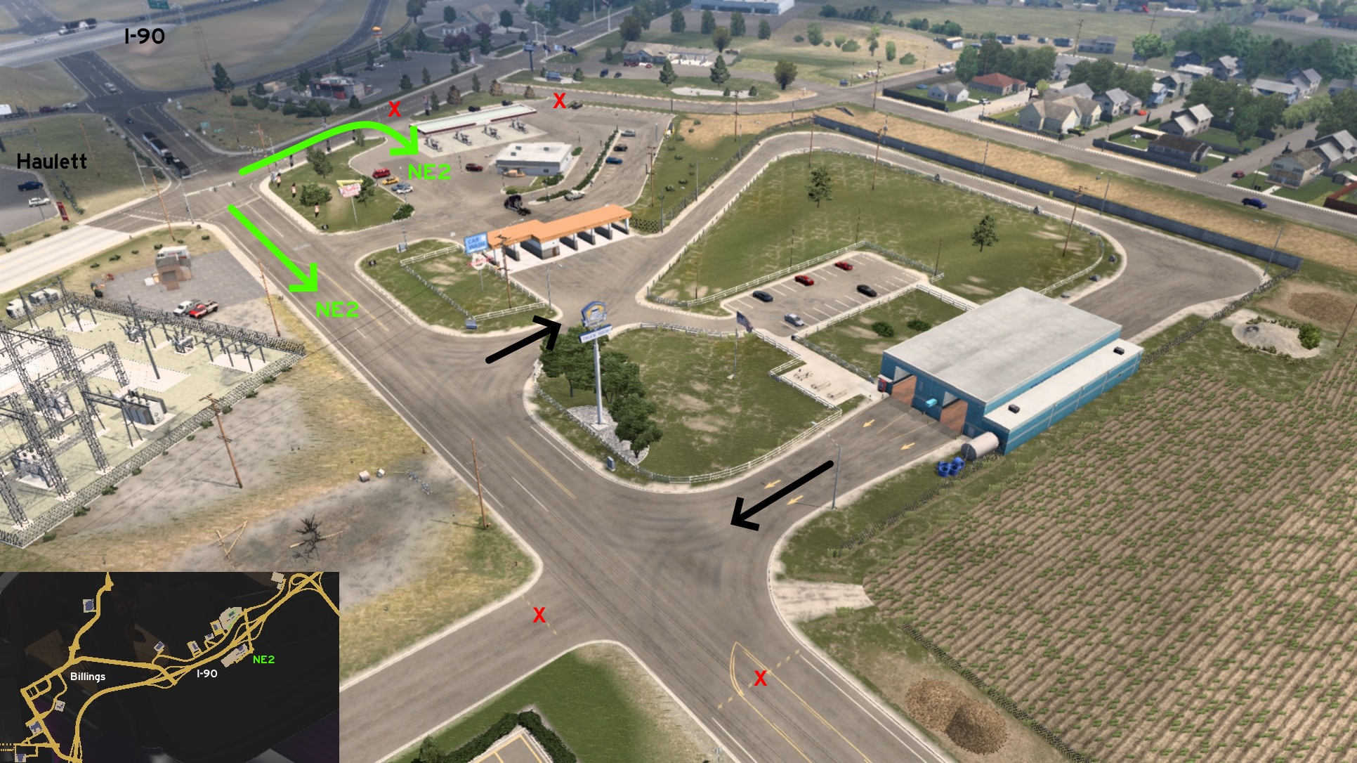 Billings
Northeast, on I-90
Discovery: Applecorn
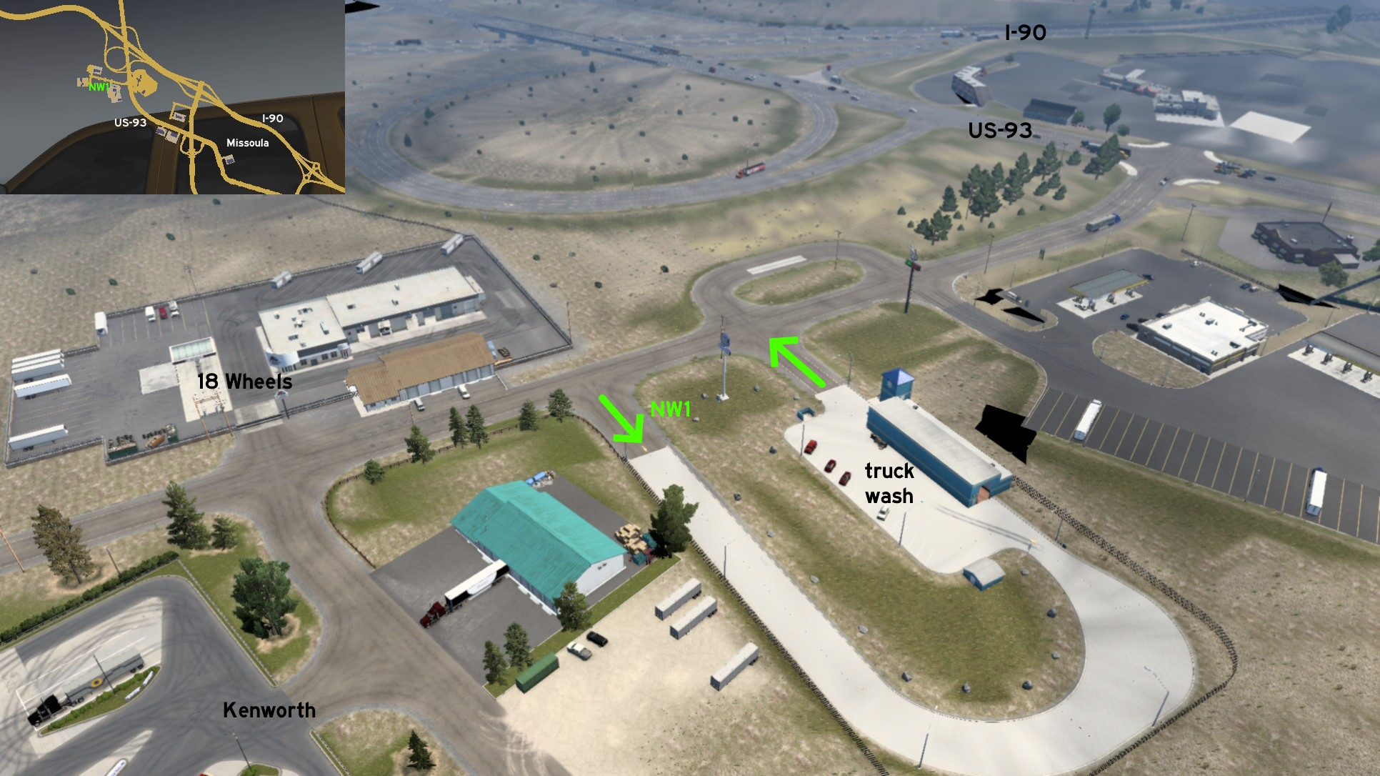 Missoula
Northwest, on US-93
Discovery: phonixl
Nevada
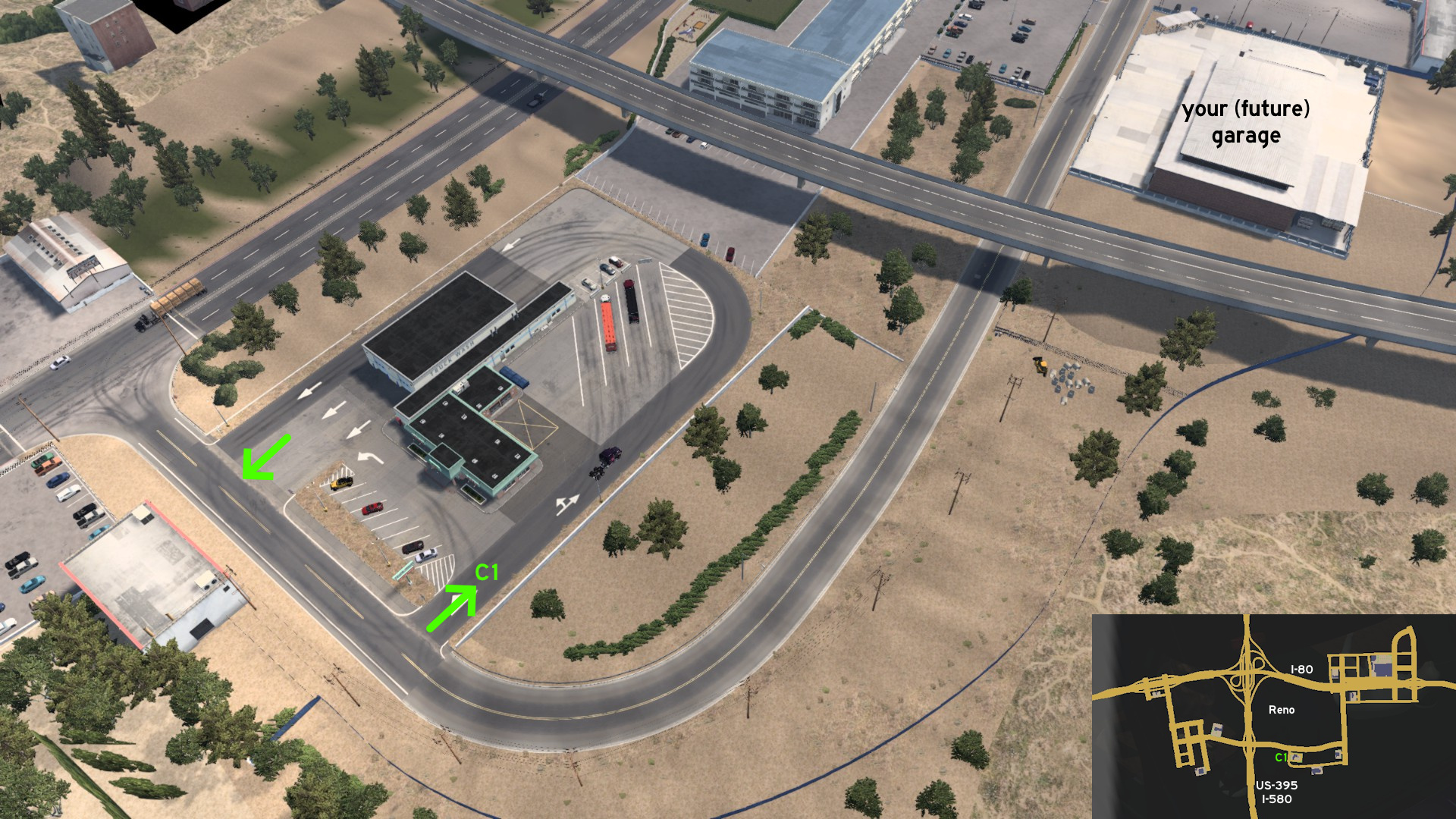 Reno
RenoOn the same road as your (future) garage, on US-395 / I-580
Discovery: ernst-ulrich.reichelt
Note: it's one of the first rest areas with a truck wash, even before it was hinted as a possible feature
The people who helped finding the unmarked roads listed here are in the credits for each city. Here's a list of all users helped us. Also thanks all users who aren't listed here, but paid us a visit.
17F
aarondinius
aclements
Ae3qe27u
airbornecowboy77
Alex Monamochamuch
AlfaPhoxtrot
A. P. 101 Gaming
ApatheticGorilla
Applecorn
aqweasd7
beta1hit
Binary
Birckablock
biromesyservilletas
blaze72003
buffalo_pete
CaptainFlint
Corran Horn
CrazyLithuanianHacker
crazy rocker
Crieris
Cyanlix
Cyclone
DDogg
dfad1ripe
DPT Wanderer
dutchheavener
aarondinius
aclements
Ae3qe27u
airbornecowboy77
Alex Monamochamuch
AlfaPhoxtrot
A. P. 101 Gaming
ApatheticGorilla
Applecorn
aqweasd7
beta1hit
Binary
Birckablock
biromesyservilletas
blaze72003
buffalo_pete
CaptainFlint
Corran Horn
CrazyLithuanianHacker
crazy rocker
Crieris
Cyanlix
Cyclone
DDogg
dfad1ripe
DPT Wanderer
dutchheavener
emeryradio
Epic Trucker Arch
ernst-ulrich.reichelt
ExaminerIan
FeteFatale
Foonty
Gardevoir
Genesai G
gg bb
Half-man half-amazing
Hedwig xo
Helen Keller
henrzman
House of Orange
HuskyDynamics
hydroxyquinoline
Ice_Tea_Zero
interlaken
jackabox miller
Jasper
JediCowboy
Jérôme
JSG4361
joshuatree37
kaia15
kettcardriverprofi
knightshift
Epic Trucker Arch
ernst-ulrich.reichelt
ExaminerIan
FeteFatale
Foonty
Gardevoir
Genesai G
gg bb
Half-man half-amazing
Hedwig xo
Helen Keller
henrzman
House of Orange
HuskyDynamics
hydroxyquinoline
Ice_Tea_Zero
interlaken
jackabox miller
Jasper
JediCowboy
Jérôme
JSG4361
joshuatree37
kaia15
kettcardriverprofi
knightshift
kubrick6719
kwolf55
Laffey
Lausambaychua
LikelyLeon
lizzard29rus
Makeleth
mattbman
Maxis2012
MikMinevi
mizho_himats1538
nathan67003
NEMEZIS
noob168
nywiigshachristian
olm823249
omni2226
Oni
OWLCAT
Ozzy
PaynZz ツ
phonixl
punkito
PWSmith1
residenTR
Richard_Stamos
RIP_C.Bennington#LP_Forever
kwolf55
Laffey
Lausambaychua
LikelyLeon
lizzard29rus
Makeleth
mattbman
Maxis2012
MikMinevi
mizho_himats1538
nathan67003
NEMEZIS
noob168
nywiigshachristian
olm823249
omni2226
Oni
OWLCAT
Ozzy
PaynZz ツ
phonixl
punkito
PWSmith1
residenTR
Richard_Stamos
RIP_C.Bennington#LP_Forever
Royal Fyre
[ru64] el giraffe
Silent Storm
Skorpionik
skunk940
skyfox122
Slovak Eagle
spiceenybaby
spy_track
sunlight
Supernovae
TechTWP
termin8r
TGM
thechief
TheElderThing
The Pitts
TheTexanHusky
THO-XVI
TruckerCarlos
TW
uratobuic
Volvo_EG
Washington_County
Wide Kemo
Zaroski
Zest
[ru64] el giraffe
Silent Storm
Skorpionik
skunk940
skyfox122
Slovak Eagle
spiceenybaby
spy_track
sunlight
Supernovae
TechTWP
termin8r
TGM
thechief
TheElderThing
The Pitts
TheTexanHusky
THO-XVI
TruckerCarlos
TW
uratobuic
Volvo_EG
Washington_County
Wide Kemo
Zaroski
Zest
More American Truck Simulator guides
- The American Truckers Guide to everything!★ 5 (960)34k views1.5k ♥53 minUpdated Aug 16, 2020
- American Truck Simulator 100% Achievement-Guide [ENG]★ 5 (704)15k views1.3k ♥8 minUpdated May 16
- Все достижения American Truck Simulator + все DLC [100% Achievement-Guide] [upd: 15.05.26]★ 5 (1.2k)14k views1.7k ♥42 minRussianUpdated Jul 12
- Texas 100% Achievement-Guide [ENG]★ 5 (443)12k views595 ♥7 minUpdated May 16
- Washington - 100% Achievement-Guide [ENG]★ 5 (503)12k views532 ♥2 minUpdated Mar 24, 2023
- Wyoming 100% Achievement-Guide [ENG]★ 5 (470)10k views495 ♥3 minUpdated Jun 26, 2024




This guide was created by its original author on the Steam Community. Are you the author and want it removed? Request removal.